The Mountains of Arizona
• www.surgent.net
|
| Seven Warriors Mesa |
• Coconino National Forest • Red Rocks of Sedona • Yavapai County |
|
Date: September 30, 2023
• Elevation: 5,258 feet
• Prominence: 886 feet
• Distance: 3.8 miles
• Time: 3 hours
• Gain: 1,060 feet
• Conditions: Cool but warming later, sunny and windy
Arizona
•
Main
•
PB
•
LoJ
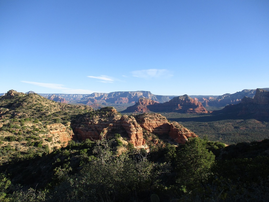
Seven Warriors Mesa rises west of state route AZ-179 just north of the Village of Oak Creek, south of Sedona. It is one of the many beautiful cliff-spire-mountains in the Red Rocks, but not one that most people have heard of. It lies west of the more famous Courthouse Butte and Bell Rock. Like all such formations in the Red Rocks, getting to the top invariably requires getting up and past at least one challenging cliff band, some easier than others.
This formation lies on Coconino National Forest land, so access is theoretically easy. The usual problem is finding a spot to park, as the trailheads fill fast. Today being a Saturday, and one of the first pleasant weekends after a summer of intense heat, it was a given that these trailhead lots would fill fast. The easiest solution is to be there at dawn. That has always worked for me.
I left Tempe at 4 a.m., stopped for gas and snacks in Anthem, and was in the Oak Creek area a little after 6 a.m., the sun not yet up although the eastern sky was starting to brighten. I followed Verde Valley School Road west from the traffic circle in Oak Creek to a parking area just past the homes, back on forest land. My plan worked well as I was the first one here. I changed into my hiking clothes but also lollygagged, to kill some time and let the sun come up some more. I started the hike at 6:30 a.m.. It was looking to be a lovely day, with clear skies and low humidity. Expected highs were to be in the low 80s. For now, it was in the mid-50s. The silhouette of Seven Warriors Mesa rose before me, looking east.
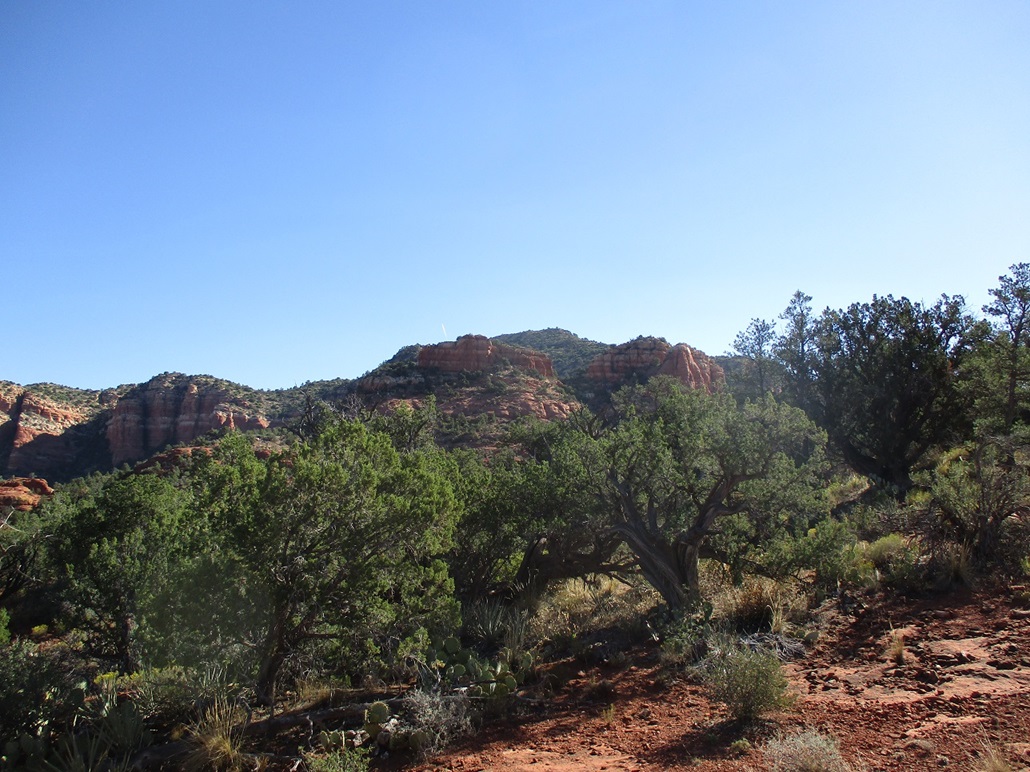
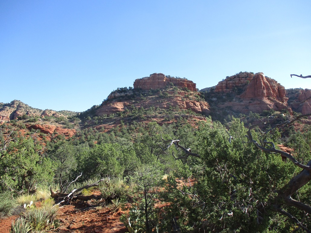
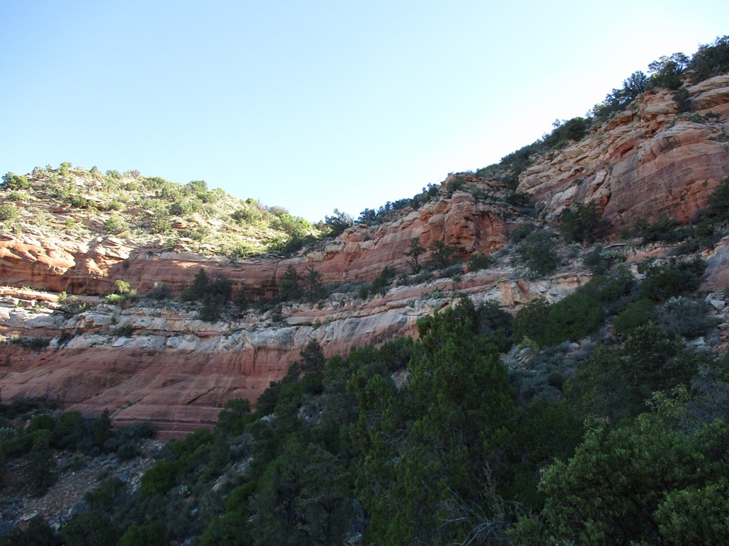
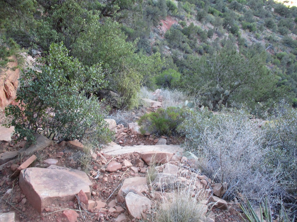
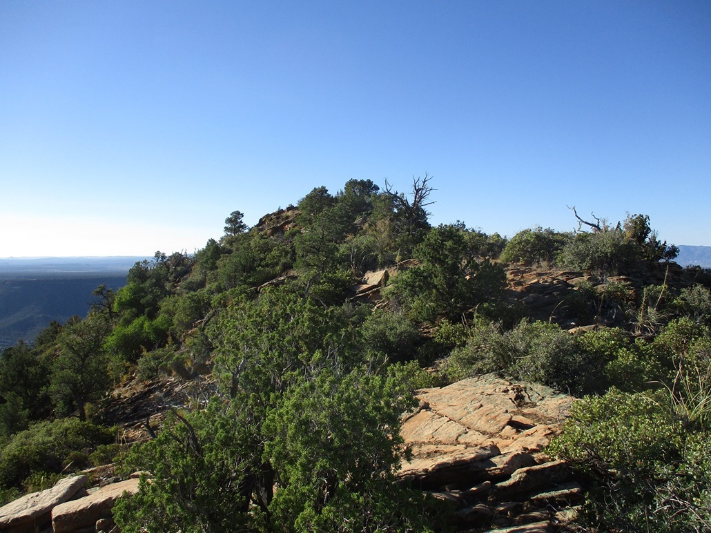
I got onto the Transept Trail. It first wanders through flattish desert terrain, with junipers, agave, mountain oak and various grasses. The ground, of course, is red sand. Soon, the trail starts gaining up blocks of red rock, now on a low ridge of red rock, gaining steeply at times. Up ahead were two big butte formations, and behind it was the summit which was mostly hidden from these vantages. The views were tremendous.
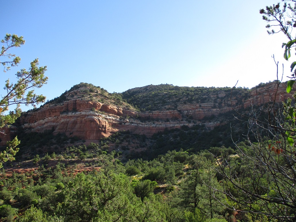
The trail reached these two buttes, then angles left and contours around them, curling back into a cove, now coming close to the actual cliffs of the main mesa. The highpoint was visible. The cliffs are tall and generally uniform, colored red, gray, white and various shades thereof. But there is a weakness in the cliffs, presenting the only viable way up and through them without requiring advanced skills and equipment.
The good trail then swings north and traverses below the cliffs. Somewhere in here is a side trail that goes up to the cliffs and the weakness. I couldn't find it at first. But I found a spot where some dead branches had been piled up, obviously by someone. I figured this was the side trail because it was the only reason these branches would be here, someone trying to keep people off of it. Sure enough, it was.
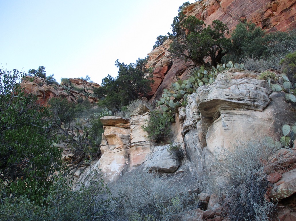
I walked in, the trail being rough but easy to follow. Within minutes, I was at the base of the cliffs, where the grade suddenly changes from gentle to steep. The scampering was not difficult but it was steep, and in many spots, the "trail" was just an eroded slope of sand with loose boulders lying atop it, ready to move if any weight was placed on them. The grade was steep, sometimes 45 degrees, but it was the looseness that I didn't like. The actual maneuvering was easy, but I had to test each step and hand-hold. I'm a big guy, hence gravity likes me more.
The route gains up one steep grind, then levels and passes below a small cliff, then resumes the steep uphill, now hard up against the tallest of the cliffs. At one point the route gets hemmed in by a big downed tree on the slope side, and the cliff wall on the other side. I had to scamper up one open rock section, then above it was a big tree. When I got to it, I found a path that veered left and away from the cliff wall and away from this weakness. I estimated this weakness scramble segment to run about 150 vertical feet and all Class 2, but with loose terrain.
Now on this path, it contoured with the lay of the land, generally level and often at the very lip of the cliff. It gained gently then, for all intents, ended. I was at the west tip of a tiny promontory that comes off the summit. I busted upslope, but marked my way with a couple cairns (and saw some that others had built) and some surveyor ribbon tied to tree branches. Coming down, it would be very easy to get cliffed out here unless you follow exactly the line of ascent.
I found ways up through the rock piles and brush, and once on top this promontory, found it to be more open with paths and lanes. The top wasn't far, and the grade starts to steepend to meet the lower rock bands of the summit block. This rock was wonderful, like a stack of pancakes. There were plenty of places to grab on to and footing was secure. Although in spots the exposure was signficiant, I never felt uncomfortable. I was soon above these tiers and on the home stretch to the summit, slightly surprised I had made it this far.
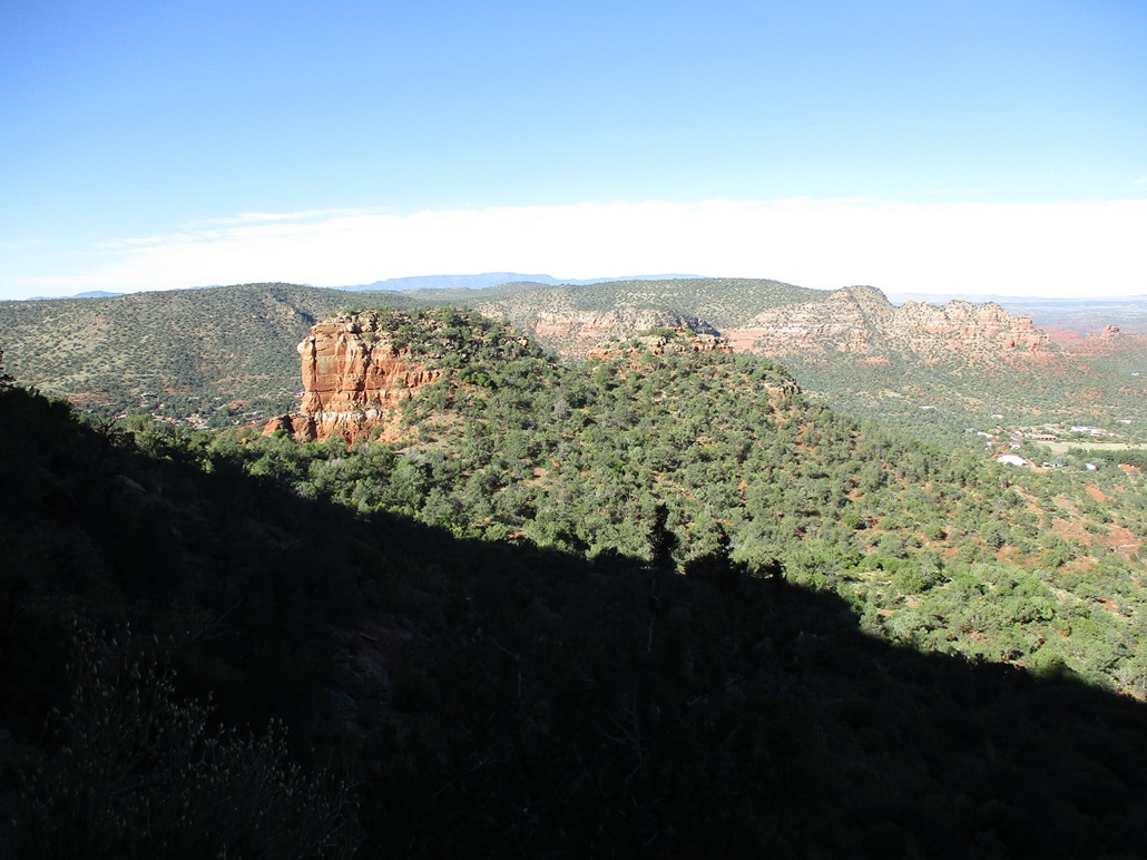
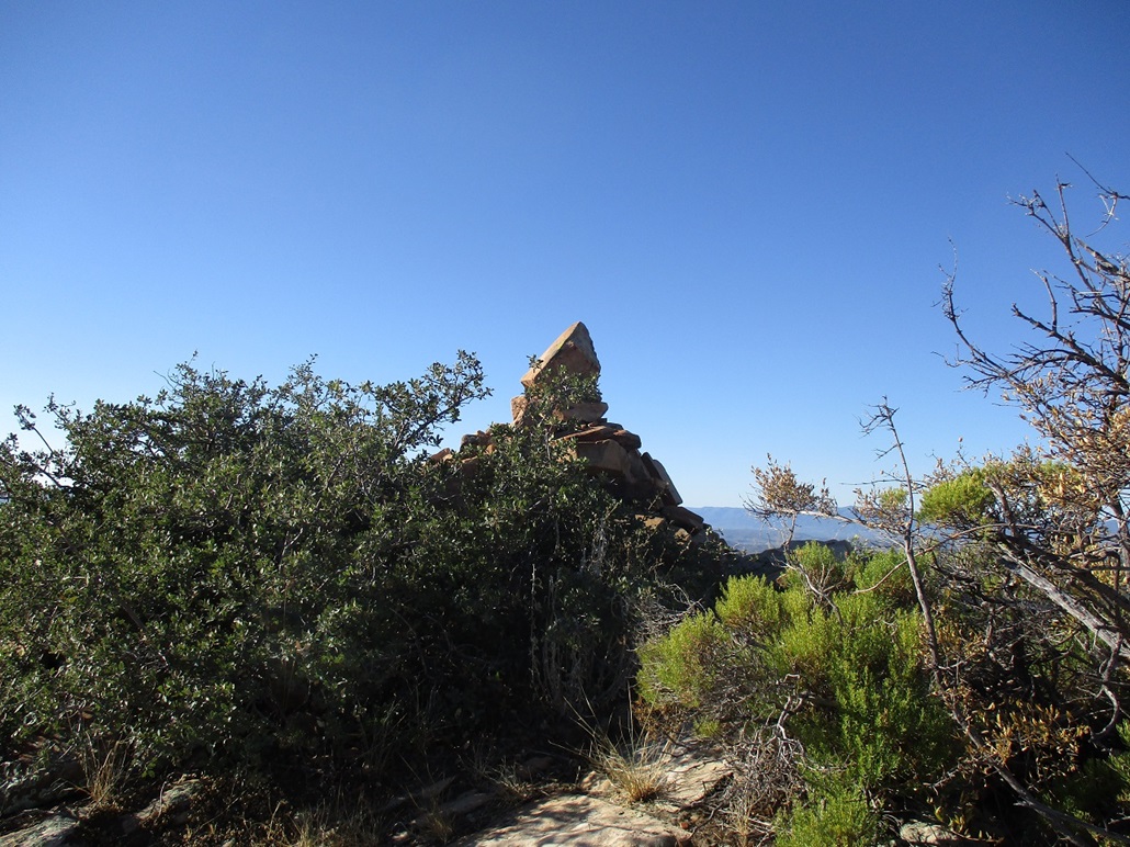
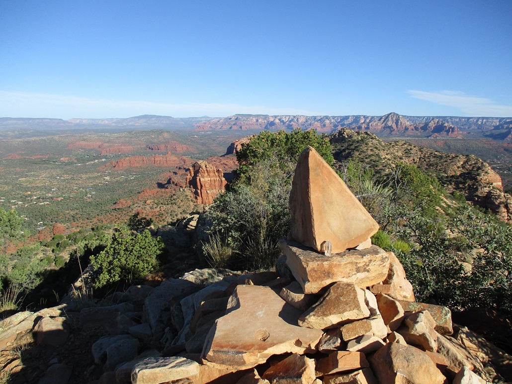
The summit is a small point of rock with a large cairn. Someone had balanced a couple rocks on the top and placed a crystal, this being Sedona after all. I found no register, but I did stop to enjoy the views. The sun was still low enough to create interesting shadows on the surrounding buttes. The day was bright blue and the colors really popped.
I descended the exact same way, untying my ribbons and carefully walking back to the weakness. I had not been looking forward to it, but what choice did I have? I took each bit slowly, often on all fives, making sure my footing was secure before lowering myself. And yes, I cliffed myself out. I found another "path" that I followed for a few feet, wondering how to get down it. I retreated to where I had been and looked harder, and found where I was supposed to have been. This cost me just a couple minutes. I had two run-ins with prickly-pear cactus that resulted in a few dozen of their tiny spines in my right elbow and right glute. I was picking them out for a day afterwards.
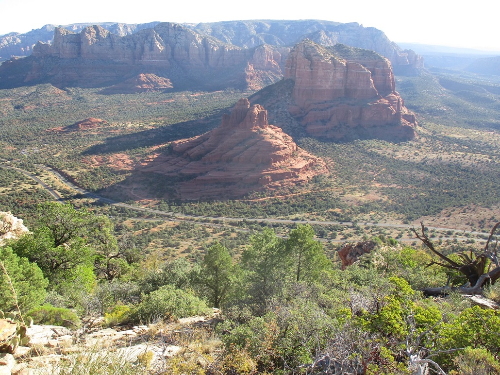
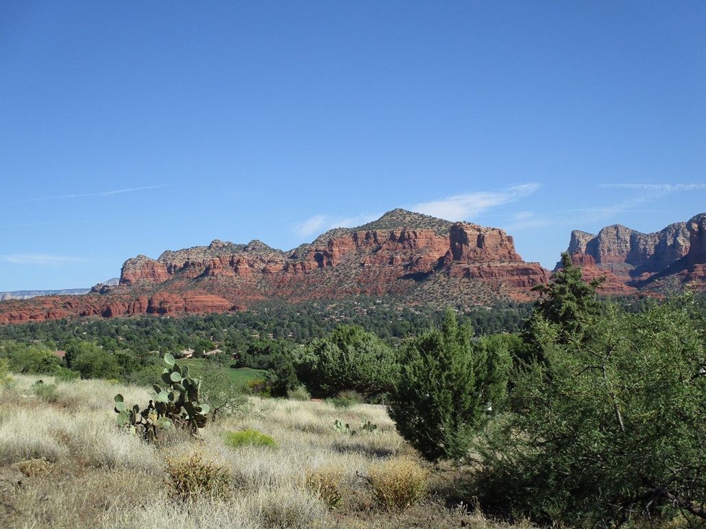
Once down off the steep bits, I was relieved and happy then to be back onto the proper trail, which I walked out to my car. With the sun up now, I stopped for photos. The ones you see here were taken on the exit. More hikers were appearing, all very friendly. By the time I got back to my car at 9:30, the small lot was almost filled, with about a dozen cars.
I was extremely pleased to be successful on this peak and, while I wouldn't say I "enjoyed" the scrambling on loose slopes part, I appreciate that it was challenging and that sometimes I need to push myself more than I usually do. In truth, it wasn't difficult, but it was loose and I really really don't like loose terrain like that. There is no shortage of beauty in the area and I took time to enjoy the views.
I had a second peak planned, a butte about three miles south unofficially called Beavertail Butte, which is the unofficial southern boundary of the Red Rocks. I hoped to get close by parking on a street in the Village of Oak Creek. This would put me about a mile away, which was good because it was warm by now, in the low 80s. But I did not feel entirely comfortable leaving my car on the street. There wasn't any sign saying you couldn't park, but I didn't want to take any chances. The alternative was to come in from the south, but that would entail a 7-mile round trip hike, which I wasn't interested in doing in this warmth. I can always come back.
I exited back onto the highways and south through Camp Verde, exiting the interstate at state route AZ-169, where I would hike a second peak, Round Benchmark Hill, near Dewey-Humboldt.
|


|