The Mountains of Arizona
• www.surgent.net
|
| San Cayetano Peak |
• Highpoint: San Cayetano Mountains • Luis Maria Baca Float #3 • Santa Cruz County |
|
Date: December 7, 2014
• Elevation: 6,004 feet
• Prominence: 1,924 feet
• Distance: 3 miles
• Time: 4 hours
• Gain: 1,800 feet
• Conditions: Clear and chilly
• Teammates: Scott Casterlin (drove), Scott Peavy
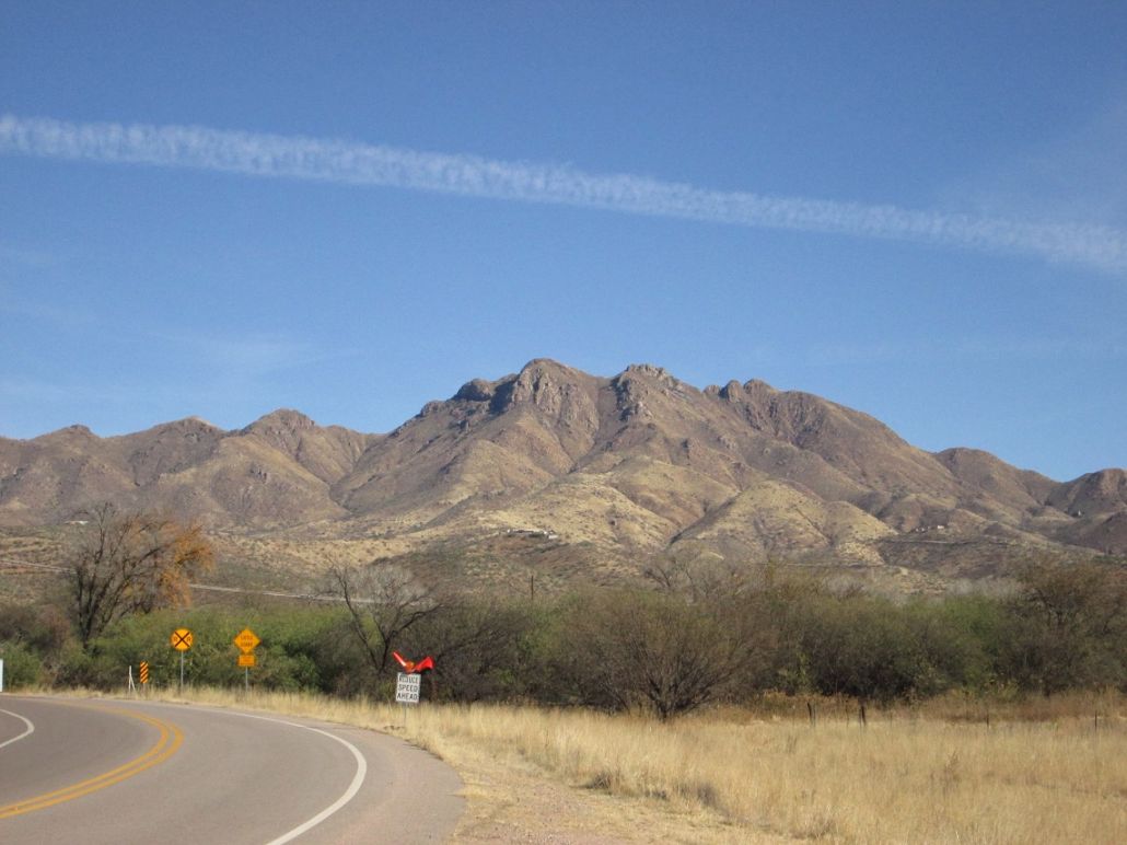
The San Cayetano Mountains are a compact range in Santa Cruz County about 20 miles north of Nogales. The range rises to the east of the Santa Cruz River valley, overlooking the town of Rio Rico. The Tumacacori and Atascosa Mountains lie across the range to the west. The summit is called San Cayetano Peak, and has over 1,900 feet of prominence.
Scott Peavy and I were discussing some other peaks, but wet weather forced us to look at alternatives. Scott Casterlin was to meet us, and San Cayetano Peak looked like a good candidate given we were both interested in it and the roads to it should be in good shape. Casterlin had hiked the peak years ago but remembered little of the route. He would not actually join us. He dropped us off and would spend the down time exploring other areas he was interested in.
I met Peavy at his place a little before 5 a.m., noticing after I had stopped and got out of my truck that my license plate was gone! I called it into Scottsdale P.D. (since I assume it was taken or fell off where I live). I figured if someone had stole it to use it for their own vehicle and then wanted to commit crimes, I didn't want to be the patsy when they ran the plates. I ended up getting a new plate the following day. I was bummed, because I had an old "A" plate, from 2001. Now, it was retro.
Peavy drove us to Tucson, where we met Casterlin at about 7 a.m. at the Grant Road exit. We then piled into Casterlin's vehicle and drove another 50 miles or so south, exiting Interstate-19 at the Palo Parado Exit. We crossed the Santa Cruz River on a brand-new bridge (erected 2013), putting us on some road below the foothills of the San Cayetano Range. We then followed roads upward, getting onto San Cayetano Road, which skirts the west slopes of the mountains about 2,000 feet below the summit, a thousand feet above the River.
We spent some time driving up and down San Cayetano Road, scouting the mountain for possible ways up, and the homes alongside the road, for possible let-in points that were hidden from the homes so that we would not draw too much attention to us. The range lies on one of the Baca Land Grant floats, but I do not know if it's still private, or state-owned, or what. The Bacas surely do not own it anymore. My guess it's probably private. Rio Rico was carved from the Baca Grant, notorious for the shady dealings that resulted in one of the largest land fraud cases in the nation's history in the 1960s.
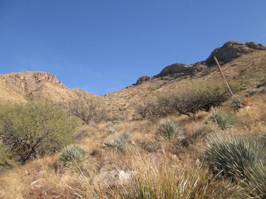
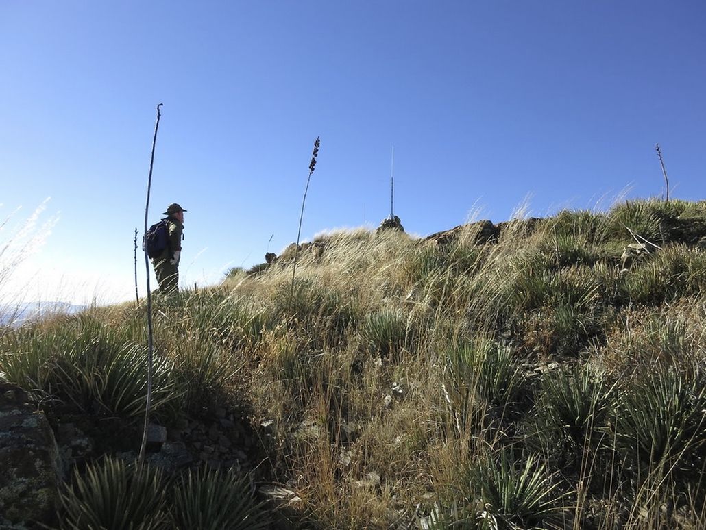
We found a spot on the road that looked like a good place to start. It was hidden from the homes and also near the drainage we wanted to follow in toward the range. We were actually very close to the peak going by a straight line. Peavy's GPS had us about 0.9 mile from the summit. We were approximately 4,190 feet elevation, a little over 1,800 feet below the top. The route looked doable, but steep, brushy and rocky. There is no development on the mountain, but we hoped past visitors had beaten a path. We ultimately didn't find too many human-created paths, but we did find plenty of cow paths, which helped. We started walking at 8:40 a.m. in cool weather with clear skies. The sun was still behind the San Cayetanos, so we had shade for all of the ascent to the main ridge.
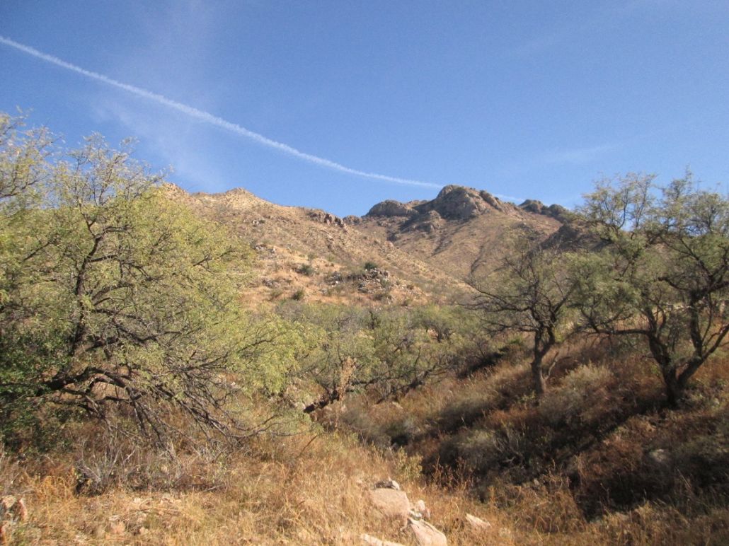
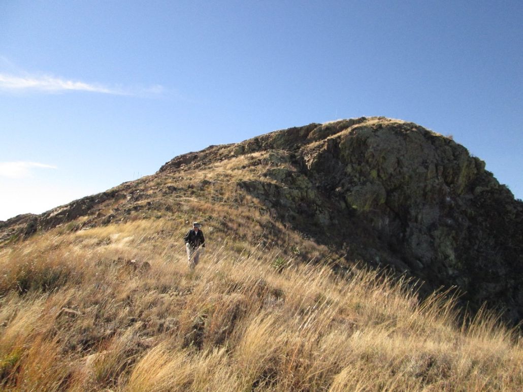
From our starting point looking up, the summit appears as a rounded mound with rocky cliffs facing north and west. To the north, two more rock outcrops lie on the main ridge. Below those is a saddle, the one we were aiming for originally. Our plan was to make up the route as we went along, following the lay of the land and paths of least resistance. We weren't locked into any particular route.
We walked in and kept near the drainage, only hopping into it whenever absolutely necessary. Generally, we stayed north of the drainages (left, if looking up), on the more-open hillsides. The going was slow due to heavy brush, high grass and hidden, rounded rocks that roll whenever weight is placed on them. We came upon a brand-new barb-wire fence about a hundred yards in, presumably the land grant boundary. We saw no signs, but the fence looked like it was put in last week. The barb wire was not rusted at all, and everything was clean and shiny. We found a low point and rolled under the fence, and continued on our way.
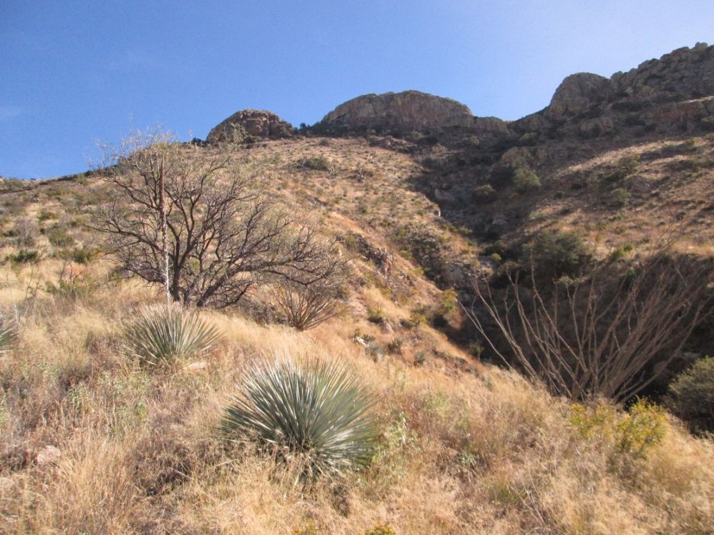
We stayed out of the drainage as long as we could, but eventually we were forced into it. Soon, though, we found some open slopes to our right (south) and walked up these slopes. We kept walking until we had a good view of the whole ridge and drainage system. When we got our bearings, we saw that we needed to be two ridges over, which meant dropping into and out of two side drainages to get to where we wanted to be. The brush was thick but never too bad.
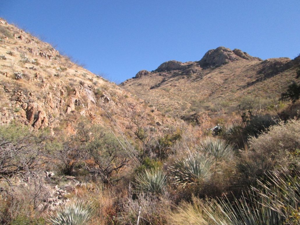
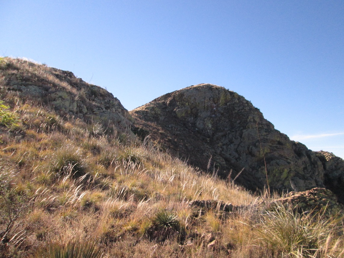
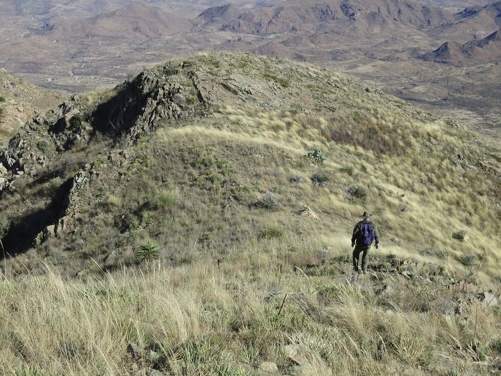
We saw that we were on a ridge that would funnel us upwards toward the small saddle between the two aforementioned rock outcrops up on the main crest. From below, this looked almost vertical, but now on it, it laid back well, and other than the heavy brush and rocks, there appeared to be no obstacles to this saddle. We grunted upwards and eventually achieved this little saddle, elevation about 5,700 feet, a 1,500-foot gain from the road. We had been walking about 90 minutes.
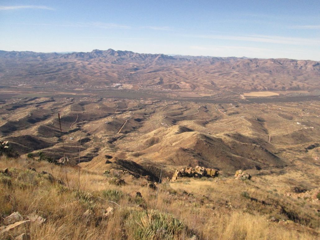
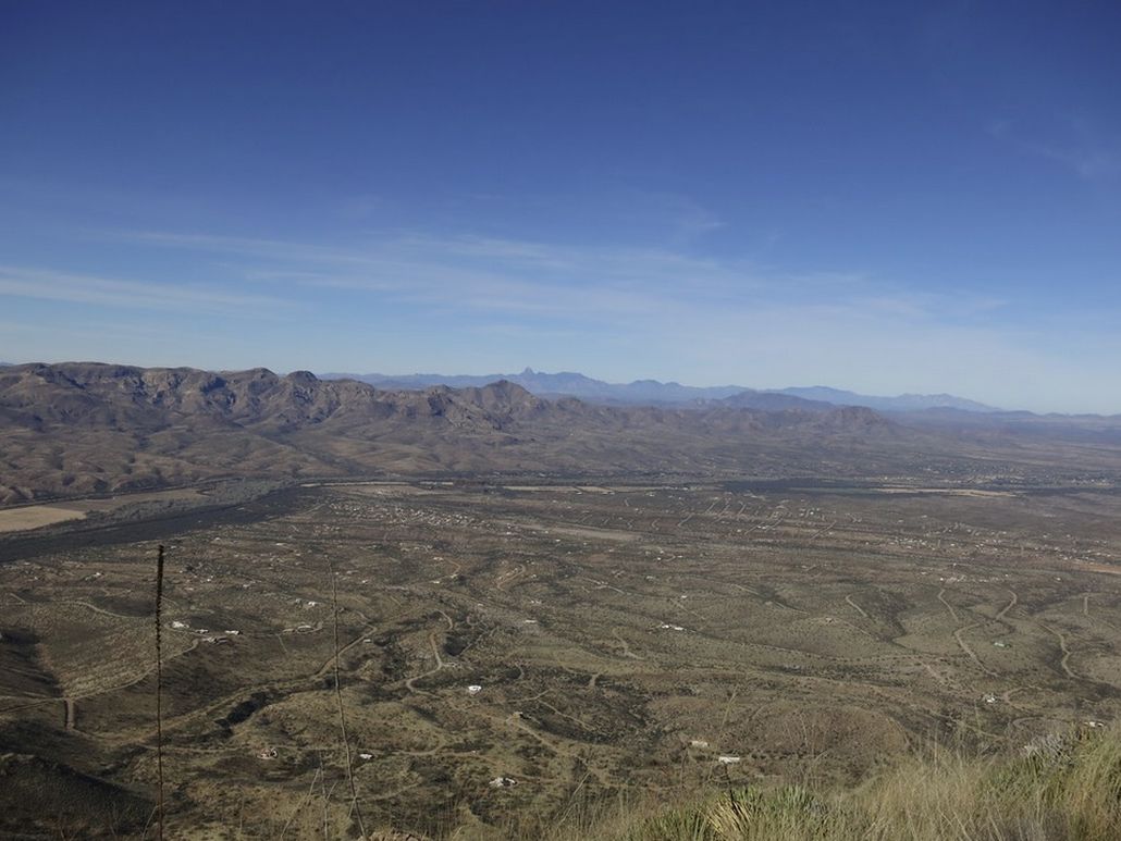
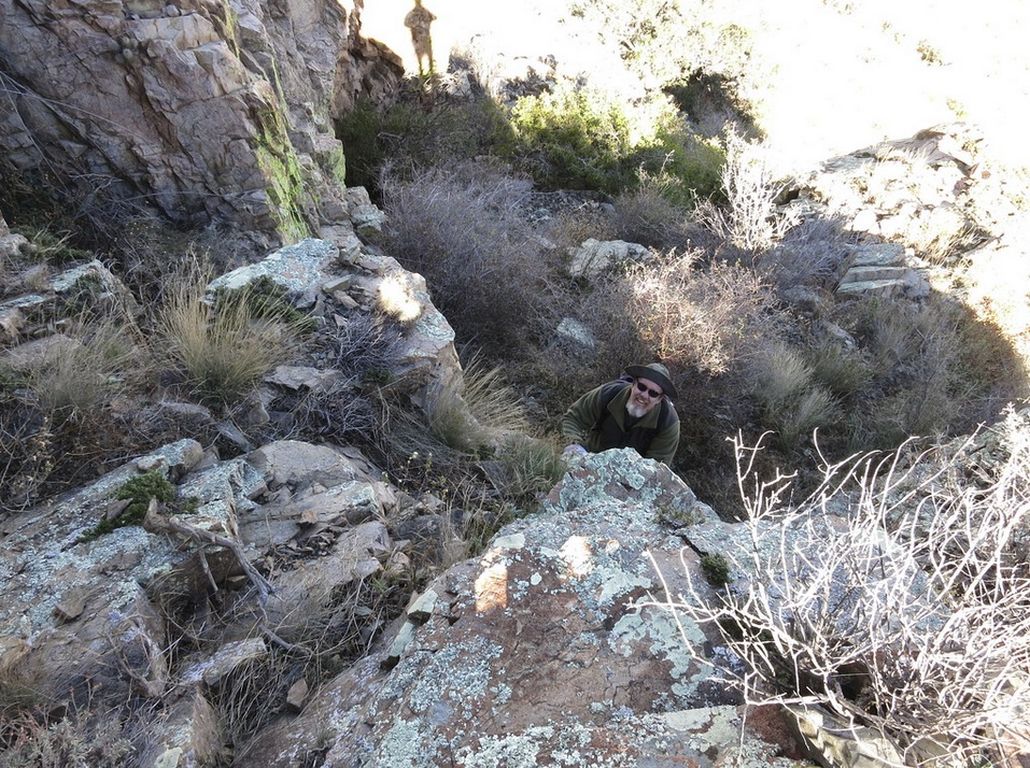
We took a break on some flat ground, now in the sun and a brisk, cold wind. The views in all directions were beautiful, with little humidity to wash out the scenery. The cool wind was enough to keep us moving. We walked along a faint path on the east side of the range that hugged the base of the rocks. We entered onto some scree slopes, angled up and to the left, then came to a small 10-foot rock band that maybe, if being generous, could be considered class-3. Above that, we crossed one more scree slope and then onto firmer ground. The rounded summit was now visible behind one last easy bump. The final 150 vertical feet went fast and was very easy. We arrived on top a little over two hours after starting.
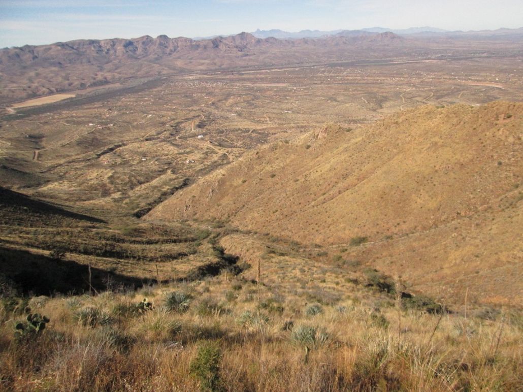
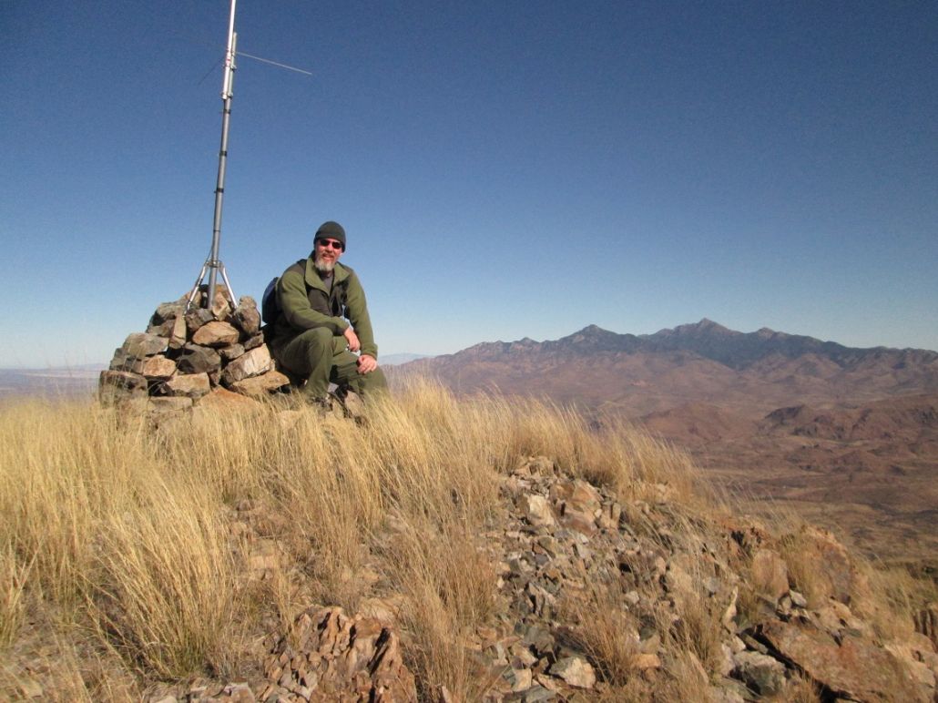
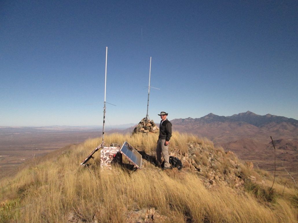
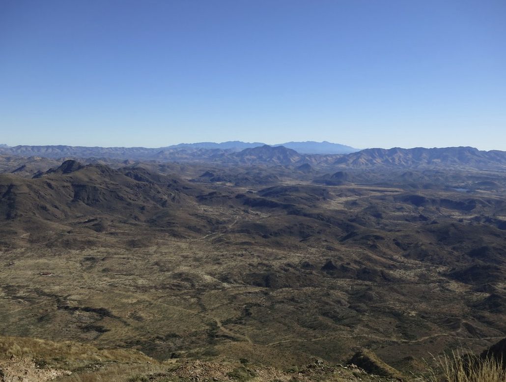
The top is open and grassy, with a little repeater box and antenna, plus a three-foot high cairn. We spent about 20 minutes up here, enjoying the great views. We could see peaks in Mexico, mighty Mounts Wrightson and Hopkins, and even Baboquivari Peak way off to the northwest. The day was so clear, we could even make out some detail on Babo's rocky pinnacle. Scott spent some time trying to locate the benchmark. We found the two reference markers, but we suspect the benchmark is buried within the cairn, which we weren't about to dismantle.
We soon started down, going slowly down the slopes, the scree sections and that one rocky section, where we had stashed our poles. We were back to the 5,700-foot saddle quickly, where we stopped for a small break, mainly to shed layers. Ahead of us was the steep slope all the way back down to the road. We went very slowly, being sure each foothold was solid. There was a lot of lechuguilla that we had to avoid. There were agave plants and prickly-pear cactus, but these were easy to avoid. There was no cholla or catclaw, and overall, the brush, while thick, was never overly pointy, grabby or scratchy. We were going about as fast downhill as we had going uphill.
We kept to this ridge until we had no choice lower down but to abandon it. We angled left and crossed into and out of a couple drainages, always trying to avoid the heaviest of the brush. Crossing one such drainage, I stepped on a slab and it gave way underneath me. It had merely been resting on the lower rock, not firmly attached to it. I took a 4-foot spill which could have been very bad, but somehow, I rolled with it and didn't ding or bash a thing.
We came upon the fence and shimmied back to the other side, and were back to the road, where Scott Casterlin was already parked. Our descent took us almost exactly the same time as our ascent: slightly over two hours each way. Scott Peavy's GPS said we'd walked 1.5 miles each way. While a short walk, every step had to be taken with care. This was no peak to rush things.
We drove out and stopped in Tumacacori, then for lunch in Tucson, then the long drive to Peavy's place, arriving as the sun was setting. I was home about 30 minutes later, driving illegally with no licence plate, but no one stopped me.
My thanks to Scott Peavy for driving and good sense up on the peak, and to Scott Casterlin for driving and being willing to drop us off so that we didn't have to leave a vehicle down on the road.
|

|