The Mountains of Arizona
www.surgent.net |
|
National Monument Red Butte • Grandview Benchmark I was on a day-long trip up on the Coconino Plateau north of Williams, west of Flagstaff, heading north toward the Grand Canyon. Earlier today I had climbed Sitgreaves Mountain. Afterwards, I drove into Williams, then started north along state route AZ-64, the main highway from Williams to the South Rim. Although the Grand Canyon was on my agenda, I wanted to stop along the way and hike Red Butte, a notable landmark summit rising about a thousand feet above the surrounding plateau. On August 8, 2023, the Baaj Nwaavjo I'tah Kukveni National Monument (Ancestral Footprints of the Grand Canyon) was signed into existence. It is composed of three large non-contiguous parcels of land that abut the Grand Canyon National Park, two up on the Arizona Strip and this one here, which is tucked south of the Grand Canyon National Park and north of the Kaibab National Forest. Grandview Benchmark is tentatively (and likely) the whole National Monument's highest point. The highest point on the northeast sector (east of the Kaibab Plateau, essentially the whole House Rock Valley) reaches to 6,960 feet and is just a gentle hill, and the highest point of the northwest sector is probably Sage Benchmark, at 6,459 feet, and possibly Hancock Knoll, at 6,453 feet.
Date: July 9, 2011
• Elevation: 7,326 feet
• Prominence: 950 feet
• Distance: 2.5 miles
• Time: 1 hour and 15 minutes
• Gain: 900 feet
• Conditions: Warm and humid, with storms developing
Arizona
•
Main
•
AZ P1K
•
PB
•
Interactive map
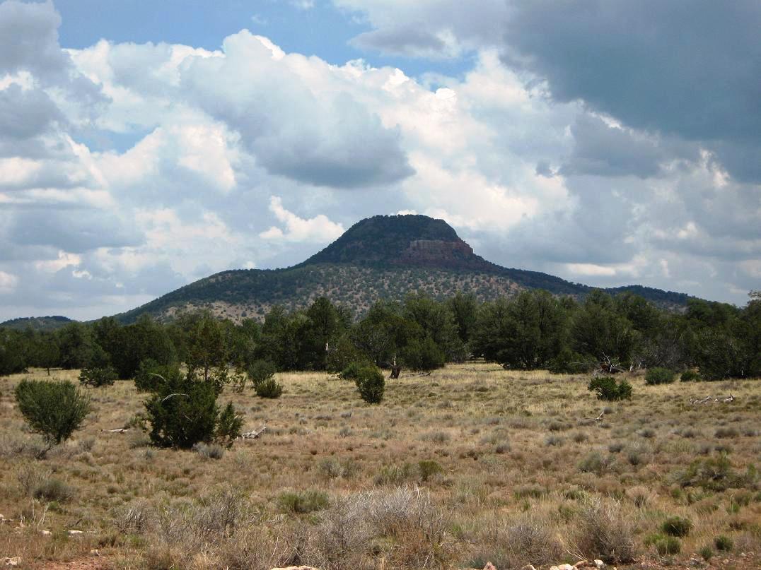
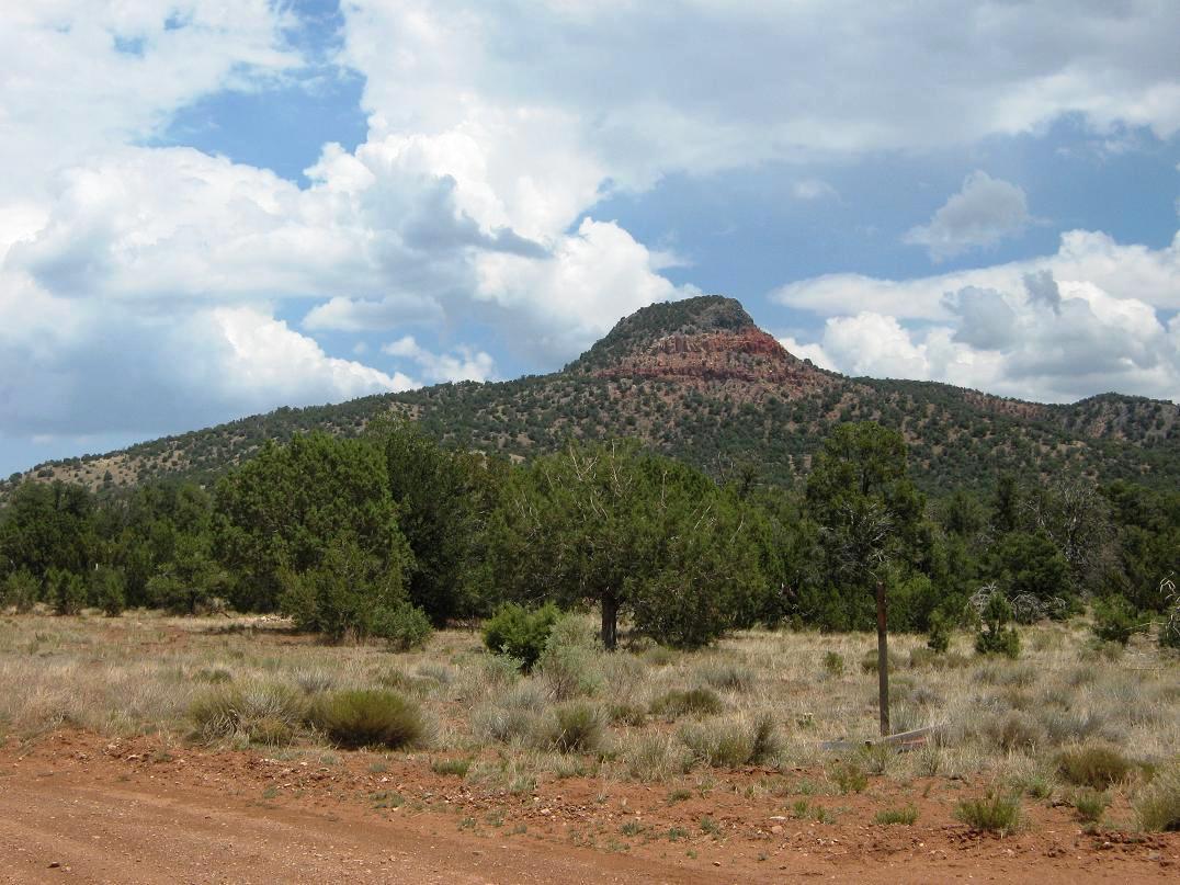
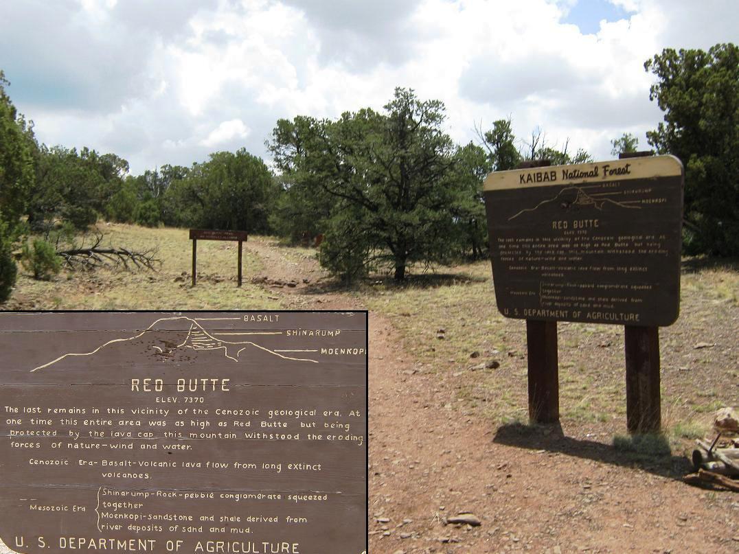
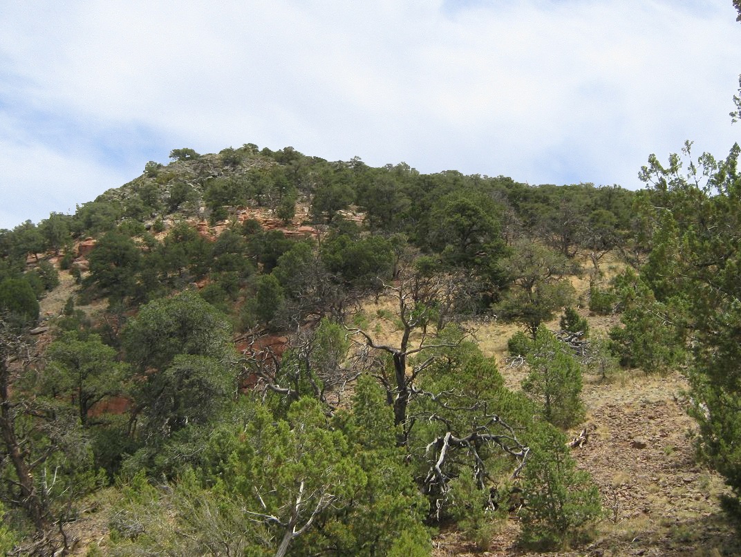
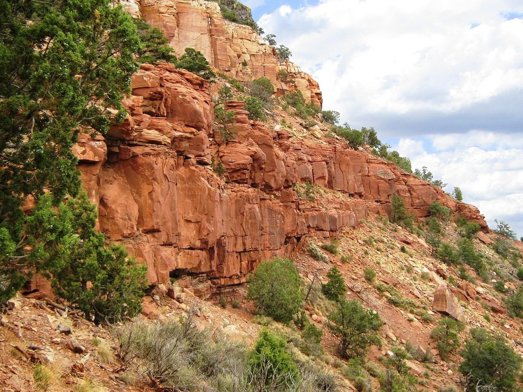
Red Butte is a hold-over from ancient times, when (as the sign at the trailhead explains) the plateau was as high as this peak's top. While the rest of the land slowly eroded over the eons, a hard basalt caprock prohibited erosion of this immediate area, leaving behind a fascinating little peak all by its lonesome, way beyond the other summits of the Coconino Plateau, which are all invariably pumice domes or formed by other volcanic events.
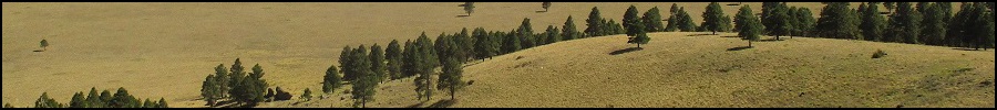
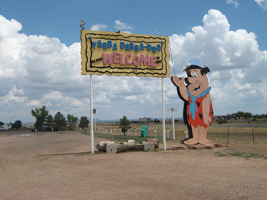
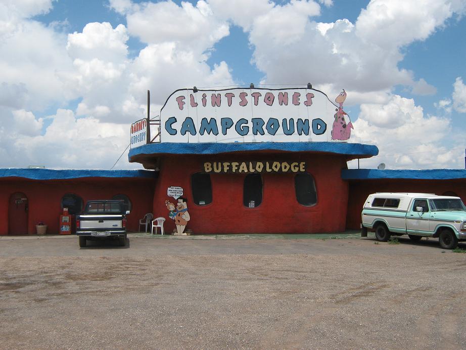
The drive north from Williams is pretty in general, but not spectacular. This is high-elevation rangeland, with spotty forests of piñon and juniper, mixed with meadows of tufty grass. About 15 miles north of Williams, the highway crests a rise and Red Butte first appears, still about 20 miles distant. Along the way I passed through the junction community of Valle, where highway US-180 from Flagstaff meets AZ-64. Valle features a couple hotels, minimarts, gas stations and the dumbest attraction in the world, Bedrock City, an homage to the Flintstones. So yes, I had to stop and tour the grounds. After saying hello to Fred and the gang, I continued north.
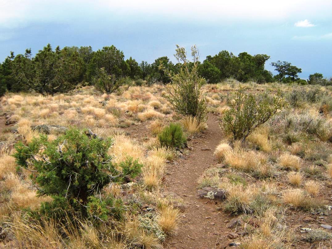
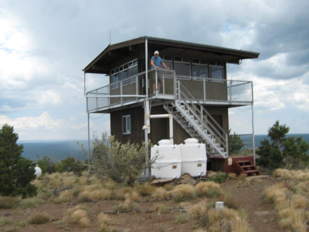
The turn-off to Red Butte is Kaibab Forest Road 320, at milepost 224. I drove 1.5 miles east, then north along FR-320 to FR-320A, which ends at a small parking area at the trailhead. The total drive from the highway was about 3 miles. I was the only one here. The weather was unsettled, with big thunderheads looming above the big peaks to the south and some active storms out west, but above Red Butte, the big puffy clouds just blew on past, the little peak apparently not big enough to generate its own micro-climates. Nevertheless, I knew this was a calculated gamble, since the weather could go to hell in moments. It was just before noon when I started the hike, and somewhat warm in the sun. The hike follows an excellent trail all the way to the top. The initial half-mile or so winds through the meager foothills, through open pinon and juniper woodland, before gaining up a low western buttress. The pitch of the trail is never more than slightly steep, and I made very quick time. The trail surmounts this buttress and then bends east, dropping slightly to a saddle just below the main summit massif. I took a water break here. The final segment of the trail gains steeply up the west-facing slopes, the trail being parsed into long switchbacks. A couple of turns come near the red cliffs of Shinarump sandstone. As I neared the top, the weather seemed to drop a notch in quality: the sun was now hidden behind the clouds, and a big thunderstorm was kicking up west, dropping a lot of lightning. The rumbles were muffled and distant, and I surmised the storm was 15 miles west, although utterly gigantic. The whole western horizon was hidden in the clouds and sheets of rain. This motivated me to basically run the final portion to the top. The trail emerges onto the flat summit between two large cairns. A manned lookout is on the eastern end, so I jogged to it and sought the highpoint, which the map said should be very nearby. It all looked flat so I kicked a few rocks and called it good. The lookout man came out to say hi and invite me up, but I declined, stating I wanted to hustle on down this peak before the lightning came near. He seemed like a nice guy, probably a little bored. Normally I stick around to visit with the lookout people, but not today. The weather was looking ugly and I figured I'd already pressed my luck enough. I ran back to the switchbacks then jogged down them, figuring I was ever so slightly statistically safer every foot I descended. The lightning was still distant, but there was no more sun. I didn't truly feel home free until I was down below the buttress, and even then, I jogged back to my truck, taking haven in the shell. The rain started to fall, sprinkling at first, then slightly heavier. It had taken me one hour, 15 minutes for the round trip, and although I rested a little back at the truck, the roads looked like they could get slick when wet, so I exited back out to the highway without much delay. From here I drove into the Grand Canyon National Park, the rain now falling as a steady drizzle. I spent the remainder of the day touring the South Rim overlooks, plus visiting Grandview Lookout.
Elevation: 7,540 feet
• Prominence: 1,060 feet
• Distance: 0.5 mile
• Time: 30 minutes of wandering
• Gain: 80 feet
• Conditions: Humid and unsettled
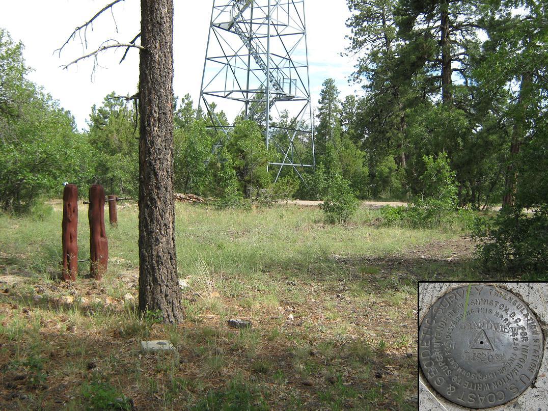
Grandview Benchmark would never be confused for a mountain, but it is a highpoint with a prominence over a thousand feet. Its claim to fame is that it is the highest point along the South Rim of the Grand Canyon. This is true, but kind of a stretch. More accurately, it is along the lip of one band of cliffs that comprise the South Rim. However, it's not right on the edge of the big chasm, and very few people bother to seek out this point. I paid my entrance fee and drove east along the rim highway (AZ-64). Grandview Benchmark was on my agenda, but so was staring down into the canyon.
I stopped at the usual overlooks. No matter how many previous times I have been to the Grand Canyon, or seen photos of it, seeing it in person is about as religious an experience I can have. It is absolutely stunning, beyond words to describe. I assure you, no matter how many photos you may have seen, it pales in comparison to seeing it in person.
The day was unsettled with clouds and thunderstorms, although the immediate area was calm. Lighting for photographs was not very good, so you'll have to trust me when I say the Grand Canyon is a beautiful place. These overlooks were crowded but not too bad. Lots of foreign languages could be heard. I am glad people come from all over the world to see our big hole in the ground. After staring into the canyon for awhile, I left to go visit a lame point in the forest. What is wrong with me?
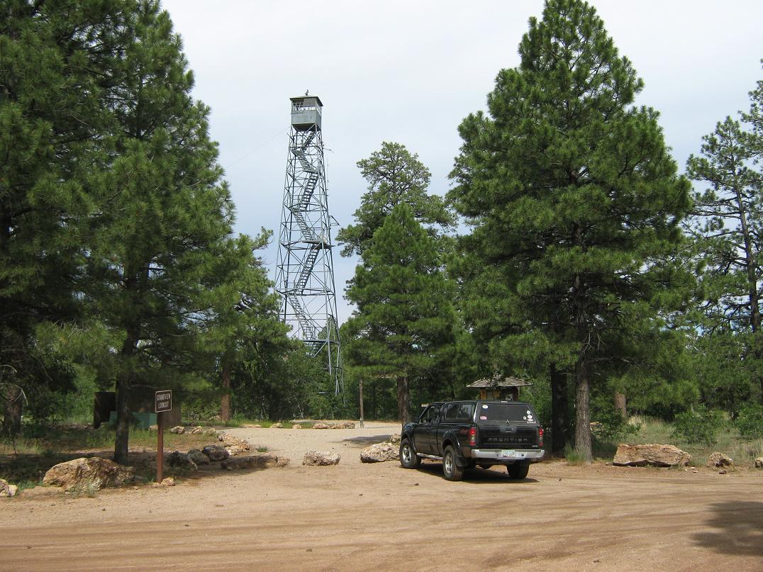
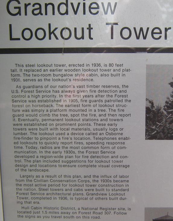
About two miles east of the Grandview Overlook is a side road on the south, shown as Coconino Rim Road on the maps, and marked as Forest Road 310. I followed this road about a mile to the Kaibab Forest Boundary, then another mile to the Grandview Lookout, parking in the nearby spaces. There was a family climbing up and down the lookout tower, so I walked around the area looking for the benchmark, which I found after a few minutes. I also walked around to be sure I had not missed any other potential highpoints. The whole place is flat, and the benchmark may be at the highest point. I felt some ground south of the tower looked promising, and also a swell of land about 200 yards north along the road. I walked a half-mile in loops just to be sure.
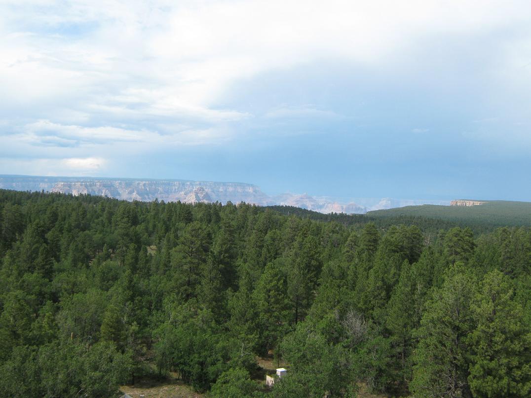
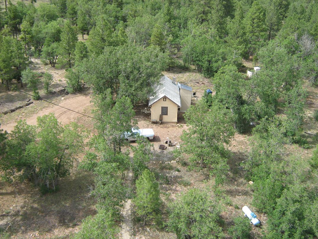
When the family was finished with the tower, I climbed the stairs. This is a well-constructed tower and everything looked very solid. I still felt nervous higher up. The stairs themselves have a very severe slope to them. The views were excellent, with views north into the Grand Canyon, and views of the forest in all directions with the big volcanos looming high to the south. The dark clouds and storms were to the west. For some reason, there were a lot of helicopters. My guess is the sight-seeing helos make a big loop this way before flying into the Canyon. The noise was bothersome.
Done with this highpoint, I drove back into the Grand Canyon National Park, amused to see a very simple kiosk on the boundary along this forest road. At one time they must have manned this spot to collect entrance fees. Now a sign just says to pay your fee at the South or East entrance gates.
Back on the highway, I proceeded east and stopped at each overlook, staring into the wonderful chasm. The scale is too big to properly capture in a photograph. Even though I was a car-tourist today, I still had fun at the Canyon. It's a wondrous place. Finally, I came to the East gates and exited, and drove all the way into Flagstaff. I was tired, so I got a hotel room, cleaned up, ate a meal, then crashed by 8 p.m., the end of a productive (for me) day.
|


|