The Mountains of Arizona
• www.surgent.net
|
| Rattlesnake Crater & North Ridge |
• San Francisco Volcanic Field • Coconino National Forest • Coconino County |
|
Date: August 20, 2021
• Elevation: 6,558 feet (HP), 6,326 feet (north ridge)
• Prominence: 548 feet (HP), 256 feet (north ridge)
• Distance: 2.2 miles (both hikes)
• Time: 1 hour & 40 minutes (total)
• Gain: 745 feet (both hikes)
• Conditions: Sunny with clouds, pleasant
Arizona
•
Main
•
LoJ
•
LoJ
•
Interactive map
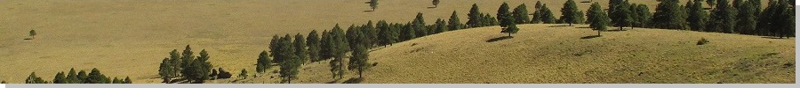
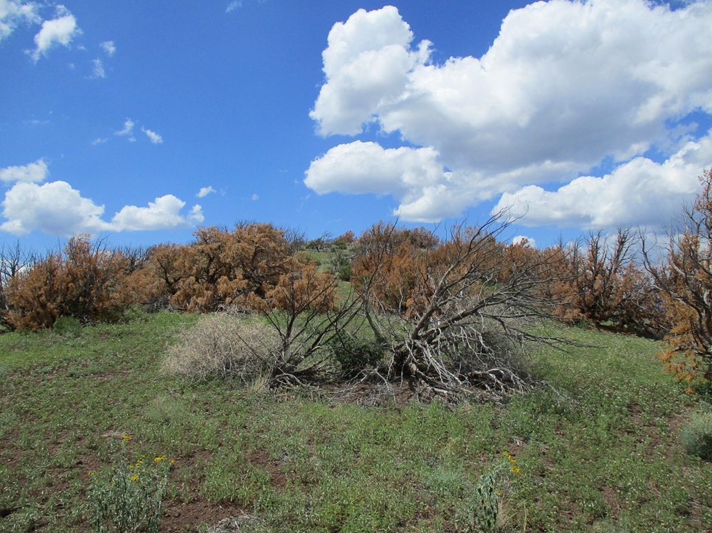
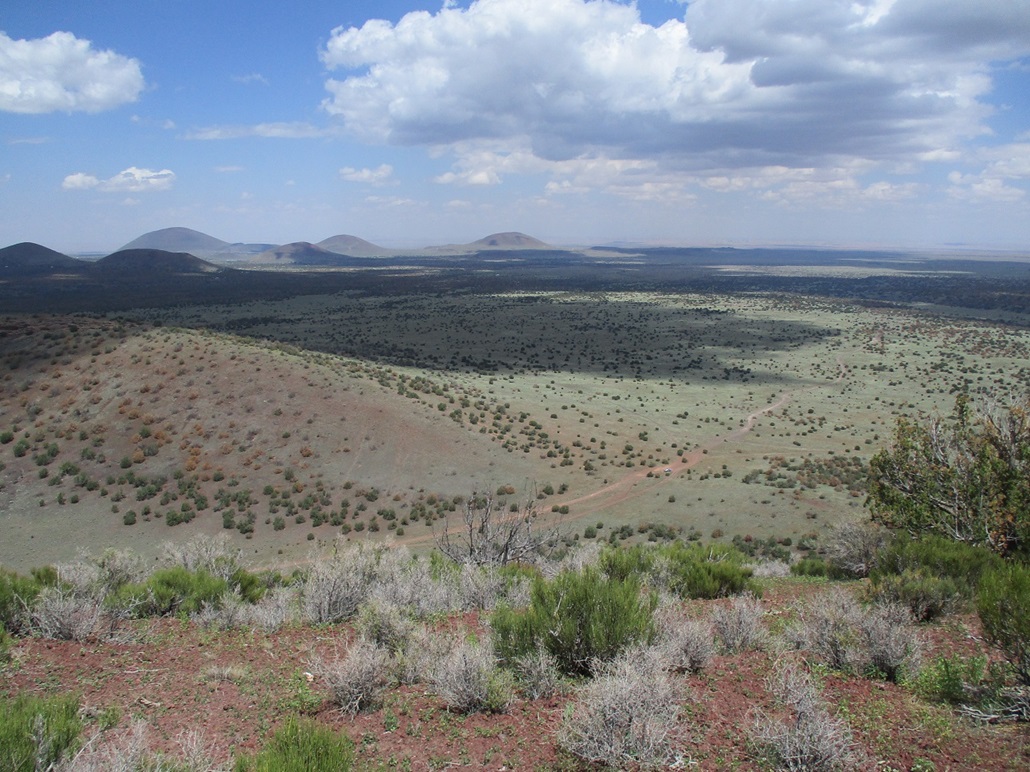
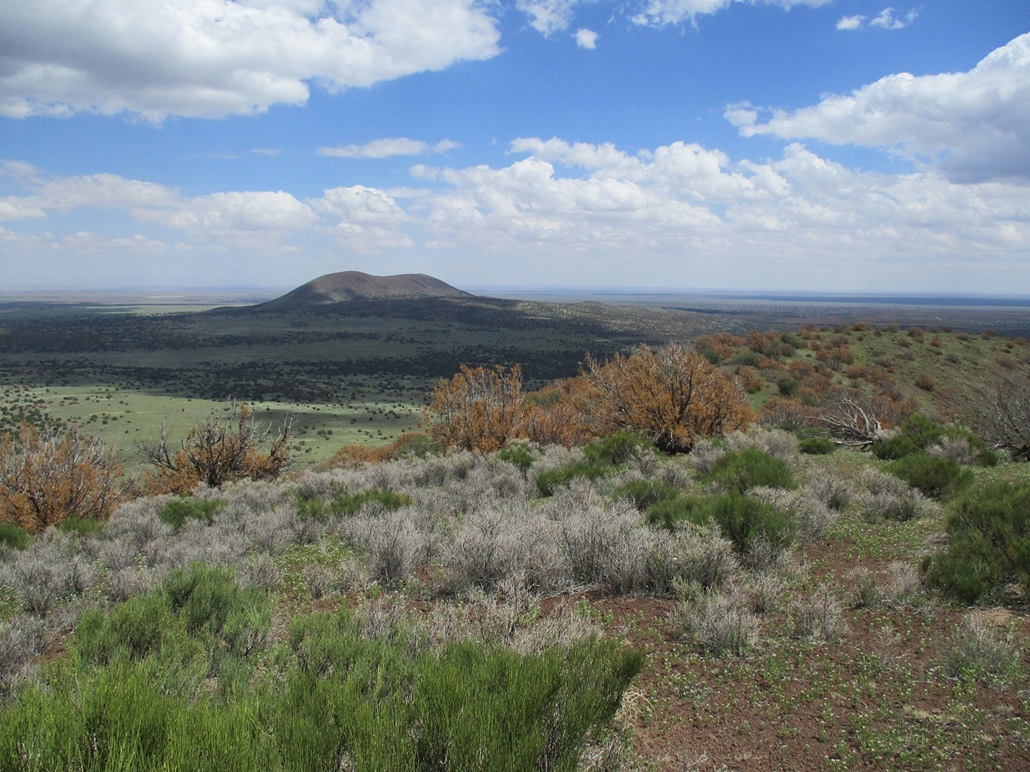
Rattlesnake Crater lies on the southeast tip of the San Francisco Volcanic Field, about 20 miles east of Flagstaff. It is visible from Interstate-40. If driving west on Interstate-40 coming in from Winslow, the first "big" volcanic hill one sees is Merrill Crater, then Rattlesnake comes next, about two miles later. It rises about four miles north of the interstate. It's one of very few maar craters in the state, in which underground water came into contact with magma and literally blew a hole in the ground. The "ejecta" formed two crescent-shaped hills, the southern one being the highest, and a northern one about 200 feet lower in elevation. The crater in between has about 50 feet of subsidence (meaning, if it was filled with water to its brim, the little lake would be 50 feet deep at its deepest).
Both Rattlesnake and Merrill Crater lie far from decent roads ... or so I thought at first. Two weeks ago, coming back from a few days in Flagstaff, I scouted some of the roads on my way home to see where they went and their quality, and discovered the roads are very good and get close to both peaks. I now had a viable way to access both these peaks.
My original plans for today were to be nowhere near here. Instead, I wanted a leisurely day of hiking a couple easy hills on the Mogollon Plateau north of Payson. I drove to Payson, then up the AZ-87 to top out on the plateau. I stopped in at Clints Well and got food and drinks, plus a couple meals for the day from one of the food trucks there.
My intentions were to hike Chavez Peak, then Turkey Peak, both northeast of Clints Well along AZ-87. I drove another 20 miles or so, looking for the road that leads to Chavez Peak. I found the road, but it was torn up, rocky and very muddy from the recent rains. I backed off immediately, then backtracked a couple miles to look at Turkey Peak. I got onto Sitgreaves Forest Road 211 northbound, then FR-82 which is supposed to get near Turkey Peak. The roads at first were decent, but farther in, I encountered wet slick roads and a couple big mudpits that I was able to motor through, but I knew I was pushing my luck. So I turned around and drove out. The recent rains had done a number on all these roads. I'd spent 90 minutes at this task and had to bail on both.
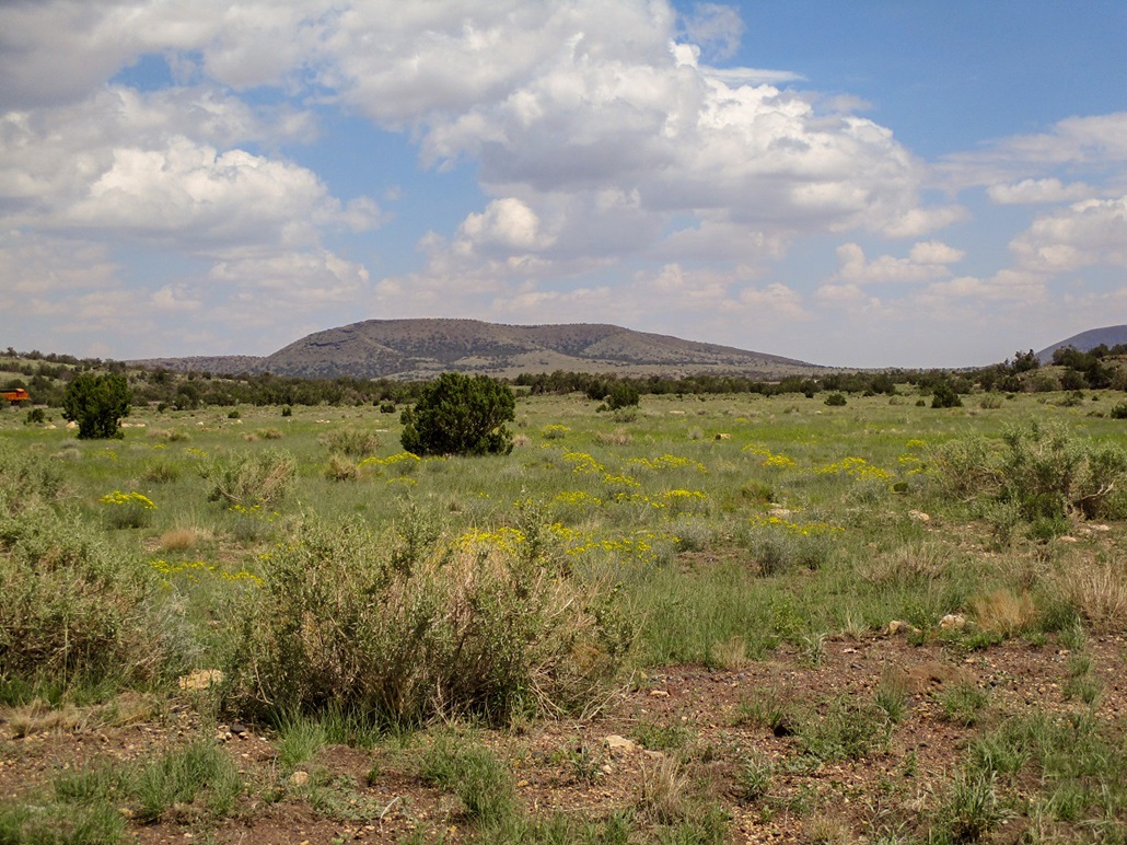
So now it's mid-morning, I've already driven 150 miles, I got lots of food and drinks and my hiking clothes. I sure as heck am not going back home. I decided to play it safe and go somewhere where I knew the roads would be better. Thus, Rattlesnake Crater now became my objective. I continued north on AZ-87 to Winslow, then west on Interstate-40 to the Winona Exit. I went right (north) and immediately turned right onto County Road 510, signed as Angell Road, and apparently a very old and temporary alignment of the original Route-66.
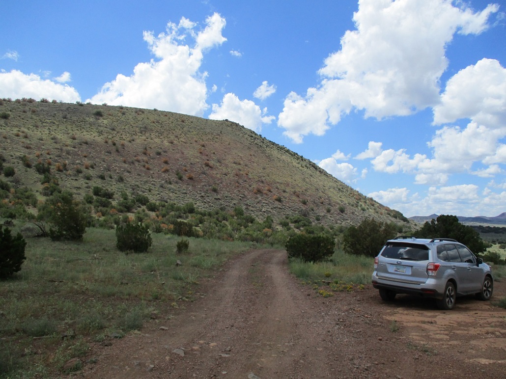
Angell Road is paved for a mile, then solid dirt and gravel with segments of old pavement. It eventually leads to the Angell Railroad Siding about eight miles farther on. I did not go in that far. I only went in a couple miles, then took a left at an obvious Y, a left marked with a small "Merrill Ranches" sign. This branch goes up and over a small hill, then down to a crossing beneath the railroad. This lowpoint was full of water, but I got through it easily. I continued on the road past a cattle grate, then took another left at another Y, always following the signs for Merrill Ranches. The road now heads north, and past a couple more grates, I turned right onto a decent road going east, directly toward Rattlesnake Crater.
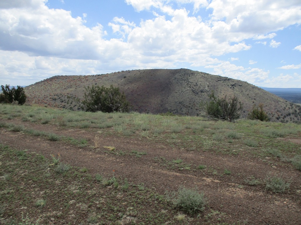
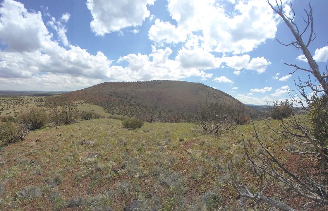
The Crater itself is a maar depression flanked on its south and north by two long hills, of which the south one holds the highest point. The road dropped into the crater, then up its other side to a pass connecting the two flanking hills. I was very surprised how easy the drive had gone and was pleased to get to this point. It situated me perfectly for hikes up both hills, neither hike looking to be more than a mile. By the time I killed the engine, it was 12:30 p.m.. The day was sunny with puffy clouds, and temperatures in the low-mid 70s, a very pleasant afternoon.
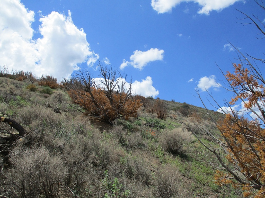
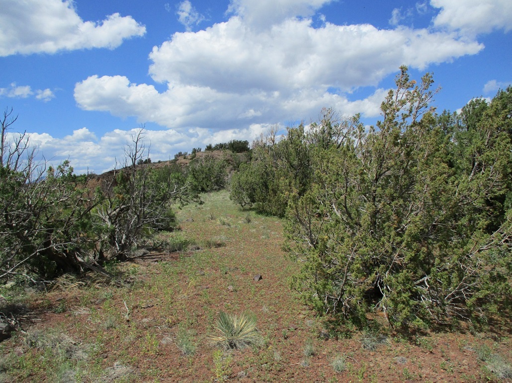
I hiked up the slope of the south hill first. The slopes are covered in pinon and juniper but many of them looked dead ... not burned, just dead, their leaves yellow. In about 15 minutes I was on the top ridge. I continued uphill aiming west, achieving a rounded top, then slightly farther on, the highpoint itself, with two large rocks marking the highest point. The one-way hike covered 0.6 mile and took me just 25 minutes.
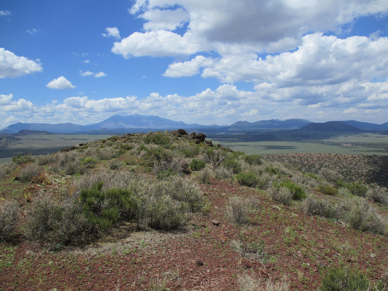
I stood atop the highest rock, looked around for a register but did not find one, and snapped a few images of the surrounding countryside. The clouds created interesting shadow-&-light effects on the ground. I did not spend too long up top, but I enjoyed this summit. It was a pleasant place to be. I hiked down almost the exact same way, even seeing my own bootprints on the lower slopes. The round-trip hike took just 45 minutes.
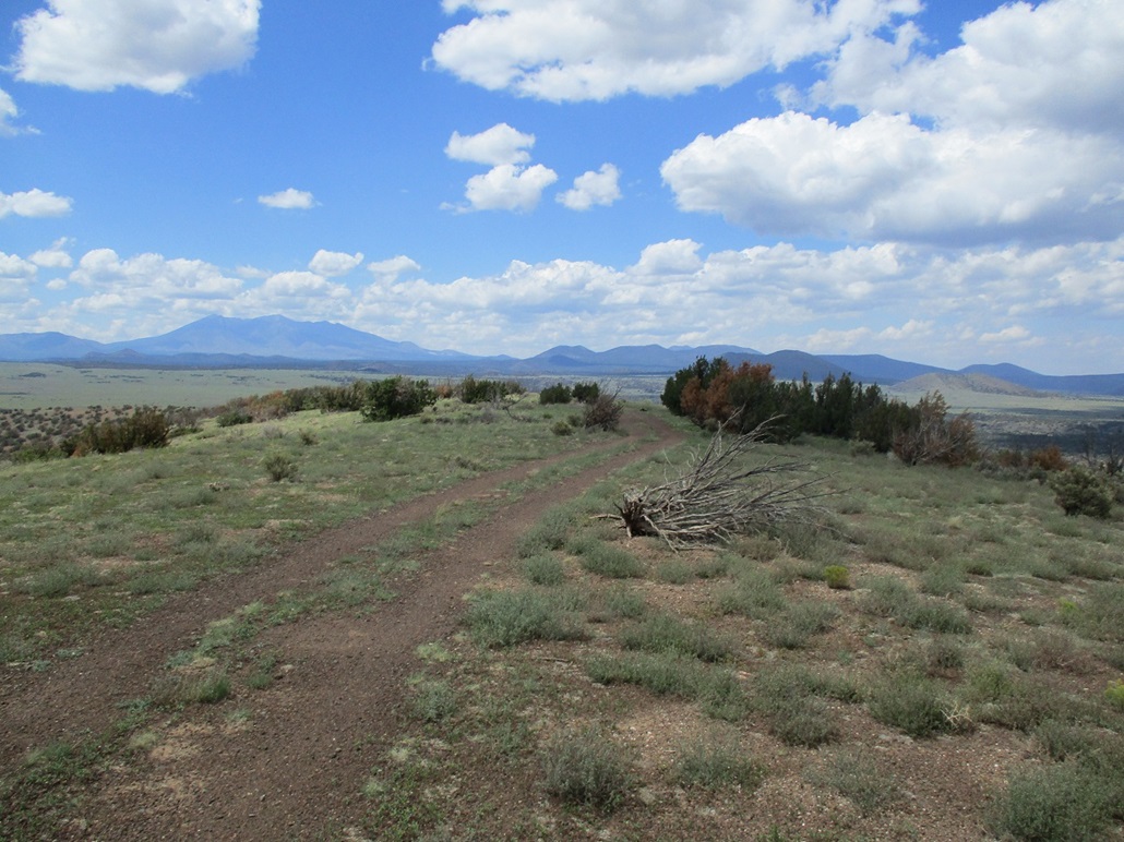
I fully intended to hike up the north hill as well. I had driven over 200 miles by now, for what was just a mile-long hike. For the north hill, I just aimed upslope, weaved through the sparse trees, scaled a couple easy rock oucrops, found a road, and was on top, just 15 minutes after starting. On top, I walked the road and snapped more photos, getting some good shots of the southern highpoint hill. I did not linger, and walked down the same way, this hike taking just over a half hour and covering a mile round trip. It was close to 2 p.m. by now.
I exited back to Angell Road, then to Winona Road and followed that into Flagstaff, where I stopped for over an hour at a Starbucks to use their wi-fi. I ran a couple easy errands and basically just did nothing. By late afternoon, I started thinking about tomorrow's adventures and where to camp. I drove northbound on US-89 about 30 miles to place me near the northern cinder cones near S P Mountain. The story continues here.
|

|