
The Mountains of Arizona
• www.surgent.net
|
| Quien Sabe Peak |
• Cave Creek Recreation Area • Highpoint: Skunk Ridge • Maricopa County |
|
Date: October 5, 2014
• Elevation: 4,884 (4,887) feet
• Prominence: 984 (987) feet
• Distance: 10.5 miles
• Time: 6 hours and 20 minutes
• Gain: 2,200 feet
• Conditions: Sunny, cool morning, then hot as we exited
• Teammates: Matthias Stender
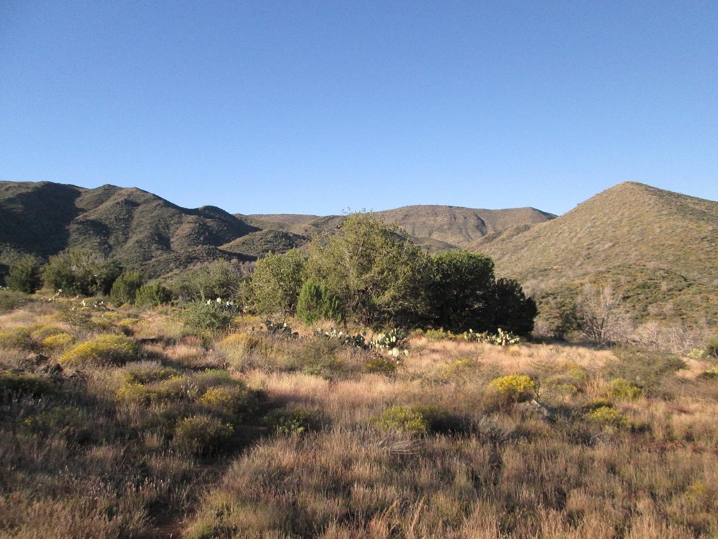
Quien Sabe Peak is the highest peak of Skunk Ridge, one of a batch of mesas north of Cave Creek in the Tonto National Forest. From points north of Phoenix and Scottsdale, the mesas are visible against a backdrop formed by the New River Mountains. Nearby Skull Mesa is the most "famous" of these mesas, but it is lower than its nearby mesas such as New River Mesa and Skunk Ridge.
Beth and I hiked here about ten years ago. We drove Forest Road 24 to the Cave Creek Trailhead, which is north of the Seven Springs Campground. We hiked south and west along Trail #4, the Cave Creek Trail, which generally stays low in the canyons and circles the mesas. On that hike, we got in about three miles, then turned around when we felt we'd had enough fun. I have been up this way for other hikes, but this would be my first time back to this specific trailhead since my hike with Beth. Today's goal was Quien Sabe Peak and my partner was Matthias Stender, who had recently moved to Arizona.
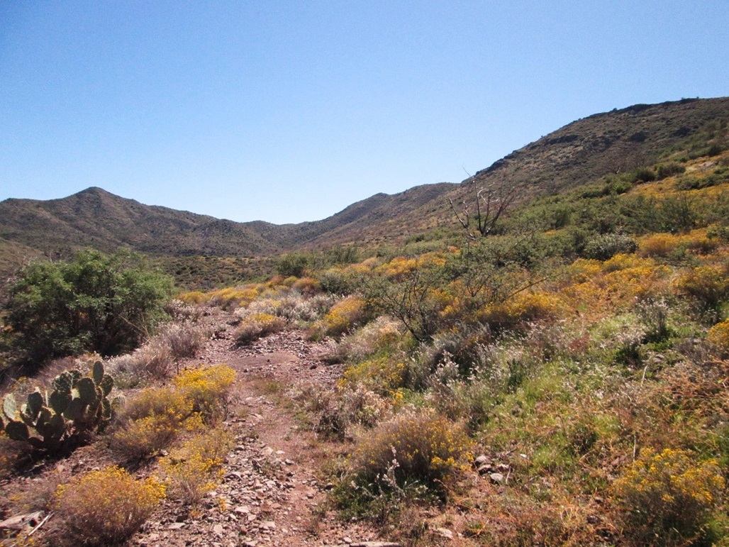
The weather was clear and dry, but still a little warm. Highs in Phoenix had been about 95 to 100 degrees in recent days, but the mornings were cool and we figured that at our slightly-higher elevation, we could expect temperatures to top out about the mid-80s. We planned an early start. I arrived at the Cave Creek Trailhead at 6:30 a.m., the first car to arrive. I got my stuff in order, then realized I had not been specific about where exactly to meet. It was possible that Matthias may have driven to the campground and started there. Thus, at 6:55, I decided to hedge my bets: I hiked south to where Trail #4 crosses a secondary forest road, FR-24B, which comes in from the campground, and decided to wait for Matthias there.
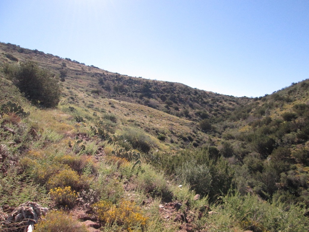
I waited about 15 minutes, but did not see him, so I decided to start moving again. I descended into the Cave Creek drainage, where Trail #247 supposedly crosses it to gain the slopes on the other side. However, recent heavy rains had apparently created some torrents in this drainage and any trace of trail had been washed away. The drainage was a mish-mash of large rocks piled up against trees, or trees uprooted and piled up against rocks or other trees. I eventually got to the other side of the drainage and found the trail near where someone had tied pink surveyor's ribbon. I hiked up this bank and gained about 30 feet to put me high enough so that I could scan the area around me.
I saw a truck and some guy parked at the end of FR-24B and assumed it may be Matthias, so I called out, and I heard a reply; it was Matthias. I thought it was the guy near the truck, and when I'd wave my hiking staff, Matthias said he couldn't see it. It turned out that Matthias was actually lost within the trees and crud of Cave Creek drainage, and was simply following my voice. That other guy across the canyon probably thought I was some kook. Finally, Matthias emerged and we greeted one another. He had parked where I had parked and was not far behind me, but I always seemed to time my movements such that I'd miss him. This added some delay, as it was about 7:45 when we finally started in on the hike.
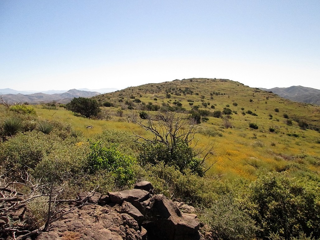
We hiked south about 0.3 mile up an easy slope, where Trail #247 met with Trail #246, called the Skunk Trail on the topographical map. We dropped a little elevation at first, but then the gradient picked up as we followed the trail south and then west, contouring with the lay of the land. We gained about 450 feet to top out at 3,920 feet elevation, putting us a little to the southeast of Peak 4160, which would serve as a good reference point for the whole hike.
From this first highpoint, we then dropped about 120 feet toward an unnamed creek emanating from Quien Sabe Spring. This creek had pools of water and looks like it runs all year, although recent rains may have added to the water levels. To here we had covered about two miles and were making good time. The main mass of Skunk Ridge was high above us, and we even debated cutting off distance by charging directly up the steep hillsides. However, the slopes looks brushy and a little too steep. It seemed wiser to stick to the trail.
We gained another 200 feet to another high-spot along the trail, then lost 180 feet as the trail swung north and then west. Then the trail gained all that back and more, meeting Trail #250, the Quien Sabe Trail at elevation 4,100 feet. According to the signs at the trailhead, we had covered 3.3 miles. It was about 9:30 a.m., the sky bright blue and the temperatures warming up, but it was still comfortable. We had not seen another person yet, and the trail was overgrown in many areas, suggesting not many people hike here.
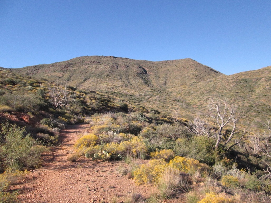
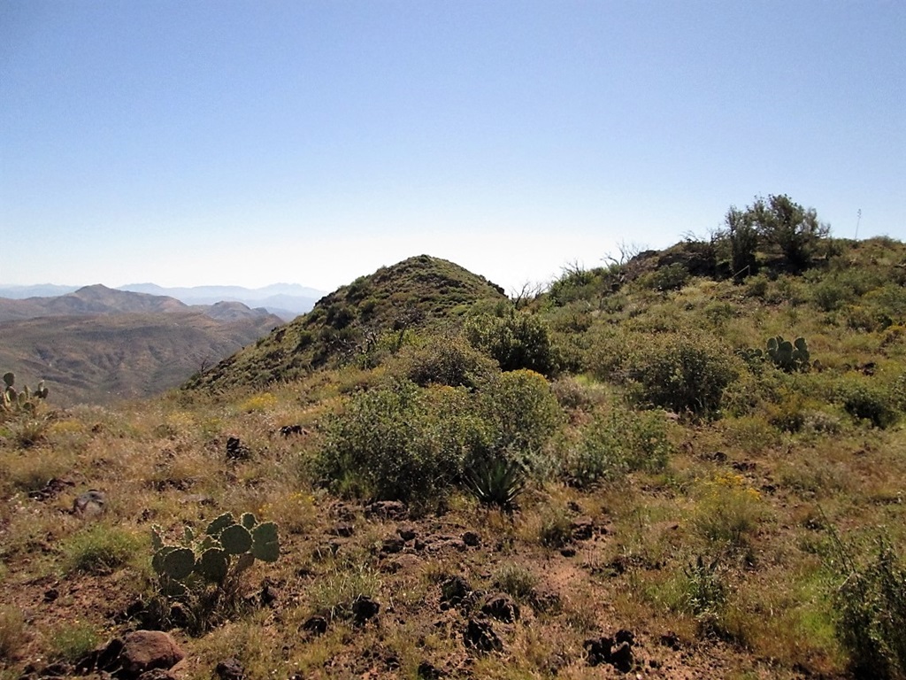
We followed Trail #250 south, entering into a little amphitheatre with Skunk Ridge now on our left, and a subridge of Skunk Ridge to our right. The trail here was overgrown in spots, and appeared to be an old road given its width. We gained about 300 feet in about a mile, putting us near a 4,400-foot saddle where the trail then descends southwest toward neighboring Skull Mesa. Here, we left the trail and started the final off-trail segment.
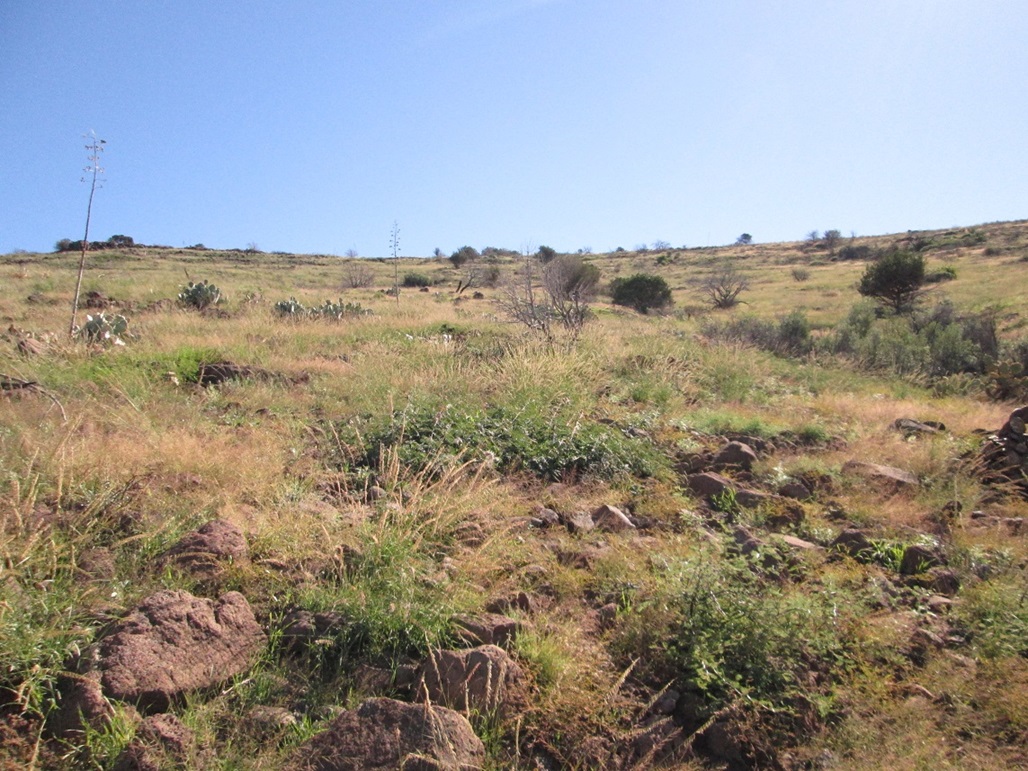
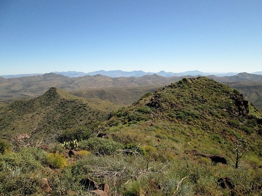
The slopes on this side of Skunk Ridge were gentle, and the brush lighter, but only by degrees. It was still fairly brushy and grassy, not to mention the rubbly rocks that lie everywhere. Our going was steady but a little slow. We gained about 400 feet to surmount one broad rise at 4,800 feet, then dropped about 50 feet into a saddle before ascending 120 feet to gain the true summit. The summit is topped by a jumble of rocks about waist high. We walked among them and tagged the highest points. It was 10:30 when we arrived, a three-hour hike not counting our delays at the start.
To the east is another hump that rises nearly as high. This hump is much more rounded and appears, especially from below, to be the highest point. However, from the true summit, peering across to this rounded hump, it is plainly obvious that this hump is lower by about three feet. We rested at the summit rocks, then decided to walk across to this hump, which was easy and took just a few minutes. Looking back, the summit rocks were obviously higher. The views were also very nice in all directions. Skull Mesa and New River Mesa were to the west, and the scattered homes of Cave Creek were visible to the south, along with Bronco, Butte and Continental Mountains. We could even see Weaver's Needle and the Superstitions way off to the southeast.
We spent about 15 minutes at this hump, then walked back to the main summit, then retraced our steps back to the trail. The walk out went well, given we were travelling mostly downhill. Unfortunately, we also had to regain those extra uphill parts on the hike out (By my study of the map, I figured our total loss on the hike in to be about 340 feet, which we had to regain on the hike up as well as on the exit). Losing elevation and the day wearing on, the warmth became more noticeable. There were many insects and I was also suffering a little from the pollen from the abundant wildflowers.
About a mile from the trailhead, I stepped on a rock funny, turned my left ankle (which has given me trouble in the past), and collapsed into a heap on the trail. It wasn't pretty to watch, but it looked worse than it really was. I was more concerned that I had re-aggravated a shoulder issue when I hit the ground, but fortunately, other than hitting it hard, it seems to be fine. My ankle didn't hurt, but it felt weak. After a few moments, we started the hike out again. I had to go slow and step carefully. My ankle felt wobbly the whole way out.
When we re-emerged onto FR-24B, we decided to walk that out through the campground and on the main road back to our cars rather than the short segment of trail. We were back to our cars about 1:45 p.m. We took a few moments to change and get things sorted out. I thanked Matthias for his companionship on the hike and a successful summit day, then started my drive out. I got a lunch back in Scottsdale then returned home about 3:30 p.m.
And now for the technical stuff: Quien Sabe Peak's prominence is listed at 984 feet (mean). Its "parent" peak is Butte Peak which is just a few miles to the south. Butte Peak's elevation is listed as 4,890 feet, and has a prominence of about 1,170 feet. However, if Quien Sabe's elevation happens to be higher, then Quien Sabe Peak would get "all" of the 1,170 feet of prominence, and Butte Peak would then be subsidiary to Quien Sabe Peak. The latest topographical map shows a 4,884-foot spot elevation for Quien Sabe Peak, but the location of this spot elevation seems to be on that rounded hump that we deemed lower than the true summit. Thus, the actual elevation my be a couple feet higher, and push the two peaks into a virtual statistical tie for summit honors.
List issues aside, I enjoyed this hike and had a good time exploring this remote, yet not-so-far-way part of Arizona. Matthias was a great partner and I was happy to team up with him.
|


|