The Mountains of Arizona
• www.surgent.net
|
| Prieta Peak |
• Tohono O'odham Indian Reservation • Highpoint: Slate Mountains • Pinal County |
|
Date: January 13, 2024
• Elevation: 3,332 feet
• Prominence: 1,617 feet
• Distance: 13 miles
• Time: 8 hours
• Gain: 2,153 feet (gross)
• Conditions: Very cold at first, cool throughout the day, bright sun, no clouds
• Teammate: Mike V.
Arizona
•
Main
•
AZ P1K
•
PB
•
LoJ
•
USGS BM Datasheet
Prieta Peak is the highest point of the Slate Mountains, which lie on the Tohono O'odham Indian Reservation about 20 miles southwest of Casa Grande. Mike V. suggested a hike of this peak and I was agreeable, seeing as I would likely never do it on my own.
We agreed to meet at the Love's Truck Stop south of Interstate-10 off Sunland Gin Road in Eloy. I was out of my door in Bisbee at 3:20 a.m. and at the Love's a little after 6 a.m., so I parked in a spot off to the side and tried to nap for about a half hour. Mike showed a little before 6:45 and we greeted one another. It had been almost 4 years since we last hiked together, when he climbed West Silver Bell Mountain.
I got my stuff loaded in his Jeep and we hit the road. We'd be approaching the peak from the east, using public road rights-of-way to get as close to the eastern boundary fence of the Tohono O'odham Nation as possible. This would still place us over 5 miles from the base of the mountains. But we'd at least be parked on public land, not on Rez land where parking is always an adventure.
We followed Sunland Gin Road seventeen miles south through Arizona City and the rural farm hinterlands that slowly gave way to open desert and scattered homesteads. Then we went west on Aries Drive a few miles, then stayed west on the Aries alignment as the paved road swung south.
Mike's Jeep would be critical for these unknown roads. Surprisingly, the roads were not too bad. There were a couple of sandy arroyo crossings that might have been too much for the Subaru. Otherwise, it was a flat hardpack road that sometimes was just a pair of tracks as it passed through grassless playas. Tire prints here suggest others come here to do donuts. We stayed on the track, making a northward bend then a westward bend, driving until we essentially ran out of road. We were about 500 feet east of the boundary fence.
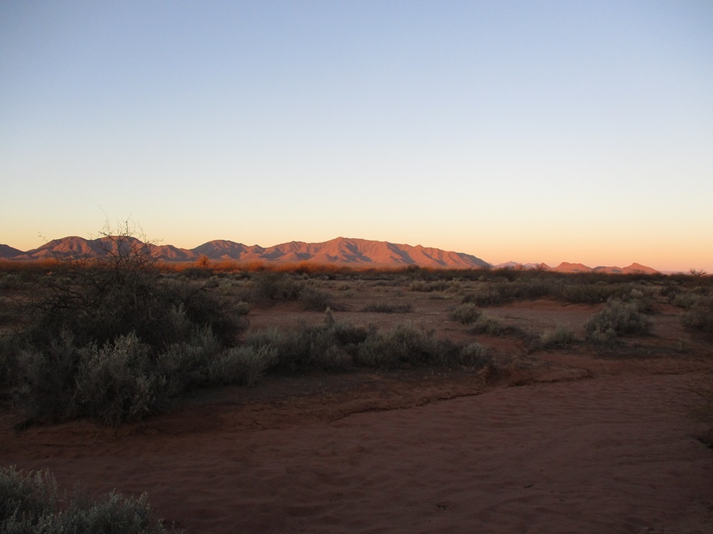
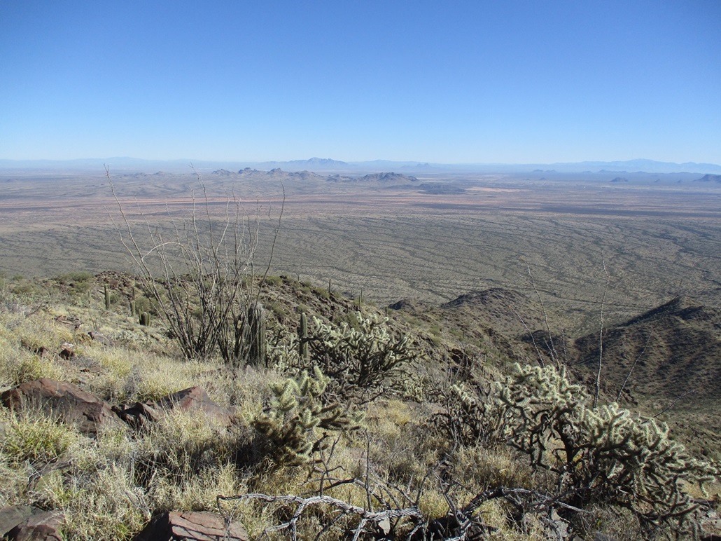
We rolled in to a spot partially surrounded by palo verde and various brush. We were a little west of Hill 1742, in a broad flat valley called Tat Momoli Valley. Prieta Peak rose west, still prieta (dark) for now as the sun slowly rose, lighting it up in the early-morning orange-red hues. We started walking about 7:30, the day sunny, calm and cloudless, but very cold, in the mid 20s for the moment.
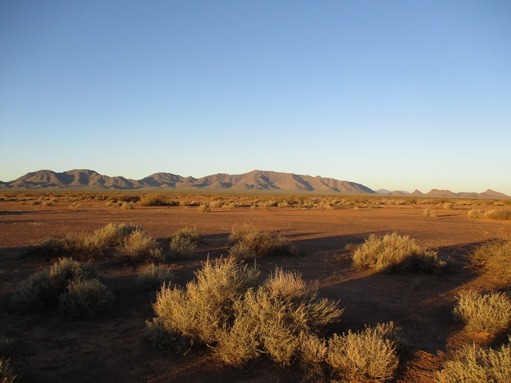
We soon same upon the boundary fence and found a spot to push down the barbs and step over it. Now we had five miles of level walking to get to the mountains. Roughly the first three miles is across this plain, then the final two up a gently-sloping bajada cut by numerous arroyos.
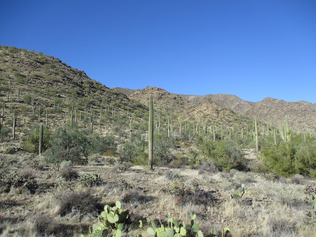
The plain was wide open and very flat. Brush was scattered and at times we were walking on bare sheets of sand. Occasionally the brush would thicken alongside an arroyo. Some of the ground had that interesting geometric pattern from the drying mud. It appears that when this place is wet, it is a broad sheet of mud and probably not walkable.
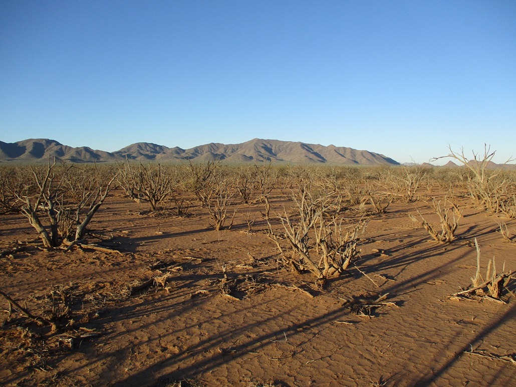
The terrain slowly changed, now slightly rockier with more grass, more palo verde, and more saguaro. We were now on the bajada, which rose ever-so-gently, the grade barely noticeable. Then, we started encountering the arroyos. Most were easy to cross, just a few feet of drop into one and up the other side, but some were quite challenging, with 15-foot walls, forcing us to walk alongside them to find ways into and out of them. We crossed easily a dozen arroyos on this segment, adding non-trivial elevation gain to our hike.
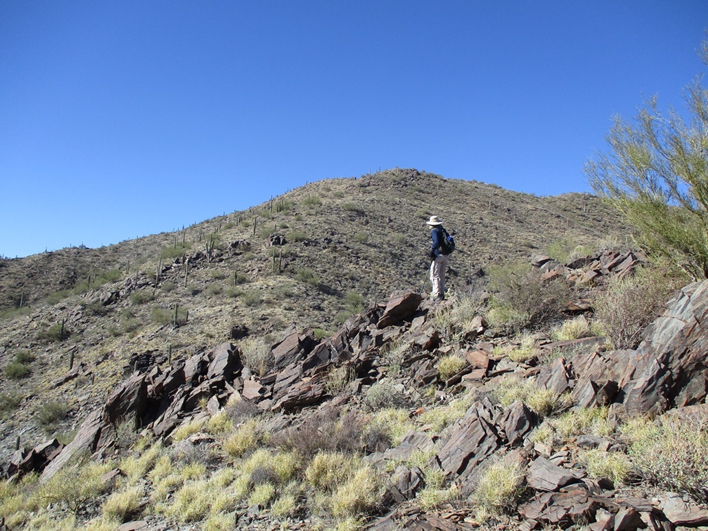
We came upon a power line and track, taking a break on the road. The power line runs up and over a pass in the mountains, servicing a big mine operation on the other side. The lowest foothills were still a little under a mile away. We were aiming for a couple of rounded foothills at the base of a prominent ridge that dropped directly off the summit. This was the ridge we planned to follow.
In time, we were at the hills, so far having walked for two hours. We started up one drainage between two of the hills, bringing us to a saddle. Above us was another rounded hill. It looked nasty. We went up and angled left, on terrain that looked most promising. It was steep and rocky, covered in grass. One short section was very troublesome to me, being flat shale-like scree that slid easily. Combined with the steepness, I was actually losing my desire pretty quick.
We could see our route, plus a couple other possible ridges, so I debated if we should drop off and follow one of those other ridges. Frankly, I was wasting our time. Ten minutes of me being a Nervous Nellie. I decided that without any other better ideas, the route we were on was as good a gamble as any other. I busted up this steep scree slope to the top of the hill and hoped for the best.
We descended about 50 feet to a saddle, the rock and footing much more secure here. We had another big slope ahead of us, but instead we went right and sidehilled past it, coming to the saddle behind it without the need to climb the extra elevation. A low moss-like shrub grew on the rocks and slope here and held everything together. I was feeling much better about the footing. We emerged onto a saddle, elevation about 2,300 feet. We still had a thousand feet to gain in 0.6 mile. For those doing the math, that's roughly a 32% average gradient, meaning that there would be sections much steeper than that. This would be the crux.
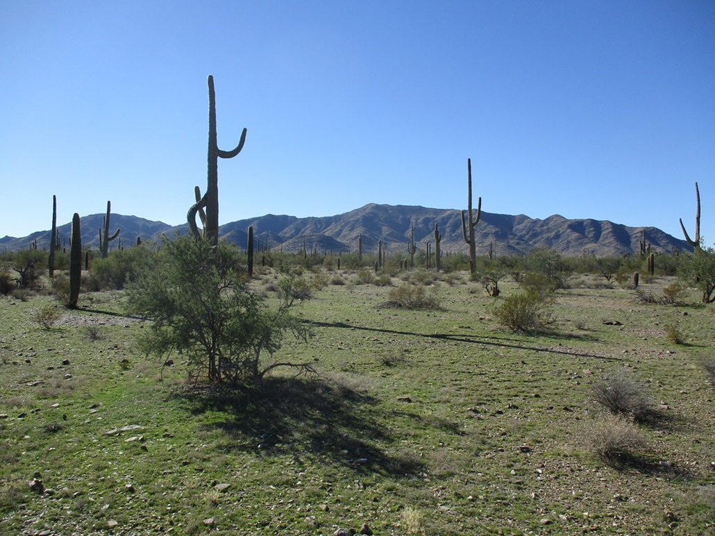
Looking up, the slope looked darn steep but not impossible. I hoped the footing would stay solid as it had been for the last little while. Fortunately, it was. The lowest slopes were more grass, cactus and small trees, then higher up, we started hitting rock bands. These rocks formed into heaps and cliffs and all sorts of odd configurations.
We were able to weave through the rocks by finding chutes, but at times, it was necessary to scramble up a face. These scrambles rated Class-3 but nothing too daunting. The rocks could be loose so we tested them. But the good news was that it seemed to stay this way, never getting really bad.
The slope then moderated and topped out on yet another knob, forcing us to drop fifty feet to the last high saddle, the summit mass now in view (the actual top was still barely hidden behind a hill). This final segment was steep but not as severe, and much to my relief and happy surprise, the top was just ahead, an easy walk up gentle slopes.
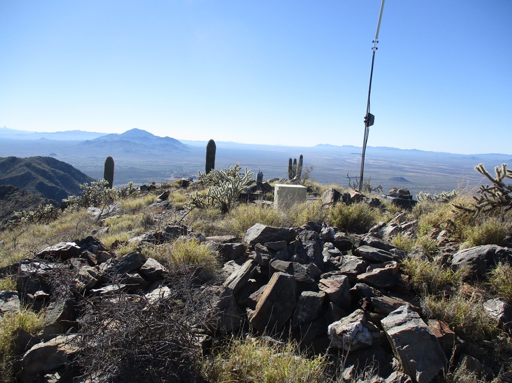
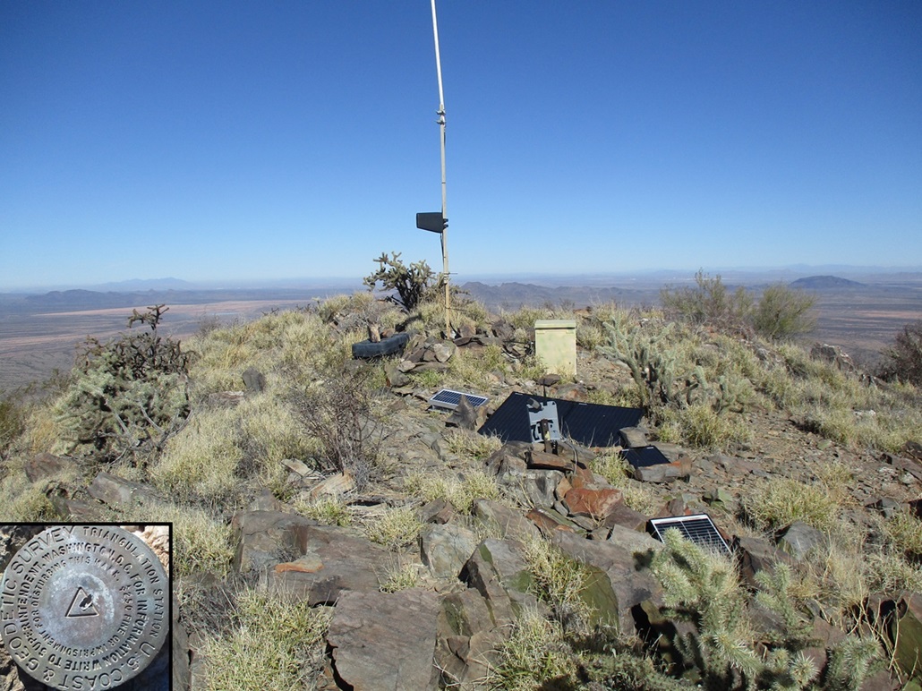
The summit wasn't anything remarkable. It was a hump of rock and brush, with solar-panels, a camera and what looked like an antenna. We could not locate a register. The benchmark was supposedly monumented here in 1920 (Mike researches this and keeps a list of benchmarks by decade). However, all we saw was an unstamped one that looked modern. We found one witness marker and it was also unstamped. That was disappointing. I took photos of both anyway, but without the name stamped on it, it doesn't feel that satisfying.
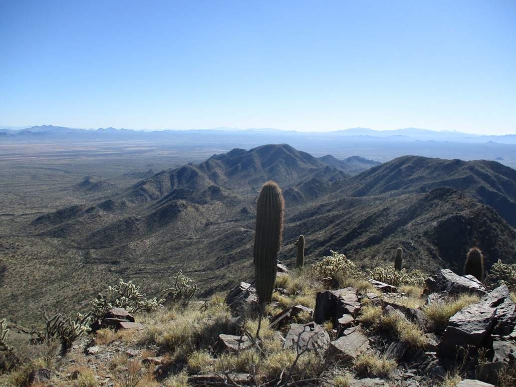
Views from up here were superb. Gu Achi rose to the south. To the west were numerous Tohono O'odham peaks, with Cimarron visible in the distance. To the north was Silver Reef and Tat Momoli. To the east were the Sawtooth Range and West Silver Bell. To the south was Coyote, Kitt and the pillar of Baboquivari. The big mine was below and we'd occasionally hear booms coming from down there. We spent about fifteen minutes up top.
Now to get down. We were soon above the steepest slope and just took each step super-carefully. I was mostly in the lead now. Going down the rock bands, I often would find any chute or ledge system that looked promising and ease down them, literally taking all this one foot at a time. I did not look up to admire the airiness. My entire focus was on the rocks and brush directly below my feet. This method worked. In time, we were down below the steepest slope and now on the earlier slopes that were not as severe.
Whereas we had sidehilled some of the lower ridge coming up, I decided to stay high and we made our way down (and sometimes up) until we were at the lowest saddle. The slope from it to the north looked really good, and so we followed it down, and it worked splendidly. This allowed us to bypass that crappy loose scree mentioned earlier. We followed ridges, slopes and drainages until we were beyond the lowest foothills. Then we popped out of a drainage and we were back on the gently-sloping bajada with all the saguaro.
It felt really good and a big relief to be off those steep slopes and back out onto the bajada. All we had to do now was walk five miles back to Mike's vehicle. This was easy, fun and enjoyable desert trekking, the bajada slopes green after a recent rain. We had to drop into and out of the arroyos like we did before, but moving mostly downhill, we moved pretty efficiently.
The five-mile trek took a couple hours. Toward the end, I was feeling pretty beat. We were back to Mike's vehicle at 3:30, an 8-hour, 13-mile hike, and especially satisfying as we tagged a very worthy peak in the process. The day had been perfect. It warmed into the 50s, which was perfect for this kind of long-distance desert trekking. Even temperatures in the 70s would have felt uncomfortable.
We piled in and drove back to the Love's where I got my gear loaded into my car and shook hands with Mike. It was great to meet up with Mike again after all these years, and I appreciate his driving us to the start of the hike and his camaraderie on the hike.
I got on the interstate and headed back to Bisbee, arriving home about 6 p.m. with a Subway footlong in my hands, the end to a very energetic and enjoyable hike/trek/climb.
|


|