
The Mountains of Arizona
• www.surgent.net
|
| Picketpost Mountain |
• Superstition Mountains Complex • Tonto National Forest • Pinal County |
|
Date: November 11, 2015
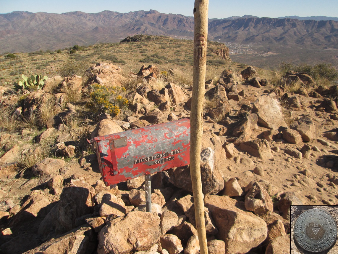
• Elevation: 4,375 feet
• Prominence: 1,455 feet
• Distance: 4.6 miles
• Time: 4 hours and 30 minutes
• Gain: 1,900 feet
• Conditions: Blue skies and cold, then warming slightly
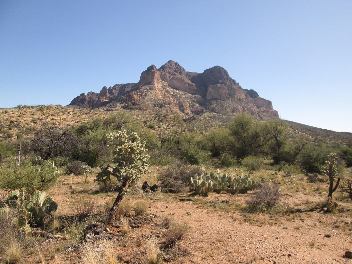
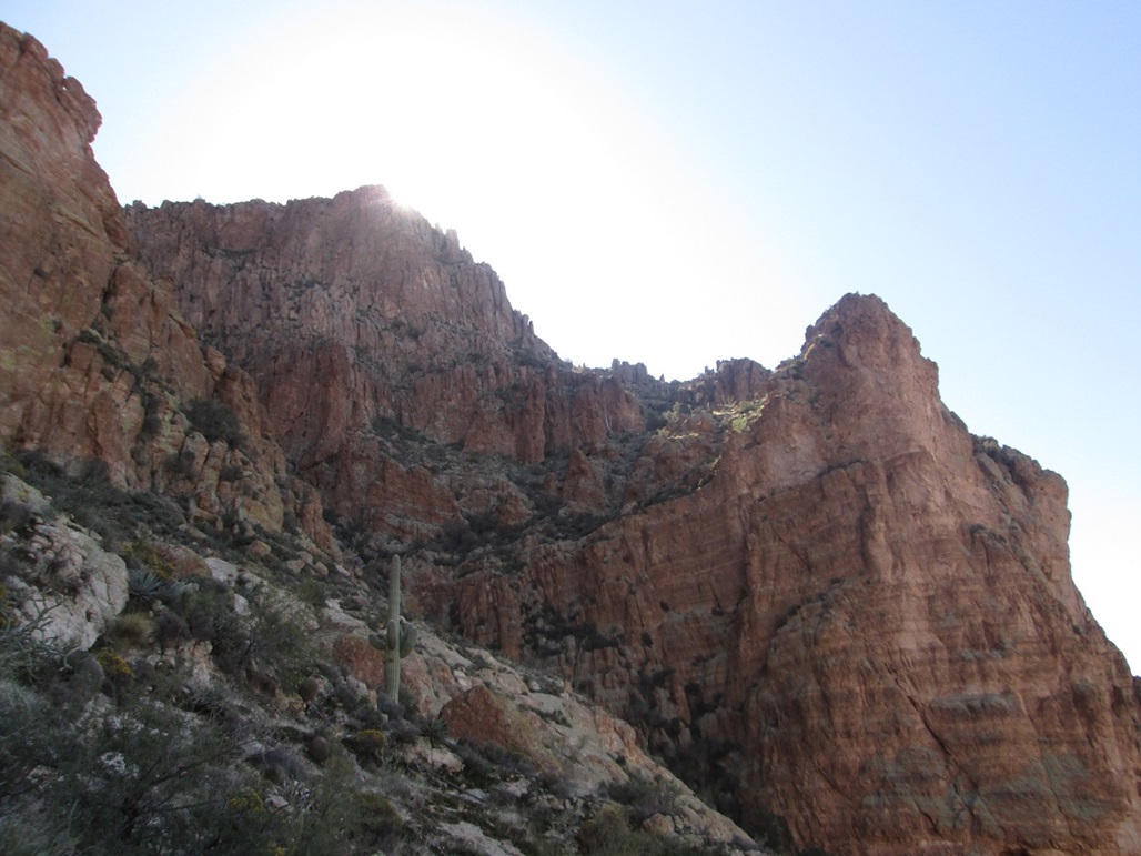
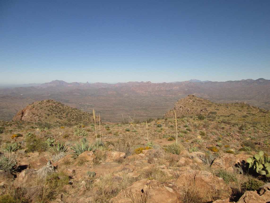
Picketpost Mountain is a familiar landmark mountain a couple miles west of the town of Superior, with highway US-60 passing below the peak. The mountain is one big blob of ancient volcanism that has weathered into cliffs that completely encircle the top. The peak sits by itself, but is surrounded by the lower foothills of the Superstition Mountains. From any vantage, it looks like an difficult mountain to scale, but there does exist a route through a break in the cliffs on the peak's north side that allows a way to the top. It is an Arizona Peakbagger's classic.
Picketpost Mountain gets its name from an old military encampment that existed at its base around 1870, under the direction of General Stoneman as part of the ongoing Apache Wars. The encampment itself did not survive much longer, but within a decade, miners found silver, then copper, which begat the town of Superior. Today, Superior sits at the base of Queen Creek Canyon, about four miles from the base of Picketpost Mountain.
I was here once before, back in early 2009. I had no trouble finding the trails and got about 500 vertical feet up the ridges to the base of a small rock scramble. I recall it was Super Bowl Sunday, and I didn't want to spend the afternoon on the peak, especially with the home-town Cards in the game. So I turned around and headed down.
I decided to finally go back and try it again, once the weather cooled down. For a peak like this, I wanted the whole day to be very cool, not just the morning. The previous weekend had been in the 80s, but then a front moved through Tuesday (yesterday), dropping the highs into the 60s. Today, Wednesday, the air was very chilly but the clouds were gone. Being Veteran's Day, I had the day open so I got my stuff together and headed to Picketpost Mountain.
I arrived somewhat early, about 7:30 a.m., the first one in the parking lot off of US-60, about 55 miles from our home in Scottsdale. It was cold enough so that I could see my breath. Since my last visit here in 2009, the newer Arizona Trail has been constructed parallel to a sandy creekbed, which used to be the trail. Picketpost Mountain was easily visible, its cliffs trying to scare me off.
I was moving by 7:45 a.m.. I followed the Arizona Trail south about 0.4 mile, the trail dropping into and out of two small arroyos, then contouring with the ridges. The trail to Picketpost Mountain goes sharp-left at a junction, with a substantial rock cairn, and an arrow laid out in rocks pointing the way (later, on my exit, that rock arrow would be disassembled and kicked aside).
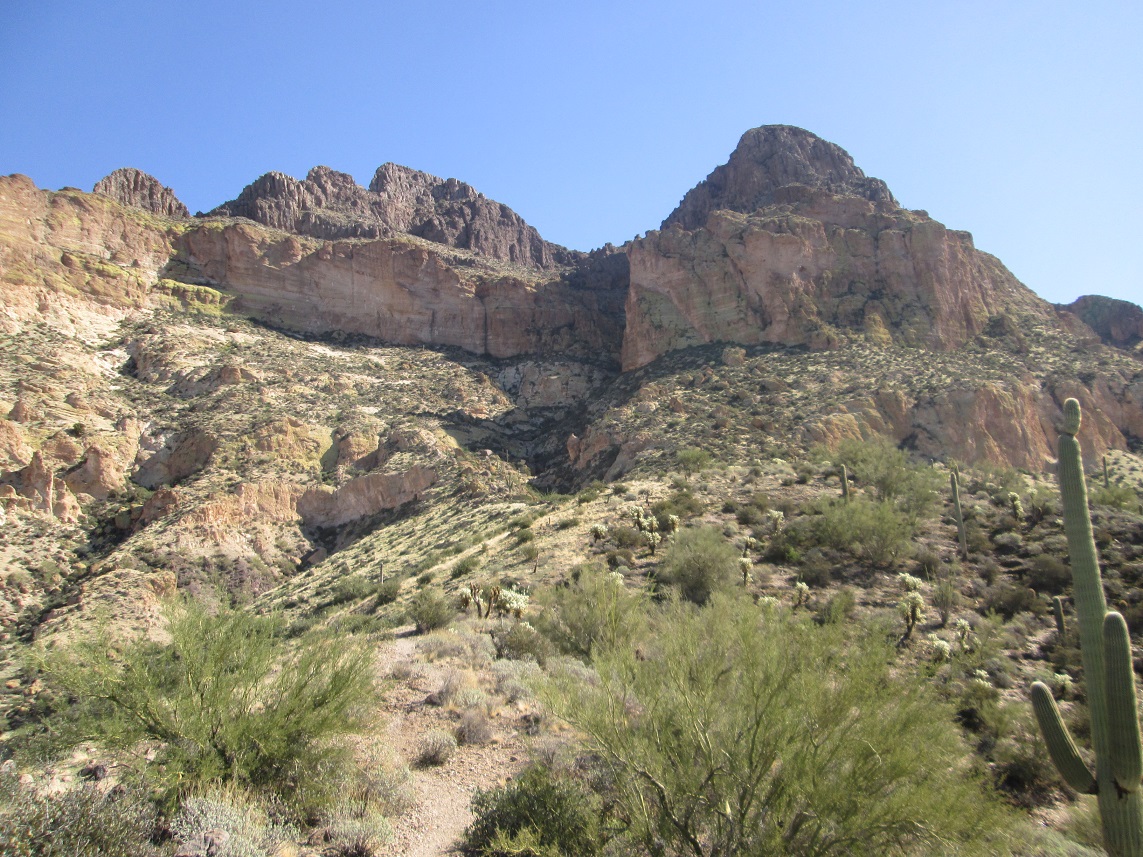
Now, the trail began to gain in earnest. At first it appears to be an old road. It curls up to a flat spot near a concrete tank. Beyond the tank, the trail resumes, now switchbacking up a slope to surmount the main ridge coming off the mountain. The gain was steady but never too steep. The trail then drops to a saddle where there is a noticeable change in the tone, going from grassier, shrubbier slopes to rockier slopes in a matter of moments. The trail now starts to gain steeply, and shortly, comes to the base of a wall of sloping white-colored rock. This is as far as I got in 2009.
I clambered up this slope, then found the trail again. I was gaining toward the base of the cliffs, and the trail started to angle right, aiming for the steep gully. The sun was still low in the southeast and I was in shade, and it was very cold.
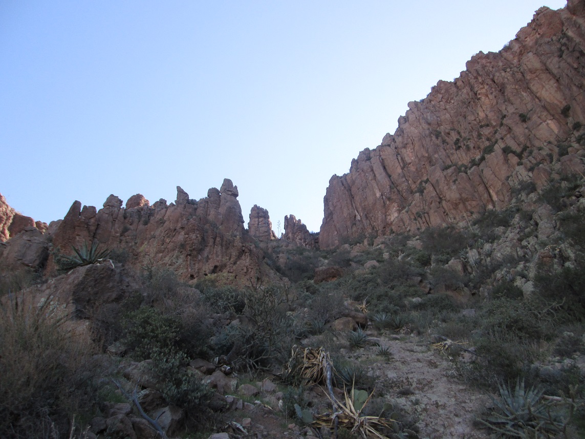
The trail starts to lose distinction as by now, I was on more rock than dirt. I started to spy small cairns and a few painted arrows on the rock, some white and some blue, the blue ones looking very old. The arrows were not necessary. Even without the cairns, the way was usually logical. The cairns were just an assurance that someone had been this way before me.
As the route gets closer to the actual cliffs, there are a few spots where the climbing becomes a little more involved, although still very easy. I had to scramble up some short sections, then traverse a couple spots where a fall could have been bad news. But these were easy, and enjoyable.
Finally, the route works its way up a steep series of clefts in the rock, immediately beside the actual gully. I could look over and see better-looking cairns in the gully, and it looked friendlier anyway. But getting over to it required one interesting traverse. It was very short, but just enough to get the adrenaline flowing. Maybe there was an easier way, but I did not see it. In any case, I was now in the gully, where I wanted to be.
I just followed the cairns, occasional flagging, and the arrows. The climbing here was easier, but brushier. There were a couple spots where I had to contort awkwardly to get past a rock or brush barrier. The higher I climbed, the more distinct the trail became. It was now considerably steeper, pushing 40 degrees, but failsafe.
Now and then I would see a branch in the trails and arrows pointing a certain way, so I would follow the branch, then get cliffed out. This happened more than once, and wasted my time. Whoever put these arrows in must have had other destinations in mind. I decided to ignore all the arrows and follow my instincts. The trail literally went straight up, was occasionally loose in spots, but was technically easy. Some sections were a little too loose, with scree ready to roll at the slightest nudge.
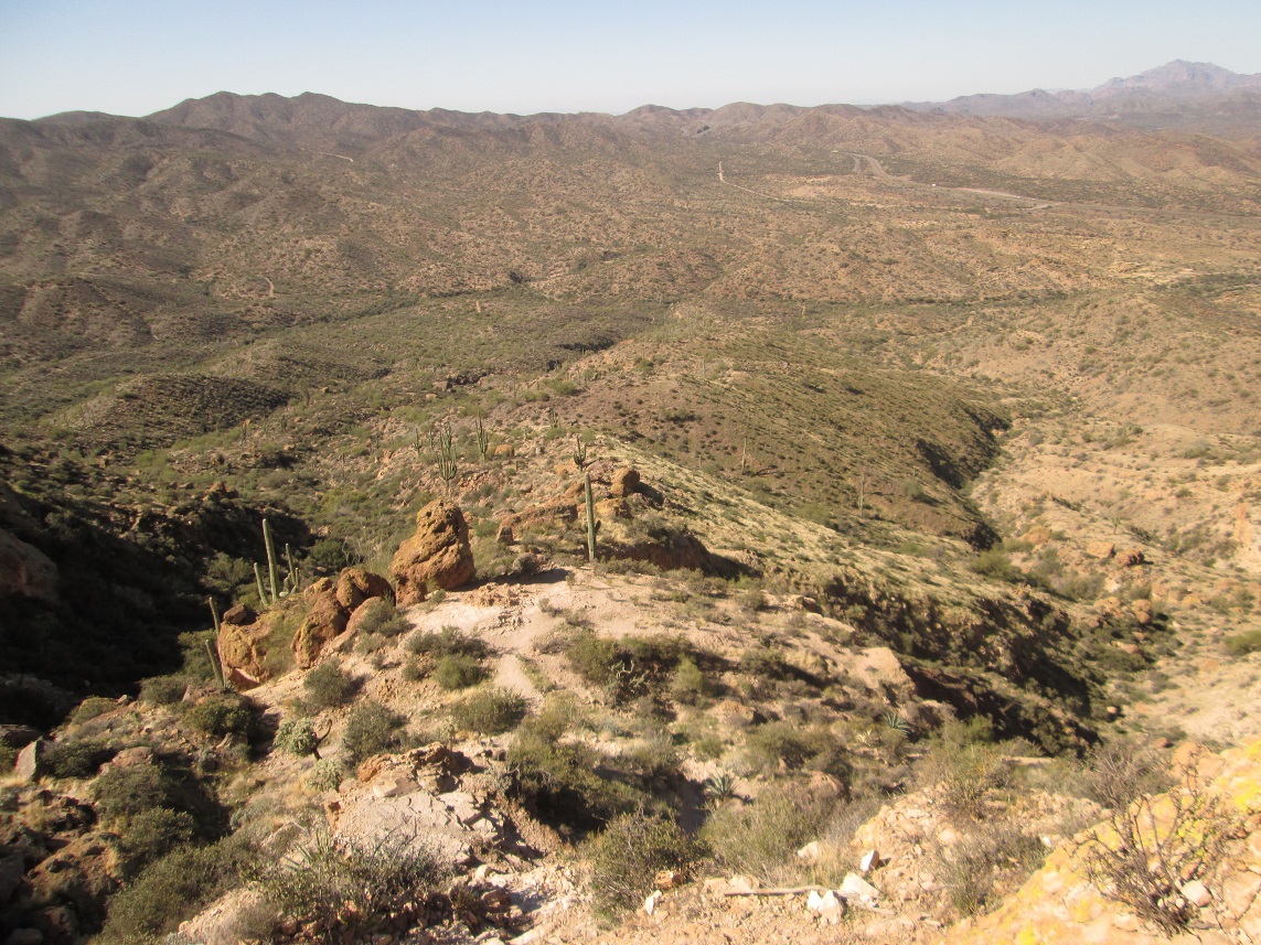
I hustled up this stretch, aiming for a small notch in the headwall up ahead. The trail then swings left toward a lower rock wall, where the trail then surmounts this wall. And just as fast, I was now out of the gully and on "flatter" terrain. From here to the top, I still had about 250 vertical feet to go, but I was now on the "top" of the mountain, it being a sloping field of brush and cactus. The trail want straight for the summit, crawling up one last small rockband along the way. At 10:15, I arrived on top.
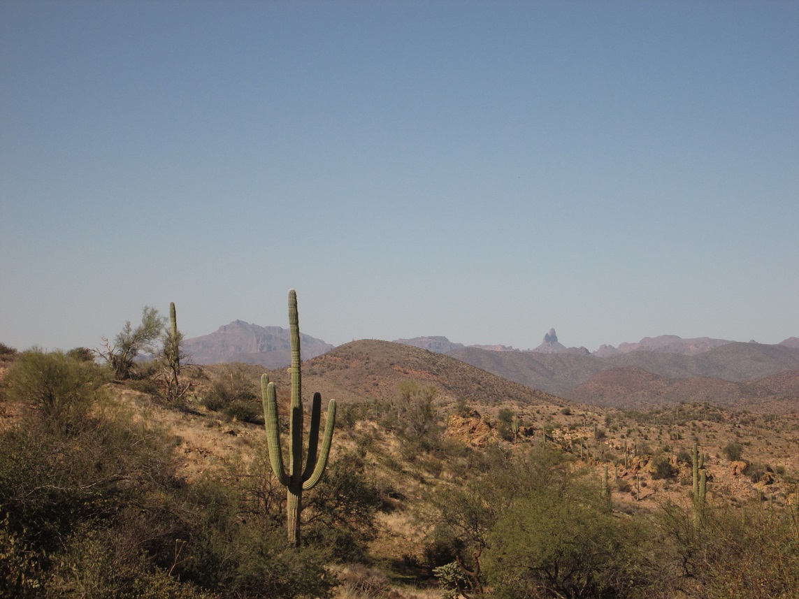
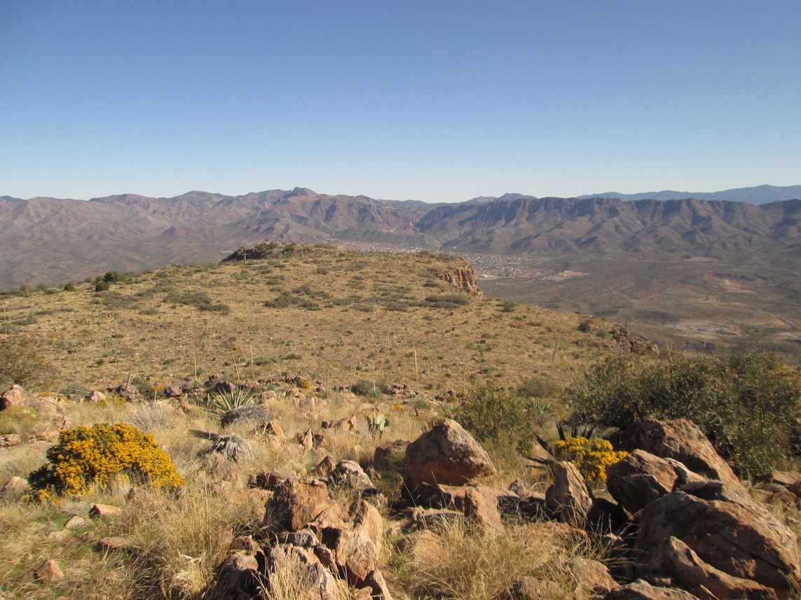
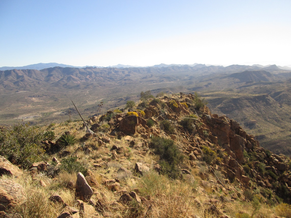
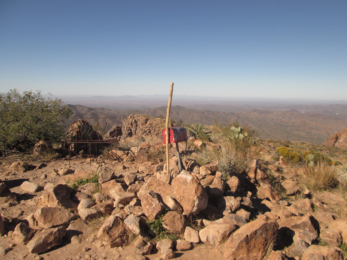
The top is noted for featuring a mailbox that holds the summit register, plus an old rusted bench someone lugged up here ages ago. I signed in, noting a lot of people had been here the previous day, and apparently every day since the weather had cooled. It is a very popular hike. Being Veteran's Day, I wanted to say something nice for all my relatives who have served and/or fought in past wars. The views were outstanding given the bright blue skies and clear air. To the east I could see Superior, with the cliffs of the Apache Leap above the city. To the northwest I could see Superstition Mountain and Weaver's Needle. The day was clear enough so that I could see the big distant peaks such as Pinal Peak, the Sierra Estrella, and Mount Lemmon. I stayed up top about 15 minutes, enjoying the views and a well-earned breakfast break.
I still had the downclimb to manage. I started down the trail just fine, following the obvious trail past two very large cairns I didn't recall seeing on the way up. I had memorized the rock formations where my trail had exited the gully, and I sensed I was too low. I climbed back up about 40 vertical feet, looked around, and found "my" trail, which was hard to see in the brush compared to this beefier one I was on. I didn't want to take chances, and wanted to descend the way I had come up. Where this "better" trail goes, I can't say.
The hike down went well. I was on my butt more often than not, but this was by choice. About halfway down the gully, I met up with a group of four on the ascent. We talked briefly, then resumed our respective hikes. I found the downclimb to go very well. Finally, I was back to those traverses which put me back onto the rockier "trail". These went well too. I was making good time, but stopping often for photos, too. I met up with another couple later on. Within about 90 minutes, I was back to my truck, a 4-hour, 30-minute round trip. All of a sudden, about 30 hikers emerged from the Arizona Trail. They weren't hiking to the summit. They must have been right behind me.
I spent some time relaxing and changing into dry clothes. I was in no hurry with no time restrictions, so I lazed around the area for a little while. The drive home went well.
I was very pleased to finally climb Picketpost Mountain. It is exactly as advertised: steep, scrambly gully, but any hiker with a willingness to do short scrambles, find routes, and put up with brush should have no difficulty with this peak. You do need to pay attention and have a sense of where to go when encountering junctions. This would be an ideal climb for someone looking to graduate from trailhikes to something more "climby".
|


|