The Mountains of Arizona
• www.surgent.net
|
| Peak 7993 |
• Springerville Volcanic Field • Arizona State Trust Land • Apache County |
|
Date: August 1, 2023
• Elevation: 7,993 feet
• Prominence: 413 feet
• Distance: 0.8 mile
• Time: 45 minutes
• Gain: 480 feet
• Conditions: Cool, sunny with interesting clouds
Arizona
•
Main
•
PB
•
LoJ
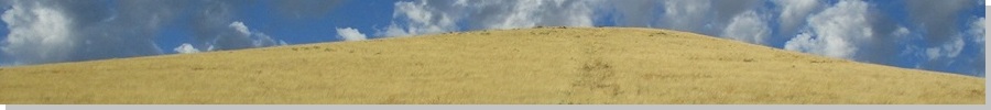
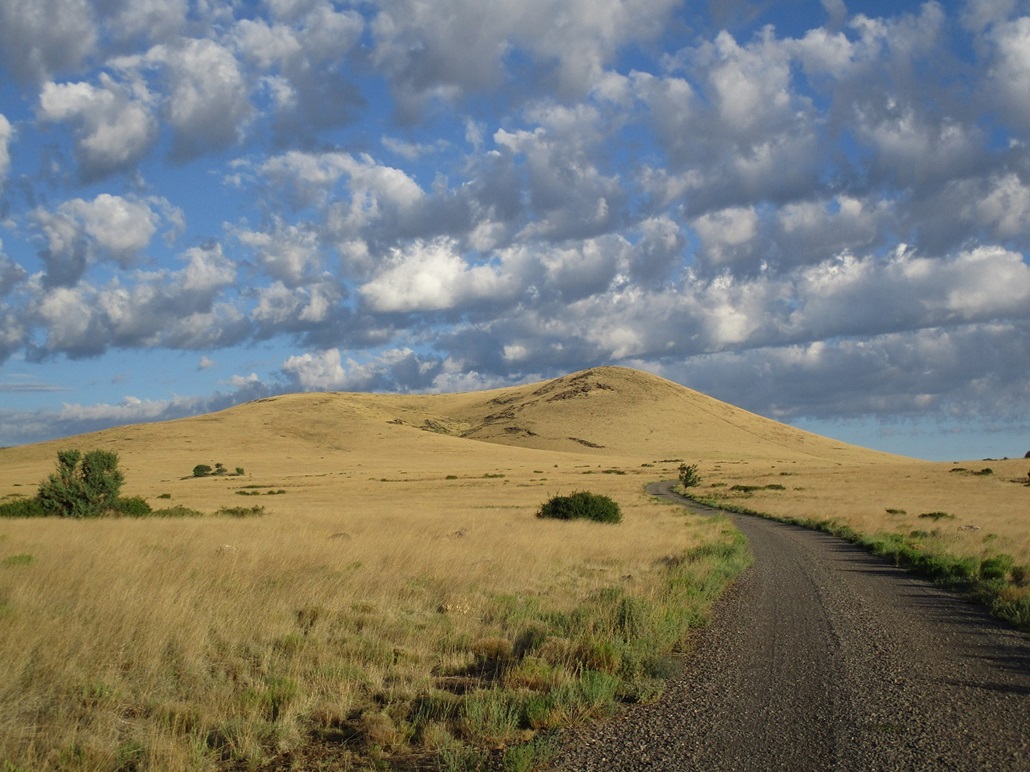
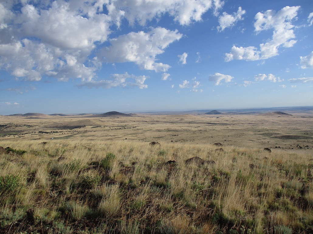
This peak lies west of Springerville, a little north of AZ-260, roughly near the junction with AZ-261. It's lower than the peaks higher up on the Springerville Volcanic Field, so that it's covered only in grass and small brush, nothing more than knee high. A good all-weather gravel road gets close to the peak, so that access is easy.
I was here a week ago, on my way toward New Mexico and a couple days in Albuquerque. On that day, I hiked three peaks on the higher plateau, which you can read about here. Finished with those peaks, I headed east on AZ-260 and gave this peak a look, but it was very warm by now, into the high 80s. Although a short hike and one that is doable even in warm temperatures, I opted not to hike it then due to my concerns of snakes hidden in the grass.
Yesterday, I left Albuquerque early and spent a few hours exploring peaks in and around the Reserve area of New Mexico. Heat wasn't as much an issue yesterday, but the storms were. The big thunderheads started building by 11 a.m., which essentially grounded me. Nevertheless, since I had plenty of time open, I drove around and even came back to this peak later yesterday, thinking that maybe the clouds will scoot through and I can run up the thing.
I sat in my car for about thirty minutes, watching the clouds. I also walked around a little. A soft rain fell, but nearby I could see sheets of rain falling, suggesting very localized heavy downpours. Then a lightning bolt hit nearby. That nixed it. I wisely chose not to hike it now, and instead returned to Springerville to find a place to crash for the night.
Normally, describing where I stayed isn't that interesting. I tried the main chain places and they were all asking for a minimum of $160 for the night, this being a Monday, a "slow" travel day. I asked one lady why so expensive and she said a lot has to do with the rooms all being taken by the firefighters who are here battling the various blazes in the region. So I found a local one-off place called Reeds Lodge, which had a better rate. This is an old motor-court style hotel dating from about 70 years ago. The room they put me in had really cool "mid century" furnishing, images of Jimi Hendrix, the Beatles, Stevie Nicks and Elvis on the walls, and on a table-console nearby, a small record player! And there were three vinyl records to choose from: the Beatles' Abbey Road, Creedence Clearwater Revival's two-record "best of", and Neil Young's Harvest. Score! These people have taste and style, for sure.
I have never owned a record player. My folks had one but sold it back in the 1980s. I came of age, so to speak, when CDs were first starting. Thus, I haven't gently laid a stylus onto a record in over 30 years. Tonight, I would break that streak. I put side 1 of Abbey Road on, and put the stylus on and listened to the slightly scratchy, non-high-fidelity output. This may be the first Beatles' "record" I have ever played. All my Beatles' recordings were cassette or CD. A couple times the needle skipped or repeated a loop. I think, but cannot be sure, I may have experienced wow and flutter. Just so you know, I skipped over "Maxwell's Silver Hammer" because I hate that song with all the might of the universe.
I was up at dawn, and looking out the window, saw clear skies and just wisps of high clouds, all the storms from yesterday simply vanished. After moping around for a little bit, I got my things packed and started on today's adventures, first up being this peak, Peak 7993.
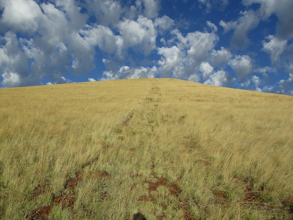
I drove back to where I was yesterday. It was pleasantly cool now, in the low 60s, and some interesting cloud formations above me, but mostly sunny. I followed tire tracks into the grass but these bent away and petered out, so I angled to my right, aiming for a noticable straight-line "cut" in the hillside. An old road? A fence line? I couldn't tell, but it likely had lighter grass where I could see where I was stepping better. My concern about snakes was lessened, but they can still be laying there, even in this "cool" weather.
I got to the track and yeah, it's an old vehicle track. I followed it straight up and soon was at the summit, the top few dozen feet being a little rockier. The summit was open and bare, a couple low rock outcrops to tag. I saw no registers or cairns. I spent a few minutes snapping images and walking the area. Since the summit is 7,993 feet in elevation, and I am 6 feet, 4 inches tall, the top of my head was mere inches from the 8,000-foot elevation barrier. As has been my habit, I didn't stop or sit. I started back down, following the road cut.
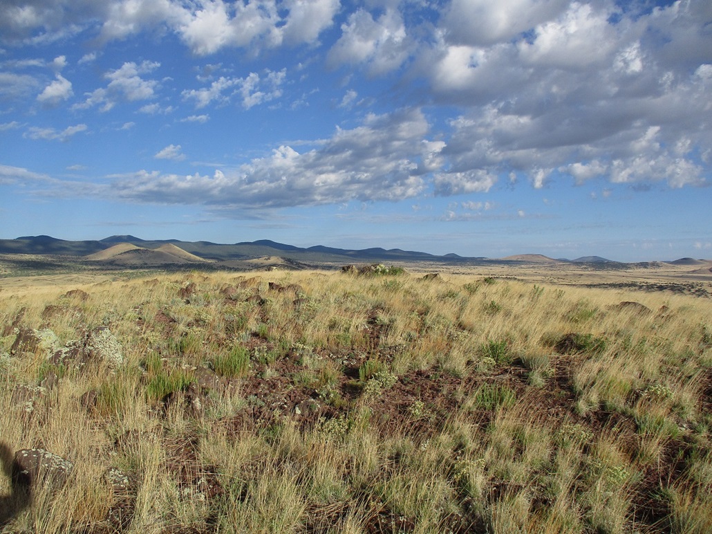
The cut was interesting because it begs the question who would do this, why and when? What purpose would it serve? Was whiskey involved? I have no idea. For walking, it was decent. Footing wasn't the best but I liked that I could see where I was stepping. Only the portion on the flatter lands at the base were covered in heavy grass. I moved quickly and hoped I wouldn't step on a rattler. The round-trip hike took just 45 minutes. Actually, as these peaks go, this was a nice one. Short and quick, with good views.
It was still early, and I had all day to waste. I did not have to be back in Tempe until nightfall. So I started looking around for more peaks to do. But I had no plan this time. I mainly looked at ones I had ignored on my previous visits, those that held little interest for various reasons. Also, it would be warming quickly so I would be forced to stay high. I drove AZ-260 into McNary, then followed the McNary-Vernon road north into the Sitgreaves Forest.
I drove the forest roads to look at Peak 8885, which is a ranked peak near Wishbone Mountain. But when I got there, the roads were muddy — apparently yesterday's rains being heavy here — and the way up was heavy forest and very quickly I lost interest. I'll save it for another day. I then followed the McNary-Vernon Road (now called Apache County Road 3140) north to the town of Vernon, looking for a way up Serviceberry Hill. But that was a no-go, being surrounded completely by fences and private property. I also took a look at Dobbins Knoll a little west, but other than drive around, made no effort. This area is also a smattering of homes and fences.
I really had no energy to be honest and none of the peaks here interested me that much. It was warming again and by noon the clouds would be back, so I decided I had had a good week, a fun excursion to Albuquerque, and that it was time to head back. I followed US-60 back into Show Low, then south for one last possible quickie hike, Hill 6882, on the lip of the Mogollon Rim that is Show Low's city highpoint. Forest Road 300 goes right up and over it, but I got in maybe a hundred feet and backed off. The road was way too muddy and pot-holed. Thus, I simply aimed the car south and proceeded to Globe and on back to Tempe, arriving in the mid-afternoon.
|


|