The Mountains of Arizona
www.surgent.net |
|
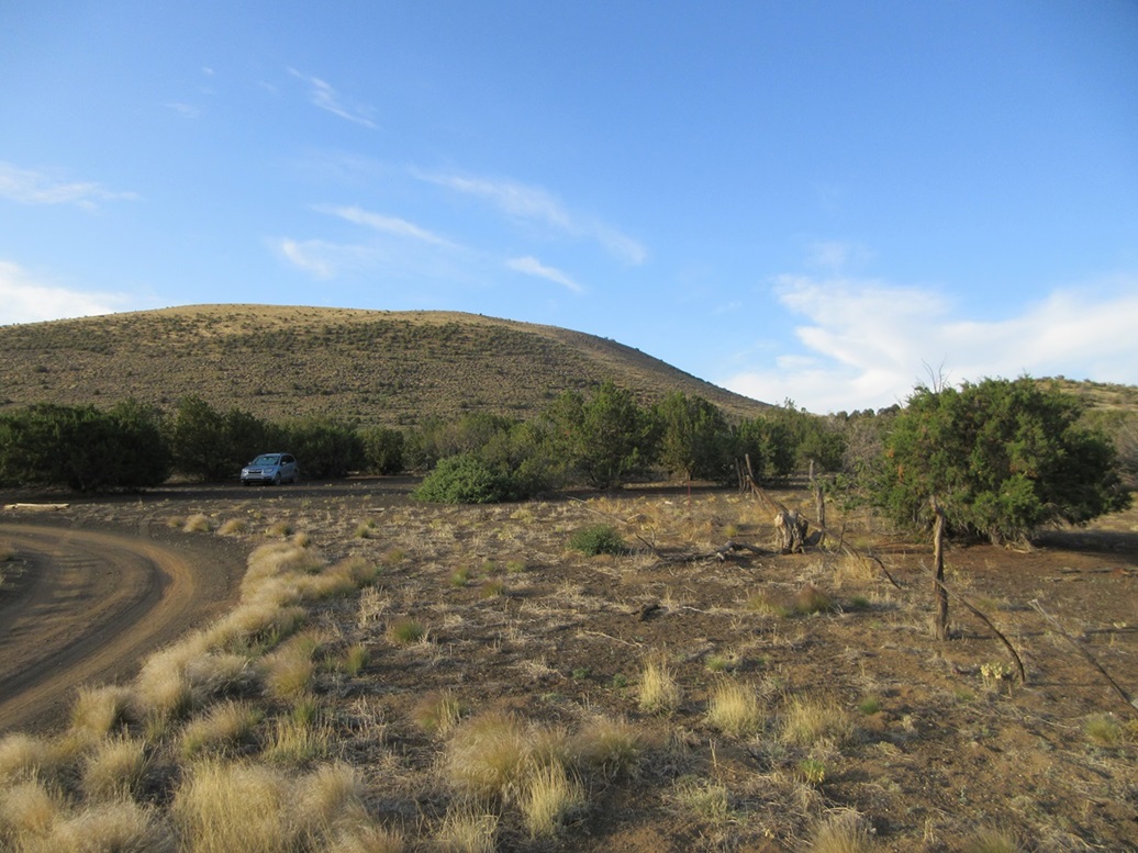
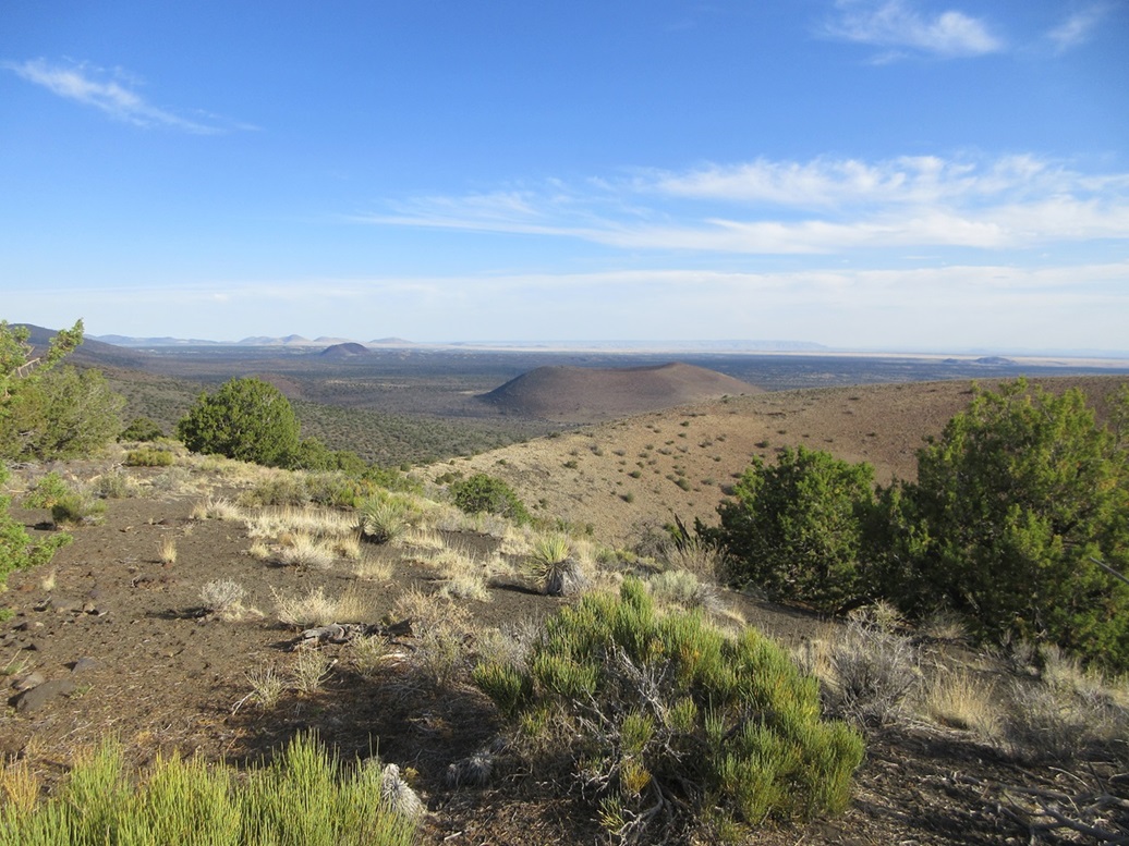
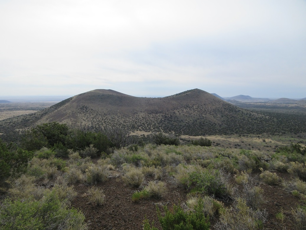
Peak 6599 • Peak 6530 These two volcanic cinder mounds lie on the east fringe of the San Francisco Volcanic Field, about twelve miles east of highway US-89 along Sunset-Wupatki Road. Nearby peaks include Black Bottom Crater, Haywire Crater and Peak 6109 (Halfmoon Crater). Yesterday, I met with Matthias and we climbed six peaks on the Volcanic Field north of Humphreys Peak. I then stayed a night in town, and looked at these two peaks for this morning before driving back to Bisbee. I was up at dawn and on the road, stopping for gas and snacks then heading north on US-89 to Sunset-Wupatki Road. I passed through the Sunset Crater National Monument and dropped elevation, going from the big ponderosa pine forests down to the scragglier juniper and piñon zones. I then turned onto FR-9122, which is the only road to turn on to out this way. This is at the east edge of the Coconino National Forest, but the road passes through and on to a checkerboard of private and State Trust lands and scattered homesteads. Mailboxes at this junction are the big hint to make the turn. Yesterday had been warm, in the mid 80s and I'd be a thousand feet lower down here, but the temperatures were not expected to be as warm, a few degrees less. Nevertheless, I wanted an early start to take advantage of the cool mornings and shade, and also since I had a lot of driving ahead of me. As I arrived here, about 6 a.m. on the nose, my car's thermometer read in the mid 60s outside. Comfortable, but it would definitely be a warm day. I drove in about a mile to a fence line, the boundary of the national forest. I turned onto a good dirt track going south, marked on the map as FR-9129M (there were no signs out here with road numbers on them). I went as far south as possible, passing through an open gate and parking in a clearing alongside the fenceline, in the shade of some large piñons.
Date: June 9, 2024
• Elevation: 6,599 feet
• Prominence: 659 feet
• Distance: 2.35 miles
• Time: 3 hours whole hike
• Gain: 860 feet ascent, 660 feet descent
• Wildlife: Hares, cat prints in the sand
• Conditions: Sunny with blue skies at first, cool but warming fast
Arizona
•
Main
•
PB
•
LoJ
•
Interactive map
The mass of Peak 6599 rose immediately to the south, but the actual highpoint was not visible from this vantage. Peak 6530 was also blocked by some lower hills. The forest service map shows a road wiggling south between the two peaks, but this road has been erased. I was about a mile on a straight line to Peak 6599, and started walking at 6:15 a.m..
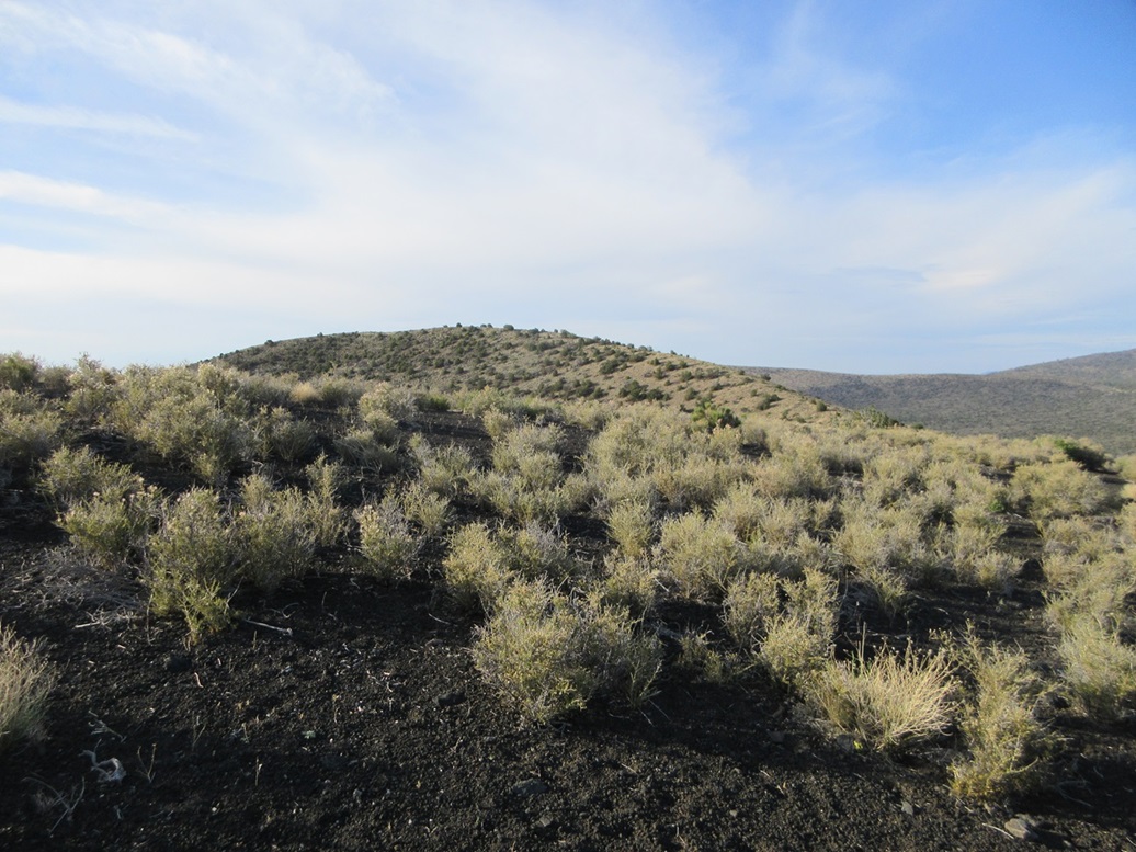
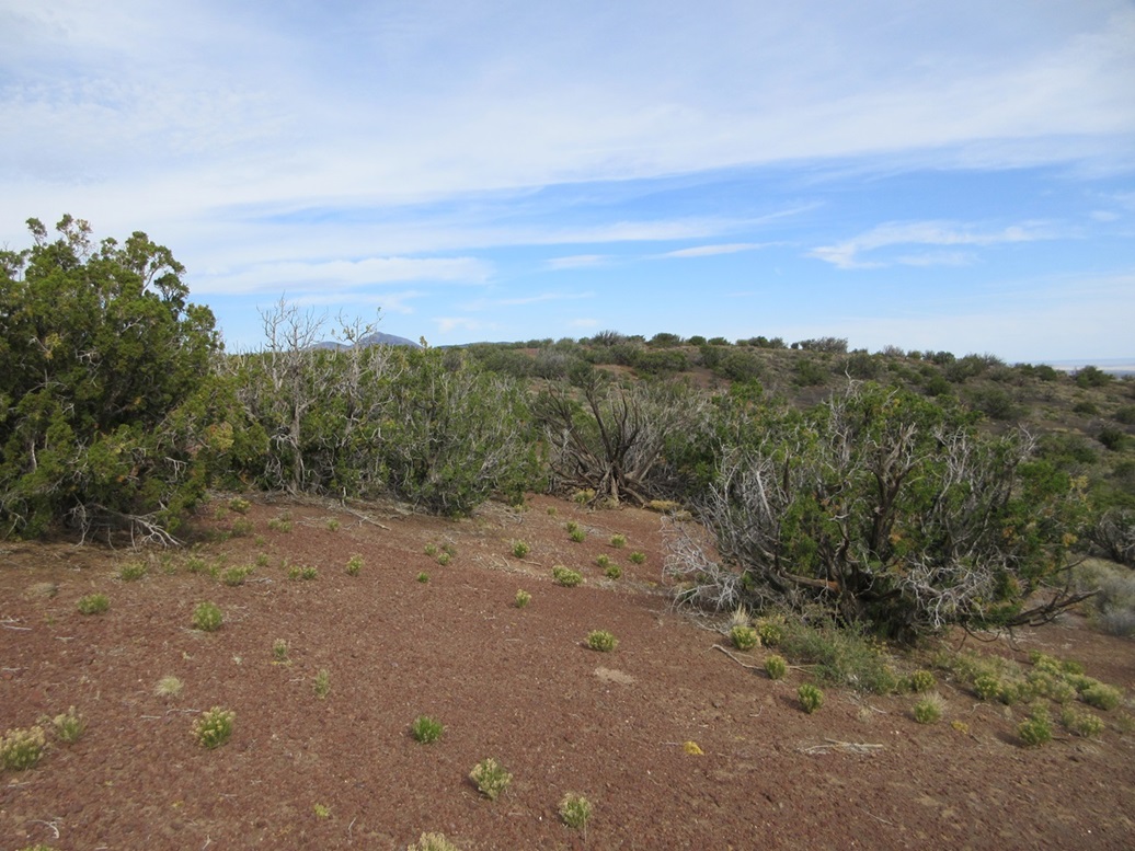
Immediately, hiking was a chore. I walked through very soft volcanic kibble and sand, each step taking twice the effort as a normal step on solid ground. The ground tilted up very gently and I had to weave through low brush. It wasn't difficult, just tiring. I hopped the fence early on, and in about ten minutes, found the remnant of the old road, which offered slightly-better footing. I walked in a little less than a mile, gaining about 200 feet, situating myself on the west slopes of Peak 6599.
I picked a spot at random and started uphill. No one line looked better than any of the others. The slopes looked steep, covered in low yellow grass with a lot of open spots of bare rock. I had to recross the fence here. The grade steepened until it was at the rock's angle of repose, about as steep as it could be to where the rocks stayed in place — barely. On the upside, I was in shade for almost all this portion.
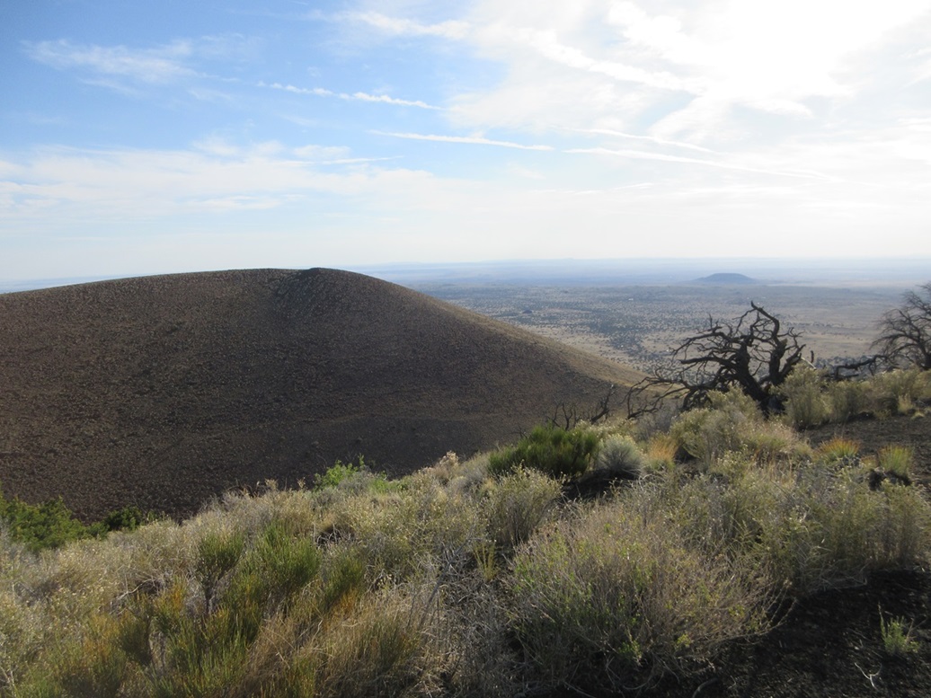
The top half of the slope, about the last 300 feet, was dreadfully loose. The rock ranged from about the size of a ping-pong ball down to dry dog food kibble to fine sand, none of it holding together. I'd step in and just slide right back down, gaining nothing. This was similar to my experiences on Black Bottom Crater and Peak 6109. The mounds on the eastern fringe of the Volcanic Field are the youngest, most just a few thousand years old, and it's likely the slopes just haven't consolidated yet like the older mounds to the west.
I got up but it was an effort. I generally angled up one way then the other, digging in my hiking poles and pushing up on them. Without the poles, it would have been near impossible to get up some of these segments. I was not concerned about falling or sliding down a ways. The rocks would cascade down just a couple feet each time. Finally, I was on the upper rim.
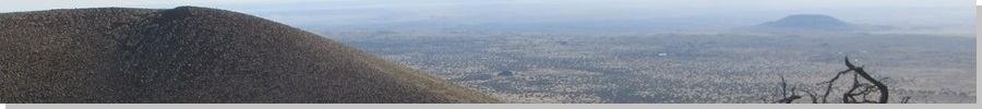
Peak 6599 has a very deep and distinct crater, about 250 feet deep and nearly circular. The highpoint is on the south lobe of the rim. The north lobe is marked with a 6,579-foot spot elevation, just twenty feet lower. I was actually on the north lobe's lower slopes. I had to drop about fifty feet to the crater rim's lowpoint before starting up to the south lobe's top.
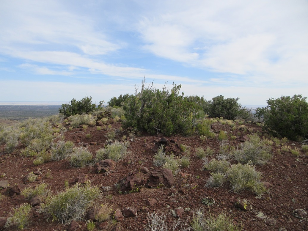
This portion was easy, the gradients being very gentle. There was some low trees up here and mostly grass, with plenty of lanes to follow. A few minutes later, I was on top, the highpoint being on the east tip of the ridge. I found no markers or cairns from past visitors. From here, the northern lobe as definitively lower. The two summits lie barely outside the Coconino National Forest, on a State Trust section of land.
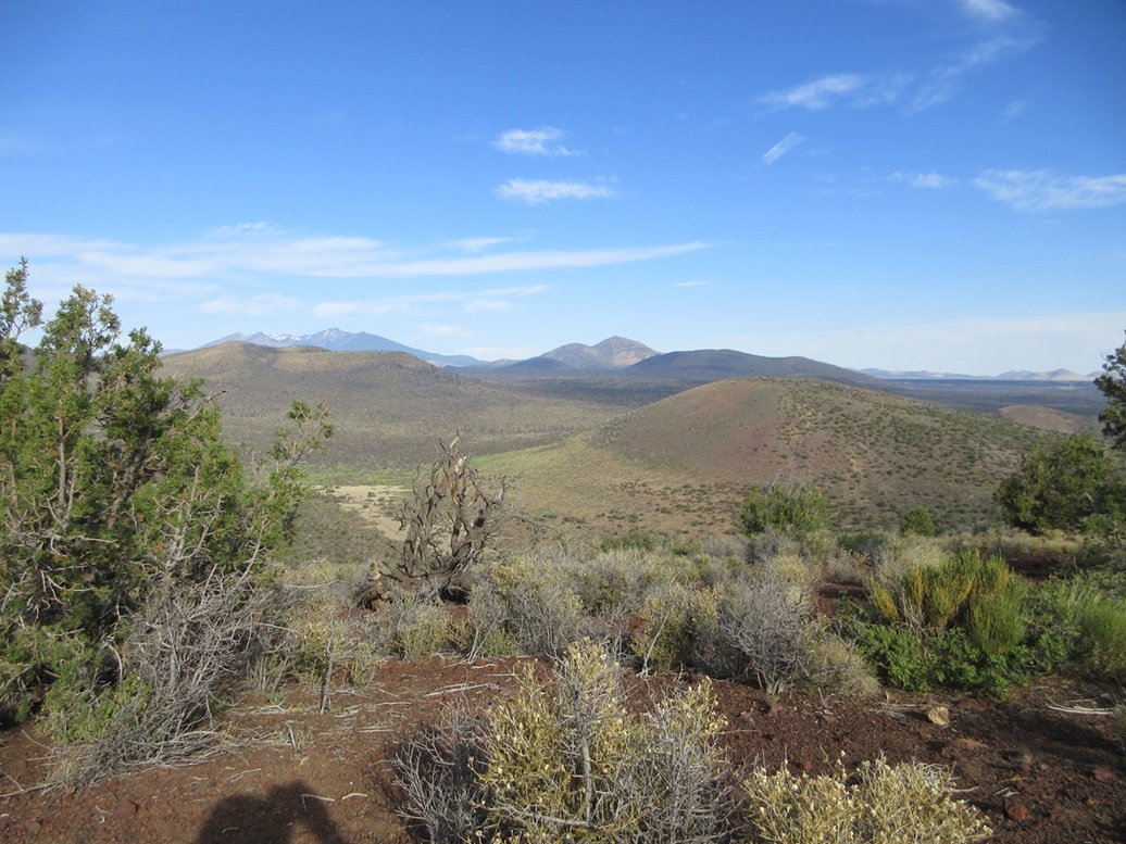
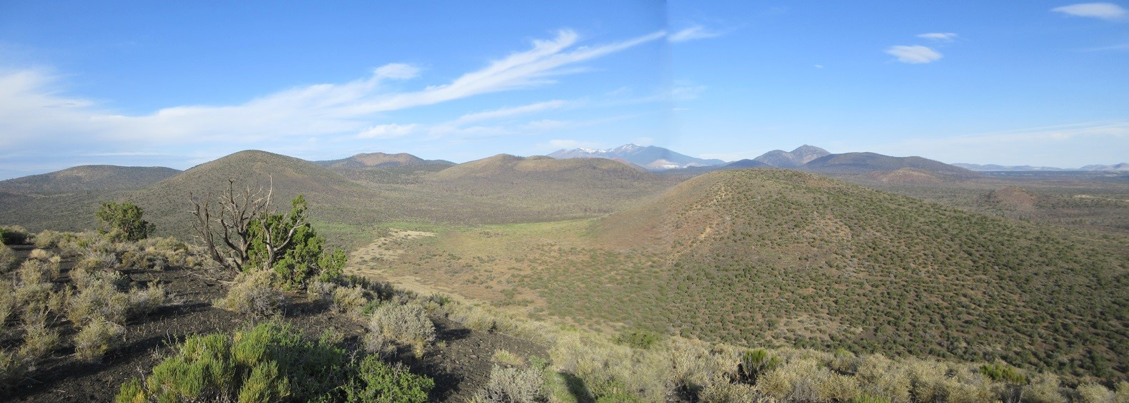
Views were good. The sky was mostly blue above me, but a sheen of high clouds was drifting in from the east. I had fine views of the nearby peaks, as well as more distant peaks like O'Leary Peak and of course, Humphreys Peak. I could see most of the cinder cones in the surrounding area. Unfortunately, views to the east were glared out by the sun and high clouds. It had taken me about an hour to get here, covering about 1.6 miles and a gain of 860 feet. It was warming but still comfortable, with a soft breeze to cool me.
I hiked down about a hundred feet then stopped when I found a nice sitting rock to have a break. Going down was much easier, now taking advantage of gravity. I was mindful not to get going too fast on these rubble fields. I'd step in, and slide about another foot, using my poles for balance. I'd lead with my left foot then with my right, like a slalom. This worked well and the descent took just fifteen minutes. I was back to the old track between the two peaks. As I crossed it...
Elevation: 6,530 feet
• Prominence: 490 feet
• Distance: 2.5 miles
• Gain: 590 feet ascent, 790 feet descent
• Conditions: High clouds now
PB
•
LoJ
... I was now officially starting up Peak 6530. I crossed through a small level portion of low trees and general branches and crud. The slope steepened incrementally, but it was not nearly as steep as over on Peak 6599.
It was warmer now and I was in the sun. I moved steadily but slowly. The challenge here was the soft ground; each step would sink in an inch or two, like walking on beach sand. Otherwise, it was very straightforward. I just aimed upward until I reached the high ridge, about a 500-foot gain.
Once on the ridge, I circled around clockwise until I reached the highest point, on the crater's west rim. The crater here is not as well defined as the one on Peak 6599. The rim circles around its east, south and west sides, and the crater opens up to the north, forming a U shape.
I was on the summit in not too long, about a 45-minute hike up from the road below. Like on Peak 6599, there were no cairns or signs of previous visitors. I kicked a few rocks and looked aroud. Unfortunately, those high clouds had moved in, muting the good light. It did not reduce the temperatures much though. Now and then, a breeze would come up, which felt good. I did not stay long up here.
Going down, I circled around to the east rim where I had come up, but instead of dropping straight down, I angled northeast and followed the long ridge downward, meeting the road about a half mile farther north. I then walked it out back to my car.
The hike covered just under five miles round trip and took almost exactly 3 hours (2 hours, 57 minutes). I was surprisingly tired, given that about 75% of the hike was on soft cinder pellets and sand, making each step twice the usual effort.
I had looked at Stewart Crater as a possible third peak. It lies a little southwest of these two peaks and southeast of Haywire Crater. It would not have been practical to hike it from where I was. I drove out to Sunset-Wupatki Road and looked for the ingress point of a road that Matthias and I took back in 2020 when we climbed Haywire. I decided to skip it for now. While possibly a short hike if I could drive to its base, I was tired, it was warmer now, lighting was lousy, and I had almost 400 miles of driving ahead of me. It'll give me a good excuse to come back.
I'm pleased that I was successful on these two anonymous cinder mounds. They're nothing special, and they're a little too remote and loose to be truly enjoyable, but for me, it helped fill in another area of the Volcanic Field. I've hiked roughly 85% of all the ranked peaks on the field. Naturally, I want to get the rest.
So now I had a lot of driving to do. I drove back into Flagstaff. Do I take Interstate-17 into Phoenix and then get to Bisbee that way? I wanted no part of that traffic, with all the weekend people heading back south, especially since Interstate-17 is being worked on in many areas, adding to the congestion.
I decided to take Lake Mary Road instead. I always enjoy this road. Traffic is never heavy, but closer in to Clints Well, where it connects to AZ-87, I started encountering RVs and trucks pulling trailers and toy haulers. I was able to pass the slowest, but after a certain point, it's simply too many people to keep passing. Fortunately, traffic moved well. It was not yet noon, so the worst of the RV/trailer traffic was still to come. When I lived in Payson, it seemed between noon and 3 p.m. on a Sunday was the worst, the main routes, AZ-260 and AZ-87, being completely clogged up by RVs and trailers. It seemed to be a contest of who could have the biggest trailer and most toys being pulled at once.
I descended down from Payson and then took AZ-188 along Lake Roosevelt into Globe, traffic here being very light. I stopped in Globe for gas, then followed US-70 toward Safford, stopping for about an hour at the Apache Gold Casino about ten miles east of Globe, on the San Carlos Nation. I'd never stopped here before. I used the facilities and sat for awhile, not doing anything. I didn't even gamble at the slots, but this rest helped a lot.
From here, I drove home via Safford, the US-191 to Interstate-10 into Willcox where I stopped for more drinks. It was warm but not crazy hot, in the mid 90s. I then followed the cut-off via Kansas Settlement through the Willcox Playa back to US-191, then the local roads into Bisbee, arriving a little before 5 p.m. I had covered 375 miles, which isn't that much longer than the most direct route via Phoenix and Tucson. This worked well, and I never needed to mess with the big cities and the lower-elevation desert heat.
This had been a good weekend, with eight more peaks added on to the pile. I enjoy Flagstaff, but being in Bisbee now, it's not as close, so I have to make the best of my time when up there. I will admit that I have had enough of the loose cinder mounds for awhile.
|


|