
The Mountains of Arizona
• www.surgent.net
|
| Peak 4939 |
• Verde River Valley • Tonto National Forest • Maricopa County |
|
Date: November 19, 2021
• Elevation: 4,939 feet
• Prominence: 319 feet
• Distance: 5.4 miles
• Time: 3 hours
• Gain: 1,180 feet
• Conditions: Sunny, pleasantly warm
Arizona
•
Main
•
PB
•
LoJ
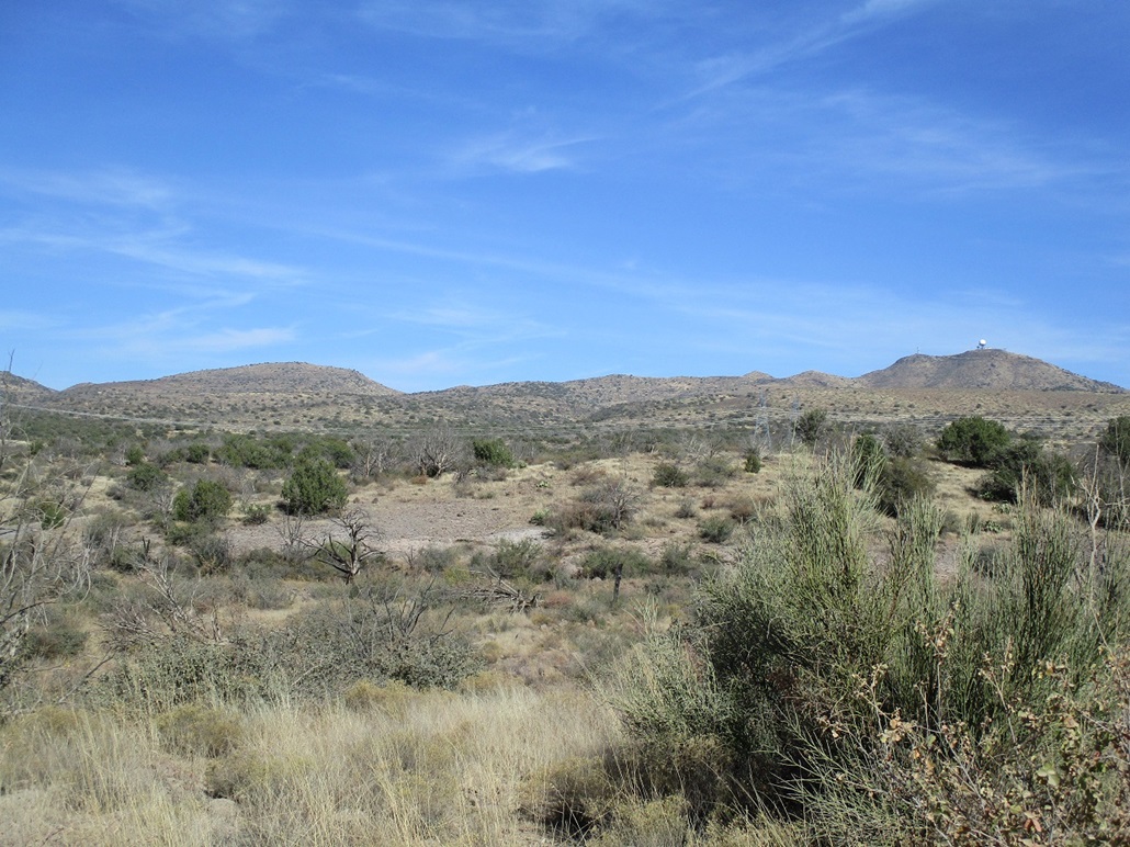
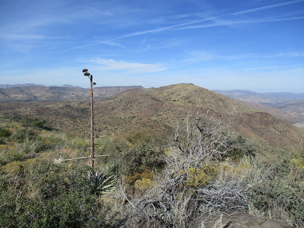
Peak 4939 is a ranked summit on the ridge connecting Rover Peak to the north, and Humboldt Mountain to the south. These peaks all lie northeast of Cave Creek and Scottsdale, forming a wall of peaks that overlook the Verde River to the east. It was the last ranked peak on this ridge that I had yet to climb. I was in no hurry, saving it for a day when I had no other plans, like today.
My usual modus operandi is to get up before the roosters and be driving in the dark, to be at the trailhead at dawn. But I slept poorly last night, so when my alarm went off at 4:30, I just ignored it. I still wanted to hike this peak, but did not get on the road until about 9 a.m.. Fortunately, the day's high temperature would be in the low 80s in Phoenix, meaning highs in the 70s in the slightly-higher elevations up north.
I've driven up Tonto Forest Road 24 now so many times they should name a drainage after me. I know it so well I could drive it with my eyes closed. I followed the usual route through Scottsdale and Cave Creek, then more miles onto the dirt roads, past Camp Creek (noting the devastation of a recent flood there, more on that lower down). I drove past the access road to Humboldt Mountain, then eased onto FR-254, then quickly a right onto FR-1024, which was rocky and bumpy, parking where FR-3196 leaves it, heading east uphill. This is where I parked last year when I hiked Rover Peak.
My initial plan was to hike north along FR-1024 about a mile and a half, then catch FR-1095, which goes northeast up Walnut Spring Canyon. A lesser track leads most of the way up the mountain, from which a short cross-country push would take me right to the top. However, in studying the satellite images, there is another track that "starts" at the saddle south of Peak 4939, then runs downhill within an unnamed canyon that supposedly connects with FR-3196. I was willing to try this approach, which would be a more direct line than having to hike north a mile and a half first.
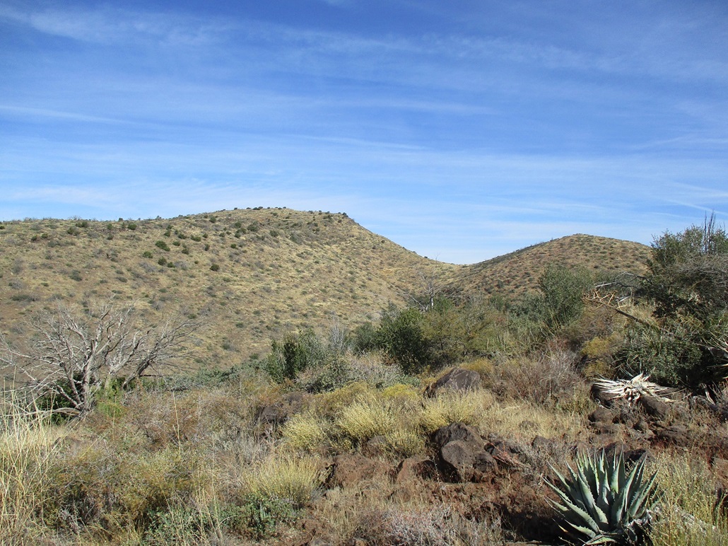
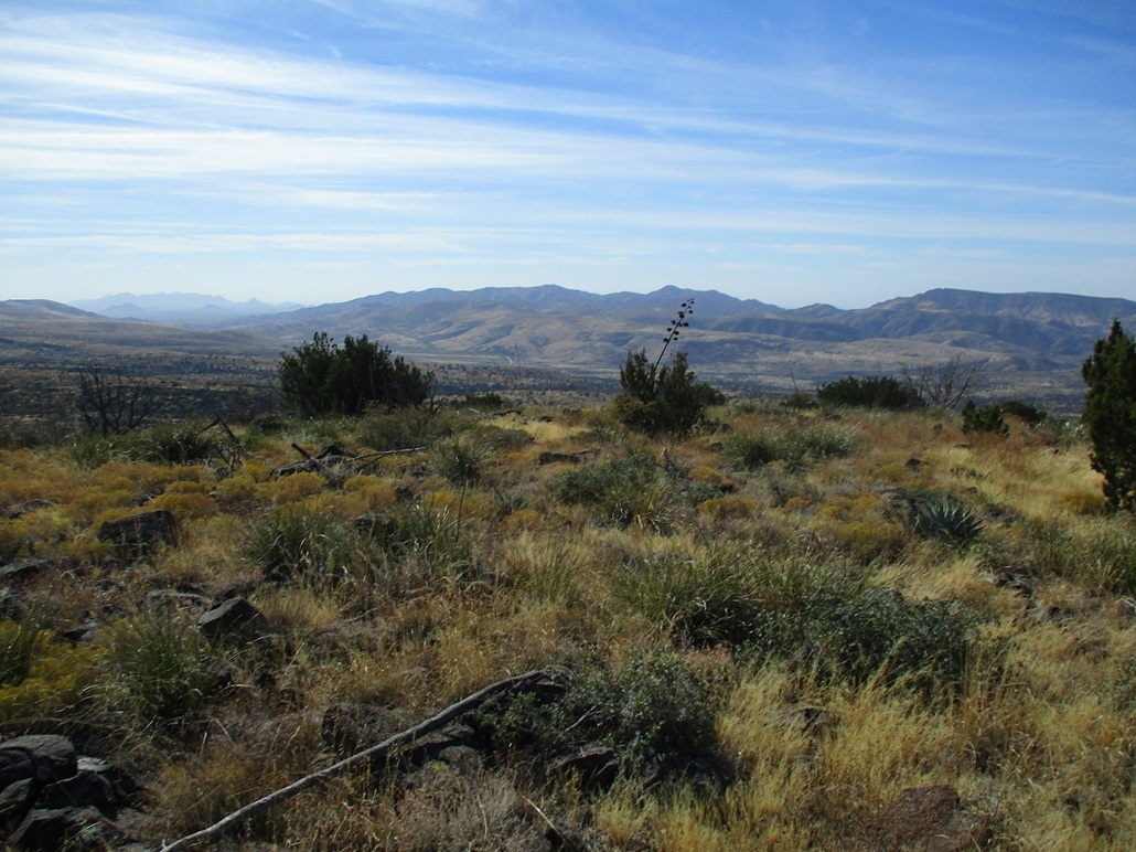
I started walking at 10:10 a.m., following FR-3196. It was sunny and pleasant, in the high 60s. The track is rocky and narrow. I passed two sets of water tanks along the way. In about a mile, the track had gained about 400 feet and was starting to lose distinction in the grasses and moderate brush. The satellite image showed that the track was slightly within the canyon (the one to my left as I hiked up). At some point, I lost any semblance of a track or path, so I angled slightly downhill into the canyon, hoping I'd find the track. No such luck. I gave up on the track almost immediately, and climbed back higher onto the ridge. It was brushy but mostly open and would do just fine for my ascent route.
I moved slowly, mainly to watch where I was stepping and sometimes to back out of a dead-end of brush, branches and cactus. I was approaching the ridge's highpoint and had a fine view of Peak 4939 just ahead. I angled down off the ridge I was on, pushing through some brush, then onto more open, grassy slopes. I could see a faint track, presumably the continuation of the one I tried to find. I got down to it, then followed it a few hundred yards to the saddle directly south of Peak 4939. A fence runs along the ridge, and surprisingly, a gate, too. I stopped for a rest, covering about two miles to this point, slightly under a thousand feet of gain.
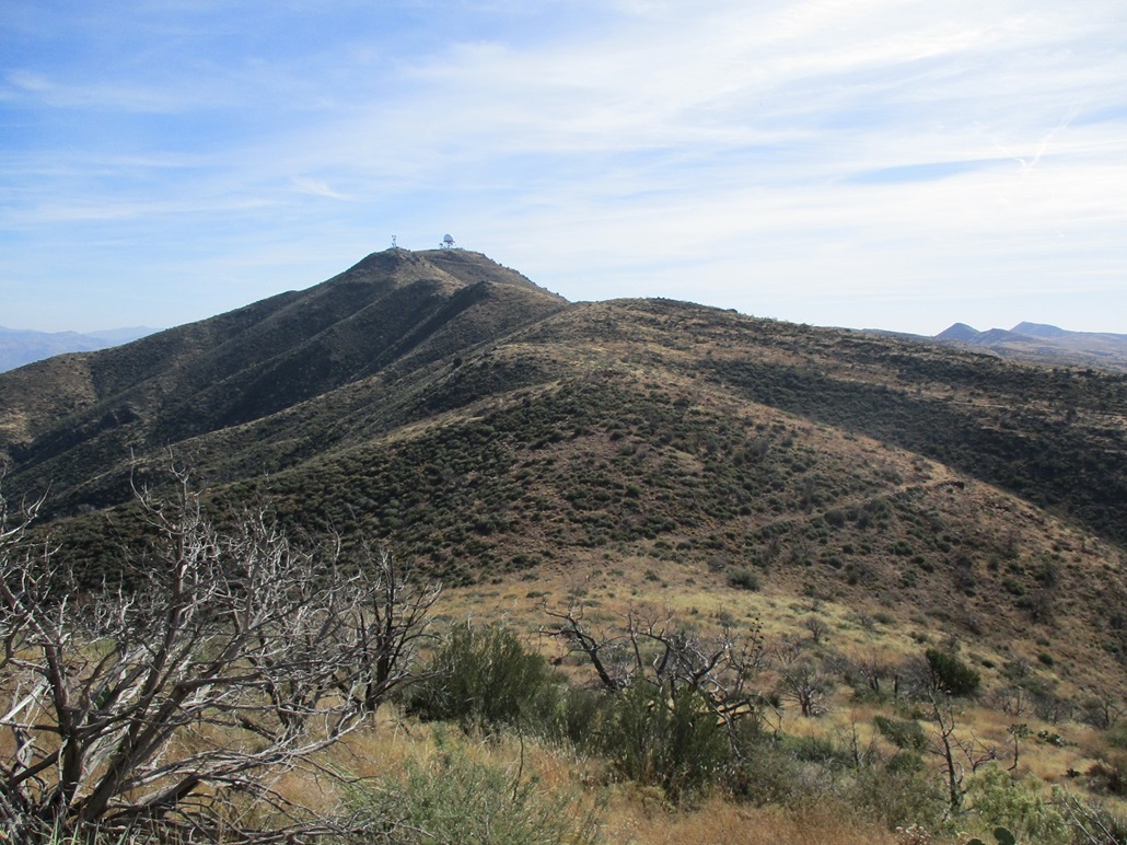
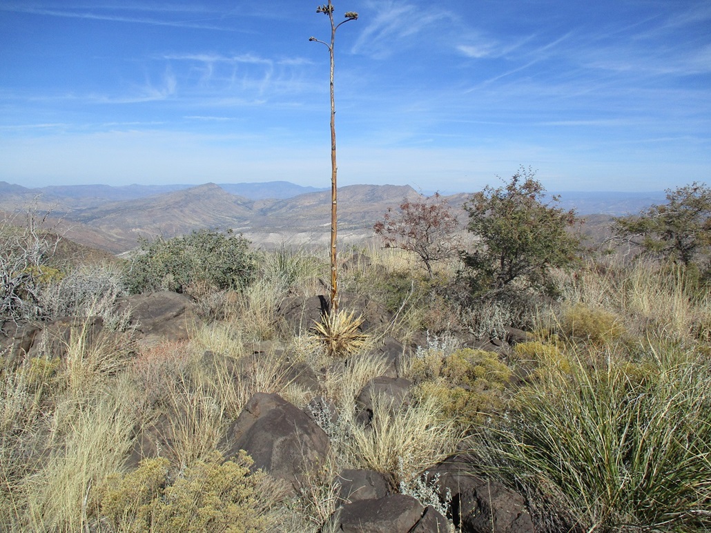
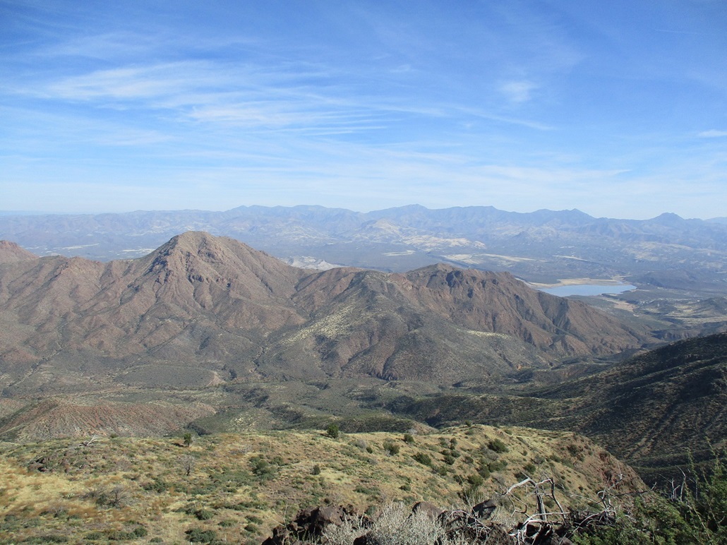
The top was about 250 feet higher, up a steep slope, then a gentle slope. I angled left, caught a ridge, then angled right and followed the gentle slope upward to the top. Up here, I had commanding views of the valleys below me, of peaks such as the Cedars and Sunset Mountain, and Bartlett Lake. The top itself was just a simple mound of rocks and brush, a couple rocks tying for highpoint honors. There was no register I could find.
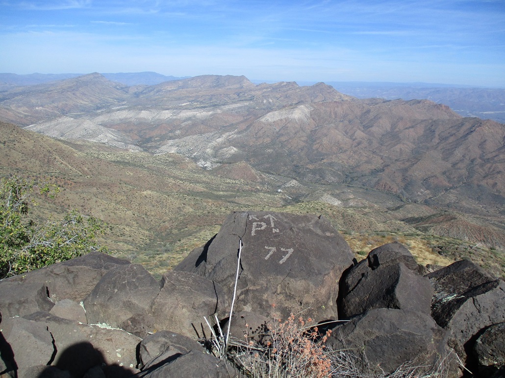
Someone etched in some curious glyphs into a rock on the edge of the cliff. It had a P with an arrow point to the left, and an N with an arrow pointing straight ahead, and a big "77" below it. The N obviously pointed north, and the P, perhaps pointing to Prescott? (It did point in the right direction). The etchings were done in great detail and probably took a few hours to do. It looked like something a prospector or explorer from the 19th-century would have done. The "77" may very well refer to 1877. I honestly have no idea and am very curious about these etchings. I spent about 10 minutes on the summit.
I thought about heading down to that other track and making a loop of the hike, but somewhere along the way, I lost my map. So I hiked back the way I came, and from this elevated position, could see an obvious line in the brush on the slopes across the way from me, clearly this being the track that I couldn't locate on my ascent. I descended to the saddle, then onto the track, then toward the phantom track, wondering how I had missed it.
Turns out it is (was) the track after all but so overgrown in large bushes and small trees that only a path winds through it. Occasionally it would open up to where you could see the rock berms alongside the path. The path was narrow and probably nothing more than an animal path. It stayed on it as best I could. It started to lose distinction too, and for about 300 feet, I was back on open grass slope, no hint of a track or path anywhere. I hiked downhill and soon found the old road I was on this morning. Now that I saw it from both ways, I would never have found it on the ascent unless I had got really lucky. There's nothing there to suggest a path at all.
Back on the road, I made good time hiking downhill back to the car. I was back a little after 1 p.m., a three-hour hike covering a little over five miles total. I took time to change and relax, in no hurry. The day was warm and clear, and I had nothing else on my busy schedule. After about twenty minutes, I got the car packed and started the drive out.
There is a tiny community of cabins tucked into a tight valley below FR-24 and Kentuck Mountain, called Camp Creek. The homes are usually invisible due to being down in the bottom and surrounded by giant trees such as cottonwoods. In August, heavy rains up in this area swelled Camp Creek. Two people riding in an ATV were swept into the floodwaters and killed. The damage was still evident, three months later. One home had its whole side ripped away, and giant trees were laying on their sides, not to mention the sheer hodge-podge of rocks and debris that had been swept along with the floodwaters. I had just been in this area a couple days previous, too. I felt terrible about the two people who perished and the people whose homes were damaged. I didn't want to linger, but I wanted to at least give thought about those who were affected.
The drive home was uneventful. I took advantage of the opportunity to explore two ranked peaks in the Cave Creek area that on their own don't interest me, but since I was up here with my gear, I thought I'd take a look. I first drove to Go John Mountain, stopped well short of the peak due to construction, and notices that these roads were private. So I backed out and took a peek at the Surrey Hills, which lie west of Cave Creek Boulevard, but parking here was problematic too, and not worth the trouble to go find a spot. Instead, I just returned home, arriving about 3 p.m..
|

|