
The Mountains of Arizona
• www.surgent.net
|
| Peak 3342 |
• Tonto National Forest • Verde River Valley, Bartlett Lake • Maricopa County |
|
Date: November 24, 2021
• Elevation: 3,342 feet
• Prominence: 422 feet
• Distance: 1 mile
• Time: 70 minutes
• Gain: 480 feet
• Conditions: Pleasant
Arizona
•
Main
•
PB
•
LoJ
Peak 3342 lies immediately west of Brushy Mountain along Bartlett Lake Road. I hiked Brushy back in February of 2019, but time constraints kept me from hiking Peak 3342 as well, otherwise I would have. These two peaks are reached from a common saddle and together could be both hiked within a three-hour window.
There are six ranked peaks that lie south of, and parallel to, Bartlett Lake Road. My plan today was to possibly visit all of the remaining five peaks, none of which are farther than a mile from the road. It was an optimistic plan, and as usual, I had to scale it back once reality set in. Turns out I only visited this one peak, which I'll explain below.
I drove up from Tempe to the Bartlett Lake Road, and drove it to its end near the Jojoba Boating Marina, a 14-mile drive from where Bartlett Lake Road leaves Cave Creek Road. A dirt secondary road, Forest Road 19, leads south to the Riverside Campground. Where this road achieves an apex, there are two ranked summits on either side, Peak 2440 to the east and Peak 2448 to the west. So I get there and take one look at Peak 2440 and immediately sense this may be too much for me. I drove a little past it and tried to get a couple looks. Its summit is a big rock outcrop forming pillars. It is possible there was a hidden ramp or alternative that a mortal like me could handle, but I did not want to hike up to find out. So Peak 2440 got cancelled. I then looked over at Peak 2448, but lost interest in that one fast when I could not locate a place to park. That peak sits on top of a ridge protected by a bulwark of low cliffs. I am sure I could have found a way up, but just wasn't that enthusiastic about the effort I'd need to put in. I lost interest in both once I lost interest in the first peak.
I returned to Bartlett Lake Road and headed west now. Peak 3069 comes next, just a mile later, and looks like a fun peak, but I could not find a place to park (not wanting to park along the main road). I cancelled that one quickly, but may come back in the future if I can do some more map-studying to see where I could park and what approach I could follow.
Back on westbound Bartlett Lake Road, I drove about three miles, to roughly milepost 10, and looked for the tiny dirt road that drops into a drainage and offers places to park and hide from the main road. This is where I started my hike up Brushy Mountain from three years ago. It looked exactly the same now. No one was here, and being a weekday, it was very slow overall. I rolled in, parked and killed the engine. I was dressed and ready to go in moments.
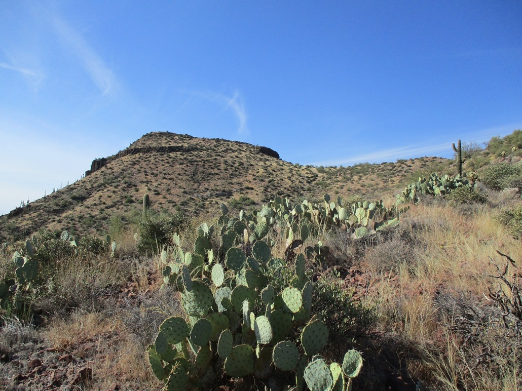
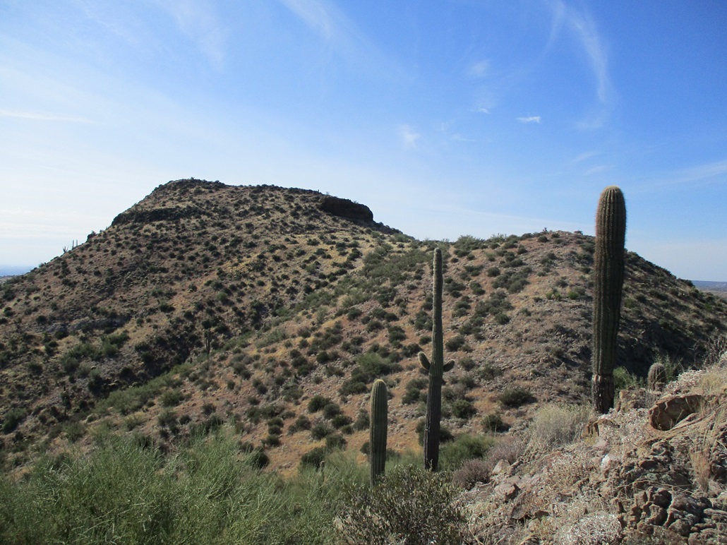
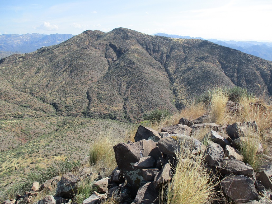
I hiked up to the saddle that connects Peak 3342 and Brushy Mountain. I then went right and started up the slopes, which were covered in cactus, scrub and knee-high grass in places. But it was all spaced out so I could usually keep to a straight line without difficulty. About ten minutes of moderate hiking, I was now on the crest of the lower ridge, and got my first close-up view of the peak.
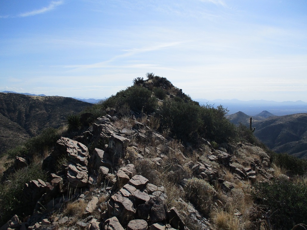
The route keeps to this ridge, goes up and over one rocky bump, then curls south and aims uphill for a cliff band. Once I was at the base of the cliff, I angled left and scampered up a steep slope of brush and rock, some of it loose, to achieve the highest ridge. The summit was just fifty feet ahead, perhaps 20 feet higher. The ridge is rocky and narrow, but safe. I carefully stepped through the rocks and soon was on top. The one-way hike had taken just 30 minutes, covering a half mile.
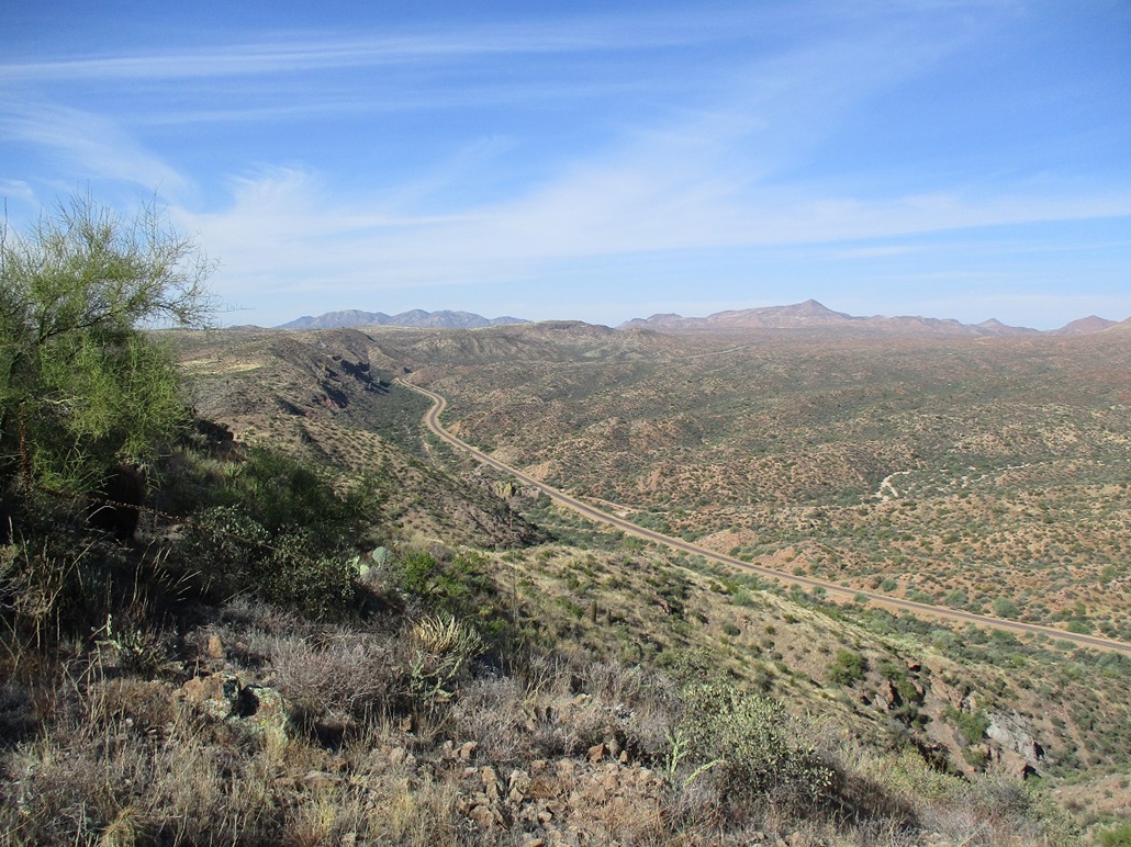
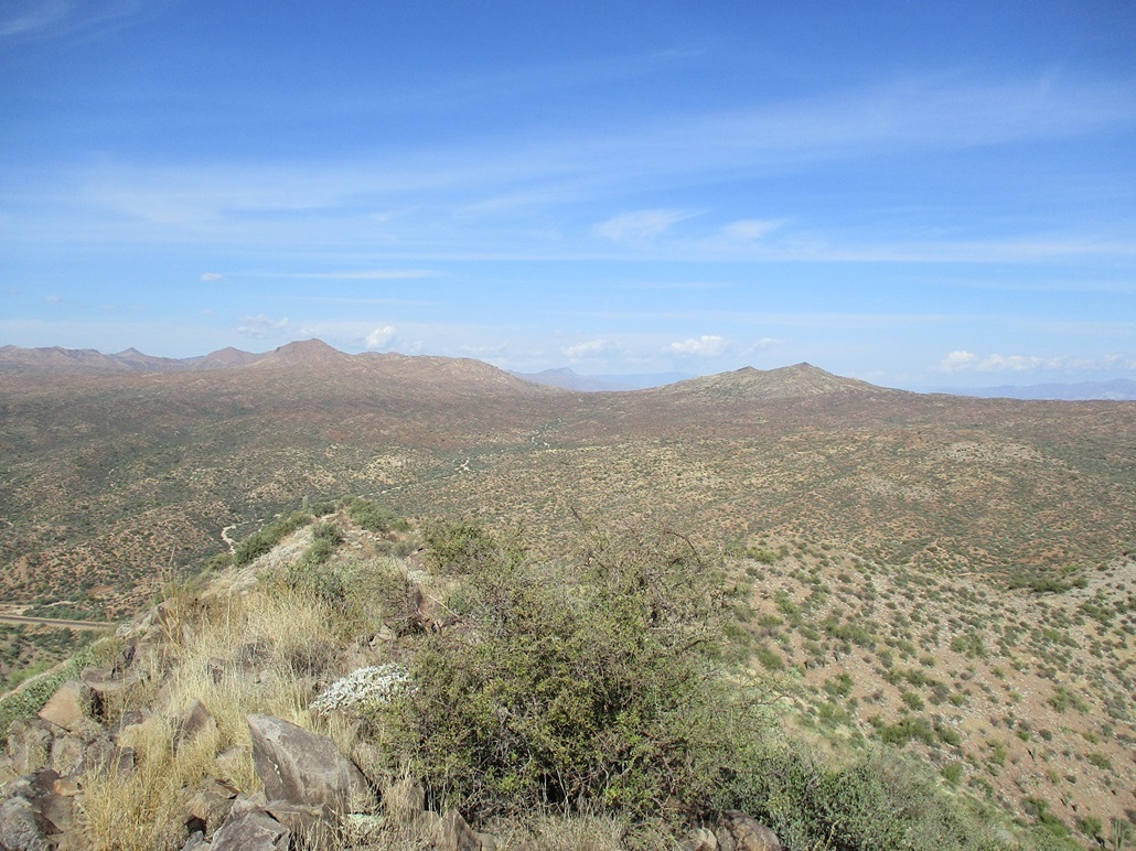
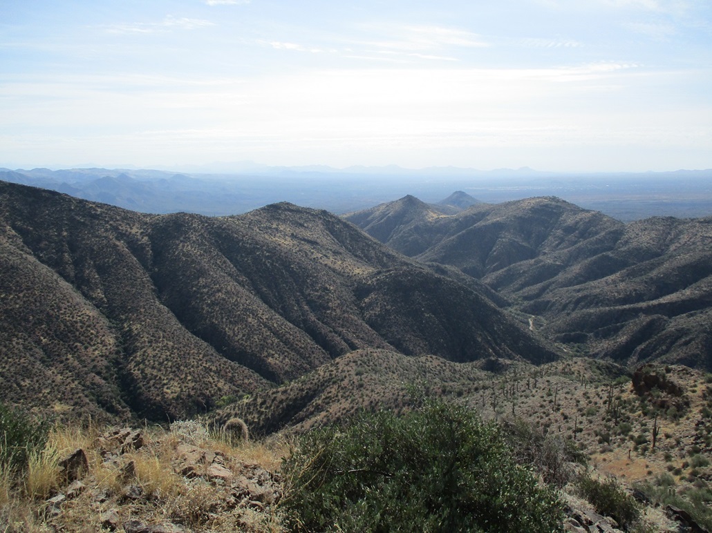
Views up here were good, especially of the surrounding hills. I lingered up here for about 15 minutes, resting and taking photos. There was a steady breeze, which was welcome. The temperature was in the mid 60s, the sky clear but a tad hazy. The sun would glare things out in the distance.
The hike back went well. I followed essentially the identical route and was back to my car quickly, total time gone a little over an hour. With time to kill, I brought out my camp chair and sat in it for almost an hour. The sun was warm but pleasant and I did nothing but sit, stare and let my mind rest.
The last peak I had eyes on was Peak 3260 to the west, but like Peak 3069, I could not see an obvious way to access it, so I also shelved that one for more study and possibly a later visit, perhaps to combine with Peak 3069. I was one for five today, but not at all disappointed. The reward is rarely the actual summits tagged (or whatever one's goals may be), but the time spent on the pursuit. I have no complaints and was grateful and happy I had the opportunity to be out amid the great scenery and terrain.
|


|