The Mountains of Arizona
• www.surgent.net
|
| Peak 2422 |
• Hieroglyphic Mountains • City of Phoenix • Maricopa County |
|
Date: January 2, 2023
• Elevation: 2,422 feet
• Prominence: 402 feet
• Distance: 5 miles
• Time: 3 hours
• Gain: 620 feet (gross)
• Conditions: Cloudy and wet, some sun later, cold
Arizona
•
Main
•
PB
•
LoJ
Dan Fleischmann and I were to meet for a couple peaks near the Table Mesa exit on Interstate-17 about 40 miles north of Phoenix. However, a storm had moved through yesterday and was still lingering. The area was still socked in by clouds and the ground extremely muddy. After some discussion, I decided to bail, and suggest we come back later when the weather is better.
Given I was dressed and ready for a hike, and having the day open, I looked around for a Plan B, and settled in on this peak with no name. It's not far from Whiskey Spring Head and about five miles northeast of Black Mountain, which I hiked a week ago. The clouds were still pushed up against the higher elevations, while it was clearing and sunny down south. This peak was right on the boundary.
I drove south to highway AZ-74, then west, then north on New River Road about ten miles (I didn't actually track the mileage). I was looking for the Emery Henderson trailhead and parking lot, where the Black Canyon Trail runs through. This area is mostly BLM and some State Land, and not developed. New River Road doesn't seem to get a lot of traffic.
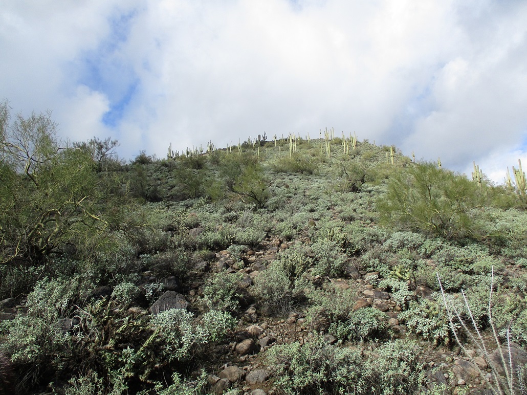
I pulled in about 8:30, and waited. The peak is easily visible a couple miles to the north, a symmetric hump of volcanic boulders and cactus. The clouds were still low and barely blotting out the summit. But they were moving quickly, too, and within minutes, I could tell they had moved out a little more. I was the only one here in the lot. I walked around the area a little bit, killing time. I finally got packed and walking at 9 a.m. sharp.
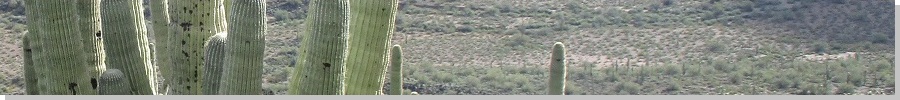
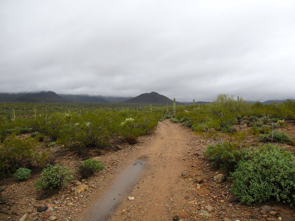
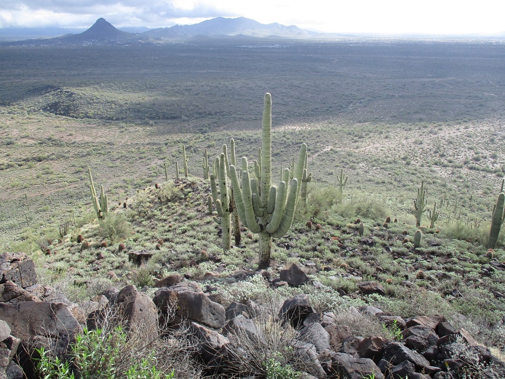
The trail appears to be an old ATV track, about ten feet wide and usually rocky. For the first couple miles, it would be mostly flat desert trekking with a few downs and ups as it moved through some creeks and one main drainage (Sweat Canyon). It was cool but not uncomfortable, and despite the abundant clouds, it never once rained, not even a spritz. Large saguaro are everywhere, along with the normal cactus and small trees and shrubs common to the area.
The rockiness of the trail helped, because in those short segments where it was just the dirt, it was very muddy in spots. The trail dropped into a drainage, where there was a trickle flowing. Numerous side trails, these more like narrower footpaths, crissed and crossed the main path. I kept to the main trail until I was "close" to the peak. By now, I was paralleling Sweat Canyon and the peak was less than a half mile to the northwest. At one such junction of the main trail and a narrower side trail, I guessed and started following this side path. (It appears that any combination of these paths would "work" as long as one aims for the mountain).
This side path came to the lip of Sweat Canyon, then dropped in about thirty feet, then wandered through this "canyon", often following braids in the main channel. At strategic junctions, I would draw in an arrow in the dirt with my treeking pole to remind myself the route when I exit. Soon, the trail petered out into nothing, disappearing into the creosote and palo verde. The terrain was still open and easy to walk through. I climbed out of this canyon and onto higher ground, now on the lowest slopes of the peak, which stood immediately above me. I started walking uphill.
In moments I came to a barbed-wire fence. It was sturdy and not easy to press down to step over. I really did not want to get down on my back to shimmy under it, given the mud, although here it was rockier so that the mud wasn't as soft as in places down below. So I cut the difference and was able to "limbo" my way through two strands. How I did it, I don't know.
I proceeded upward. The rocks here were smaller and apt to roll, but not much of a problem. Higher up, the bigger boulders take over. In the wetness, these were sometimes slick, so I moved carefully. These were heaped the usual way: a big jumble of shapes, never too cliffy, but often requiring hands to ease up through spots. I just moved slowly and carefully. Some of the big rocks moved! That's always a good way to get one's attention.
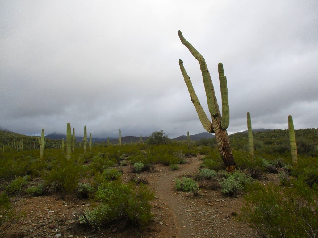
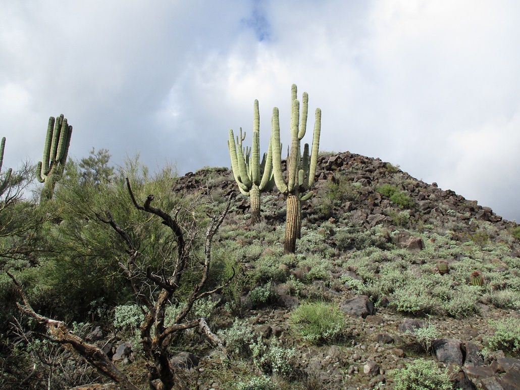
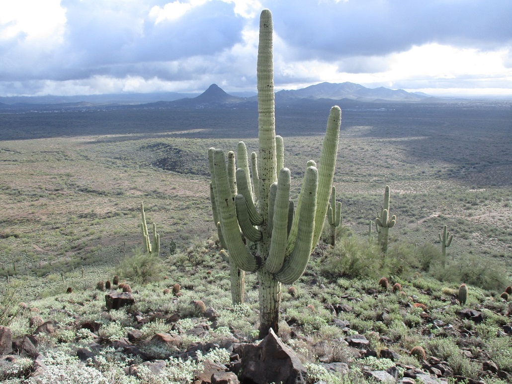
The slope moderates slightly for about 50 feet, nearly flat for a brief spell. On this small bench were some enormous saguaro, huge monsters unlike most I've ever seen. I took an image of one such saguaro. Its base was easily two feet in diameter. Its lowest arms were ten feet above ground. If I stood up next to it, reached up and stood on my tippy toes, I could not touch these arms. It was an impressive cactus! There were others like it nearby. These guys are probably 150 to 200 years old. That blows my mind. Whatever is in the soil here must be good for saguaros.
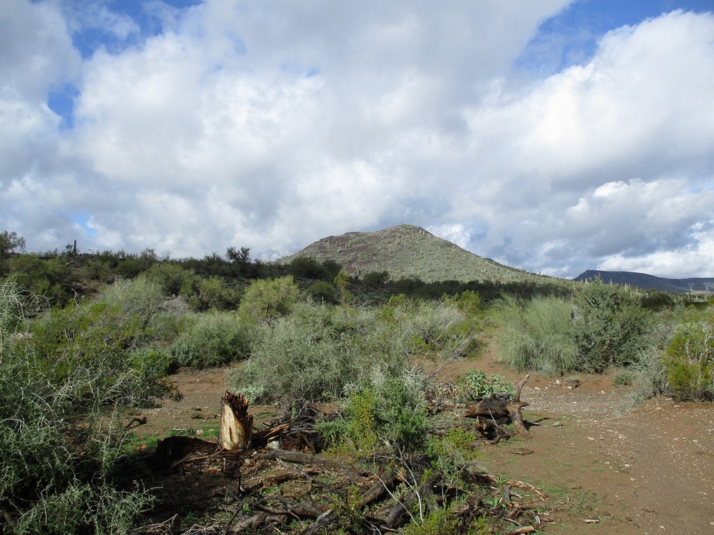
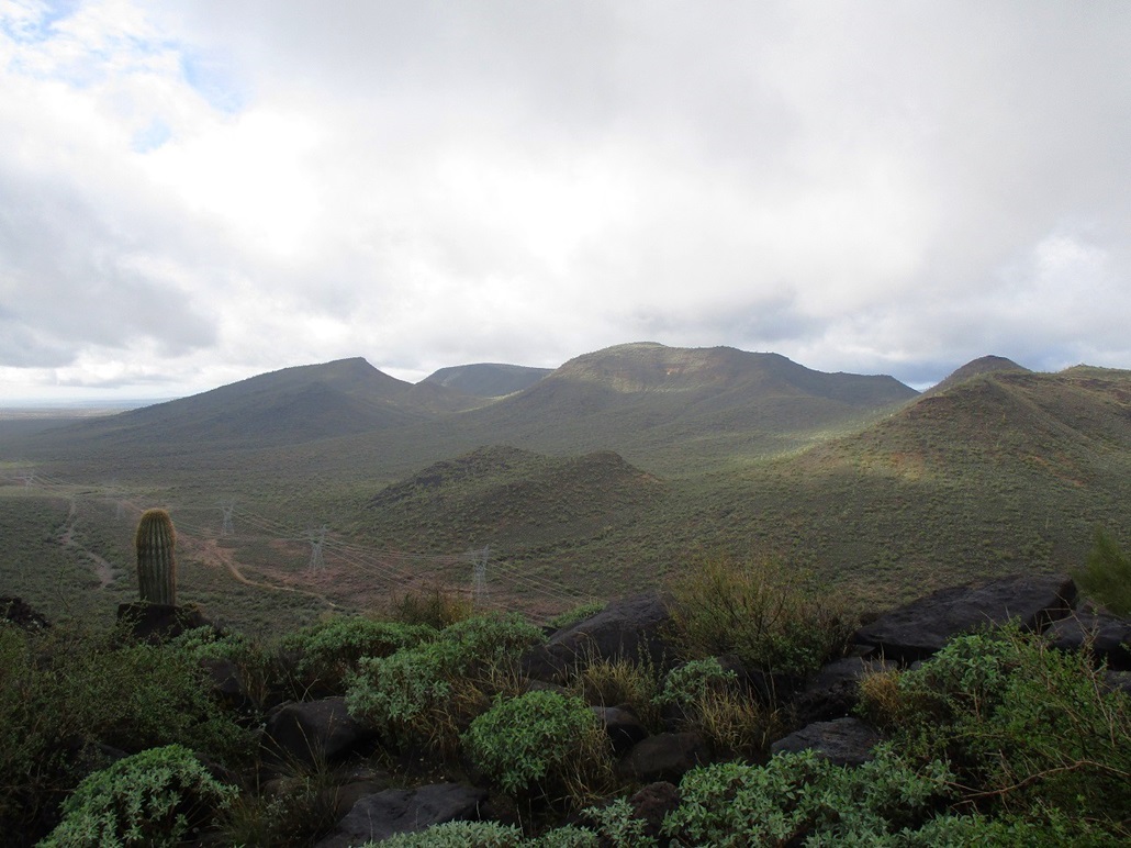
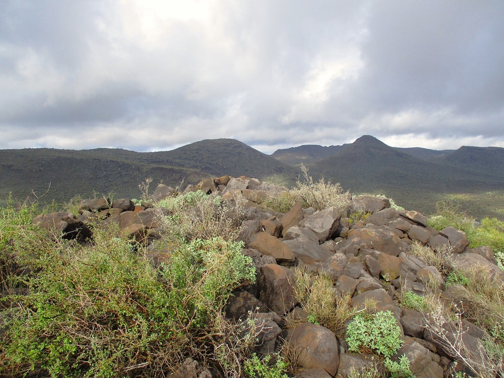
The summit was just another hundred-foot gain up more boulders, and I was soon on top. The summit is rocky with a couple windbreaks. These don't look like ruins nor that old. I found the register in a cairn, set in by Barb Lilley. The last person here was in 2016. It was still very cloudy to the north but also starting to break up more, with the sun popping out for the first time. It was chilly, but I was comfortable and sat here longer than I normally do on a peak. To the north, the bigger hills were socked in by the clouds. Closer in, I could see Sweat Peak and Doe Peak to the north, and Whiskey Spring Head to the west. To the east I had good views of Gavilan Peak and Daisy Mountain. To the south I had good views of the morning glare, as the sunlight was refracted a billion different ways by the mistiness.
I hiked down the same way, and took it real slow. I did slip a few times, and had to really watch myself. I stopped again to admire my new saguaro friend, and allow the sun to come out so I could snap some images. Once down the slopes, I had to get past that fence again. I was unable to repeat my maneuver from earlier, so I got on my back, shimmied, and got back up. Surprisingly, I didn't get that muddy.
The hike out went well. Those arrows I had drawn in did help me because some of those junctions would not have been obvious at all. But, had I got "off route", I could have simply walked south and found the trailhead easily enough. Navigation here is very simple. I was back to my car at noon, a three-hour hike. There were a couple cars here, and a guy on his motorcycle who was just hanging around. I got out of my damp clothes and into more comfortable clothes for the drive home.
This peak was a lot of fun and I was pleasantly surprised how well it went and how much I enjoyed it. It was logistically easy, navigation was easy, there was no unpleasant bushwhacking, views from up top and along the way were good, and there was no one else around. It does not seem likely this trail would ever be over-run with lots of people. This is a part of the state that gets overlooked. Most people are here for Lake Pleasant, while the rest are zooming up the interstate. Given that our plans fell apart, this was a good way to salvage the morning.
|


|