
The Mountains of Arizona
• www.surgent.net
|
| Peak 2046 |
• Maricopa Mountains • Sonoran Desert National Monument • Maricopa County |
|
Date: February 5, 2022
• Elevation: 2,046 feet
• Prominence: 471 feet
• Distance: 3.5 miles
• Time: 1 hour, 20 minutes
• Gain: 606 feet
• Conditions: Blue skies and very pleasant
Arizona
•
Main
•
PB
•
LoJ
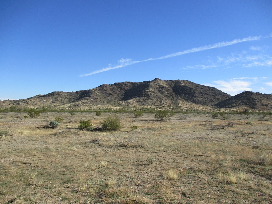
Peak 2046 is a stand-alone hill about a mile south of state route AZ-238, west of Maricopa. It's hard to be more exact because there are few landmarks out here. It lies opposite the junction with the gated road to the old ENSCO site, if that helps.
By the way, the ENSCO site is a fascinating piece of Arizona history and it's the reason there is a highway AZ-238 to begin with. In the 1980s, the ENSCO people, whoever they were/are, wanted to build an incinerator in the open desert northwest of the village of Mobile. The incinerator would be for items too unsafe to simply be placed in a landfill. They reached an agreement with the state, and part of the deal was that the state would build a 20-mile (give or take) paved highway to the site. This is AZ-238. Prior to that, there was no paved route into the area. People who lived in Mobile had to get there using dirt desert tracks. And keep in mind, there was no city of Maricopa at the time either. Back then, it was just a little cross-roads village of maybe 500 people. The whole ENSCO thing fell apart in the late 1980s-early 1990s. Nobody wants hazardous waste in their area, and the fact that a lot of it would be shipped into Arizona from outside was doubly troubling.
I moved to the Phoenix area in 1992, but for some reason never travelled on AZ-238 until years later. I knew people who did and they mentioned it being half paved, half dirt, but a "quick" way to Gila Bend. Most of these people were going to Rocky Point in Mexico. Thus, they were willing to drive a dirt road for 20 miles if it shaved off a lot of extra time. At some point, and I have no idea when, Maricopa County footed the bill to pave that stretch from where AZ-238's pavement ended, to Gila Bend. Thus, the entire 43-mile segment between Maricopa and Gila Bend is now fully paved.
To be technical for a moment, the full segment is not AZ-238. Only the initial 20 miles from Maricopa is. The remainder is just a county road. In Gila Bend, you don't see the AZ-238 shields on the signs pointing to Maricopa. There is also a sign mentioning "end of state maintenance" or something like that, where the highway goes from state to county status. I think this stuff is kinda interesting. In a way, we're it not for ENSCO, there'd be no paved route to these parts and hiking ranked summits here would be more challenging. So, thanks ENSCO.
A month ago, I was in Yuma taking care of personal matters, then driving back to Phoenix, and completely spur of the moment, I stopped alongside the railroad tracks that parallel AZ-238 and went to go climb the peak. It really was that spontaneous a decision. I figured, how hard can it be? Well, when you don't do your homework, it can be hard.
On that attempt, I simply chose a bad line. I was too far to the west, and I could not see all of the ascent ridges fully. I went up a slope to a ridge, thinking it would go, but suddenly, it dropped almost 200 feet. This was a bad choice, and given it was already 2 p.m. and I might be here after dark if I kept going for it, I bailed and walked back to my car. And I almost screwed that up too. I learned a little lesson in doing so.
I had parked in some random cleared area in a buffer zone between the highway and the tracks, the railroad tracks about 150 feet from the highway, and in between, just some open ground with brush and gobs of trash. I parked in such a way that I was "hidden" from the highway. So when I was walking back out, I realized I did not have any landmarks to reckon by. So I just walked until I was back to the road, and obviously, my car not there. I honestly had no idea if I was west or east of it.
I had taken a photo of the peak when I started the hike from near my car, so I looked at it on the camera screen, and judging by how a foreground peak lined up with the main peak, I knew I was too far west. I walked east and only saw my car when I was about 50 feet from it. Lessons I learned: (1) Don't hide the car too well, and (2) park near some feature the next time I'm here. By now, you probably know I don't use GPS. I still like to use visual reckoning and orienteering when I hike. But yeah, sometimes I get myself into minor pickles.
Today, I started in Gila Bend, after yesterday's nuttiness down on the Organ Pipe Cactus National Monument. Today, I would drive the Agua Caliente Road again. I started kind of early, drove to Sentinel, then Hyder, then up Agua Caliente Road. My first goal was to visit Sundad and its fascinating rock art. Then I drove a little more and hiked Saddle Benchmark. I then drove until I was back on pavement in Arlington the town. That's when I decided I'd retry Peak 2046. So I drove back to Gila Bend, amused that I did a huge loop starting and returning to Gila Bend. I got onto Maricopa Road (noting the absence of the AZ-238 shield) and drove until I was near the peak. Now, I knew what to do.
This time, I pulled into an open area farther east than my first time here. I deliberately parked in the open, not hiding it behind some bushes. I was not concerned about random ne'er-do-wells who might want to break into it. I also parked near a white siding shack alongside the railroad. These can be seen from a long ways away, so even if I couldn't see my car, I'd see the siding shack and know to go there.
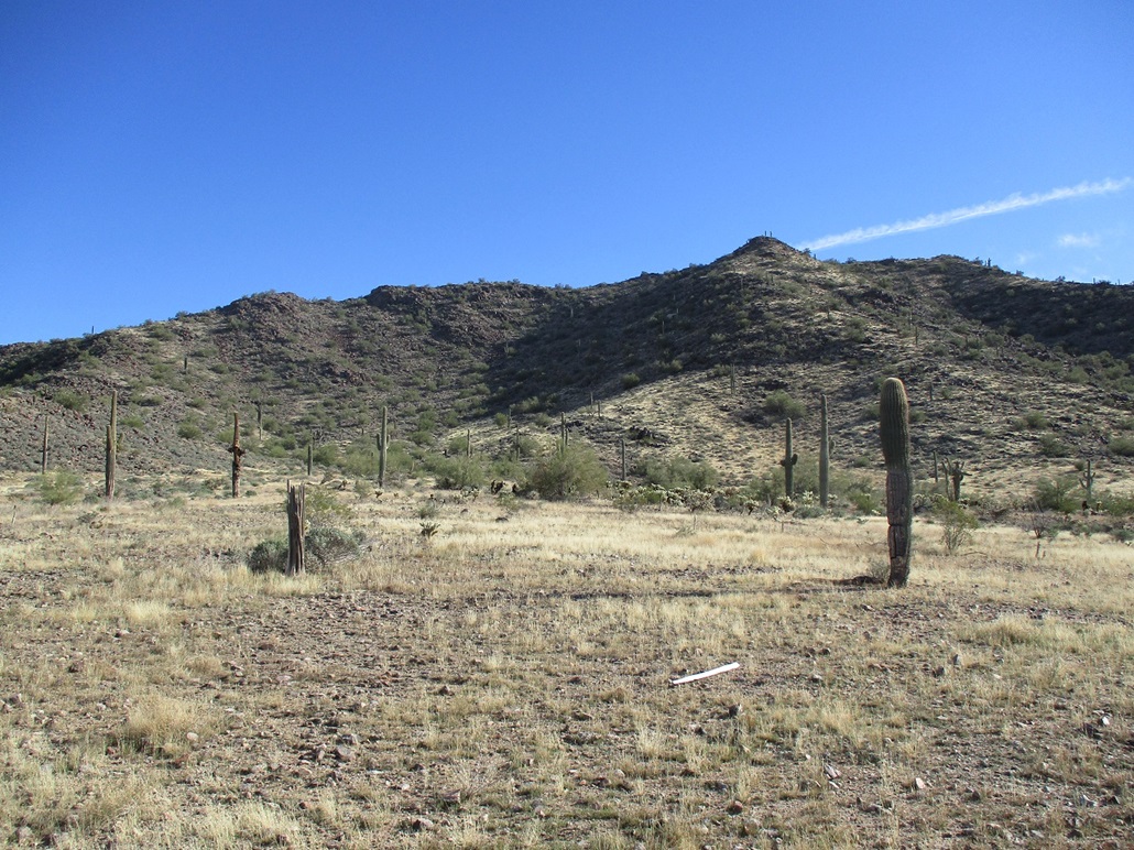
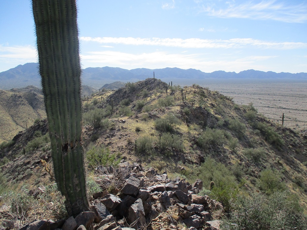
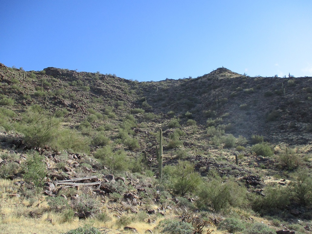
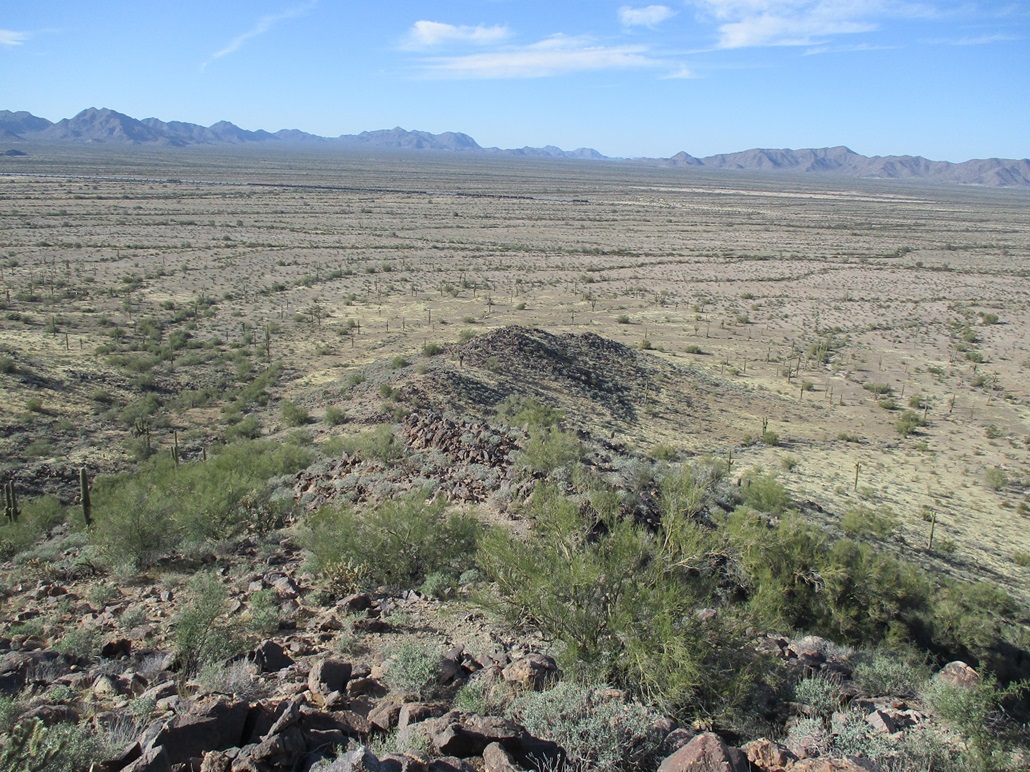
I crossed the tracks, 4 sets of them. Then I had to scootch beneath a barbed-wire fence. I had to get almost entirely on my back on the ground to get low enough. This was a well-constructed fence. Then it was just a walk of a mile across the desert flats to get to the base of the peak. I was on a line aiming right for the summit, and a ridge dropped off from the summit right toward me. I also studied a ridge slightly east. It looked friendly, but had two large rock outcrops higher up. Thus, I figured I'd go with the one right in front of me.
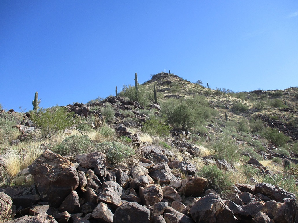
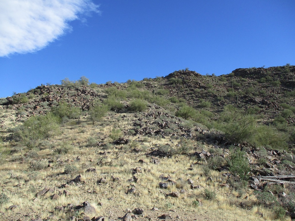
I was soon on the ridge, the slopes increasing incrementally. Looking up, there was grass virtually the entire way, which suggested the ridge would lay back well. There were a couple rock segments about midway up, but these were mostly level. I made good time, nothing slowing me down. The brush was spread out and the rocks were solid.
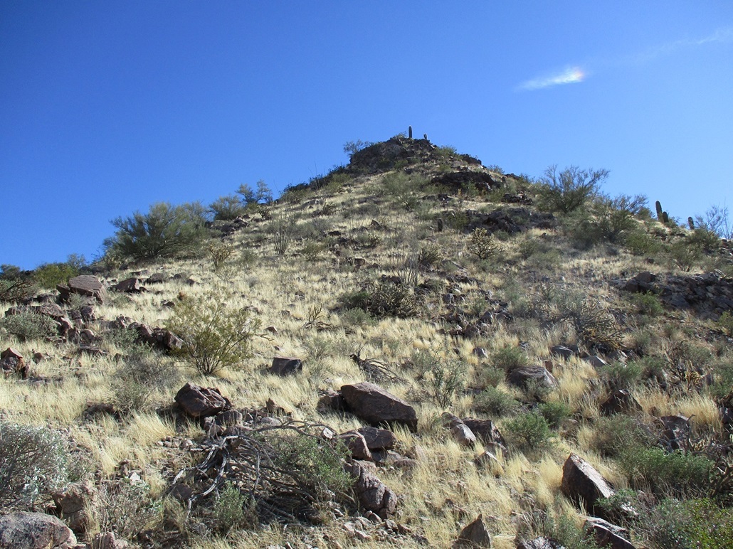
The final slope abuts a rock knoll at the summit. The slope becomes quite steep, but not impossible. I was soon at the base of the rocks, about 25 vertical feet below the summit. I angled right and clambered up a couple rocks. The best-looking option was a ramp that looked protected and with natural steps and hand holds, but it was guarded by two very pointy plants. I had to very carefully contort my body around these two plants. Once in the ramp, it was an easy scamper to the top. I would not rate any move above Class-2, maybe 2+. A lot of the rock was loose, which I don't like.
The summit was small, and the register held just four names going back over two decades. Matthias was here last week. Before that, it was many years since someone had signed in. I can understand why this peak sees so few visitors. It's not a bad peak. I liked it up here, the views were excellent. I signed into the log, then started down.
I wasn't too keen on descending the rocks I had just come up, and from the summit, I could view the parallel eastern ridge, the one I studied on the walk in. It didn't look too bad. I knew there were two rock sections that could be troublesome. Another thing you probably know by now about me, if you're a loyal reader, is I use the hope method when climbing. In this case, I hoped I would find a way down the rocks.
The initial descent went fine, just the usual rock piles and brush. I was quickly upon the higher of the two rock sections. I hiked to its edge, and only then could see below me. I was about 20 feet above the ground, and saw a lovely ramp of jumbled blocks that fed me down below this rock pile as though it were nothing. That went easy. I was pleased.
A few minutes later, I was on the lower of the two rock sections. Same thing. I got to its lip, saw about 25-30 feet of vertical, and just as quickly, saw a bomber ledge-ramp that made the descent almost trivial. The hope method worked well, once again. Now below the two rock obstacles, I just had to deal with the littler stuff, brush and grassy slopes, but that was easy and I was soon off the ridge and back on the flats.
When I was up high, a train was coming through, and at some point, I noticed it had stopped. This area has multiple tracks and I am thinking this one was stopped to allow another one to pass, which is what happened. Another train came though as I was descending. Good, I thought. By the time I am walking out, this first train would be on its way.
The problem was that the train blocked my view of the siding I had parked near. I kept walking and the train just stayed put. At the fence, I found a spot to step over, then had to angle wide around the stopped train. These things can be a mile long and I was glad he had stopped in such a way that the detour wouldn't be too lengthy.
I was on its back end, the engines up front, the engineers inside, probably doing calculus necessary to drive the trains. On this back end, I stopped to look at the last car up close. Everything was making noises. Beeps, chirps, sounds of pneumatics releasing and re-engaging. It's almost like these things are alive, like they're breathing.
I was able to find my car easily. The round trip had taken a little over an hour and went well. I was happy to successfully hike this peak after last month's unsuccessful attempt. I drove to Maricopa and on home, arriving as the sun was setting. I'd been gone two days, hiked four peaks, got blown over by the wind, and ultimately had a good time. Things didn't go to plan, but things worked out well in the end.
|


|