
The Mountains of Arizona
• www.surgent.net
|
| Painted Benchmark |
• Painted Rock Mountains • Maricopa County |
|
Date: May 1, 2016
• Elevation: 1,455 feet
• Prominence: 675 feet
• Distance: 3 miles
• Time: 2 hours
• Gain: 885 feet
• Conditions: Cool and very humid
Arizona
•
Main
•
PB
•
LoJ
We wanted to explore the Agua Caliente Road, a 48-mile dirt road that connects the town of Arlington (west of Phoenix) to the towns of Agua Caliente and Hyder. It's a gravel road that passes through scenic desert lined by bluff-like mountains. It is a "direct" link between the westernmost suburbs of Phoenix to the small paved road net paralleling Interstate-8 in Yuma County.
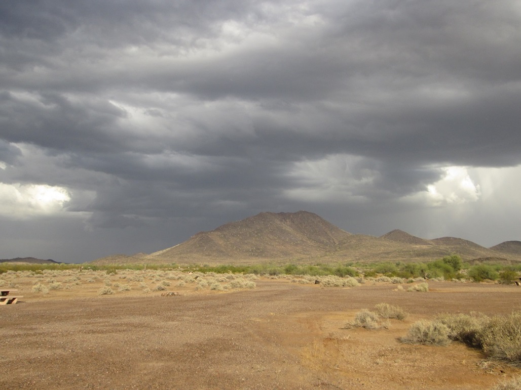
Well, that was the plan. An unusually active storm came into the state over the weekend. We had mixed clouds and sprinkles over us in Scottsdale, but as we drove west, we could see much meaner-looking storm cells in the distance, including a particularly dark mass exactly where we were heading. So we went that way anyway, and hoped things would work out.
We followed Interstate-10 to state route AZ-85, then a series of local roads and parts of Old US-80 through Arlington, which is mostly farms and scattered homesteads. We were soon at the turn off to Agua Caliente Road. It was drizzly where we were now, but more ominous to the west.
I eased the truck about six miles along Agua Caliente Road. Unfortunately, the rain fell heavier and heavier, rendering the road itself into mud, while the desert plains on either side were turning into vast shallow pools of water ... and mud. Lightning bolts were hitting the ground around us. The road itself held up well and we had good traction, but we were unsure about finding a place to pull off and camp, concerned that anything not on the main road may be too soft with all the water. Thus, we backed off and tried our backup plan.
Back on Old US-80, we drove south into Gila Bend. The rain stayed heavy and blew sideways across the road. If it wasn't rain being blown sideways, it was dust. We could see big dust clouds everywhere. Ironically, with us being where the rain was, the wetness mitigated the dust clouds. I'd rather deal with rain than dense dust clouds any day.
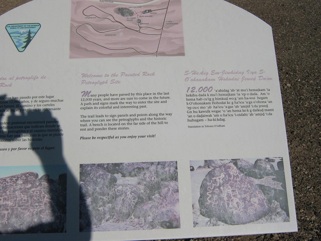
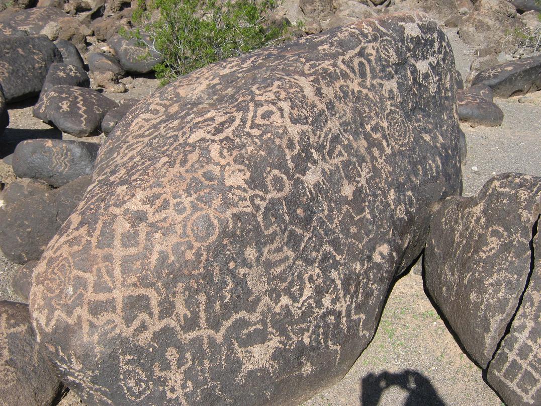
We drove through Gila Bend then went west on Interstate-8 about 15 miles to Painted Rock Road, then north and west about a dozen miles to the Petroglyphs Campground, a BLM-run outfit nearby a small pile of rocks notable for its abundance of ancient petroglyphs. We had camped here a few years ago, and it would be a good place for us to camp, now that our original plans had been dashed.
Being late April-Early May, the weather is usually hot by now. There was no one in the campground, not even a camp-host. It was entirely vacant. We found a spot we liked, backed the truck in, and then "camped". We sat for long spells in the front of the truck, eating Mexican pastries we picked up at a supermarket. We still had periods of heavy rain and cloud-to-ground lightning for a few hours. I was legitimately concerned about walking in this weather, given all the lightning.
The clouds finally cleared out about 6 p.m., and one other vehicle arrived to camp at another spot far from us. I walked around the area, checking out all the mud puddles. About a mile away, we could hear loud "Norteño" Mexican music, the kind with trumpets, tubas and waltz-beats. There was a party gearing up. It wasn't too distracting. There are farms in the area, and being a Saturday night, one of the homesteads was fixing to be a big fiesta for the evening.
I was beat, and got myself situated in the back of the truck about 9 p.m., while βð stayed up front. I slept well, but seemed to wake every two hours. She stayed up most of the night and listened to the Mexican music. Apparently, it was a real wingding. They went on most of the night. But it was far away enough so as not to be too annoying.
I got up about 6 a.m. the next morning. It was light out by now, and although there were no more clouds, the air was moist, almost foggy. Everything was covered in dew. The temperature was about 60 degrees, and I'll bet the dewpoint was about 59 degrees. I spent an hour sitting around and eating, then decided to go hike me a little peak, a bump called Painted Benchmark, which lies at the north end of the Painted Rock Mountains. The range highpoint is at the south end, near Interstate-8.
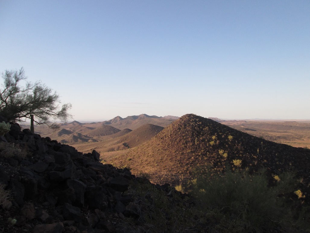
From camp, I walked east across the desert and a couple arroyos, aiming for a ridge south of the peak. The slopes looked lenient and friendly. The desert trek was easy, walking across hard-pack sand. But soon, the sand transitioned to larger black basalt boulders, common to every peak in the region, this being the sprawling Arlington-Sentinel Volcanic Field.
Gaining the ridge was easy. Once at it, I turned left and looked up about 400 vertical feet of steep slope, all of it covered in this volcanic rock. It was steep, but it looked hikable. I walked upward, weaving through the rocks and occasional 5-foot cliff walls. In another 30 minutes, I was on top of this peak.
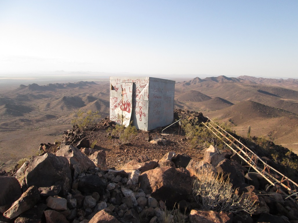
The top features a small shed building, covered in metal sheeting and "petroglyphed" with names and drawings using spray paint. How people knew to randomly have a can of spray paint with them when they climbed this peak, I'd like to know. I guess some people always carry spray paint.
The views from the top were nice. Looking west, I could see Oatman Mountain, then Face Mountain, Yellow Medicine Butte (my original peak that I had to abandon because of the rain), and way off in the distance, Cortez and Eagletail Peaks. Woolsey Peak was close by, plus lots of desert plains and farm fields. Some of the finest cotton in the world comes from these very fields.
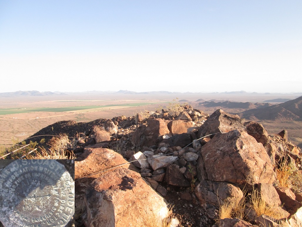
I looked for the benchmark, but could not find it. I found a witness marker instead, which was close enough. The hike down went fast, and I was back to the truck within two hours. We stayed another couple hours here before driving home. Although gone just 24 hours, this sort of quickie-campout was fun, lucrative and kind of epic given the crazy rain and lightning.
|


|