The Mountains of Arizona
• www.surgent.net
|
| Old Caves Crater |
• San Francisco Volcanic Field • Coconino National Forest • Coconino County |
|
Date: January 18, 2015
• Elevation: 7,183 feet
• Prominence: 423 feet
• Distance: 2.4 miles
• Time: 1 hour
• Gain: 540 feet
• Conditions: Mild and sunny, snow on slopes in places
Arizona
•
Main
•
PB
•
Interactive map
We spent a weekend in Flagstaff, staying in a hotel rather than camp. The weather in Flagstaff in January can be cold, but we got lucky and had mild conditions. The last big snow was over New Years, and since then, the weather had been clear and warm, by Flagstaff standards, with highs in the 40s and 50s. Thus, there was little snow locally, although it was in heavy abundance on the San Francisco Peaks above town.
We came here because we had both experienced a loss in the past week or so. My friend and climbing partner Adam Helman passed away on the 9th, and βð learned a few days later that one of her doctors, a kindly old man to whom she had grown very close, had passed away recently. Getting away for a few days to let our minds rest and enjoy the different scenery is what we both needed. We left our place in Scottsdale late Friday to avoid traffic, arriving in Flagstaff a little before midnight after an eventless drive.
I had brought maps for a few of the mid-sized volcanic cinder cones that surround the city as possible day hikes. Specifically, I had maps for A-1 Mountain, Wing Mountain and Slate Mountain. Although snow was light in town, it could still pose a barrier, not so much for hiking, but for the roads. On Saturday morning, I ran a few errands in town, and took the opportunity to drive the few miles west to the A-1 Mountain exit off of Interstate-40. I drove north about a mile and came upon a gate spanning the road. Normally, the road is open and gets close to the peak, but today it was shut, and while the road was still open for hiking, I chose not to. The road itself was wet and slick, and it would have been a tedious, slippery, gooey hike. I decided to back off and save this for a later date. This effectively cancelled my plans for the other peaks, for similar reasons.
We still had our own hike planned, to walk along one of the many FUTS paths, FUTS standing for Flagstaff Urban Trail System, a myriad of trails that wander through town. One let-in point was nearby our hotel. We started our hike around 3 p.m., intending to hike toward the Northern Arizona University campus, follow a path north where it meets with the main road in town (Milton Road, Old Route 66), then from there back to our hotel.
We walked the path slowly, enjoying the walk through the NAU campus. Along the way, we found a wallet on the ground and called the NAU police, and while waiting for them to show, a young woman asked us if we'd seen a wallet. It was hers and she was very relieved. The policeman showed up and we told him everything was cool. We figured we earned some good karma points there. At the half-way point of the hike, we emerged onto Milton Road, crossed it and spent about an hour at the Barned and Noble bookstore. We then walked back to our hotel.
We detoured to the grocery store to pick up a pint of Ben & Jerry's ice cream, which we shared in honor of Adam, who was famous for eating a pint after every climb (and saving the empty container for his giant pyramid of empty ice cream pints). I let βð choose the flavor.
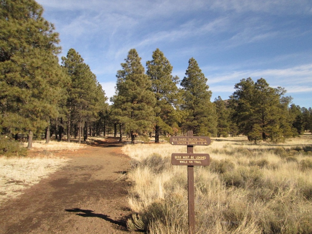
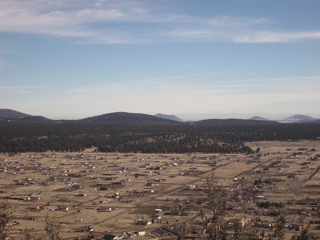
The next day, I was looking over our newly-purchased Flagstaff trails map, looking for something to do that wouldn't take all day or involve lots of muddy roads. I found a hike up Old Caves Crater, located along US-89 north of town. It looked low enough to probably not have too much snow on it, with good parking, and short, about 1.2 miles each way. Plus, it would probably provide excellent viewpoints of the surrounding big peaks. I kissed her bye. She was recuperating from yesterday's walk, cocooned in blankets watching a movie. I drove to the trailhead, arriving about a quarter to 11 a.m., the conditions very mild.
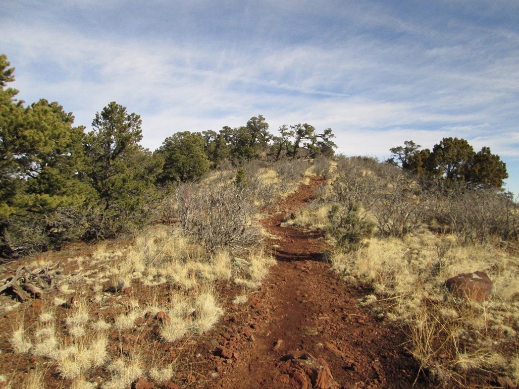
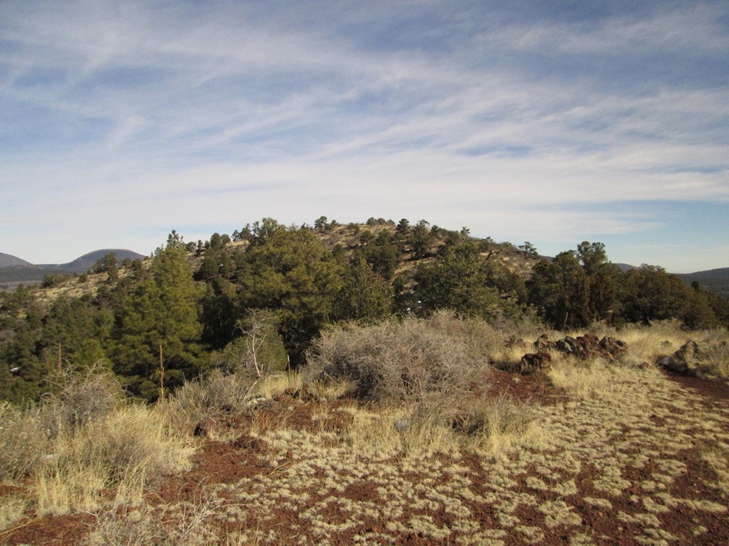
The hike goes fast. The trail heads north, then bends east slightly, gaining the southwest-trending ridge of the old crater rim. The trail is wide and flat, covered over in billions of tiny cinder pellets. Then I rounded a bend and was on north-facing slopes, immediately encountering snow and ice patches. However, the tread was good and I raced past these. I stopped at one point to let a couple pass as they were heading down, the man in front, his wife (presumably) behind him, their dog walking between them. I asked about the snow, generally trying to be friendly. He answered, and walked past. Then she walked past and asked him who he was talking to. I was standing right there! Did she not see me? I don't blend in that well with the background, do I?
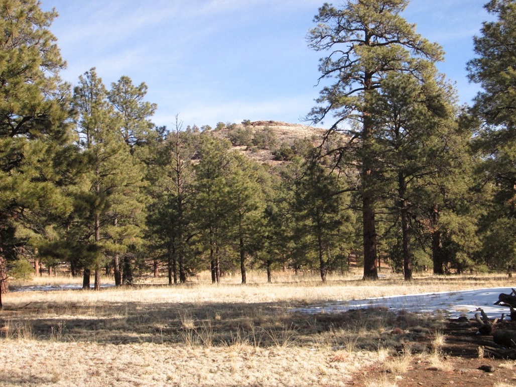
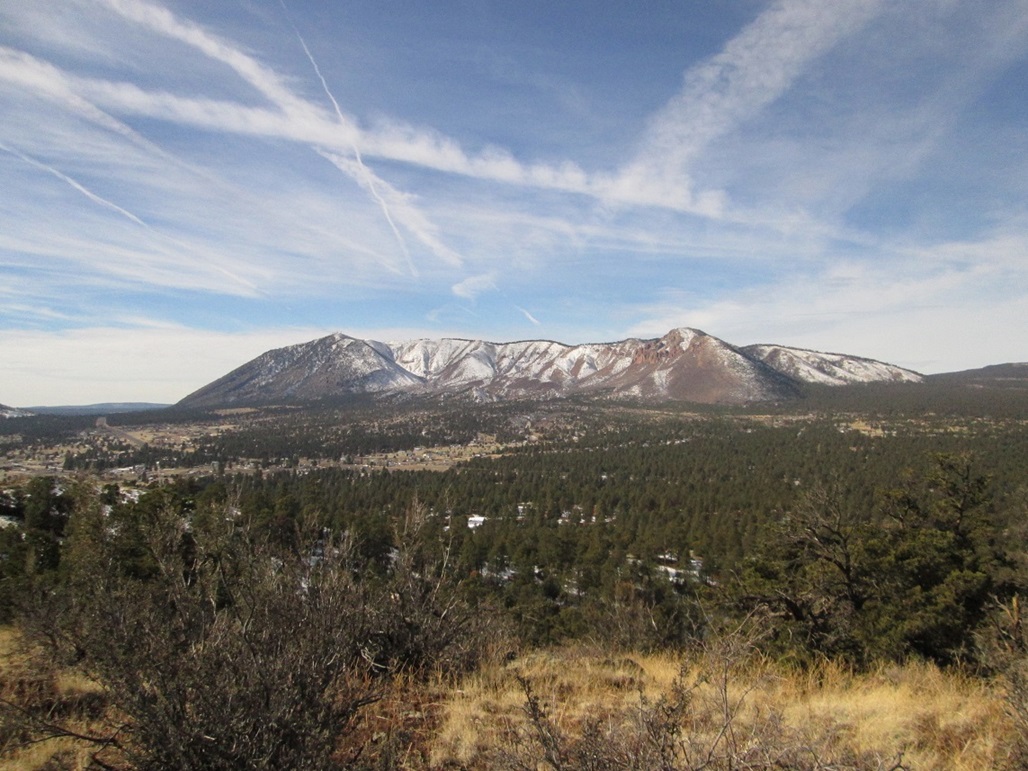
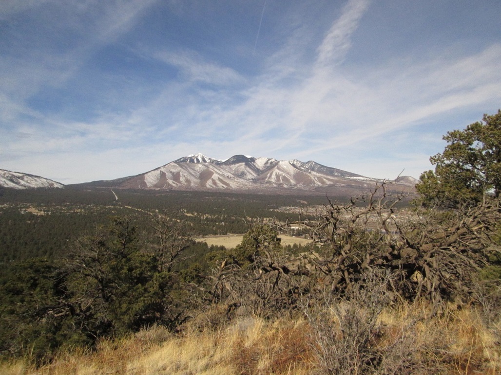
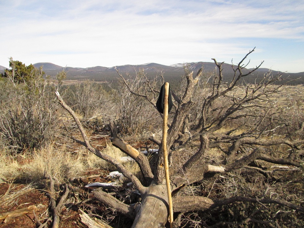
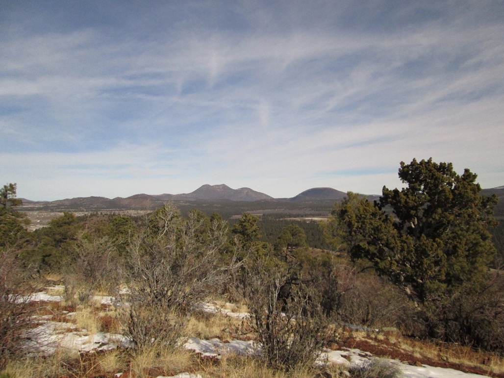
In moments I was on the top, the one-way hike covering 1.2 miles, gaining about 540 feet, taking me 20 minutes. As expected, the views were outstanding in all directions. I had a great view of the magnificent San Francisco Peaks and of Mount Elden, seeing them as two separate masses rather than blending together as they seem to do from other viewpoints. Looking north I could see O'Leary Peak and Sunset Crater, east I could see more hills and a large crater that I think might be Merriam Crater, and south I could see Mormon Mountain and the Turkey Hills. I spent about 15 minutes up here to snap images and to wait out one woman having a conversation on the phone, all the while standing on the top rock. She finally got off and wandered away so I could tag it and snap better images. As usual, Stick Scott was there with me.
The hike down went quick, and I was back to my truck after a total of one hour. I barely broke a sweat, but it was a good way to work off some of the fattening food I'd been eating. See, after we ate that ice cream, I went across the street and had a huge cheesy quesadilla at the Mexican food place. So I had about a week's worth of fat and cholesterol to flush out. This walk helped a little.
We didn't do much the rest of the day. We were content to laze around. I walked around the immediate area, then watched some movies on TV with B.. We stayed one more night, then drove back to Scottsdale the next morning, arriving home about 11 a.m.
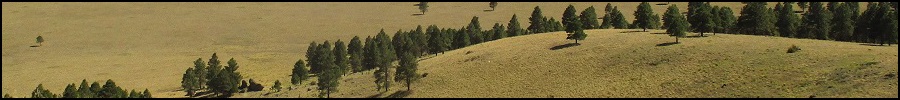
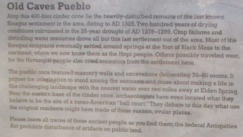
The Old Caves Crater gets its name for being the site of an old Sinagua Indian village from the 13th Century (see the images on the left sidebar). I did not walk past these old caves due to the snow and my desire not to deal with mud. The small cinder hill appears to be a popular "short" hike if looking for a workout. I saw bicycle tire tracks, too. There are trails that encircle the hill, so there are options if you want to spend a half-day here.
|


|