The Mountains of Arizona
www.surgent.net |
|
Peak 3171 "Light No. 1 VABM" • Peak 3185 These two peaks are the highest and most prominent peaks at the north tip of the White Tank Mountains. Peak 3171 lies west of Peak 3185, and it used to host a light beacon that were common on the peaks in the White Tank Mountains. These beacons were likely placed atop the summits for night visibility for pilots, especially those from nearby Luke Air Force Base. However, that is just an educated guess. I cannot locate any source that confirms this. Rough roads surround and traverse the range. These days, the highpoint, Barry Goldwater Peak, has a batch of towers, then the slightly-lower "Radio Towers Hill" has a virtual city of towers atop it, these all related to the daily needs of Luke Air Force Base. These tracks make getting into the heart of the range a little easier. A spur track goes to the summit of Peak 3171, while another track gets to within 150 feet of Peak 3185's summit. Access is via dirt roads that emanate off the Sun Valley Parkway, a quasi-freeway that circles around the White Tank Mountains on its north and west sides. The parkway connects Interstate-10 in Buckeye to Bell Road in Surprise. I was on this road back in August when I hiked Twin Buttes & Peak 1729. I followed Sun Valley Parkway for the heck of it, my first time on it. A couple of large housing developments have sprung up along it. These are way out in the middle of nowhere ... for now. In twenty years, it'll probably all be continuous suburbs. Yesterday it had been cloudy and stormy, the rain lingering into this morning. However, the reports said the rain would stop and the weather improve to clouds and sun as the day wore on. Since this hike would entail mostly old roads and tracks, this would be a good day for such a hike. I mentioned it to Matthias and he was interested too.
Date: February 26, 2023
• Elevation: 3,171 feet
• Prominence: 451 feet
• Distance: 11.6 miles (total hike)
• Time: 6 hours, 5 minutes (whole hike)
• Gain: 1,662 feet
• Conditions: Cold, breezy, trailing clouds of a storm passing through
• Teammate: Matthias Stender
• Prog/Jazz bands played: Can, Hiromasa Suzuki
Arizona
•
Main
•
PB
•
LoJ
We met at the Wal-Mart in Goodyear. He then drove us to the general area where we would be hiking. But it was not known if there would be access to the tracks directly off the Parkway. When we got there, we saw fencing along the road and a gate with a lock and a "No Trespassing - Arizona State Trust Land" sign. Moments later we found a wire gate that had been snipped open. The many tire tracks suggested people enter here often. Matthias drove in a little bit and parked, slightly out of sight from the highway.
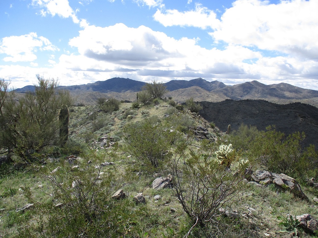
We started walking close to 9 a.m.. It was cloudy now, big puffy ones, moving through fast as the trailing edge of the storm. It was cold and breezy too, sometimes the breezes quite strong. The desert flats here are covered in roads and tracks. We knew to follow a "main" track that headed southwest, although any path in that direction would get us there. We followed one path south for less than a mile, then a better path (the main one we wanted) southwest, curling around a ridge and placing us on the lower slopes below Peak 3171 and 3185. It was about a two mile trek to get to the base of the mountains.
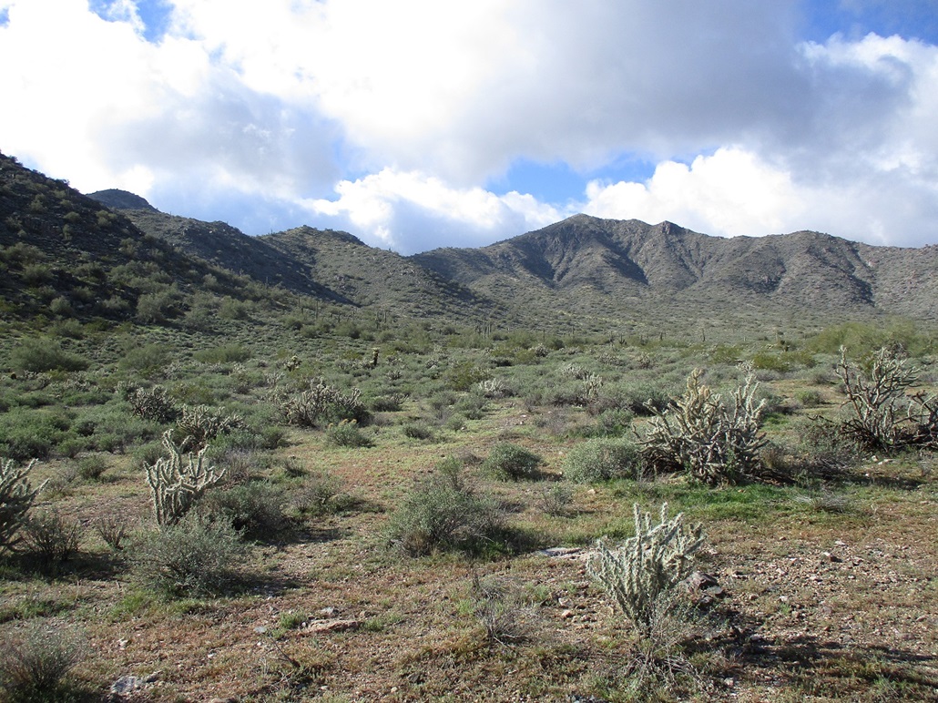
The road then starts to gain elevation in earnest. It comes to a heinous-looking segment that slopes at about 45 degrees and has erosion channels three feet deep. To the left is a better road that bypasses this nasty segment. So we walked it and shot past the junction that would put us back on the main track. We got into what looked like an old mine platform before realizing what we had done. We backtracked to the proper side-road and were soon back on the main road. This road stays atop a steeply-sloping ridge that connects to the roads high up in the mountains. The going was easy but steep with segments of loose gravel. It achieves a saddle, then levels a little and then comes to the saddle betweenm the two peaks, elevation about 2,720 feet. Up this high now with nothing to block it, the cold wind would sometimes get heavy and uncomfortable.
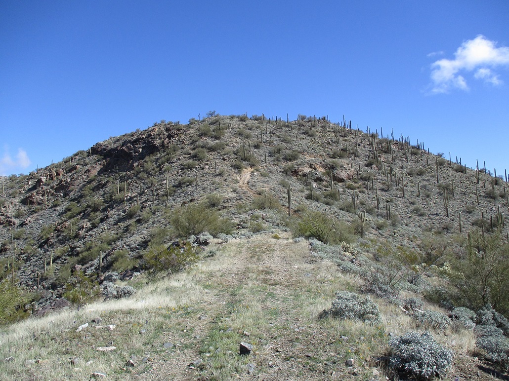
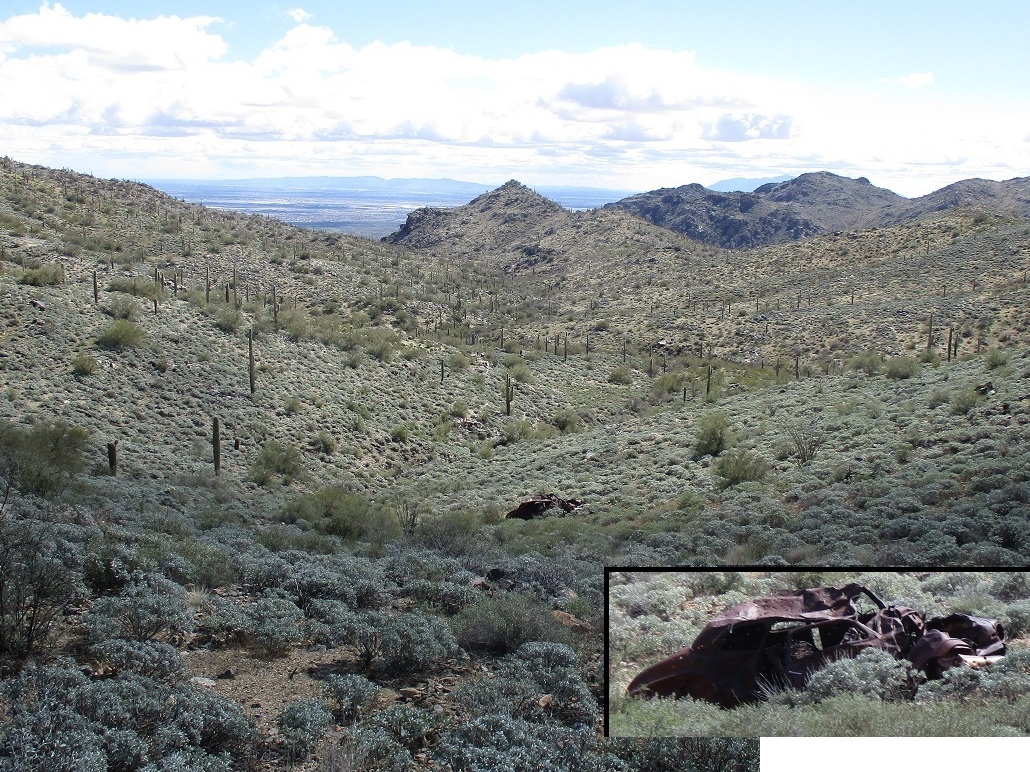
We went west, aiming for Peak 3171 first. The tracks gains more elevation, then traverses Peak 3171's south flank. Along the way is an old sedan lying in a heap about a hundred feet down a slope. By the looks of it, it looked like something from the 1940s. We were soon at a trail junction, where the spur track gains steeply uphill to Peak 3171's summit. This last spur was very steep and rubbly. The map cites a VABM (vertical angle benchmark) on the summit, named "Light No. 1". These elevations are determined remotely (sighting from other monumented points and using trigonometry), and there is no actual benchmark disk monumented at the summit. Otherwise, it'd just be labeled "benchmark".
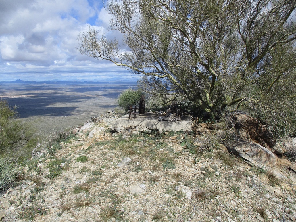
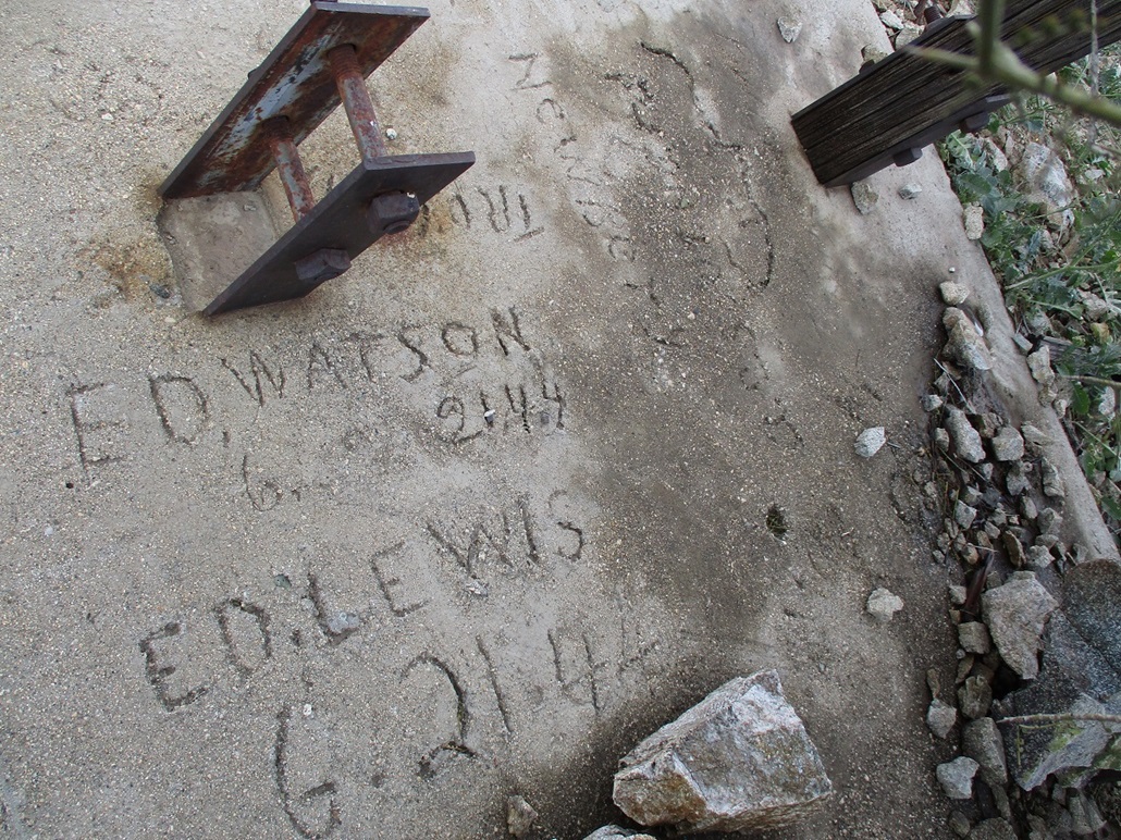
The track gains the summit and simply ends. Up ahead are two small bumps, the farther one the highpoint, the closer one with a concrete pad that once anchored the light beacon. For an example of one, see this trip report from Cat Hill. Or check this one out, White Benchmark. But there was no beacon here, just the pad and the metal anchors. Two fellows named Ed wrote their names into the concrete on June 21, 1944. They were probably the ones who put in the pad. We signed into a register at this pad, then the one on the actual highpoint. However, the wind was heavy, and we both got moving back down, never stopping for a rest on this summit. We took a break down below, where we had some wind protection.
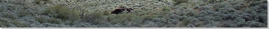
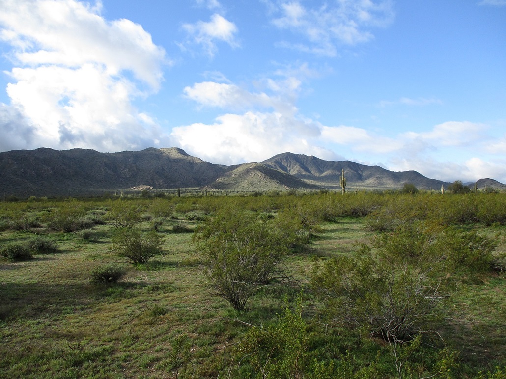
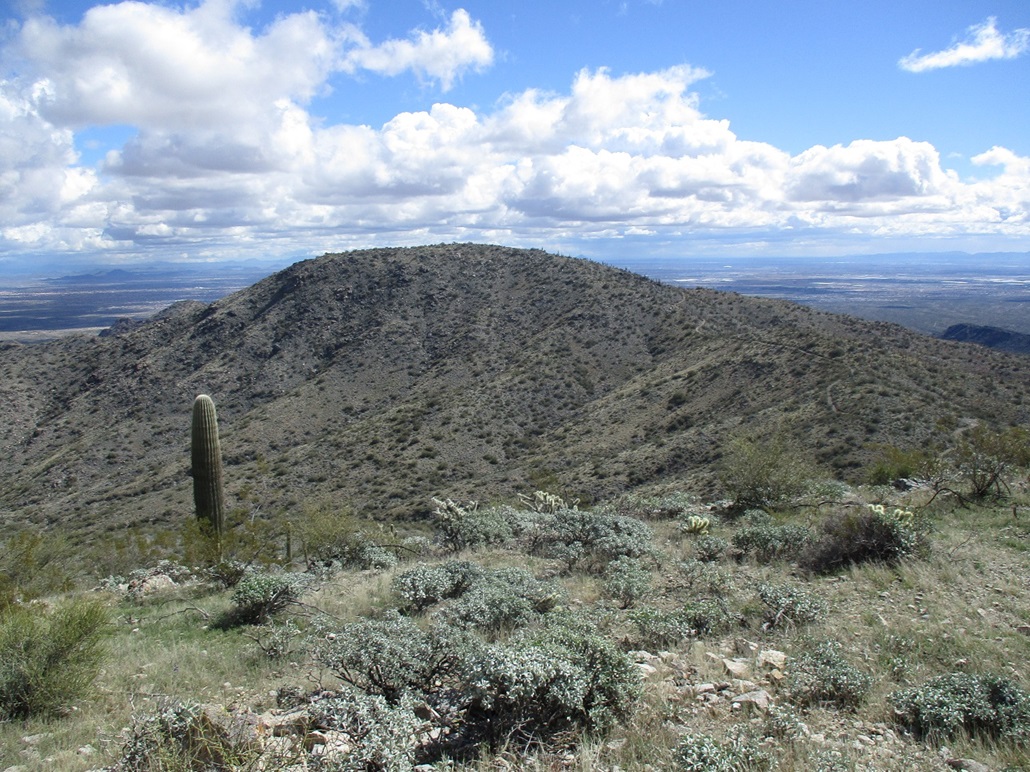
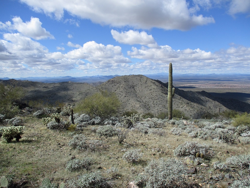
From this high vantage, we could easily see Goldwater Peak and the nearby Tower Hill. The clouds were scooting through quickly. They were puffy clouds, perfect for photography. Also, looking down at the roads, it's a natural question to ask, "what the hell were they thinking?". The road we followed up was steep and not in good shape at all, but in the old days, it was probably maintained. Other roads in the area ranged from decent tread to heavily eroded. That old sedan somehow got up here, before meeting its doom. Even when the roads were in better shape, they were steep and exposed shelf tracks at best. Getting up them took a good strong vehicle, nerves of steel, courage of a lion, a flask of whiskey, two packs of unfiltered smokes, and a stick of butter to eat. In the 1940s, men were men. I hope the person(s) in that sedan were okay. It was bashed up pretty bad. We did not check for skeletons.
We hiked back down to the saddle between the two peaks for another break, then got moving toward Peak ...
Elevation: 3,185 feet
• Prominence: 405 feet
• Distance: included in above
• Gain: 465 feet (from high saddle only)
• Conditions: Still breezy and chilly
PB
•
LoJ
... 3185. The track curls around two low hills then traverses below the south slopes of Peak 3185, curling around to its east side where the track achieves its apex before continuing east. We left the track, only about 150 vertical feet to gain to the summit, all of it on nice slope, except for the cholla parts. Going up, we got around them okay.
The summit here is broader and rounder than that of Peak 3171. We found the register ... lying out in the open. Just laying there on the summit rock, the cairn in which it sits disassembled. The register back at the concrete pad on Peak 3171 was also sitting in the open, on the pad itself. That register sees hikers occasionally, mostly locals from the area, about one or two groups a year. But this register had no one since Bob Moore in 2009. I doubt Bob would just leave it in the open, and if he did, that the register would still be intact after 14 years in the open. Someone had been here (and probably back at the other peak too), but never signed in. Maybe they were unclear on the concept. After we signed in, we tucked it nicely back in its cairn home, waiting for the next visitor, whenever that is.
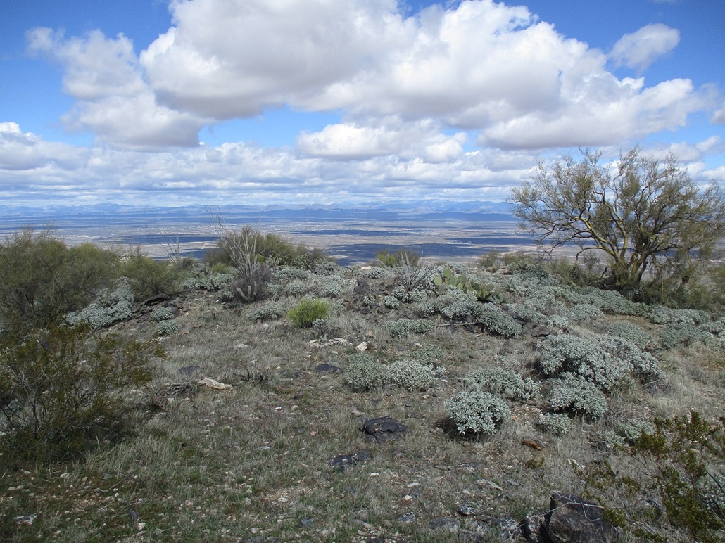
We took a break here, the wind not so bad, there also being good sitting rocks. We spent about 15 minutes up top, looking around. To the north were the Bradshaw Mountains. When the clouds would lift, we could see slopes completely covered in snow that had just fallen. Peaks to the northeast were also covered in snow, not just a dusting but completely covered.
We went down the same way. I got bit bad by an effing cholla ball. I knocked at it but that just drove more barbs into my skin, and it hurt like crazy. Back at the road, I stopped to pull the barbs out with my needlenose pliers. A dense patch of cholla would stop an army. We hiked down back to the saddle, then down the steep slopes back to the desert flats. By now, we could hear more engines and see a couple ATVers show up. A pair passed us going up as we walked back. I am curious how high they could get. We saw no evidence of tire tracks higher up. I'm not sure anything could get up these tracks after a certain point.
We were back to Matthias' vehicle at about 3 p.m., a six-hour hike. This hike had gone well, and today was a perfect day for a hike like this. Had the weather been warmer, even just in the 70s, it could be a rough hike. It's an easy hike since it's mostly road-following, but it is steep and open to the sun and wind.
Thes two peaks put me at 998 ranked summits world wide. We had thought about hiking a peak at the south end of the range, but we were both tired and we got our money's worth. Matthias got us back to the Wal-Mart, where I got my stuff transferred. We shook hands and he went on his way. Me, I got a Hawaiian barbecue chicken dinner from a place nearby, and was back to my place about 5.
|


|