The Mountains of Arizona
www.surgent.net |
|
Peak 3336 • Peak 2565 Today's adventures takes us to the hills in and around the community of New River, north of Phoenix. These hills are the southern and western foothills of the New River Mountains. The area here is a mix of Forest, State Trust, a little BLM, and a lot of private land, but generally, the peaks are not (or mostly not) on private holdings. After a few days of mild and sunny weather, a storm would be moving into the state, part of the big sequence of storms slamming California. The main storms would not arrive until tomorrow. Today would be mostly cloudy and cool, but not cold. I wanted to knock off a couple peaks while the weather was decent, and wasn't terribly picky. Much of this was planned at the last moments, as in very late the night before. I set my sights on Peak 3336, north of the populated parts of New River, and Peak 2565, a cliffy peak to the south. I also explored a third peak but gave up as most of its approach was on private land.
Date: January 14, 2023
• Elevation: 3,336 feet
• Prominence: 736 feet
• Distance: 3.8 miles
• Time: 2 hours, 30 minutes
• Gain: 1,295 feet (gross)
• Conditions: Cloudy
Arizona
•
Main
•
PB
•
LoJ
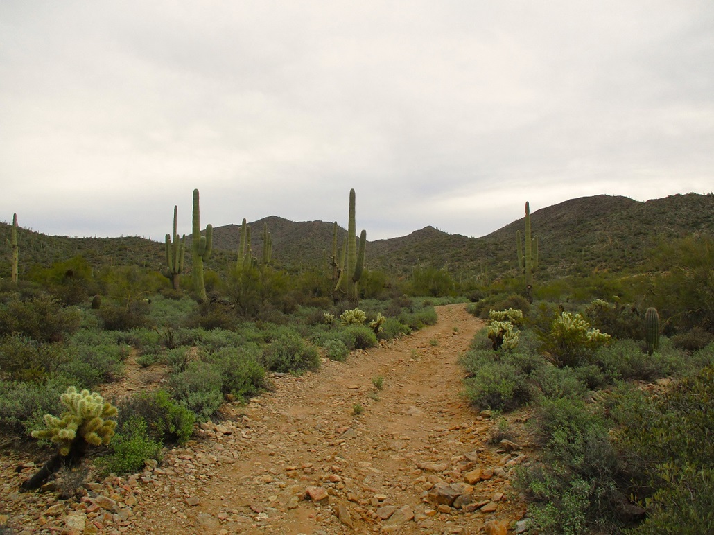
I was not up at dawn, but instead got a leisurely start, out the door about 7:30 a.m.. Another 45 minutes later, I exited Interstate-17 onto New River Road, followed it north and east to 27th Avenue, and took that all the way north to where it ends, abutting State Trust land. I went east on Photo View Road, an unpaved residential road, less than a mile to where it meets 23rd Drive. To the north is an unlocked gate with the usual "no trespassing permit required" sign for entering onto State Trust land. I had mine, so I was good to go. I drove in on the rocky but passable road about a half mile, parking in a cleared spot too good to pass up.
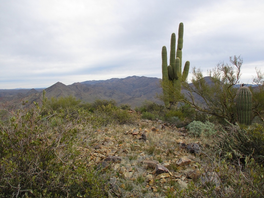
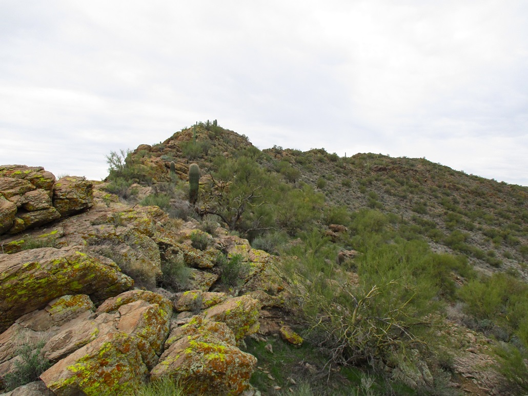
Peak 3336 is a large peak rising east of where I parked. Viewing satellite images, I saw that a track or trail of some sort passes right over its summit, forming a loop. The "trailhead" is at the end of the road I was on. I parked short of this trailhead, where the road simply ends in a clearing. This is not a developed trailhead, and not even the shooters come here as I saw no evidence of them, such as spent shells.
I started walking at 8:45 a.m.. In minutes, I was at this trailhead. I walked in on it and not more than thirty feet later, came to a split. I chose to go left, since it appeared the trail would mainly go up, except for one large drop along the way, whereas the other branch went up and down a number of ridge bumps. I gave consideration of hiking the whole thing as a loop. I would decide that later.
The trail drops into a drainage, then starts up the opposite slopes, gaining moderately steeply. It was a good-looking trail, about a foot wide. Clearly, some time in the past, someone felt it necessary to construct a trail. This is not an informal use trail nor is it one kicked in by the cattle (there were a few out and about). The terrain is too rocky for them to have moved aside the amount of rock that was moved to form this trail. Who built it, when and why, remains a mystery. A miner?
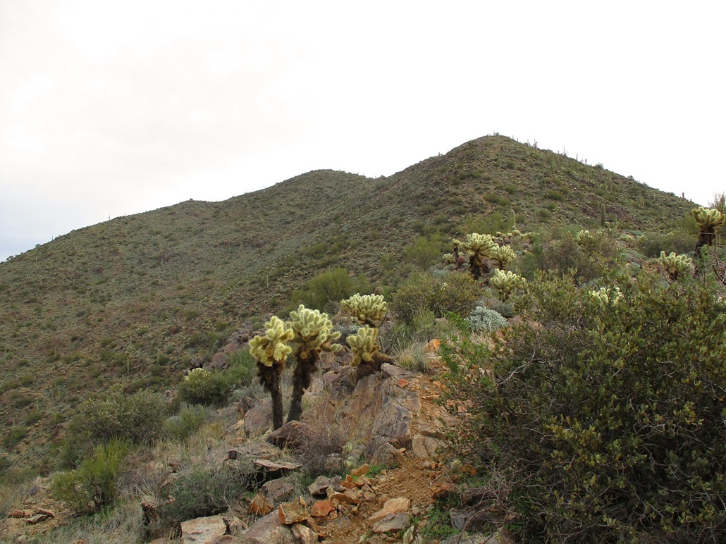
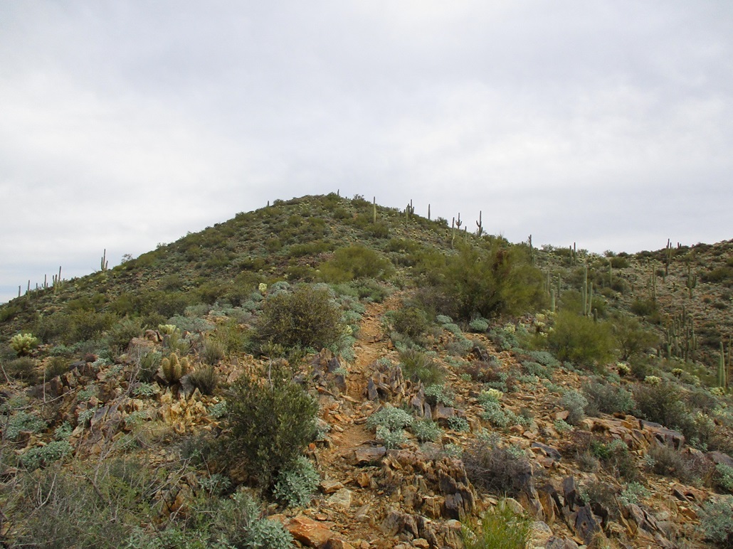
The trail rises to a hilltop, elevation 2,640 feet, then drops steeply, losing 120 feet. (Thus, I get credit for climbing Hill 2640, prom: 120 feet). Looking up, the summit was set back, and the ridge I was going to follow in full view. I could see the trail higher up. One section looked very steep, which concerned me a little.
I got up the next slope, which went well, then a little drop of about 30 feet, a little flat segment, then I was at the base of the steep portion. Yeah, it looked damn steep, and the trail did not switchback. It just went straight upslope. The lower part wasn't difficult, then it steepened, and I found myself battling loose rocks and dirt in the trail itself. It became clear real fast that the trail was a liability, offering no sense of security at all. So I angled off it and climbed the rest of this slope, about 300 vertical feet, on its natural rocks, with abundant cholla to make things fun.
This worked well, and was no easier or harder than any of the other open-slope scrambles I have done. Had the trail not been here, I would not have thought twice about just barging up the slope. Other than a couple easy scrambles and the need to ensure the rocks were solid, I had no trouble at all. Yes, I did get bit by a cholla or two, in case you wonder.
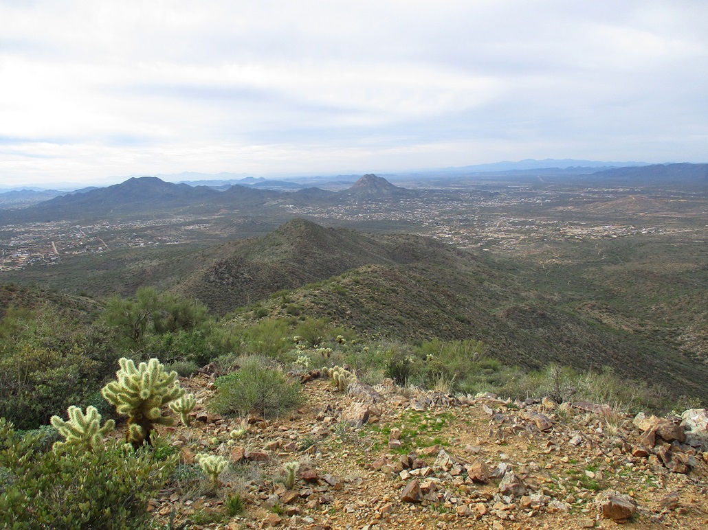
Once above this part, the top was a short distance away, another 200 feet higher. Now much less steep, it was an enjoyable walk to gain the highpoint. I even had about a minute of sun breaking through the clouds. The summit is bare, with one big saguaro slightly offset. I found a register in a cairn, placed there in the past couple of years. Bob Moore was here in 2021, then a New River local in 2022, and me in 2023. Others have been up this peak in years past. I spent about ten minutes up top, looking around. The gray clouds dampened my desire to shoot images, but I shot a few anyway.
I studied the trail that goes along the parallel ridge, but it goes up and over about three bumps, and looked about as steep as what I had just come up. So I chose to simply follow the same route down. At least I knew what to expect with that nasty steep section. Looking across, I saw what looked like an adit opening, too rectangular to be natural. A mine perhaps? Could this be why there is a trail here? And if so, why a trail on my ridge? Surprisingly, the trail was well-defined the entire way, never once fading out.
Going down that steep segment, I got onto the rocks and just took it real slow until I was down below it, when I got back on the trail. Then it was just a matter of walking back out to my car. When I piled in, I was a little surprised to see that it was 11:15 a.m. now. I had been gone two-and-a-half hours! I naively had figured "a little over an hour" because I saw the trail on the sat images.
Overall, this was a fun hike, not memorable, definitely a one-and-done peak for me. The trail was great for 80% of the hike because I could move quickly on it, then it sucked for that steep part. If you go, be aware of this and think about doing what I did by hiking on the rocks directly.
I got moving and retraced my driving until I was back onto New River Road.
Elevation: 2,565 feet
• Prominence: 325 feet
• Distance: 3.2 miles
• Time: 2 hours
• Gain: 575 feet
• Conditions: Some sun, then more clouds
PB
•
LoJ
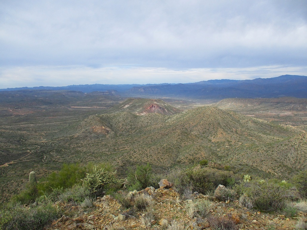
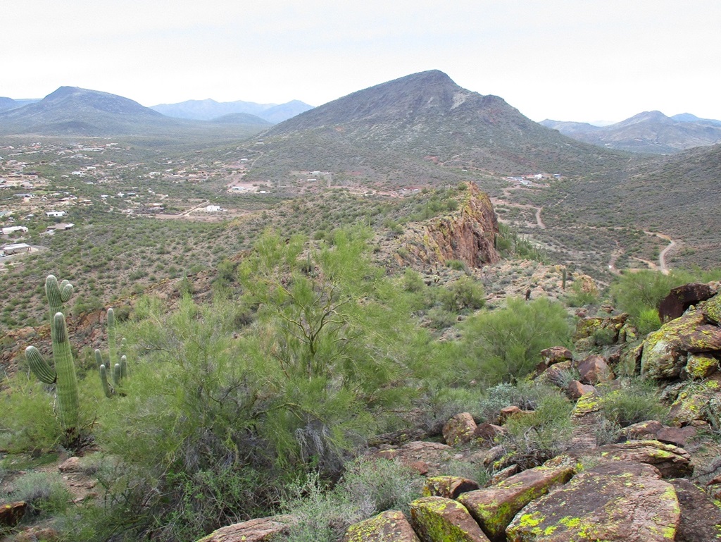
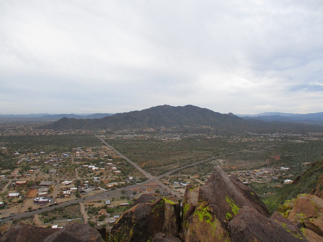
I went east and south on New River Road, closing in on Pyramid Peak, where Circle Mountain Road branches to the east. This peak has a line of cliffs facing southwest, all sloping down to the northeast. The summit and top ridge are on State Land, but the lower slopes are private. A few homes are built in to the hillside.
I looked for a place to park, but did not feel comfortable leaving my car on the shoulder of Circle Mountain Road. I went back and forth a couple times but couldn't find any good places. There are no businesses nearby where I could stash the car. After about ten minutes, I gave up and moved on to my next objective, Peak 2565, which rises just a mile to the south.
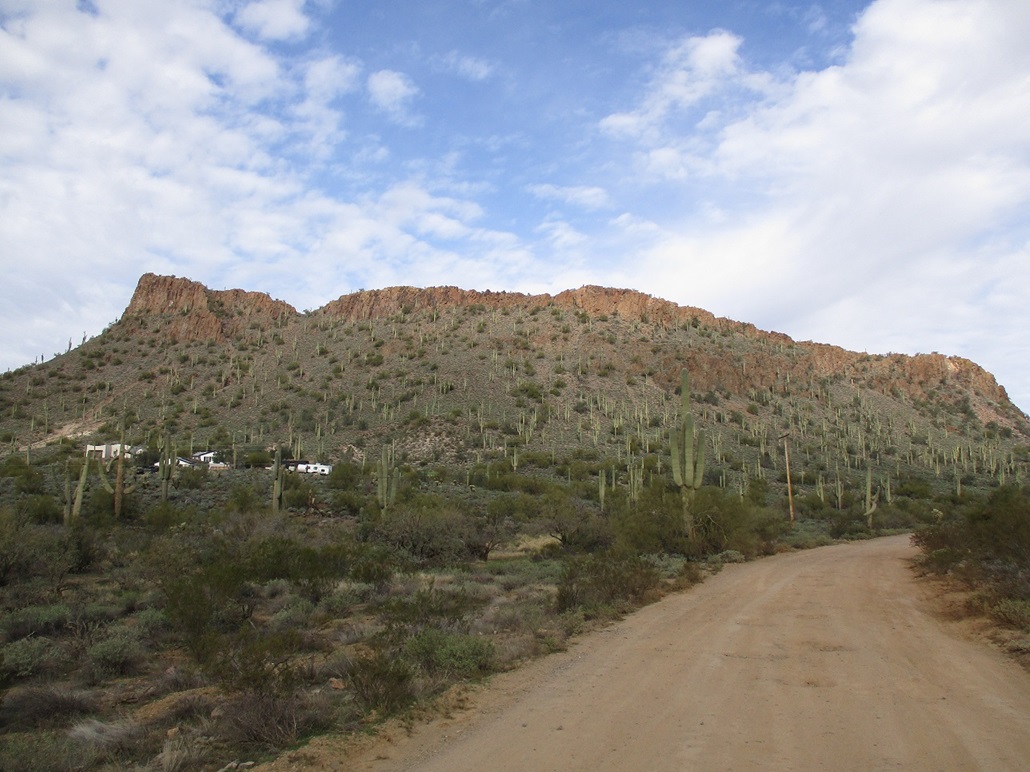
Peak 2565 also has a similar shape as Pyramid Peak, with a wall of cliffs facing southwest, and slopes falling off to the north and east. Most of this is on private land, but satellite images showed a few trails. My hunch was that locals hike here often and that whoever owns the land likely does not enforce the proscription.
I parked at the Andy Kunasek Trailhead for the Maricopa Trail. I was last here in 2018 when I hiked Peak 2875 (Sage's Peak). This put me south of the peak. Looking at the road maps, residential roads get close to the east base, where one of the trails picks up. But uncertain just how "private" this area was, I hedged my bets, playing it safe by parking where I did.
I was walking at noon sharp. The sun came out for a few minutes so I snapped a few images. Then just as fast, the clouds took over and that would be the last of the sun for the day. I followed Linda Lane east, as it curves around one hill, gains a slope, then proceeded north on Rolling Rock Road. I passed a sign about "no trespassing at gate ahead, no turn-around". Something like that. It wasn't worded very well. I walked the road, then saw a man with his son doing some work in the yard. I hailed him and asked about the trail. He was super cool and said where I could find it, that he's been back there and taken his kids up, and so on. That immediately put aside any concerns about being where I shouldn't be. He said the land is owned by "some corporation". That sounded even better. That meant they weren't local.
I walked the road to a transformer box, then entered into the brush and immediately picked up a trail. It was hewn into the rock and was itself rocky with "shale" everywhere. Footing was never a problem, but I slid a few times. This kind of rock doesn't hold togther well.
About ten minutes in, I came to a bend in the trail, a left going uphill. There was a sign here about "no trespassing" in both English and Spanish, badly faded, propped up against a bush. Even more evidence that the owners really don't care if people hike back here. I call this a "back pocket" rule. They probably know that people go back there, and know there's no way to stop them, and are de-facto okay with it. But if someone were to build a fort, or start digging things up or abusing the land, then they could invoke the trespass and shoo them off. Anyway, I could hear a bunch of voices up ahead of me. Other lawbreakers like myself.
I followed the trail as it gained up toward the rocky spine of this little peak. The voices were that of three or four younger teenage boys. They were clambering on the rocks having a merry time. I figured I'd pass them, but I ended up following a rough path slightly below the rocks, while they stayed higher, and I never saw them after that.
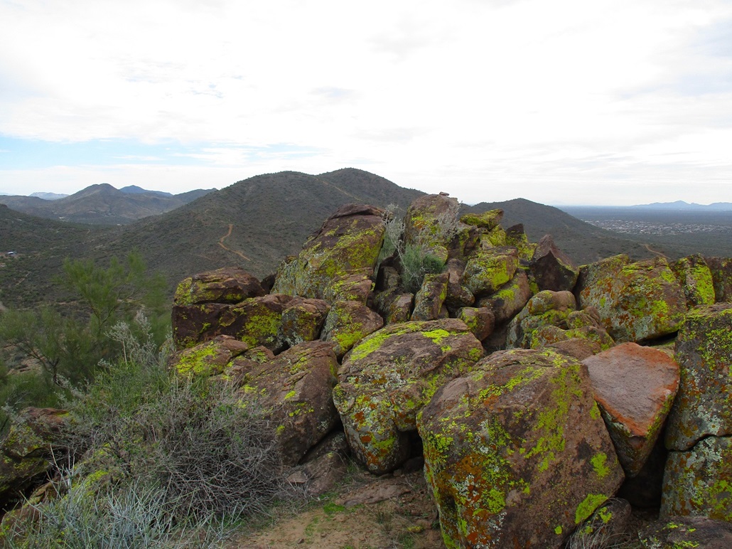
The spine of this hill is very rocky, big heaps of talus and outcrops to where staying high would mean a lot of Class 2/3 scrambling and a lot of time. By staying low, on the rock margin itself, I could move quickly and avoid the rocks until I was close to the actual highpoint, then I would bust up to the top.
I was following a path, but it was weak and I'd lose it, then 30 seconds later, find it again. The route was logical, just stay close to the base of the rocks. I was soon at the last saddle below the top. I then took off up-slope and scrambled up the big blocks to the top, itself a big rocky block. Here, I had to move a little carefully. On one side, 60-foot cliffs, on the other side, a jumbly heap with possible 15-20 foot drops if I wasn't paying attention.
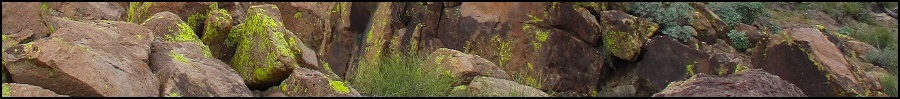
The day was cloudy but the views were good. I spent about ten minutes up here and had a relaxing break, enjoying the views and the rocks. From up close, these are impressive cliffs. The rocks were big red-colored boulders, covered in yellow lichens. The combined effect was quite pretty.
I egressed the same way. Back on the road, that first guy came driving by and asked how I enjoyed it. He was a cool dude. Then I met another local out walking his dog. He was chill too. Some places in the state, people think you're worse than Satan for hiking on or near their homes, but not here. These people get it. They know the score.
I was back to my car at 2 p.m., a two-hour hike of about 3.2 miles round trip. I was pleased, as this little peak seemed like nothing special, but in reality was a real pleasure to hike, just enough scrambling to make me feel like I earned this summit.
Sufficiently tired now, I took the scenic (non-freeway) route along the Carefree Highway to Scottsdale Road, then I got onto the freeway and back to Tempe.
|


|