
The Mountains of Arizona
• www.surgent.net
|
| Naco Hills Highpoint |
• Highpoint: Naco Hills • Mule Mountains • Cochise County |
|
Date: December 24, 2023
• Elevation: 5,805 feet (Lidar)
• Prominence: 548 feet
• Distance: 4.4 miles
• Time: 2 hours, 20 minutes
• Gain: 870 feet
• Conditions: Sunny and cold
Arizona
•
Main
•
PB
•
LoJ
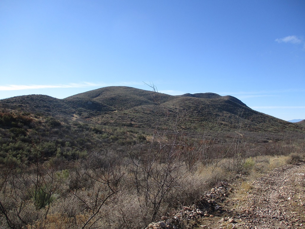
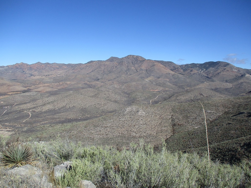
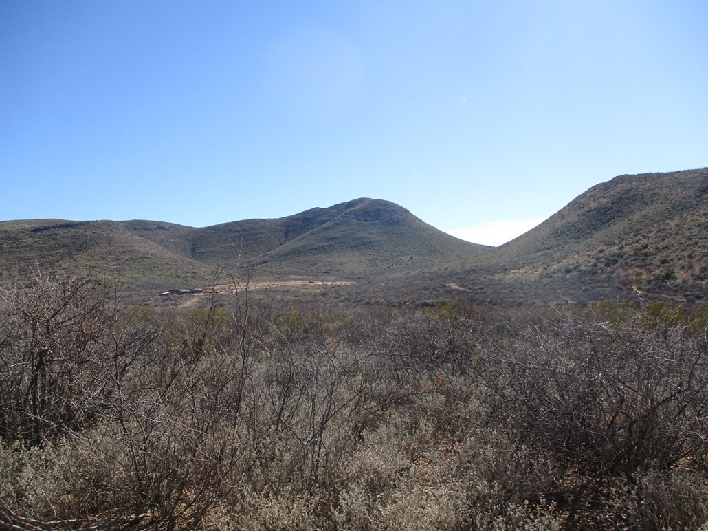
The Naco Hills are a small batch of hills at the southwest tip of the Mule Mountains, about eight miles west of Bisbee along state route AZ-92. There are two ranked peaks in the hills, and my goal today was the highpoint itself. The hills have tall south-facing cliffs, and long gentle ridges that trend north. They are too low to be forested. Instead, just about every thorny and prickly desert plant lives in these hills. The ground is mostly limestone, which forms small cliffs and from a distance, gives a striped striated appearance.
Naco is the name of a town that straddles the international border. There is a tiny portion within Arizona, with a population in the hundreds, and a larger (by comparison) city in Sonora, population about 6,000. It is one of a handful of crossing points between the United States and Mexico within Arizona, but not nearly as busy as the main ones in Douglas/Agua Prieta to the east or Nogales to the west (and other ones farther west).
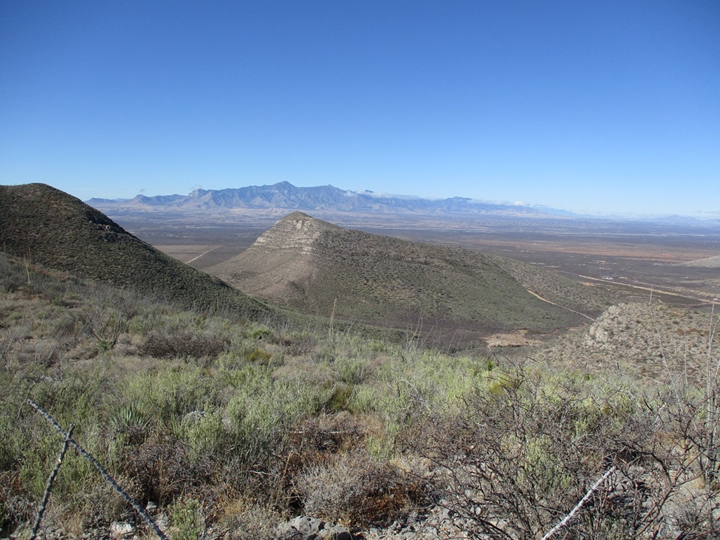
The word "Naco" supposedly comes from the local indigenous language meaning "prickly pear", but in Spanish slang, it means tacky, vulgar, low class, and so on. It, like Bisbee, is a mining town, and there are mines still digging for copper over on Cerro San Jose, the giant mountain that lies south of Naco by a few miles.
The more I read up on Naco, the more fascinated I became. It was a site of a handful of battles during the Mexican Revolution of the 1910s-1920s. Apparently, people from Bisbee would watch the battles from elevated (and safe distance) positions on the American side. Troops from nearby Fort Huachuca were stationed on the American side to ensure that the battles did not spill over. The Mexican combatants knew better than to get the American military involved, but occasionally, a stray bullet would cross over and hit someone on the American side.
In 1929, an American stunt pilot offered to help one of the sides by dropping hand-made bombs. They accepted his offer, and he dropped a few ... including inadvertantly a handful on the American side. Thus, Naco, Arizona, has the peculiar distinction of being the only locale in the United States that got bombed on during the Mexican Revolution. The pilot was eventually jailed (in the United States) for his actions.
These days, Naco is like a suburb of Bisbee. A lot of people live there but work on the American side. The Mexican Naco also, not unexpectedly, has issues with drugs, smuggling and violence, but not nearly on the scale as in other areas. Apparently, to the rest of Mexico, Naco is so far off in the hinterlands that it is "forgotten by God". To Americans, it was a place to drink and gamble during the Prohibition years of the 1910s-1930s. Even now, the drinking age being 18 in Mexico, it sees a lot of action with people too young to drink legally in the United states going down there to party and baile.
I've only been to American Naco ("Naco Northside") once, just to see what was there. I have yet to cross over the border into Naco Southside. During the day, and if you just walk over, it's pretty tame and popular. Americans naturally go there for the cheaper products, prescription drugs, things like that.
Today, Christmas Eve, I had open and it was looking to be a clear and chilly day. We had a storm pass through two days ago, and yesterday was clear(er) but very windy. Today was calm with blue skies, temperatures in the 40s and low 50s. But it wasn't dry. There was frost this morning and dew everywhere. In the low valleys, there was fog, and on the distant mountain ranges, a few clouds clung to the highest peaks.
I wanted to explore Naco Hills Highpoint. It was close and if I was shut out for some reason, I wouldn't feel like I wasted a whole day getting there. I drove downhill on AZ-92, got gas and snacks, and drove a few more miles westbound on AZ-92 past a slight bend where the highway cuts south across the toe of the hills. About a mile later, I eased onto Rio Vista Road, which is a dirt road but maintained, as there are scattered homesteads out here. This is outside the Bisbee city limits. I've been back here one other time, when my wife and I stayed at a rental. I recall it being very peaceful and enjoyable.
I went north on Rio Vista about a mile and a half, then west on Calle 9 for a half mile, then north on Via Liberacion for a mile. Where I made the turn onto Liberacion, two dogs started to bark and chase my car as I drove. They looked like siblings and probably belonged to a nearby homesteader. They looked healthy.
They seemed friendly at first and I went slow because the road was rocky. Then one started to bark very intensely, as if he really meant it. Then they both started to circle my car as I drove. I had to be very careful not to hit one because they would dart in front of me. Stupid dogs. When I saw they were both behind me at one point, I "gunned" it, now going about 20 miles per hour over the rocks. One dog chased me for a few hundred yards then finally gave up the chase. I adore dogs but these two were jerks. I was very concerned I'd hit one. I really really did not want to hit one, but they were so worked up I was afraid one would lunge in front of or even at the car and I would hit it anyway.
From Liberacion, I turned right (east) onto Red Mountain Road, which was actually a better road. I was now north of the hills. I went a little over two miles, to where the road started to enter a little canyon hemmed in by the Hills and the other hills to the north. I had to take a lesser "bypass" to get around one property. I drove a little farther, now driving the road within the base of this drainage. I parked when I found a good elevated spot off the road, almost exactly due north of the highpoint peak. I was past the last of the homes.
I started walking at 10:15 a.m., following the road east then northeast. It eventually gains a saddle about a mile away, but I did not want to go that far. As I walked the road, I looked for places where I might bail and start up the slopes early to gain the peak's northeast ridge, which is what I wanted to follow to the top. I found one road behind a gate with "posted" notices. One cow stood on the other side and watched me. This road would have been great because it would have gained a couple hundred feet and placed me close to the ridge to where gaining it would not entail much extra effort. But the posted notice and the cow suggested that I should keep it legal and stay on the main road. But I kept this side road in mind for later.
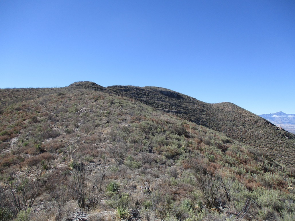
I walked almost to the saddle, but when I saw a chance, I left it early and cut across to catch the ridge, which here is a big rounded hill. I did not want to hike over it, so I sidehilled until I was south of it. The bush so far was tolerable, and I was able to find lanes most of the way.
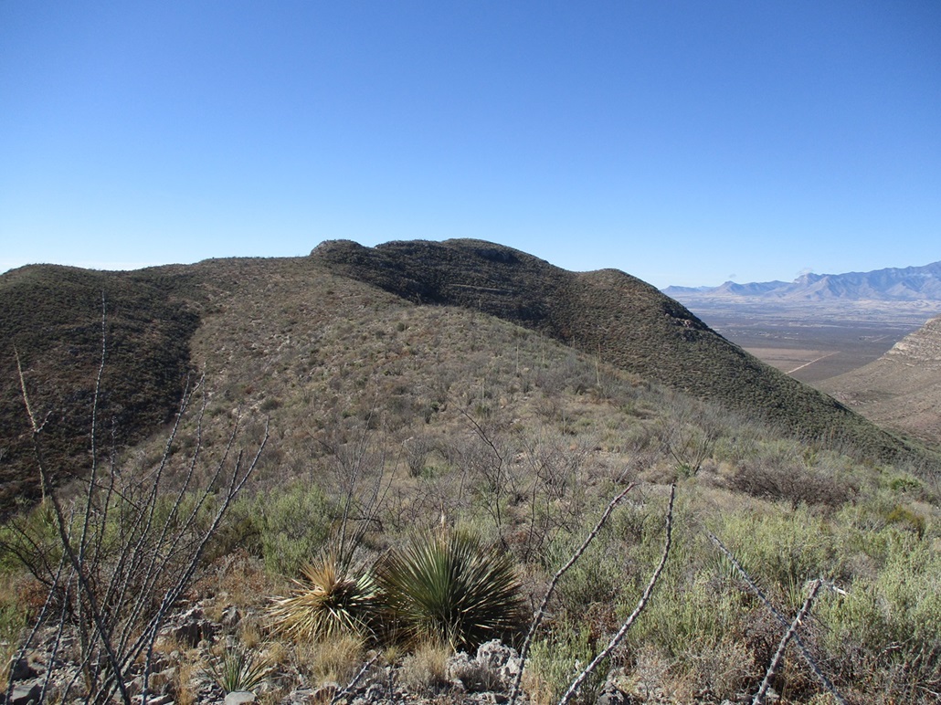
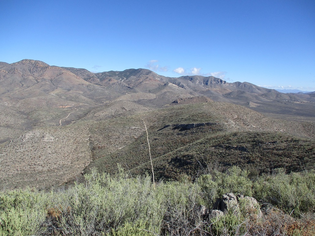
The route from here is a no-brainer. The summit lies ahead about a mile distant. Between me and it was more ridge and about three or four bumps along the ridge. I did not necessarily stick to the ridge itself. I'd sometimes drop to one side or the other, following whatever lane opened up in front of me. I crossed one "fence" along the way, it just being three strands of barbed wire laying on the ground.
There is one "big" gain of about 400 feet about halfway up, and this is where the brush and branches started to thicken. I was moving slow and often changing course to find openings, and just as often giving up and barging directly through the tangles. This got me above the big hill, to a waypoint marked on the map by a 5,675-foot spot elevation. I crossed another fence in this area. Its strands had been pulled down after a small tree had fallen on it.
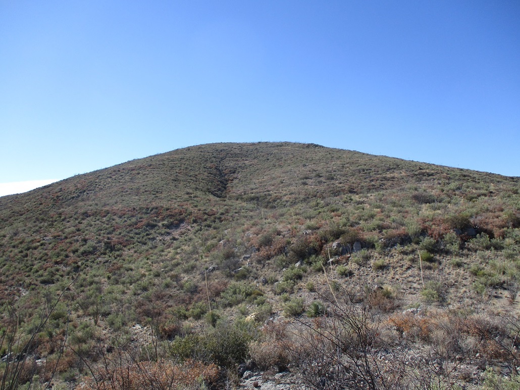
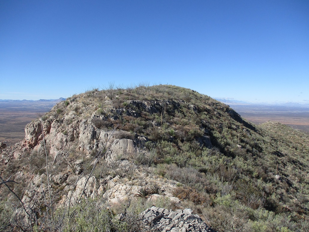
Beyond this hilltop, the ridge flattens a bit then descends down a couple of messy cliff bands, which were easy to manage except for the brush. Next up was a rounded bump on the short summit ridge. I got here okay, and for the first time used my hands in a couple spots to get up some of the rocks. The top was just a few dozen yards away.
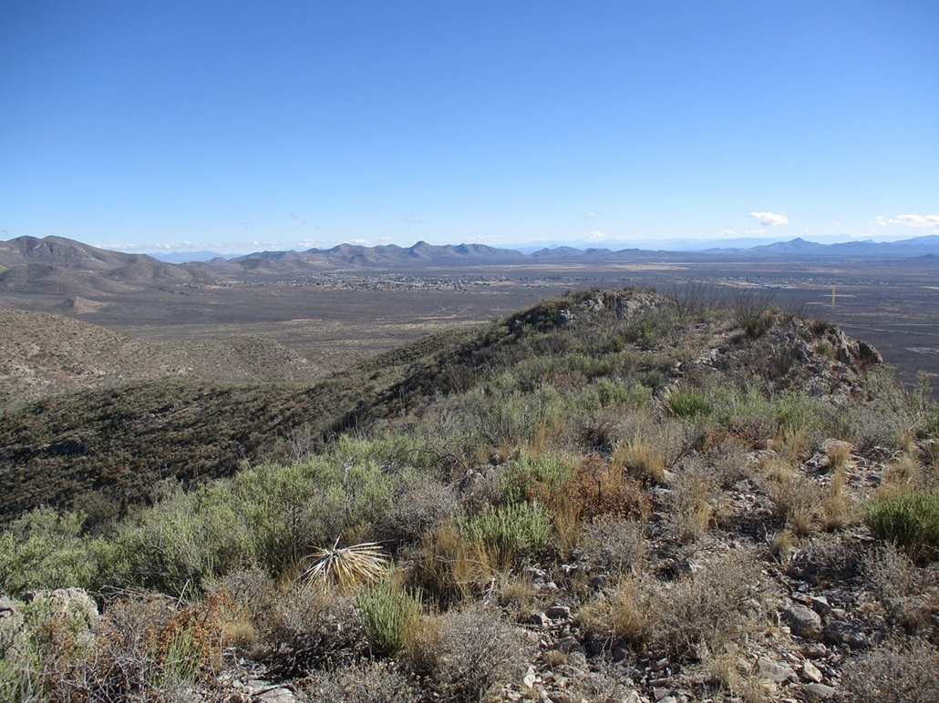
I was literally on the cliff's edge here. To my right (north) was brushy slopes, to my left (south), drops of a hundred feet if I wasn't careful. I worked through the brush, ocotillo and rocks and was soon on top of Naco Hill, a one-hour-and-twenty-minute ascent. It felt longer.
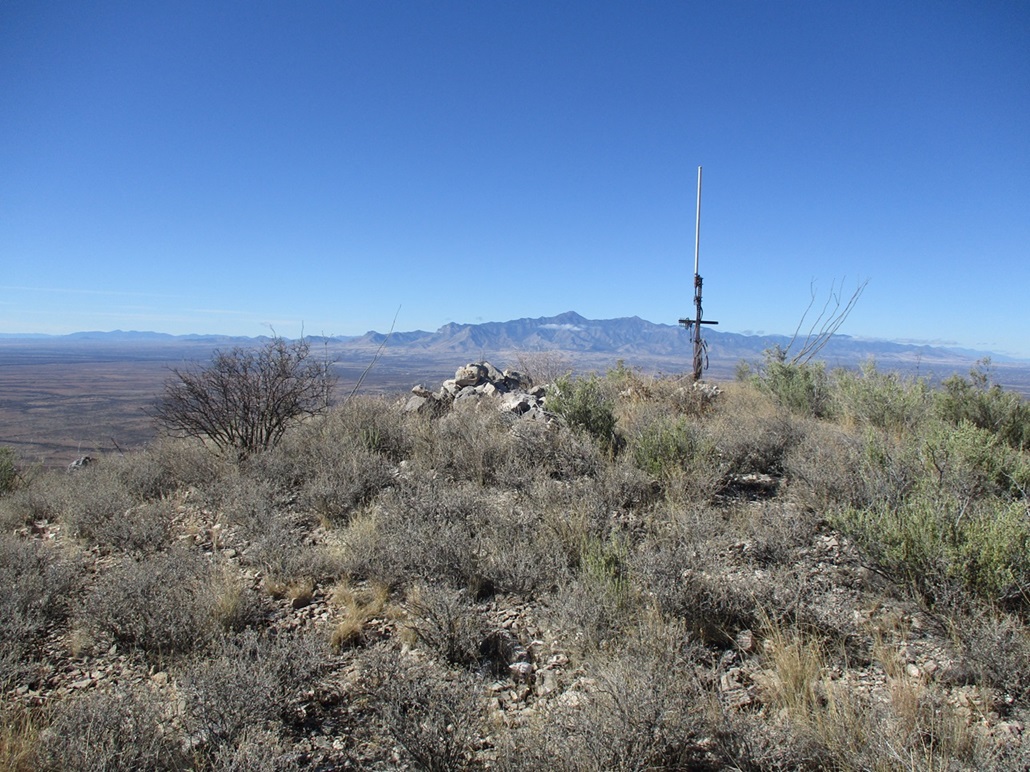
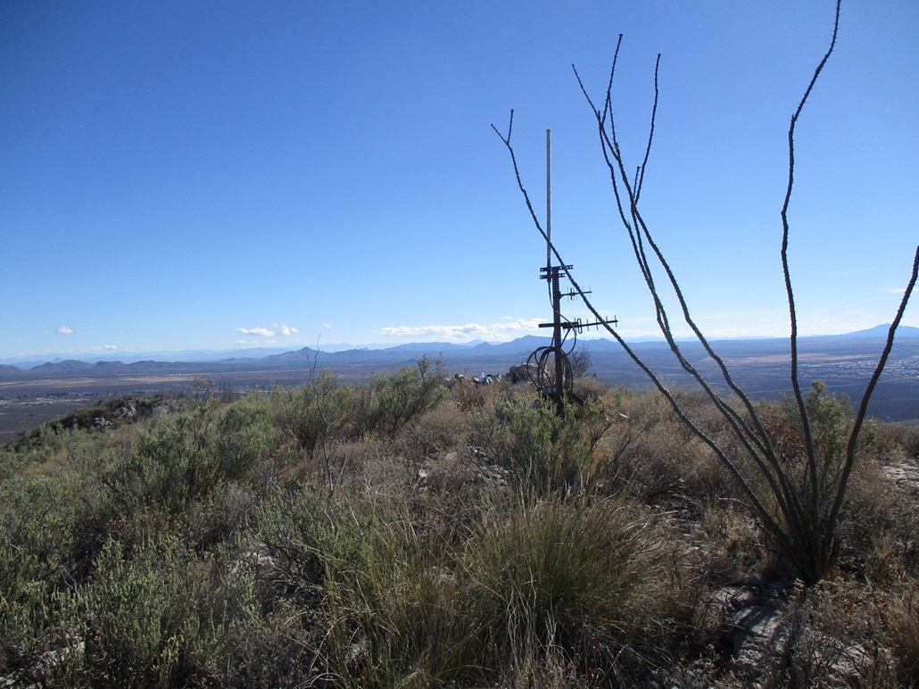
The top has a small antenna and repeater box, probably for the Border Patrol or Sheriff, so I left it alone. I found the register and signed in. Andy Martin was last here in March 2021. Just a few names were in the register, which went back to 1990 (Bob Martin). I snapped some photos and looked around. It was chilly up here but calm, and I stuck around for about five minutes. I got what I came for and was pleased.
Going down went well because I had gravity on my side, and I could see ways through the brush better. But I took it slow as there was no way to move fast through the brush and rubble. So I got down to a lowpoint above those roads I mentioned earlier. I could see how the road curved to meet the main road. This could cut off almost a mile and save me the hassle of having to gain, drop, regain and then drop back to the road if I stayed on the ridge.
I decided to go for it. The temptation was too much. I dropped down off the ridge, and here hit the heaviest brush of the day. I got caught up in one tangle to where I just had to do a roll to get down and through it before collecting myself and getting back up. It wasn't a fall. It was me using my mass to get through it, after I had committed to it and where backing out wasn't possible.
I only had to drop about a hundred feet. This put me back on this ranch road, and I only had to walk about an eighth of a mile. I don't like being on clearly-posted land but like I said, the potential upside was too much to resist. I moved fast and soon got around the gate (it wasn't actually fenced here) back onto the main road. The big cow? I did not see it. I was back to my car in exactly an hour after starting down from the top.
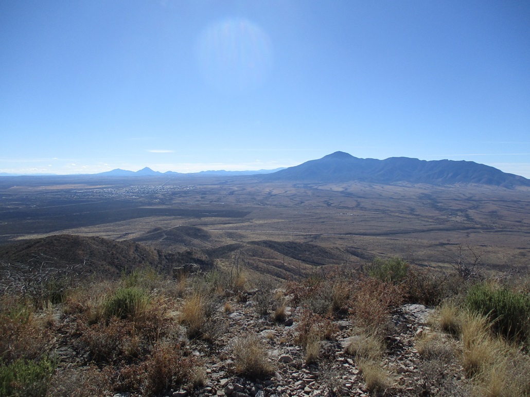
I exited the same way, and those delinquent dogs were nowhere to be seen. I drove back to Bisbee and stopped off at a small cemetery where I had a good unobstructed view of the Naco Hills so I could take a good distance image of them. I bid all the residents here a Merry Christmas. I was back home a few minutes later.
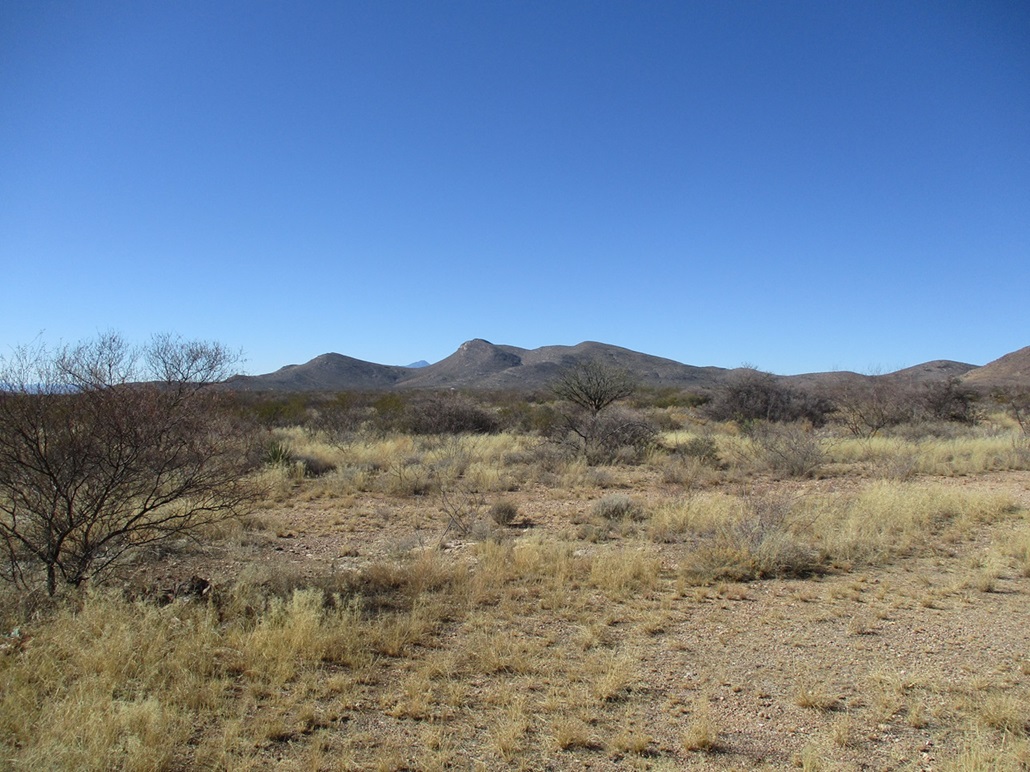
The hike had gone well. I had been concerned about how access would be, how the roads would be, how far out I would need to park. Turned out that things worked out well. In fact, I could have driven farther but in retrospect, felt no need to. As I drove out, I inspected the access for the lower "Little Naco" hill to the west. It also has a nice long north-facing slope and looks like an easy climb, but it's all private property here. The people seem to live north of the road, while south is just fallow, but private, land. There is land for sale, so it's possible it's not being actively lived on or used, which might offer a way up. I did not want to bother today and will ponder on that for a future date.
|

|