
The Mountains of Arizona
• www.surgent.net
|
| Mount Wilson |
• Black Mountains — Mount Wilson Wilderness • Lake Mead Recreation Area • Mohave County |
|
Date: January 22, 2012
• Elevation: 5,445 feet
• Prominence: 3,215 feet
• Distance: 9.6 miles
• Time: 7 hours
• Gain: 3,100 feet
• Conditions: Cool and cloudy, spotty sun
• Teammates: Scott Peavy
Arizona
•
Main
•
AZ P1K
•
PB
•
LoJ
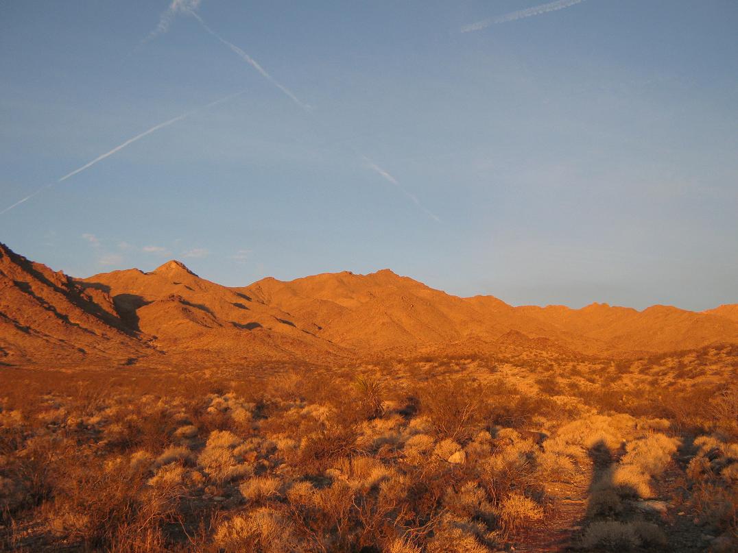
Mount Wilson is the highest peak of the north portion Black Mountains (north of highway US-93), the range of peaks that parallel to the Colorado River in northwest Arizona. Although it's in Arizona, Mount Wilson feels like a Nevada peak, with less cactus on its hillsides, plants more common to the Mojave Desert than the Sonoran Desert, and geology more like the peaks just across the river in Nevada. Mount Wilson is the big peak one sees from the Nevada side of Lake Mead when looking east, and the peak lies within the Lake Mead Recreation Area boundaries, as well as within its own designated wilderness.
This is one of those peaks I kept delaying. It's far from home (about 250 miles), but close to my parents in Henderson so that I always figured I would hike it while visiting them. But I either visit in summer, or I have little time, so finally, I decided to make a firm date for an attempt. Scott Peavy was also interested, and we hatched our plan last month during our hikes up Mohawk and Sheep Peaks near Yuma. I'd drive up to visit with my parents, then meet Scott at the trailhead on one of the mornings.
The weather was not cooperating. A storm was coming in, due to hit southern Nevada Friday afternoon. Saturday looked like a bad day too, but Sunday looked promising, so we agreed to meet on Sunday the 22nd. I was busy up until late Friday anyway and couldn't get rolling until Saturday morning. The day was cool, cloudy and rainy as I drove northbound along US-93, then once I hit Kingman, very windy, with sustained 45 m.p.h. winds and gusts above 60. In Boulder City, El Dorado Valley looking south toward Searchlight was one giant wall of dust. Then, coming over Railroad Pass into the Las Vegas basin, the air was mist-like, the "mist" being fine particulates from the dry lakes and surrounding desert sands. However, conditions calmed down that evening, like the weathermen promised.
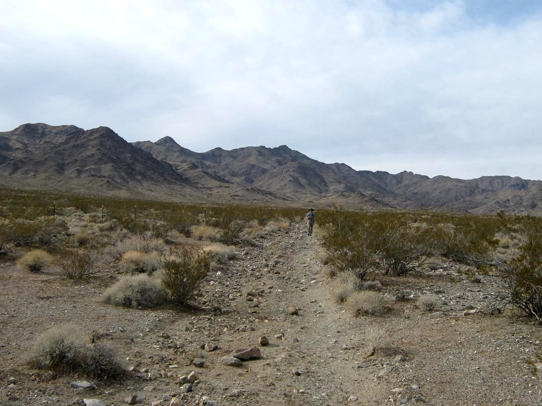
I rose early on Sunday and drove back into Arizona over the bridge, then following Temple Bar Road north 10.4 miles to a single track heading west. I drove this about 2.5 miles to its end at the Missouri Springs (BLM) parking area, arriving at 7 a.m. exactly, still dark. Scott Peavy's car was there already. We greeted, got our packs arranged, locked everything up and started our hike at 7:30, the sun still low in the east and blocked by the mountains that way. There was no wind, some high clouds, and very mild temperatures. It was like yesterday's windstorm never happened.
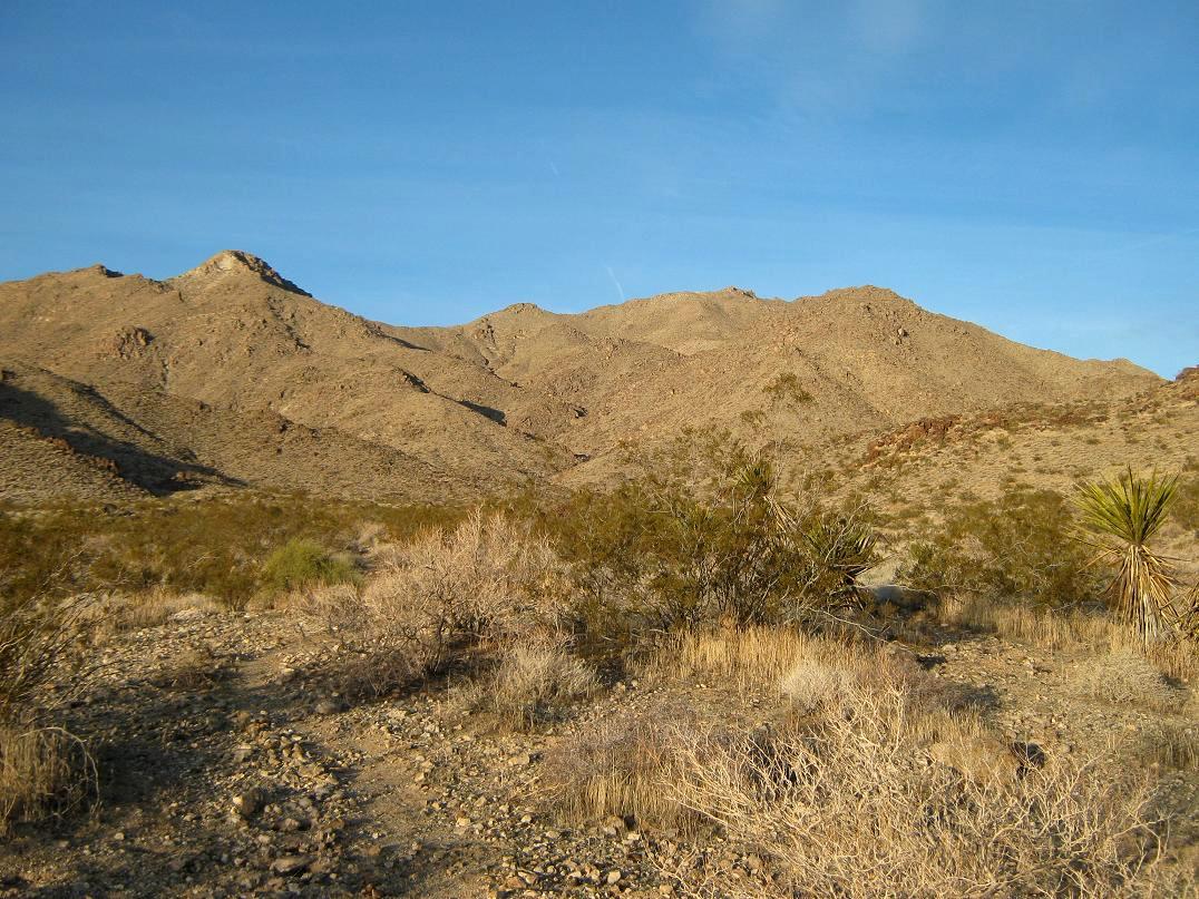
The initial segment of the hike was up the remaining 2.2 miles of road heading directly into the range. Like all road hikes, it was easy and boring. We gained into low foothills, then entered into the canyon where the road ended, although the map showed it continuing about another half-mile toward mine prospects. We were south of a small rocky hill with spot elevation 3,180. We found paths that seemed to head where we wanted, so we followed these another half-mile. We trended left, mounted a ridge and from here, had a good view of the main range crest and the various ridges leading up to it. Peavy's GPS had us 2.8 miles from our cars and about 700 feet higher. We had been walking an hour.
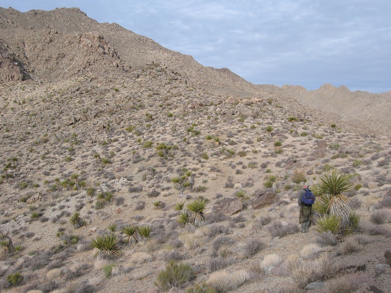
From our slightly-elevated vantage point we could see the drainages and ridges that we wanted to be near, so we descended into the washes and quickly got ourselves into the "right" wash, which we followed for about 20 feet before finding a good path that went up a slope to our right. We followed this path as it wormed through low hills and bigger mine-claim cairns. We were south of a prominent east ridge marked by a hilltop, elevation 4,348 feet on the map.
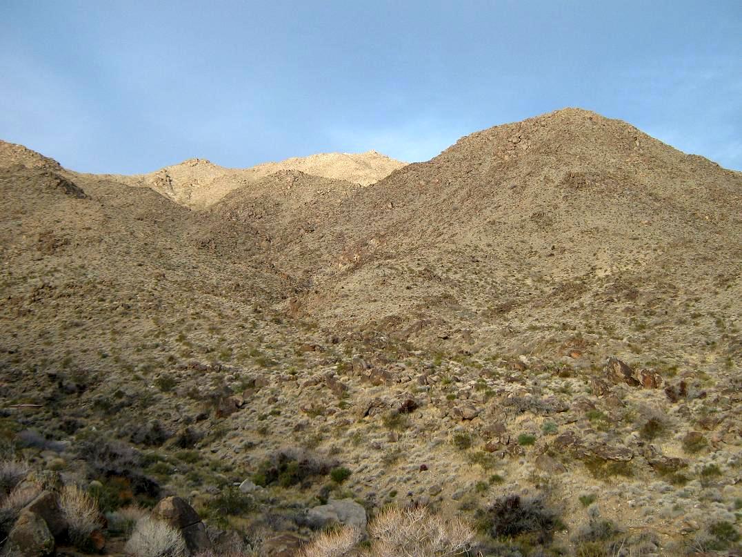
The slope looked open and obstacle-free, so we decided to charge directly up, aiming for a small rock outcrop about 300 feet higher. From here, we angled left and continued walking up the steep slopes, going from one rock outcrop to the next. The footing was usually solid, if slightly slippery, but never was it too steep or dangerous. In time, we had come to a small flat area about 100 feet below Hill 4,348's top, where we went left and sidehilled around this hill to catch the main east ridge's saddle a few hundred yards ahead. This segment went very well, allowed us to gain about a thousand vertical feet fairly quickly and avoiding the rocky drainages.
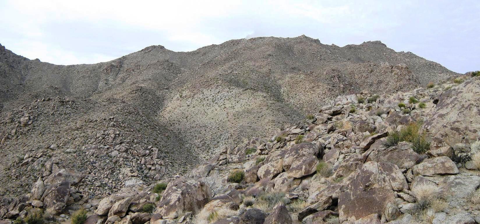
We were at 4,200 feet elevation on this ridge. Looking up, the main range crest was about 800 feet higher, while what we thought was the summit was off to our right (northwest), about 5,400 feet elevation. The weather was holding so far: cool, not cold, and very still. We hiked along the current ridge, bypassing rocky sections and downclimbing about 60 feet at one point to drop into a saddle, now directly below the slopes that would take us to the main crest. The good news: the slopes laid back for us, forming essentially a giant ramp for us to follow.
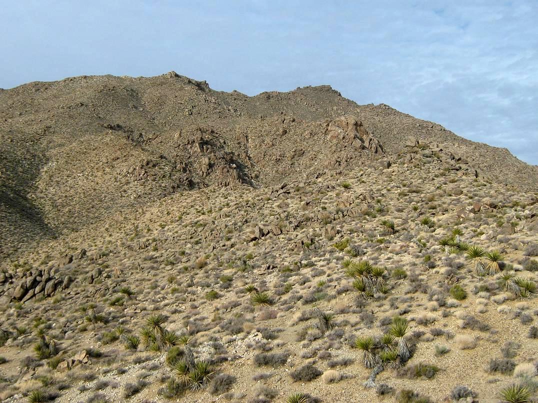
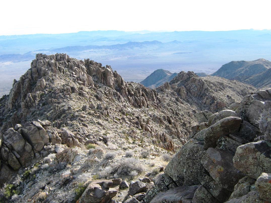
We hiked upward, aiming for the little rock outcrops along this ramp, steadily gaining elevation, and nothing to impede us. The brush was light and blessedly cactus-free except for harmless little barrel cactus. These Nevada peaks sure are a pleasant change, I thoiught to myself. So we kept at this and in about 45 minutes had climbed all the way up to the range crest. The views were magnificent, with Lake Mead and the steep-walled canyons south of big Hoover Dam now visible. We still had another quarter-mile to go to the top, now following the main crest and its many rocky gendarmes.
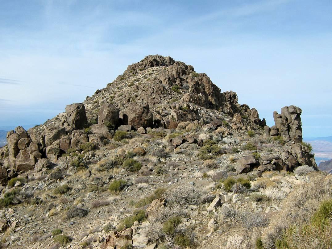
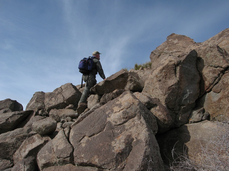
The first couple were easy, bypassing them on our right (east) along scant paths. Rounding one, we could now see the summit, a stark conical hilltop on the west edge of a trapezoidal-shaped summit ridge, with a big, rocky false summit directly ahead, this being what we'd seen all this time from below. It looked mildly challenging, but given how well things had been going so far, we were confident there was a good path through this obstacle.
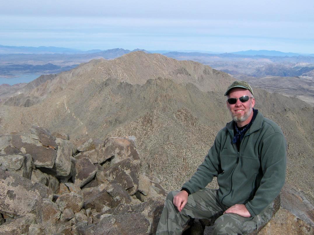
We were able to find a path through this rock jumble, then eased down a couple rock ledges on the other side. Once past this obstacle, the summit was an easy walk a few hundred feet farther. We ascended to the top rocks up an easy chute, finding places to sit amid the jumble of rocks on the summit, with million-dollar views in all directions. The clouds had lifted and the sun came out to provide excellent lighting. The wind was light but it was slightly chilly on top. According to Scott, it took us 3 hours and 54 minutes for the ascent, a gain of 3,100 feet over 4.8 miles.
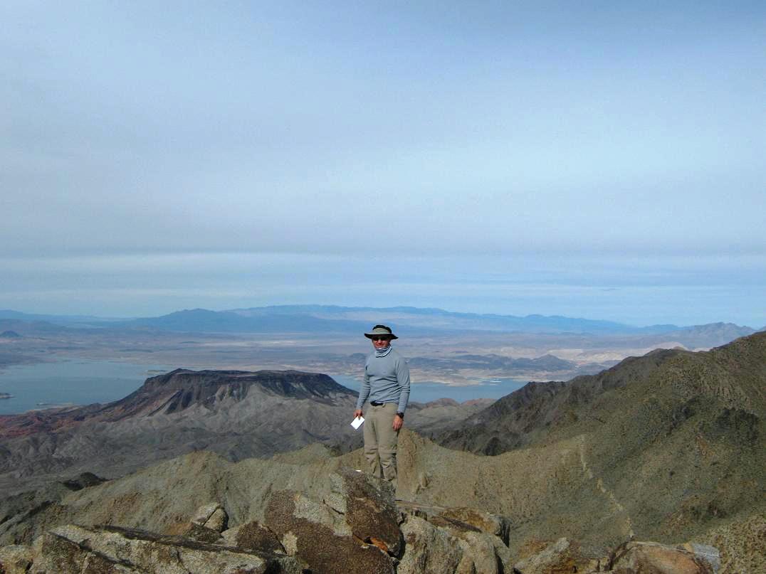
Looking west we could see some of Lake Mead, the Hoover Dam and the new Mike O'Callaghan-Pat Tillman arch bridge that spans the canyon. More of Lake Mead along with surrounding mountains could be seen to the north and northeast. We could make out the Grand Wash Cliffs off to the east, covered in a light veil of snow. The rest of the Black Mountains stretched south of us, and the extremely rugged cliffs and canyons lining the Colorado River laid our below us, south to west to north. We were up here for about a half-hour, some of it trying to locate the benchmark. Scott found the two witness markers, but they were pointed in conflicting directions. Then we started the trek down.
The climb back through the rocky obstacles along the crest went easy since we knew where to go, then the downhill sections back onto the east ridge went very well, given the nice slopes and solid footing. We dropped a thousand feet in less than an hour and continued to make good time as we descended into the lower drainages, then back out along paths back to the road. The final road walk was easy and uneventful. The walk out took us about two and a half hours, and we were back to our vehicles at 2:30, an overall seven-hour journey. After changing and relaxing a bit, we said our goodbyes and started the slow drive out back to the pavement.
From here, Scott went on back to the Phoenix area while I went back into Nevada, stopping along the way to visit and tour the new bridge. I have been over the Hoover Dam itself about 60 times over the years, and have watched the slow construction of the new bridge since it was started in 2005. It is a remarkable edifice, that they were able to span the thousand-foot wide chasm with a gigantic concrete-and-steel arch bridge. There's a nice pedestrian footpath that leads to the actual bridge, where you can look down onto Hoover Dam. It is named for Mike O'Callaghan, a former governor of Nevada, and Pat Tillman, the football player who was killed in action in Afghanistan in 2004. I highly recommend a visit. I have to admit: I had some vertigo just standing on the bridge, despite a large fence that keeps us safe from a fall.
I stayed another night with my folks, had a nice buffet dinner, then drove home to Arizona early the next morning. I was pleased, of course, to succeed on Mount Wilson. It went easier than I had figured. I was assuming more rocky cliffs and brushy slopes, but overall, the rocks were not a problem and the slopes were open with minimal brush. Again, I really like that about these nifty Nevada peaks (I mean Arizona). My thanks to Scott for his company and being okay with my slow pace!
|


|