
The Mountains of Arizona
• www.surgent.net
|
| Mormon Flat Peak • Peak 2276 |
• Goldfield Mountains • Tonto National Forest • Maricopa County |
|
Date: February 11, 2020
• Elevation: 2,276 feet
• Prominence: 436 feet
• Distance: 1.6 miles
• Time: 1 hour, 10 minutes
• Gain: 460 feet (net), 580 feet (gross)
• Conditions: Cloudy and cool, but with sun, too
Arizona
•
Main
•
PB
•
LoJ
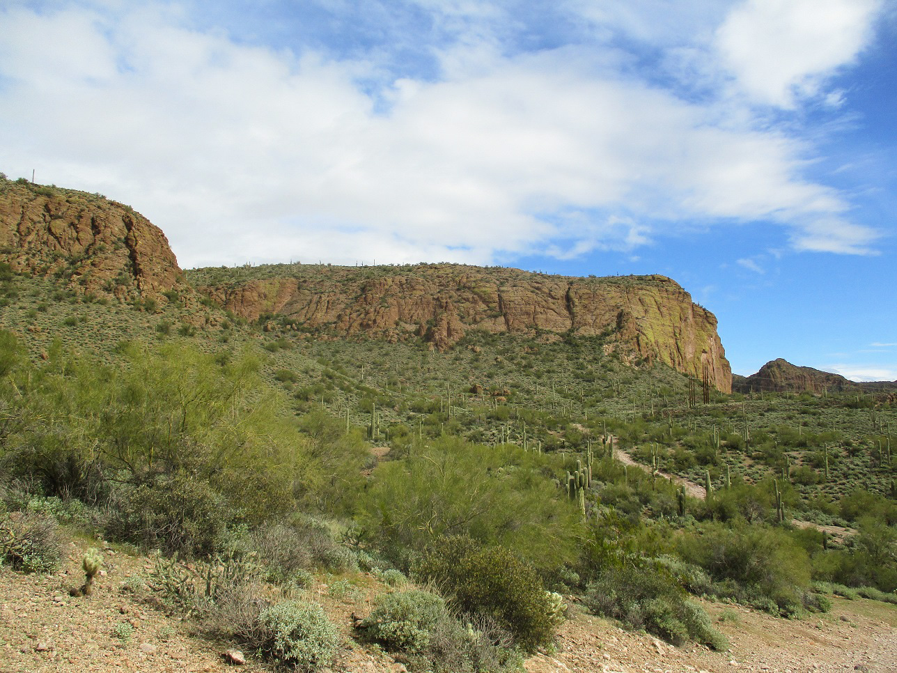
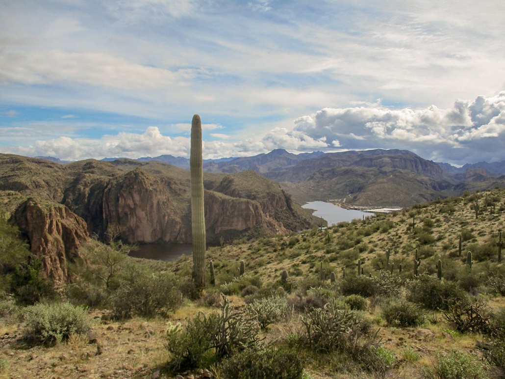
This peak is at the west tip of Canyon Lake along the Salt River. The Mormon Flat Dam is built into the canyon north of the peak, where the river narrows between steep rocky cliffs. Canyon Lake then forms behind the dam, opening up to the east. The peak is part of the Goldfield Mountains and is within the Tonto National Forest.
The lake takes up what used to be known as Mormon Flat, a wide and flat area where the Salt River and LaBarge Creek met at a confluence. Mormon Flat was used for recreation and grazing by the early settlers in the region, most being Mormon. A story was invented that the Apache Indians raided and killed a group of Mormons here in the late 19th Century, and it may even show up in some websites, but there is no evidence such a raid ever happened. The Mormon Flat Dam was completed in 1925, and the lake formed afterwards, inundating the Mormon Flat.
The peak itself is south of the dam, and close to state route AZ-88, where the highway bends from north to east before dropping to the south shoreline of Canyon Lake. The peak is basically a raised platform surrounded by cliffs that rise about a hundred feet tall. It's not a peak with a pointed top, although its highest point is atop a slightly-pointed ridge. It's not really a bluff either. The rock appears to be volcanic tuff. I found a fantastic aerial video of the peak and of the dam on youtube. The drone buzzes all around the peak giving views from multiple angles.
Naturally, the peak (or formation, whatever it should be called) has no official name. Given the presence of the Mormon Flat Dam, and the historic Mormon Flat, and this peak's centerpiece location to both, it seems only natural it should be called ... Mormon Flat something. I went with Peak (•). Maybe it will catch on. I figured I better call it something before the official Arizona Peak Namers come by and call it Pine, or Red, or Black, like they do every other peak in the state.
I've been aware of this peak for awhile, since all I do is study maps. Then I saw a brief piece at HikeArizona on it, and that got me thinking to come up and hike it myself. The past day had been rainy and today started out cool with abundant low clouds, although the sun was out most of the time. I had the morning open and zero desire to do anything productive. I didn't leave home until 10 a.m.. I followed Loops 101 and 202 east to the US-60 into Apache Junction, then onto Idaho Road (AZ-88) and the continuation of AZ-88 into the hilly hinterlands.
The clouds were bunched up more as I drove into the range. In the distance the skies were dark gray and ominous, but where I was, it was just cloudy and breezy, with segments of sun. I drove about a dozen miles on the highway past Apache Junction. Traffic was light due to the conditions and being a weekday. Most plates were from out of state. I have driven this way perhaps a dozen times in my years here and there is invariably someone driving a mountain road for the first time, utterly terrified, going 10 miles per hour. That happened again. I did not rush them, and went with the flow. But it did add time. I arrived to the "pullout" below the peak a little before 11 a.m..
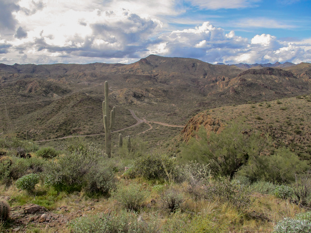
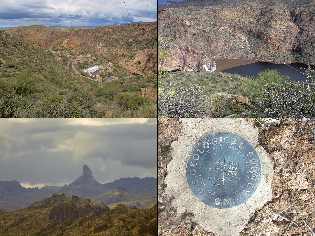
I parked were a paved access road leaves the highway, this road going up over a ridge, then down to the Mormon Flat Dam. The peak lies to the north of here, its big cliffs the most notable feature. The peak has a lower subpeak, elevation 2,200 feet, to the its southwest (and northeast of where I parked). The main highway makes that bend here to Canyon Lake.
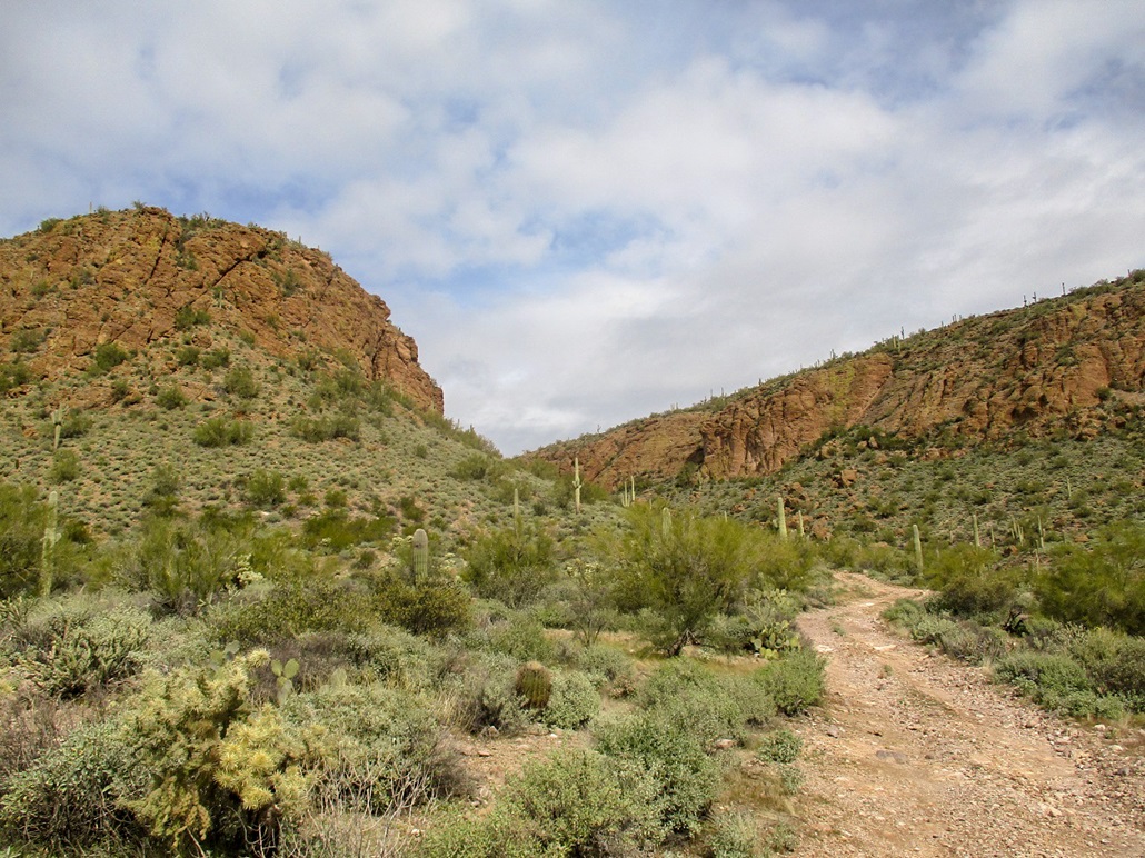
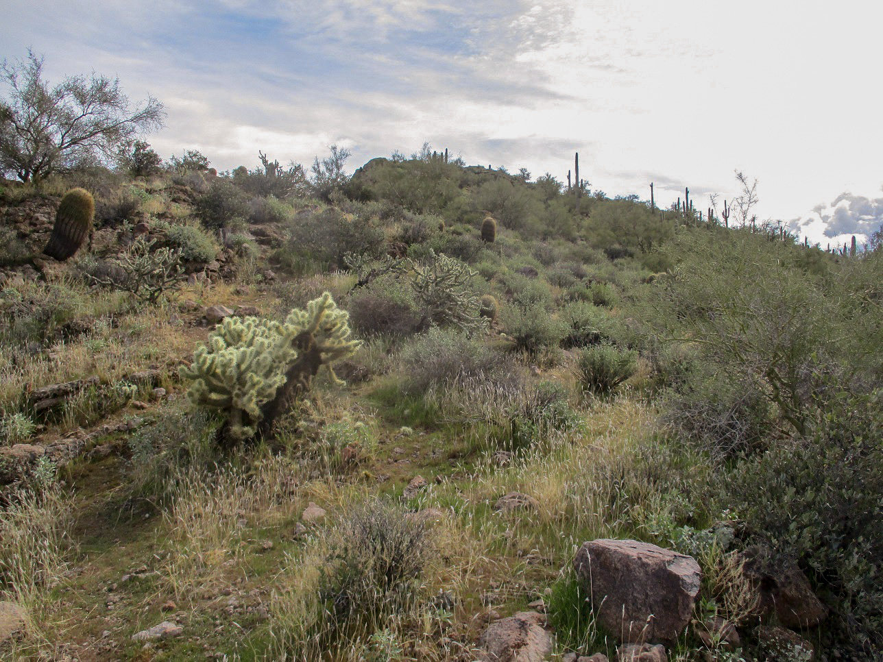
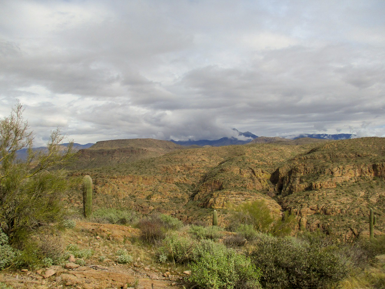
I started hiking soon after parking, following a dirt road down about 60 feet into a drainage, then up as it angled left to gain a saddle between the main peak massif and lower Peak 2200. This road is rough and there to service power lines that run up this canyon, obviously there for the Mormon Flat Dam. As I hiked, the cliffs all looked steep and uniform, so I assumed a passage would reveal itself higher up.
At the saddle, I found a path, and followed it up to meet the base of a rocky extension of one of the cliffs. Behind this, the trail angled upward into a brushy and steep slope that allowed passage to the top of this peak. The path was in good shape and easy to follow. Once out of this drainage, I followed the path up to the obvious highest point not far ahead. Another path breaks from the main path a few feet up, this second path staying below the highpoint and aiming for the far end of the formation.
I was on top in about a half hour, the hike covering less than a mile with about 460 feet of gain. It was a fun hike, and the cliffs and drops briefly gave me a sense of vertigo. The mountains in this part of the wilderness are a mix of odd-shaped summits that all look like they "lean", and strata that is not always level. It messed with my mind, making me feel off balance sometimes. But it was all safe too, and I enjoyed the top, spending about 15 minutes up here.
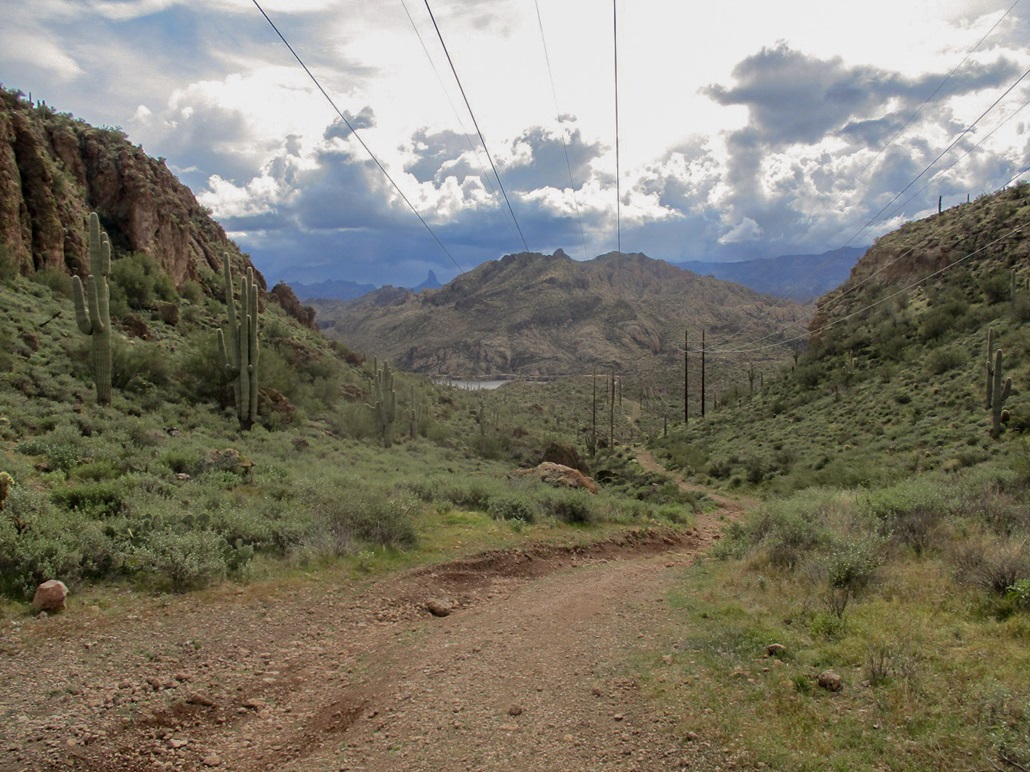
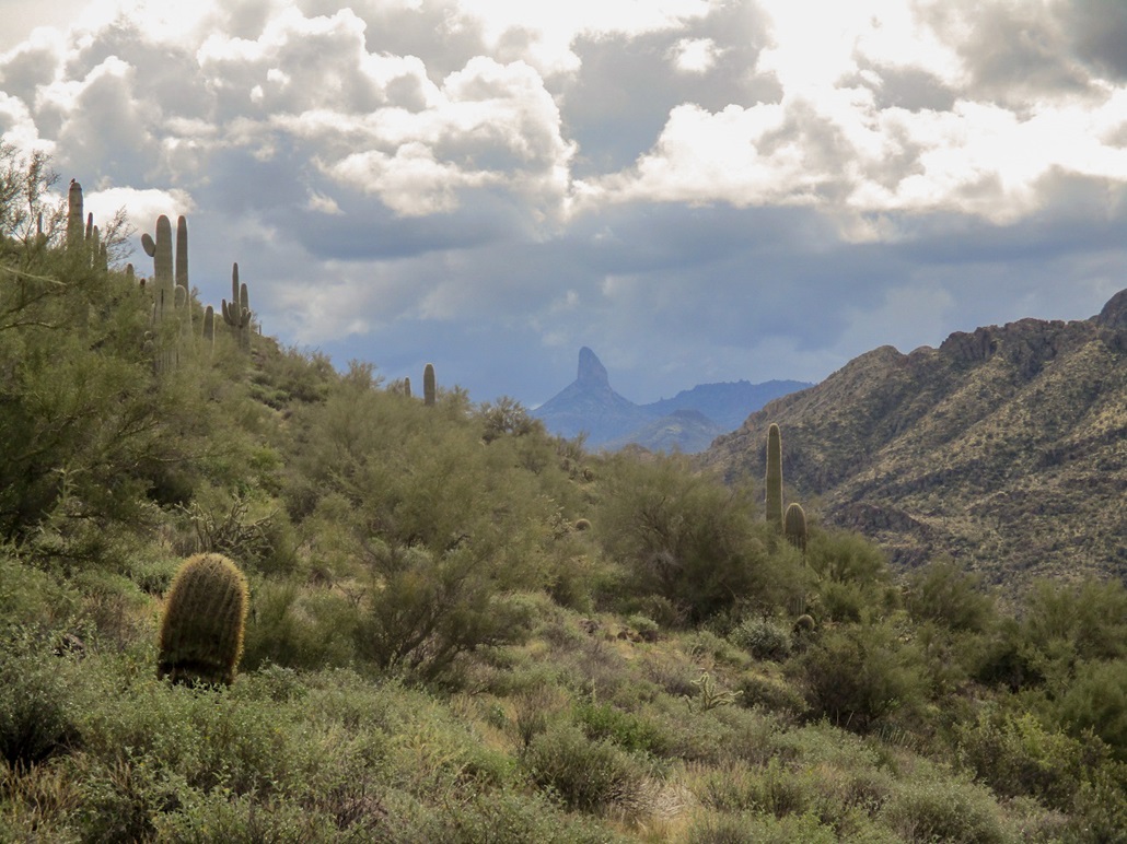
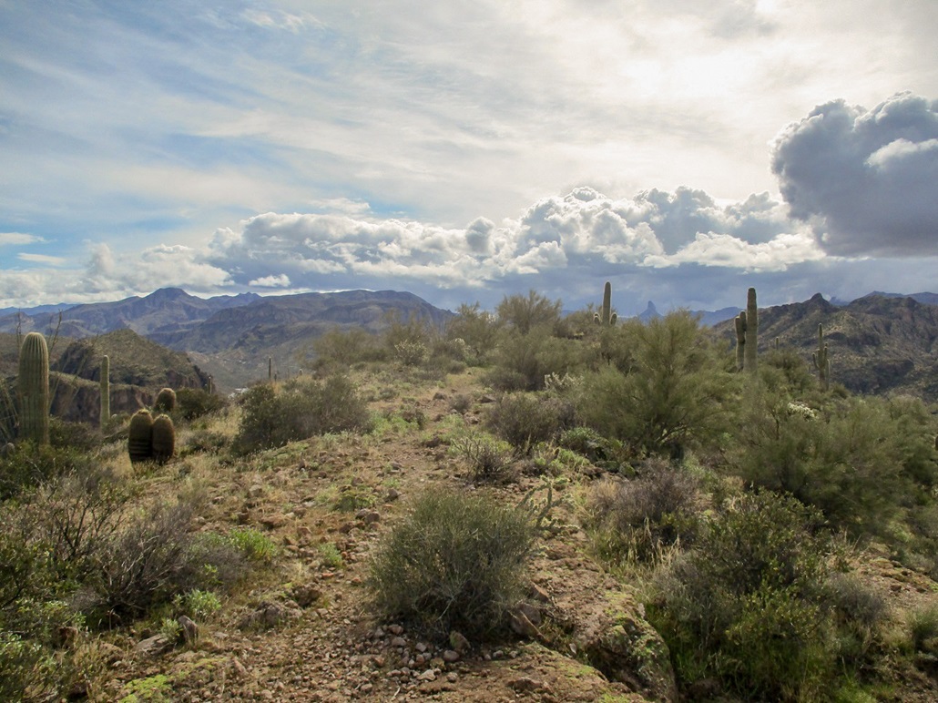
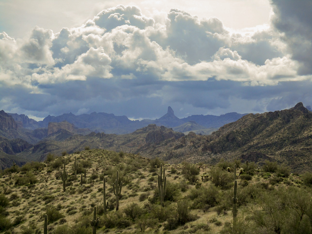
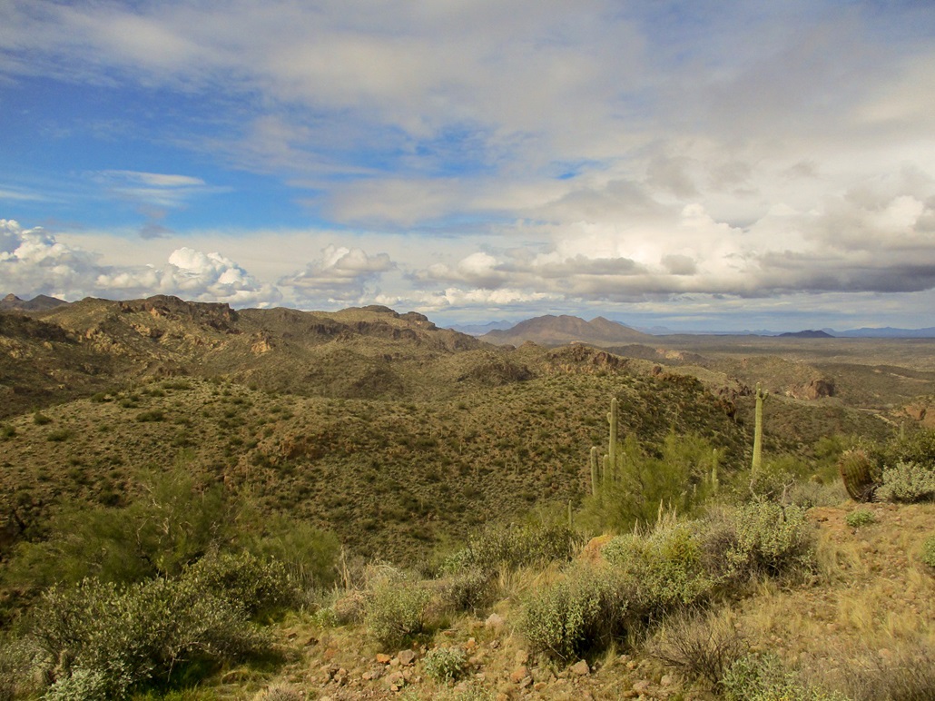
To the east, I had a good view of Weavers Needle, partially enveloped in clouds. Numerous other mountains in and surrounding the Superstitions were visible too. Looking north, the cliffy El Recortado lies across the river. Beyond and above would be the Four Peaks, but the clouds were completely shrouding them this morning. When they did appear, they were covered in newly-fallen snow from yesterday's brief storm. I signed into the register, only the second person to do so in many years. I know people come here. Maybe not a whole lot, but clearly they do. Either no one finds the register or don't care to sign in ... or I suspect most people take the lower branch of the trail to the far east end for views of the lake. There is also a benchmark on top, not stamped with anything except a "24" which makes no sense to me. Looking up the datasheets later, I could not find anything for this benchmark.
I hiked down slowly. The dirt portions of the trail were a little muddy and loose from the moisture, so I travelled carefully. I was back to the saddle, where I took a brief detour to hike partly down the other side to view the dam and its service roads. Then I just hiked back to my car. I had been gone for 1 hour and 10 minutes.
I drove out slowly, following a big work truck, which was good because I wanted to go slow and scout roads and other peaks in the area. Once back into civilization, I took local boulevards through A.J., which I never explore, back to the Loop-202 and then back home. Energized now, I actually was slightly productive the rest of the afternoon, working from home.
I needed the break from the stuff that I am dealing with at the moment. Actually, it's good news. Today I learned we've been accepted to rent a lovely home in Payson, Arizona. I will be moving items into it over the next month. This means that after 27 years and 6 months and 1 day of living in the Valley (Phoenix and environs), I am leaving. I'll still commute to my job, but I feel like I've been "set free". I love the state, love the variety, and appreciate we have a big city for its amenities, but living in the burbs with the traffic and heat, it got old ten years ago.
|


|