The Mountains of Arizona
www.surgent.net |
|
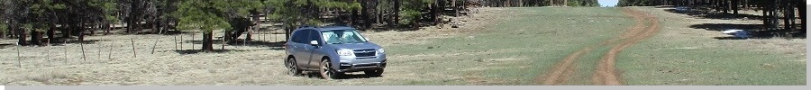
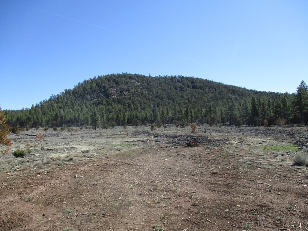
Moritz Ridge • Spring Valley Knolls HP I returned to the Parks area west of Flagstaff, the first time I've been anywhere near Flagstaff in almost a year. On the agenda were four peaks, three located adjacent or nearby to Spring Valley Road which heads north out of the village of Parks, and a fourth more to the east, along FR-171 nearer to Bellemont. These four peaks were chosen since they "fill in" this area for me. I have hiked virtually all the other ranked peaks north of Interstate-40 in the area, except for these four. Two of them, Peak 7591 and Walker Hill, are borderline ranked peaks, but the newer 1-meter Lidar maps show that both appear to have prominence values of 305-307 feet. Having four peaks clumped together made the decision simple, getting more bang for the gas buck. These four peaks also have another thing in common: they are mounds of volcanic boulders and kibble, heavily forested and with no views. These were not the most exciting peaks to climb. I had good weather, but by the end of the day, it got warm, pushing 80 degrees, warm by Flagstaff standards.
Date: April 29, 2023
• Elevation: 7,656 feet
• Prominence: 316 feet
• Distance: 1.5 miles
• Time: 75 minutes
• Gain: 505 feet
• Conditions: Sunny & clear
Arizona
•
Main
•
PB
•
LoJ
•
Interactive map
I was on the road by 5 a.m. and in the Flagstaff area a couple hours later. I went west on Interstate-40 a few miles and exited at the Parks Road exit. I planned to climb the farthest peak first, then work southward back toward the interstate. Thus, Moritz Ridge was first.
I drove north on Spring Valley Road about 10 miles. The road passes through a tiny section of private property. At a sign saying "you are leaving private land", a forest road, signed as Kaibab FR-2478, branches east into the trees.
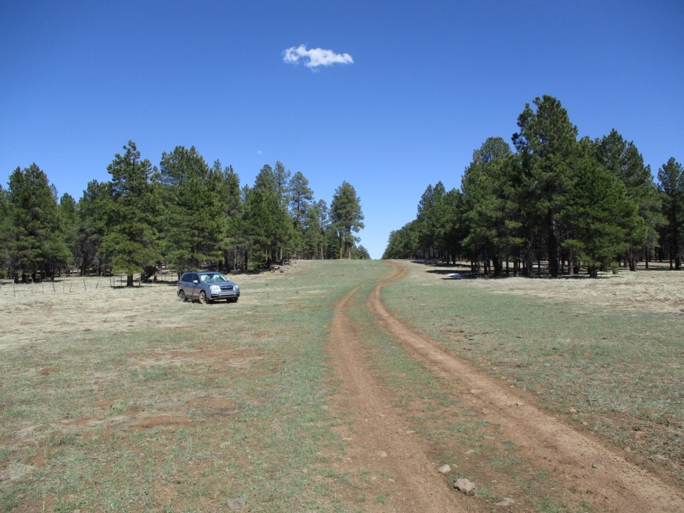
This road was better than I expected. I was able to drive about a mile, parking in a clearing just before the road breaks out into the open again. I was about a half-mile southwest of the highpoint and planned to tackle it head on. The road itself bends to the southeast and, according to the map, curls around and circles the peak, ending on the ridge a bit east of the highest points. I could have walked the road, or even driven it, but that would have added a couple extra miles each way. Other than some ruts, the road was in fine shape, high clearance all that would be necessary. There were a couple bypasses where the main road is apparently always muddy.
I started walking at 8:20 a.m., the sun already high in the eastern sky. The air temperature was in the 60s, but the sun was intense, making it feel warmer. I walked the road into the clearing, then angled northeast off the road, aiming for the Moritz Ridge highpoint hill. I walked into a soft drainage, then angled off of it, now on the steeper slopes toward the top.
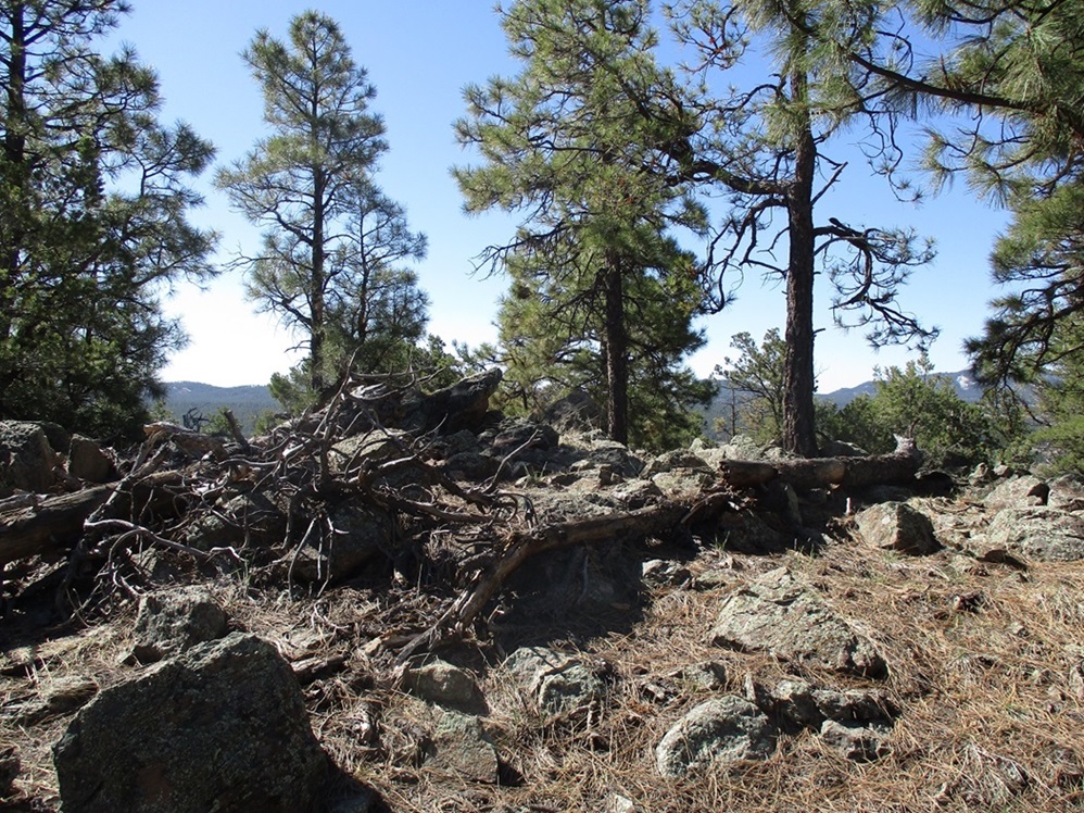
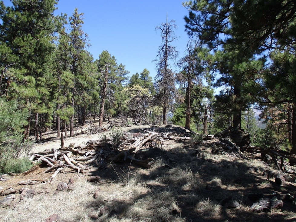
At first, the terrain was typical for the area: heavy ponderosa forest, light undergrowth, a lot of downed trees and random logs, and about six inches of pine needles forming a mat. I gained about two hundred feet, then things opened up. I was now at the base of a big slope of rocks.
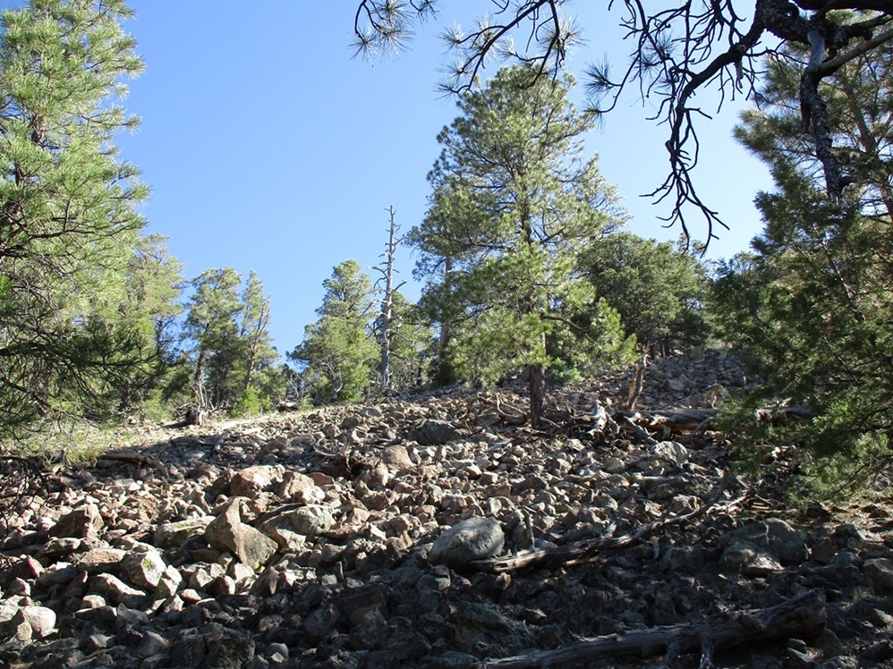
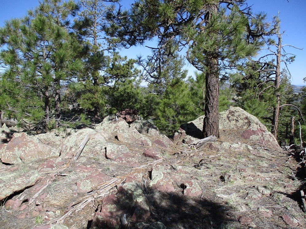
From here to the top ridge was up these rocks. These are the lighter-colored "ashy-agglutinate" rocks rather than the blacker basalt boulders more common on the volcanic mounds in the deserts. The rocks were big, too, some bigger than a car. Most were solidly in place, but a few were not. I moved slowly, being sure each rock was not going to suddenly move.
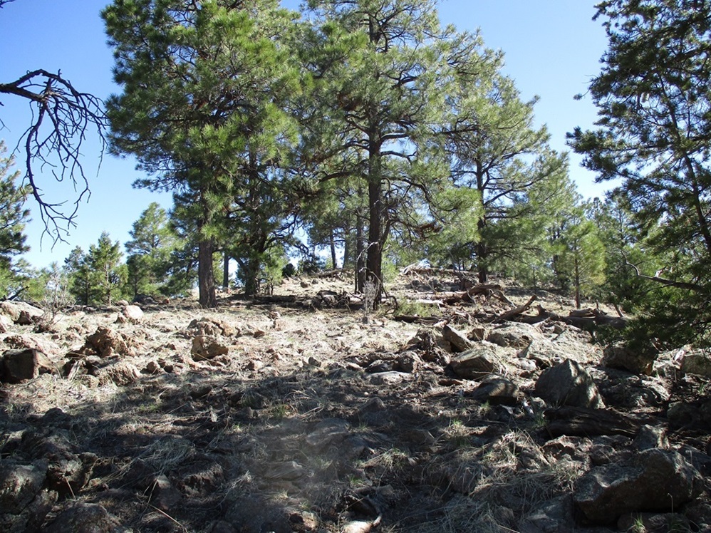
I aimed upward toward a cliff band since it looked interesting and I wanted a closer look. Once at it, I moved to my left and scaled an easy band of heaped rocks to gain the high ridge. The scrambling was minimal. I'd rate it Class 1+. I used my hands maybe three times, mainly for balance.
The summit ridge is shaped like the letter C, the presumptive highest point on its northern lobe, spot elevation 7,656 feet. I walked to it first and found the register in a cairn on one of the high rocks. I was the first to log my name in over two years, the previous visitors being the Roaches. I had some decent views to the north, but otherwise the summit was wooded.
I walked back and also visited the southern lobe, an area enclosed within a 7,640-foot contour of about the same size as the northern lobe. There's no way to sight between the two. I tagged the highest rock, then studied the slopes below me. There was no need to follow my ascent route exactly. What I saw looked doable, so I descended off the summit rocks and onto the slopes below. The downhill hike went well, there not being as many rocky slopes as what I saw coming up.
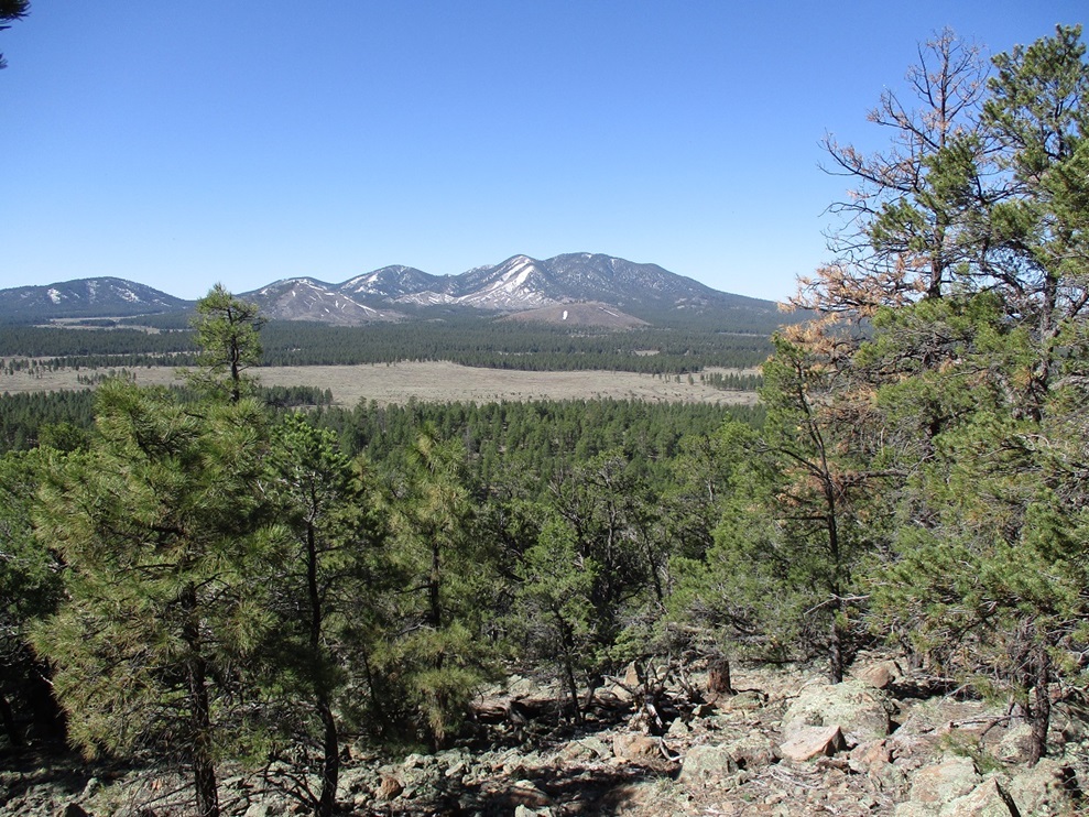
I was down in a matter of minutes, skiing the mat of pine needles, sometimes deliberately, sometimes not. At times the trees thinned out enough to where I had fine views of Sitgreaves Mountain and its subsidiary peaks, snow still clinging along its ridges and shielded gullies. I simply walked back to my car. I was surprised to see I had been gone a little over an hour. I gauge three-quarters of a mile each way due to meandering, but I suppose the rocks slowed me down, although it didn't feel like it when I was actually moving.
Elevation: 7,901 feet
• Prominence: 421 feet
• Distance: 1.7 miles
• Time: 90 minutes
• Gain: 535 feet
• Conditions: Sunny, warmer
PB
•
LoJ
I drove back southbound on Spring Valley Road, toward Sanderson Pass where the road crosses between Government Hill and the clump of peaks called the Spring Valley Knolls. I was looking for a forest track that branches east from the road, but when I got to it, it was spanned by a large metal gate. I parked and inspected it. Access is not prohibited, and there's a smaller "human" gate to the side anyway. This is forest property here, but there are pockets of private property in the area, to where it's best to be mindful who owns what. I knew I was okay where I was.
I walked through the smaller gate and followed the road toward a corral. Just beyond the corral to the north was a small RV, with a few furniture items and a small motorcycle. The place looked clean and probably lived in, but when I was here, there was nobody around ... or maybe he or she was asleep.
The highest of the knolls rises immediately north of the RV, a mound heavily covered in forest. I could have busted directly upslope, but decided instead to follow a track northbound that skirts the hill to the west. The topographical map shows this track to bend east then curl south, ending within the crater. I followed the track, but missed the part where it curls into the crater. I followed the main track until I knew I was too far east, but this was no big deal. I had gone no farther than a quarter mile. Doubling back only cost me ten minutes, if that.
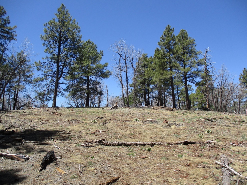
Instead of looking for the alleged track, I found a slope and started following it uphill. The grade was lenient and the forest not so thick here. In minutes I was on the crater rim. Here, the crater is formed into a U shape. The presumptive highpoint is a spot elevation of 7,901 feet on the eastern lobe of the rim. I was on the eastern lobe already. This worked out well because I would be obliged to walk nearly the entire rim, thereby tagging or kicking any potential highpoints along the way.
I found a small cairn on top of a rock, and sure enough, within it was a register. I signed in and noted the names of others. A couple were familiar to me, a couple more were not. Some were hunters. This "highpoint" was wooded and I had no views except of the nearby trees. It did not feel like the highest point either and I wonder if the spot elevation was taken here because of this convenient rock.
I continued following the rim until I was on its western lobe. When I could see through the trees and see the corral down below, I bailed off the high ridge and hiked down the steep slope to the bottom. I was glad to take this slope downhill. Going up it would have worked, but it was steep and going down was much easier. Like on Moritz Ridge, the mat of pine needles meant I would sometimes skid and ski a few feet at a time.
When I got back to the RV and corral, a horse was frolicking in the corral. I didn't see any people, but it appears to be actively used. I was back to my car after 90 minutes. It was warming now, but I was feeling energetic. I drove into Parks and sat for a spell at the cool Texaco near the interstate. I got some snacks and sat on their benches to kill some time.
Elevation: 7,591 feet (7,597 feet per Lidar)
• Prominence: 306 feet (Lidar)
• Distance: 2 miles
• Time: 75 minutes
• Gain: 450 feet
• Conditions: Warmer
PB
•
LoJ
Next on the agenda was Peak 7951, the highpoint of a small batch of low-profile hills slightly northeast of Parks. In studying the newer Lidar data at the 1-meter scale, it suggests a summit elevation of 7,597 feet and a prominence of 306 feet. This unassuming hill now graduates into the world of ranked summits, soon to be trod upon by Those Who Summit.
From the Texaco, I didn't go very far, not even a mile, pulling into a small parking lot on the north side of the road. This is an informal trailhead, one trail being the old alignment of Highway 66, before it was realigned in the 1930s and before it was then superceded by the Interstate in the 1970s. Portions of the east-went roads near Parks are the old Highway 66 route.
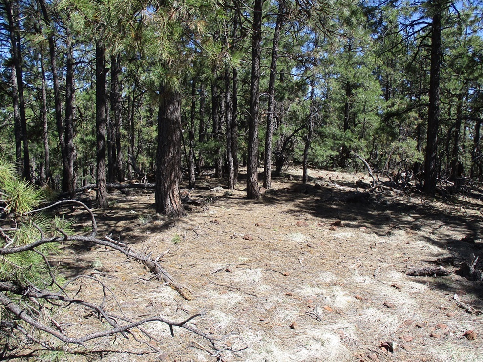
From this trailhead, I followed the main road north. This road then bent west past a few slash piles where they pile up logs and branches and then burn them off. Peak 7591 does not rise steeply and is essentially invisible for the duration of the hike in. I aimed north and soon came upon a better road and a crew of Civilian Conservation Corps people. I walked right past them and nary a one said hi.
The road I was now on aims toward a saddle east of the peak. I followed the road to the saddle, then angled west and followed the gentle slope all the way to the top. The one-way hike covered a mile and went well, it being very warm by now. The summit is broad and somewhat open if I took time to find openings. I had views of Kendrick Peak to the north. There was no hint of past visitors, so I built a cairn at one likeliest highest rock, and placed a register therein. I also took time to actually sit my butt down and have a summit break. I found some good sitting rocks in the shade and spent about ten minutes here.
I hiked down the same way obviously. I had been gone a little more than an hour. This wasn't an exciting peak, but it was easy and a chance to get one more into the books.
Elevation: 7,690 feet (7,698 feet per Lidar)
• Prominence: 307 feet (Lidar)
• Distance: 0.7 mile
• Time: 50 minutes
• Gain: 350 feet
• Conditions: Warm and sunny
PB
•
LoJ
•
USGS BM Datasheet
I continued eastbound on this main road, Old Route 66, also called Brannigan Road. It passes by Fortynine Hill then through a small ranch before angling back to the interstate and running alongside it as a frontage road. I found Coconino FR-171 (I was now in the Coconino National Forest), turning onto it and almost having a little fender bender with a truck making a turn. He assumed I wasn't going to make the turn.
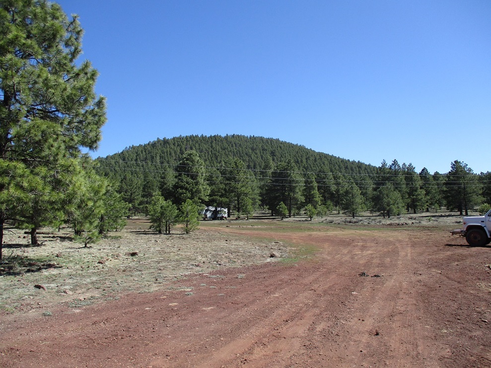
There is some new development going on here, what looks like small cabins all connected together. Back in 2020, this was all dirt and grass, and the setting for a ruckus in which one guy got punched in the nose. I went north a few miles on FR-171, then turned left (west) onto a gas-line access road in a cleared swath through the forest. This road was in good shape, just one spot needing high clearance. About a mile in, I was northeast of Walker Hill, its summit a little over a quarter of a mile distant. This hill looked like all the others — a mound covered in thick forest.
Walker Hill is another peak that Lidar suggests is very likely to exceed the 300-foot rule for prominence, also placing it into the ranked status. Also, the summit elevation is usually taken from a benchmark, but the benchmark's datasheet mentions that the benchmark was placed about six feet below the summit of the hill. Thus, the older measurement would suggest a summit elevation of 7,696 feet, while Lidar says 7,698 feet.
I was pretty beat by now and it was also warm. I didn't have to go far, but I moved slowly. I walked across a grassy meadow then into the trees. Following a north-facing ridge covered in trees, there were snow patches every few dozen feet. I just went upwards, then over a little bit, then more up and I was soon atop the wooded summit. It was completely wooded and without views. I did not find a cairn nor the benchmark (I did not know it was offset from the summit until I read of it later). I also did not stay long. I followed my route down exactly.
At one of the larger snow patches, I did something I rarely do since conditions have to be just like they are today: I took a snow bath. I got undressed, dug into the snow until I hit the clean stuff, and grabbed a handful and scrubbed myself. The snow crystals felt scratchy, like a textured body wash. My hands got cold, but the snow-scrub felt great. I got my shorts back on and walked the final few dozen yards to my car. Done for the day, I changed into my driving clothes and startd the slow roll back to Tempe. It was 3 p.m. now. I was successful on my four peaks today and felt happy about that, even if I had no views. By my calculations, I hiked a little under 7 miles but with almost 2,000 feet of total gain.
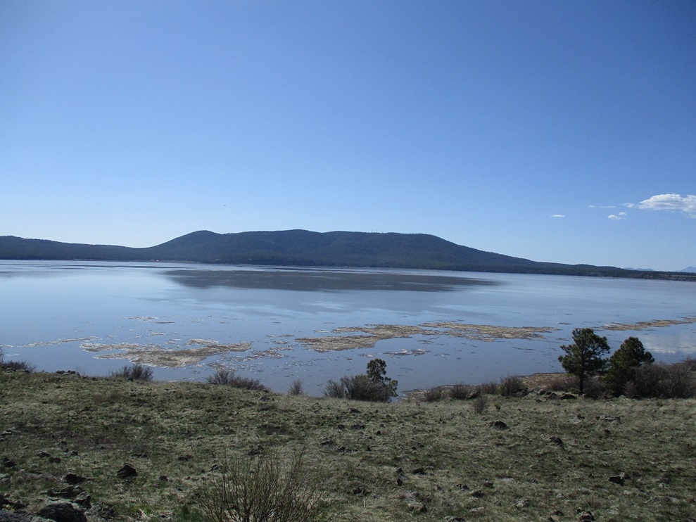
Rather than take the suckiest interstate ever, Interstate-17, back to Phoenix, I chose to take the longer but much more scenic Lake Mary Road/Highway 87 route through Payson, about 20 miles longer but far less crowded and much more lovelier. The twenty or so miles along Lake Mary went slowly, as there were many people coming and going from the lake. Also, the lake(s) were almost completely full, due to the abundant rain and snow we got this year. In past years, the lake would nearly dry up into a small body of water and surrounding mud flats.
I continued a few more miles and pulled into one of the Mormon Lake viewpoints. Mormon Lake, too, was "filled". The depression it sits in could conceivably hold water up to 50 feet deep, which will never happen. However, the lake spread out across the entire breadth of the depression and I guess may have been ten feet at its deepest. It was quite a sight, the first time I've ever seen it remotely filled with water. Mormon Mountain across the way reflected over the water. Humphreys Peak was also visible, snow covered, in sharp detail due to the low humidity.
A woman got a flat tire, and there were a few people trying to help her fix it, the problem being that they could not release the spare from the undercarriage. My old Nissan truck had a similar setup, where you have to fish a t-shaped prong through an opening near the license plate to catch within a groove, the t-end providing enough torque to get the process going. You turn it and release the chain holding the tire in place. I offered to help. They knew the routine, but apparently the new thing is to use a smaller "star" attachment that mates with its female half above the spare. But the attachment is just a half-inch wide and offers no torque. All of us tried. This was a brand new Toyota, and I must say, this new setup stinks. Someone had an electric pump and got the tire filled, hopefully enough so she could get into Flagstaff. What a stupid design. What if they got the flat deep in the forest or on a mountain road?
I drove into Clints Well, getting onto AZ-87, which was really torn up, moreso than the last time I was on it. The drive into Payson went well. I stopped for gas and snacks. We previously lived here up until 2021, but when I am back, it does not have any emotional impact for me.
I then drove into Tempe, arriving late in the day, and got me the 4-taco special at El Jefe's on Price. I deserved it. Today had been a very long day, but I enjoyed it and am always happy to get to the high country now and then.
|


|