The Mountains of Arizona
• www.surgent.net
|
| Monument Peak |
• Mogollon Rim Foothills • Tonto National Forest • Town of Star Valley, Gila County |
|
Date: March 21, 2020
• Elevation: 5,089 feet ✳
• Prominence: 321 feet ✳
• Distance: 2 miles
• Time: 75 minutes
• Gain: 460 feet
• Conditions: Sunny with some clouds and pleasant
Arizona
•
Main
•
PB
•
LoJ
•
Lidar
The weather today was fantastic, with blue skies, a breeze, spotty high puffy clouds and temperatures in the 50s and low 60s. I wanted to get out for a hike, but had to stay close to home as I had some furniture deliveries in the early afternoon. I chose a peak here in town, Monument Peak, and as a chaser, a nearby hill called Yerba Senta Butte.
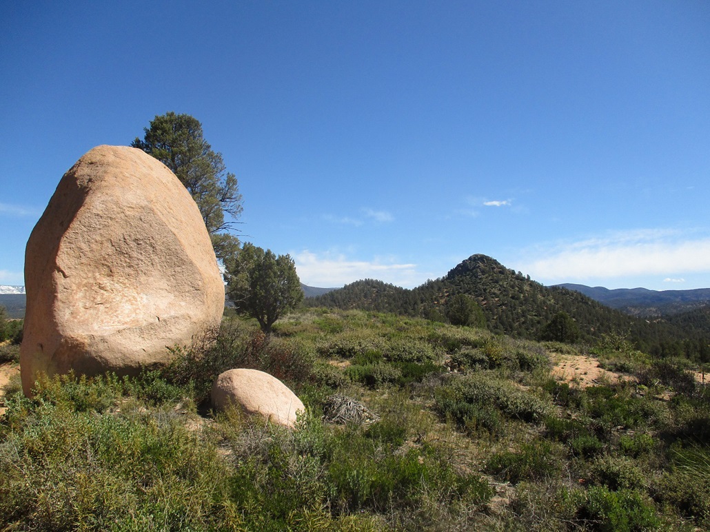
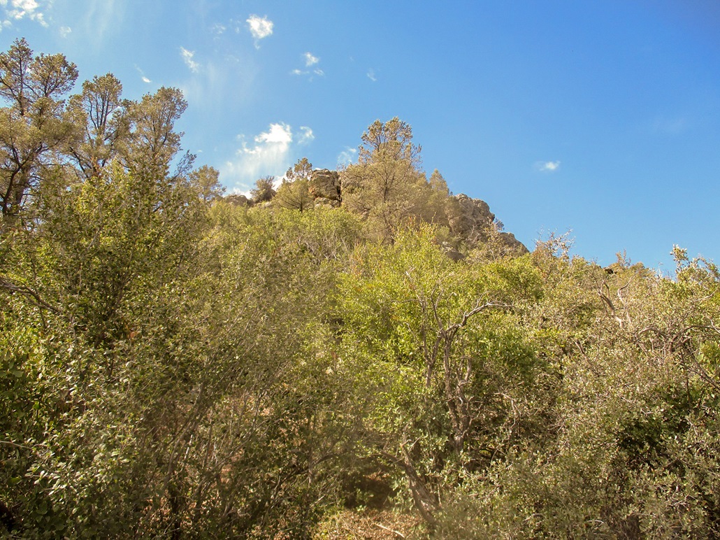
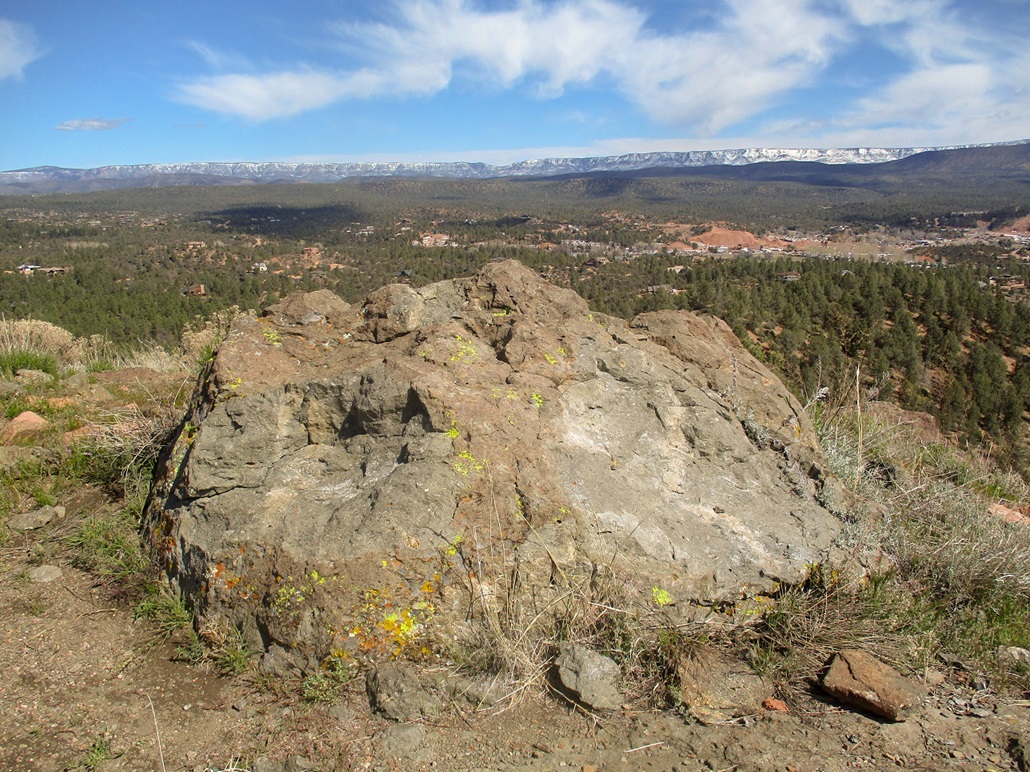
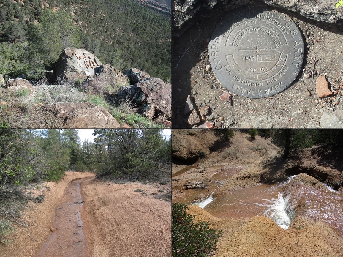
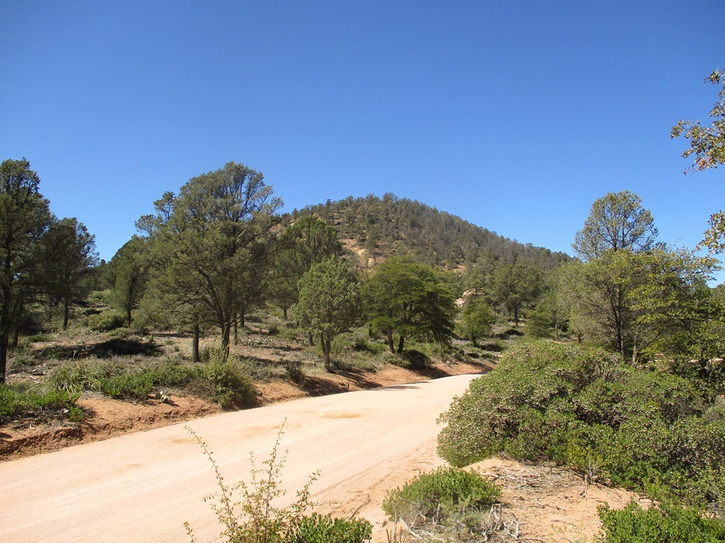
I did not have to drive far, about 5 miles, to get to the parking area for Monument Peak. I took Granite Dells Road from Highway AZ-260, heading southeast. The road narrows, then turns to graded hard-pack. Yerba Senta Butte comes first, but I would save that for the drive out. Monument Peak becomes visible after passing Yerba Senta Butte, the peak topped by a rocky crown. About a mile before the peak, the road passes an interesting oblong-shaped boulder standing on end, about 25 feet high. I took an image of this boulder and of the peak rising behind it.
I rolled into the Monument Peak trailhead parking lot a little before 8 a.m., the first car here in the small clearing. The rains from two days ago had swollen all the little creeks, and the trails had turned into small rivers. I was able to cross them or parallel them without too much trouble. In places, the ground was a soft mud.
I followed the trail markers, going where they pointed. There are numerous other trails, tracks and
paths emanating in all directions, so it would be easy to get onto one of these "wrong" paths. But in truth, it would also be easy to correct any errors. The brush was low enough to allow for good views of the area, and getting lost would be difficult.
The Monument Peak Trail is actually a loop that encircles the peak. I came to where the paths meet, and then pretty much on a guess, went left, or clockwise on the loop. I met a guy here who had hiked the peak recently and he gave me some general tips, which boiled down to following whatever open paths and lanes I could find.
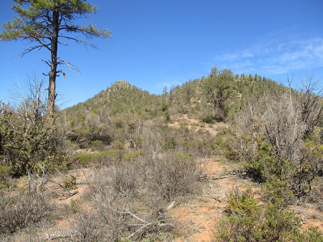
I stayed on the main trail for a few hundred feet, then came to a split, with one branch going uphill, aiming for a saddle between Monument Peak and a smaller hill to the east, elevation 4,880 feet. The path worked well. It was a narrow ATV track that still had some tire prints on it. It went steeply uphill and slowly lost distinction, finally disappearing altogether.
By now, I was well up on the flanks of Hill 4880, and the forest was still open enough so I could see reasonably far. There was ponderosa pine, and a lot of mountain oak. I was able to find openings and lanes and even hints of trails, and soon was at the saddle between the two peaks.
Here, I found a human-made path. It was well-defined and went the way I wanted to go. I followed it, and when it seemed to veer away from the top, left it and started uphill, following whatever openings I could locate. This went well as I had options nearly the entire hike. Only a few times did I have to hunker in and bash through a patch of brush. I had one scare: one path came to a small tree humming with bees. I backed off and tried a different way.
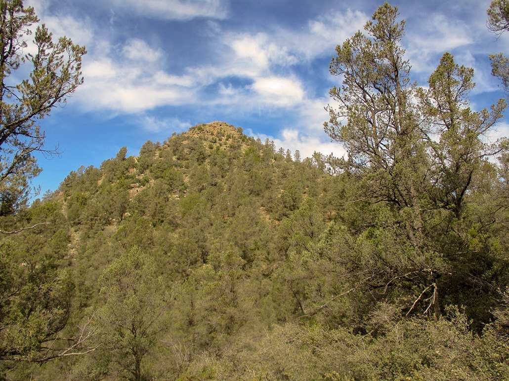
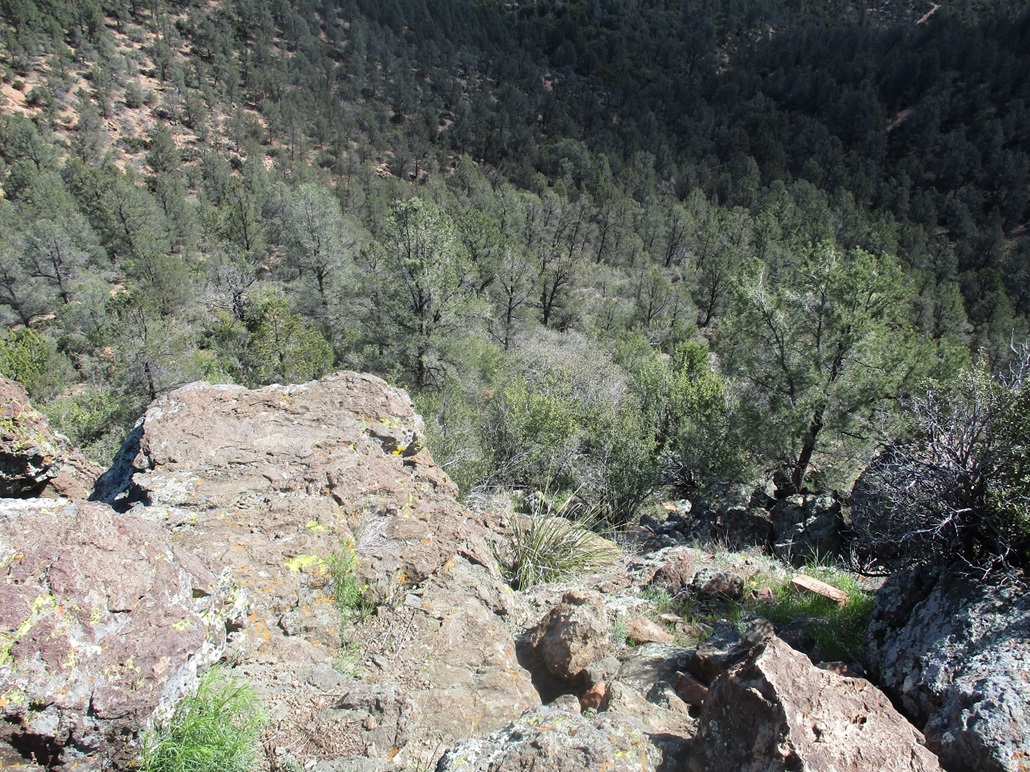
I was soon at the base of the summit rocks, still about 40 feet below the top. The rocks were heaped so that climbing them was easy. Toward the top, I stashed my poles so I had my hands free for a couple simple moves. The crux would rate a low class-3, and it was not difficult. The rock was solid with plenty of holds.
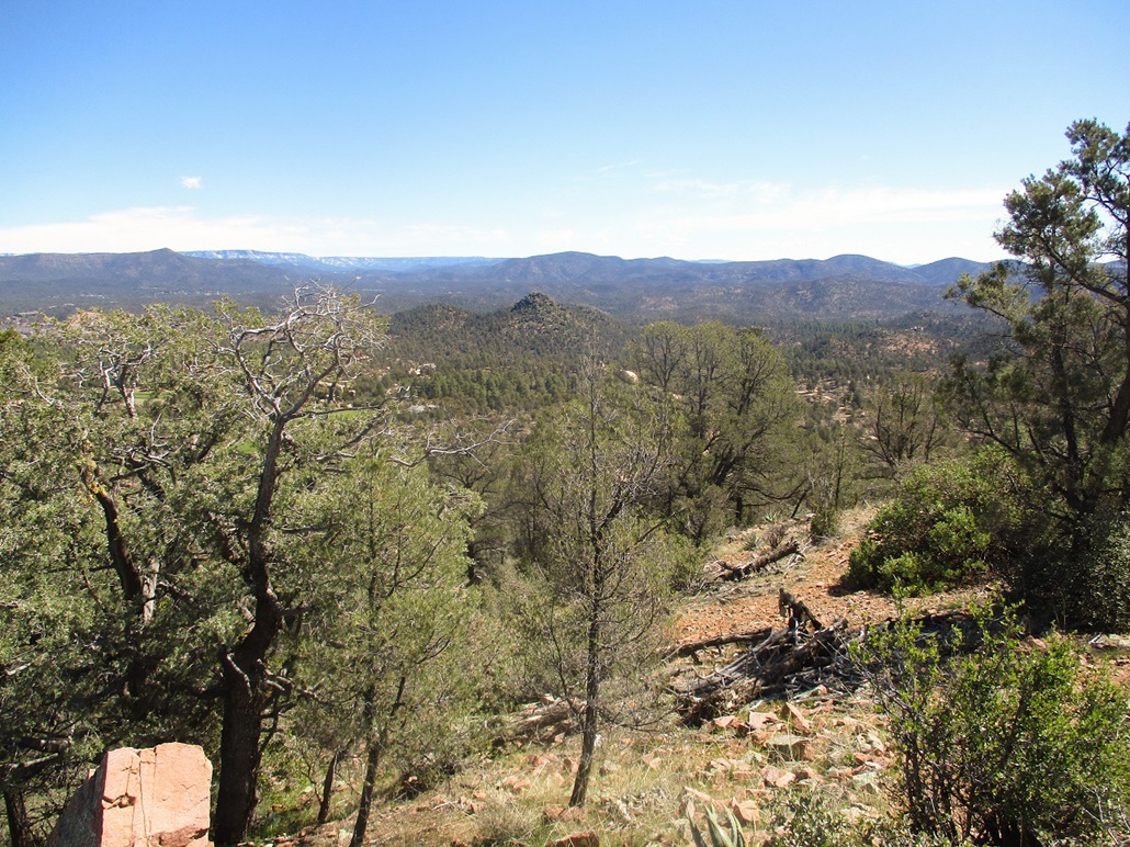
I was soon on top, a small flat platform with a big boulder dead center. In a crook of a nearby rock was a benchmark. The views up here were outstanding, and I actually sat and rested for nearly 15 minutes, enjoying the views and the quiet and the lovely weather. I did not feel a need to turn around immediately.
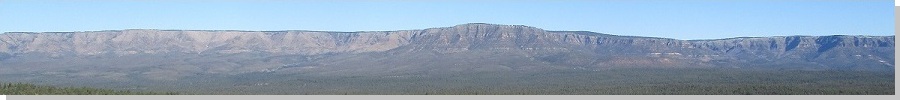
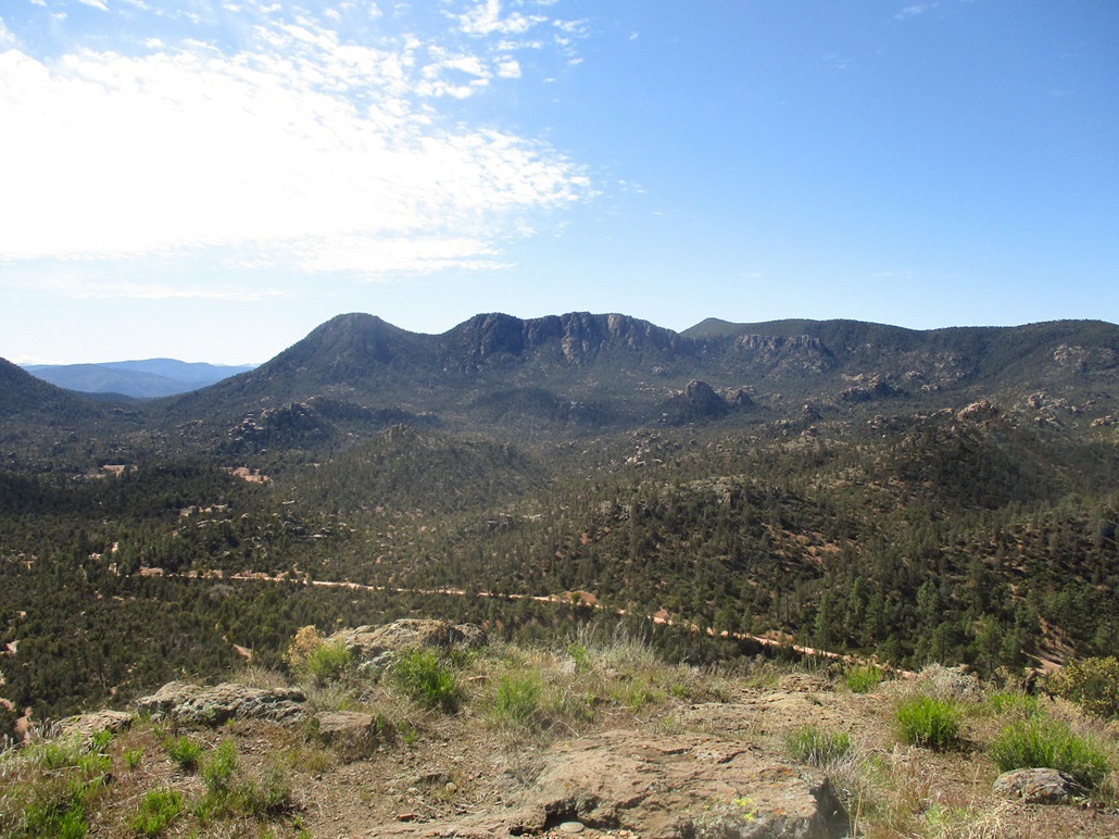
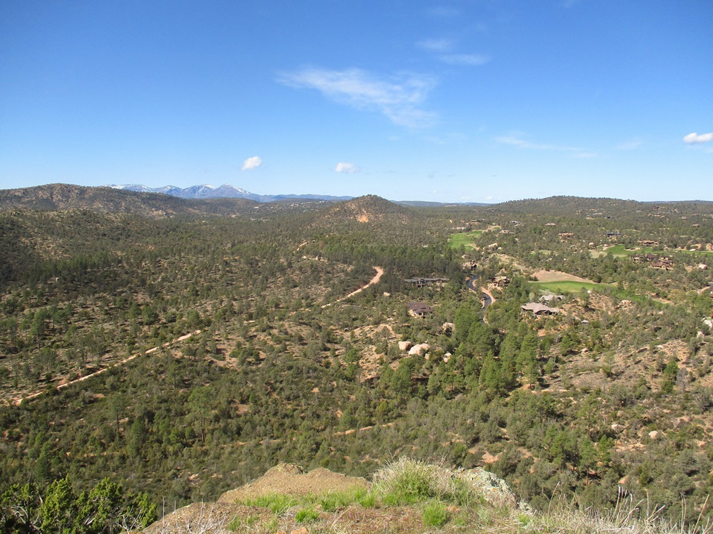
Up here, I could see the rocky terrain below and the cliffs of the peaks to the south, notably, that of Gibson Peak. To the north I had a perfect perch to view the long snowy sweep of the Mogollon Rim. To the west were the buildings of Payson, and of the surrounding forest.
For the hike down, I generally followed my same route but did not repeat it exactly. I followed openings as I found them, and I was able to re-meet that ATV track again, lower down from where I left it. From there, it was an easy hike back to my car. The lot was now "full", with 4 cars. However, I did not see anyone else other than that one guy at the start. The round trip hike took 75 minutes, and since it is so close, I will repeat it. However, it may be a little harsh when it gets warm. The snakes will be out, and the bees likely more active.
Being technical for a moment, Monument Peak actually lies within the Star Valley town limits. The boundary for the Tonto National Forest is about a half-mile to the south. However, the signage and trail markers were all Forest, and the distinction here is minor at best.
Elevation: 5,173 feet • Prominence: 223 feet • Distance: 0.5 mile • Time: 30 minutes • Gain: 230 feet
PB
•
LoJ
I drove back about a mile, honing in on Yerba Senta Butte. The hill is fairly symmetrical and covered in the same mix of ponderosa and mountain oak (and other bushes and cacti). I parked in a small clearing north of the hill, and was soon on the move.
I hiked up the road as it petered out into an indistinct path, clearly not maintained by anyone. I followed what I could but soon lost any semblance of a path and found myself in much thicker brush. Here, I had to really hunker in to get through this stuff.
I did not have far to go, and was okay with the idea of bashing through this brush to get to the top. But in moments, I came upon a path. This was welcome. I followed the path upward. It was not the best path, as it was sloppy, eroded, rocky and not always obvious. But it went up, and I was soon below the top, weaving through a couple easy rock bands along the way.
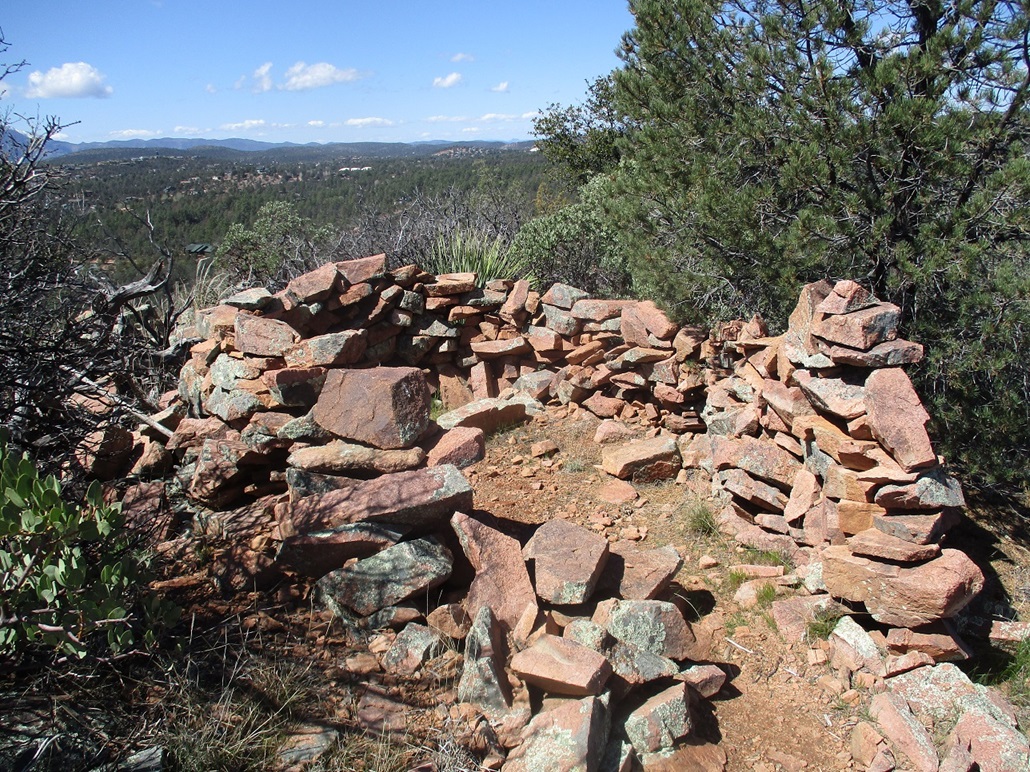
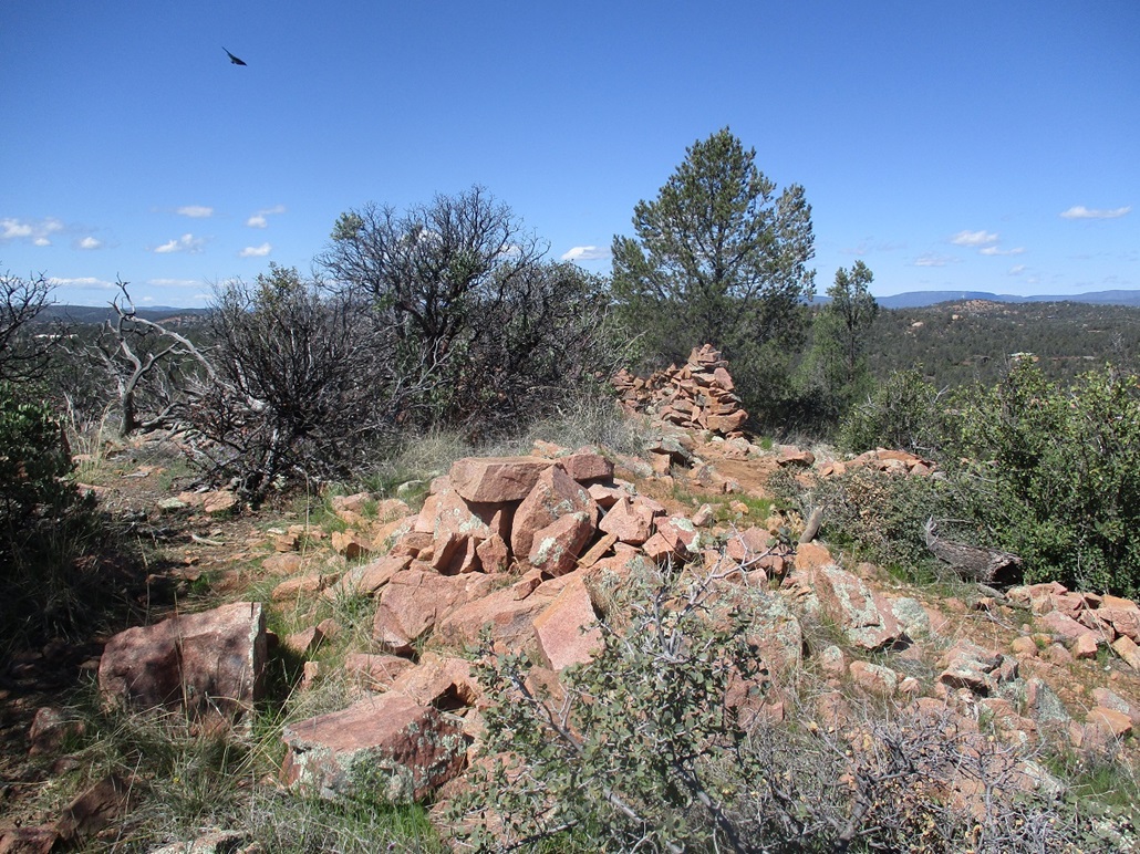
The top features a decent-sized cairn and a large windbreak, walls about three feet high and about 7 feet in diameter. It looked like some serious effort to construct it. Could this date from the old-time Indians? Maybe, I don't know.
I did not spend much time up here, and started down another trail that went east, figuring I'll make this a loop hike. But the trail angled away from my car, so I abandoned that plan and just retraced my general route. The hike did not take long, barely a half hour. By itself it's not much of a hike, but combined with Monument Peak, I felt I put in a good morning's effort.
I was back home before 11 a.m., still plenty of time to clean up for the furniture people.
Again, being technical, this butte lies barely inside the Payson town limits, the boundary literally a stone's throw to the east of the hill's summit.
|


|