
The Mountains of Arizona
• www.surgent.net
|
| Mohon Peak |
• Highpoint: Mohon Mountains • Arizona State Trust Lands • Yavapai County |
|
Date: March 5, 2016
• Elevation: 7,499 feet
• Prominence: 2,059 feet
• Distance: 18 miles
• Time: 9 hours and 30 minutes
• Gain: 4,010 feet
• Conditions: Overcast, some sun, breezy and cold
• Teammates: Matthias Stender & Chris Gilsdorf
Arizona
•
Main
•
AZ P1K
•
PB
•
USGS BM Datasheet
Mohon Peak is in western Yavapai County, in an area cut off from the rest of Arizona due to the sprawling holdings of the O-RO Ranch and other surrounding ranches. The two nearest highways, US-93 and Interstate-40, are both far from the peak and it's not visible at all from US-93. It is visible from Interstate-40, but it is far and you have to know what you're looking for.
The peak is named for Jim Mahone, a Hualapai Indian and scout for General Crook during the Indian suppression wars of the late 1800s. Mahone was born in about 1854, his original name Ma Hoi Na Ve. He assumed his "American" name in 1873 when he joined the United States Army. He was known as one of the best and most durable trackers and scouts of his time. His birth year is uncertain, and he died in 1949. Assuming him to be about twenty when he joined the army, he was at least 95 when he perished. His nephew, Fred Mahone, became a leader of the Hualapai and helped secure the establishment of the Hualapai Indian Reservation.
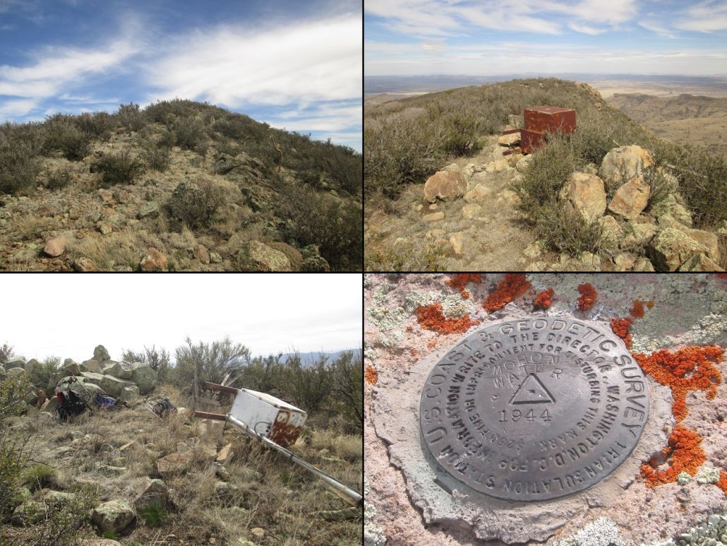
In Will Barnes' Arizona Place Names, he mentions that Mohon Peak is named for Jim Mahone, and mentions some old maps citing the name as "Mohone", that the extra "o" is an error. Thus, it's reasonable to assume that it is pronounced "Mo-hone", accenting the last syllable. The benchmark atop the summit calls the peak "Mohon Water" for some reason.
Mohon Peak sits within a checkerboard of land owned either by the O-RO Ranch, or Arizona State Trust lands. Most of the O-RO lies on the Baca Land Grant, a 100,000-acre square of land lying about seven miles to the east of Mohon Peak. The O-RO also owns a lot of the extra square-mile sections surrounding the Baca Land Grant, and presumably leases the Arizona Trust lands in between for grazing rights. Its total holdings are over 250,000 acres. Mohon Peak itself lies within one of the State Trust sections.
In 2010, I drove here intending to hike the peak. I found the Trout Creek road from US-93 easily, followed that to Bogles Ranch Road, then that road up and over the Aquarius Mountains (which parallel US-93 and lie west of the Mohon Mountains). I found Wagon Bow Road, and followed a series of bladed tracks north, coming to Winslow Canyon. To here, I had not encountered any difficulties, and the roads were very good.
However, the road into Winslow Canyon became rough very fast. It was rocky and steep, so I put my truck into 4-wheel drive and eased down into the canyon, losing about 120 feet, to a point where the road crosses the actual sandy drainage. Here, it was washed out. There was a 3-foot lip from where the road was supposed to enter into the sandy bottom, and this blocked me from forward progress. I had not planned to hike it from here, and had hoped I could get a few more miles north to Little Mesa Tank.
Not fully defeated, I tried other roads. I drove up and out of Winslow Canyon, then followed whatever tracks I could find up on these elevated mesas. Curiously, they were signed as though they were residential streets. This is a development where presumably, people can buy a property and put up a home. I drove every single road I could find, each time coming to a dead end.
I backed out to the main Bogles Ranch Road and drove that farther south and east, not knowing where I was going. I drove about five extra miles and found nothing, clearly driving away from my goal. It was obvious I would not hike the peak this day. I spent about three hours here, gathering information for a future trip here. During my time here, I never saw another vehicle or person.
I did not make any attempts to revisit this peak until now, March 2016. I was down to the last three peaks of the Arizona 2000-foot Prominence Peaks list, and being so close, I was a little more motivated to come back and retry this peak. My partners were Matthias Stender and Chris Gilsdorf. I had not seen Chris since 2010. I met Chris at 3:45 a.m., near the Denny's on Carefree Highway and Interstate-17. Matthias rolled in a little bit later, and after introductions, we got rolling for the 140-mile drive to our objective.
We arrived into Wikieup on US-93 as the sun was rising, then followed the Trout Creek and Bogles Ranch roads, following the identical path I took in 2010. There was one new development: the Arizona Department of Game & Fish had worked out an access agreement with the Wagon Bow Ranch, with a sign-in kiosk at the Wagon Bow turn-off. This was not here in 2010 (or, I don't remember it being here). We signed in and got a ranch pass. This gave us some peace of mind, knowing that a lone vehicle parked out here would not necessarily draw suspicion. I also had my Arizona State Trust Lands placard. We got to Winslow Canyon a little before 8 a.m., and I was curious to see what the road looked like. Visitors in recent years had been able to drive past it, so I assumed the road had been repaired.
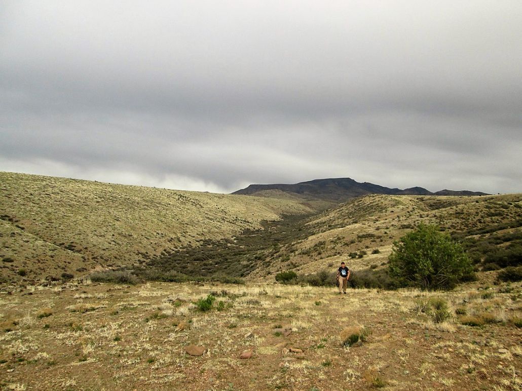
Matthias drove into the Canyon slowly, Chris and I helping by jumping out and removing bigger rocks from the road. We stopped and inspected the road where it meets the sandy bottom, where I was stopped in 2010. It was now drivable, but barely. Matthias got down it, then as he was driving up the other side of the canyon, decided he didn't want to proceed. He parked in a small clearing within Winslow Canyon, elevation 4,420 feet.
We had hoped we could get to Little Mesa Tank, about three miles north, from which it is a 12-mile round trip hike to Mohon Peak. However, we had also mentally prepared ourselves for the probable event of parking earlier. It was clear that were we to drive these roads, we'd be going so slow that it would be faster to walk them. We started our hike at 8:20 a.m.
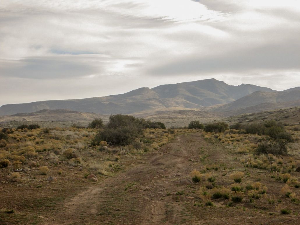
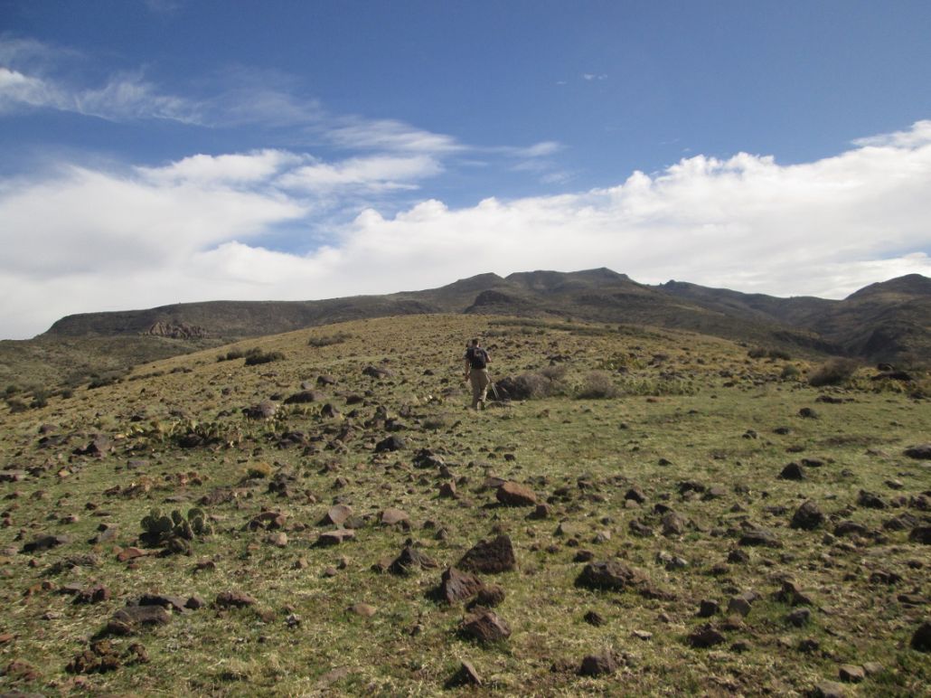
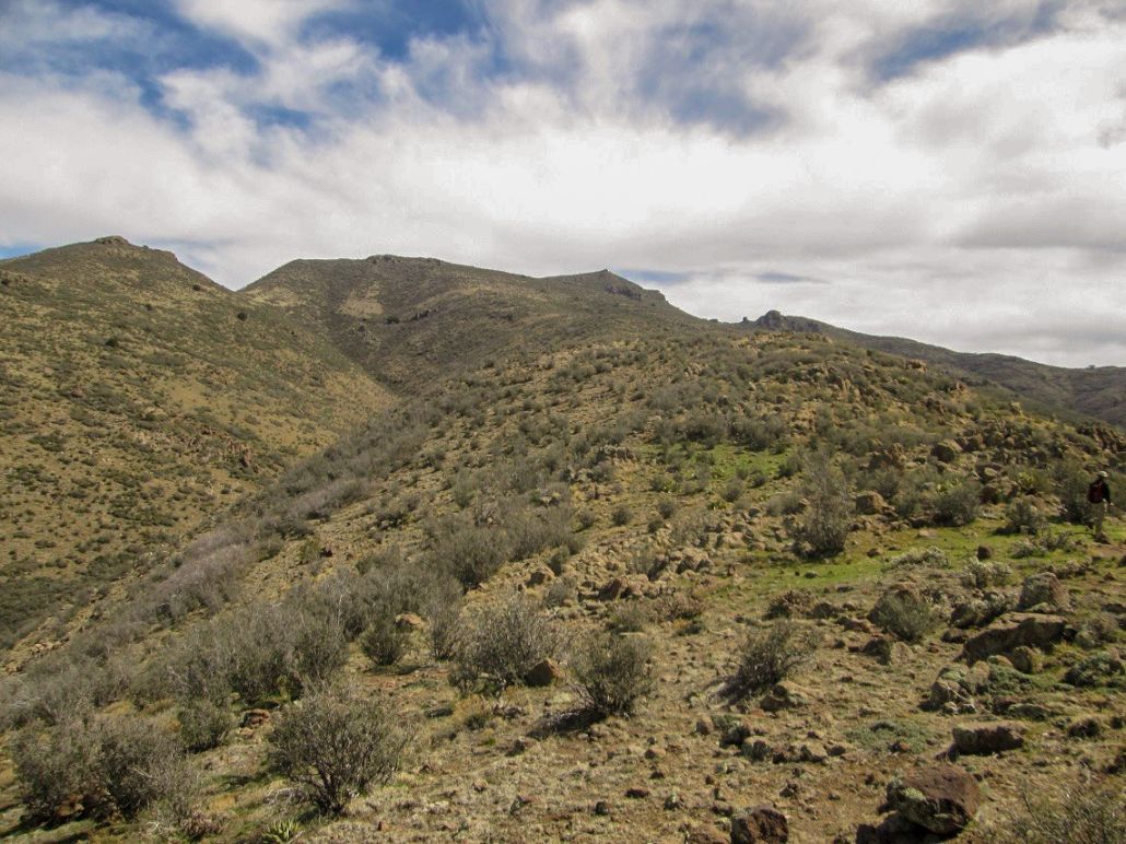
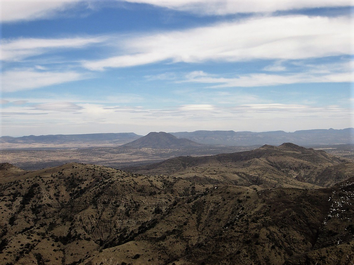
We followed the road up and out of Winslow Canyon. It gains 220 feet, then drops into Gonzales Canyon, losing 120 feet. The road then gains out of that canyon and bends north across a broad mesa, aiming for a little bump in the far distance, marked as spot elevation 4,810 feet on the map. This is north of Little Mesa Tank, where we had hoped to drive to. We had covered this three-mile segment in about an hour. The day was overcast and we could see Mohon Peak, but the sun was still low in the east, so that the west-facing slopes were still in shadow. Lighting for photos was lousy.
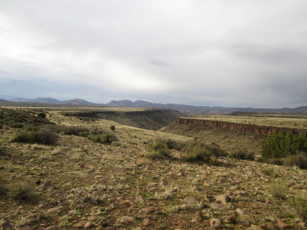
The road then comes to Dividing Canyon, an impressive canyon with vertical walls that in some states would be a major attraction, but in Arizona is just another boring canyon. Looking east, the canyon makes a seeming straight shot toward Mohon Peak, still way off in the distance.
We followed the road down into Dividing Canyon, losing 270 feet. The road was covered in giant boulders about three feet across, and probably had not seen a vehicle in 50 years. When it came to the bottom of the canyon, we left it and started trending east through the low trees within the canyon bottom. Within moments, we were at the fence line.
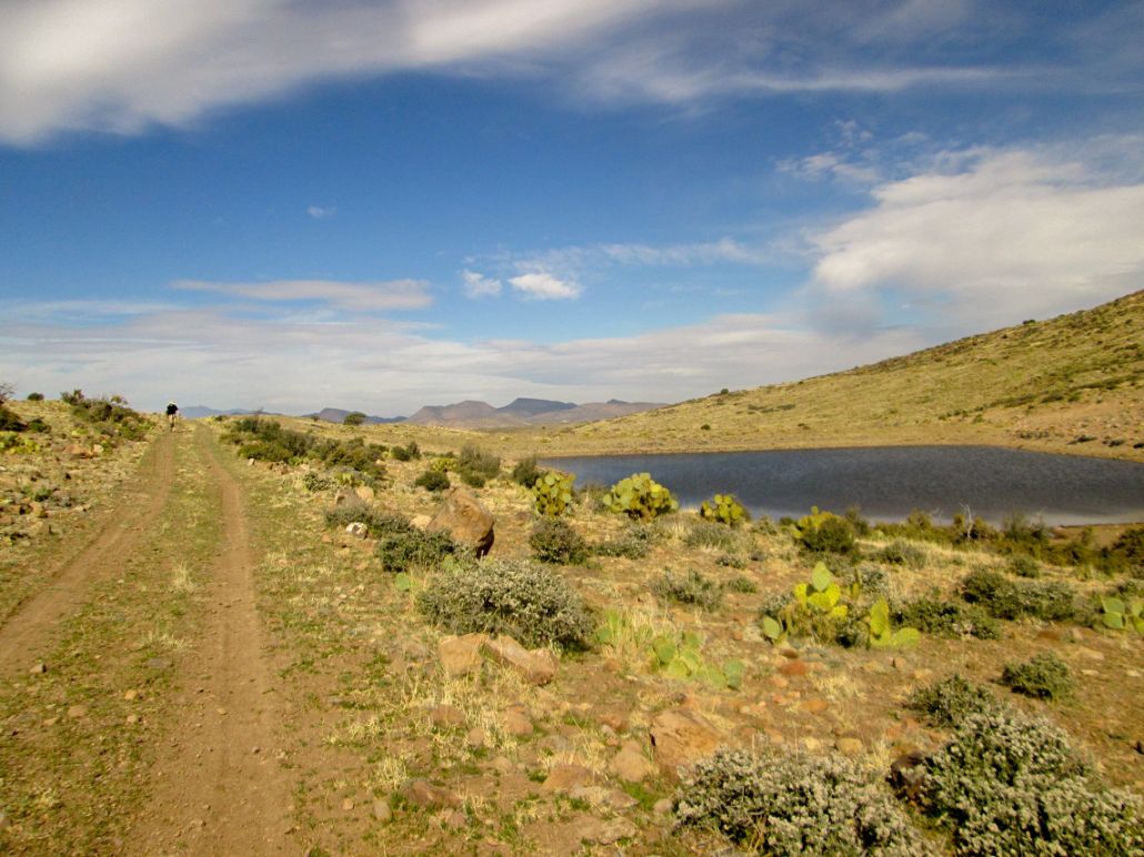
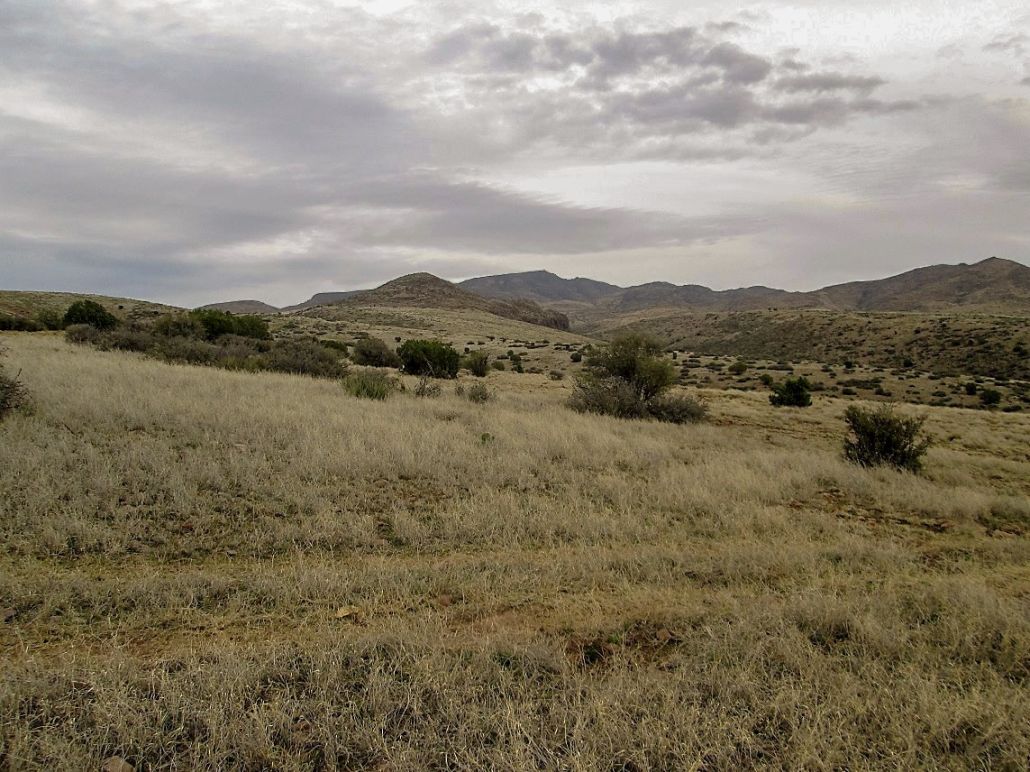
We scooted under the fence. We agreed to make our eastward walk go as fast as possible, no lollygagging, smelling the flowers or horsing around. We followed cow paths through the light trees and then came upon a better road, this one maintained and presumably driven on semi-regularly. However, closely inspecting the road bed, it did not have fresh tire tracks. This road ascends out of the canyon, eventually achieving the highpoint of a ridge at elevation 5,220 feet, before dropping about 75 feet. About a quarter-mile to the east is Goldwater Tank. We stayed on the road past the tank, then took our first break of the day.
To here, we had now walked about five and a half miles. We were still more than three miles from Mohon Peak, and 2,300 below it. We had covered this segment in about two hours, moving quickly. On a positive note, the clouds had moved aside and we had sunny conditions. However, now higher on the ridges, we also had consistent winds.
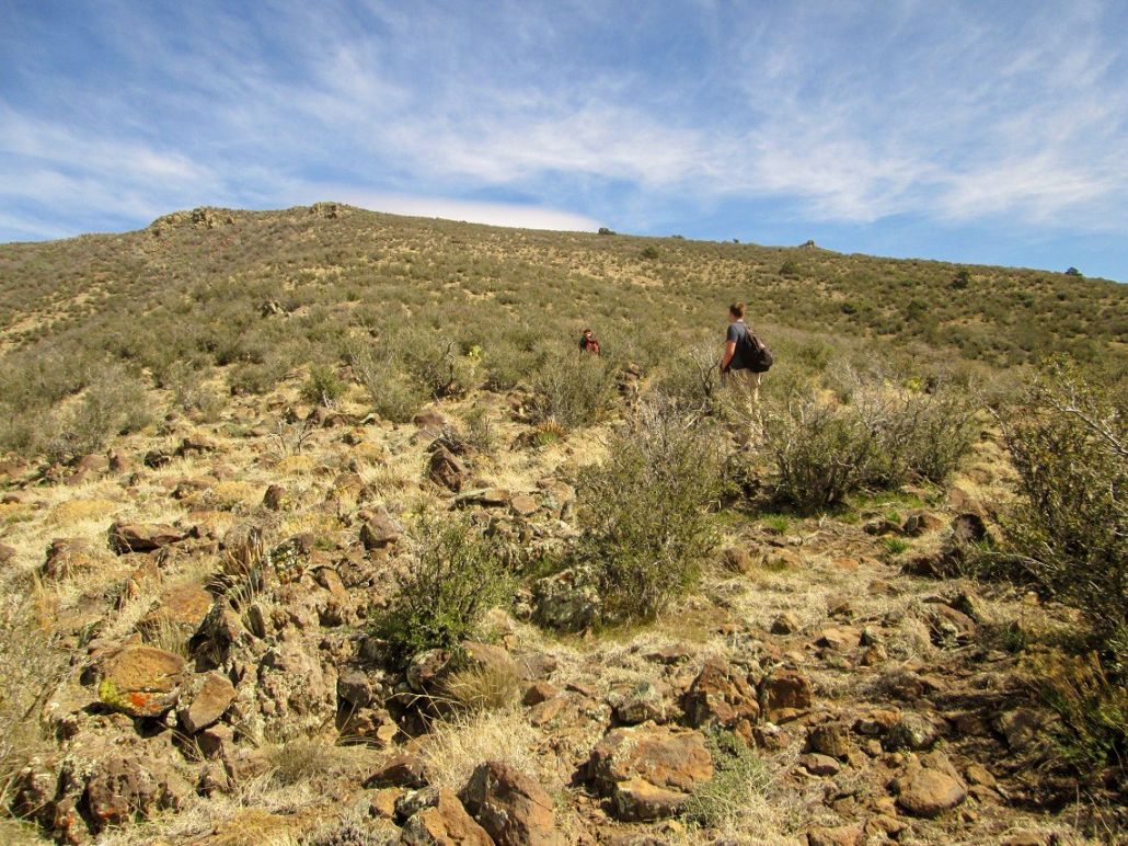
We spent about twenty minutes on our break. I ate a little too much, because when we started moving, I felt sluggish and could not get into a rhythm, whereas on the hike in I had felt energetic and moved quickly. We walked up the remaining track, then angled left and started the off-trail trek, now on very gentle slopes covered in rocks and grass that had been mowed to about an inch high by all the cattle, although so far we had not seen any of the beasts out and about. We had seen a lot of deer, though.
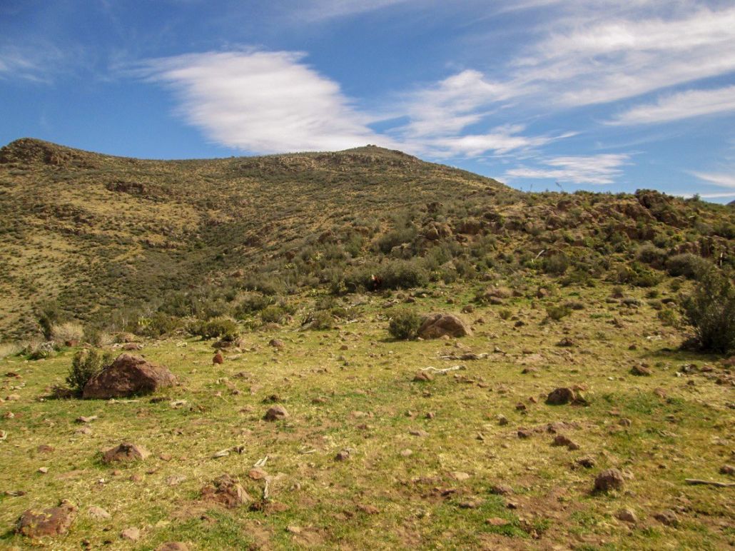
We were hiking toward Peak 6406, about a mile away and 1,200 feet higher. The terrain steepened slightly and became brushy, but cow paths were everywhere so that we could usually work our way through the brush without difficulty. We encountered a couple very easy cliff bands along the way, but they were easy to scale or bypass. If the cows can find ways up these, we certainly should be able to as well.
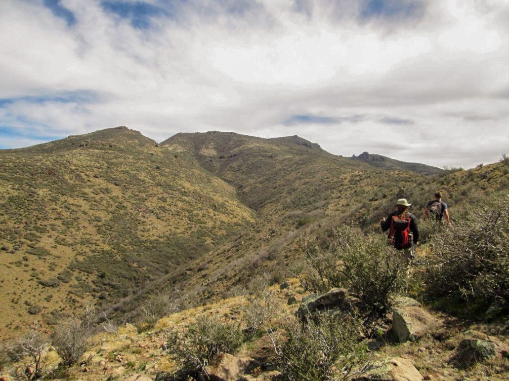
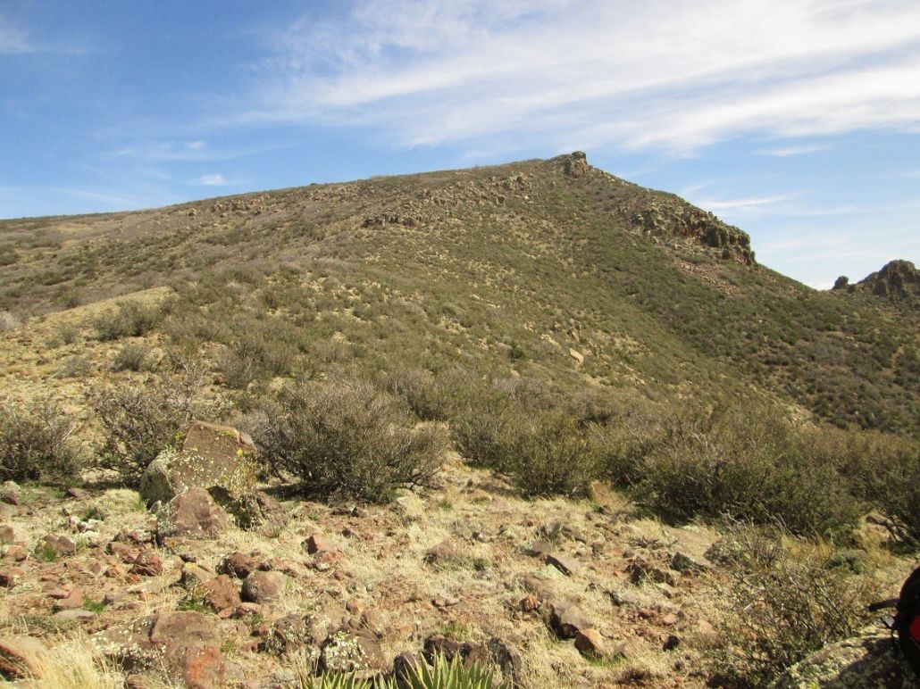
We traversed below Peak 6406, then achieved the saddle to its east. Looking up, we could see a rocky prow that was either the top, or very close to it. We trudged up these slopes, the hiking very easy, but tedious and tiring considering we were on our ninth mile of the day. We gained another saddle, elevation 7,070 feet, directly west and below the summit.
The last segment went well but here, we had thicker brush (mountain oak) and a few small rocks to get past. We aimed for the prow, but the summit was just a few dozen feet higher to the northeast. We were finally on top, 1:30 in the afternoon, five and a half hours after starting this long trek. We plopped onto the rocks at the top and rested. I shot a few photos of the peak, the junk lying about, and of the surrounding area. We spent about twenty minutes up here, enjoying the deserved break. We could not find a register.
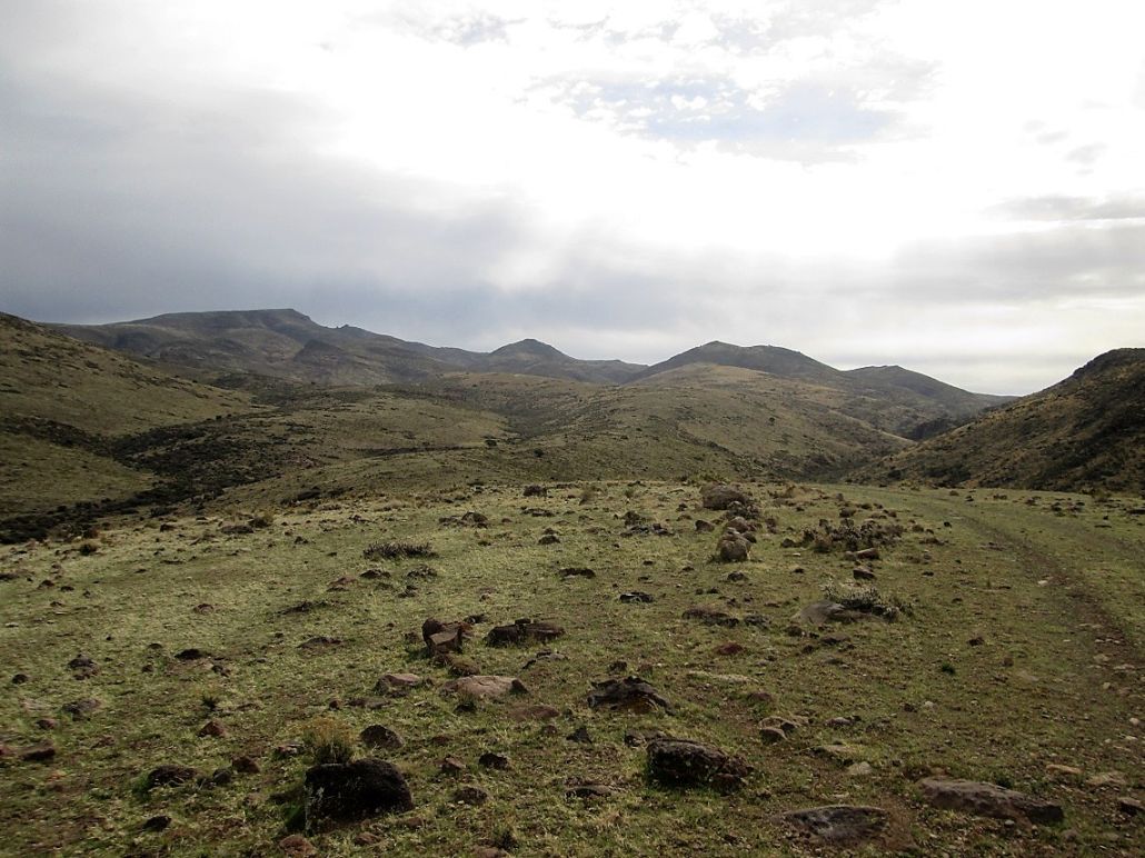
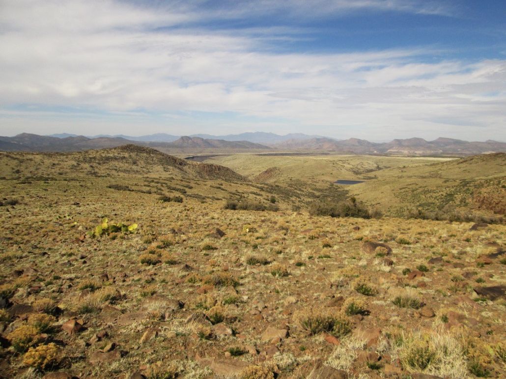
The surrounding sky was a mix of high clouds and occasional blue patches. The farthest ranges were slightly obscured by the hazy moisture. Looking east, we could see Mount Hope, which lies dead center on the Baca Land Grant of the O-RO. Beyond that, we could see plateaus such as Juniper Mesa, and the Hyde Creek Mountains. There was spotty snow on some of the nearby north-facing slopes. Looking west, we could see the Hualapai Mountains, the Aquarius Mountains, and barely make out some of the Cerbat Mountains by Kingman.
I was happy to have summitted, but also knew that our job was only half done, that we still had nine more miles to hike out. Already tired, I wasn't necessarily looking forward to the long hike out, but obviously, I had no choice. I decided to get started earlier than Matthias and Chris. I hiked down, retracing our route up, and generally was about two minutes ahead of Matthias and Chris. We did not stop for a break until we were back to the track near Goldwater Tank. This segment had taken us a little over an hour. We rested here for about fifteen minutes.
We still had that long segment between Goldwater Tank and the boundary fence to cross. We all got moving and walked at a fast pace. I think we were all a little paranoid. We'd often stop, thinking we heard a vehicle engine, but it would be a distant airplane. Or we'd see something off in the distance thinking it was people or a vehicle. But we never saw a soul.
As soon as we could, we left the road and entered into the trees within Dividing Canyon's bottom, and we hustled until we came upon the fenceline again. Scooting underneath it back onto the "legal" side, we took another break here. Thus far, we had walked 15 miles. Our only fear now was that we'd be too tired to actually get up again. We still had to hike up the road out of Dividing Canyon, then back to the vehicle.
That final segment took an hour, and at 5:50 p.m., we stumbled back to Matthias' vehicle, 18 miles of hiking later, thrashed but elated. Our ascent of Mohon Peak was a success, and it would make the sore legs and tightened muscles that much easier to deal with. We drove out to US-93 as the sun was setting, and it was dark by the time we stopped at the Shell Station in Wikieup, where we got drinks ... and home-made tamales, which were quite good for being $1.50 each at a gas station in the middle of nowhere.
The drive back to Phoenix took a couple hours, and we rolled into the Denny's parking lot a little after 9 p.m., where we transferred gear, shook hands, and went our separate ways. Me, I was starving by now, so I walked into the Denny's and had a meal. I didn't arrive home until a little before 11 p.m.
I am happy to have this peak done and in the books, and appreciate Matthias and Chris and their work in helping make this happen. It was a long, but pleasant day. The terrain up here is expansive and remote, beautiful in its own way. Not many people come here, and I probably wouldn't either were I not so obsessive and compulsive about completing this particular peak list, but I am glad I did. In one gigantic day hike, I got a lifetime's fill of this area, and I am okay with that.
(Would I recommend this peak? No. It's very remote and a major hassle just to get close to it and hike it, its private-property issue notwithstanding. There are much better options nearby.)
The elevation gain came out to almost exactly 4,000 feet. We parked at 4,420 feet, and the summit is 7,499 feet, for a net difference of 3,079 feet. Along the way, there were drops of 120 feet, 270 feet and 75 feet. Since those drops need to be regained twice (once on the hike in, again on the hike out), I added twice their sum, or 930 feet, to the net figure, for 4,009 feet gross elevation change. Some of the elevations were inferred from the map by reading contours, so the figure has an accuracy of plus or minus 50 feet.
. . . . . . . . . . . . . . . . . . . . . . . .
Here are some interesting links about the O-RO Ranch and the area:
• Sharlot Hall Article on Indian Scouts. This mentioned Jim Mahone, referencing a contemporary article that says he was 120 when he died, although that figure is an obvious emebellishment.
• Kathy McCraine's Website. She lives on an adjacent ranch and is a long-time writer about ranching in Arizona. There are links to articles she has written for various magazines about the O-RO, which are quite fascinating and with excellent photography.
• Black Helicopters. An article about possible things going on here that aren't really going on, wink wink.
|


|