The Mountains of Arizona
• www.surgent.net
|
| Merrill Crater |
• San Francisco Volcanic Field • Coconino National Forest (part) • Coconino County |
|
Date: August 25, 2021
• Elevation: 6,595 feet
• Prominence: 765 feet
• Distance: 9 miles
• Time: 3 hours, 30 minutes
• Gain: 1,050 feet (gross)
• Conditions: Sunny and clear, cool at first but warming fast
Arizona
•
Main
•
LoJ
•
Interactive map
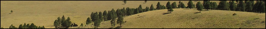
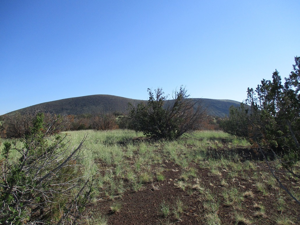
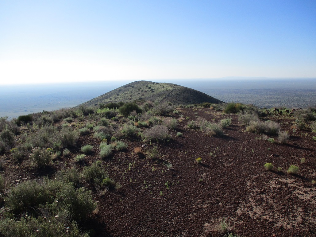
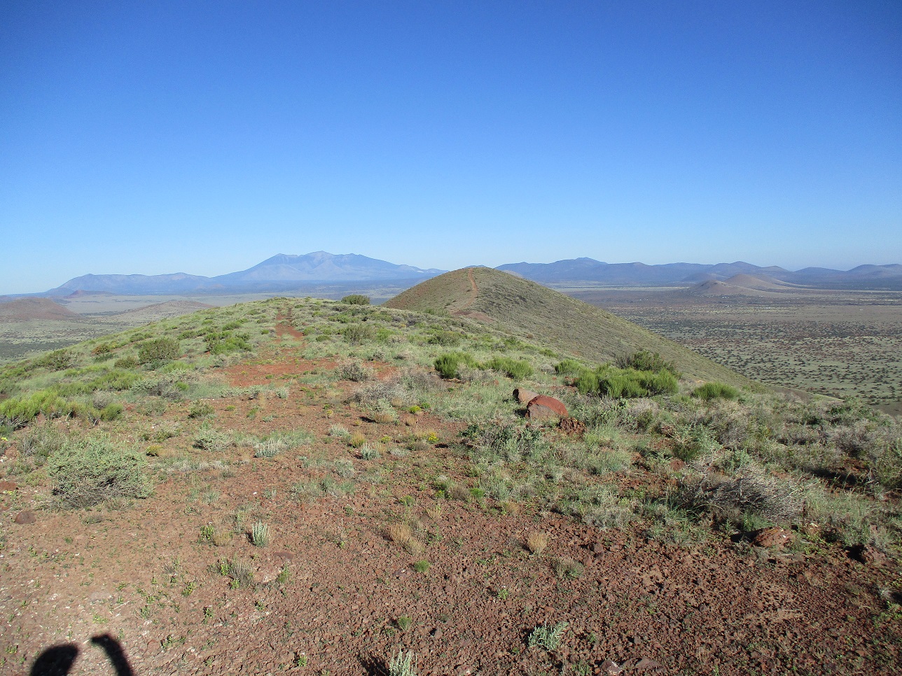
Merrill Crater is the southeasternmost large cinder mound on the San Francisco Volcanic Field. If driving on Interstate-40 near the Twin Arrows exit, Merrill Crater rises above the plateau about five miles north of the highway. It has a bread-loaf shape, the highest point being on the west hump of the ridge, and a benchmark affixed to the slightly-lower eastern hump of the ridge. The mound lies about 20 miles east of Flagstaff.
I was here just a few days ago, hiking nearby Rattlesnake Crater. I returned for a couple days in the Flagstaff area, now setting my sights on Merrill Crater. I left home the day before and drove up onto the Plateau, then to Flagstaff via Lake Mary Road, then to the Interstate, where I took the Winona Exit. I followed Angell Road east about 5 miles, then north (County Road 415) about 3 miles to the Angell Railroad siding. The land here is mostly open rangeland, but near Angell Siding, the road crosses over a cattle grate at a fenceline, the north side a low forest of pinon and juniper. I drove into the junipers and parked about a hundred feet off the road, completely hidden. This would be my camp for tonight.
I arrived in the area in the late afternoon. I took some time to walk the area. I was about 300 feet south of the railroad line itself. I walked to it and inspected the random piles of railroad junk lying everywhere. In the trees were small piles of old railroad ties and other wooden items, lain here so long they've long-since dried out and are essentially cracking into smaller bits. Every ten feet was a rusted food tin dating from many decades ago. They were everywhere. It was like archaeology for the common man. I did not come across modern-day junk like food wrappers or bullet shells. I don't think many people bother to drive out here, even the ne'er-do-wells who seem to find every nook and cranny in the state to shoot and litter. I was on Coconino National Forest property, but the big trees were well to the west.
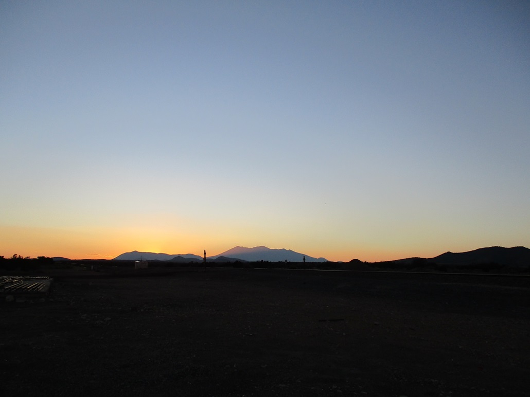
As the sun set, the temperatures cooled into the 60s. It was moderate and very pleasant. The full moon was a few days ago. Thus, the moon would rise a couple hours after the sunset, a waning gibbous that was still about 70% full. My camp was a cot and a sleeping bag in the open beside my car. For a couple hours, it was completely dark, until the moon rose and lit the place up. I laid down and looked at the stars and listened to the occasional coyote howl. It was quiet and peaceful. Except for the 120-decibel horns blasted by the trains that rumbled through about every 15 minutes.
This is a major train line so there were big trains heading both ways every few minutes. Since this is a siding, I supposed that the train engineers were obliged to crank the horn as they passed through. After the horns, there would be five minutes of rumbling as the train clanked along the tracks. Then peace and quiet ... then another train. It went on all night. I knew this was a train line, but I guess I underestimated how loud they are. Fortunately, I have some foam ear plugs in my car, so I put some on and that helped. I was able to get some decent sleep that night, awaking at dawn.
I milled aroud the area a little to awaken a little more. It was just after 5 a.m., and cool, but not cold, maybe low 60s. It would be a warm day today so I wanted an early start. I took down my camp, threw it all in the car, got my pack in order and started walking at 5:45 a.m., the eastern sky lighting up but the sun still below the horizon.
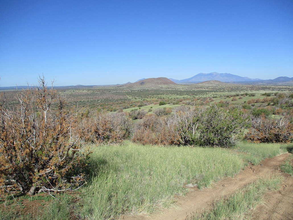
I walked over the tracks. This is a "wye", where a couple tracks curve to the north forming a little "pulloff" to store a train car or two. The whole area was scuzzy in a railroad sort of way. Piles of stuff everywhere, haggard and ugly. Beside the wye is a rough track, marked Coconino Forest Road 9124T. The road parallels the little track segment, then passes a fence line, heading north with a slight northeast bent. The road was scant and often hard to discern since it gets driven so rarely. However, someone had driven it recently and I followed their tracks, but I suspect they had trouble keeping to the road as their tracks would end suddenly too. A mile and a half later, the road drops into Youngs Canyon, then up the other side. A half mile later (two miles total), the road comes to the forest boundary.
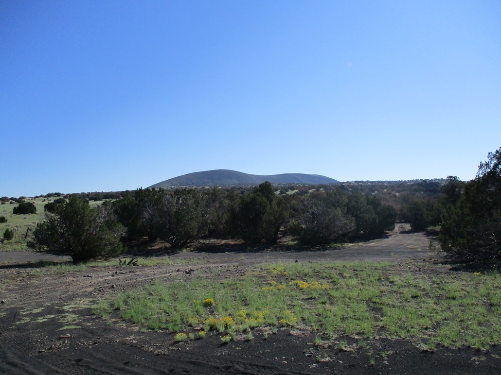
There is a gate here and a sign warning against trespassing, hunting, camping and so on. I did not breach the gate. Instead, another track heads east, still on Coconino Forest land. This is labelled FR-9161T on the map. This road wandered about a mile east, generally parallel to the fence but meandering to get around trees and rock outcrops. The road gained about 250 feet, placing me on a bluff a little west of Hill 6121.
The land north of the fence is a checkerboard of private and State Trust lands. The private lands are part of the Merrill Ranches development, intended to be sold as quarter-section (160 acre) plots for homes, but not intended to be functioning ranches. The section beyond the gate I mentioned was a privately-owned section. Now a mile east, the section north of the forest boundary was a State Trust section. I had my permit on my smartphone. So I hopped the fence and started walking through knee-high grass, aiming northeast. I passed over Point 6152, then dropped about 60 feet, now at the base of Merrill Crater itself.
My plan was to then walk west and place myself at the west base of the peak, then follow the slopes up from that direction. However, from where I stood, the summit was directly above me and just 400 feet higher. The slopes looked steep but not impossible. I decided to try these slopes and see how they went. It looked like your typical steep rubbly cinder slope common to the area.
The first 150 feet went well. The slopes were loose but vegetated so that it held together well. Then, not so much. The slopes now were more like scree slopes of golf-ball sized rocks, and nothing held together. Instead of busting directly upslope as had been my plan, I now tacked west on a long diagonal uphill, mainly to take advantage of the occasional big rocks. This worked well in that I got onto the ridge, but absolutely do not recommend it ever again for as long as the Universe exists.
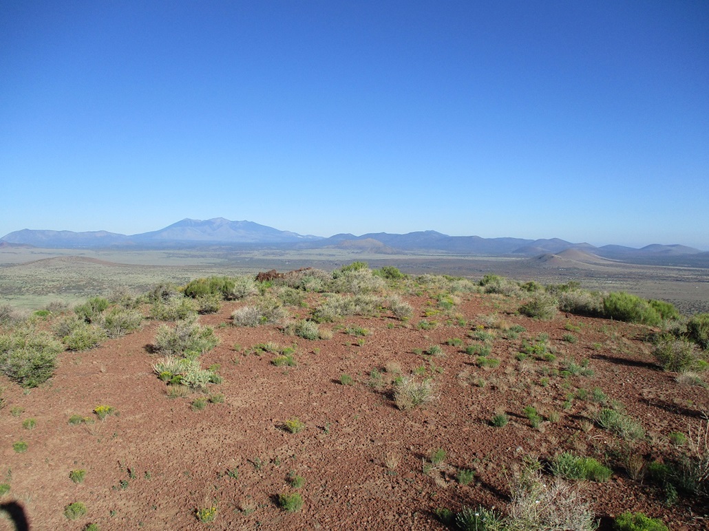
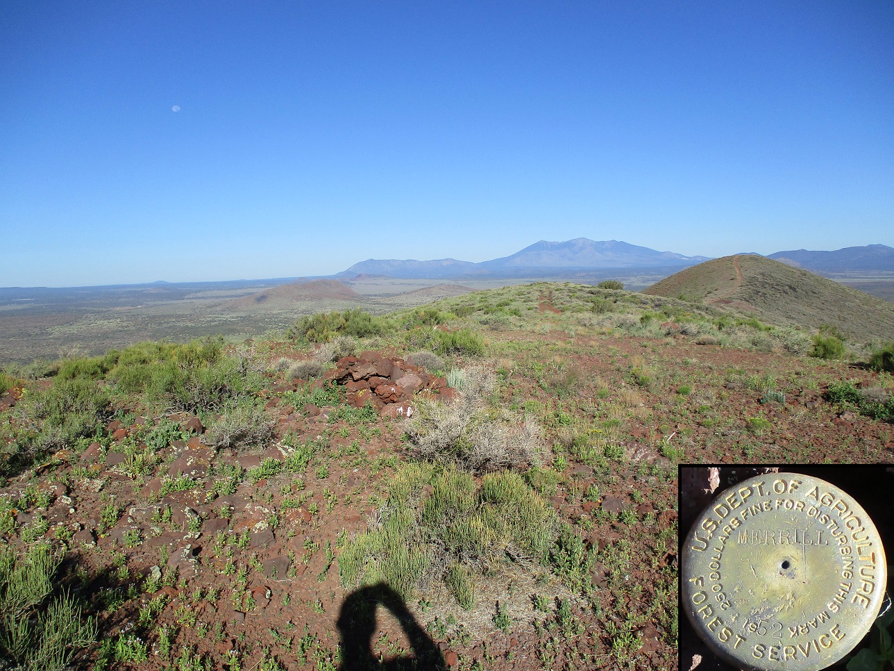
I was now on the west ridge, just a few dozen feet below the top. I had to scoot under a fence line here. This fence is along a section-line boundary, so that the next section to the east, the one containing the summit and the eastern benchmark hill, was private. If you study the map, the summit is just a hundred feet or so east of the boundary. I was soon on top, the summit itself not that exciting but with fine views. I snapped a couple images but didn't tarry. A track leads off the summit, down to a saddle losing about a hundred feet. There is a small gravel pit here. Then I hiked up the track east to the lower (by 36 feet) benchmark hill. I found the benchmark within a rock cairn. I snapped a couple more images, then headed west again up to the summit once more, then back onto State Trust land. The side trip to the benchmark covered about a half-mile each way and took twenty minutes as I was moving fairly quickly.
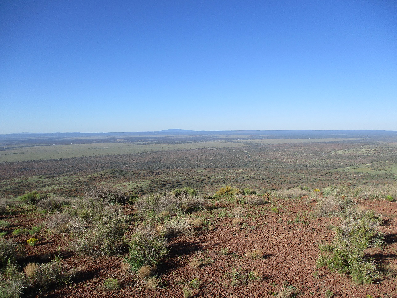
I took a break once back on the State Trust side of the fence. It had taken me about 90 minutes to get here, covering 4 miles. The sun was up and it was warming up, but still pleasant for the time being. I wanted no part of the southern slopes I had battled coming up. Instead, I walked down the west slope, which was far more pleasant. Lower down, I angled south a little more. I then had about a mile walk up and down about three ridges to get back to the forest boundary. I took another break once back on forest land.
The remaining two miles took about an hour, and it was quite warm by now, into the high 70s, keeping in mind it was still not yet 9 a.m.. I just put one foot in front of the other until I was back to my car. The last mile and a half, from Youngs Canyon back to the siding, was a slight uphill the whole way. I hadn't noticed it hiking in, but tired now, I certainly noticed it. I was back to my car at 9:15 a.m..
I had no urgent plans so I changed into more comfortable clothes and hung around the area for another hour, doing nothing. The hike had gone well and I gauge I covered 9 miles with a gross gain of over a thousand feet once the ups and downs were figured in. I was tired but not beat. It had been a good hike. Only the last little bit, in the warming conditions, slowed me.
I exited back to Winona Road, and with time to kill, drove east about ten miles on Interstate-40 to the Twin Arrows exit. On the south side is an old service station that dates from the old Route-66 days. The station itself has been abandoned for decades and is now falling down and covered in graffiti. I pulled up to it and walked its perimeter to take photos --- some of the graffiti was well done. You can see my photos by clicking here.
The newer Twin Arrows Casino is north of the interstate. I drove to it. It wasn't busy at all. I went in, cleaned up a little in their restrooms, had a breakfast and checked texts and emails, and spent an hour here altogether. The casino itself is attractive, the closest Indian casino to Flagstaff.
|


|