The Mountains of Arizona
• www.surgent.net
|
|
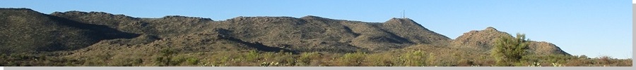
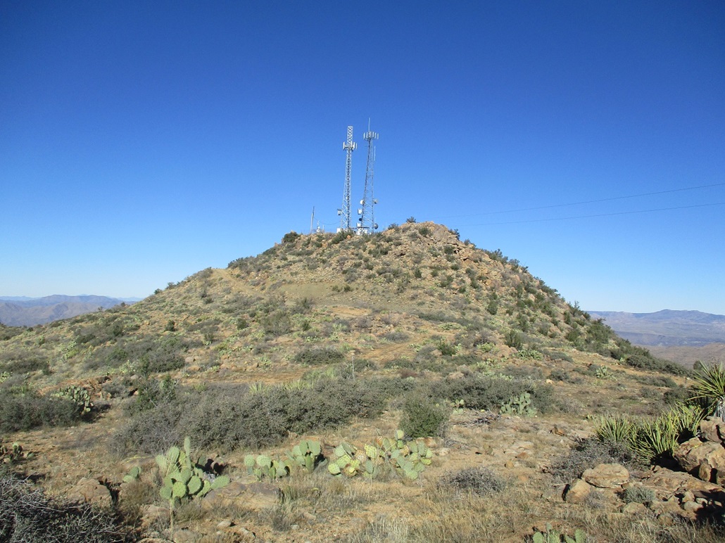
McCloud Mountain • Kingsbury Mountain The McCloud Mountains rise in an part of Arizona few people go to. They are in southern Yavapai County near the town of Hillside, along state route AZ-96. The land here is mountainous high desert, most of it privately owned as ranchland or for mining. No one gets here unless they have business out this way ... or want to enjoy the scenery on an uncrowded highway. On today's agenda was the highpoint of the McCloud Mountains, which has no name but goes by McCloud Mountain. After that, it was wide open. I would figure out what to do afterwards going by what looked accessible and interesting.
Date: December 17, 2019
• Elevation: 4,960 feet
• Prominence: 1,070 feet
• Distance: 6 miles
• Time: 2 hours 30 minutes
• Gain: 1,110 feet
• Conditions: Clear and sunny, but extremely cold
Arizona
•
Main
•
AZ P1K
•
PB
•
LoJ
•
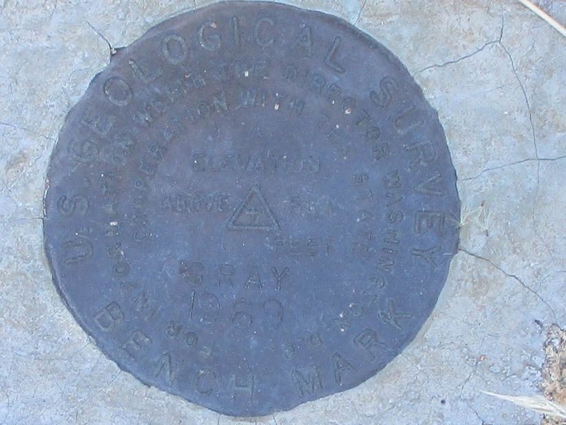
USGS BM Datasheet (Gray BM)
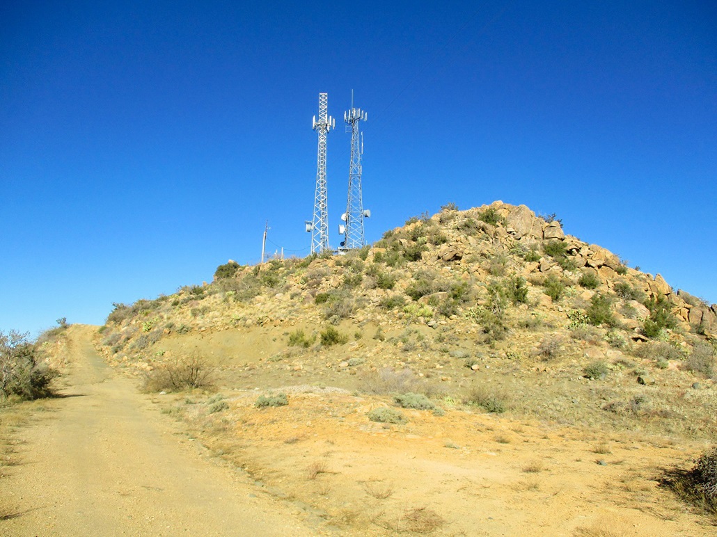
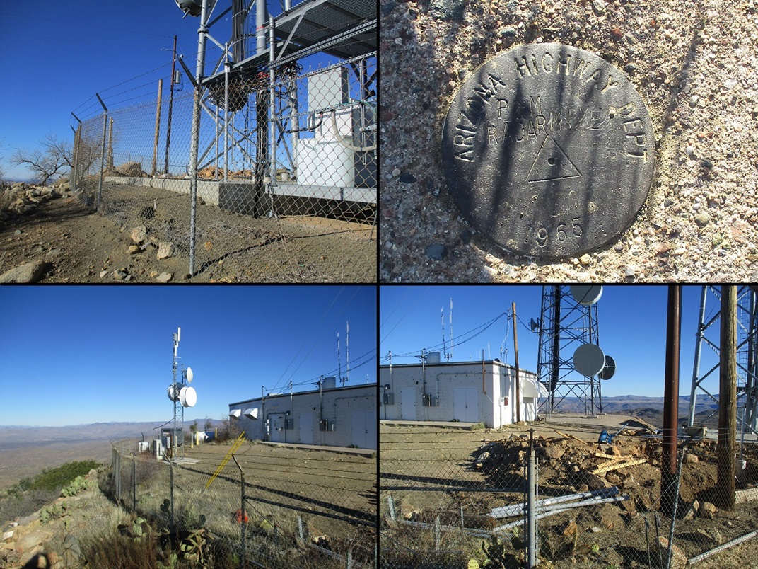
McCloud Mountain itself has communication towers on its summit and a road to the top. Hiking it is easy as a result. I looked at hiking it years ago, but the only road I knew came in from the east and passed through a ranch where they restrict passage under normal conditions. I was unaware of a bypass road that comes in from the northeast as it was not printed on the topographic maps. However, it does appear on the satellite images. In any case, I had pretty much forgotten about McCloud Mountain until recently.
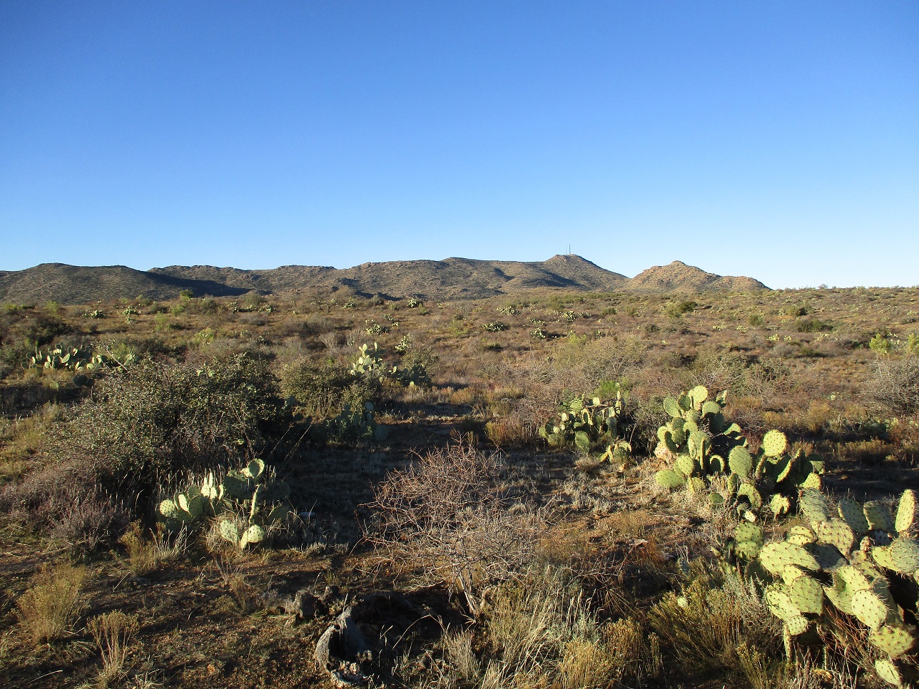
I wanted a hike but something easy, where all I had to worry about was walking. So I got up before dawn and got on the highways heading out of Phoenix. I took routes US-93 through Wickenburg, then AZ-89 through Congress, Yarnell and Peeples Valley. I then got onto Yavapai County Road 15, which passes through the tiny town of Kirkland and then after wandering through mountainous terrain, meets up with AZ-96 just north of Hillside. McCloud Mountain is plainly visible, about two miles west of the town. The drive covered about 135 miles and I had no traffic other than weekday cars closer in to Phoenix.
The sun was rising but it was very cold, well below freezing once I gained elevation. The sun was up by the time I was on the elevated plateau around Yarnell and Peeples Valley, but the outside temperature ranged from 19 to 25 degrees Fahrenheit, said my car's thing that tells temperature. The sky was clear and there was no wind. The daytime highs up here were supposed to be in the 40s. I knew it would be a cold hike so I planned accordingly.
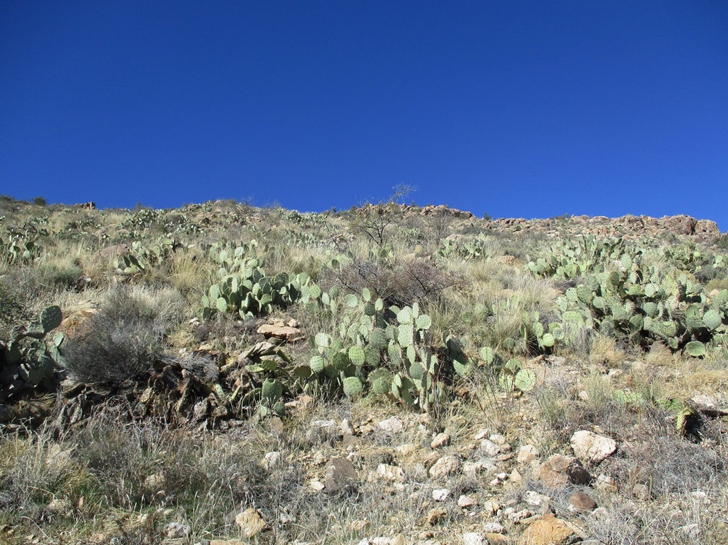
I followed AZ-96 about a mile northwest of Hillside. Just past a beefy cattle grate, there are pullouts, fences and gates on both sides of the road. I wanted the south side, so I opened the gate (a wire-stick crumple gate) and drove in, closed the gate behind me, and parked about a hundred feet up the road, just enough so I wasn't right along the highway. The fence and gate had no ranch signs, just an Arizona Game & Fish sign saying to shut it. I had my state lands permit, so I was legal.
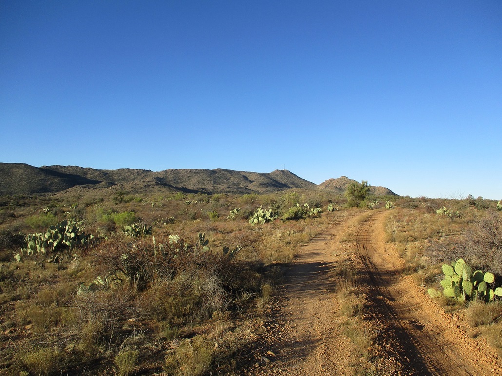
I got suited up and locked the car, and started walking about 8:20 a.m.. The sun had been up now for over an hour but was still very cold, but not uncomfortably cold. It was probably in the high 20s. I had on a lot of layers but travelled light. I did not need much in my pack. I walked the road, following it up and down as it meandered through the hilly terrain, slightly spooking some cattle along the way. They weren't too concerned. Just a couple got up to mooove aside.
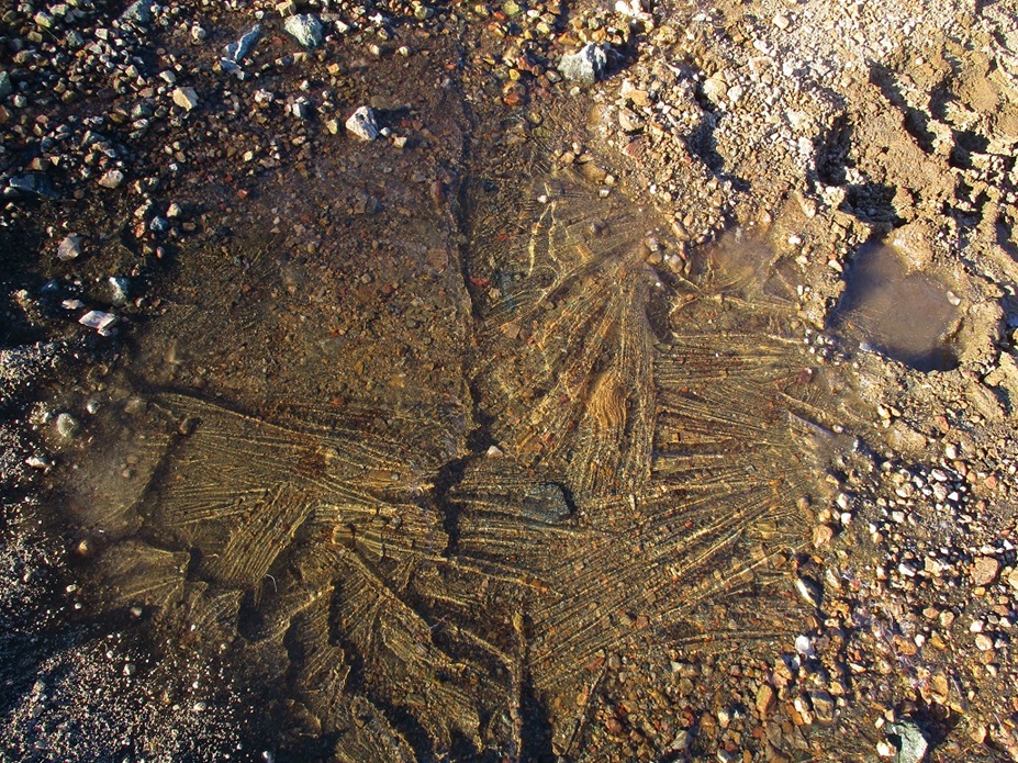
This bypass road then meets the main road, the one that comes up from the ranch to the east. I continued up the road, by now consistently more steeper as most of the elevation gain is made along this latter half. However, it was never that steep since it must be driven by vehicles. There were rivulets of water and puddles along the way, all of them frozen over. And it wasn't just a sheen of ice. I would tap them hard with my hiking pole and it was solid ice all the way down.
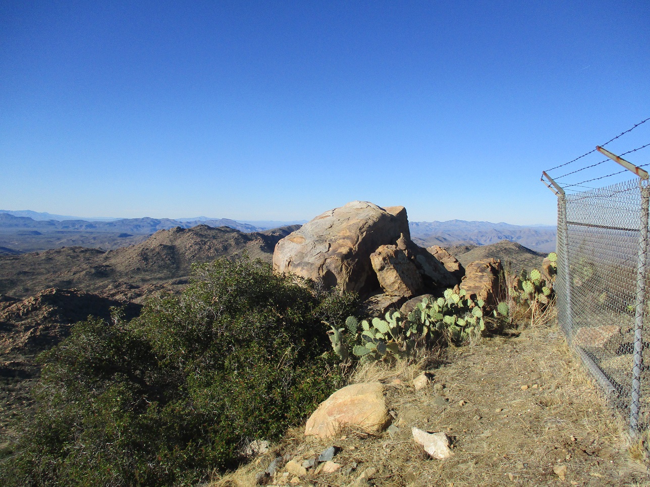
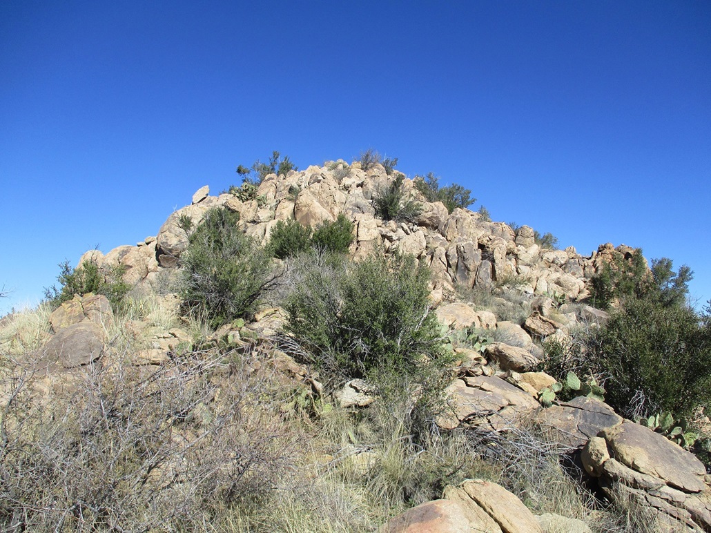
The road switchbacks up to the highest ridge, then curls around to the top. A gate and fencing blocks any access to the towers, which was fine by me. I found a path on the outside of the fence and followed it around back to the highest point, a large boulder about five feet tall outside of the fenced area. I clambered up onto this boulder and sat down, taking a break. The one-way hike had covered a little under three miles and had taken just over an hour.
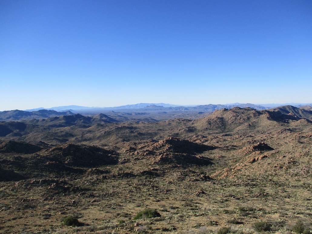
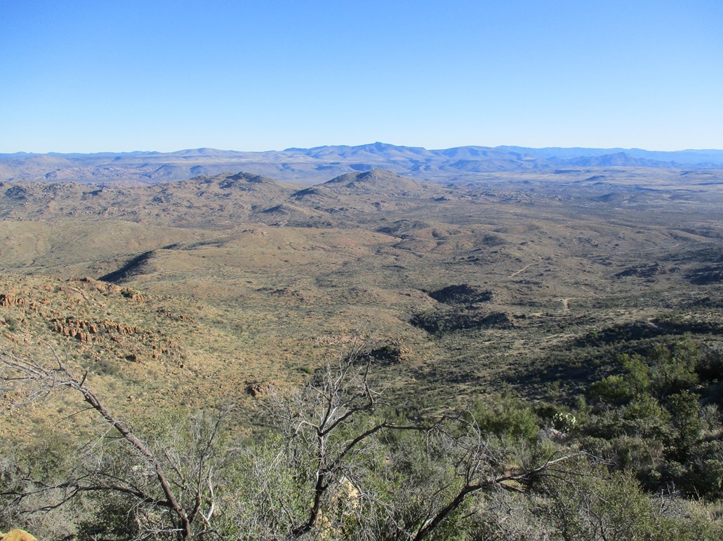
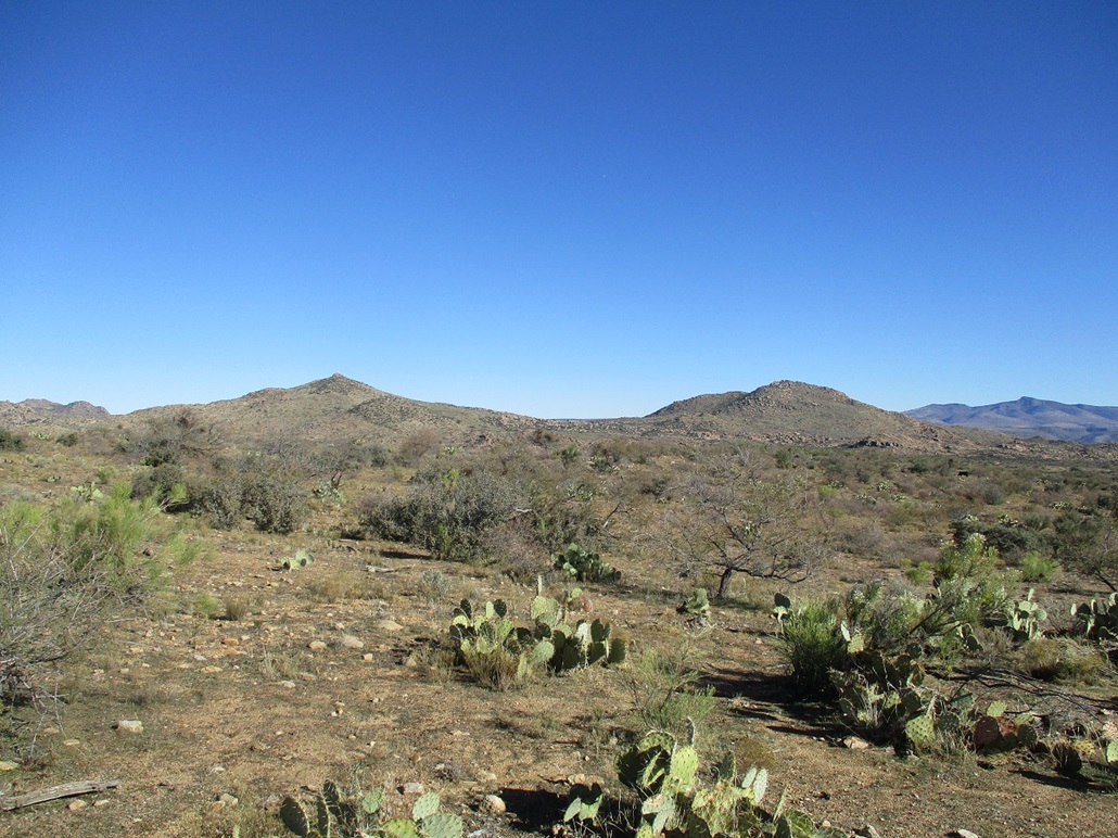
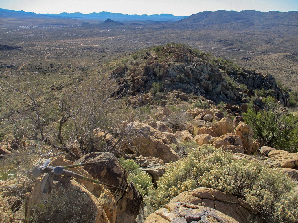
Up here, I had great views in all directions. It was warming up, into the mid 30s so that it wasn't uncomfortable when I stayed still. However, my butt got cold sitting on the rock. I admit I don't know a whole lot of ranges out this way. I knew that the Weavers were to the southeast, and to the west were peaks around Bagdad. I could not identify most of the peaks and ranges I could see. But I enjoyed the clean and crisp views.
After about ten minutes, I hiked back down to a low-point in the road, then walked a little to the south, gaining about 60 feet to top out on a soft rise. I was looking for USGS BM "Gray", but could not find it at first. I did find a cairn and an old log book dating from 1990. I was the sixth of seventh person to sign in. Andy Martin had signed in back in 2014. Then there was some guy from this past February. None of my usual hiking pals, who had been here earlier, had signed in. I found the benchmark on a rock flush to the ground. I was looking on the higher rocks at first. I spent just a few minutes here, the side trip covering a half-mile round trip.
I hiked down to my car by following the road, making good time. The road was solid most of the way, with few loose sections and few spots of slippery gravel. I was back to my car a little before 11 a.m., a two-hour and thirty-minute round-trip hike. It had gone as planned, with no unexpected challenges.
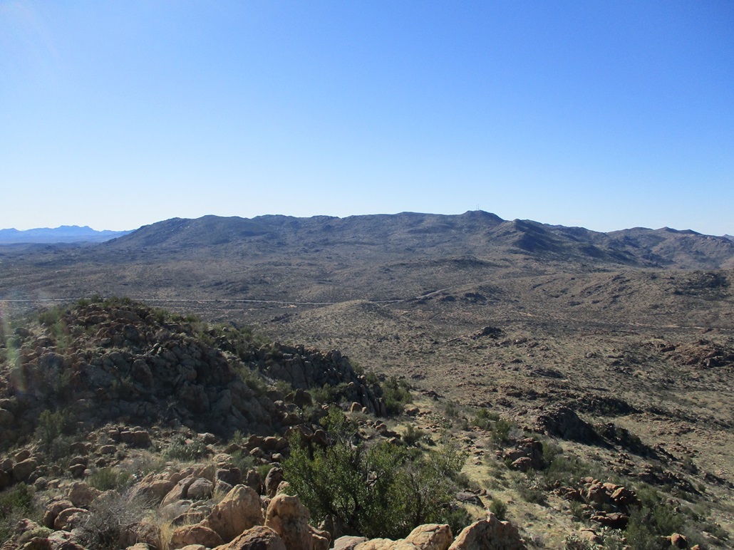
I had originally planned to hike a peak near Yarnell as a second peak for the day, but I was intrigued by two rocky summits lying northeast of AZ-96. They looked interesting and challenging and I had good views of them both as I walked down the road to my car. I was not aware of their names, but since I was here, I elected to hike one or both of them instead of the one by Yarnell.
Thus, all I had to do was exit from the gate, cross the highway, then pass through another gate and drive about a mile before parking again. I still had not decided which one I would hike. The story picks up where I hiked the mystery peak.
Elevation: 4,584 feet
• Prominence: 424 feet
• Distance: 3 miles
• Time: 1 hour and 50 minutes
• Gain: 604 feet
• Conditions: Sunny and clear, very chilly
Once back to my car, all I had to do was drive across the highway (AZ-96) to another gate on the opposite side, this one a more substantial gate made of steel pipes. It was dummy-locked with a chain and there were no restrictive signs. This was probably State Trust Land here, so I felt okay entering in beyond the gate.
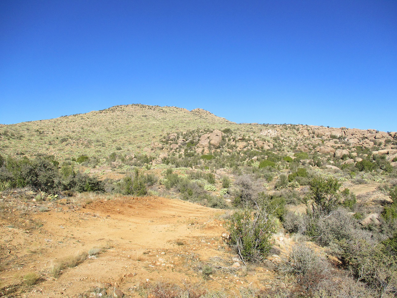
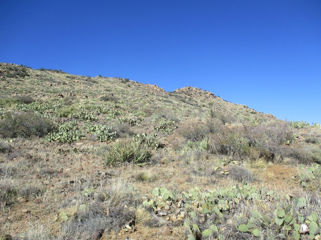
I drove a decent dirt track in about a mile until I came to a corral and windmill. There was no easy way past this, so I backtracked a little to a three-way junction, and drove another track briefly to a cleared area with a fire ring, where I parked. The two peaks rose to the north, a rocky saddle connecting them.
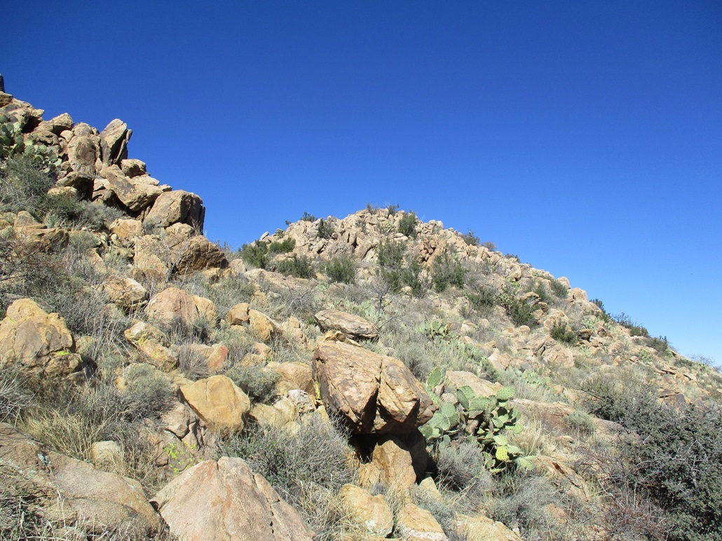
I started walking through the open desert, quickly came to a fence that I had to scoot under, and continued until I had gained a small rise, where I could see things better. I could see the road up a ways, so I aimed for it and was soon on it. The road leads into the area between the two peaks. The rocks here are plentiful, forming walls and small clifs about 30 feet high in places.
I had not yet decided which peak I would hike, or in what order if I hiked both. I wanted to study them some more, so I kept to the road, which bends right, then gains up a slope through the rocks, putting me on the saddle itself, still covered over in massive rocks everywhere. It was actually quite pretty.
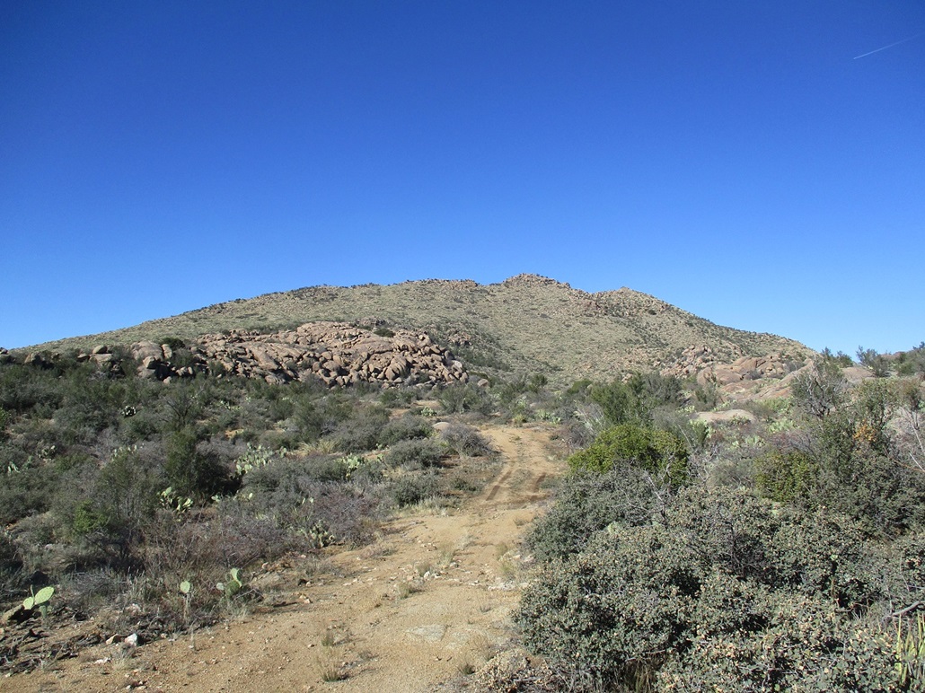
I chose to hike "this" peak (the one you're reading about) first. I could see up ahead a good-looking slope that seemed to funnel right up to the rocky summit. I left the road at some point and hiked through a jumble of rocks, cactus, cat-claw and various brush. In places, it was man-high woody plants, the kind it would be impossible to barge through. Whenever it seemed all hope was lost, I found excellent paths that perfectly threaded the gauntlet of plants and rocks. These paths were put in by cows over the years, and I applaud their trail-building skills.
I was able to work my way through the heavier brush and cactus with little trouble, and as the slope increased, the going became easier, the grabbier brush lessening and leaving just prickly-pear cactus and low grass. The hillside was rocky and easy to scale. I gained about 500 feet and aimed toward the saddle on the ridgeline, gaining it fairly soon. I had been hiking about 45 minutes.
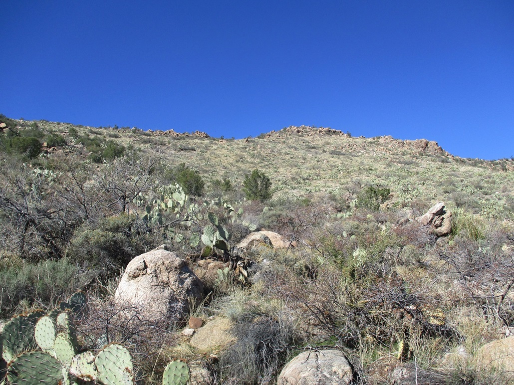
Once at this small saddle, I studied a way up through the jumble of summit rocks. There seemed to be many options. I picked one that worked well, but there was brush in a lot of the crevices and voids. I had to maneuver past the brush. The scampering was just class 2, nothing difficult, but awkward in places. I was on top quickly.
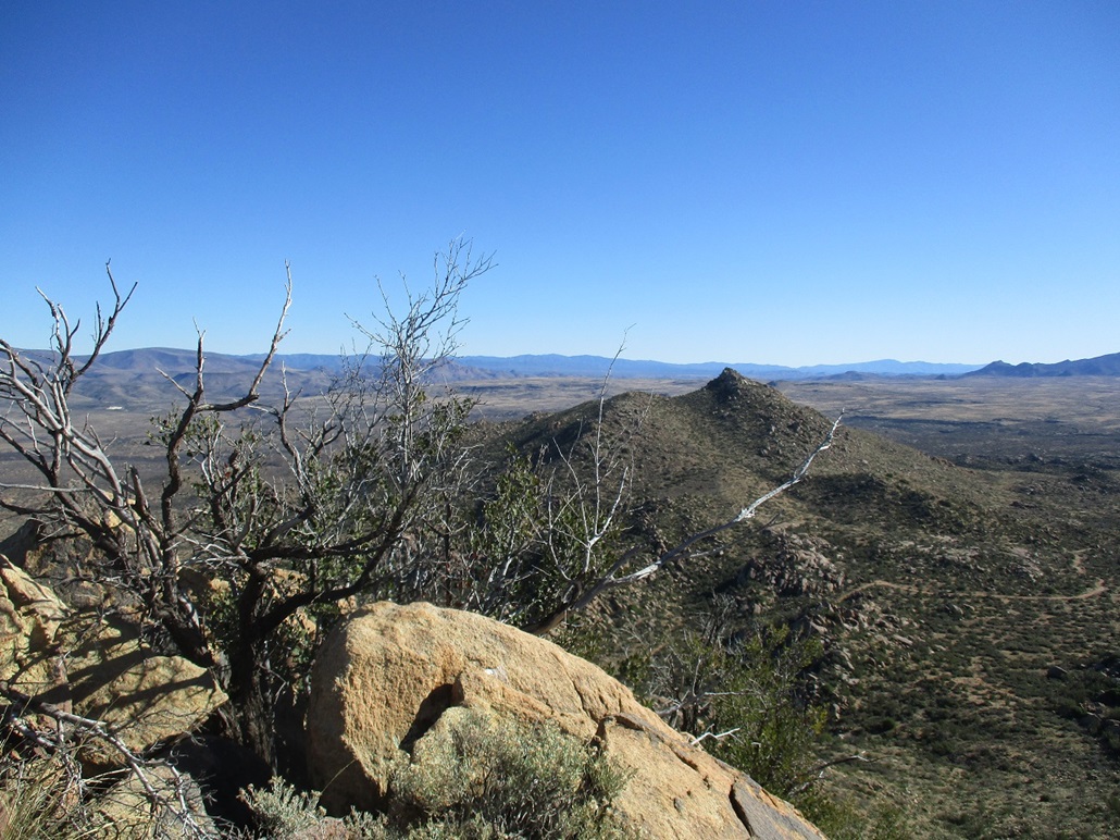
I sat on a rock near the summit, and found the register. It was placed here by Barb Lilley in 2015, but no one had signed in since then. I looked around at the surrounding vistas, identifying some obvious peaks (McCloud, Mount Martin, the Weaver Range), and a lot of peaks I had no idea of their names. I also learned this peak is called Kingsbury Mountain. The one across the way that I had also considered hiking, is called Sadies Peak.
I descended off the rockpile back to the saddle, and could see my car down below and a barrier-free slope almost all the way to it. Thus, I did not repeat my ascent route, but instead beelined off the saddle back to my car. I generally kept to a SSE bearing, angling across the slopes and going down whenever I could. The slopes were full of prickly-pear, but not much else, and it was easy to work downslope without dealing with brush and dead ends.
This worked very well, and shaved off a mile compared to the ascent. I would suggest to anyone wanting to climb this to take this route. Just aim uphill and angle right past the first apparent highpoint, where eventually the real highest point becomes visible.
Now on the desert flats, I followed open paths and found myself at the corral again. I was able to walk through it since all the gates were open, but it had a lot of tight turns and I probably would not have bothered in my vehicle. In any case, the road was washed out on the far side of the corral. My ascent route covered just two miles, while the descent just one mile. I was back to my car a little before 1 p.m., a total time gone of one hour, fifty minutes.
I decided not to hike Sadies Peak. I was happy with my haul today and pleased that this hike had gone well. I had only decided to hike it descending from McCloud and had no information on it whatsoever. My map had cut off below the peaks so I had nothing to go on other than my common sense.
For the drive home, I back-tracked through Kirkland to AZ-89, then through Yarnell and down the steep grade into Congress and Wickenburg. Here, I followed Vulture Mine Road south through the vast open desert west of the White Tanks, catching Interstate-10 in Tonopah, then on home.
I give this peak high praise. It goes fast and has enough things to keep it interesting. A natural pair would be this and Sadies Peak. The summit of Sadies Peak is a rocky crown too, and it looked possibly more challenging, but I could not see it from all sides. I was happy with one of the two.
|


|