
The Mountains of Arizona
• www.surgent.net
|
| Maverick Butte |
• Verde River Valley • Tonto National Forest • Maricopa County |
|
Date: May 22, 2019
• Elevation: 4,870 feet
• Prominence: 450 feet
• Distance: 7 miles
• Time: 4 hours
• Gain: 1,960 feet (gross)
• Conditions: Cool and blustery with fast-moving clouds
Arizona
•
Main
•
PB
•
LoJ
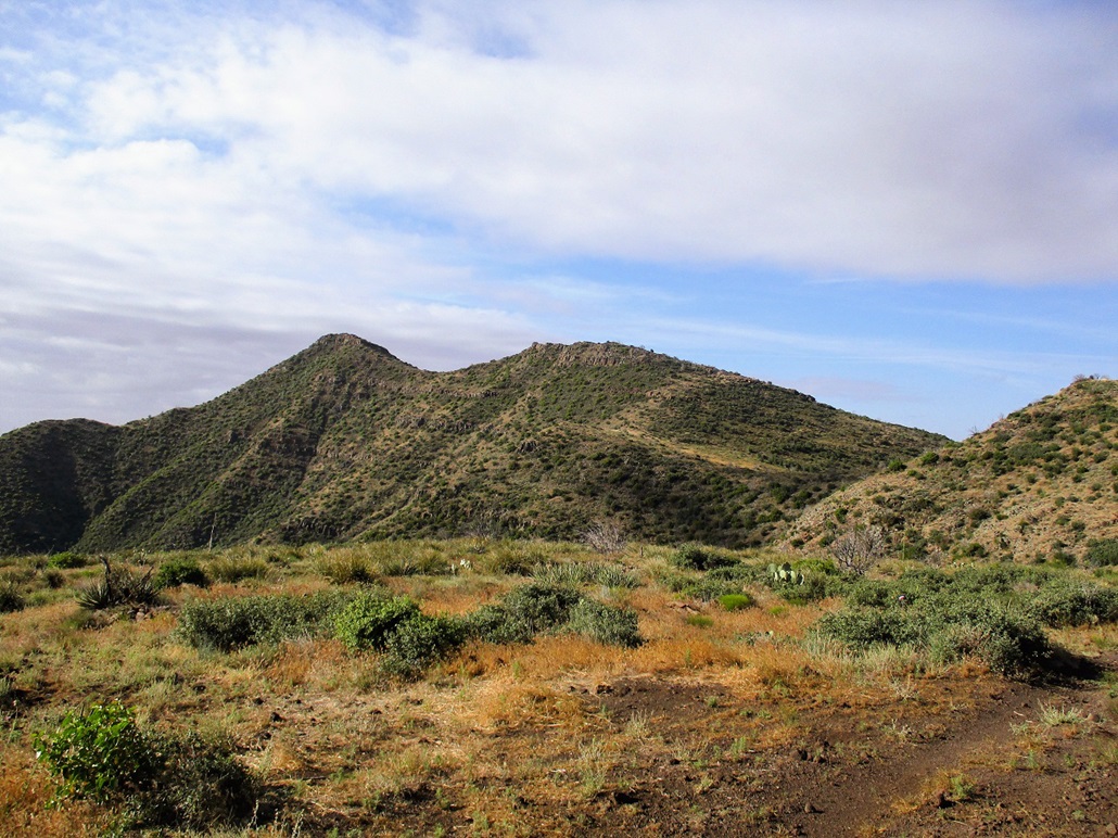
Maverick Butte is one of about a half-dozen peaks that lie atop a long ridge separating the Verde River valley to the east from the highlands lying north of Carefree and Cave Creek. The most notable peak in this small unnamed range is Humboldt Mountain, which has a FAA radome atop its summit. Maverick Butte is two peaks to the south of Humboldt, and one north of Kentuck Mountain.
I was here because (a) I had the day off and (b) the weather is bizarrely cool for this time of year. Normally by late May, the highs are in the low 100s and the lows in the 70s. It's usually too warm to be hiking in this area, not to mention the critters that populate the hillsides and effectively lie hidden in the grasses. But the past few days have been cold and blustery, and today was no different. Weather forecasts said the high would be in the low 70s, with clouds.
I've been bingeing on these peaks up in this area now for the past few months. I was here just a week ago climbing Indian Butte and this would be my fifth trip here since February. It's not too far from where we live, and very few people come here to hike, and those that do generally keep to the area around Seven Springs.
So I got up real early and was on the road a little after 5 a.m., going north up Scottsdale Road to Carefree, then up Cave Creek Road, then on Tonto National Forest Road 24. The pavement ends, but a good all-weather road continues. I went slow and arrived to the trailhead, a wire-gate along FR-1099 a little over 9 miles of driving from where FR-24 starts back at the Bartlett Lake Road junction. When I rolled in, the outside temperature was 47 degrees, and there were low clouds, moving quickly being pushed by an upper-level breeze. It was calm where I was, but now and then a breeze would pick up. I started hiking at 6:40 a.m., elevation 3,630 feet.
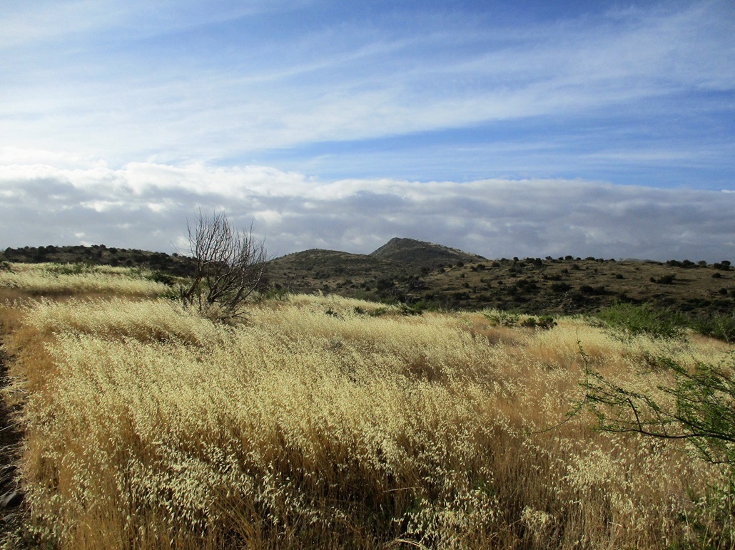
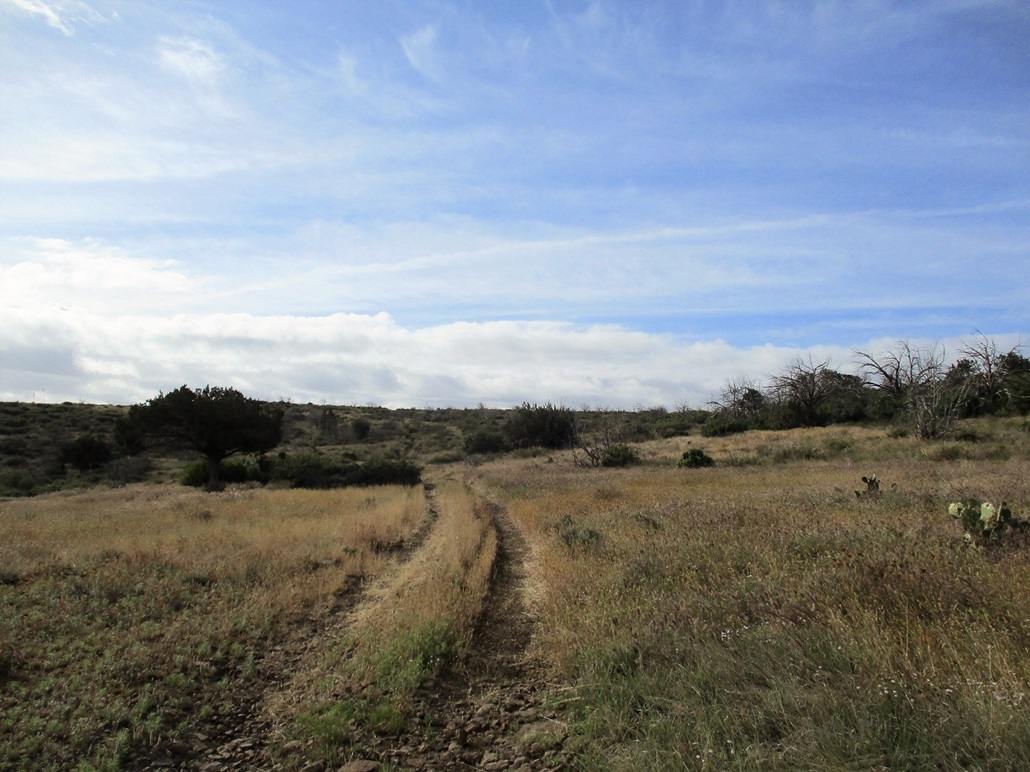
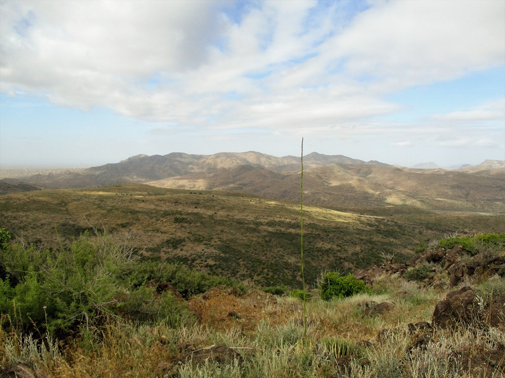
I followed FR-1099 east, gaining about 800 feet in two miles to get me onto Deer Flat. The road is covered in moderate-sized boulders but is not steep. A good 4-wheel drive vehicle could handle it. Once the road started to level as it neared Deer Flat, I could see Maverick Butte peeking above the ridge to my right (south).
The track bends south and makes an end-run around a small hill and for a moment, lies precariously above thousand-foot slopes dropping quickly to the east. I was on the main range crest and up here, the breeze could be heavy at times. The views were great, the sun popping out now and then so that I could take some photos. The track then drops about 120 feet and peters out in the knee-high foxtail grass near an earthen tank. I had hiked about 2.5 miles in an hour.
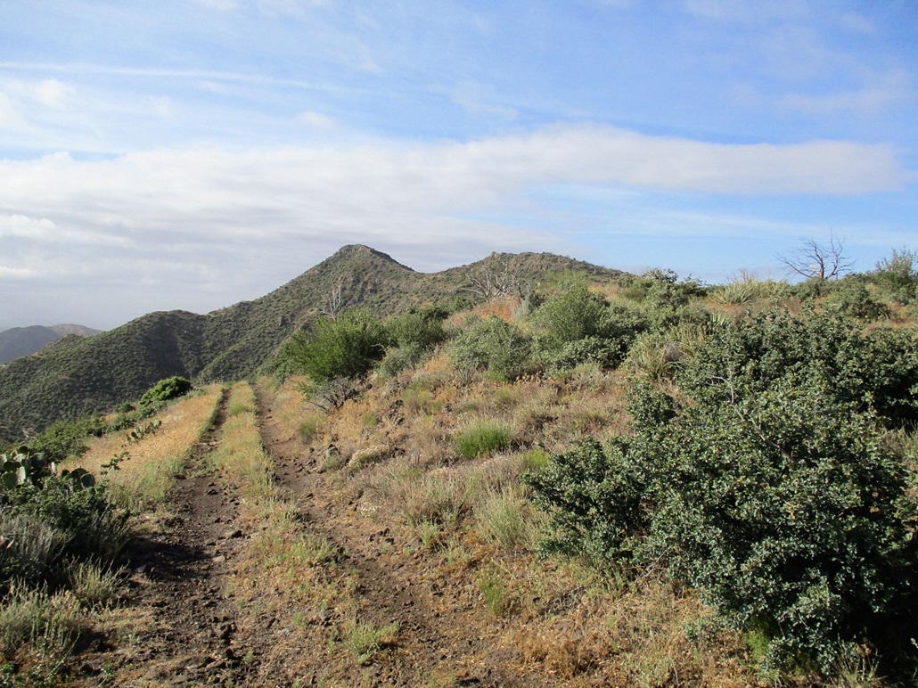
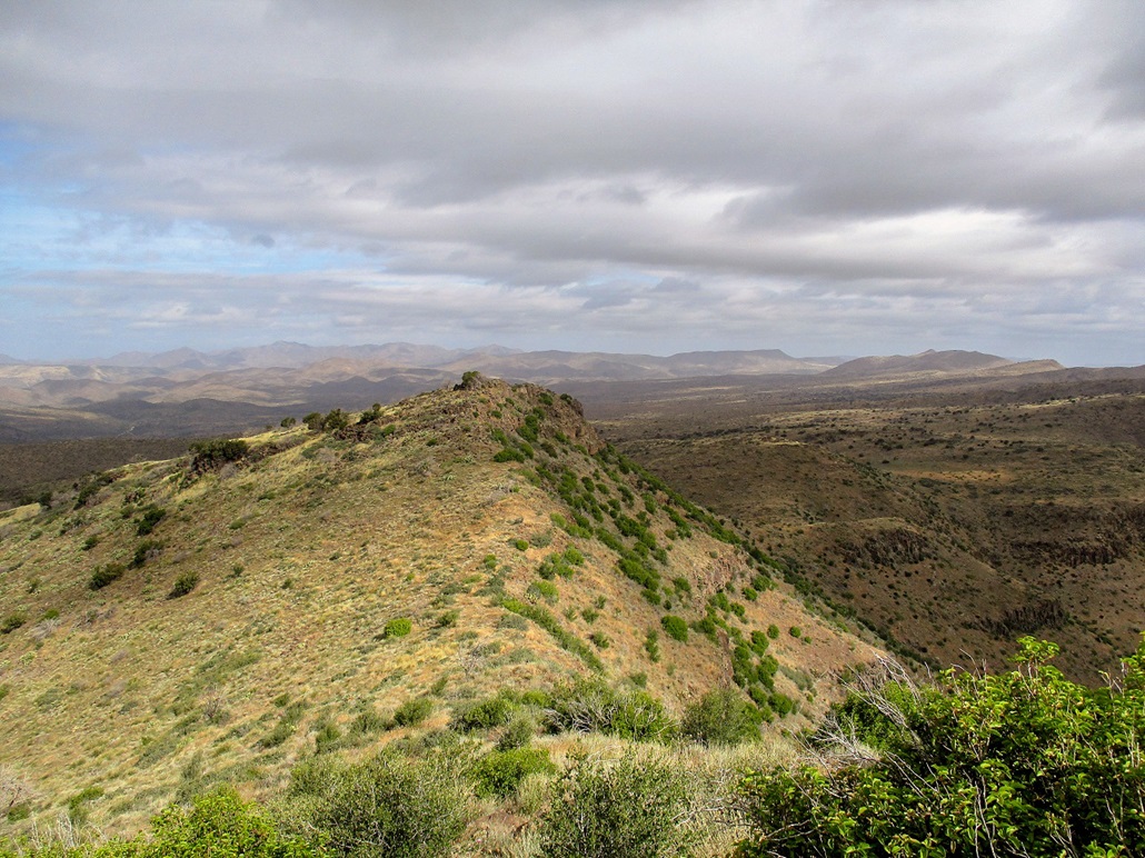
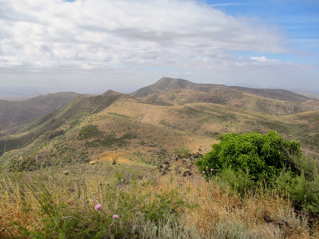
From here to the summit was off-trail, up and down two false summits along the way. I started hiking through the tall grass, then met the base of the first hill (spot elevation 4,566 feet), where the grass lessened. I could see my feet better on this hill. I gained about 140 feet, not quite tagging its top, then dropped about 120 feet. I was now below the north summit (elevation 4,760 feet) of Maverick Butte.
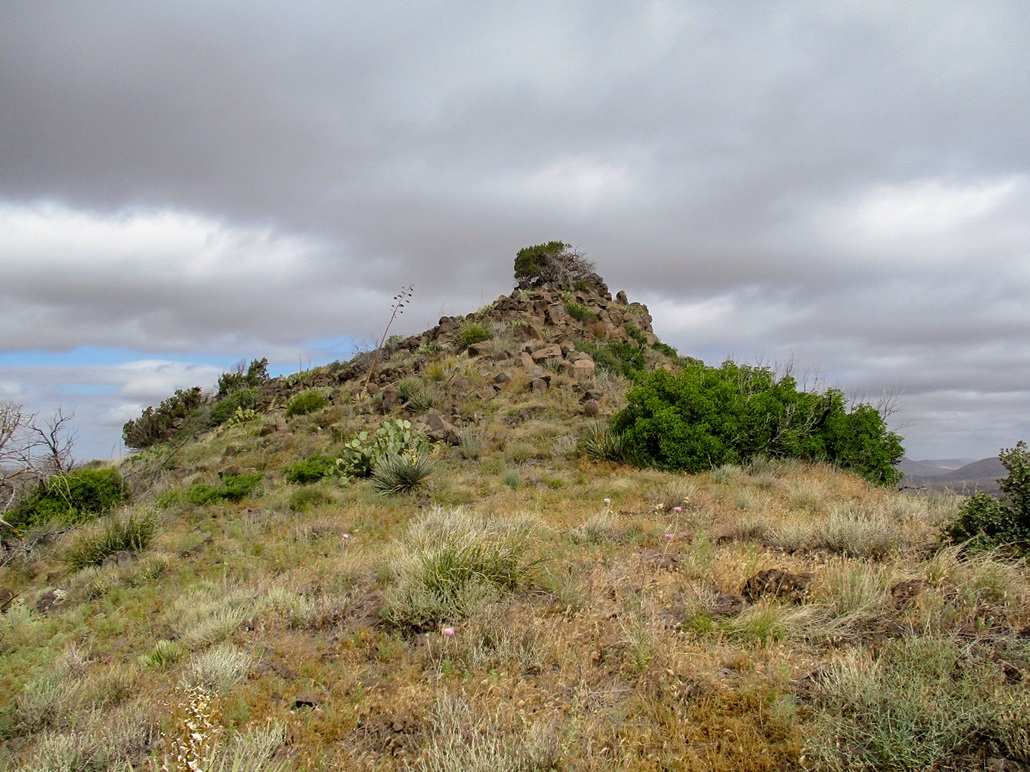
I had to gain about 350 feet, battling short segments of mountain oak and cactus. I was soon at the top of this peaklet, a large tree growing amid the rock outcrop at its summit. Across the way was one more saddle then the real top.
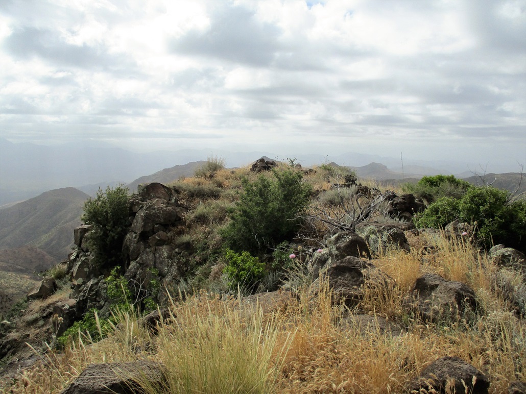
I dropped 100 feet to the saddle, then started up yet again, another 200-foot climb up grass, brush and scattered cactus. There was a cliff band up ahead, but when I got close to it, I could see an obvious cleft in it where I could get up just one 4-foot step and a little easy scramble. The summit was just a couple dozen feet higher, and I was on top at 8:40 a.m., a two-hour ascent. It was quite chilly up here in the consistent breeze. The clouds above me moved quickly, south to north. The sun would come out for a minute here and there. That's when I would snap as many images as possible.
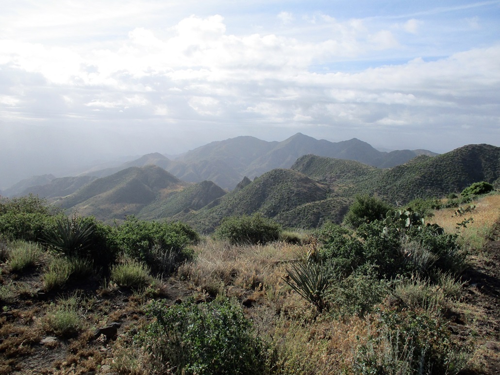
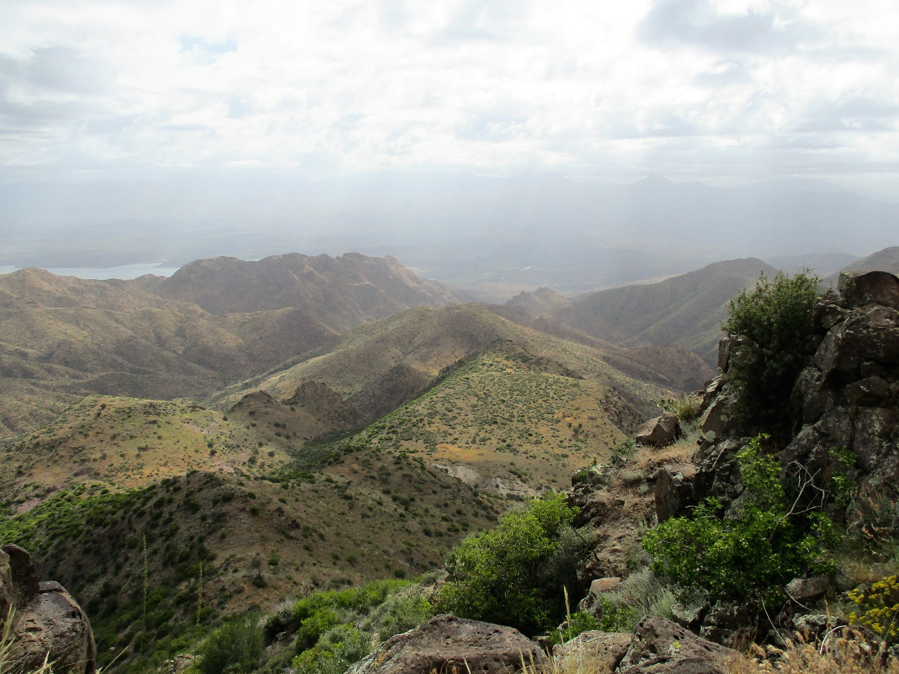
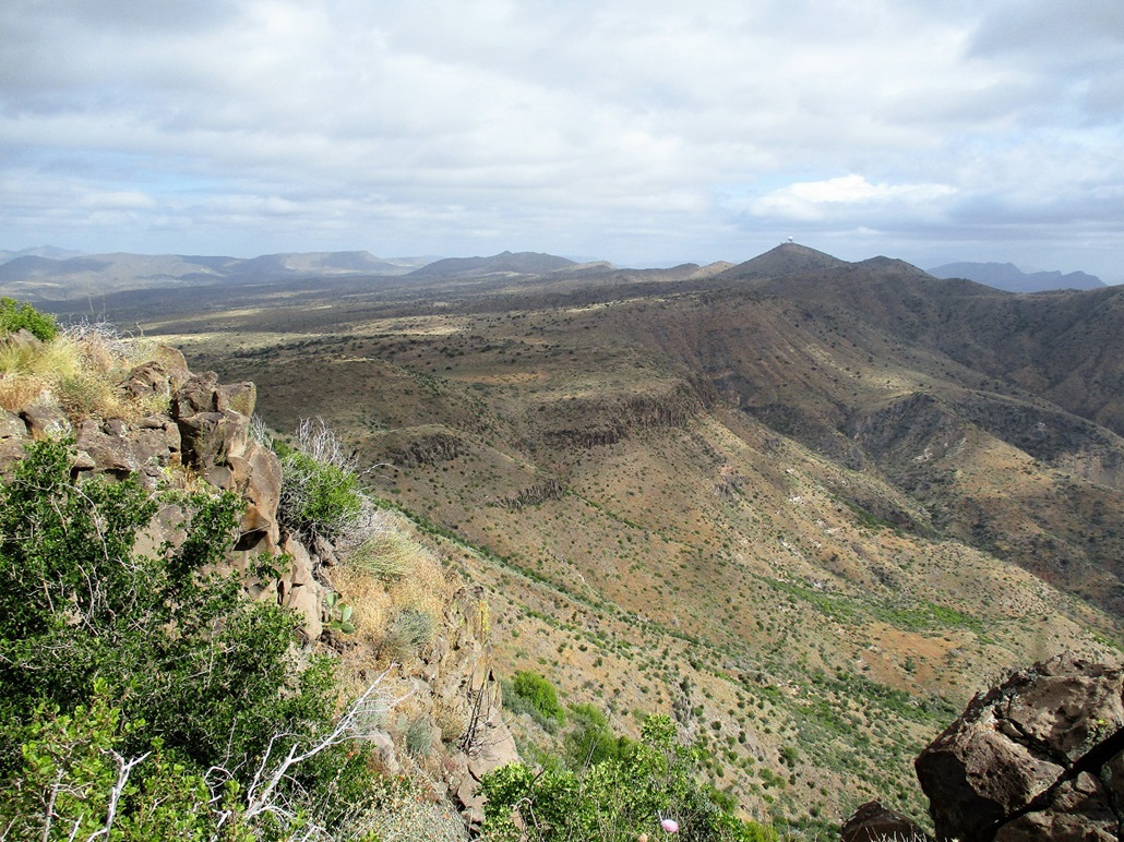
Despite the clouds, the views were fantastic. Looking south or north, I could see the steep slopes and cliff bands of this range, this being essentially the west walls of the Verde River canyon. Apparently there are a lot of Hohokam ruins down below but I had no intention of exploring. I spent about 20 minutes up top, relaxing and having snacks and liquids. The top is marked by a cairn but I could not find a register.
For the hike down, I retraced my route exactly. It appears I could have simply followed a ridge due west with no trouble, but it would be all cross-country and even in this cool weather, a snake encounter would still be likely. Once back on the old track, I walked at a quick pace back to my car, descending in 90 minutes. I talked with a guy out target shooting. He was out here for the same reason --- taking advantage of this freak cold spell. We both know full well within two weeks we'll be in the 110s. I was back to my car at 10:40 a.m., a 4-hour hike taking breaks into account. Although the summit is just about 1,240 feet higher than where I started, I gained nearly 2,000 feet when all the ups and downs were accounted for.
I changed into more comfortable clothes and started a slow drive back to civilization. I stopped for snacks but otherwise just drove back home, arriving about noon. The hike had gone well, but this particular peak likely sees few visitors. For one thing, it is not visible from FR-24 except briefly, so most people may not know anything is there. I actually had planned to hike Kentuck Mountain but figured following a track would be wiser, given the chance for snakes. I never saw any, and that was fine with me. Nevertheless, I enjoyed the hike and really liked the views looking east down the steep escarpments.
|


|