Lousley Hill tops a small ridge of hills about five miles east of the main McDowell Mountain range. The hills lie on the long downward sloping plain fronting the Verde River. They are contained within the McDowell Mountains Regional Park, with access of of Rio Verde Road, north of Fountain Hills. There is a $7 day-use fee to enter the area.
This morning, I had some business to attend to in town, but I was done with that by noon. The day was surprisingly cool for mid-August, highs expected to reach the mid 90s. My plan was to hike something local in Phoenix. Thus begat a nearly 80-mile drive that would eventually bring me to the Lousley Hills.
At noon, the temperature was just 87 degrees. For mid-August in Phoenix, that's about 20 degrees below normal. There were big puffy clouds in the sky. Apparently, another "heat dome" was building over the northern Rockies and the Central Plains, which blocked in the low-pressure cells over Arizona and New Mexico.
My first goal was Peak 2112, a little east of Piestewa Peak. I drove up 36th Street, going by what I saw on the satellite images, but parking is strictly forbidden here, and not wanting to add extra mileage to my hike, abandoned this attempt entirely. I'll try it later when it's cooler.
So I got onto the AZ-51 freeway, then westbound Loop-101, exiting at 7th Street. I wanted to hike Peak 2111, in the south end of the Union Hills. It looked promising, there being an old road to its top. However, the homes surrounding the peak bar access to any trails beyond them, and I could not find a way past them. So far, I was 0 for 2.
Next, I drove east on Deer Valley Road to Cave Creek Road, going northbound all the way to Cave Creek the town. I wanted to check out Surrey Hill, west of big Black Mountain. It looked short, but there was no evidence of a trail. I wanted no bushwhacking. Even though the temperatures were tolerable for me for a short hike, they're also prime snake-weather temperatures too.
By now, I'd killed about 90 minutes, and was thinking there may be no hike, but instead to enjoy the drive. It was not a bad day at all, so I really could not complain. I drove south now on Scottsdale Road, then hung a left (east) on Dynamite Road, then north on Alma School Road to the Brown's Ranch Trailhead, near Brown's Ranch Mountain. Nearby Cone Mountain looked attractive, but it is also brushy and probably full of serpents. I sat for a spell in my car and vegged.
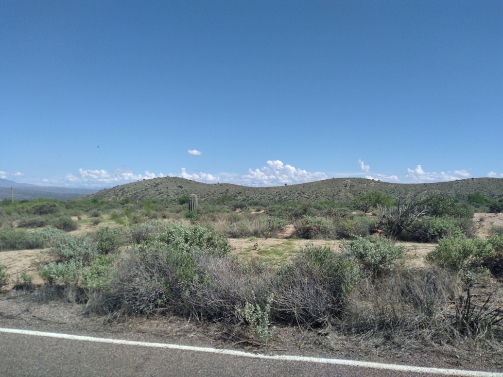
I continued eastbound on Dynamite Road to the little town of Rio Verde, then south through town and onto Rio Verde Road, south toward Fountain Hills. Suddenly, I remembered the Lousley Hills and figured this would be a good time to hike them. By now, the temperatures were hovering around 92-94 degrees, going by my car's temperature gauge.
I entered into the park, and drove a few miles to the visitor's center. They closed at 2 p.m.; it was now 2:20 p.m., but I could hear talking inside. Soon, two people came out and we had a friendly discussion. I was still not entirely sure if I would do the hike. It was getting a little hot by now, about my upper limit for hiking temperatures. They said it's all trail and not too long. I decided I would drive to the trailhead and make a decision then.
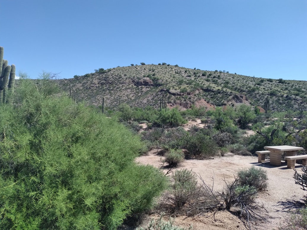
The trailhead was another couple miles up the road, well-signed and easy to find. I pulled into a spot, not surprisingly the only one here. The hill was right there in front of me, and the trail looked good. So yes, I decided to hike it.
The trail is a 1.1-mile loop, going by the sign at the trailhead. It drops into a drainage, then up the other side, where the trail branches. I went right. I moved slowly, paying attention to my breathing and comfort, plus also keeping an eye out for snakes. The trail was wide and solid but at times, brush and grass grew alongside it. I saw about two dozen little lizards scurrying about.
The trail makes a few switchbacks so that the gradient is lenient, and there were a couple palo verde trees tall enough to provide shade. It was warm in the sun, tolerable in the shade. The one-way hike covered a half mile and I was on top in about 20 minutes.
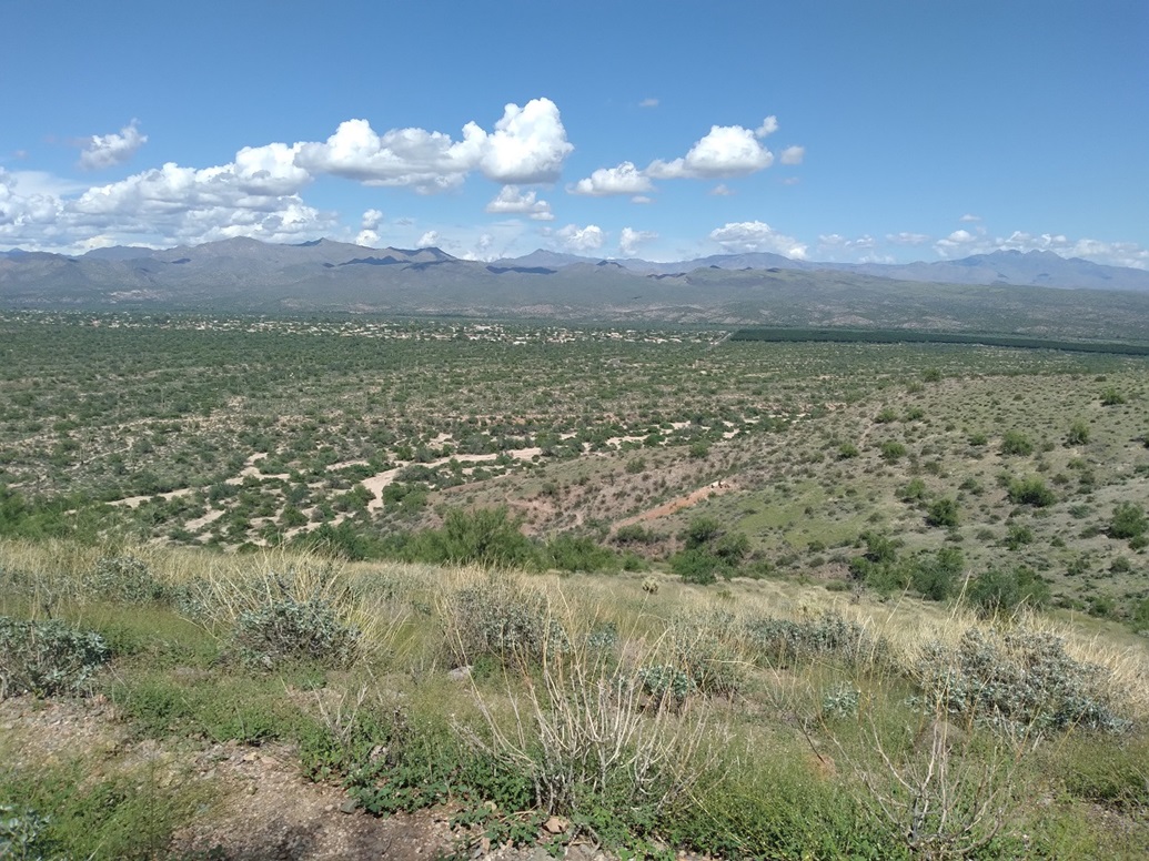
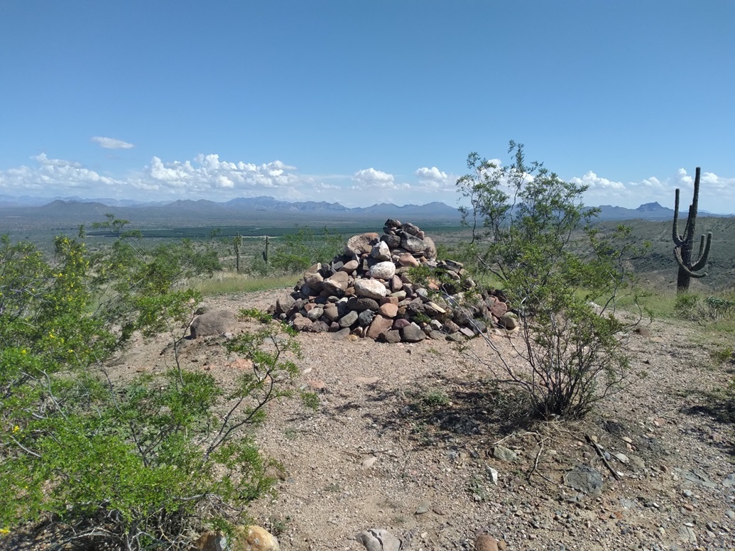
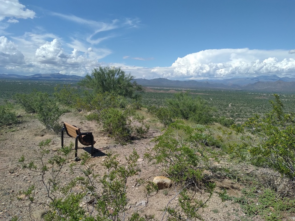
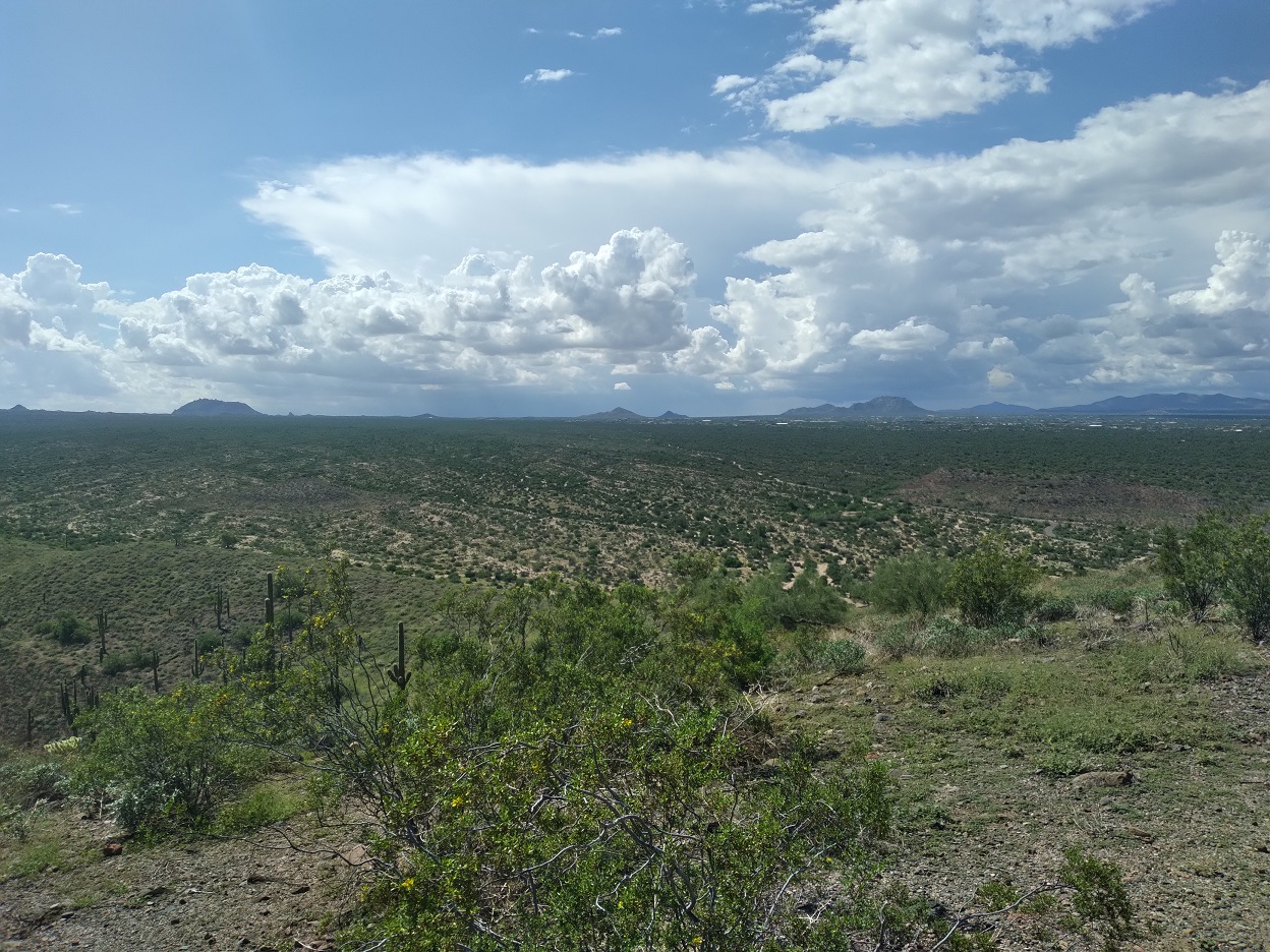
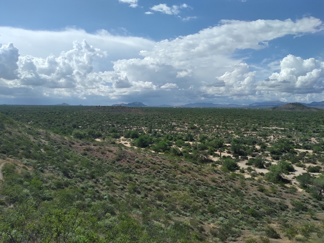
The summit features a large cairn about 4 feet tall and 6 feet at its base, plus a memorial bench. The views up here were very good, a high perch to view the Verde River and the mountains beyond it, plus the McDowells to the west, although by now I had sun looking that way. The view north was of the peaks that way, plus big cloud banks and possible thunderstorms developing.
I hiked down and was back to my car in about 15 more minutes. I was burning up by now. I changed out of my boots, then started the car and did something I rarely do: I turned on the car's air conditioning. Oh man it felt good. I have gotten out of the habit of using the AC over the years, and normally I do fine, but today, it really helped.
I left the park and paid my day fee as I exited, at a small kiosk near the entrance. From here I drove into Fountain Hills, then to the Beeline and then home. It was about 4 p.m. by now, a short hike to cap a long and meandering drive.
Lousley Hill was actually quite nice and the area itself is attractive, with places to camp. I came away more impressed than I was expecting and would recommend this short hike as something to do if in the area.