The Mountains of Arizona
• www.surgent.net
|
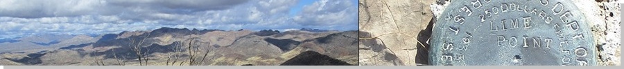
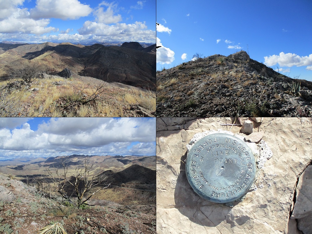
| Lime Point |
• Superstition Mountains • Arizona State Trust Lands • Pinal County |
|
Date: January 1, 2022
• Elevation: 4,203 feet
• Prominence: 443 feet
• Distance: 1 mile
• Time: 1 hour
• Gain: 480 feet
• Conditions: Cold and very windy, blue skies and puffy clouds
Arizona
•
Main
•
PB
•
LoJ
Today being the first day of 2022, I wanted to start the year off on a high note, literally. A few days earlier, Matthias had hiked a pair of peaks south of Superior, Lime Point and Peak 4053, the highpoint of the White Canyon Wilderness. It looked like a fun pair of peaks, so I set out to hike them myself.
Yesterday had been rainy and gray, but today was sunny with blue skies, and cold, temperatures in the low 40s even at 10 a.m.. I drove to Superior, then south on AZ-177 a few miles to the Lime Point area. I parked at the apex of the highway where it passes through a hefty roadcut, the walls about 40 feet high. The gradient on both sides of the pass, in both directions, is 10%, perhaps the steepest grade on any numbered state route.
I parked in a pull out on the east side of the highway (i.e. from the northbound lanes). I was dressed warmly, but even so, I was knocked back by the fierce wind and cold temperatures. Here, the temperatures were in the high 30s and the wind gusting about 40 miles per hour, especially as it funnels up and through the pass.
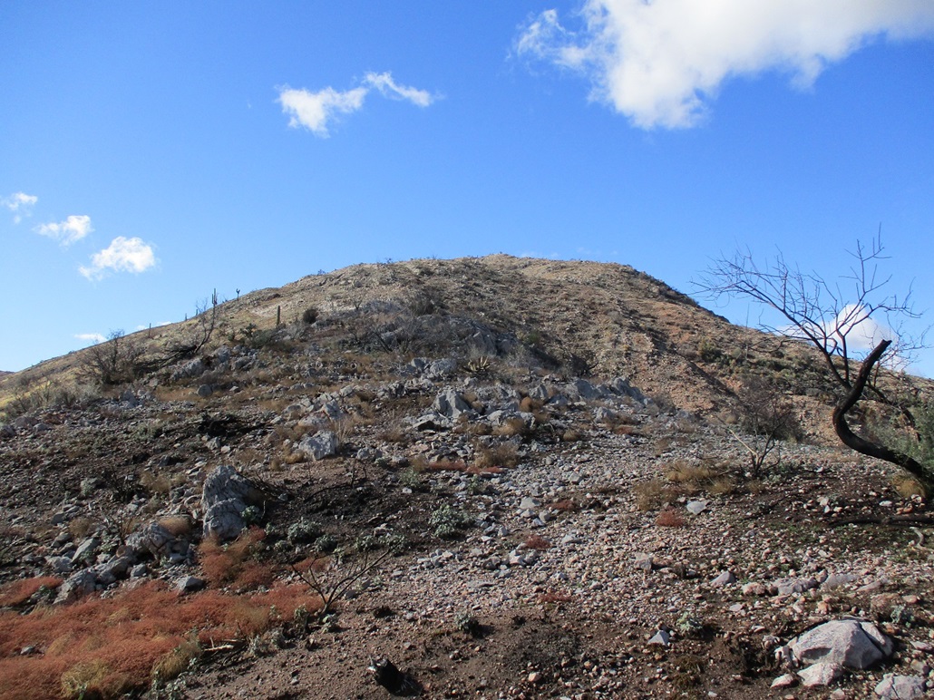
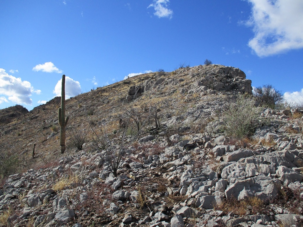
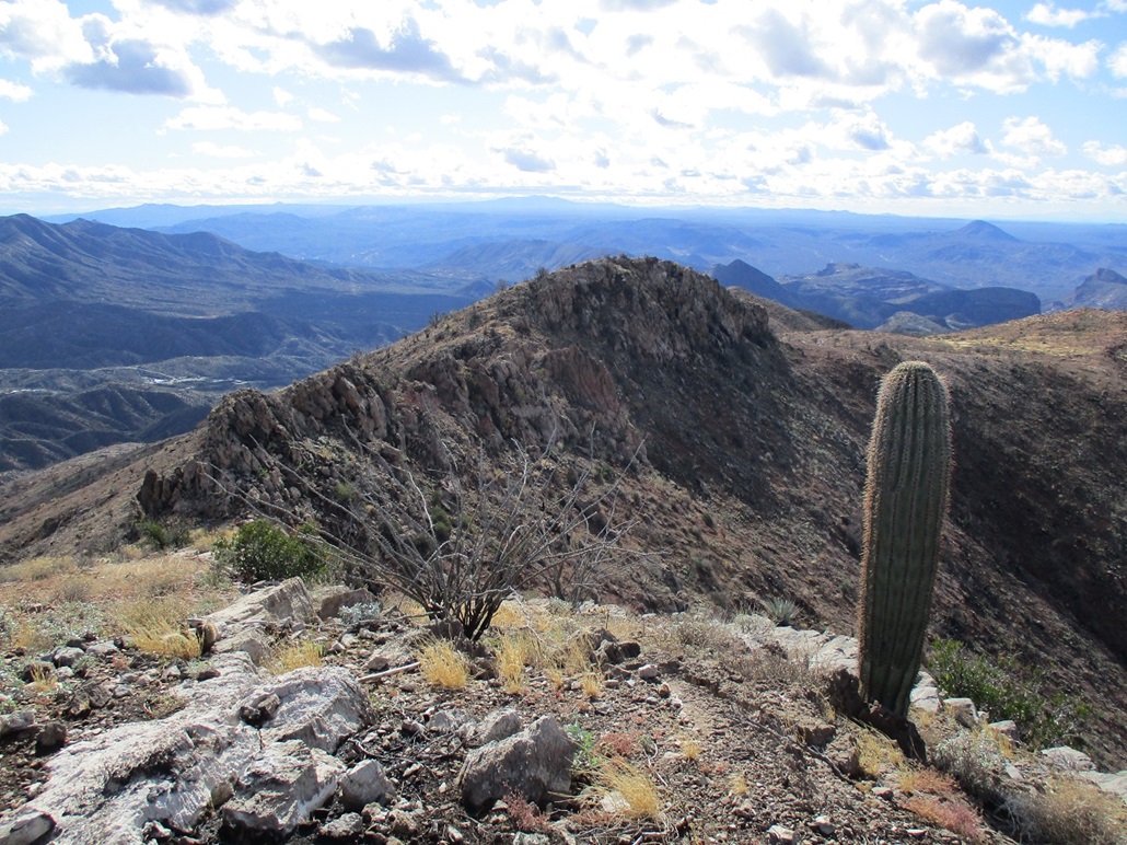
I walked across the road, then up a steep and loose slope of shale-like rock fragments. I passed a gas line, then started uphill, generally moving climber's left as I ascended to take advantage of the lay of the land, the slopes not being so severe as I moved left. The ground was bare, evidence of a recent fire. Even the big saguaro were burned, standing but dead.
As soon as I got onto the ridge, the wind whammed into me. At times it would push me around. It was all I could do to stay upright. Thus, I generally kept to the lee side and out of the heavy wind. The rocks here are limestone, which break off into all sorts of blobby shapes, and are often very rough to the touch. When they didn't roll from under me, they offered solid footing.
The hike up was short. The route basically hugs the ridge and passes by a couple rock outcrops and north-facing cliffs. And then I was on top.
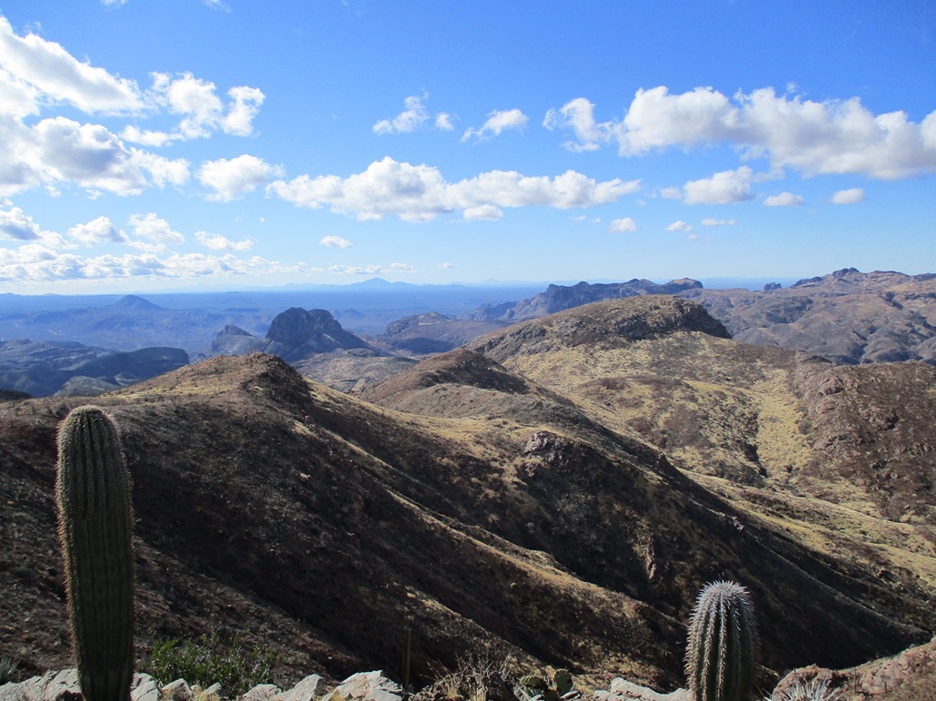
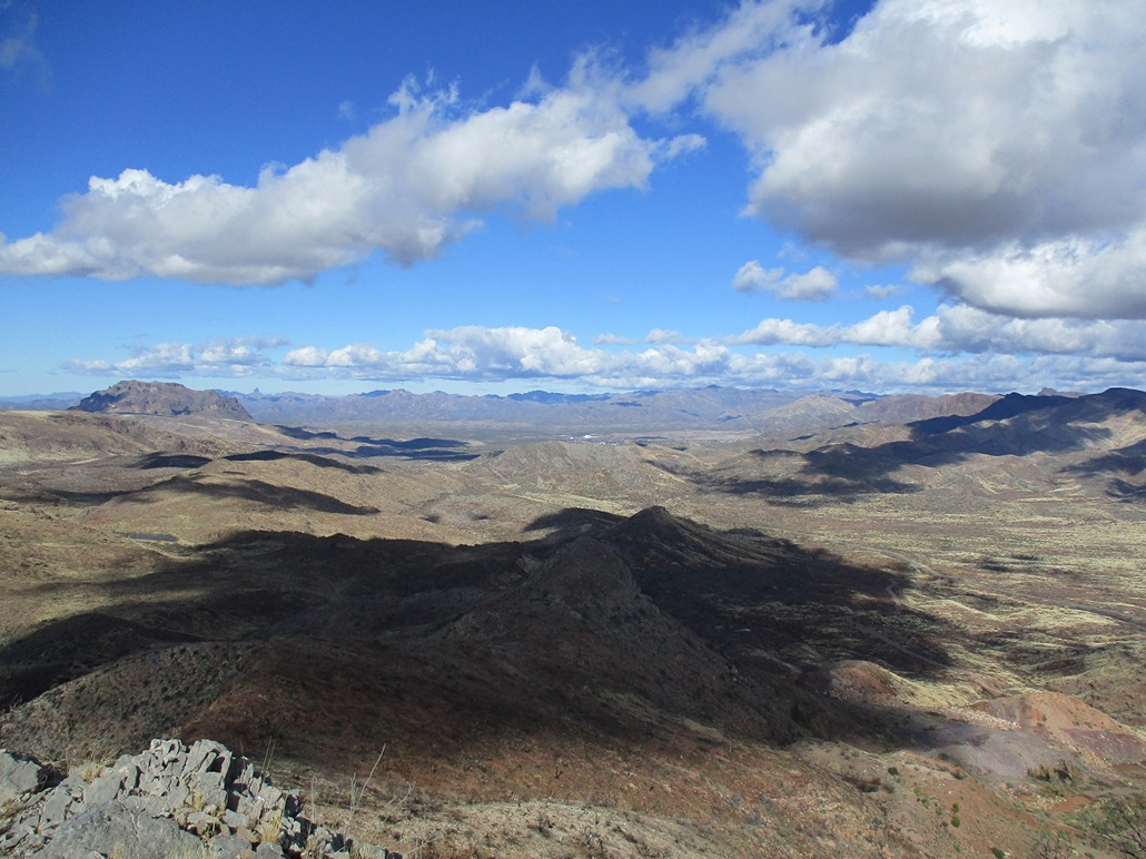
The summit is small and bare. I found a register and signed in, and snapped images of the surrounding peaks and clouds. The wind was pushing me around. I am a big guy, but even so, I had to plant both feet and squat to keep from being blown over. It was some of the strongest wind I've ever dealt with in Arizona. I daresay gusts were pushing 60 miles per hour. It was supremely uncomfortable.
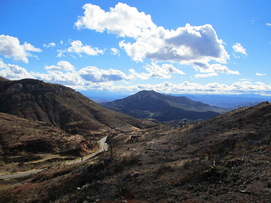
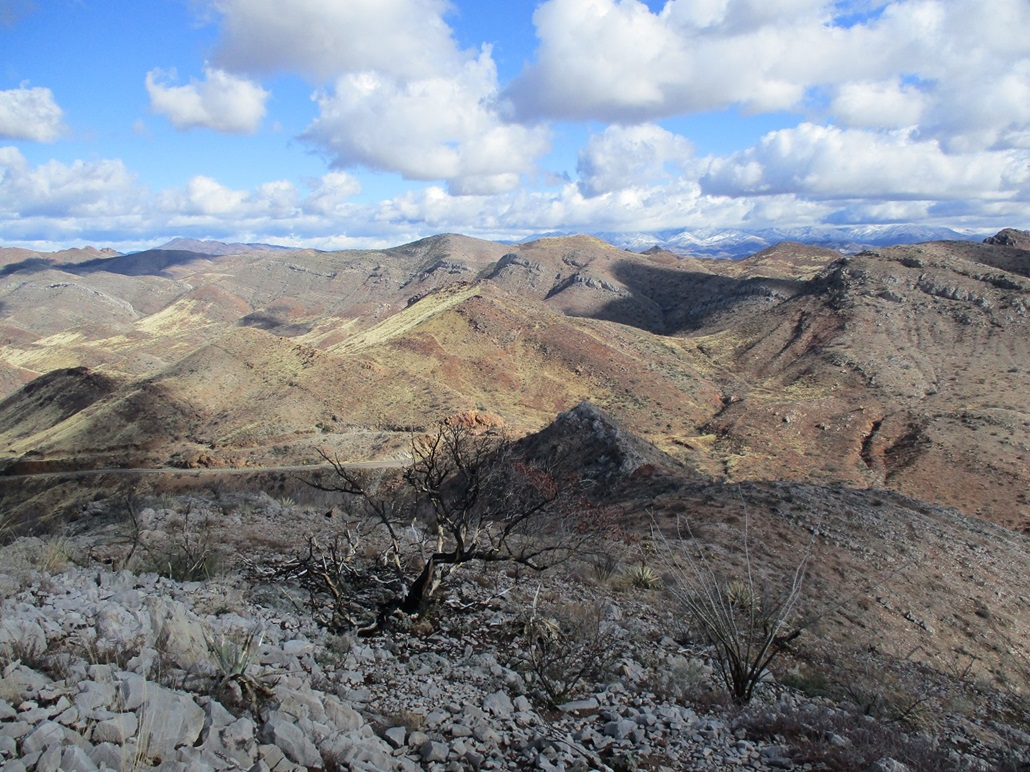
I did not stay long at the top, and immediately gave up any intention to hike out to the other peak. The wind was not making this fun. In fact, frankly, I was miserable. But on the upside, the views were fantastic, especially with snow on the higher peaks. The clouds were scooting through fast and had that puffy look with dark undersides, perfect for photography. So while cold and windy, it was scenic.
I hiked back to my car, total time gone about an hour. So now, what to do. It seemed silly to have driven about 50 miles to hike just one peak for a total of one mile. I had the day open with no reason to rush home. So I decided to do a driving tour. I continued south on AZ-177 into Kearny, and drove through town. I wanted an image of the big "R" on its hillside for a project I am working on (the R is for Ray High School, in case you ask). Kearny is a "replacement" town after the big open pit mines to the north expanded and literally took the earth out from under the older town of Ray.
I then drove through Winkelman, now on AZ-77, then to Oracle Junction, where I caught AZ-79 northbound. Suddenly, my life had purpose again, as I remembered the Durham Hills were in the area. I had checked out an approach road a few months back. So now, that was my new plan, to go hike to the highpoint of the Durham Hills.
Today was brilliant. It was still cold and windy, but bright blue and crystal clear, humidity in the single digits. So some guy in a big pickup hauling a massive trailer gets on my ass. I'm doing 70, the speed limit is 65. I do not intend to speed up. Besides, I need to keep an eye out for the road I need to take for my second hike. At one point, he brighted me. So yeah, I slowed a bit just to annoy him. Then I'd speed up. He finally stayed back a reasonable distance. There are few things that truly annoy me in life, but people pulling those ungodly tacky trailers is one of them. The people, and the trailers. I cannot even fathom the mindset and thought processes that these people have to think that buying a $200,000 building on wheels to haul around their poop is a keen idea.
Anyway, I found my road, and Mr. Trailerman whizzed on pastso he could get to Florence faster. Me, I was getting ready for Peak number 2 of this very young year.
|

|