The Mountains of Arizona
www.surgent.net |
|
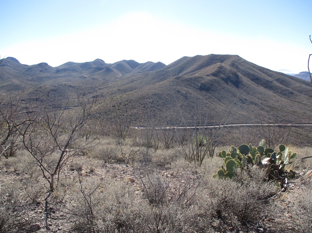
Peak 5529 • Peak 5138 The Leslie Canyon National Wildlife Refuge is about 15 miles north of Douglas, at the south end of the Swisshelm Mountains and the smaller Pedregosa Mountains. The Refuge covers just a few square miles, mainly a canyon and its flanking ridges and peaks. I was curious about the Refuge and wanted to explore it, to see what the roads are like, what kind of access issues might be present, and also to hike a couple of its peaks. There are three ranked peaks nearby the one road that passes through it, Leslie Canyon Road. There are a couple more farther south, not near any roads or tracks. From Bisbee, it's a 25-mile drive to Douglas, then another 16 (going by mileposts) north on Leslie Canyon Road to the west entrance of the Refuge. I was intending to hike all three of the ones near the road, plus an unranked hilltop marked by the "Leslie" benchmark. On the map and satellite images, they looked to be straightforward. As is often the case, other factors popped up that limited me to just two of the four peaks, and I was happy to get those two.
Date: January 15, 2024
• Elevation: 5,529 feet
• Prominence: 549 feet
• Distance: 1.6 miles
• Time: 2 hours
• Gain: 870 feet
• Conditions: Cool, sunny and clear
Arizona
•
Main
•
PB
•
LoJ
I left Bisbee about 6:45 a.m. and drove into Douglas, then up Leslie Canyon Road, which is paved for the first few miles out of Douglas then wide well-tended gravel for the remainder. The day was sunny and cold at first, temperatures about 30°, but clear and calm, no clouds or wind to deal with.
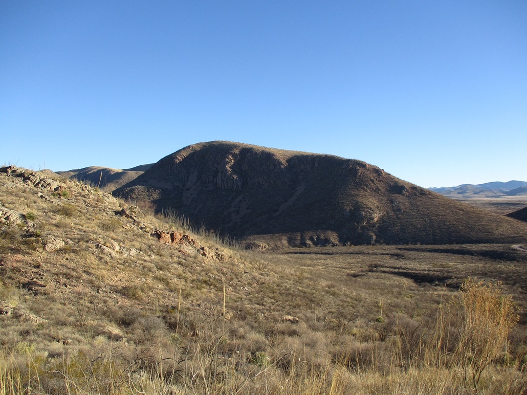
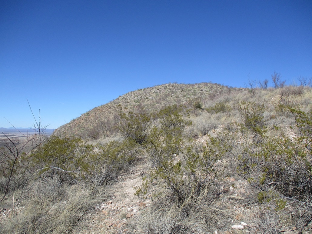
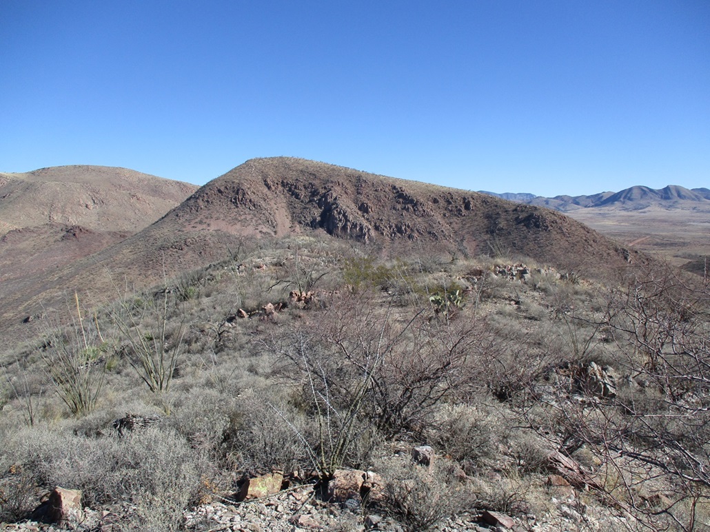
Leslie Canyon Road goes north, then makes a right, aiming toward the hills that flank in Leslie Canyon. I reached an apex below Peak 5138, then descended into the canyon, with fine views of the two peaks on the east side of the canyon, Peaks 5529 and 5270. I drove past the east boundary, then turned left (north) onto a gated track on State Trust land. I drove in about a quarter mile, parking north of a cleared area with troughs for the cattle that graze the hillsides. Peak 5529 rose to the west.
The map shows the road goes north, then curls west and gains a saddle north of Peak 5529. My plan had been to hike the road to the saddle, then charge upslope to the top. I started hiking at 8:30, and got maybe 200 feet north on this road when I realized that the intended route did not look promising. The slope up from the saddle looked way too steep, and there was a ragged line of rock cliffs and jumbles at the top, which looked like trouble.
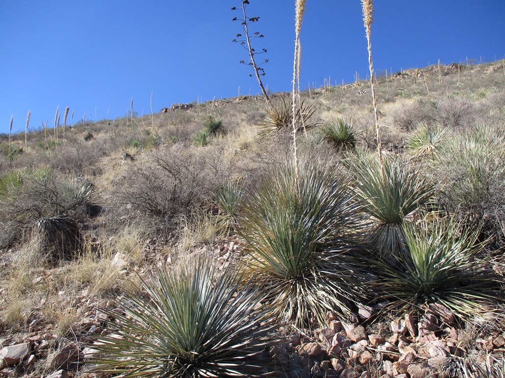
Instead, I set course on a more direct line, what looked like a long steep ramp to the ridge. The rock barriers up high did not look too bad from this vantage point. I had to descend into a draw, then up the other side, battling woody scrub, ocotillo and thornbrush along the way. I generally went up and to my left, a steep ascending traverse, trying to get on what looked like the friendliest slope.
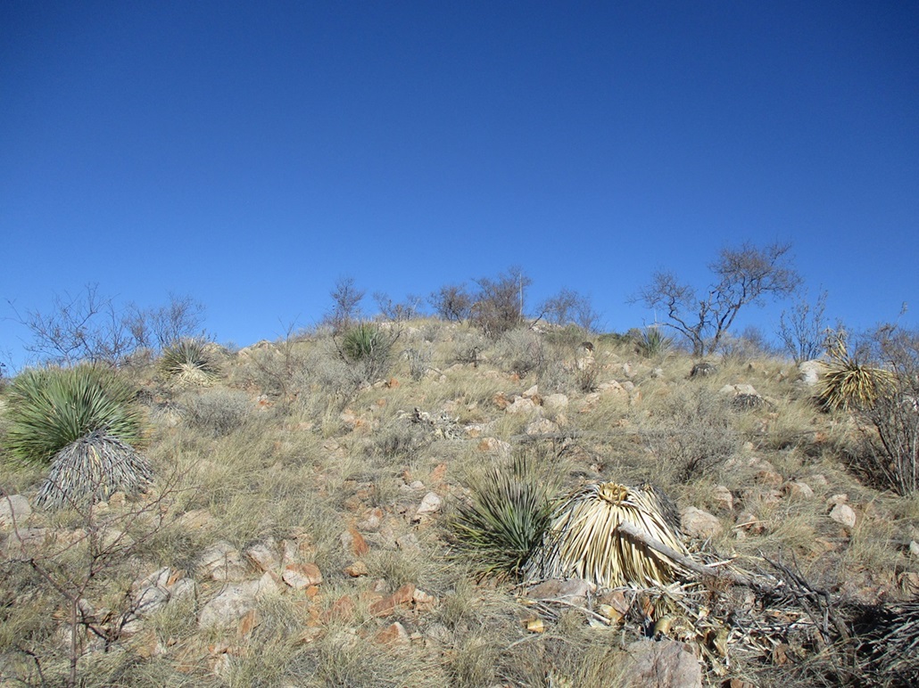
The grade steepened quickly, and the slopes were covered in loose unconsolidated rocks that slid or rolled with most steps, even some of the larger ones. The brush was still moderate, including agave, sawgrass and prickly-pear cactus, and small trees about ten feet high. Footing was not solid. I often slid back, or kicked a few rocks loose. I had to test each step carefully. This was fast becoming a chore.
My route brought me to a fenceline, the boundary of the Refuge. This was a sturdy barbed-wire fence and it must have taken some effort to install it on this sloppy slope. I figured if some random guys could put in a fence up here, I should be able to gut this out. It inspired me not to wimp out.
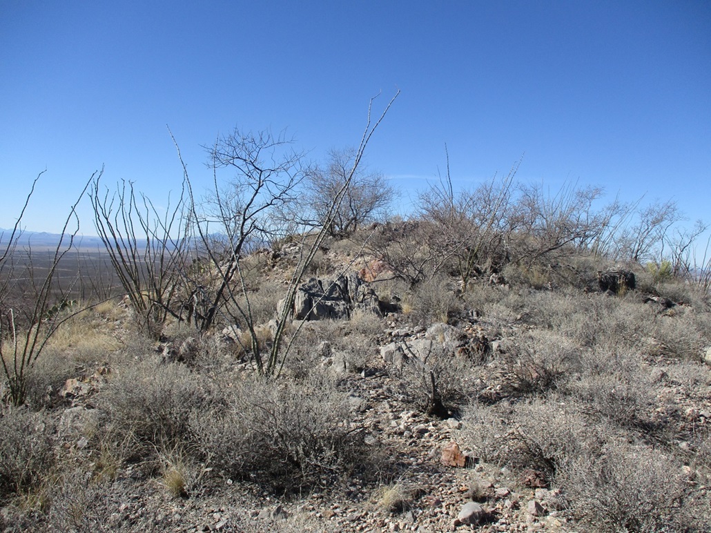
I didn't stick right on the fence. I often followed lanes that zig-zagged up, but at times, I did use the fence posts to help stabilize myself and pull myself up in spots. Toward the top, I came upon the larger rock outcrops and jumbly cliffs. Here, I had to use my hands to work up a few chutes and think carefully where to place my feet. None of the scrambling was Class-3, but it was sloppy and loose. I just moved carefully.
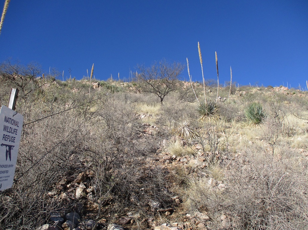
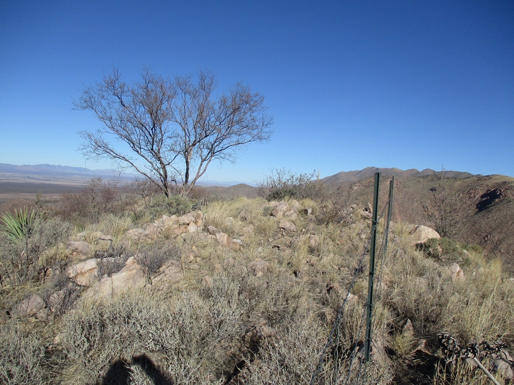
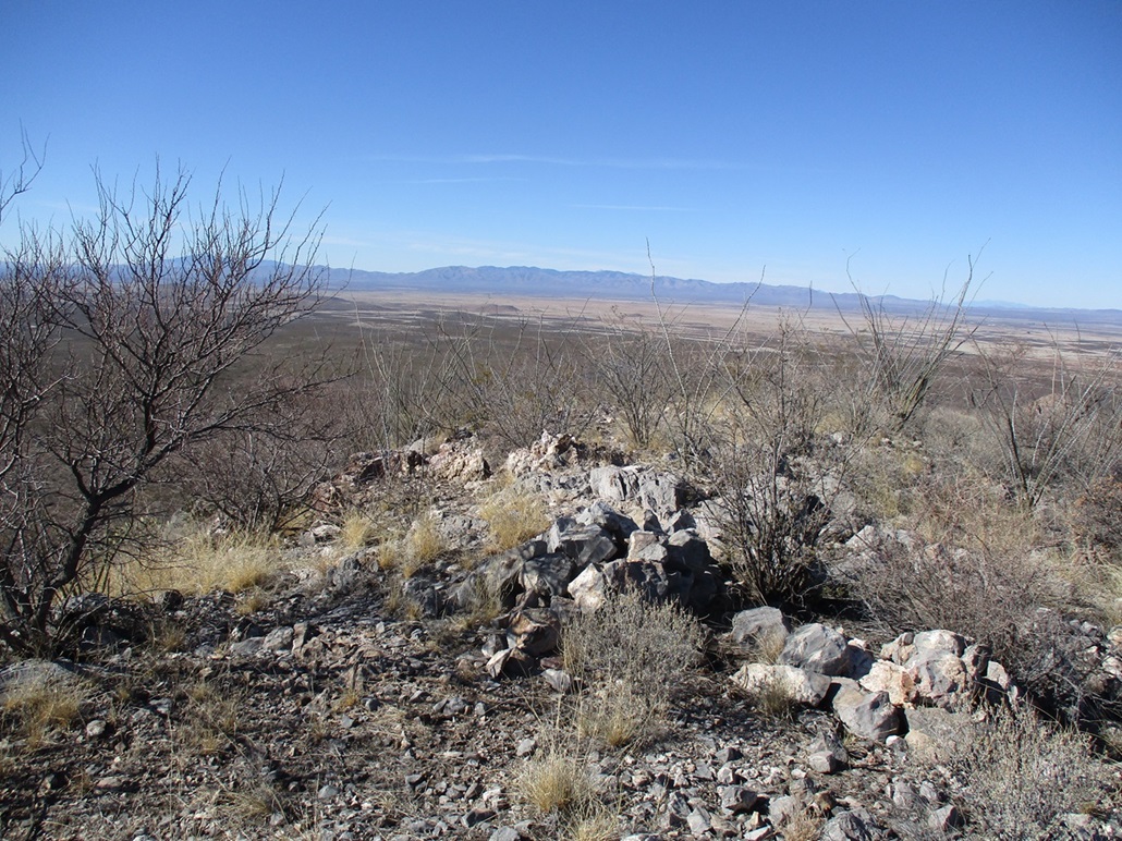
Finally, I was above the steepest stuff and now on the upper ridge. I angled right and up an easy slope to the top. The fence itself makes a turn nearby and crosses over the summit, placing the highpoint about 5 feet inside the Refuge. Signs on the fence, even way up high, mentioned "No unauthorized entry, no public access". Up to this point I had been on State Trust land, and I wasn't going let no stinking fence stop me five feet short of the goal. I shimmied under the fence and walked to the rock pile, tagging a few of the higher ones and looking for a register, with no luck.
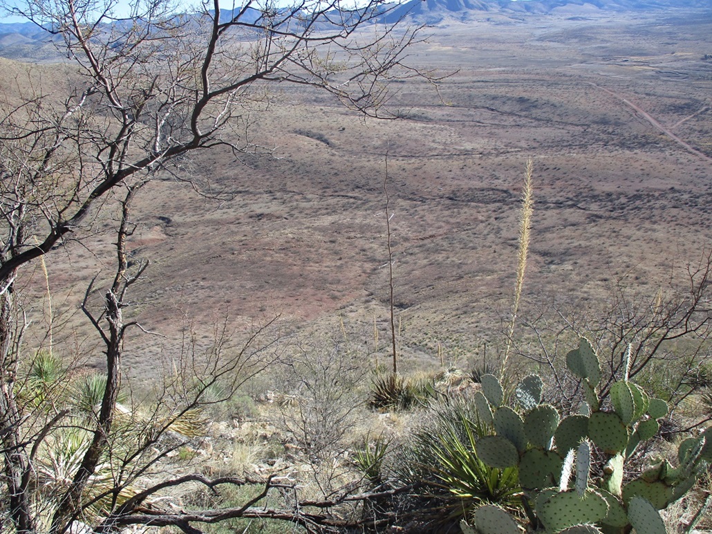
Views from up here were good, and the day was turning into a very nice one, the temperature now about 50°. I did not stay up top long, just long enough to have a drink, then start down. I was not looking forward to the downhill slip-and-slide.
I retraced my route and kept close to the fence line. I was able to use gravity and my long legs to ease down some rocky portions, then once back onto the looser smaller rock slopes, took baby steps using my poles to keep me upright. These slopes were apt to move and slide with the slightest of pressure. Somehow, I never actually fell.
Once below the steep slopes, I angled wide to bypass the cattle who were collecting around the troughs. I had parked a few dozen yards north of them. I was back to my car at 10:30, a two-hour hike. I was pleased to be back and pleased to be down. This peak had taken longer than I expected and took far more effort too. It is a pretty peak, but in retrospect, not worth the effort. I'm glad I hiked it, but am also glad this will be it for this peak.
I drove out to the main road, my plan now to hike Peak 5270, which lies south of the road opposite Peak 5529. There's even a nifty one-car-size pullout nearby. But there were signs along the fence like I had seen higher, about "no public entry" and so on. It's one thing to scoot under a fence and be outlaw for five feet, but I did not feel comfortable breaching the fence here where the signs were plainly obvious. I decided to skip this one and save it for later, if ever.
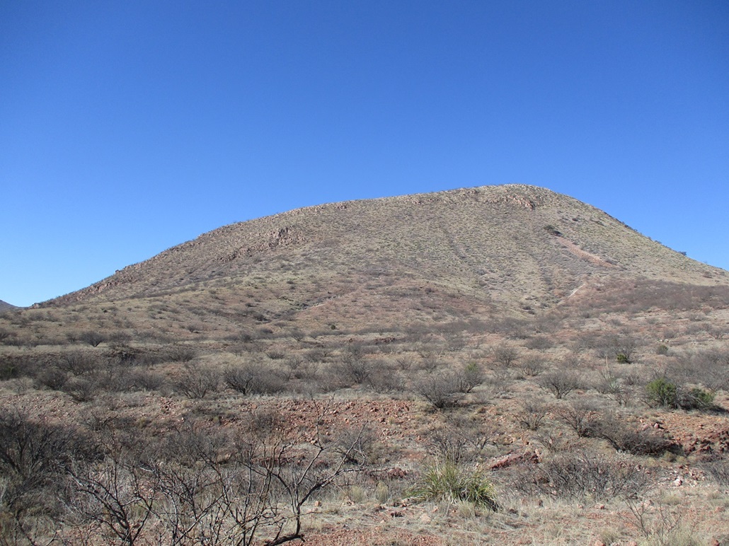
Instead, I drove back a mile or so and situated myself at the pass below Peak 5138, easing into a small cleared area. Peak 5138 looked like an easy peak and something welcome after my earlier effort on Peak 5529.
Elevation: 5,139 feet (Lidar)
• Prominence: 301 feet
• Distance: 0.6 mile
• Time: 30 minutes
• Gain: 320 feet
• Conditions: Sunny and pleasant
PB
•
LoJ
I walked up the slope to a rock protrusion and what looked like an old mine shaft, now closed in with rocks and dirt. Behind the rocks I found a path. It was meager but it was definitely a path.
I hiked along the path through ocotillo and brush, the path helping by generally keeping away from the thorns and barbs. Higher up, it comes to a fence. Whereas on Peak 5529 I had been on State Trust land until crossing over the last tiny bit onto the Refuge land, this time it was the other way: I went from being on Refuge land onto State Trust Land. I was at the summit quickly, a fifteen-minute hike.
Views were good here too, the day being so clear. I found a register that went back over 30 years, with Bob Martin signing in back in 1992. The papers were brittle and water damaged. I was able to sign in. I was surprised to see that about a half-dozen people or groups come up here. It's an easy hike and I am sure the locals may use it for exercise. I spent a few minutes up top.
The hike down went well, and I was back to my car at 11:15, slightly under 30 minutes after starting. It felt good to hike this little peak, an easy second peak for the morning.
I wasn't that interested now to hike up more brushy pointy slopes, so I decided to head back home. I drove back into Douglas then toured its main street, something I have never done. I drove up to the last street before the border fence, then turned around and retraced my route back to the main highway and on home.
Today's mission was a success. I got two peaks, but more importantly, got a better sense of the roads, land and access out this way. The road, for example, is one way to get to the Chiricahua Mountains, so I'll be driving it again surely. I am undecided about the other peaks in the Refuge. I was surprised that it barred access except for one trail. The various websites don't mention this, but do mention it's open for hiking and birding.
The 1-meter Lidar data set (USGS 1 Meter 12 x64y350 AZ_CochiseCounty_2020_B20) gives a summit elevation of 5,139 feet and a saddle elevation of 4,838 feet, for a prominence of 301 feet. This peak's "map name" will remain Peak 5318, as that is what is printed on the map.
|


|