
The Mountains of Arizona
• www.surgent.net
|
| Peak 5630 • Kings Crown Northeast Peak |
• Superstition Mountains • Tonto National Forest • Pinal County |
|
Date: April 28, 2012
• Elevation: 5,630 feet
• Prominence: 1,030 feet
• Distance: 4 miles
• Time: 2 hours, 45 minutes
• Gain: 1,300 feet
• Conditions: Sunny and pleasant
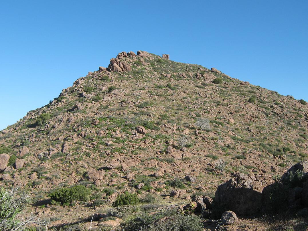
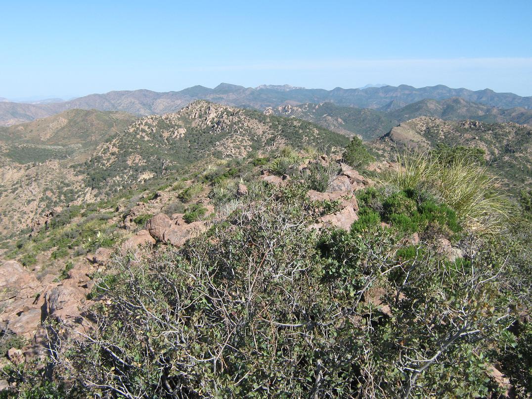
Kings Crown Peak is a large mountaintop not too far north of highway US-60, a few miles east of Superior and north of the Oak Flat campground. From the road it looks like a lovely peak, with nice lines and dramatic west-facing cliffs in places. But it's not even the highpoint of this "part" of the mountain range, where the Superstition Mountains kind of merge into the Pinal Mountains. An unnamed peak about a mile northeast is about a hundred feet higher. This "Kings Crown Northeast" peak would be my goal for this morning. It too is visible from the highway, but because it's set farther back, it doesn't have the eye-catching quality that Kings Crown Peak has.
I badly needed to get away from the craziness of final exams at ASU. It had been a rough week. We set up a circuit centered around Globe for this weekend. The plan was to camp a night at the Oak Flat campground, hike this peak today (Saturday), then go camp in the Sierra Ancha and hike Black Mesa tomorrow. The weather was warm but not hot, and very dry. Conditions favored these mid-elevation peaks this time of year.
We left Scottsdale around 4 p.m., hit a little traffic heading east, but generally made good time. In about an hour we were in Superior, then a few minutes later, had driven up the interesting grade through Queen Canyon to top out on Oak Flat, elevation 4,000 feet exactly. This short stretch of land features a campground and active mine up in the hills. We rolled into the campground around 6 and found a spot. Not surprisingly, it was crowded, mainly with scout groups and various other people. I guessed there to be about 200 people at the campground total, of which 175 of them were testosterone-mad 12-year old boys yelling, jumping, tackling and throwing stuff, even past 10 p.m., which was the time we gave up and left the campground. We drove back onto US-60, went a half-mile east to Tonto National Forest Road 342 on our left, drove up about a half-mile and found a nice pullout where we camped, completely quiet and peaceful. Why we didn't leave sooner, I don't know.
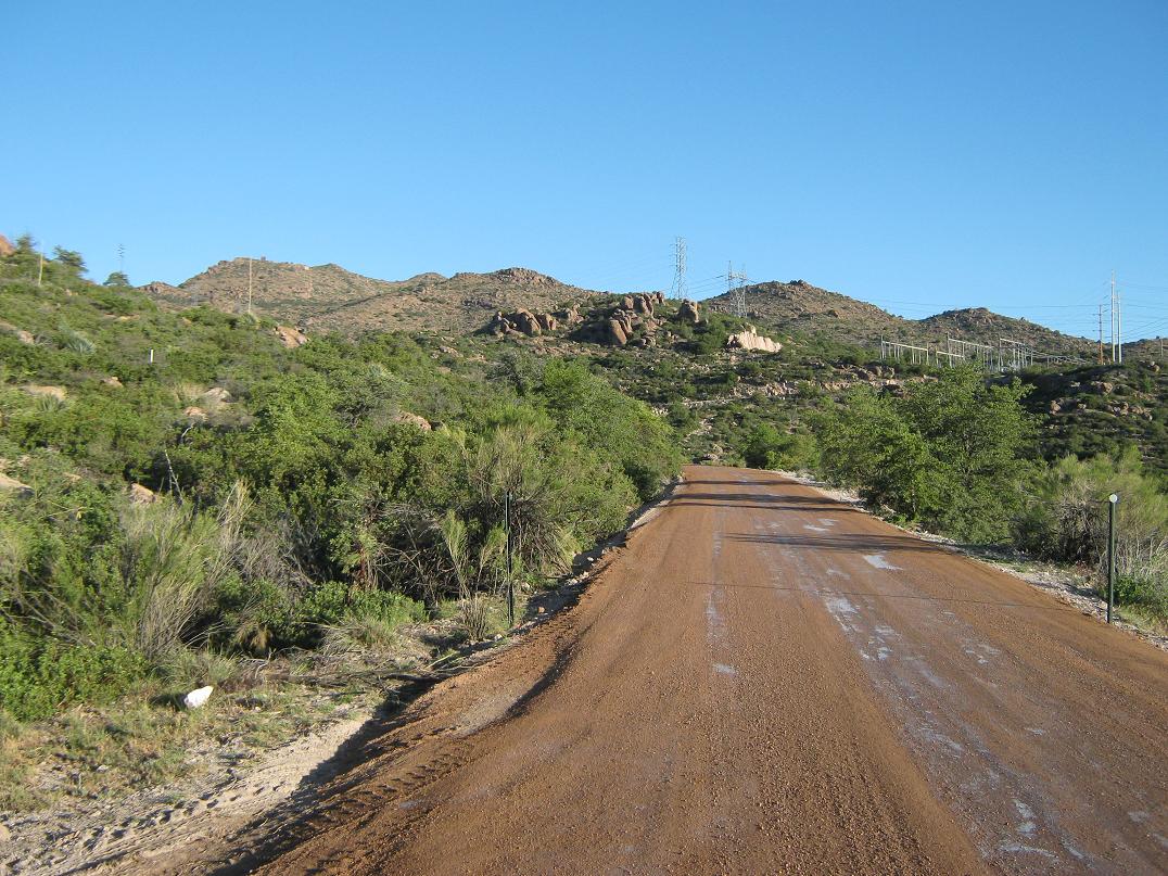
Next morning we awoke and drove up this road north another mile and a half, eventually topping out near the Silver King power station, built here to serve the surrounding mines. The road worsened at the station itself, so I backtracked and parked in a pullout about a quarter-mile south of the station. It was early and pleasantly cool. I got my pack on, kissed her goodbye and started hiking at 6:45 a.m.
I followed the road back to the power station, following it around the complex to where it veers upslope and makes a hard bend left (west). Then, it was an easy matter to walk this road about a half-mile to a point where it dropped about 50 feet, just below a huge power line stanchion set atop the nearby ridge. The road was in very bad shape, but it made for easy walking.
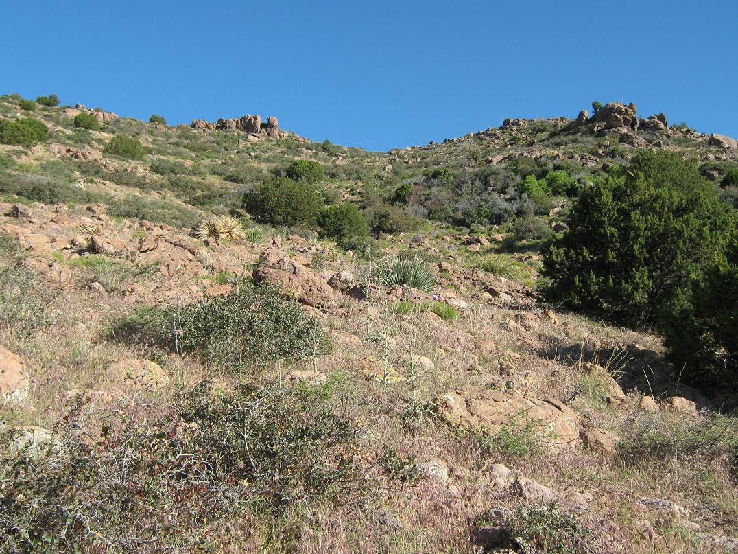
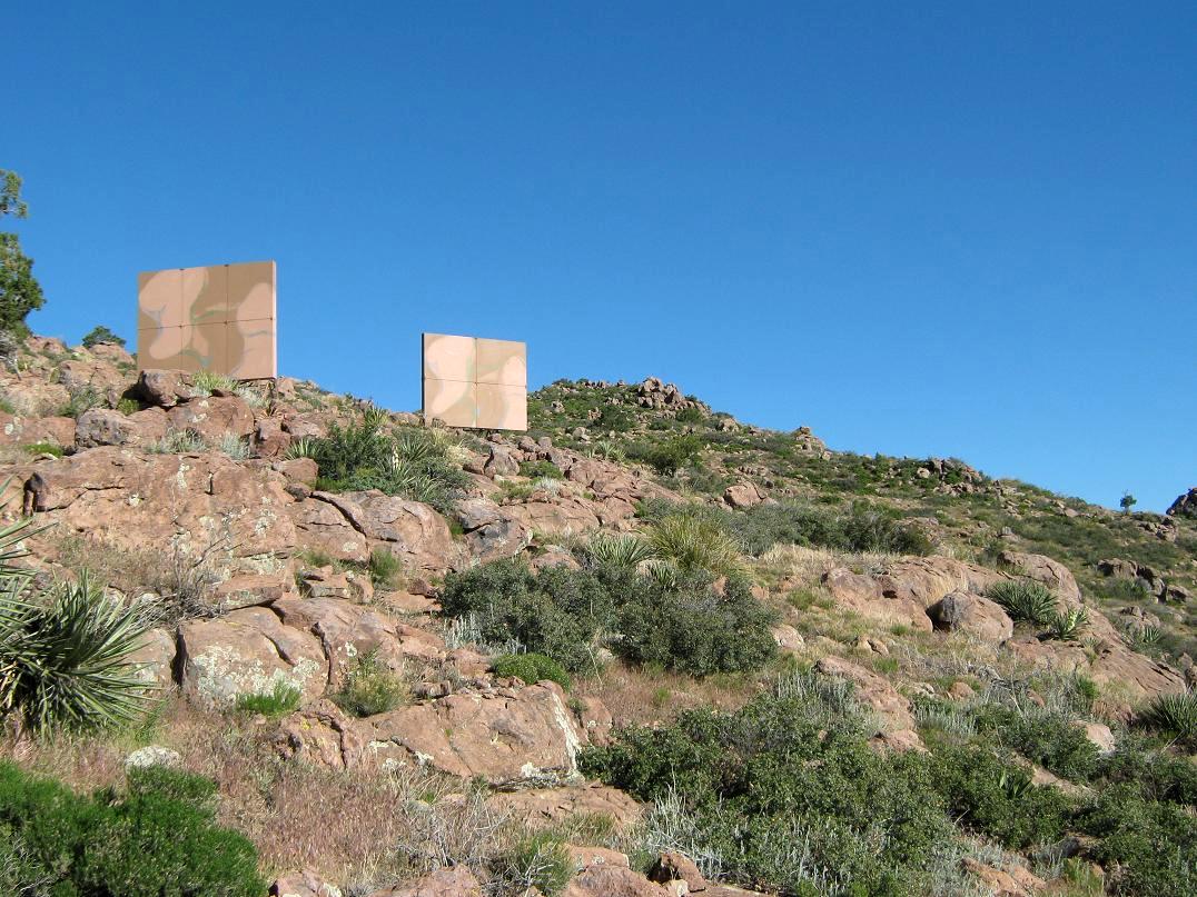
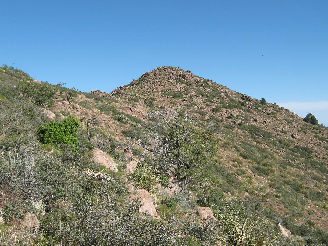
At this lowpoint, I left the road and started up the cross-country portion of the hike. The first segment was up a slight gully, but I aimed a little to the left and entered into some brushy and rocky terrain, gaining about 300 feet and coming to a set of rock outcrops. I bypassed the rocks to the left, and got a view of the next segment, a big false summit another 400 feet (or so) higher up, with some off structures jutting above its east flanks. The terrain was rocky but open, with low scrub, cactus and a lot of mountain oak, which in places grew together very thickly. I went up-slope aiming for the false summit, but ended up veering right and traversing toward these structures. There are three of them, big 20-foot tall panels painted in camo, no apparent electronics within them. I have no clue what they do or why they're there.
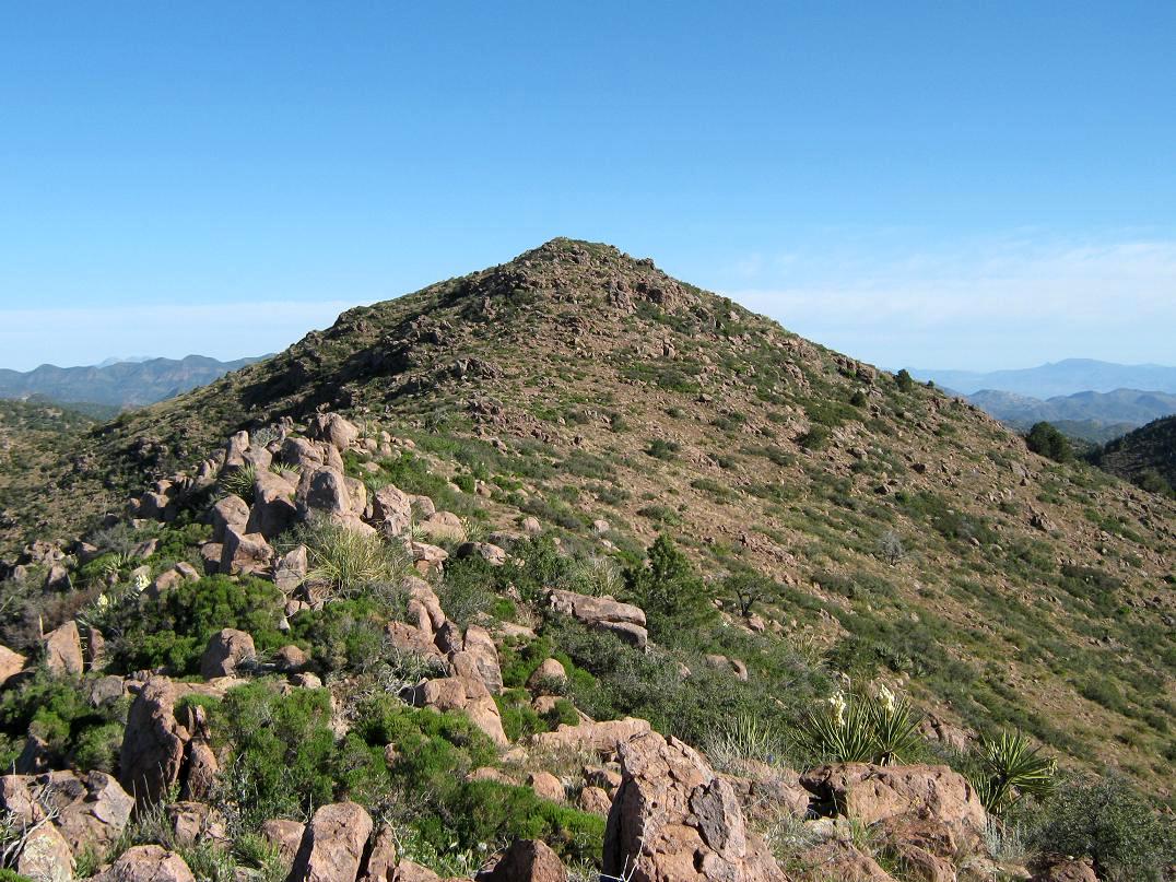
Past these "things" I aimed up slope again toward yet another false summit, which I thought might be the real thing for a few giddy moments, but when I hit its top, and saw the real summit still a ways away to the north, I scolded myself for being so rash. The final segment was directly along the ridge, hopping over nice rocks and side-stepping the brushy patches. The slopes were lenient and I arrived on top at 8:15 a.m., a 90-minute one-way journey with about 1,200 feet of gain.
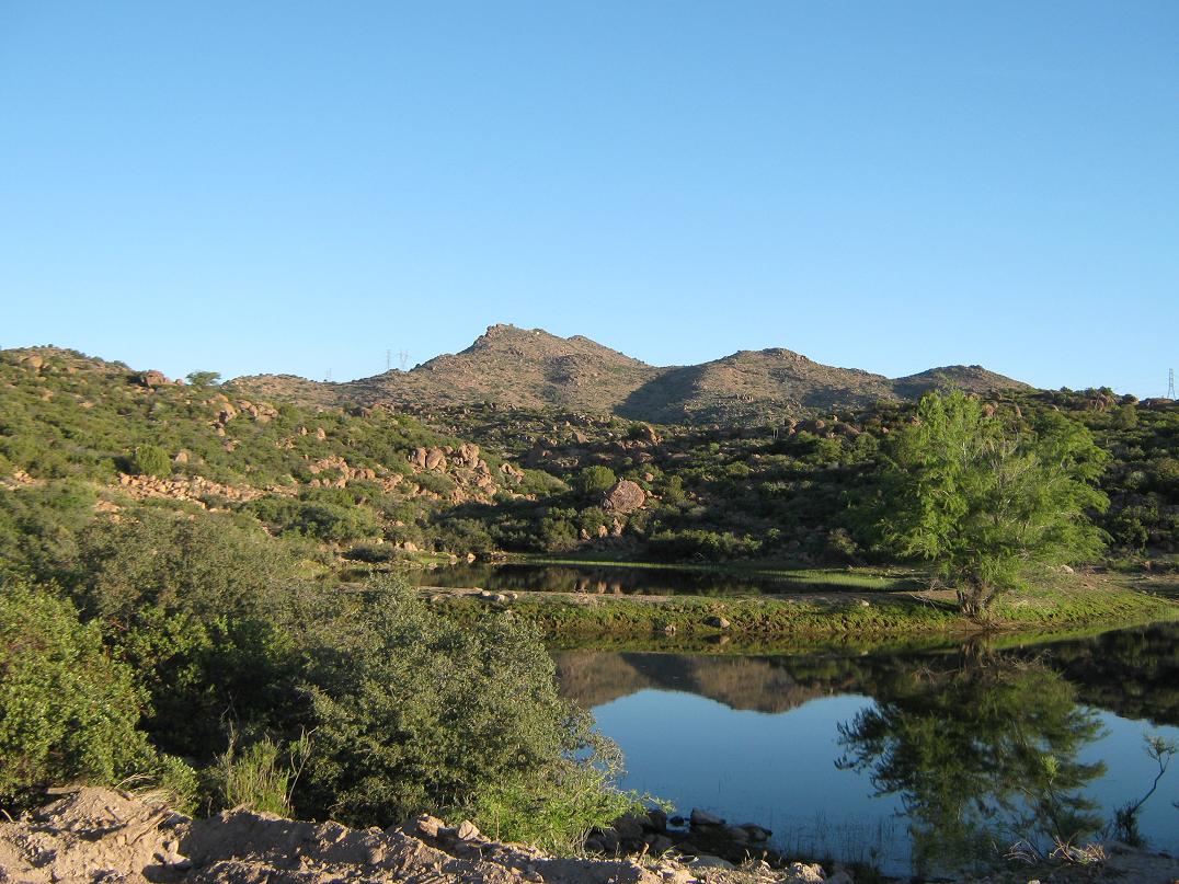
The summit itself was rocky and slightly overgrown. I could not find a register, but I sat and enjoyed a drink and a breakfast, looking around me at the lovely views of nearby mountains and nearby mines. To the north I could make out the profiles of the main Superstition massif, Weaver's Needle, and way far off, the Mazatzals. Closer in were innumerable peaks of the Superstitions, coming this way and meeting up with the Pinal ranges. (Frankly, I do not know what range Kings Crown would belong too. I arbitrarily assign it to the Superstitions because it's rocky, like the Supes, not as big and "piney" like the Pinals.)
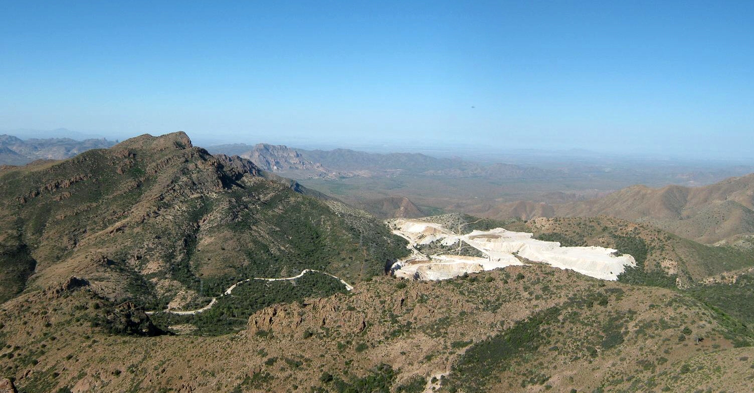
West I had a great view of Kings Crown Peak and a big mine directly below. South I could make out my route and the mine near the Oak Flat campground. In fact, I could make out at least three mines from this perch, including the big tailing hills nearer to Globe. Despite the mines and the powerlines, the views were very pretty. I suspect very few people hike this particular peak. I stayed up to about 15 minutes, then started down.
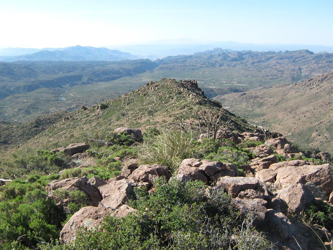
The downhill went easier as I could eyeball some routes better. I ended up dropping below the main crest and following paths through the thick woody brush, paths likely put in by game and also, cattle, who free-roam these mountains. They get pretty far up, judging by their poop. I was back to the road in less than an hour, and back to the truck by 9:30, a total of 2 hours and 45 minutes gone.
βð was hankering to get moving. The road gets a lot of traffic as people shuttle to and from the power station, so it wasn't very peaceful as we thought at first. Also, the road itself is covered in a glue-like substance, binding the hard-pack into a hard-coat sheen, presumably so it can handle the work trucks and occasional bigger truck that rumble to the power station. I saw one such big truck spraying the goo on the road as I descended back to the road. As I walked the road, this gluey-goo was still wet. It smelled like Elmer's glue, not a bad smell, probably non-toxic. But the truck had sprayed the side of my truck with this stuff and it left a bunch of stains that I need to aggressively buff out somehow. Plus, the grit that does kick up from driving the road gets into the undercarriage and sticks there. It's nasty stuff, whatever it is.
We got moving quick and drove into Globe for supplies, then drove north to our next camp at the base of Black Mesa in the Sierra Ancha near Lake Roosevelt. We somehow missed the junction, but arrived to our camp area around 1 in the afternoon. The day was highlighted by a diamondback rattlesnake who slithered into camp and took refuge in the shade of my truck.
Despite the gluey ending to the hike, the peak itself was easy and fun, with just enough off-trail to make it challenging. The views were excellent, and overall it was a worthy destination.
|

|