
The Mountains of Arizona
• www.surgent.net
|
| Kendrick Peak |
• San Francisco Volcanic Field • Kaibab National Forest • Kendrick Mountain Wilderness • Coconino County |
|
Date: June 18, 2005
• Elevation: 10,418 feet
• Prominence: 2,488 feet
• Distance: 8 miles
• Time: 6 hours
• Gain: 2,700 feet
• Conditions: Clear, dry and breezy
Arizona
•
Main
•
AZ P1K
•
PB
•
Interactive map
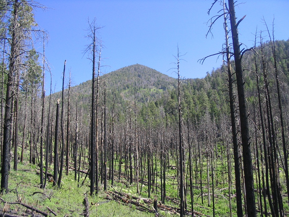
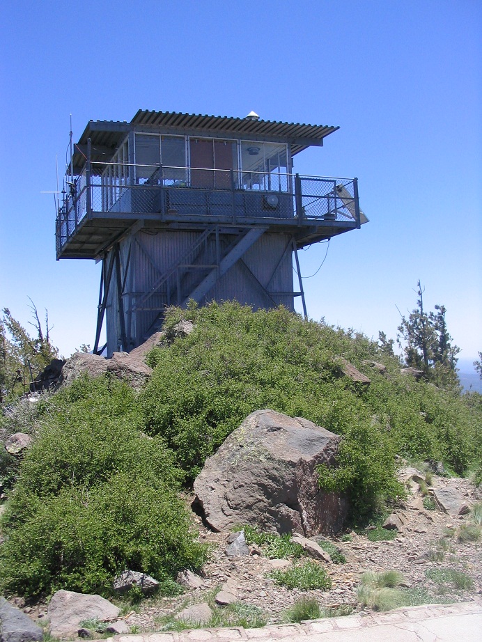
Kendrick Peak is the highest peak in the San Francisco Volcanic Field not named Humphreys Peak. At over 10,000 feet elevation, it stands high above the forests and meadows of the Coconino Plateau. Three trails lead to the summit on which a lookout tower is located. The peak and surrounding areas are still recovering from a large fire from 2000.
We drove from the deserts to hike Kendrick Peak, catching it during a spell of stable, clear and dry weather. We arrived the night before and after getting food and supplies in Flagstaff, we drove toward the general area, parking and camping in a pullout underneath the ponderosa, seemingly having the place to ourselves. We ate on the truck's tailgate, a half-moon providing light. We slept well in the cool and calm conditions.
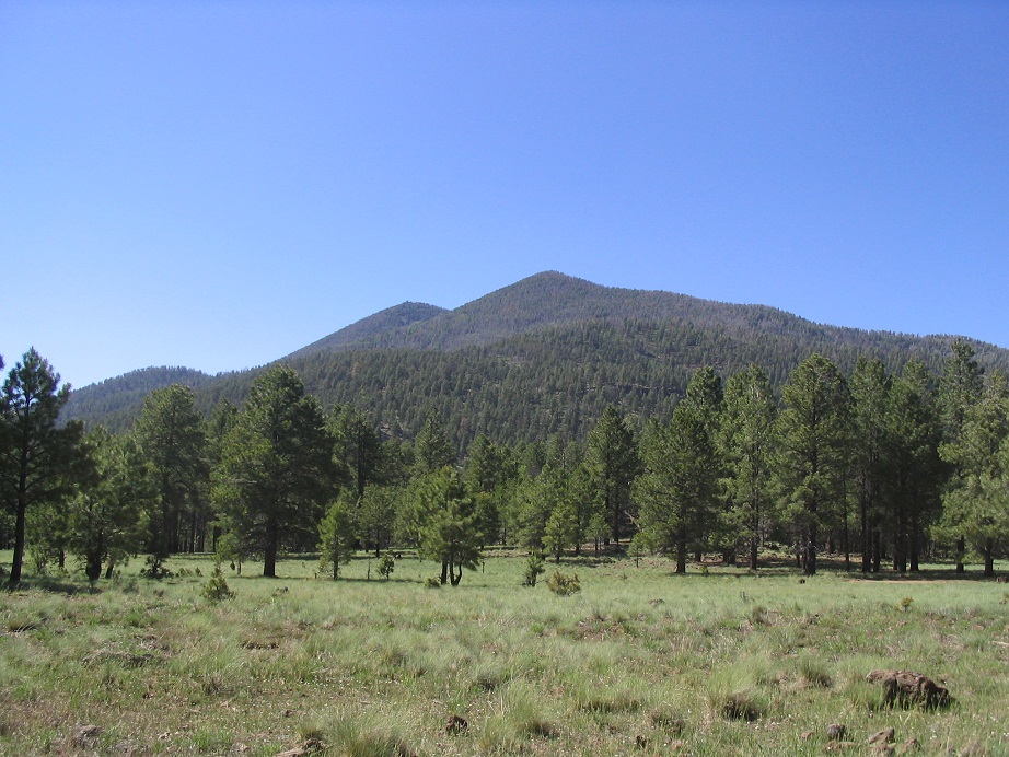
For a 10,000-footer, Kendrick Peak is well-hidden by the forest from most of the roads that come near it. We caught on to this peculiarity when driving in, as we never actually saw the peak. The forest is thick here and long line-of-sight views are not easy to come by, except for occasional meadows. The best long-range views of Kendrick Peak are from the north along US-180, and from points south and southwest along Interstate-40 from Bellemont west to Williams.
The next morning started clear. We got situated and drove four miles to the trailhead, now able to see the peak up close. It is a double-summitted mountain, with the western peak highest at 10,418 feet, the eastern peak coming in at about 10,140 feet. A ridge that stays above 10,000 feet hangs between the two peaks, separated by less than an air-mile. Otherwise, the slopes of the mountain drop dramatically in all directions. We parked south of the peak, intending to follow the most popular and well-maintained of the three trail options. After time getting ready, we started in about 8:30 a.m. in very nice conditions.
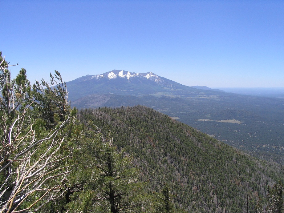
The trail begins a steady uphill grade with little variation, and fortunately, at a nice slope. The first portion is through thick forest, then as it gains up a canyon, where the views start to open up aided by cleared areas from the 2000 burn. Forests are hardy beasts and we are happy to report much new growth in the wake of the heavy burn scars. Gaining up the ridge, we had outstanding views of Humphreys Peak to the east, completely unobstructed. As we moved farther up the canyon and ridge, below the prominent south headwall, we could spy the lookout sitting way high on the summit. We took a breather at a point before the trail gained onto the headwall itself.
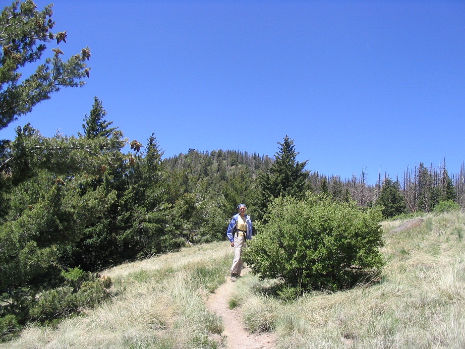
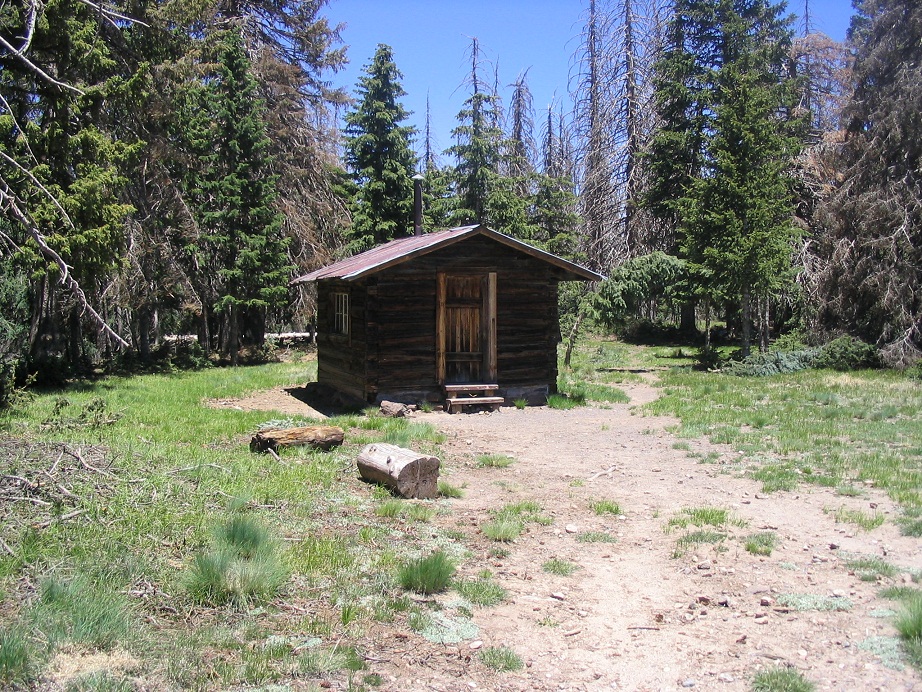
On the headwall, the trail makes long sweeping traverses, with few switchbacks and with very reasonable grades. We made good time amid the thicker and more lush flora. About this time we met up with a few hikers already on the downhill after their early morning summit. In time, the trail works its way more toward the base of the eastern lower summit, before a sharp turn back to the northwest, in which it finally gains onto the ridge connecting the two peaks. Views opened up nicely here, with lovely meadows and a nice mix of forest, grass and rocky outcrops. We walked to an old cabin which in the past had been used by the lookout personnel.
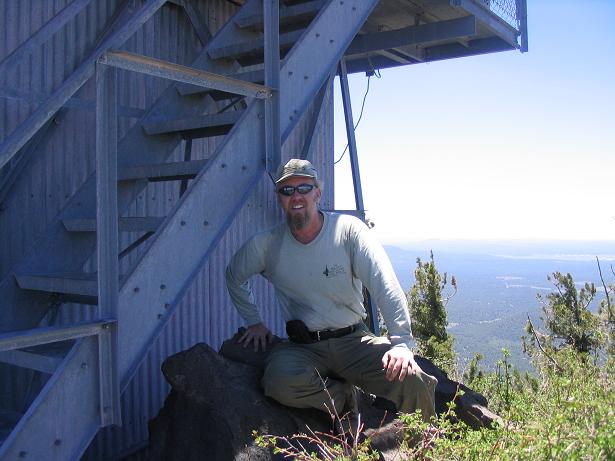
At the cabin, we took a short break, then continued on to the summit a couple of hundred feet farther up. We arrived on top, tagging rocks and searching for the highest natural points amid the base of the massive lookout tower. Views were stunning in every direction. The humidity must have been in the single percents because we could make out fine detail on peaks 50 miles away. Humphreys looked so close we could almost touch it. A stiff breeze was the only source of discomfort. We descended back to the cabin and took a long lunch break and rest. The trail had become busier, and we chatted with the various hikers. Most were coming up (or going down) our way, but a few had come up from the other routes (one guy reporting his way was very overgrown and hard to follow).
Eventually we began our hike down, which went without event other than taking it slow. At the very bottom, within sight of the parking lot we heard a long extended creak, then some cracks, and about 20 feet to our right off the trail, a tree fell! This was a first for both of us, to see a tree actually fall. And yes, they do make a noise when they fall. We just happened to be walking by when this old guy finally gave out. Fortunately we were well clear of its path. Back to our truck by 3, we drove back to Flagstaff and got a hotel room. We slept like fallen logs that night (reference intended).
The drive back to Phoenix the next day had one interesting incident, as a small grass fire on the median of Interstate-17 near Camp Verde was generating smoke and flames. But no fire trucks were there so it must have just started. Traffic slowed into a single file as the flames were lapping the edge of the highway and sending dense smoke across our road. We just held our noses and pointed the truck through the haze, and got through. The rest of the drive was uneventful, and hot.
|

|