
The Mountains of Arizona
• www.surgent.net
|
| Javelina Summit |
• Skyline Regional Park • White Tank Mountains • City of Buckeye, Maricopa County |
|
Date: January 21, 2019
• Elevation: 2,212 feet
• Prominence: 672 feet
• Distance: 6 miles
• Time: 3 hours
• Gain: 792 feet
• Conditions: Blue skies with high clouds, breezy at times
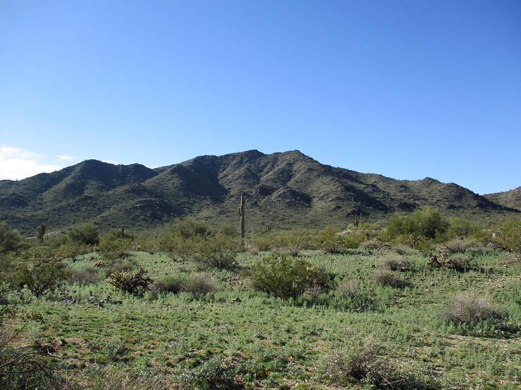
Javelina Summit is a peak in the southern foothills of the White Tank Mountains. It is now part of the Skyline Regional Park and a relatively new trail leads to its summit, prompting me to explore it. The name of the peak was apparently given to it by the Skyline Regional Park Council of Elders, as no mention of this name is found on any map. The peak lies near the Verrado housing development, all contained within the City of Buckeye.
I came here with the day open, due to the Martin Luther King holiday. I would have to cross through downtown Phoenix, but I got an early start and with the holiday, traffic was not too bad. I left home in Scottsdale about 6:40 a.m., and arrived to the Verrado exit about 7:20, a 40-mile drive, give or take. I went north to Lost Creek Drive, then west to its end near a golf course. The public can park in the dirt clearing. Some guys were working on a new house nearby.
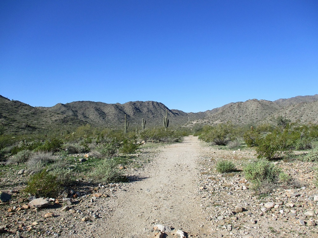
I started hiking a little after 7:30 a.m., the sun just starting to light things up. The weather was mostly clear and cool, temperature about 45 degrees. I walked west past a pedestrian stile, then another hundred yards or so, going left at another main "road". Here, development has yet to occur and these tracks date from many decades ago. An old topographical map shows part of the area as the "White Tanks Proving Grounds". The roads are open for hiking, and may be developed more formally in the future.
For the moment, I was north of the peak, and the route would go a mile west, then a mile south, and then the newer trail that comes up from southwest of the peak. The topographic maps do not show the newer roads or tracks, so I had a copy of a satellite image, which was helpful. I followed the roads and tracks, eventually trending west again. A few small signs pointed me in the right direction. I walked west, coming to the junction with the southward track, near a small hill. I had covered this segment in about twenty minutes.
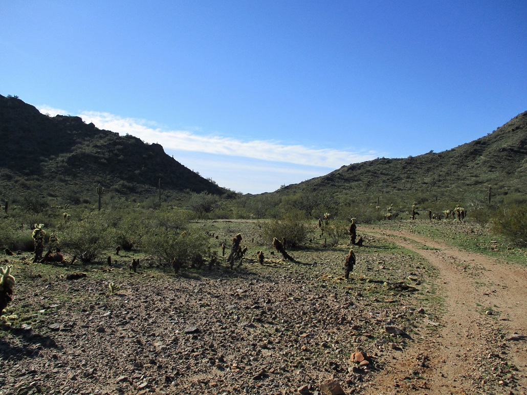
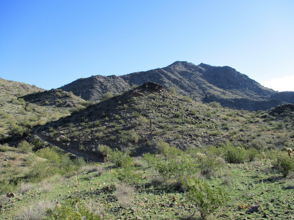
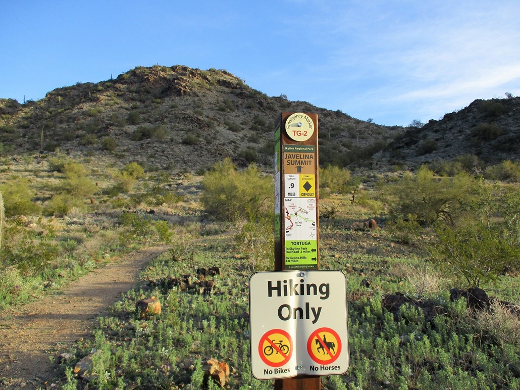
I went south on this next track. It runs against the grain, meaning that I had to drop into and out of a handful of arroyos, some about 30 feet deep. It achieved the saddle west of the summit, then dropped into one more arroyo, then came to a much-better-looking trail, the "Tortuga" trail. I was now within the Skyline Regional Park. The peak was now east of me. I followed the Tortuga Trail briefly, watching a mule deer amble by on the slopes ahead of me. I had to drop into and out of one more arroyo (the same one from about 500 feet to the north). Shortly, I came to the junction for the Javelina Summit Trail. I could hear some voice up ahead of me.
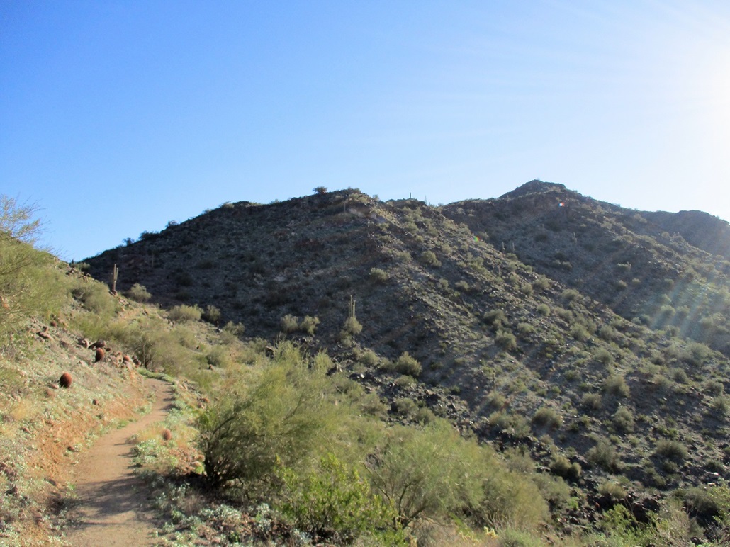
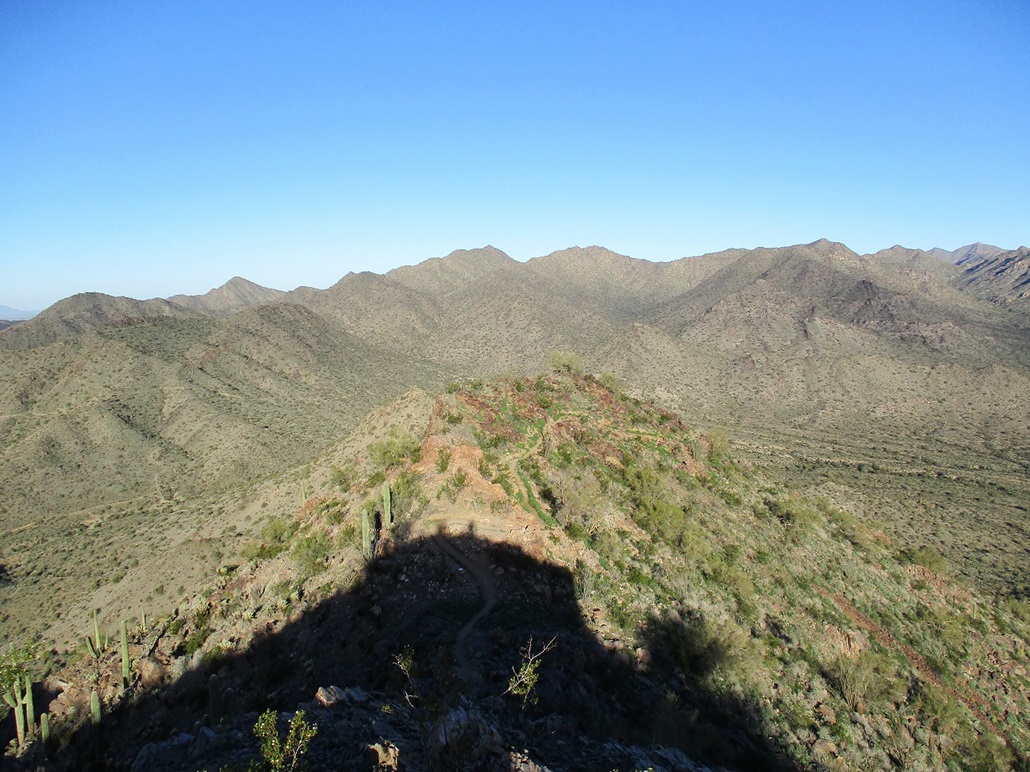
The signpost said the summit was 0.9 mile. I started walking uphill, enjoying the nice path. It was smooth and free of encroaching brush. About half-way up I could see the talkers, a group of four guys. I caught up to them and we chatted. They were local and friendly. I soon moved on, but then a couple of them caught and passed me. The trail gains steeply up to a pointed bump, a false summit. Near the bump s apex, the trail cuts north and east, rounding it, where the actual highest point is now visible, itself another pointy lump of rock.
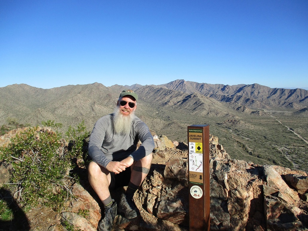
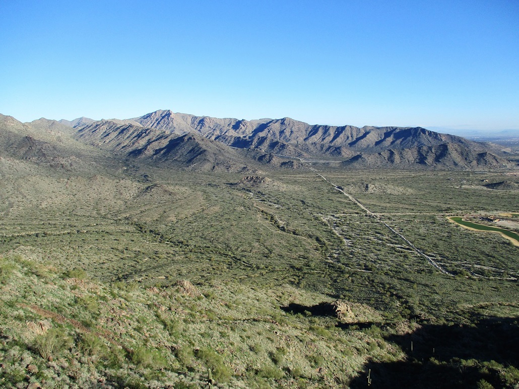
The trail up the last forty feet was sketchier due to it being hewn directly into the rock. However, it wasn t bad, and I soon arrived on top, where the two fast guys were already there. Not long after, the other two guys appeared. We all talked, and I spent about 15 minutes up top. It had taken me 90 minutes to gain the top, covering about three miles, with only the last mile being remotely steep. It was a pleasant hike. The views of the White Tank Mountains were fantastic, plus other surrounding peaks like Woolsey to the southwest, Extrella to the southeast, and the dozens of peaks in between. Looking east, much of the metro-Phoenix area was under a light ground fog. It was still cool, in the 50s, with a steady but light breeze.
I said goodbye to the guys and started down, following the same route exactly. I had to scoot carefully on the steep parts below the top, but the rest of the hike went quickly. I was soon off the Javelina Summit Trail, then back onto the scragglier tracks I had followed in. Once back to the north side of the peak, on that mile-long segment back to my vehicle, I encountered more people, probably a dozen in all, some walking dogs. I was back to my car a little before 10:30 a.m.. By now, the little lot was full of cars, and as soon as I pulled out, someone was there to take my spot. It seems to be a popular trailhead for locals, and suggests to me it may be absorbed eventually into the Skyline Park, or made into its own park of some sort.
Driving out, I wanted to check out another hill, this one located at the extreme south end of the range, immediately north of the highway AZ-85 and Interstate-10 interchange. Back in 1998, I was a member of the Central Arizona Mountain Rescue team, and we had a big evidence search in some mines within these hills on behalf of the Maricopa County Sheriff and all sorts of Federal types, the search presumably for evidence related to the 1995 train derailment that occurred west of Gila Bend. Somehow, looking into mines here had some connection to the train sabotage about 60 miles away.
I wasn t here to do any evidence searching. I just wanted to see the area again, after twenty-plus years. I "kind of" remembered how to get there, and once off the interstate at Miller Road, started to recognize things again. However, I came to a sign that said the small bit of BLM land up ahead was closed to any recreational activity. I was not sure if this included my destination, but I decided I wasn t that curious, if it meant being on proscribed land.
I decided instead to just get back on the interstate and head home, arriving a little before noon. I will come back because there s a whole bunch of new trails in Skyline Park I want to explore. I enjoyed very much the hike up to Javelina Summit. It is a great trail with great scenery.
|


|