
The Mountains of Arizona
• www.surgent.net
|
| Indian Butte |
• Tonto National Forest • Verde River Canyon • Maricopa County |
|
Date: May 14, 2019
• Elevation: 3,745 feet
• Prominence: 485 feet
• Distance: 6 miles
• Time: 3 hours
• Gain: 1,025 feet
• Conditions: Clear and very nice
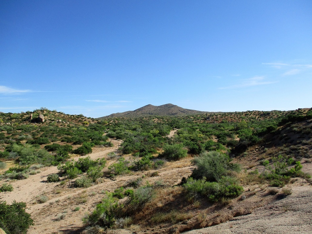
Indian Butte is an obscure peak in the Tonto National Forest, near Bartlett Lake, about an hour northeast of Phoenix. In recent months, I have "discovered" this area as a rich source of fun and interesting peaks to climb. I was last here six weeks ago, hiking up St. Clair Peak. Indian Butte lies about two miles to the southeast.
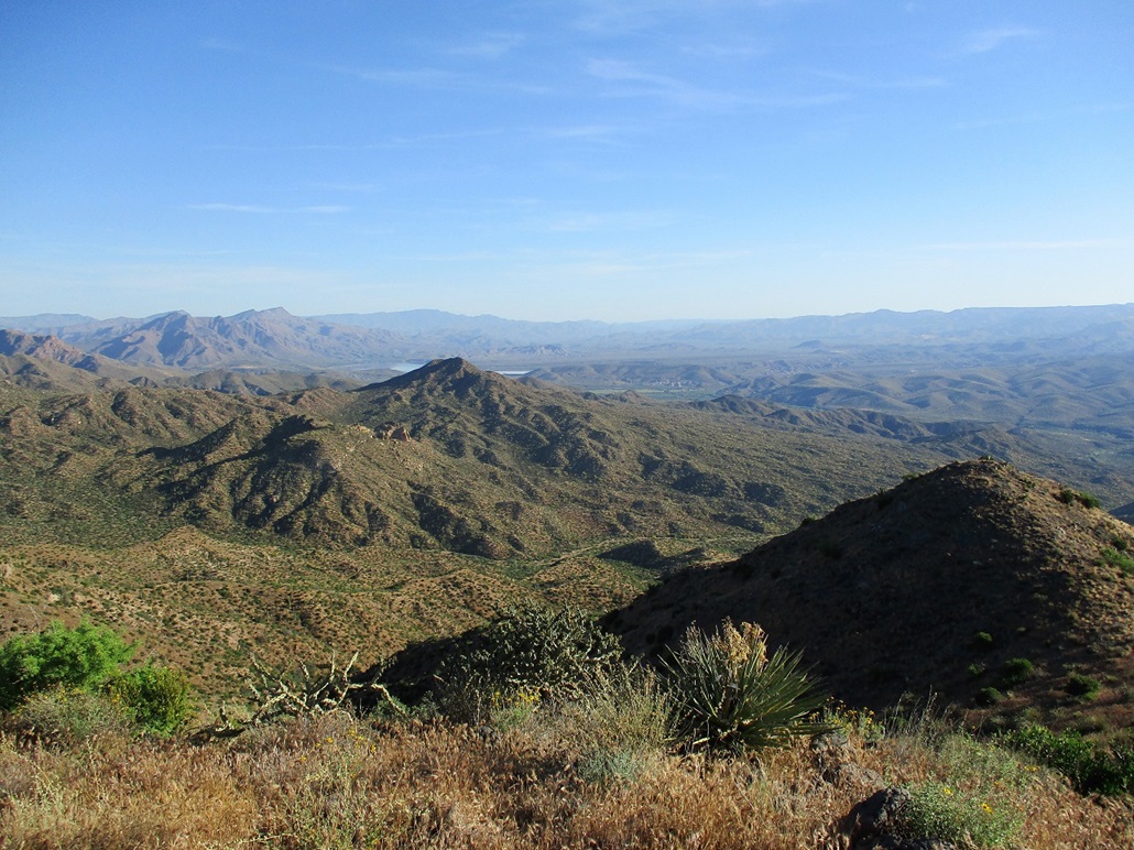
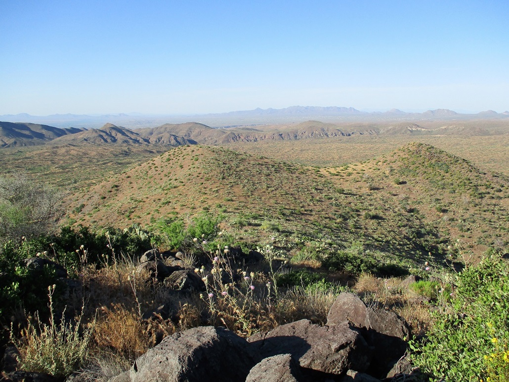
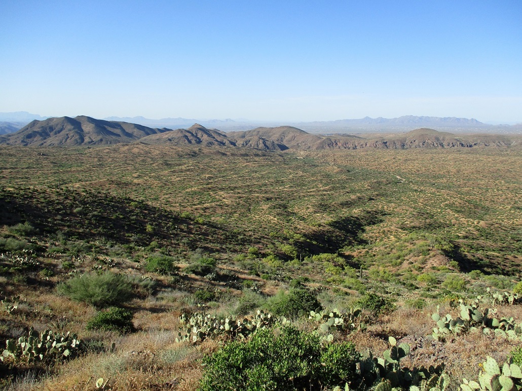
The peaks here don't have great prominence (usually in the 400-700 foot range), but they lie atop a broad slope that eventually drops about 1,500 vertical feet to Lake Bartlett and the Verde River. Thus, once on top of these peaks, there may be over 2,000 feet of vertical differential over the Verde River. The views are outstanding. And, adding to the attraction, most people come here to sit and drink in their boats on the lake and river below. Relatively few come here to hike. Because the roads have such dramatic elevation differences, bicyclists come here often.
I had the day open and the weather was supposed to warm up in the Phoenix area, into the high 90s. However, the mornings were still cool and I wanted to tag a summit that was not too far away. I was aware of this peak from my last visit here, so I chose to come here. I left home a little after 4 a.m., got supplies and a Tonto day pass at a local Circle-K, and slowly drove toward my objective. From where Bartlett Lake Road leaves Cave Creek Road, I covered about 10 miles, parking in a pull-out near the signed Indian Springs Wash Road. From my home, I had covered about 45 miles. The sun was barely rising when I rolled in, and it was cool, about 55 degrees.
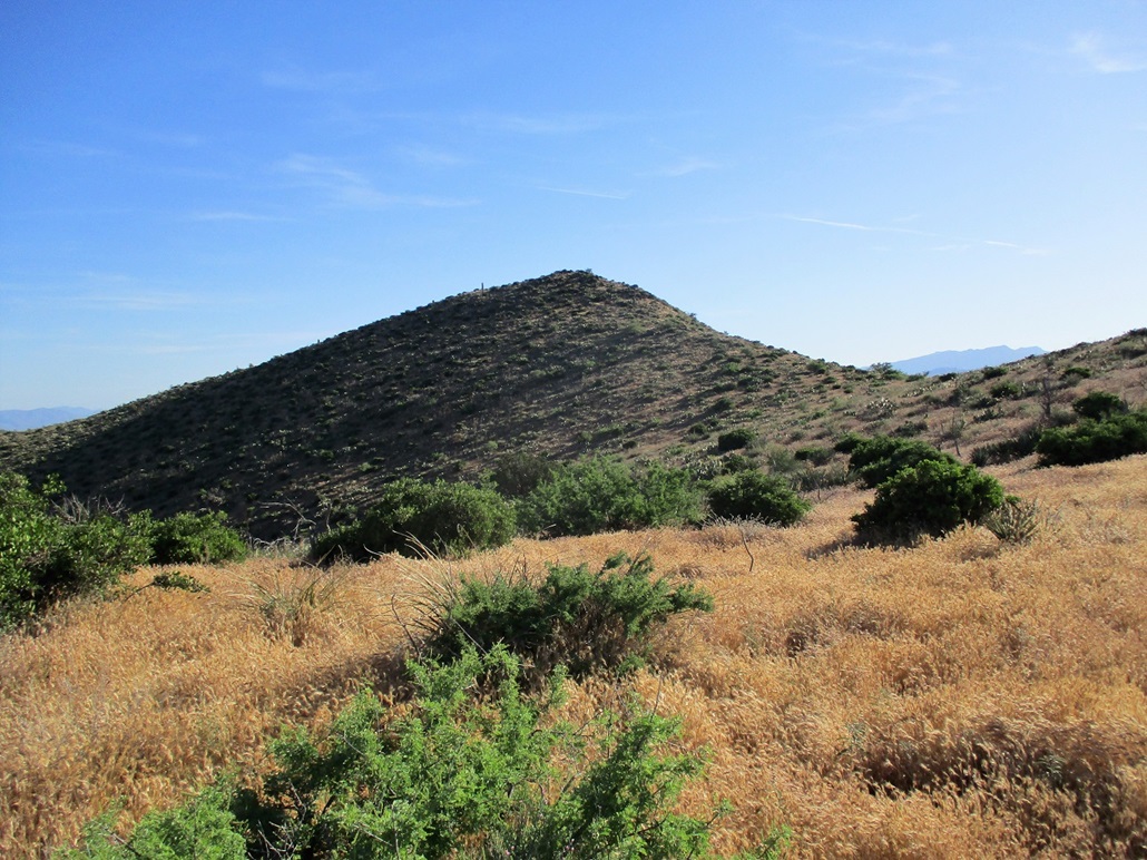
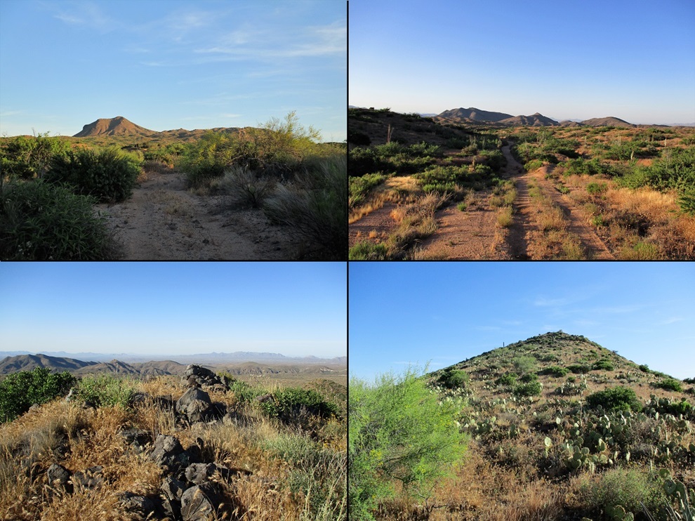
I locked up the car and started hiking at 5:35 a.m., walking northbound up Tonto Forest Road 532. Despite being on Forest land, there are no big trees here. This is mid-elevation desert, with lots of cactus and low brush, the biggest trees being about 8 feet high. I walked up the road for a couple miles, gaining about 450 feet. The peak is in view the whole way, but the highest point is hidden for much of the way by two bumps to its south. The hiking here was easy, the road being within a sandy wash for about 90% of the way, before ascending onto some elevated ridges.
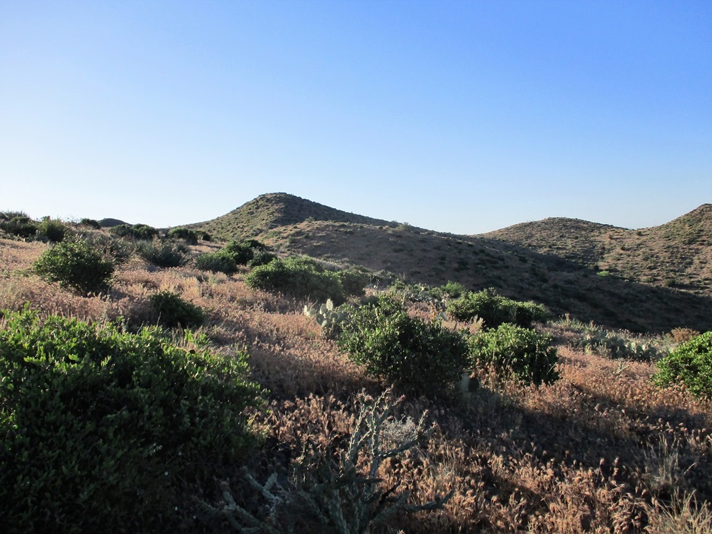
Where FR-532 tops out at its apex, I found an overgrown track that went north, whereas FR-532 went west and started downhill for Horseshoe Lake a few miles away. I followed the track as it stayed atop the ridges, going north then east to where all semblance of a road ended in a small clearing. I was below a slope of a bump, this being the western tip of a small ridge off the summit trending west.
I decided to go up-slope and follow the ridge, going up and down about four of these bumps, losing about 30 feet of elevation each time. Soon, I was at the saddle below the top. The final segment went fast, being a little more rocky here. The footing was always solid along this ridge, and the grass was not too deep, maybe a foot at the most. It was still cool, and I hope the snakes would stay in their holes for at least a few more hours.
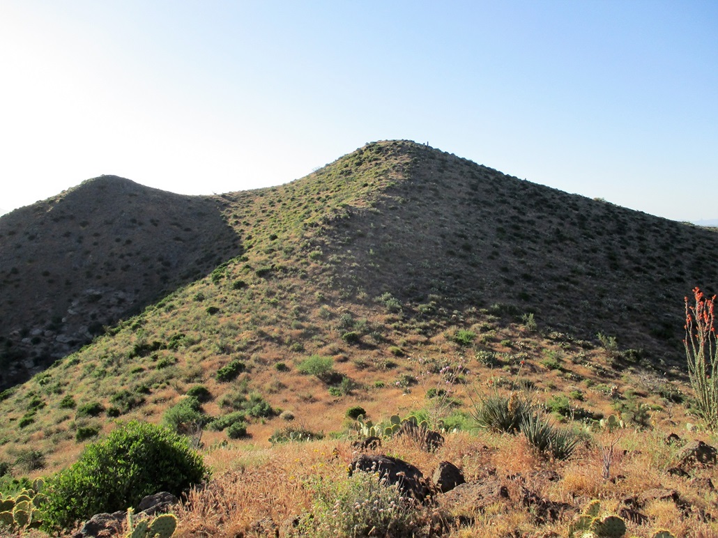
I was on top the peak at 7:05 a.m., a 90-minute hike with just over a thousand feet of elevation gain. Up here I had a breeze and million-dollar views in all directions. The sky was clear with no humidity, and I was very pleased how well the hike had gone, and how scenic it is. I spent about 15 minutes relaxing. I looked for a sign-in log but found nothing. The top is marked by a three-foot tall cairn.
For the down-hike, I decided to drop off the summit to the south. This would lead me to a saddle, then up slightly to another saddle separating two bumps, the two seen earlier as I started my hike. From here, I had a long drop down into the arroyos below. To the south was Brushy Mountain, which I hiked in February, and other nearby hills. The downhill hike went well, but I had to correct my route a couple times to avoid bad brush or steep drops. But I was soon off the main mountain mass and now within the confusing arroyo braids and the spits of elevated land that separate them.
I was not concerned I would get lost. All the arroyos would merge into the main channel, the one I had followed this morning. Nevertheless, I did not want to deal with tight brushy channels, so I generally tacked southwest, up and down the little bumps, until I came out to the main road, FR-532. I even saw my own bootprints in the road bed.
The hike back went quickly, and I was back at the car at 8:30 a.m.. I changed into dry clothes and drove out, seeing a big rattlesnake trying to cross the road a couple miles into my drive. I hope he made it. I never saw a snake on my hike (which was good), and prefer not to encounter any snakes, but they are interesting creatures and don't deserve to get run over.
Back in Cave Creek, I scouted the roads to another peak, Continental Mountain, which has roads to its top, but no one ever seems to climb it. I followed Fleming Springs Road through pricey ranchettes and discovered why no one hikes it: the road ends at a trio of gates, with strongly-worded signs about not welcoming visitors. By now, it was warming, so I just headed home, now dealing with more traffic.
I give this hike high marks and recommend it to others. I was expecting less, apparently. The hike was a lot of fun, easy, the slopes were not a rubble-fest, and the views from the top were excellent.
FR-532: This road is called the Indian Springs Wash Trail and can be hiked down to Horseshoe Dam. The road was gated south at the Bartlett Lake Road, but there were fairly fresh tire tracks in the road when I was here, so somehow, people get onto this road in their vehicles. It's not a bad road for hiking to Indian Butte, staying mostly within the main arroyo and being a little sandy in parts. There is one steep embankment that leads onto the ridges. Where the road then drops toward Horseshoe Dam, it is steep and would likely require 4-wheel drive.
|


|