
The Mountains of Arizona
• www.surgent.net
|
| Horse Mountain |
• Bradshaw Mountains • Prescott National Forest • Yavapai County |
|
Date: June 4, 2011
• Elevation: 7,078 feet
• Prominence: 1,078 feet
• Distance: 4 miles
• Time: 3 hours
• Gain: 1,120 feet
• Conditions: Sunny
Horse Mountain is in the southern Bradshaw Mountains, west of Towers Mountain and about eight miles northwest of Crown King. For my birthday, we looked for a place to escape, preferably somewhere cooler with a neat hike to do. We always like Crown King (maybe not so much the roads getting there), and have been here five times now, coming here about once every other year. Our last time here was in September 2009.
We left home Friday afternoon around 4:30 p.m., but traffic was lighter than expected. We had an unexpectedly easy drive to the Bumble Bee exit, and from there, a bumpy 26-mile drive to Crown King. The road, while advertised as being passenger-car passable, is washboarded and generally a chore to drive. We arrived in Crown King about 7 p.m., but continued onward, intending to get to the Horse Mountain trailhead, which is located at Hooper Saddle.
We followed Forest Road 52 (The Senator Highway) north and west out of Crown King. The first five miles was in good shape, but after its junction with FR-520 (the back-way access road to Towers Mountain), the road's condition worsened. We had just a couple miles to Hooper Saddle, but we had to go extremely slowly, easing up and down the big rocks and deep ruts. It took nearly a half-hour to cover the two miles. We arrived at the trailhead at 8 p.m. We had driven this road in 2003, and I don't recall it being in such poor shape. We had the camp area to ourselves and a very peaceful night.
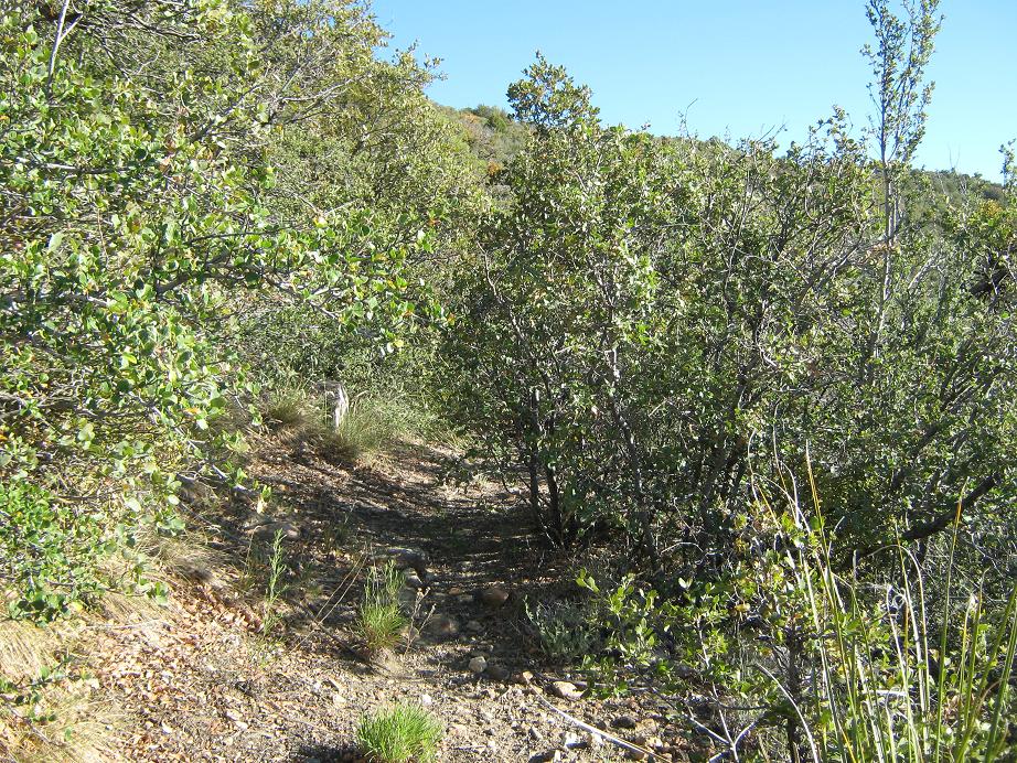
The next morning started cool, but it was going to be a sunny, cloudless day. Even at nearly 6,000 feet, it could get warm up here, so I started hiking at 6:35 a.m. The map shows a trail most of the way to the top, but quickly I could see that this was going to be a rougher hike than planned. The first couple-hundred feet are okay, as the trail winds steeply through chest-high woody brush. Then, the trail "ends". Well, not really, but the brush had grown across it so thick that it had obscured the trail completely. I inched forward, sometimes able to see an opening ahead of me, but often, I stopped and was completely bewildered! More than once I guessed and yes, the trail would re-appear again. So I kept at this for about a half-hour, not too happy about the brush. My goal was the crest at 6,640 feet. If the trail was this overgrown thereafter, I'd turn back.
I got a little lucky. The trail seemed to open up a tad more as I approached the crest, and at the crest itself, the brush ceased. Now, I had more grass, cactus, and shade trees such as juniper. Farther ahead, I could see stands of ponderosa. Things looked promising, so I kept walking, now following a rough path south toward a hill marked as spot elevation 6,871 on the map. The trail disappeared again up here, but now I had a fence to follow. Why it was up here I have no idea, and it was very old.
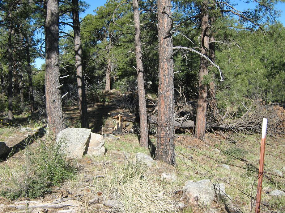
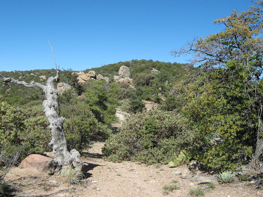
Near Point 6,871, I angled west and now had much better conditions: big ponderosa, little underbrush, and a soft mat of pine needles to walk on. The fence went west, too. I followed the lay of the land, going up and down the ridge to where the fence bent right again. But now, I was below a small hill, and once I surmounted it, could see Horse Mountain's summit ahead, a third of a mile distant. I angled northwest down a drainage, then up to a rock outcrop where I found a few cairns, and the fence again. The remaining hike followed cairns, mostly in line with the fence. Below the top, there is a gate in the fence, surely one of the more remote, useless gates ever installed. The going looked less brushy on the other side, so I passed through said gate and walked up the last 100 feet, some of it brushy, to the top.
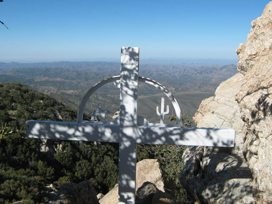
The summit is a big jumble of granite rock, free of trees and brush, and offering superb views up and down the Bradshaw Range. A wrought-iron memorial for Bill Ray, presumably a local rancher, sits below the summit rock. The top rock is easily scaled, and I signed in, the first for 2011. I noted an average of about one group per year who sign in. Given the remoteness of this peak and the bad road needed to get there, I am not surprised. And, not surprisingly, a couple of signers are acquaintances of mine from other hikes. A small world, indeed.
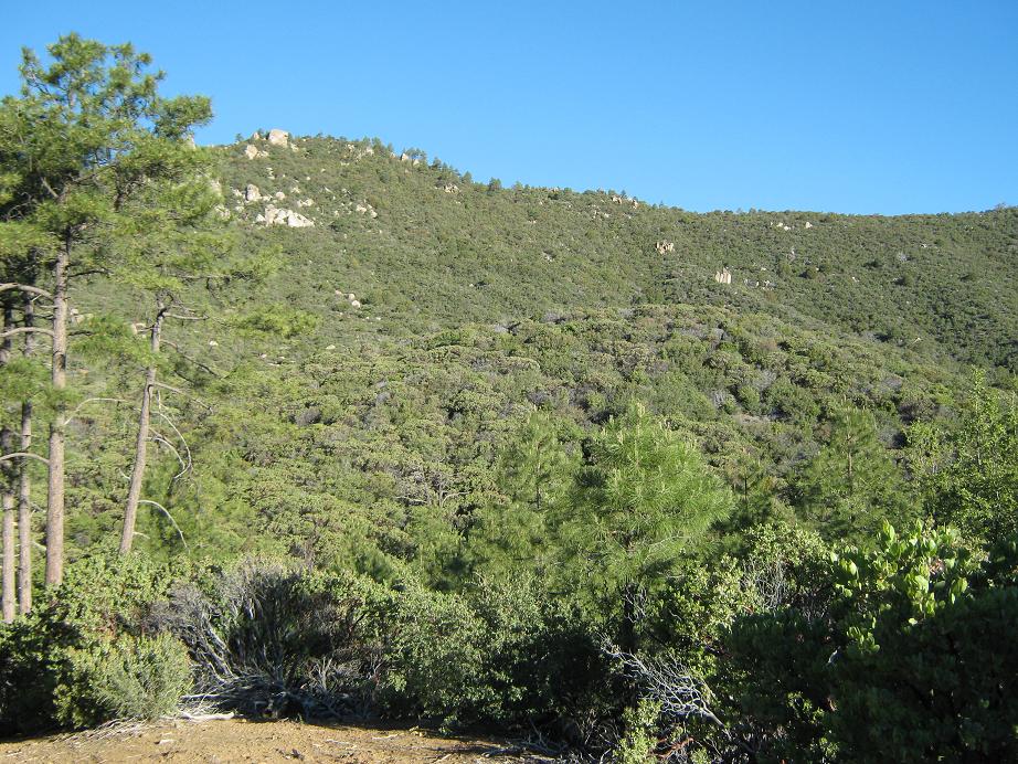
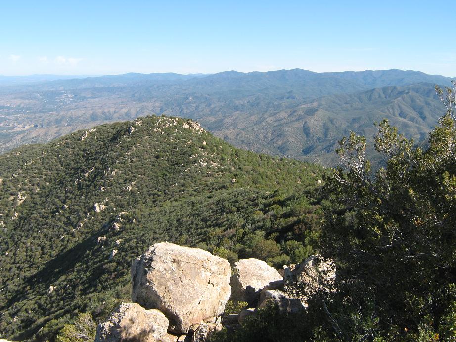
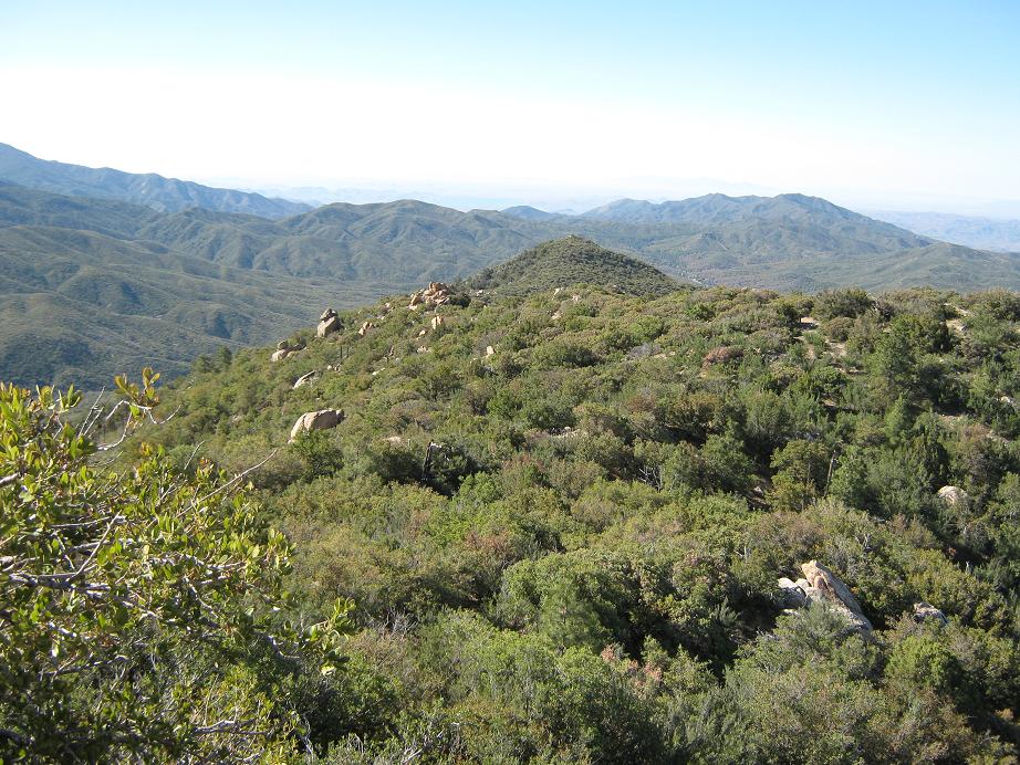
The view north features the peaks of the north Bradshaws including Mount Union, the range highpoint. It does not stand out as obvious, but it is higher than its nearby peaks and you can barely make out the towers atop its summit. Big Towers Mountain is immediately to the east, while the foothills and deserts fanned out to the south. The slope gave away very steeply west, dropping 2,000 feet, with the Weaver Range off in the distance. I was very impressed with the views, and would be happy to go on record as claiming them to be some of the best you can get from any peak in the Bradshaws (given most of the rest of the peaks are wooded).
It had taken me two hours to gain the top, even though the one-way mileage was about two miles and just 1,100 feet of gain. Of course, a lot of that time was lost to stopping in utter confusion, trying to glean the trail through the overgrown greenery. For the descent, however, I knew where to go, and I made great time. I had built little cairns for my own use for the descent and these helped a lot, especially at the 6,640-foot crest, knowing when to re-enter the brush. I had also broken many branches or cleared out deadwood on my way up, which helped, of course, on the way down. I was back to the truck in less than an hour. In all, a good hike with tremendous views as the reward.
βð was happy where she was, not a soul having driven by. The temperatures were still pleasant and we spent about 30 more minutes here before leaving. Our original plan had been to camp here both nights, but we both wanted to get up past that bad stretch of road, closer to Crown King, and not have it on our minds the rest of the trip. I decided to drive it in 4-wheel low, which I use rarely. My truck inched forward at 5 miles per hour, often slower, but going up the road (we had about 600 feet of gain) was much better this way. We just took each obstacle one at a time and after 40 minutes, had covered the 2.5-mile stretch to the FR-520 junction. A 4-wheel drive enthusiast with a Jeep would probably enjoy this road, but we didn't like it much. We do 4-wheel drive roads as a means to an end, but this one was really ugly. We were glad to be above it now, and probably will never drive it again.
We spent the rest of the day encamped at a nice spot about a mile south of the FR-520 junction. Even though it was alongside the road, we were back in far enough to be hidden and there were all sorts of easy nature-walk trails in the area. We just lazed around camp, took naps, walked around, talked, celebrated my birthday, and got another good night's sleep in the cool pines of the high country. The drive out the next day went without much incident and we were home by noon, Sunday.
|

|