The Mountains of Arizona
www.surgent.net |
|
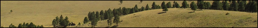
Govern Benchmark • Peak 7997 These four volcanic mounds lie in Government Prairie, a large expanse of grass and spotty forest north of the Parks exit off Interstate-40, about 20 miles west of Flagstaff. The prairie lies south of Kendrick Peak and east of Sitgreaves Mountain. I visited the batch over two separate days, driving to and from Henderson, Nevada, breaking up the drive each way. There are five separate hills in this region named "Government". The two largest features are called Government Hill and Government Mountain; I did not climb these on this visit. Three other hills are lumped as the Government Knolls. I climbed the two northern ones as a single hike on my drive to Henderson, then came back and hiked the southern one, plus Klostermeyer Hill, on my drive back home. Both Peakbagger and ListsofJohn call the two northern hills "North" and "South", while the southern one goes by "Peak 7830" although it is labelled as "Government Knoll" on some topographic maps. The northernmost of the knolls is the highest and has a benchmark stamped "Govern". Older maps include Wild Bill Hill in with the Government Knolls, so the name seems to shift as newer maps are made. To me, these four hills, plus Wild Bill, comprise the Government Knolls grouping.
Date: September 1, 2020
• Elevation: 8,142 feet
• Prominence: 442 feet
• Distance: 3.3 miles
• Time: 2 hours
• Gain: 472 feet
• Conditions: Sunny with clouds, warm and pleasant
Arizona
•
Main
•
PB
•
LoJ
•
USGS BM Datasheet
•
Interactive map
I left Payson about 8:30 a.m. and was in Flagstaff a little after 10, following AZ-87 and Lake Mary Road. Traffic was light, being a weekday. I topped the gas and got onto Interstate-40, exiting in Bellemont. I followed the north frontage road a couple miles west to Coconino Forest Road 171, the same one I was on a few weeks ago when I hiked Wild Bill Hill. I did not see any fights this time.
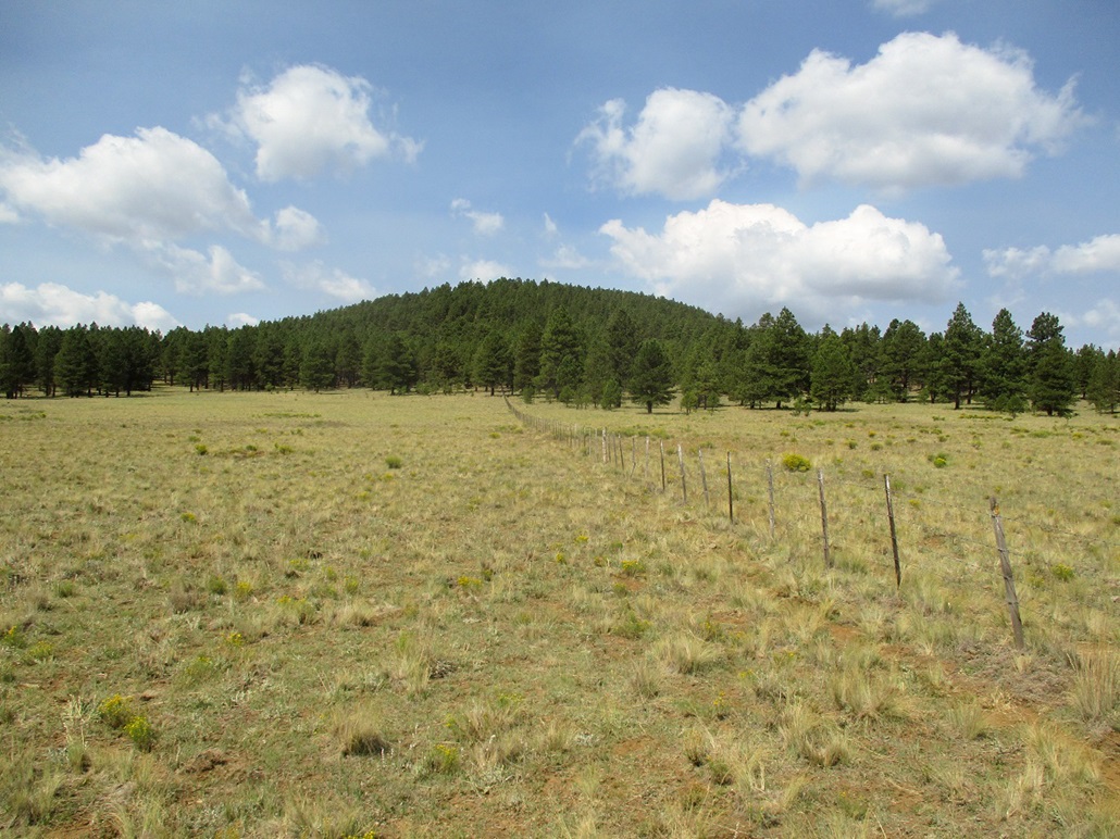
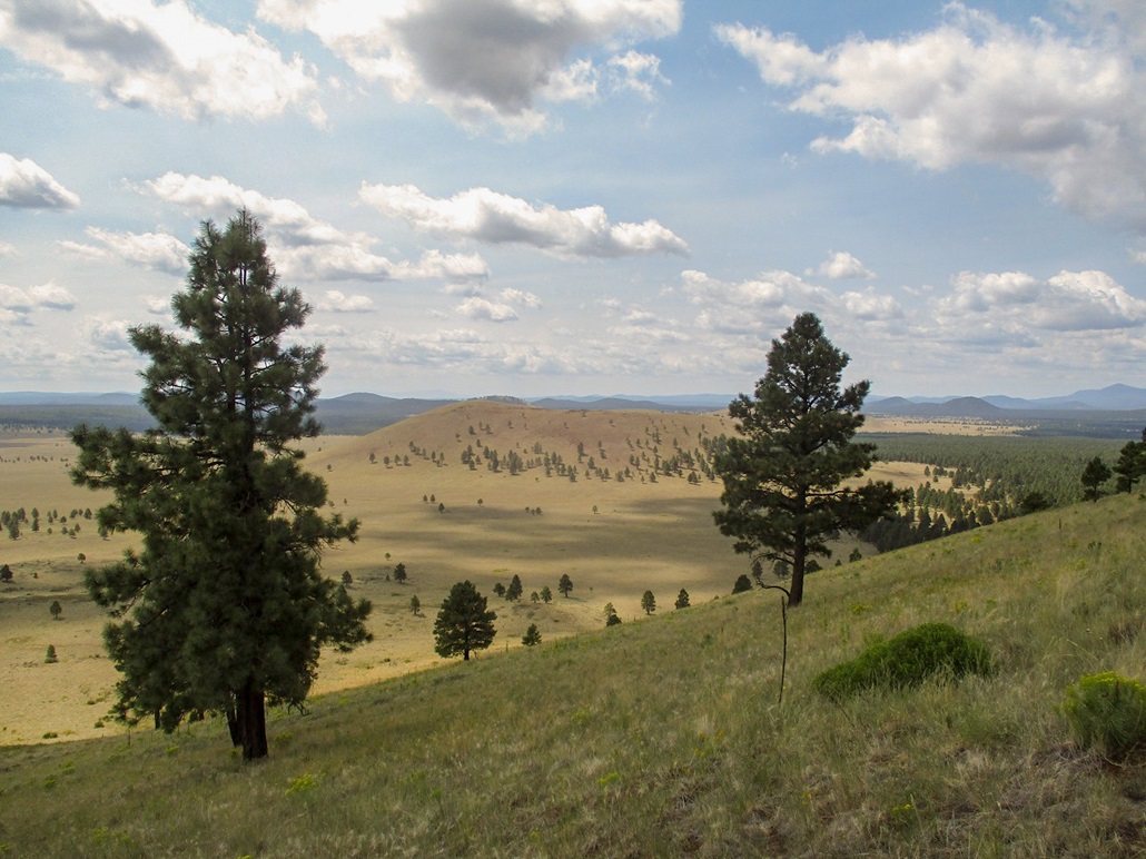
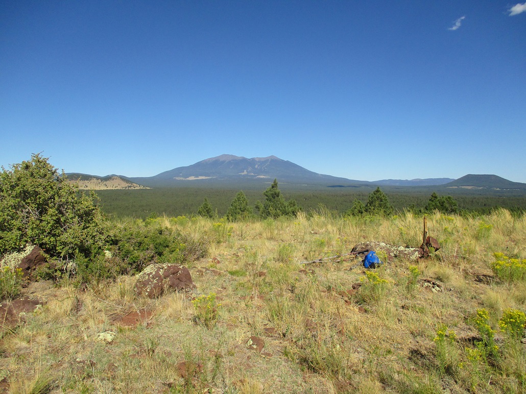
I drove up FR-171 to FR-812 (which becomes Kaibab Forest Road 781), passing below Antelope Hill. I stayed on the road past one junction, the road narrower but in good shape. I parked in a clearing near a gate spanning the road, the north Government Knoll to the west, and Antelope Peak to the northeast. The day was sunny with clouds moving through quickly, the after-effects of a system that moved through the state over the past couple of days. The temperature was in the low 80s, and there was a stiff breeze.
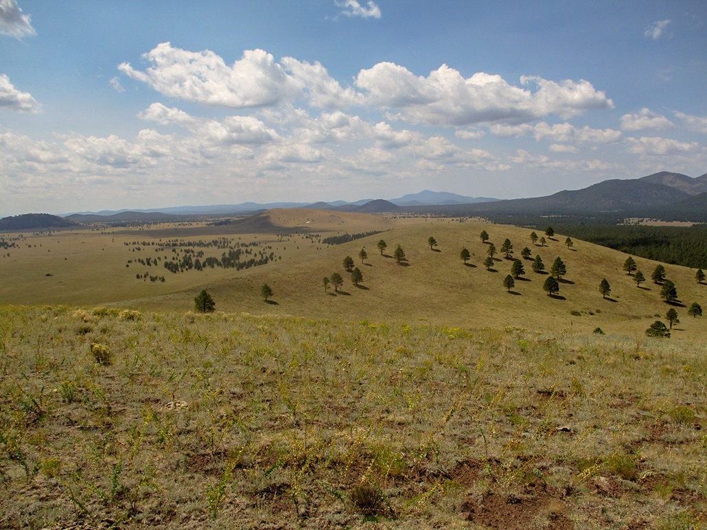
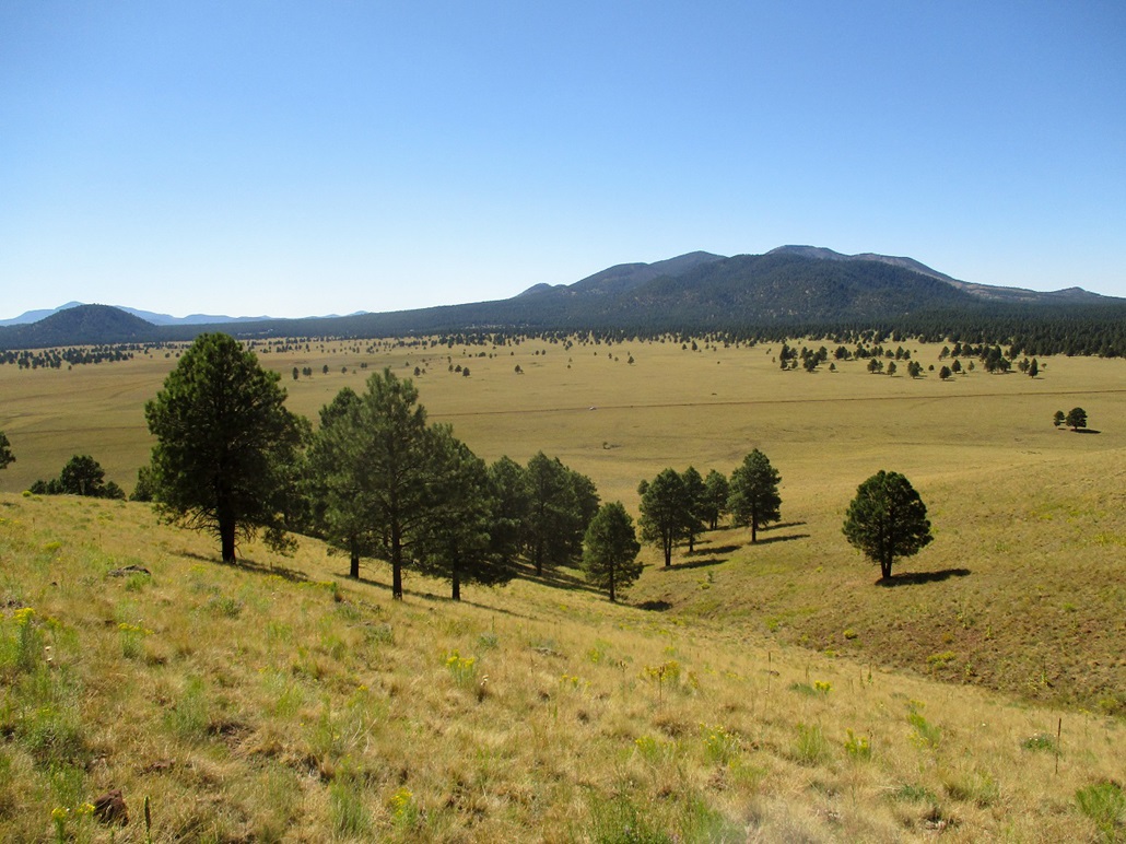
I hiked along the fence to a corner, then had to shimmy under it. It was a new fence and taut, with no place to push down on the wires. I was now walking south along more fence. Quickly, I was at the base of a ridge, the main east ridge of the knoll. It was forest here but mostly open. I hiked up this slope and continued along its spine. As I gained higher, the demarcation between forest and meadow became more pronounced: forest to my right (north), open grass slopes to my left (south). After surmounting a rise, I could see the top up ahead.
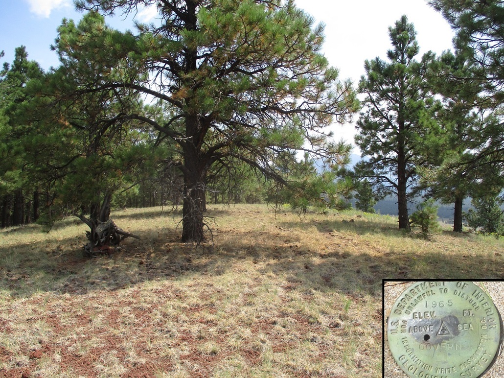
I was on the summit quickly, about 20 minutes after starting. The one-way hike covered about 0.8 mile. The top is mostly open with a couple trees nearby the top. I found the "Govern" benchmark, then found an old register tucked into a log hidden by rocks. I signed in, the first since last year, although I am sure more people come here than the register would indicate.
I did not stay long. I took a few images, then started straight down the south slopes, descending into the little valley hemmed in by the knoll I had just hiked, and the next one south ...
Elevation: 7,997 feet
• Prominence: 317 feet
• Gain: 360 feet
• Conditions: No change
PB
•
LoJ
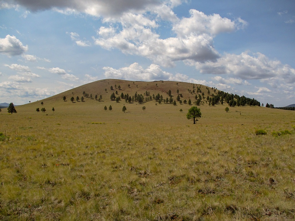
The next knoll, Peak 7997, or "Government Knoll South" on the Peakbagger and LoJ websites, was in my sights. It lies a mile south of the north Knoll, the one I was just on. The descent went well, and the walk across the meadow went quickly too. I had to breach another fence, but this one was older with spots to push down on the wires to step over them.
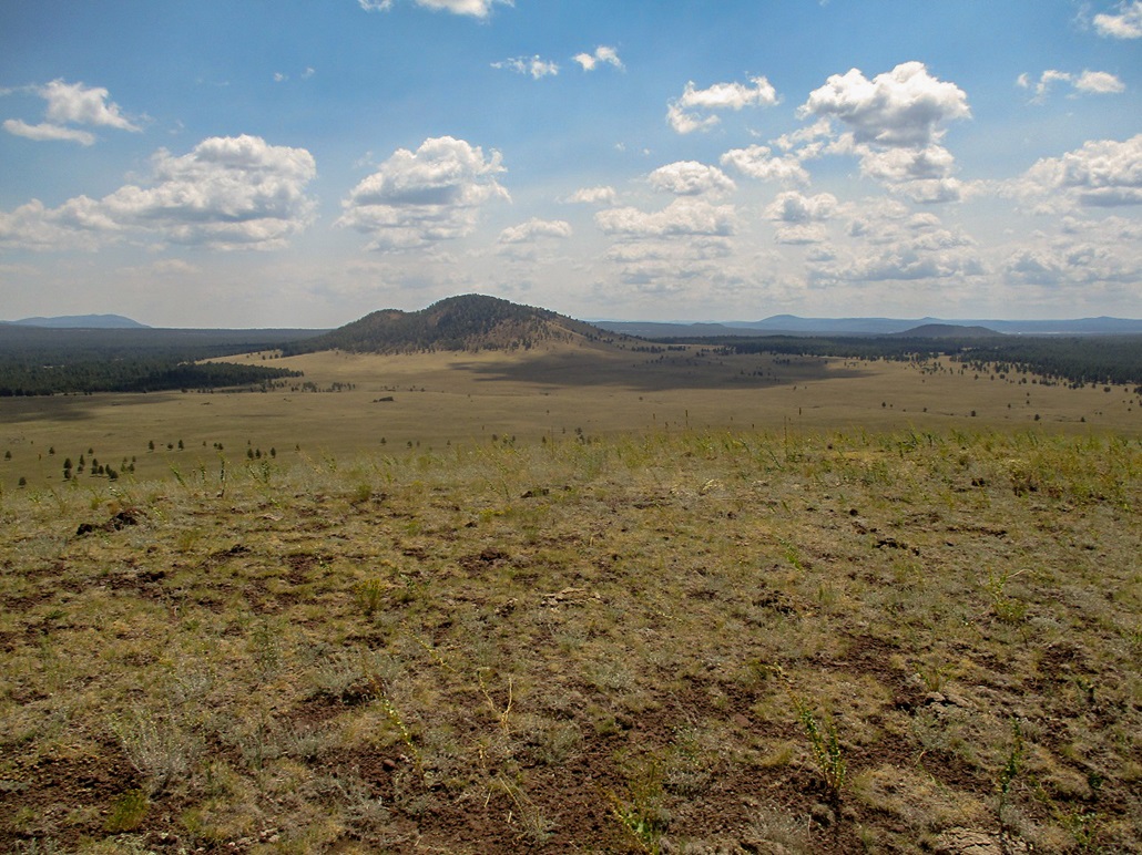
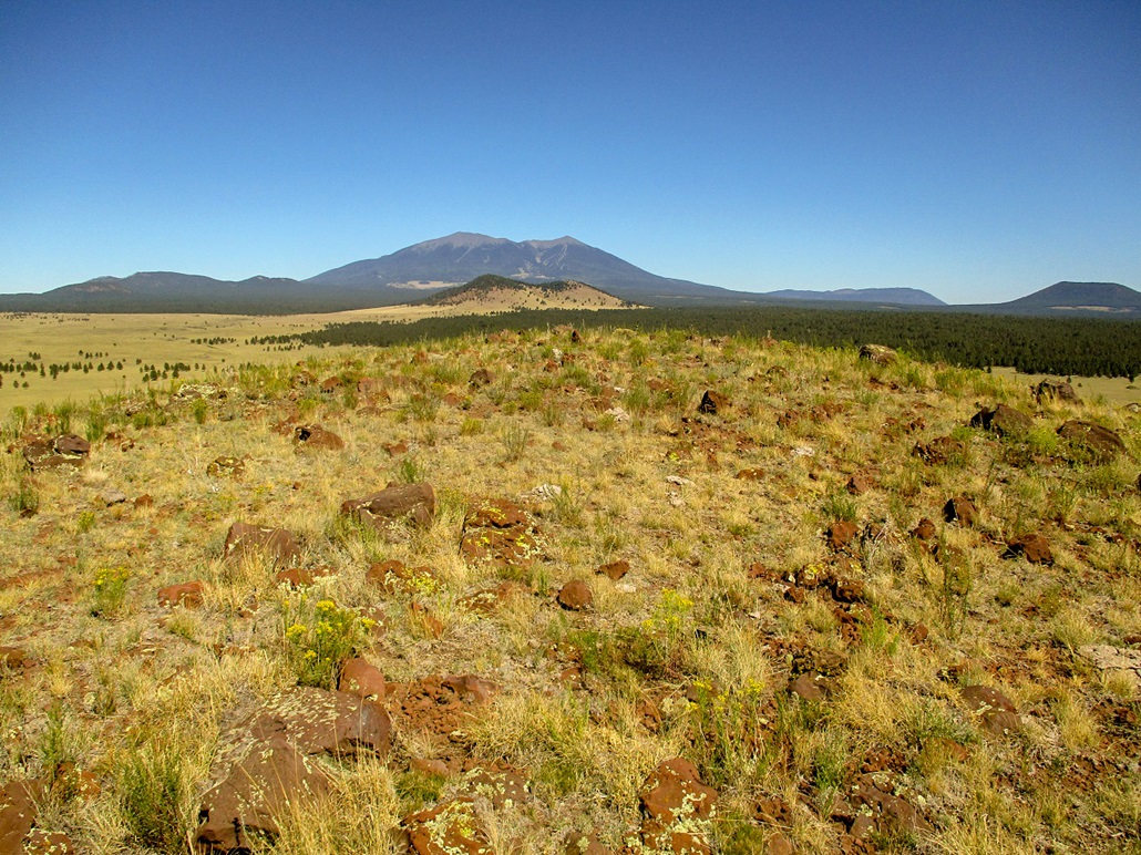
The slopes of Peak 7997 are much more bare, with a few trees scattered here and there. I just picked a line and started uphill. It was a steep slog but easy, and in about another twenty minutes, had arrived on top this knoll. The top was bare, with low grass and random rocks. I could not locate a register or cairn or sign that others had been here.
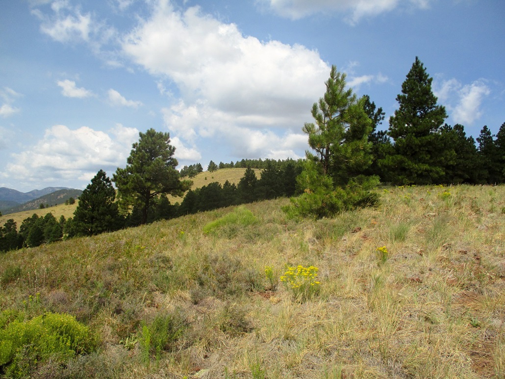
I stayed up here about five minutes, taking a drink break and snapping more photos. The day was breezy, and up here, the gusts would kick up, but it was warm and I was very comfortable. I had excellent views of surrounding peaks and hills, with Kendrick to the north, Sitgreaves to the west, Wild Bill Hill to the east and Humphreys rising behind it, plus many other hills, too many to mention by name.
I descended off the knoll on a northeast bearing, and was soon down on the flats. I got onto a jeep track, then another one, then cut cross-country through the scattered trees. I had to hop over the flimsier fence along the way, then came upon the "good" fence, which I followed back to my vehicle. I had been gone just under two hours.
It was nearing 1 p.m. when I started out. I still had a couple hundred miles to Henderson. The drive went well, me taking the scenic route from Seligman via old US-66 through Peach Springs, then back to Kingman. It was pleasantly "not hot" even at Hoover Dam, where the temperatures were barely 100 degrees. I got to my parents' place about 4. My father had a small surgery the next day and needed me to drive him there and back, plus stick around to make sure he was okay otherwise.
Date: September 3, 2020
• Elevation: 7,830 feet
• Prominence: 330 feet
• Distance: 1.2 miles
• Time: 45 minutes
• Gain: 380 feet
• Conditions: Sunny and very warm, dry and cloudless
PB
•
LoJ
I stayed with my parents in Henderson for a few hours this morning. I had to pick up some medications for my father, and wanted to wait until his nurse came by to give him a once-over. When everything seemed to be in working order, I started my drive back to Payson, leaving around 10:30 a.m., the day already warming up fast. Three hours later, I was in the Arizona high country, but the temperature was still in the low 90s at this elevation.
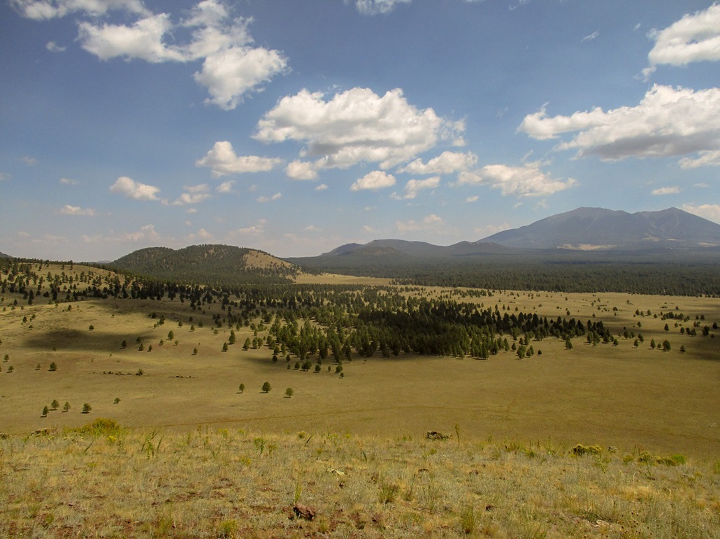
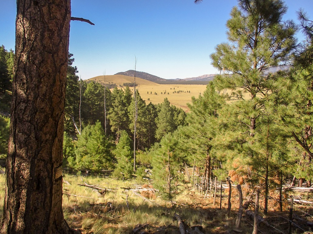
I left the interstate at the Parks exit, got drinks, and drove a little east on the frontage road (old US-66), then north on Government Prairie Road. The road starts in thick forest, then passes through a residential area. At milepost 3, the residences end and the forest property starts again, this time in the broad Government Prairie meadow. Despite the warmth, the conditions were outstanding. It was sunny and with low humidity, bright blue skies and no clouds.
I drove north up Kaibab FR-107 about a mile farther, placing myself west of Peak 7830, the southernmost knoll of the Government Knolls. I parked in a clearing beside the road, about a quarter-mile north of a stock tank where cattle were already assembling, presumably to stay close to water on this warm day. My car's temperature gauge said it was 88 degrees outside. I got suited up, carrying extra drinks, and started hiking at 2:00 p.m. sharp.
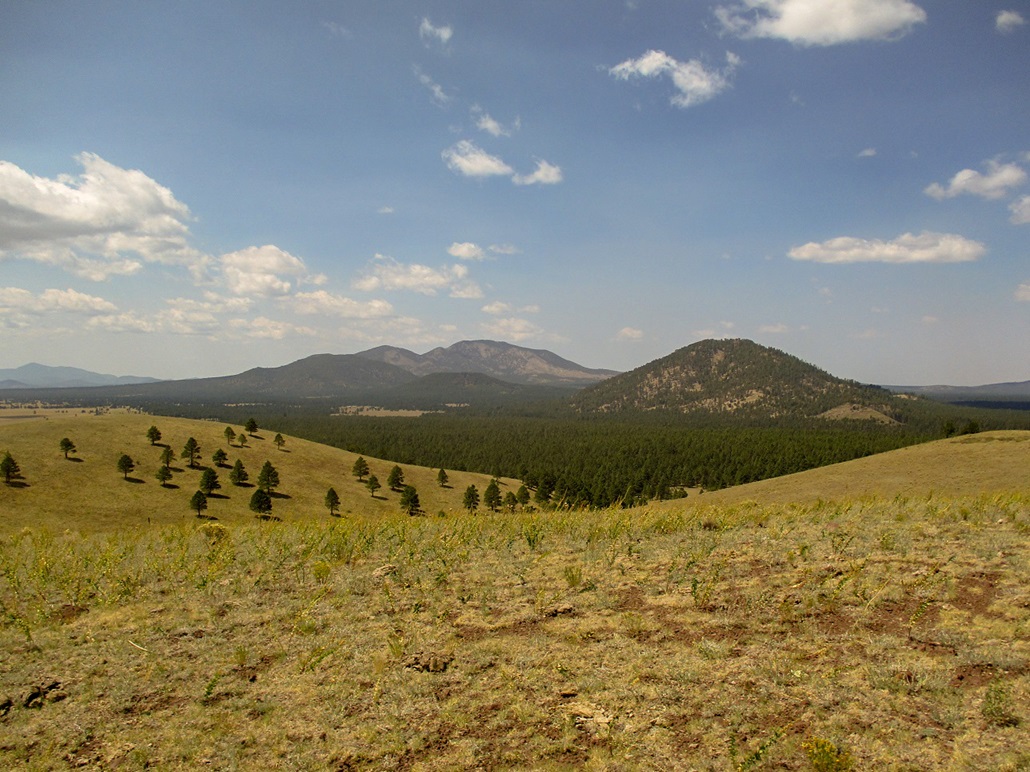
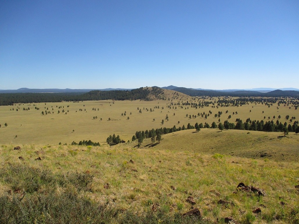
The route is obvious. I walked across a little flat, then angled toward a copse of pines on the hill's southwest slopes. I planned to hike up to a saddle south of the highpoint, but I was more eager to get into the trees and take advantage of whatever shade I could. Although it was warm in general, in the shade, it was very comfortable. However, the trees end, and the last two-thirds would be up open slope.
The slopes were easy and laid back well. I just went slow and soon, was on top. I snapped a few images of the surrounding hills and distant peaks. Down in the meadow below I saw a bunch of mooing specks being herded by a cowboy on his horse. He was leading them to the stock tank mentioned earlier. I hiked down the same way, and was back to my car at 2:45. The hike had gone quick and I wasn't as thirsty as I thought I would be.
I drove the road south, aiming for Klostermeyer Hill. By now, the cowboy and the herd were at the stock tank. Whereas before there'd been maybe eight cattle when I drove in, there were now thirty or forty beasts, including bulls with big horns. They were all drinking and mooing and having a merry time, a keen bovine wingding. The cowboy just leaned forward on his saddle and watched them. I inched by in my car, so as not to spook any of the cattle. He lifted a couple fingers to acknowledge me as I drove by. Although I couldn't hear him, I'm pretty sure he said something like "howdy, podner" as I drove by.
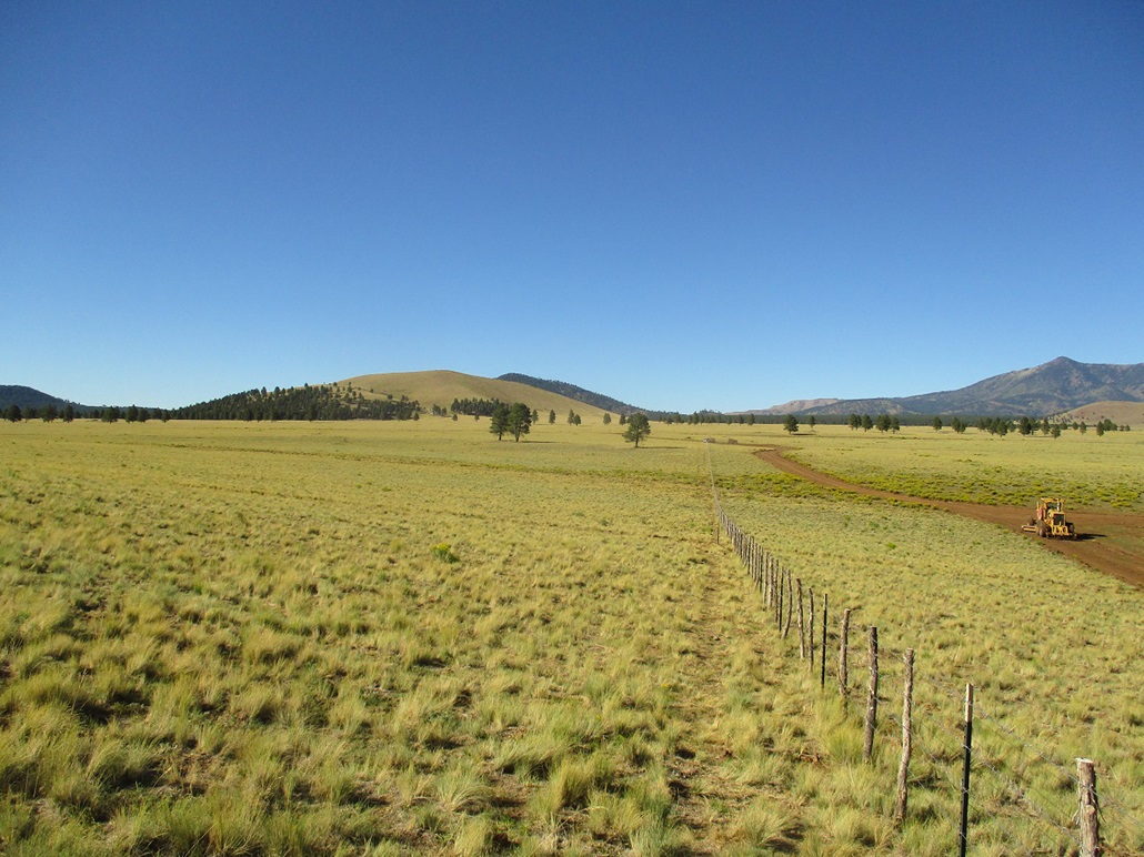
I did not have to drive far, maybe a mile south, then a mile east on a newer-looking road marked as FR-882 on the maps. I then drove south a short ways on a lesser road, parking at a gate that surrounds a quarter-square-mile section of private land and a couple earthen tanks. The roads look recently bladed and bermed and comparing to the maps and satellite images, look to be slightly rerouted, too. It was now close to 3 p.m. and still very warm, but calm and pleasant. The good news was I would have more trees and shade on my next hike.
Elevation: 7,810 feet
• Prominence: 370 feet
• Distance: 1.4 miles
• Time: 45 minutes
• Gain: 367 feet
• Conditions: Same as above
PB
•
LoJ
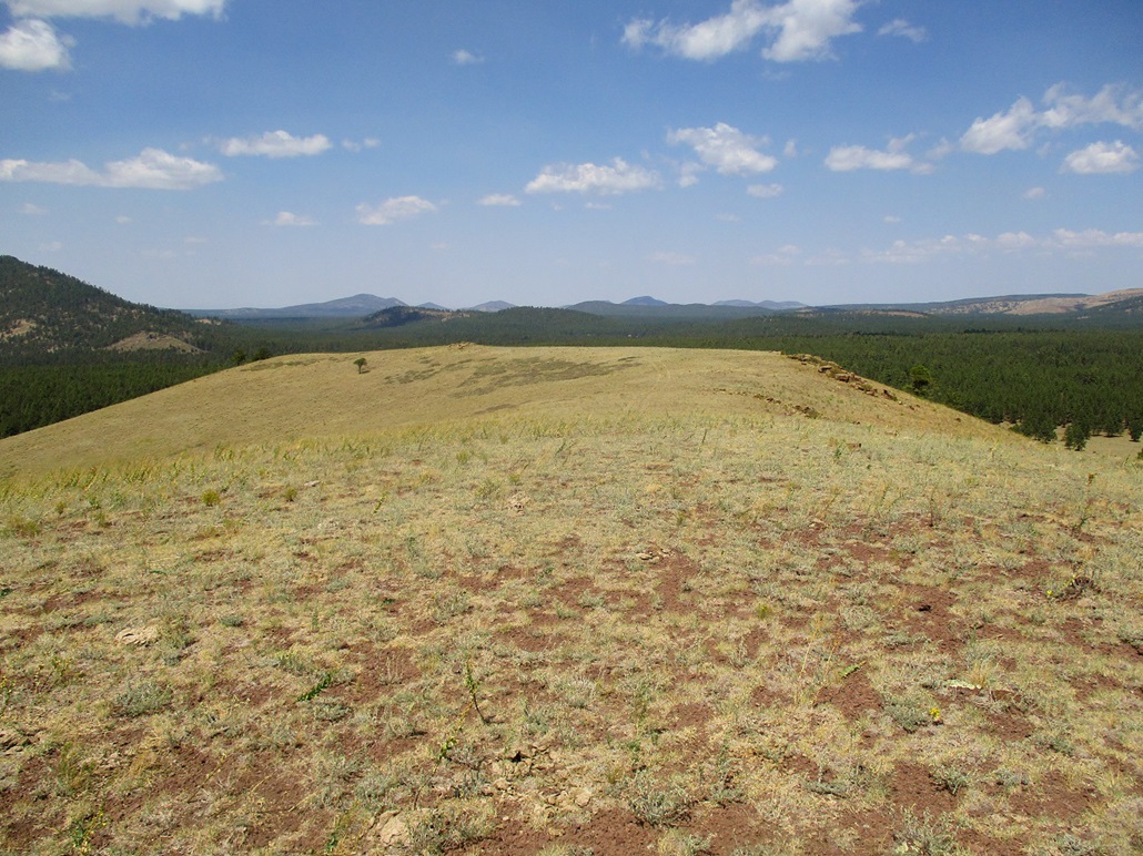
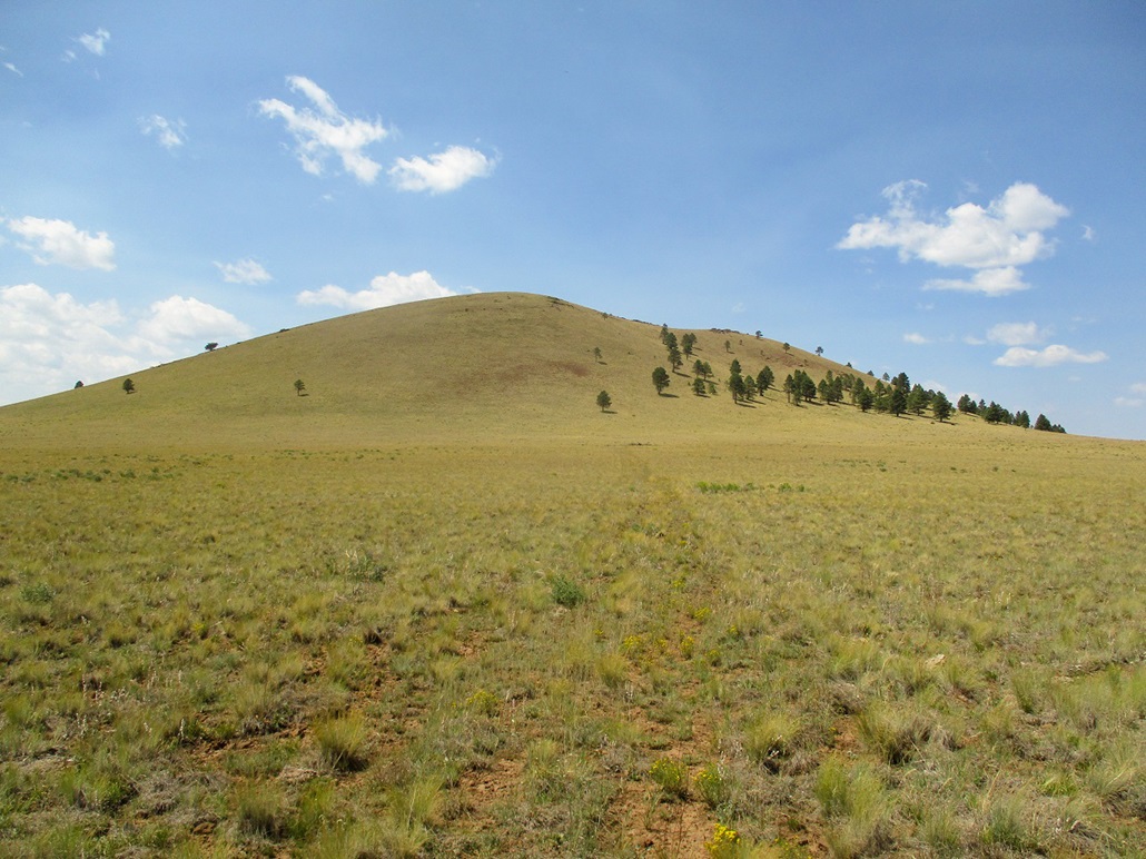
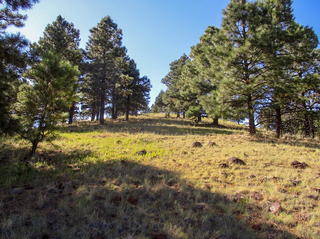
I was walking at 3 p.m., staying on the right (west) side of the fence, following a decent path. The path and fence then enter the trees and start to gain elevation. I was not entirely sure where the highpoint might be, so I stuck with the fence and path until it would end. Toward the top ridge, the slope steepened and there was some minor downfall, but the fence continued up and over the ridge, as did the path. I was in the trees for most of the way and the shade helped considerably.
The top appeared to be to the west, so I hiked up open slope and soon was on the summit, which was like the others: bare with some rocks. The highest rocks appeared to be within a bush. I tagged a few rocks and took a break up here to drink and relax. Like on the other hills, I enjoyed the views, snapped some images, but did not spend a lot of time. There was no cairn or register and I did not leave any.
For the descent, I liked the fence and path, so I chose to follow it down, too. The round trip hike took 45 minutes and covered about 1.4 miles. The hike was enjoyable and straightforward. I have no idea who Klostermeyer is.
It was close to 4 p.m., so I drove back to the interstate to Flagstaff, topped the gas, and drove home to Payson, arriving a little after 6 p.m.. This being the Thursday before the Labor Day weekend, people were already driving their massive RVs and trailers up on the plateau, looking for places to stake out their compound for the weekend. Traffic wasn't too bad but the big trailers clog everything up no matter what.
This had been a productive couple of days, but I am most happy that my dad's surgery went well and he appears to be back to getting healthy.
|


|