The Mountains of Arizona
www.surgent.net |
| Government Benchmark |
• Tombstone Hills • Arizona State Trust Land • Cochise County |
|
Date: January 9, 2024
• Elevation: 5,233 feet
• Prominence: 465 feet
• Distance: 1.5 miles
• Time: 1 hour
• Gain: 570 feet
• Conditions: Sunny and clear, very chilly
Arizona
•
Main
•
PB
•
LoJ
•
USGS BM Datasheet
•
Interactive map
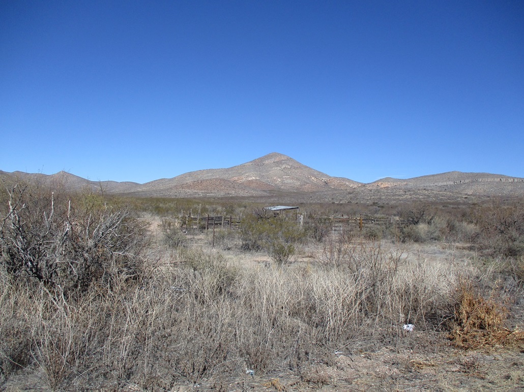
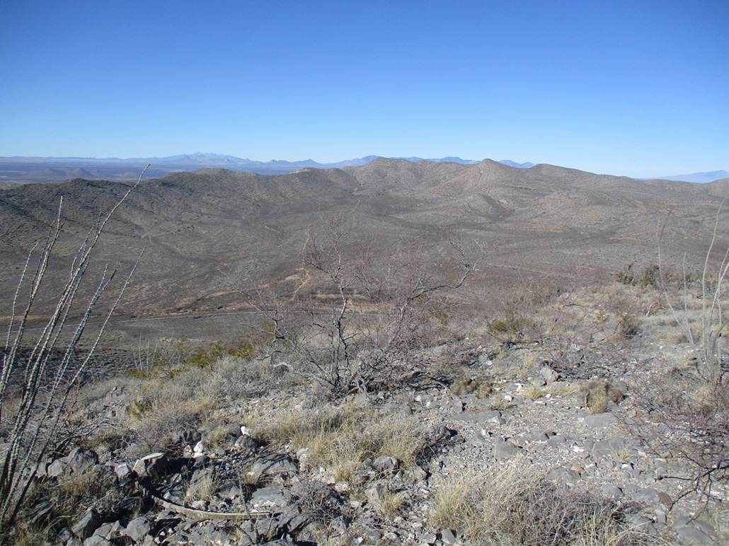
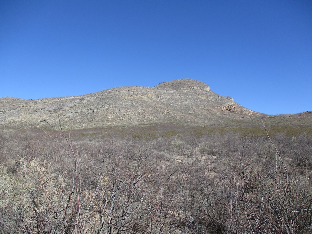
I returned once more to the Tombstone Hills to hike yet another peak, Government Benchmark. This peak has a nice rounded profile with some cliffs on its south and southeastern faces, and lies about a mile west of State Route AZ-80 about five miles south of Tombstone.
I approached the peak from the west, via the Old Bisbee Highway. I don't know much about the history of this old road other than finding some snippets that indicated it was functional up to the 1930s, before what was then US-80 was built out, that alignment being on the east side of the peak.
Access to the Old Bisbee Highway is via a gate just south of milepost 323, where the highway descends southbound out of Tombstone. It's easy to miss the gate as it is tucked in from the highway, flanked by brush. I had been here a couple weeks ago and learned that the gate is unlocked and unposted, which is de-facto permission that one may enter. Most of the land in the immediate area is State Trust. A tiny portion past the gate is private. There is a corral behind the gate, abutting the highway fence, but you'd probably never notice while driving by.
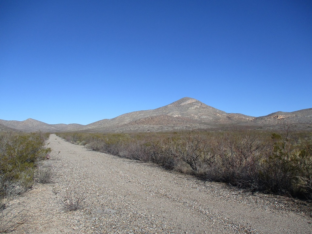
I did some morning duties for my classes and with a couple hours to spare, drove the 20 miles from my home in Bisbee to the gate, pulled in, and drove a few feet to the Old Bisbee Highway. I was pleased to see that the old road is in decent shape, better than I was expecting.
I turned right (nothwest) onto the Old Bisbee Highway, which these days is just gravel with some hints of old asphalt. It is narrow and the brush grows thick to the edges, plus some in the tread, so I got some minor pinstriping as I drove through, going slowly, 15 miles per hour maximum. Where natural arroyos would cross the road, old concrete culverts still exist, doing their job. Thus, the road is mostly smooth and not undercut out by the arroyos.
I was partially expecting I wouldn't get in anywhere at all and have to start my hike from the gate and corral. Once on the road, I drove it as far as I could. The road goes northwest, then curls north and northeast. I got as far as where it makes turns northward. Part of my problem was there was absolutely no place to pull to the side. I could have parked in the road, but it would be my luck that this would be the one day when five other people want to drive through. Luckily, there is a pull-out near a stock tank shown on the map. This area is flat with a couple fire rings. There were some bullet shells and some skeet pigeons, but it wasn't trashed or messy at all. Very few people come back here, it seems.
I was close to the top, about a half mile on a straight line. I got properly suited, and started hiking about 10:30 a.m., the day a nice sunny blue sky day, temperatures in the high 30s but calm.
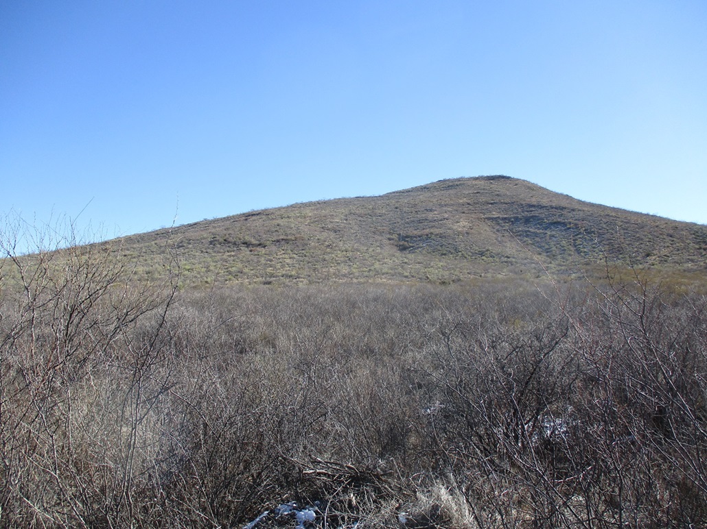
The brush is thickest where it lines the old road, much of it thorny and tangly. I pushed through it and it seemed to relent just a little. As the slope gently increased, there was more ocotillo to weave around, plus creosote, desert sage and various grasses. The tread was limestone ledge rock and some rubble. The rubble wanted to roll, but the exposed ledge rock offered good footing and sometimes allowed me to walk about 50 feet unimpeded. I followed a northwesterly ridge all the way up, the gradient staying consistent and never posing any problems. Higher up in the shade, some remnant snow from a couple days ago still lingered, and in a couple spots, was icy.
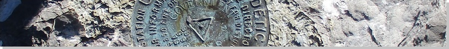
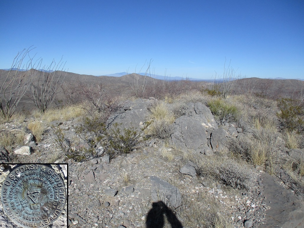
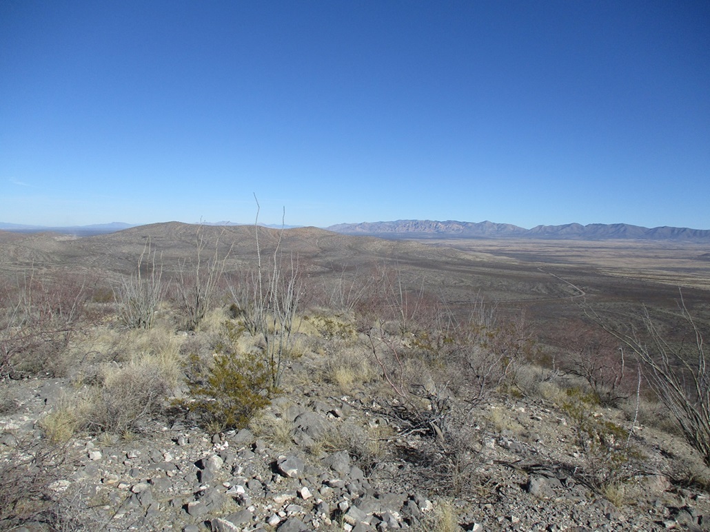
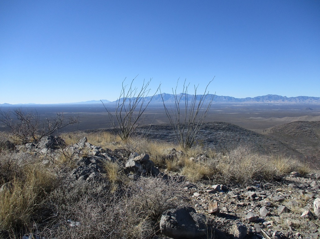
I was on top the peak about 25 minutes after starting, a three-quarters mile of a hike accounting for the weaving I had to do. The top is open with some brush, a few boulders and a cairn. The cairn held some items that looked to date from the old surveyors, but I could not locate a register. The benchmark was found easily embedded in the rock. I spent about five minutes up top taking photos and enjoying the views.
I followed mostly the same route down, and didn't move much faster due to the brush, but overall it was a very easy hike and took me about an hour. I was happy to be down, basking in the glory of having climbed my 800th ranked peak in Arizona.
On the way out, I walked over to a gate on the other side of the highway as there is another ranked hilltop that way. This gate (and the road behind it) were decrepit, any signs having been weathered away. I did not pass this gate but noted it for a later visit. Whoever owns it or manages it probably doesn't come this way very often.
Done with this little outing, I drove back home, showered, did a grocery run and logged in for a couple zoom meetings and attended to my online students.
The summit and key-col elevations are derived from the 1-meter Lidar data, "USGS 1 Meter 12 x59y351 CA_AZ_FEMA_R9_Lidar_2017_D18".
|

|