The Mountains of Arizona
www.surgent.net |
|
Peak 1536 • North Star Hill (Peak 1377) On this Festivus Day, I wanted to perform a feat of strength by hiking a couple peaks and also some trails, and have a generally merry time. I had nothing going on today, so staying cooped up in my measly apartment wasn't something I wanted to do. I set my sights on some peaks in Goodyear. I wanted to look at a batch of peaks in the Estrella Mountain Regional Park, four that are relatively close to the main parking area. I had maps for all four, but had no idea how many I'd actually hike. I've never hiked here before, so this would be new territory for me. I was being kind of lazy today. I had decided from the outset that I do not want to waste time with scrambling and rocks that come off in my hands. I wanted only easy ones today. Mentally, I just wasn't up for messy hikes. In the end, I'd hike nearly 9 miles, bag two peaks, hike nearly five miles of trail, encounter an "enchanted forest" of cloth rag dolls, and a Christmas tree on top of a summit. All this cheered me, and I had no grievances to air as a result.
Date: December 23, 2022
• Elevation: 1,536 feet
• Prominence: 436 feet
• Distance: 1 mile (peak climb), 6.5 total miles for the hike
• Time: 1 hour (peak climb), 3.5 hours total
• Gain: 526 feet
• Conditions: Clear, inversion layer with schmutzy air
Arizona
•
Main
•
PB
•
LoJ
From Tempe, it's about a 40-mile drive to the Estrella Mountain Regional Park. I rolled in about 10 a.m., paying the $7 day fee, and following the main road a couple miles to its terminus. The parking lots are very big, one for cars, another for RVs. There were about a dozen vehicles in the car lot (a lot that could hold a hundred).
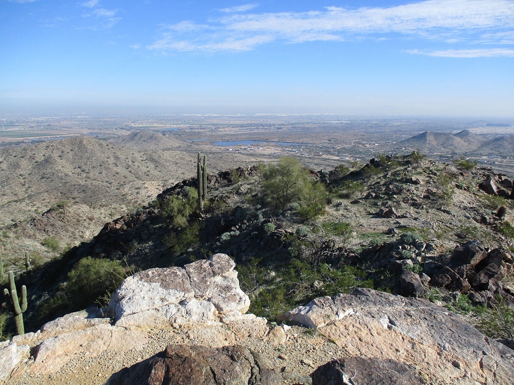
The day was sunny but not very nice. There was an inversion layer, keeping the lower elevations underneath a layer of light fog, dust and smog. It was cool, in the mid-50s. I could see the peaks within five miles clearly, but the ones farther back, they were hazed out in the moistish air.
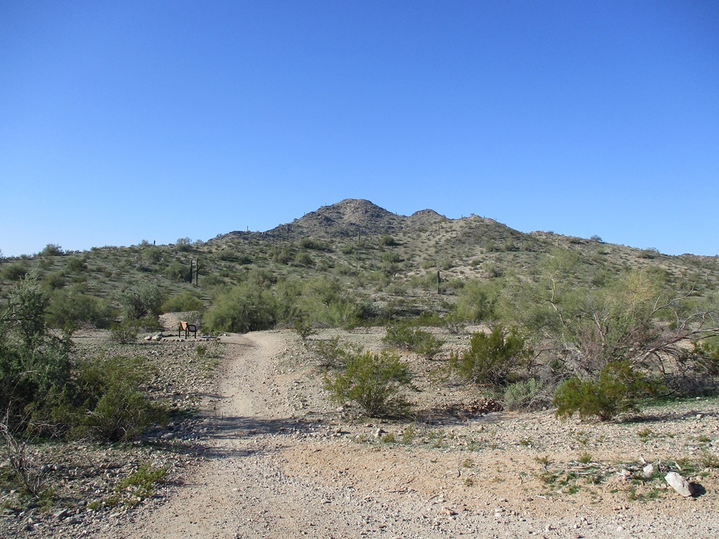
Peak 1536 is close by, the peak closest to the parking lot. I got suited up and was walking within moments, following a spur-connector to the Toothaker Trail. One of the ridges off Peak 1536 comes down the trail right there, mere feet from the trail junction.
I chose not to follow this ridge for two reasons: (1) higher up there appeared to be a mean-looking rock outcrop that could stop me, and (2) I didn't want to start hiking off trail so close to the parking lot where I could be seen.
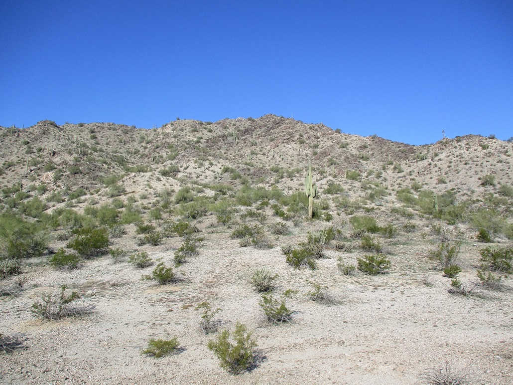
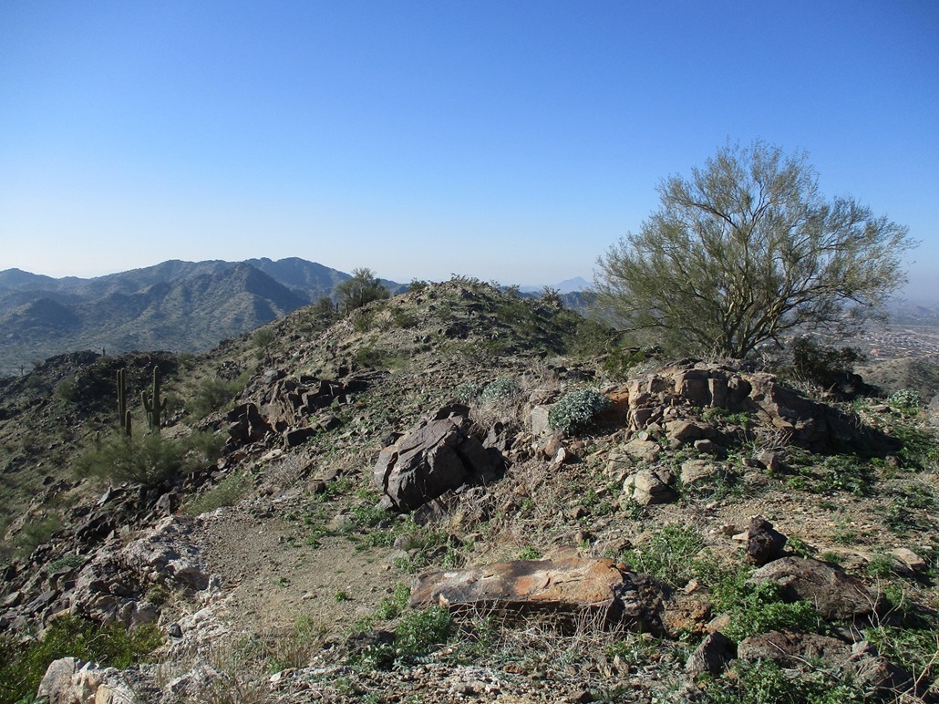
I followed the Toothaker Trail south about a half mile, until I was on the peak's southeast flanks. There were a couple good ridge options that appeared would get me to the top with no undue hassles. I picked one and started up it.
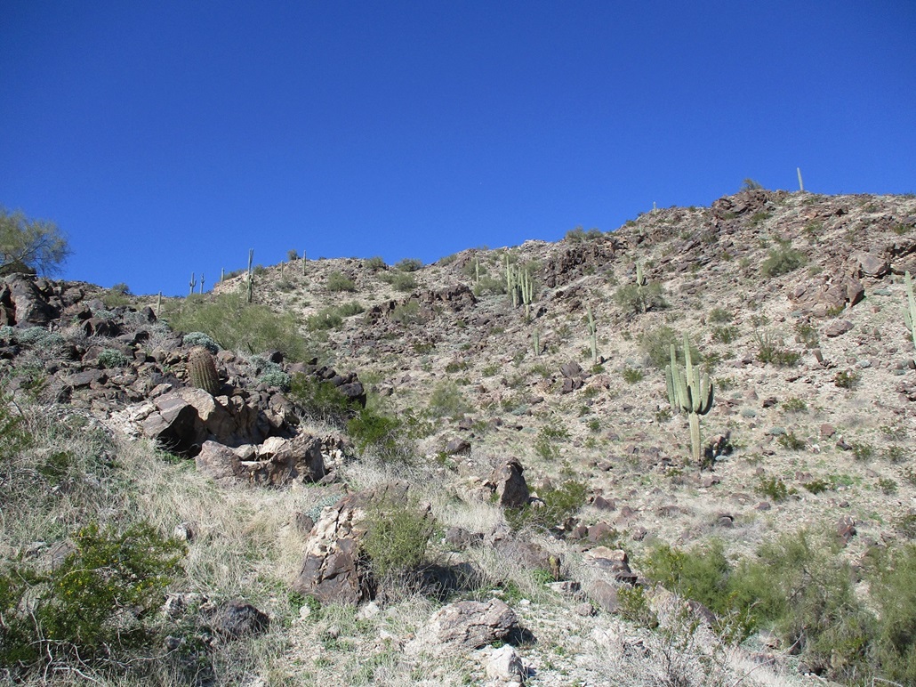
The uphill went well. The slopes lay back nicely, covered in coarse granite rocks and with a larger rock outcrop every five minutes or so. These did not pose any challenges. It was easy to get through the outcrops, and the slope of rock held together well, for the most part.
In about twenty minutes, I had gained most of the elevation and just a steeper slope of about 75 vertical feet lay ahead of me. Here, the slope was steep enough so that the looser smaller rocks slid easily, and even some of the bigger ones. I had to test each big rocks and move carefully. But this did not take long, and I was soon on top, conveniently within feet of the summit(s).
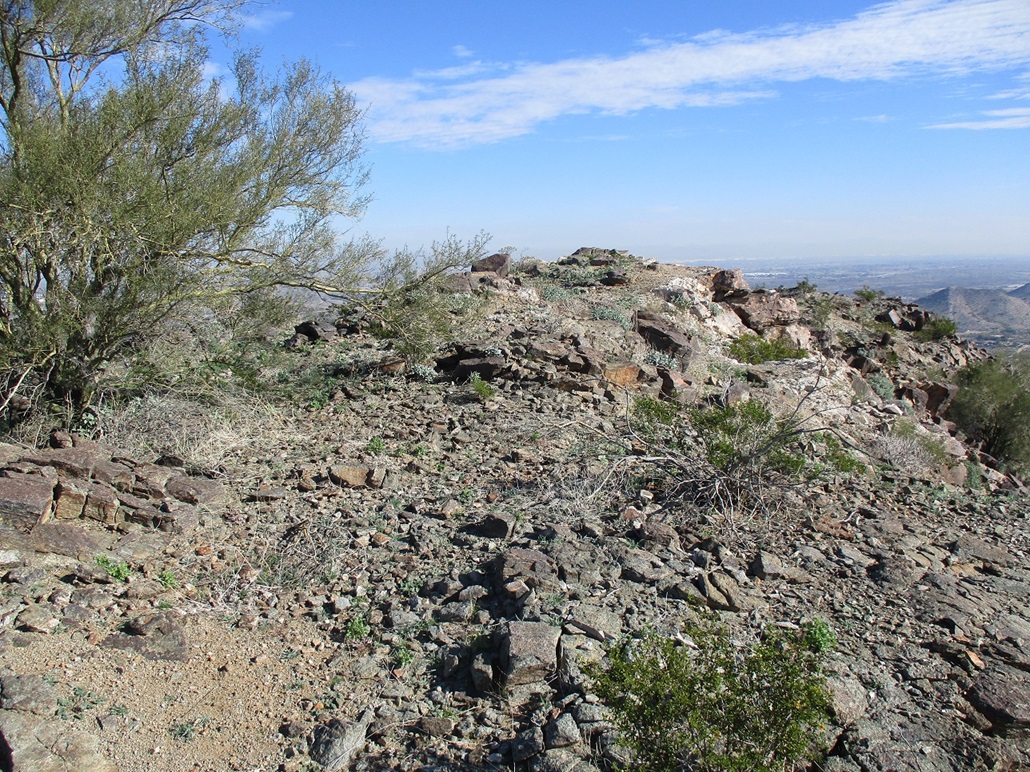
I walked to one of the summits, this one east of the two with views down over the Gila River and the homes and buildings of Goodyear and Avondale. The big buildings in Phoenix were smudged out by the mucky air. Looking south and west, where the muck wasn't so pronounced, the air was clearer, but still moist enough to haze out the distant peaks. Still, views that way were nice. I also walked to the western of the two humps. I found no logs or cairns or other signs of past visitors.
I descended the same way, going slow, and was soon off the peak and back onto the Toothaker Trail. This off-trail side trip to the top and back covered about a mile round trip, taking about an hour. I was pleased to get a peak into the books.
Now, what to do next. I continued south on the Toothaker Trail, which leads generally southwest and aims for Peak 1633 about a mile distant. It has a more rocky summit ridge on its east flank. It looked doable, but scrambly. I continued on the Toothaker Trail to its junction with the Rainbow Valley Trail. I was now southeast of Peak 1633 and was looking for other possible ways up. However, from these angles, it looked worse. Rather than go back to the east side and start from there, I decided not to bother, and just enjoy the trail hiking. It was just me. There were a couple mountain bikers and two women on horses, but otherwise, I had the whole place to myself.
I ended up hiking a complete loop around Peak 1633. According to the park map, I had hiked 1.2 miles on the Toothaker Trail south to its junction with the Dysart Trail, then another 0.9 mile on the Toothaker to the Rainbow Valley Trail. Then 1.5 miles on the Rainbow Valley Trail to the Dysart Trail, 0.7 mile on the Dysart back to the Toothaker, and finally, 1.2 miles back out to the car. So, the peak hike covered a mile, and the trail hike covered 5.5 miles. The trail hike was enjoyable, and I was perfectly happy to do this rather than bust a gut to tag another peak I don't really care about.
As for the other two peaks, all I could do was study their ridges and lines to gather ideas for a future visit. My time here came to a little over 3 hours. By now, it had warmed into the high 60s.
Elevation: 1,377 feet
• Prominence: 317 feet
• Distance: 2.4 miles
• Time: 75 minutes
• Gain: 330 feet
• Conditions: Cheerful
PB
•
LoJ
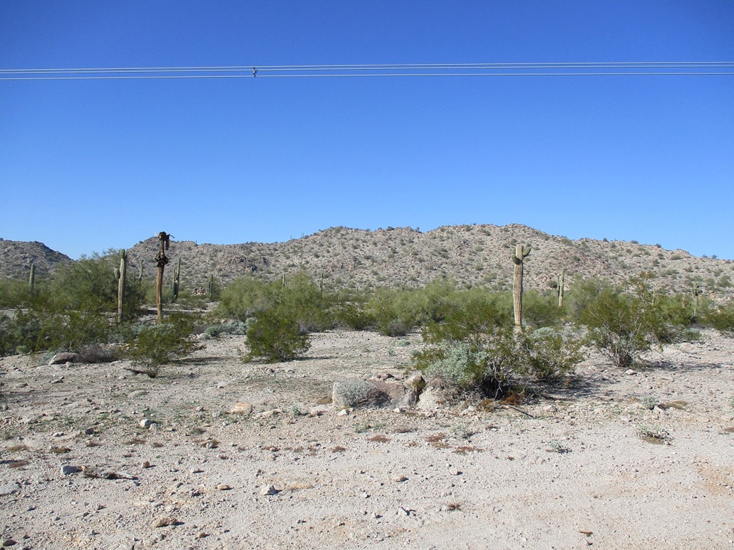
Peak 1377 lies about 10 miles southwest of where I was now. I've been aware of it, but it alone would never justify a day trip out this way to hike it. But since I was in the area, I figured now would be as good a time as ever to visit it.
I followed Estrella Mountain Parkway southwest, now in the big Estrella Mountain Ranch housing development. I was looking for Calistoga Road, which curves through the new homes for a couple miles, then simply ends at some ugly barriers where the development abuts the desert. I'm not sure if they plan to extend the road in the future. There were signs about "no vehicle access" but nothing about no trespassing. I saw a guy walking his dogs, so I figured this area is open to hikers and walkers. Peak 1377 is a low desert ridge about a half mile to the north.
I did not park on Calistoga Road. Instead, I drove onto a side road near some new homes and parked at the end of a cul-de-sac with no barriers between me and the open desert. I started hiking, following bladed roads, then lesser ATV roads and footpaths. I could hear voices and up on top of the ridge I could see some people hiking. I had no map, so I simply aimed for the mountain and hoped I'd find a track or something.
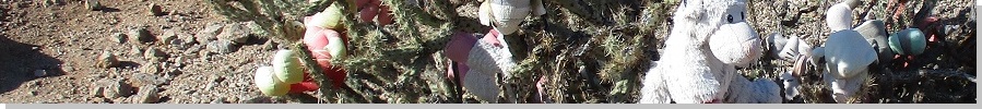
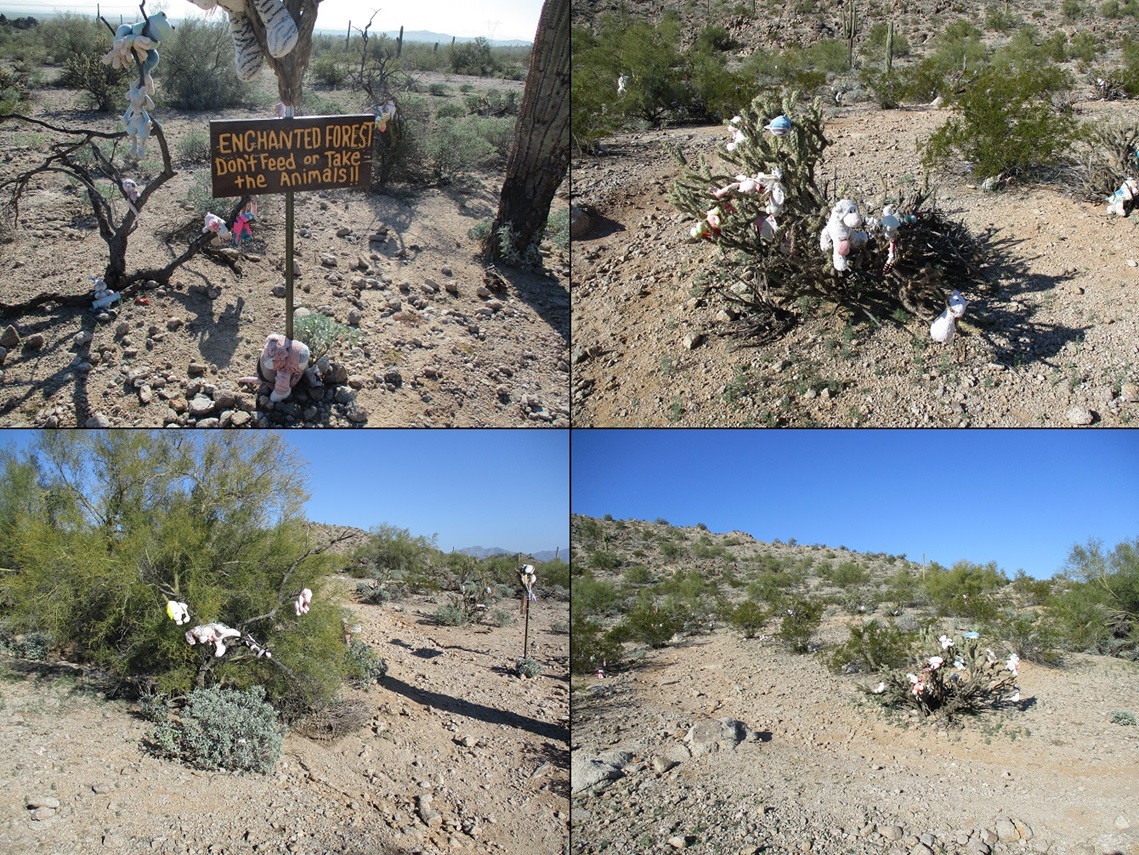
I followed a scant set of tire tracks. As I neared the mountain's base, up ahead was an odd sight. I couldn't tell what it was. When I got near it, it was a bunch of trees and brush (palo verde, creosote, cactus) with dozens of rag cloth dolls placed into crooks, leaning against the base, or wherever they could be placed. The dolls were of all varieties, such as teddy bears, winnie-the-poohs, various animals like goats and cats, even a shark doll. Probably a couple hundred of them spaced out over an area about a hundred feet to a side. A sign nearby calls it the Enchanted Forest. I certainly wasn't expecting this, but I was amused and even a little delighted, because it's not everyday you stumble into an enchanted forest. I was enchanted.
Here, a good footpath picks up, so I followed it as it gained uphill, meeting a bicycle path. I was seeing more people too, not many, just a couple or three. Online images show a lot of trails and routes here, and apparently is popular with mountain bikers. It certainly stands to reason that locals in the area use this hill to keep fit. It's easy to tell the hiking paths from the biking paths: if it looks like a hiking path, it's a hiking path, and if it looks like a biking path, it's a biking path. It's that simple.
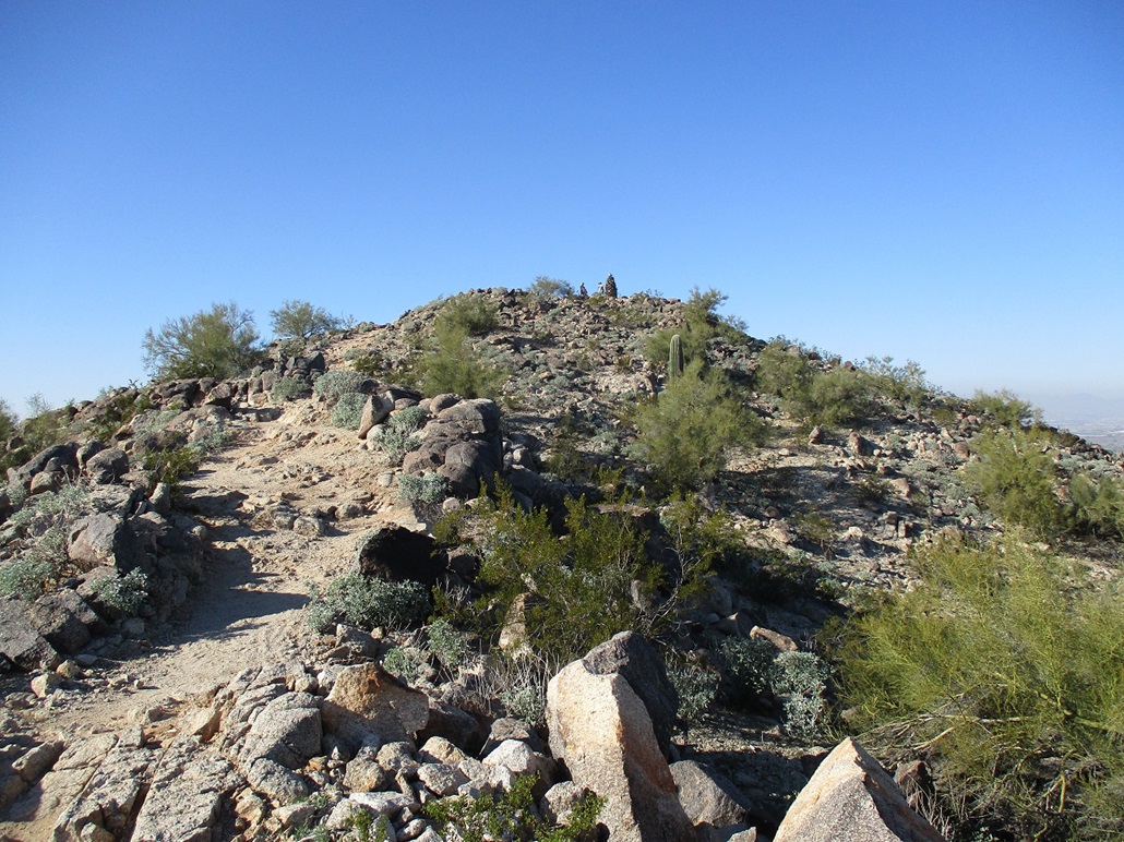
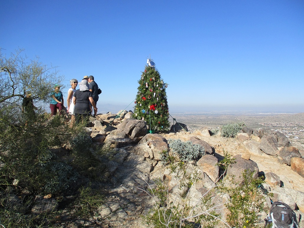
The trail achieves the main ridge and passes through a small saddle. Up ahead was the summit, and atop it ... a Christmas tree! When I got there, sure enough, it was a lovely 10-foot tall Christmas tree with ornaments. It was a legitimate tree, held in place with climber's rope acting as guy-wires. Whoever put it up did a fine job of securing it.
There were a few people up here hanging out. So I hung out for a few minutes too. I asked one of the guys about the tree. It's a tradition, something they've (whoever "they" are) been doing for a few years now. I also asked him if this peak has a name and he said it's called North Star Hill. It's probably an informal name, but it's good enough for me, so I use it here.
I stayed up top about ten minutes. A woman was sitting smack on the highpoint rock. I faced a moral dilemma. Without tagging this rock, I could not claim I had actually climbed this peak. In the cut-throat world of peakbagging, this is taken extremely seriously. I couldn't just place my hand mere inches from her behind without causing a ruckus. Nor I couldn't ask her to stand for a moment, that seemed ungentlemanly. So I got clever, and as I exited, I grazed my pant leg on the rock's top edge. Thus, I could count it. Crisis averted. And I didn't have to buy her a drink.
(The preceding events are all true, but really, even had I not tagged the top part of the rock, I would have still counted this. I was trying to use sarcasm to illustrate what a silly rule we have that one must touch the top-most point to make a summit count. While that's kind of the desired theoretical idea, in reality, things must be taken into account. For example, on broad summits with an indistinct top, I walk the area and invoke my "shin" rule, which is, the highpoint, wherever it is, had to be no higher than my shin at some point in time. I also have my "Greens Theorem" rule, which is, if the highpoint is enclosed inside fencing and the elevation difference is just a foot or two, I walk the perimeter in a counter-clockwise manner to claim it. Here, I had to invoke the "butt on a rock" rule, which is, don't be putting your hands near someone's butt unless you want to cause trouble.)
I hiked down the same way, and coming up were about another 15 people. One woman said she hikes this once a year, specifically to see the tree. Then there was a group of about five moms and another five or six teens and younger kids, then some solo people. Yes, this really is a cool tradition and I honestly felt a little Christmas cheer. And I'm not being facetious. I was not expecting an enchanted forest of rag dolls, nor was I expecting a Christmas tree on top. What I thought was going to be a mundane hike on a mundane desert hill turned out to be a real charming outing. Even old crusty curmudgeons like me can still get into the spirit.
Observing that dolls play a minor role in the Festivus canon (in the Seinfeld episode, Frank Costanza recounts fighting another customer at a toy store over a doll, which prompted him to beget the holiday), seeing all these dolls in the Enchanted Forest somehow seemed so appropriate. A Festivus Miracle!
I was back to my car and back to Tempe at nearly 5 p.m., a Subway sandwich in my hands. Today had been a fun day. Happy Festivus and Merry Christmas!
|


|