
The Mountains of Arizona
• www.surgent.net
|
| Golden Gate Mountain |
• Tucson Mountains • Pima County |
|
Date: January 11, 2014
• Elevation: 4,288 feet
• Prominence: 1,128 feet
• Distance: 2 miles
• Time: 2 hours, 30 minutes
• Gain: 1,300 feet
• Conditions: Cold and clear skies
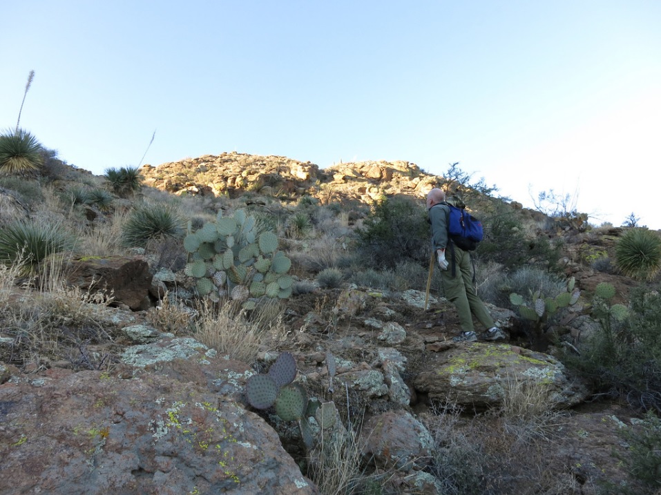
• Teammates: Scott Peavy
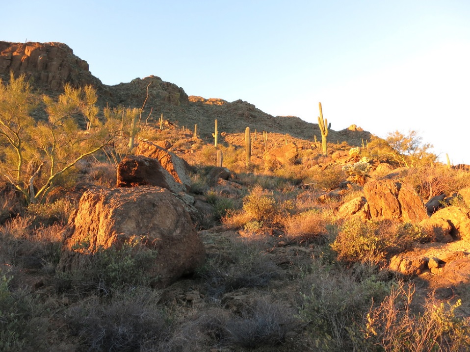
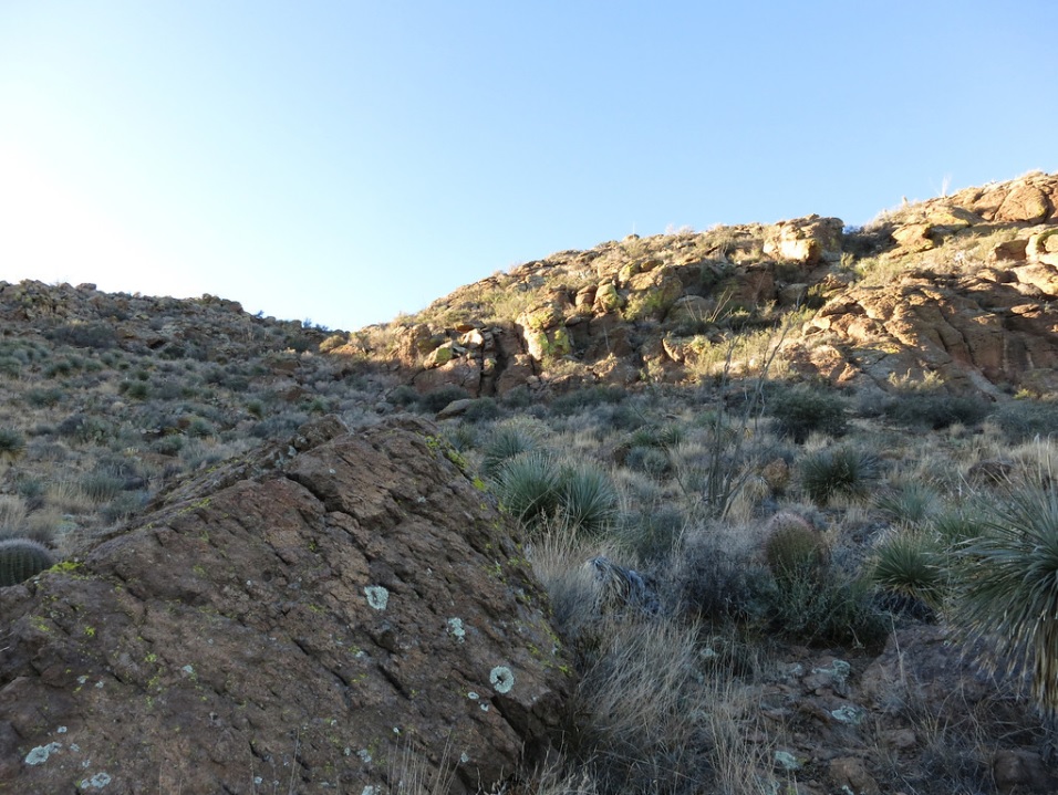
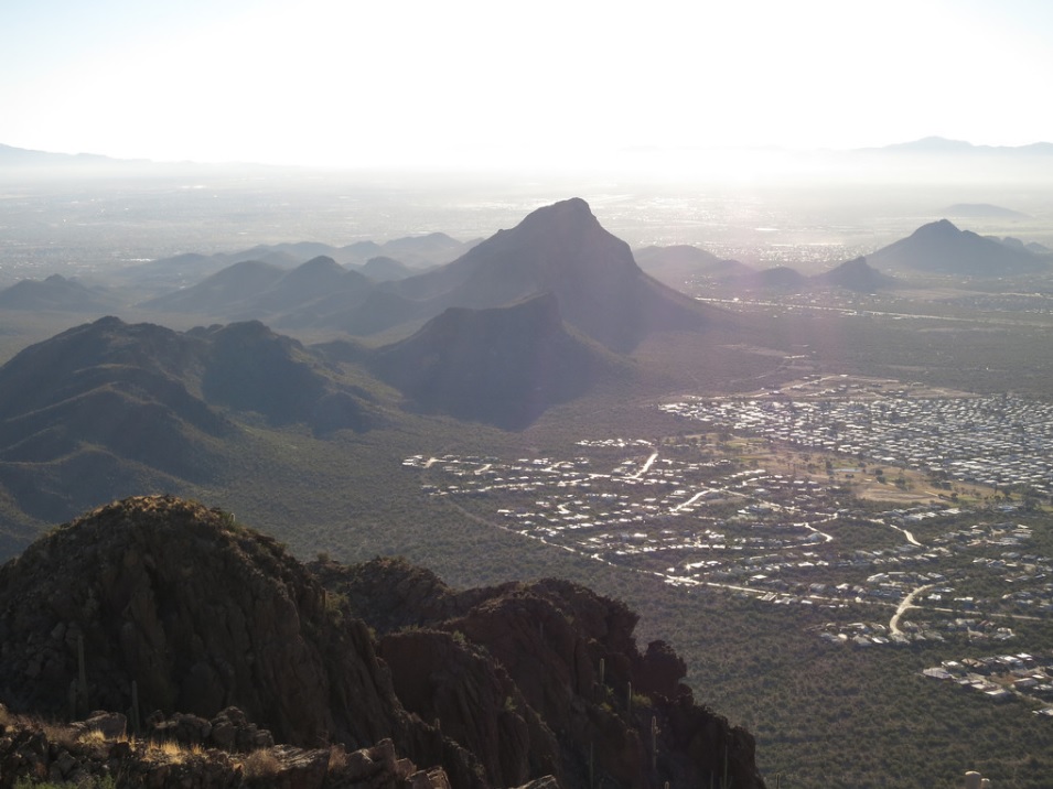
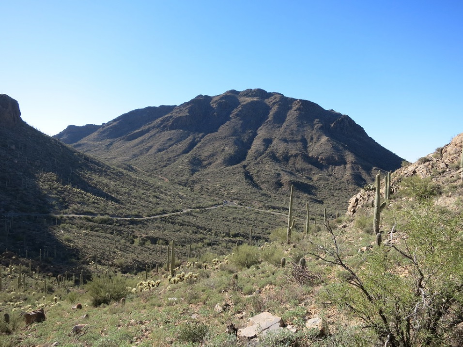
Golden Gate Mountain is one of the bigger mountains (by elevation) in the Tucson Mountains, rising to 4,288 feet. The mountain is located south of Gates Pass Road on the west side of the range, a couple miles east of the Gilbert Ray campground. Looking from the west, the mountain has cliffs up to a couple hundred feet high. From the east, the cliff bands aren't as severe, with more rock-and-brush slopes. The hike is cross country, but short.
Scott Peavy and I planned for a day trip to Tucson to hike a couple of the more prominent summits in the range, which is topped by Wasson Peak, about three miles to the northwest. We had this one, and Cat Mountain to the south, on our agenda. We hoped to climb both in a single day.
We left his place in Gilbert at 5 a.m. and arrived in Tucson around 6:45 a.m. We followed Speedway Road west into the foothills, then onto Gates Pass Road at a Y-junction. This road crests the range at Gates Pass, and immediately, Golden Gate Mountain looms dead ahead. We dropped a couple hundred feet and parked at the David Yetman Trailhead. The day was clear and calm, with temperatures about 40 degrees as we started the hike. The sun was still behind the hills to the east.
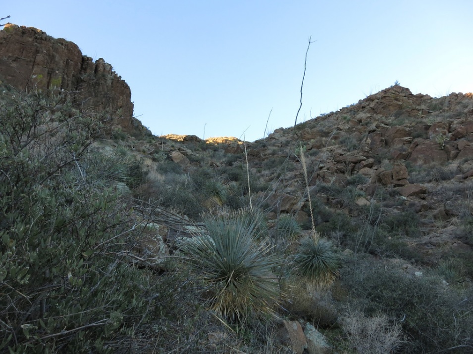
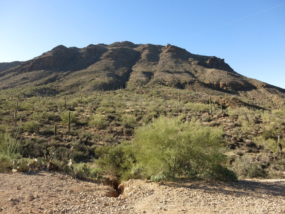
We followed the Yetman trail about a quarter mile southeast, gaining about a hundred feet. We left the trail, then started hiking directly up the northeast-facing slopes of Golden Gate. Looking up, the slopes looked open for about another 600 vertical feet, then the lowest of the rock bands started. However, we could eyeball some promising ways up this slope that avoided cliffs, and at no time did it appear difficult.
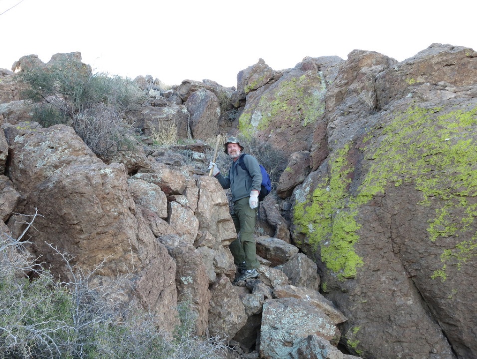
The lower slopes are pitched very nicely, and the brush is open enough so that we could generally avoid the plants and cactus. The slope then steepened by degrees, so that we then found ourselves on the steepest stretch, which ran about 300 vertical feet. We aimed for the lowest rock bands, then angled right into a gully. Occasionally, we'd see what looked like a path, but the navigation, even without any paths, was very straightforward.
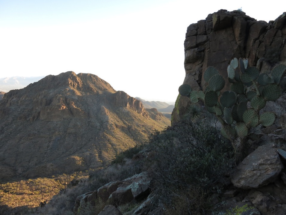
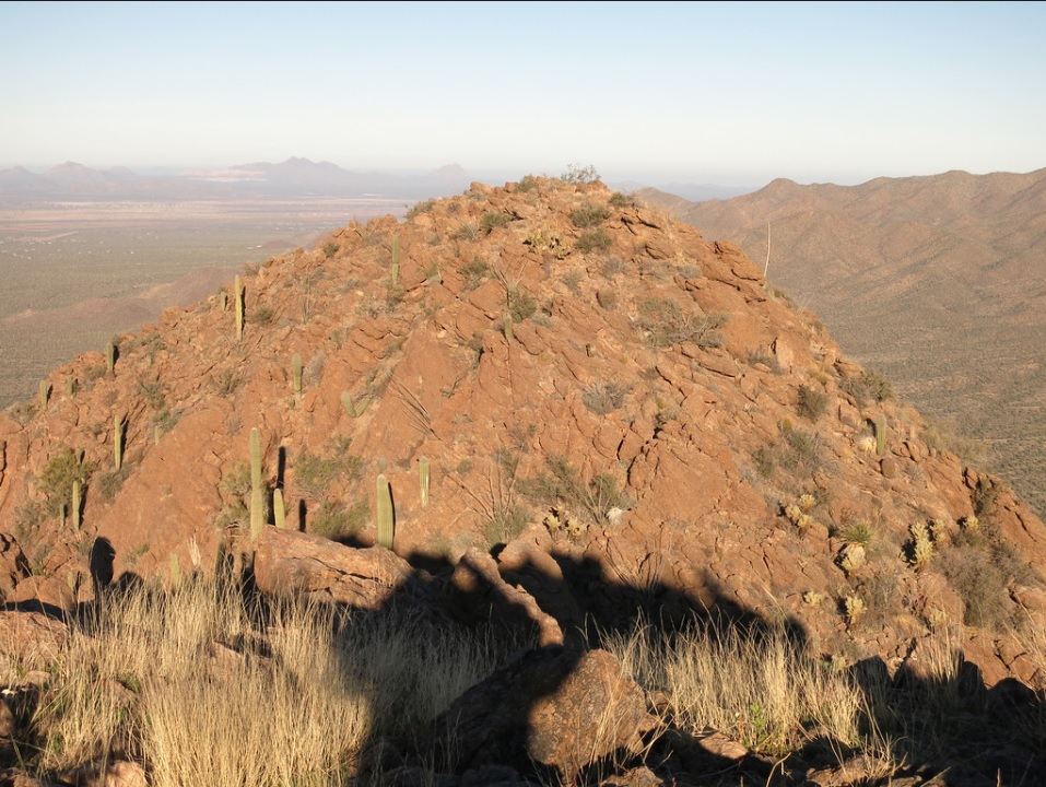
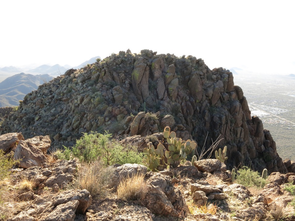
Now higher than the main lower cliff band, the gradient lessened slightly, and we were now below another substantial cliff band. We angled left now, aiming for a low-point in the ridge above us. Here, we did find a rough path, and we followed it to this lowpoint, placing us directly north of the presumed summit.
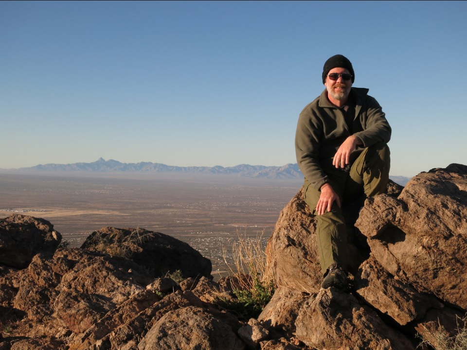
From the ridge lowpoint, we walked south, meandering through the rocks and upclimbing one short chute of easy talus, and immediately, we were on top, the summit marked by a cairn. Our hike had taken us 1 hour, 12 minutes. We rested here, signed into the log book and inspected the view. All the famous peaks could be seen: Wasson, Gu Achi, Kitt, Coyote, Baboquivari, Keystone, Wrightson, Apache, Rincon, Mica, Lemmon and the Silver Bells. The day was fantastic with clear blue skies, but it was breezy. Up here at over 4,000 feet, the temperature about 45 degrees, the sustained breeze chilled me quickly, so I sat in the lee of the large summit rock.
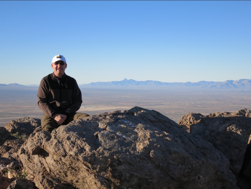
The ridgepoint immediately north of us seemed to be possibly as high than our position. I used my water bottle as a level and it seemed to confirm we were higher here. We spent about 20 minutes at the summit, then climbed back down to the lowpoint. We decided to scamper up to this other ridgepoint, which took about a minute. Sighting back, it seemed to confirm the southern summit is highest, but it is close, maybe just a couple feet difference.
Back at the lowpoint, we hiked all the way down without stopping. We took it slow on the steep portions, mainly to keep from having rocks slide out from underneath us. In an hour, we were back to Scott's car, a round trip of two miles and 1,300 feet of gain in a combined two and a half hours. It was not quite 10:30 a.m., and our hike up Golden Gate had gone very well, faster than I had figured it would be.
From here, we drove a few miles west and south to our next objective, Cat Mountain.
|

|