The Mountains of Arizona
www.surgent.net |
|
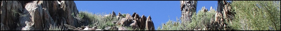
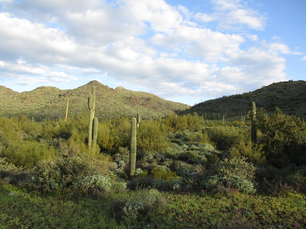
Go John Mountain • Peak 2850 I returned to the Cave Creek Regional Park to take a look at Go John Mountain and a second peak, Peak 2850. This would be my second time ever at this park, my first time just a few months ago when I hiked Peak 2711. The park is fantastic, with many well-maintained trails interconnecting to form loops. Along with hikers, mountain bikers and horse riders use the trails too. My main objective was Go John Mountain, which lies outside the park, but with trails within the park that get to its base. I also had Peak 2850, which rises less than a mile north of the main trailhead parking lots, as a second peak if all went well with my Go John expedition. I was on the road about 6:15 a.m., heading north with the Friday traffic, which wasn't too bad since most were heading into the city. In roughly an hour, I was pulling into the park. The front gates were open but no one was at the kiosk to collect the day fee. I just drove in and parked in the lot nearest the Slate Trail. I would pay my fee when I exited.
Date: March 24, 2023
• Elevation: 2,557 feet
• Prominence: 304 feet (per Lidar)
• Distance: 5.3 miles
• Time: 2 hours, 15 minutes
• Gain: 760 feet total
• Conditions: Sunny and very pleasant
Arizona
•
Main
•
PB
•
LoJ
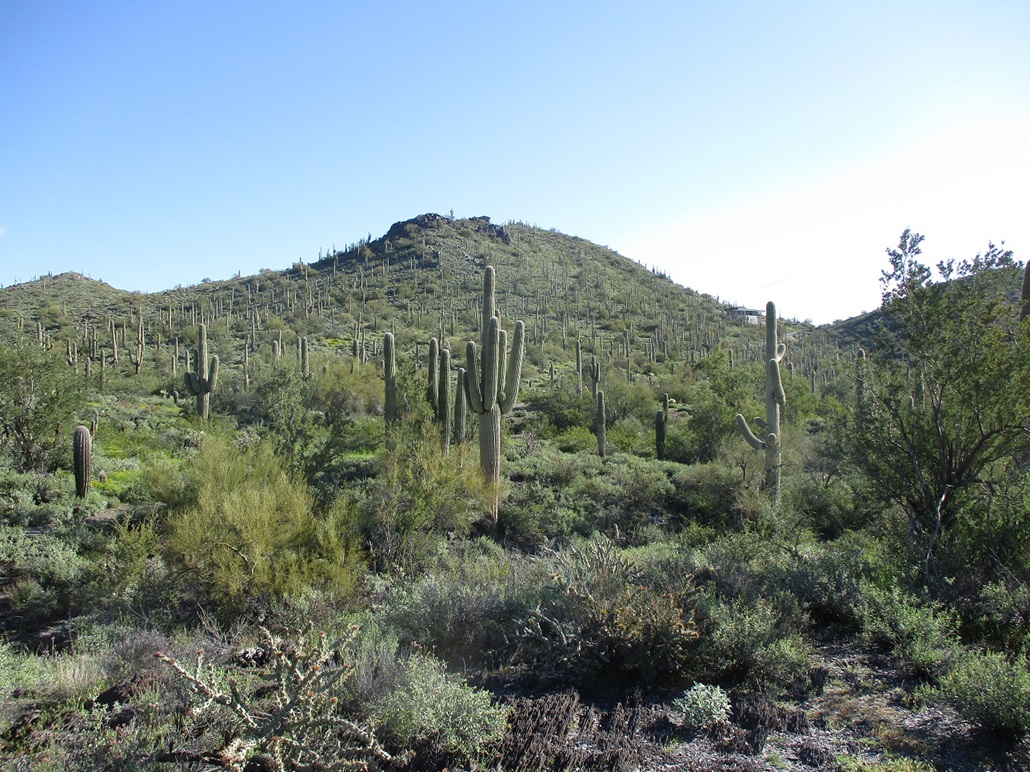
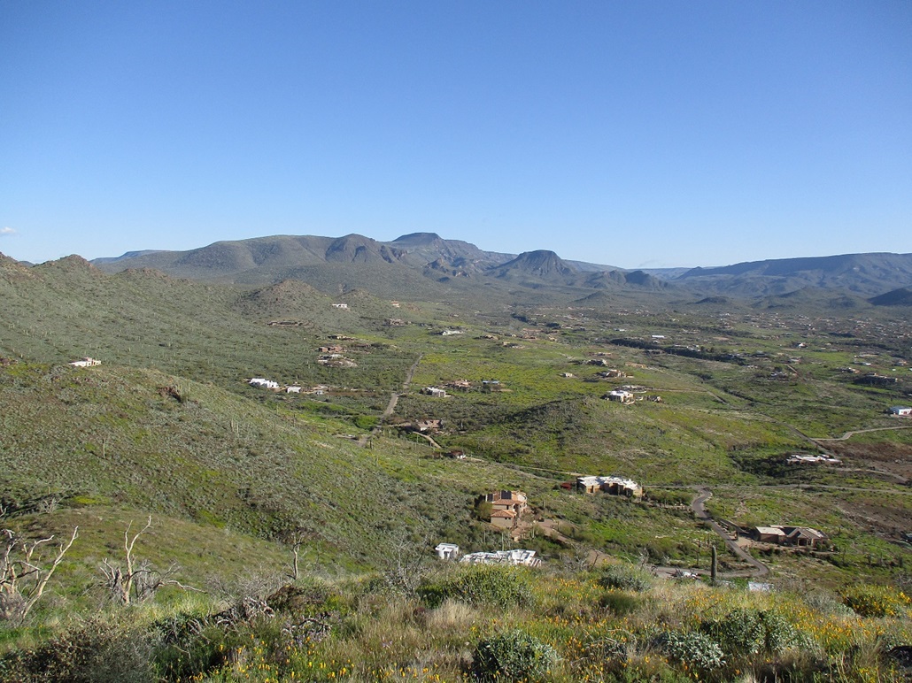
Go John Mountain is named for George O. John, owner of a mining claim within these hills from many decades in the past. These days, it rises above scattered mansions that dot the area, all within the town limits of Cave Creek. A year or two ago, I was in the area so I followed some residential roads in toward the peak, but I didn't get very far. The only road that goes to the peak, Old Stage Road, was shut that day due to work trucks.
Rather than deal with residential roads and possibly nosy residents, I opted to approach the peak from within the Cave Creek Regional Park. Looking at their online trail map, it showed a 2.1-mile one-way hike to where the trail ends at the road itself. If I was unable to gain access to the peak, at least I would have a hearty hike to there and back.
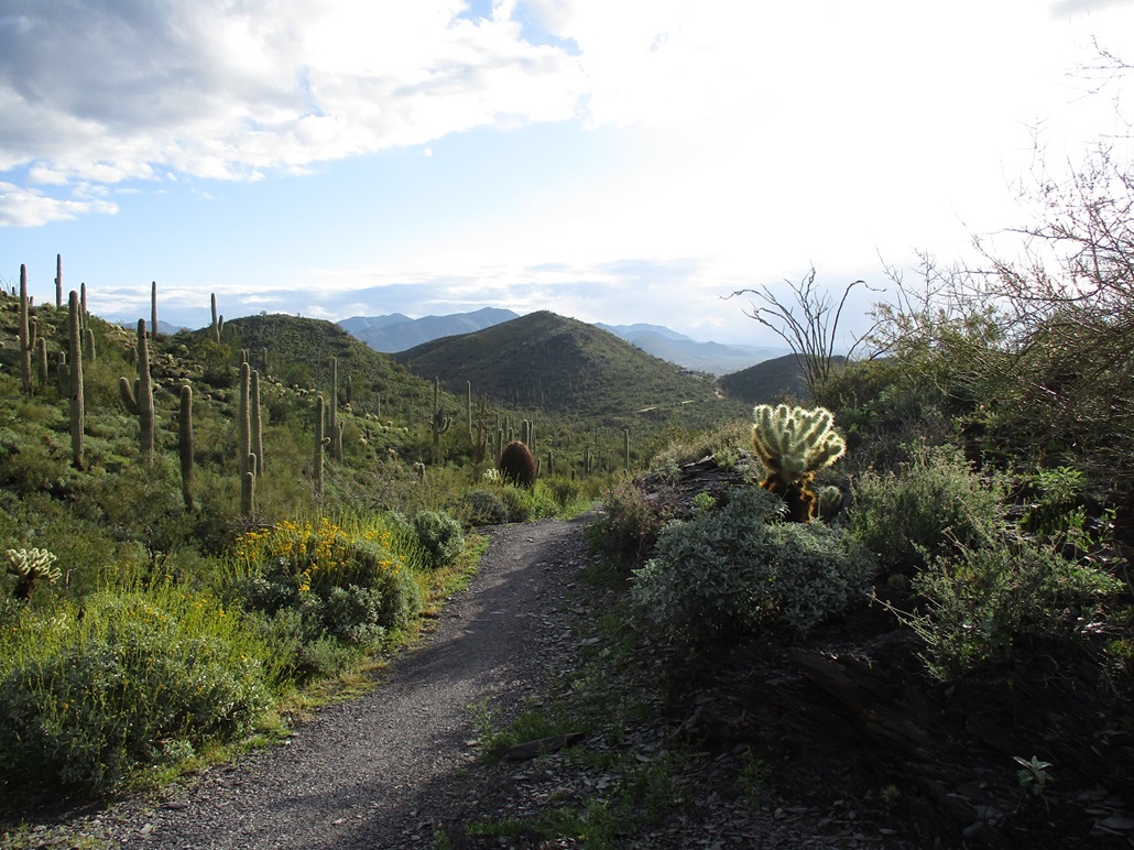
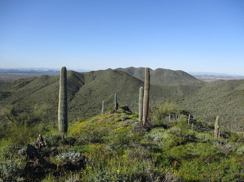
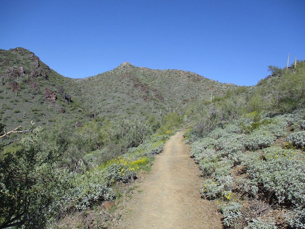
I started walking at 7:20 a.m., the sun rising and lighting everything up nicely. It was cool, in the 50s, sunny with no clouds, and calm. I was the only one here so far. I followed the Slate Trail east for 0.8 mile (going by the trail map), then north on the Quartz Trail for another 0.8 mile, then northeast on the Flat Rock Trail for 0.5 mile. It was at the Quartz & Flat Rock trail junction where I had my first view of Go John Mountain. I covered the 2.1 miles in about 35 minutes, an excellent rate for me on trails. The elevation difference so far was not much, about 300 feet of uphill, then a 100-foot loss as I descended the Flat Rock Trail.
The trail meets a side track that goes north a few dozen yards to Old Stage Road. The immediate area is closed, but I reasoned I was staying on tracks anyway, so no harm, no foul. I followed this track to the road, at the south base of the peak. I looked up to see what I was in for.
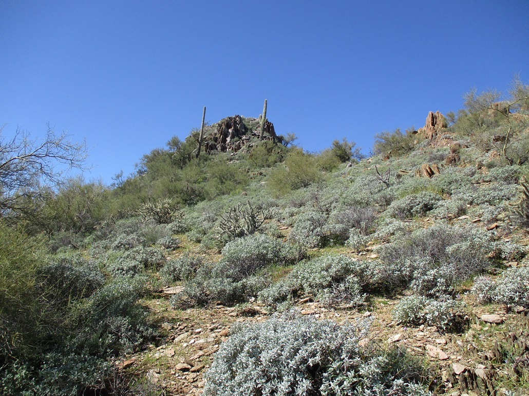
Up above is a rock prow forming into a small wall of cliffs. I got onto the slope and started walking uphill. The brush was light and spread out, and the rocks usually held together well. The grade steepened as it met the base of this prow. The rock was more abundant here, and to my relief, set solidly in place ... most of the time. I always move slowly on this kind of jumbly terrain anyway.
As I inched closer to the rock prow, a chute became evident. I carefully scrambled on the lower rocks until within the chute, which ran about 20 feet from base to top. The moves were easy and protected, nothing Class-3. This fed me to the top of this prow and now on the straight-away to the summit, not far ahead.
This last segment went very well, now on much gentler-sloped terrain. The brush was light, the rocks not in the way, and there was always an easy way around any obstacle. I was on top quickly, the one-way hike taking about an hour. I figured an extra 0.4 mile from where the trails ended to the top.
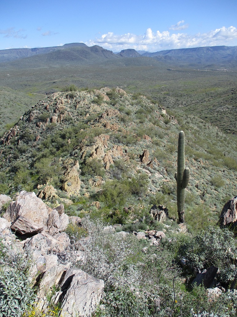
The views were excellent and I took a moment to snap some images, but I did not delay and I never took a proper break on the summit. There was no register (nor was I expecting one). I retraced my route almost exactly, eased down off the mountain and then back onto the Flat Rock Trail, where I stopped for a rest.
The land-use maps show that Go John Mountain is private, but what kind of private is not made clear. There are two properties, one to its west, another to the southeast. There was no fencing anywere nor any signs. Do any of these people own it? Or is it "at large" town-owned land? I don't know.
Happy with my success on Go John Mountain, I debated my next moves. I opted to follow the Quartz Trail northwest, rather than retrace it south. It would meet with the Go John Trail and I could make this into a loop hike. So that's what I did. By now, there were more people on the trails, but not many. A jogger passed me, a mountain biker came toward me going the other way, and I tailed some hikers as I (and we) walked back to the parking lot. By my figures and using those on the map, I had hiked 5.3 miles.
There were more cars now and more people here and there but it did not feel crowded. I stopped at a picnic table and rested, deciding what I wanted to do. Peak 2850 still interested me and it wasn't far away. It was still early and the day was lovely so that made it easy for me to make my decision.
Elevation: 2,850 feet
• Prominence: 400 feet
• Distance: 1.8 miles
• Time: 90 minutes
• Gain: 750 feet
• Conditions: Still lovely
LoJ
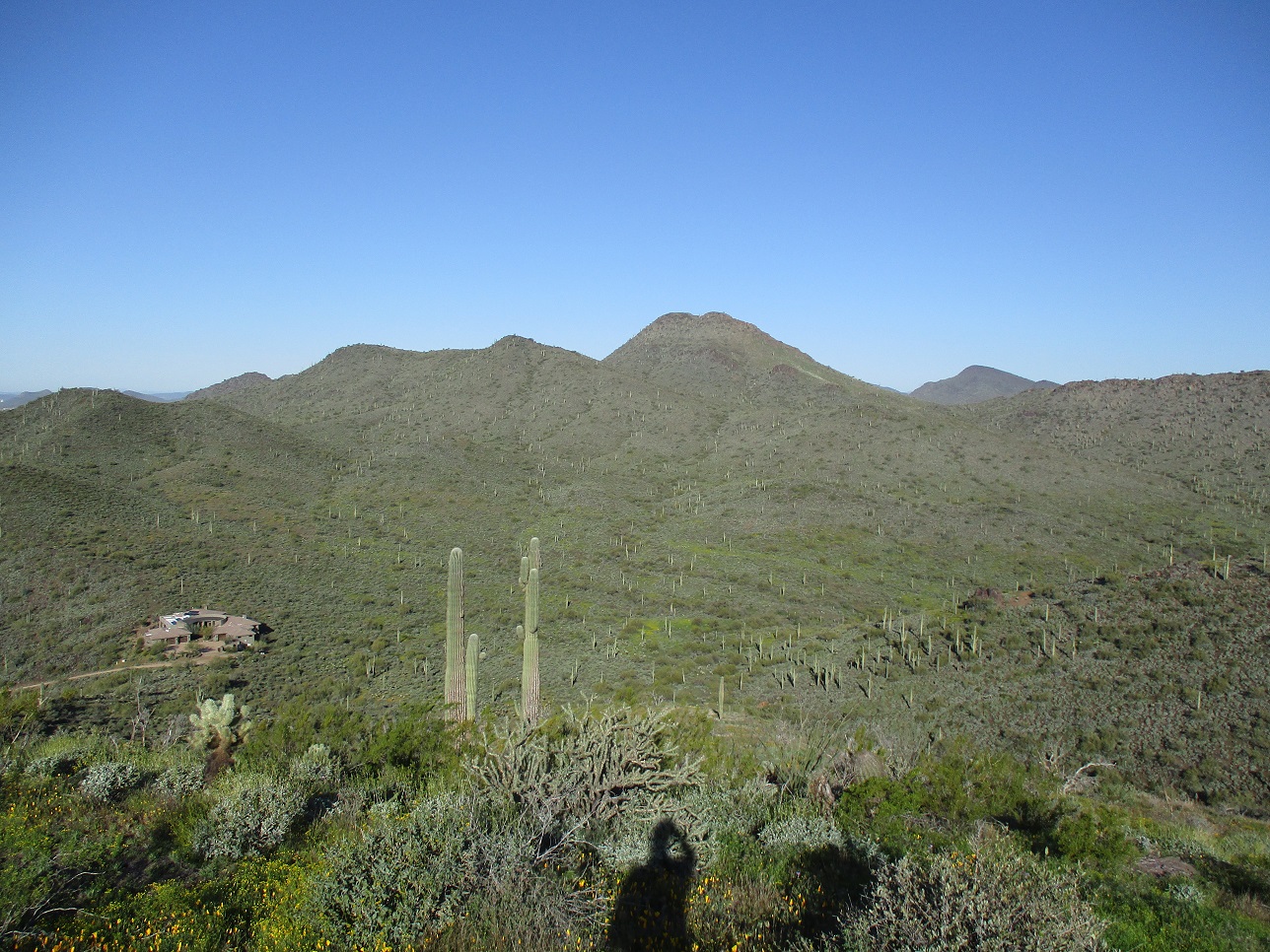
Peak 2850 has a distinctive summit, a knob of white-colored rock that from a distance looks like a pimple on a ridge. It lies about a half-mile on a straight line from the parking lot, and the Go John Trail goes up to a saddle just east of the summit.
I started walking the trail, only to stop to the side when groups on horses would be coming downhill. There'd be the main person up front and perhaps 4 or 5 others following. I've never ridden a horse, so I can't comment on that experience. There were three groups in all. I think I said "hi" to each person because as each passed and I just stood there, they felt obliged to say hi to me. I sometimes said "howdy", in case any were from out of state and wanted that Old West flair.
Once the horse teams had moved on, I got moving uphill. I passed a couple of groups of people, then topped out on the saddle. Some people were here already, sitting and others standing around taking a break. From this saddle, a ridge leads directly to the summit, which from this angle looks like it did from below and other vantages. It looked cliffy, but not sheer. I suspected that there would likely be some messy heap of rocks within this outcrop that might go to the top.
I found a very weak path that started up this ridge, and was able to follow it for about a hundred yards. But it was a path, no doubt. The terrain was brushy and rocky, with some palo verde, but usually open enough so I could avoid most of the branches or spines. There were a couple rock outcrops along this ridge, too. These weren't difficult but they were messy. I had to push through some brush in some places.
This went fast and I was soon on a ramp leading directly to the summit. From this close in, I could see a brushy slope that looked promising. I hiked to it, and sure enough, it went straight up and wasn't a bad slope at all. And it wasn't too brushy either. The brush was mainly on the sides. I still had to step carefully, but it was standard Class-2 stuff. At worst, I had to hoist up a three-foot rock step or sidle past awkwardly-placed rocks. But this went very fast, a minute or two, and I was on top.
While I had been "pretty sure" I'd be able to find a way up this peak, I was still very pleasantly surprised to make it, and that it was actually quite easy. The top is small, just a few feet end to end, with a small cairn but no register. I snapped some photos but didn't linger.
I descended the same way, and eased down off the rocks and onto the ridge itself. I found a mine shaft, fenced with "Danger" signs. I hadn't seen it coming up, but this would explain the old scant path that I had followed earlier. I doubt too many people come up here to hike this peak. As usual, I wonder how the miners in the old days knew to dig a hole "right here". This seemed like an unnecessarily inconvenient place for a mine shaft.
I hiked slowly down the ridge, working my way through the rocks and brush. I was within feet of the trail. I guess I got distracted because I walked straight into a barrel cactus. I whammed my right shin right into it. Holy smokes, that got my attention, and yes, it hurt a lot. Three large spines had embedded into my skin. I pulled them out and each had gone in a good quarter inch, up to a half inch. I got a boatload of surface scratches too, and it all hurt in a general mush of various types of pains.
Back on the trail, I took a break and made sure I was going to live. It still hurt and I had some nice lines of blood going on. So I started to slowly walk. It hurt, but I could walk. Every few steps I'd been a jolt of pain. I was able to get down fine and almost back to my car when these jolts seem to happen with every step. So I inspected my shin and saw a little nubbin of a spine sticking out. When I pulled it out, it was a full half-inch of spine that came out. This was the culprit. I think I got them all because I didn't have any more sharp pains.
I changed back at the car, washed my shin with some water, then got moving. It was not yet noon, believe it or not. I wanted to pay my entrance fee. Yeah, I could have just left and saved $7, but I wanted to play by the rules. I stopped into the visitor's center and they were unsure how to process a park pass payment. They wondered why I hadn't paid when I came in, so I told them why. They got it figured out. More importantly, I went into the men's room and washed my shin with proper soap and water.
In spite of being one with the cactus, I had a great morning and happy to get two peaks into the books. I felt pretty good overall, even my shin was behaving. To reward myself, I got the four-taco special at El Jefe's nearby where I live.
I have now been to the Cave Creek Regional Park twice now and both times have enjoyed the hiking trails. They are well constructed and smooth and easy to make good time. There are benches every couple hundred feet, all of them in honor of someone or two. It was on these occasional benches that I'd stop to rest. I also studied Peak 3080's lines and may come back for it later on. But peaks aside, this is a great park and I recommend it.
|


|