
The Mountains of Arizona
• www.surgent.net
|
| Glassford Hill & East Summit |
• Highpoint: Town of Prescott Valley • Yavapai County |
|
Date: October 24, 2016
• Elevation: 6,178 feet
• Prominence: 618 feet
• Distance: 4.5 miles
• Time: 1 hour and 45 minutes
• Gain: 1,075 feet
• Conditions: Cool temperatures, high clouds
Arizona
•
Main
•
PB
•
City HPs List
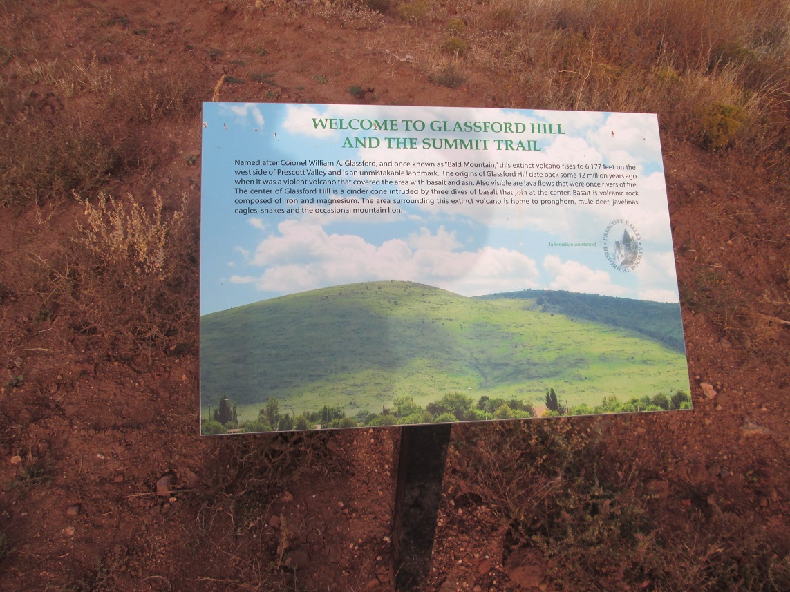
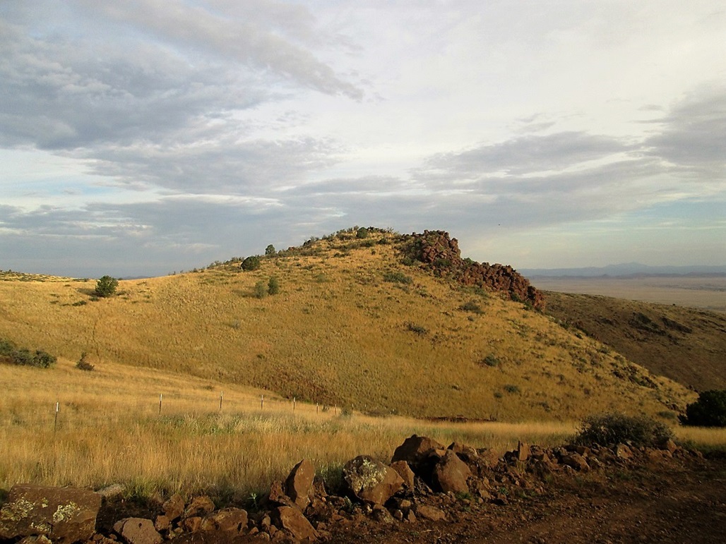
Glassford Hill is a broad mound with long, unbroken slopes covered in grass and spotty trees. It sits between Prescott and Prescott Valley, and is the highest point within Prescott Valley’s city limits. The hill is actually a volcano that erupted about 12 million years ago. Its appearance causes it to stand apart from the surrounding peaks and hills of the area, which tend to have sharper profiles, greener forested slopes and longer ridges, more like traditional mountains.
I get to Prescott about once or twice a year, often just passing through, and each time I look at this hill as something to hike when in the area. I probably would not come all this way just for this one hill. Ideally, I would combine it with other destinations.
I have done the usual googling and binging for information on this hill and usually come up with nothing. I assumed it would be a popular local's hike, but apparently, not so. It seemed few people hiked it, so I assumed that it must be on private land or state-trust land. For this trip to Prescott, I did not do my homework for Glassford Hill. I actually had not planned to hike it, but then our original plans kind of fell apart.
Long story short, we were in our hotel room in Prescott yesterday. I had hiked Spruce Mountain that morning and was napping, but about 4 p.m., I got bored and told βð I wanted to drive around, do a little "scouting". I wanted to get as close as possible to this hill and see it for myself. I had no maps. Just me, our new Subaru, and a heart full of hope.
I drove into Prescott Valley on eastbound state route AZ-69, covering about 7 miles. I then came upon Glassford Hill Road. This looked promising, so I turned left (north) and drove it to see where it went. A couple miles later, I went left on a newer road put in for a new housing development. I kept following roads until I was close to the east base of the hill. I was making turns on instinct alone.
I then found myself on Prescott East Road, and unexpectedly found a sign saying "Summit Trail" with an arrow. I followed this to a brand-spanking-new parking lot, the trailhead for the equally brand-spanking-new summit trail to the top. I had no idea I'd find this. I assumed I’d come upon fencing and "no trespassing" signs. What a pleasant surprise! It was a little late in the day for the hike, and I had promised βð I wouldn't be long, so I decided to hike the hill first thing tomorrow.
Next morning, I was up before dawn. I wanted to be at the trailhead early, as we had to be back in Scottsdale that morning and I still had a job I had to go to that day. I did not expect the hike to take long, perhaps two hours at most.
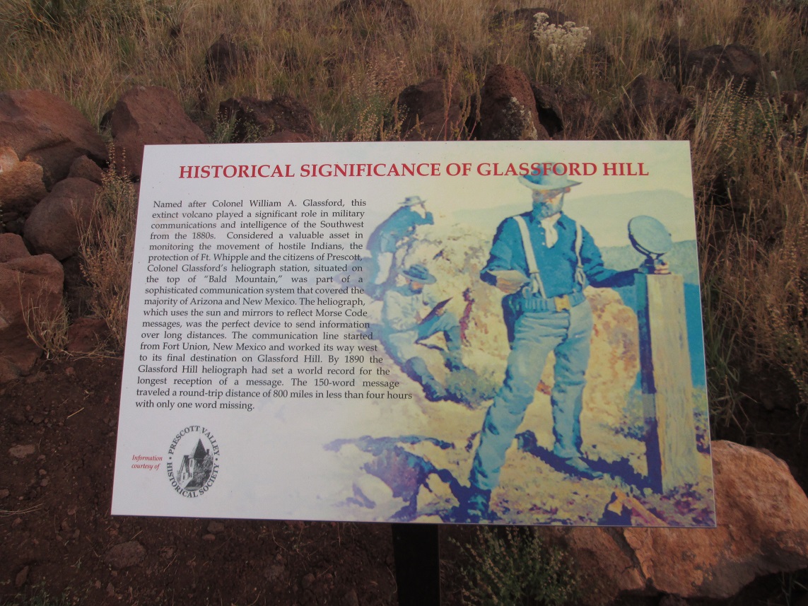
The hill is named for Col. William Glassford, and was part of an extensive network of heliograph stations, where messages are sent via mirrors reflecting the sun from other mountaintop heliograph stations in the southwest. This was in the late 1800s when Prescott was still growing and there were combative Indians still in the area. It is not clear if Glassford was actively part of the heliograph activities. Not much is known about Col. Glassford.
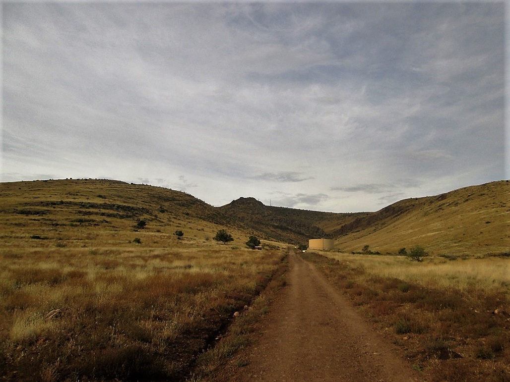
I parked and got moving quickly. Following the graveled trail north to a bridge, then going left (west) up a road, heading toward a big water tank. This segment covered 0.6 mile, gaining about 150 feet. Informative signs are spaced along the way, as well as mileage markers are every quarter-mile (an Eagle Scout project, I learned). A guy was jogging down, but that was it. I saw no one else.
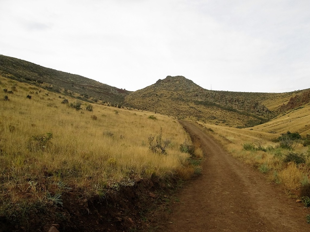
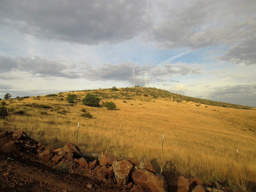
I was at the tank in about 10 minutes. I went right, past the tank and continued up the road into a canyon formed by the old crater. The towers atop the summit were visible, partially obscured by a basalt fin of rock sitting dead center, high in this canyon.
The trail is a road, and it switchbacks of the north-facing slopes (left, as one looks up) within the canyon. The sun was still low and there were a lot of clouds, so lighting was bad for photographs, bad in general. The temperature was mild, about 60 degrees. The road is new. It does not appear on the most recent google-earth image, dated about 2014-15.
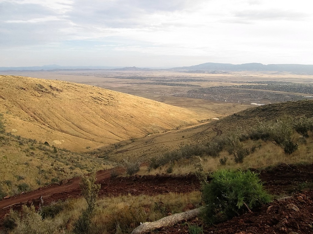
The road was wide and steep in spots, but always easy to follow. It makes several long switchbacks, about 8 in all. In about thirty minutes of this grind, I was above the last of the switchbacks, the summit and its towers to my right, a smaller hill, elevation 6,125 feet, to my left. Not surprisingly, the road goes left to the smaller hill, not to the real summit.
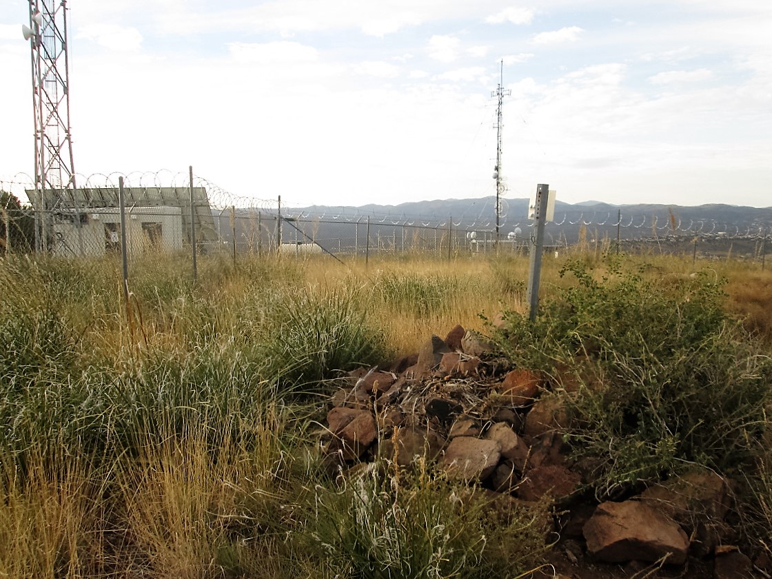
I went west and hiked up the grassy and rocky slopes, gaining about 125 feet, to put me at the fence surrounding the various towers and buildings. These were smaller towers, not huge beefy ones. I went right and circumnavigated the fence. Up ahead I could see a rock-pile and a breach in the fence. I passed a witness marker along the way. I was at the top. The rockpile may have hid the benchmark, and I had no intention to dismantle it.
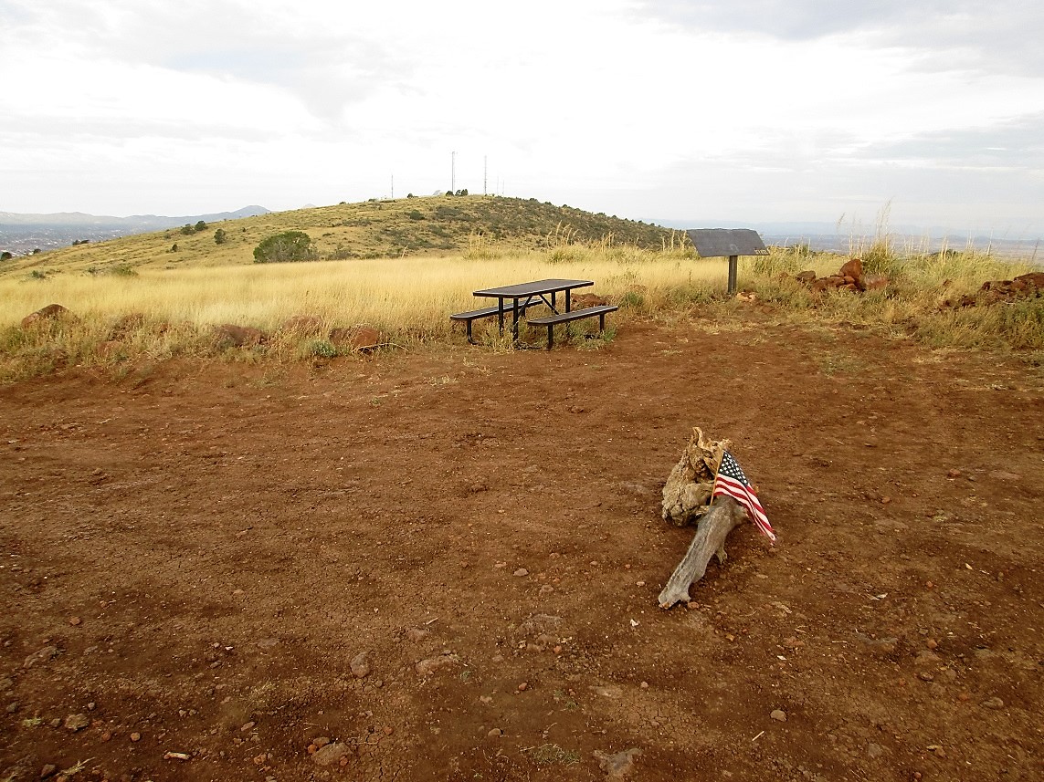
The day was still kind of gray with the heavy high clouds. I spent a few minutes looking around, making sure I hadn't missed anything. It was not a pretty summit. I exited back to the road, then walked up to the eastern subsummit for photos and to read whatever signs had been installed. Here, the sun broke through the clouds and for a few minutes, I had good lighting for photographs.
It had taken me 55 minutes to get to the summit, and about 15 minutes of lollygagging at both the real top and the lower eastern bump. I started down and hiked back to my car in 40 minutes. I could see hikers down below, but no one was coming up the switchbacks. Most seemed to get to the first bend then turn around. I saw about 10 people total. Given it was a Monday morning, that is probably an expected number.
I motored back to the hotel, took a shower, got us packed and drove us home, taking the scenic route down AZ-89 through the mountains and then the towns of Peeples Valley and Yarnell. We stopped for about 10 minutes at the memorial for the 19 firefighters who were killed in a massive blaze on June 30, 2013. They are building a park, but it's not yet completed. We had hoped to go to the actual spot, but I expect that location will never be made publicly known. It was sad. We picked up a brochure with ways to make donations to fund the park. We will certainly contribute for the park.
I got us home safely, got unpacked, got myself showered again then headed into work, where I was a zombie for about 5 hours. I took the liberty to research Glassford Hill on the internet and all of a sudden, found a bunch of hits for the new trail, which officially opened just this past May.
I recommend a hike of this hill. It's easy and quick with convenient access. It's a good workout, and I was happy to have hiked it, especially since I had no advance plans nor was expecting anything other than fencing.
|

|