The Mountains of Arizona
www.surgent.net |
|
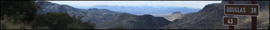
Peak 5212 • Peak 5505 • Peak 5583 The Geronimo Trail is a dirt backroad scenic byway that connects Douglas, Arizona, to the Animas Valley in New Mexico, about a 60-mile journey. The road runs close to the Mexican border, then angles northeast and gains into the Peloncillo Mountains before descending into Animas Valley. It connects to New Mexico highway NM-338, which then heads north to the town of Animas and eventually to Lordsburg, about 105 miles total from Douglas. I've been on the Geronimo Trail a few times recently, but no farther than seven or eight miles in from Douglas. I wanted to drive the whole thing, so I incorporated it into a quickie overnight journey to Deming, New Mexico, hiking a few peaks along the way. I had intended to leave Friday (the day before) but a storm had passed though the region and yesterday was still heavy with clouds and wind, but not a lot of rain. I waited a day, and today started out clear and calm. I left Bisbee about 7:30 a.m. and followed the highway into Douglas, passing through town, and getting onto the Geronimo Trail itself (it is the continuation of 15th Avenue in town, and is paved for the first four miles heading eastbound). Milepost markers begin at the western terminus of the Trail. The first twenty miles or so is through desert and the hills of the Perilla Mountains, then opening up into the San Bernardino Valley. At times, the road is within a half-mile of the border wall, then it veers away. It passes the old Slaughter Ranch, then later passes the road to Guadalupe Canyon. The Geronimo Trail is wide and very well maintained. I could go 40 miles per hour with no problem, but usually kept it about 30, just to enjoy the scenery. There were no other vehicles out this far. The Trail then aims for the western foothills of the Peloncillo Mountains, the range that straddles the Arizona-New Mexico state line. I was gaining elevation but slowly, the gradient being very gentle. I had identified three peaks that all lie within five miles of one another, all within a mile of the road. First up was Peak 5212.
Date: March 9, 2024
• Elevation: 5,212 feet
• Prominence: 372 feet
• Distance: 1.8 miles
• Time: 45 minutes
• Gain: 557 feet
• Conditions: Sunny, cool and breezy
Arizona
•
Main
•
PB
•
LoJ
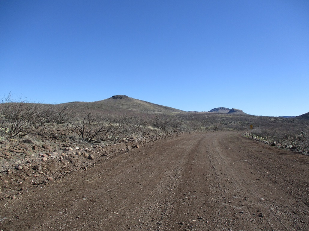
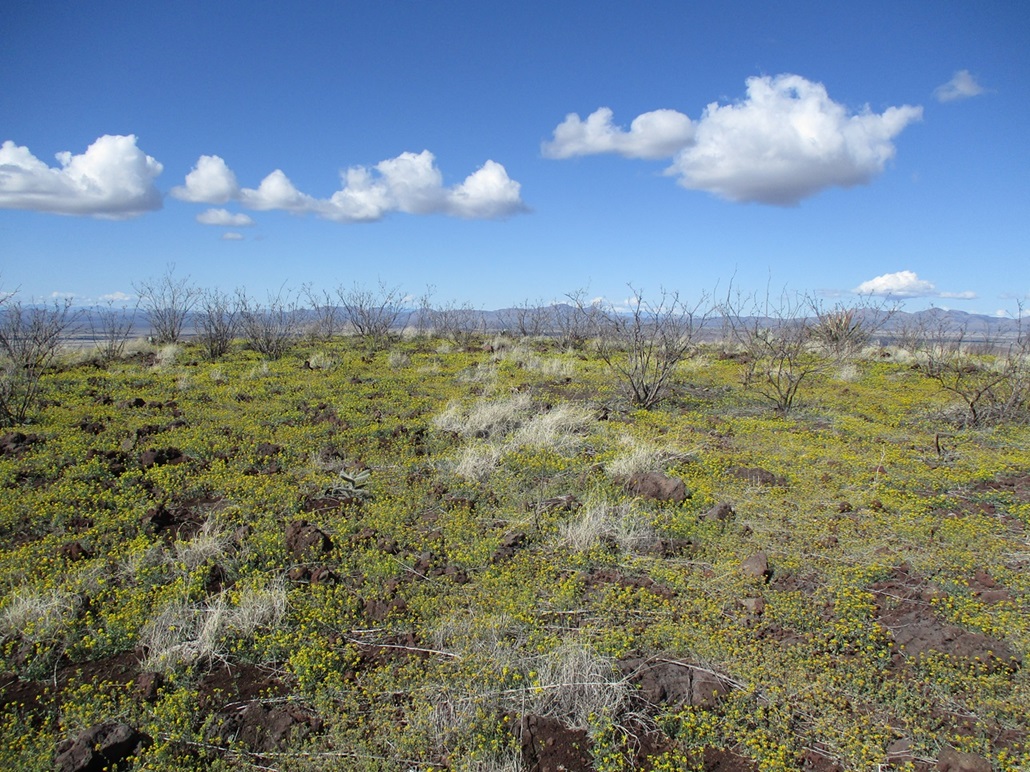
The road started to gain into the lower foothills and become more curvy, and after one bend, suddenly, I had a fine view of this peak, it being obvious as the first feature of any size in about fifteen miles. From the west as I approached it, it has a very broad, symmetrical profile and appears to be a volcanic mound with a small caprock at its summit.
I passed through some ranch buildings, including one that was built out of large stones and looked very impressive. However, it all looked unkempt and possibly abandoned. The road had narrowed by now and was wiggling with the lay of the land. It was still a fine road, though. Going by milepost markers, I passed milepost 29 before parking in a clearing across from an old track southeast of the peak. I would be approaching Peak 5212 from this direction, leveraging the track to get me close to the base of the peak.
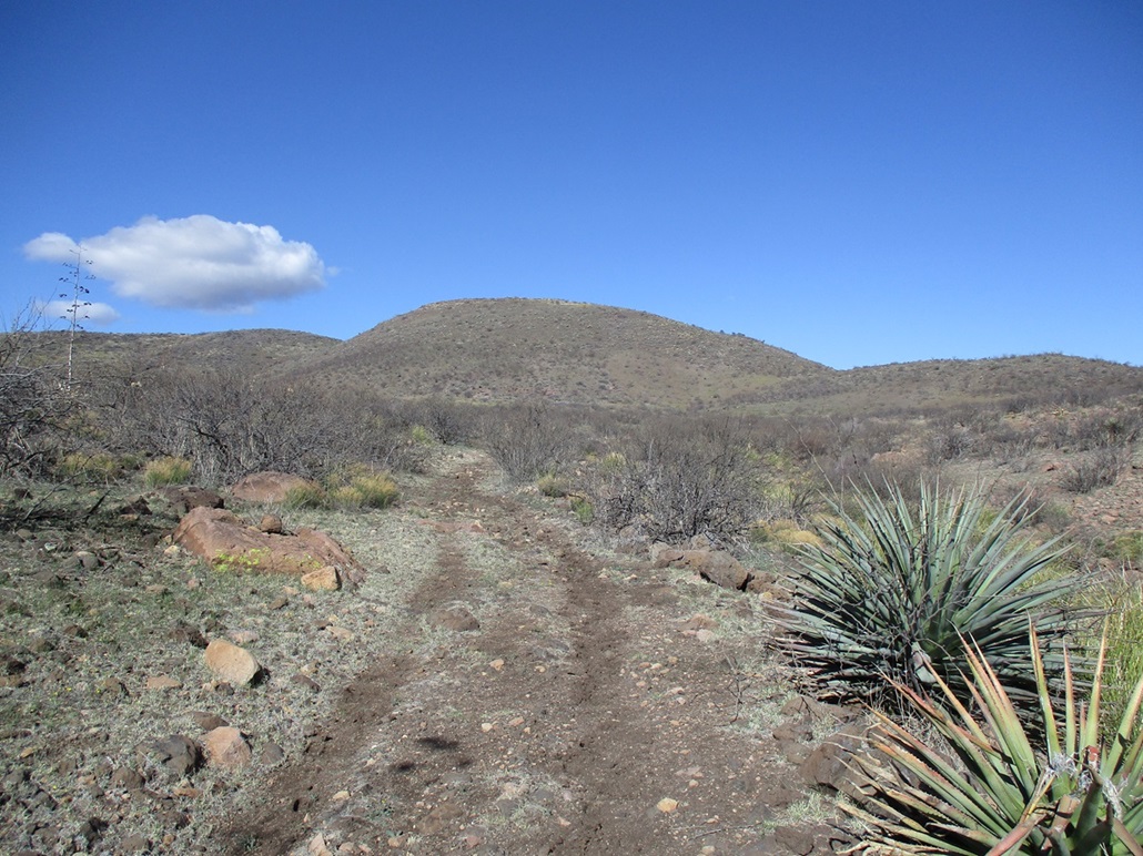
I got my stuff together, locked the car and started walking, 9:45 a.m., sunny and pleasant, temperature in the low 50s. I crossed the main road onto the old track north to a gate, walking around it and continuing up the track. This track is very rocky and there were no hints of recent vehicles on it. I could see the peak the whole way. From this vantage, it was a loaf-shaped hill, covered in low scrub and patches of yellow, suggesting wildflowers.
The track went in about a half mile but was often indistinct, which was not a problem. Navigation wasn't a problem, the track just meant I could cover some distance without dealing with brush. It drops into and out of a drainage, then through an opening in a fence line, now on a sloping pasture.
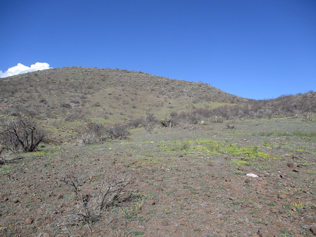
I angled left a little and took on the peak directly, picking a line and following it upslope. The ground was small pumice boulders and as is typical, roll with each step. The grade was steep but never too steep. I maintained a steady pace and was on top the hill after about 25 minutes.
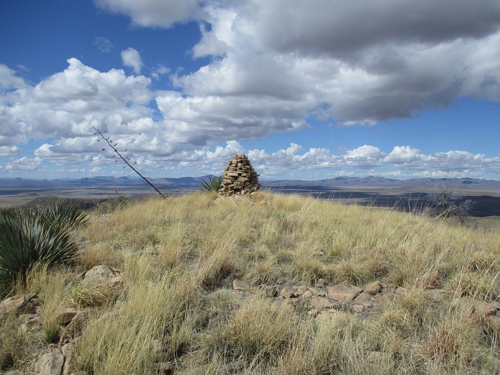
The top was covered in low blooming yellow flowers (poppies or marigolds, not sure which), which was very pretty to see. Otherwise, it was just some random open scrub, lots of rocks, and a few woody plants about waist-high. The top is also somewhat broad and finding the highest rock wasn't obvious, so I walked around and stepped on anything that looked promising. I did not see a cairn nor any evidence of past visitors. Only two previous ascents have been noted at Listofjohn, and none in almost 20 years. This is very far off any beaten path and not very many people come here. However, I would not be surprised that a random cowboy has been up here, perhaps even a cow or two.
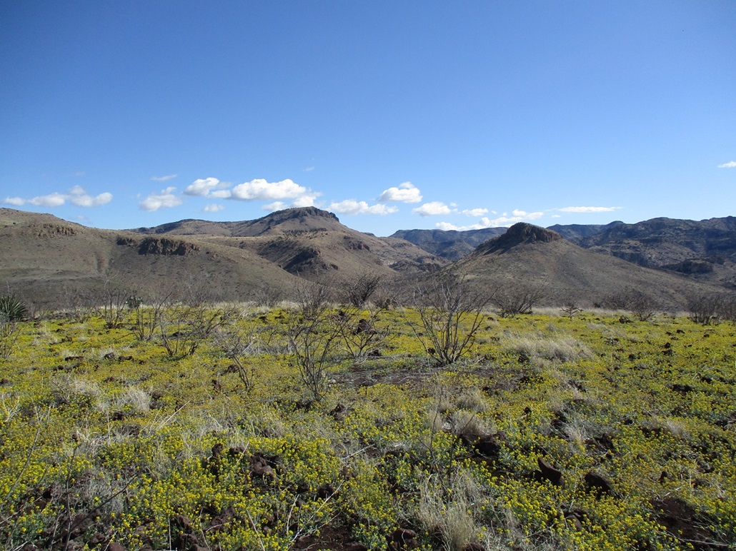
The views were wide open and lovely. Looking north and west I had expansive views of the San Bernardino Valley, while south and east I was looking at the Peloncillo Mountains. My next peak, Peak 5503, rose immediately to the east, with a big cliff facing me. Were it not for that cliff, I would have climbed it on this hike as a loop. A few clouds had moved in but nothing threatening, just some random puffy clouds, the kind that usually follow a storm system.
The hike down went fast, and I was back to my car at 10:35, about a 50-minute hike covering a little under two miles. This was an easy peak with easy access, and I was happy to see the wildflowers, the first mini-bloom of the year.
Elevation: 5,503 feet
• Prominence: 521 feet
• Distance: 1.2 miles
• Time: 55 minutes
• Gain: 763 feet
• Conditions: Still nice but much cloudier
PB
•
LoJ
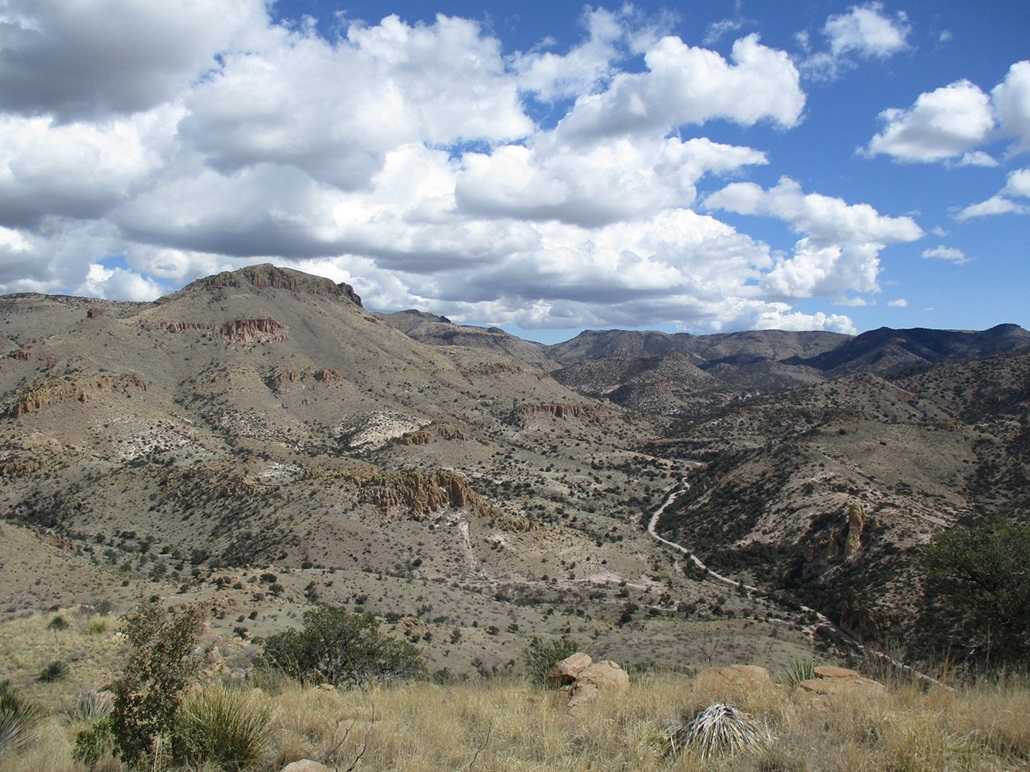
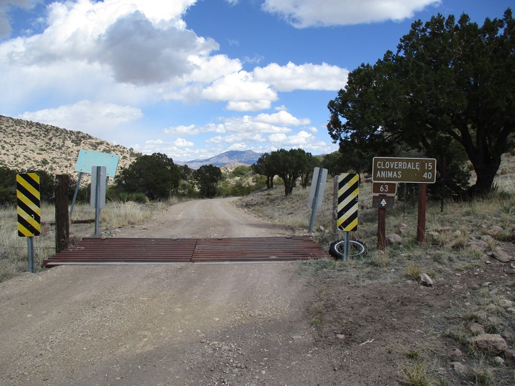
Back at my car, I did not have far to go. I got back onto the main road and drove it another two miles, passing milepost 31 along the way and then crossing into the Coronado National Forest, now marked as Forest Road 63. It's still a good road but noticeably narrower than before, but with a good tread.
Peak 5505 rises north and west of the road, with a big cliff surrounding its summit, and momentarily causing me to pause and wonder if I would have any luck. I drove a little ways beyond it to get a look at its east ridge, and saw a very promising ramp that breached the cliffs on the east side. I doubled back and parked in a tiny loop off the main road. I started hiking not more than ten minutes after I had finished my last one.
I crossed the road, then down into Cottonwood Creek, which parallels the road, then up the other side, battling some brush briefly, before getting back into the open. The cliffs and the ramp rose above me, about 700 feet higher, so I started walking on a straight line toward it.
The terrain was steep but with no barriers. The grass was not even ankle high, and there were very few rocks (at first) that wanted to roll and slow me down. It was just a matter of slowly walking uphill toward the ramp, which I did. The last hundred feet did get steeper, with looser rocks, but it was still walkable, no hands or scrambling required.
The ramp fed me onto the upper ridge above the cliffs. I angled left and busted up another slope, a gain of about 75 feet. This put me onto the final ridge to the top. It was stunning up here! The way the rocks and the ridge and the plants combined together, it looked like Hobbitland. For some reason, that's what popped into my head. It was officially an adorable ridge.
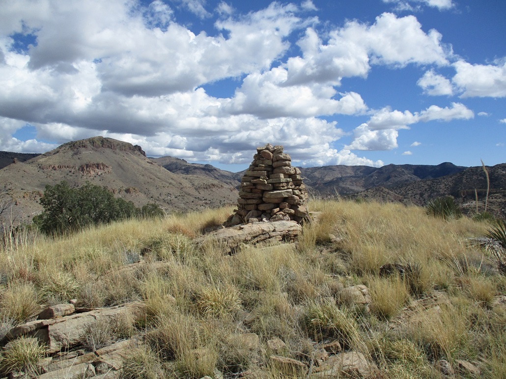
I had one more slope to gain, then an easy walk along the highest grassy ridge to the summit, which is topped by a very large, well-built cairn, easily 6 feet high, and not just a heap of rocks, but fitted together to create a more cylindrical shape. I even found a benchmark affixed nearby. It was just an elevation marker, reporting 5,503 feet for the height. I could not locate its datasheet online.
It was breezier up here so I didn't stop. Instead, I walked to the edges and shot some photographs. I thought there might be a register hidden in the cairn, but no luck. This peak sees about the same amount of visitation as the one I was just on. It had taken me about a half-hour to get here, and in that time, the clouds had amassed. Looking west it was still mostly clear, but above me it was mixed, some with that dark underbelly. Looking east, the clouds were heavier, bunching up against the higher peaks. Rain was unlikely, so said the weather websites.
I hiked down the same way, and was back to my car in a shade under an hour since starting. I thoroughly enjoyed this peak and recommend to anyone who finds themselves in the area.
My next peak was just a couple more miles east, so I got back in my car and motored toward it...
Elevation: 5,583 feet
• Prominence: 383 feet
• Distance: 1.4 mile
• Time: 80 minutes
• Gain: 403 feet
• Conditions: Blustery, sunny, some darker clouds
PB
•
LoJ
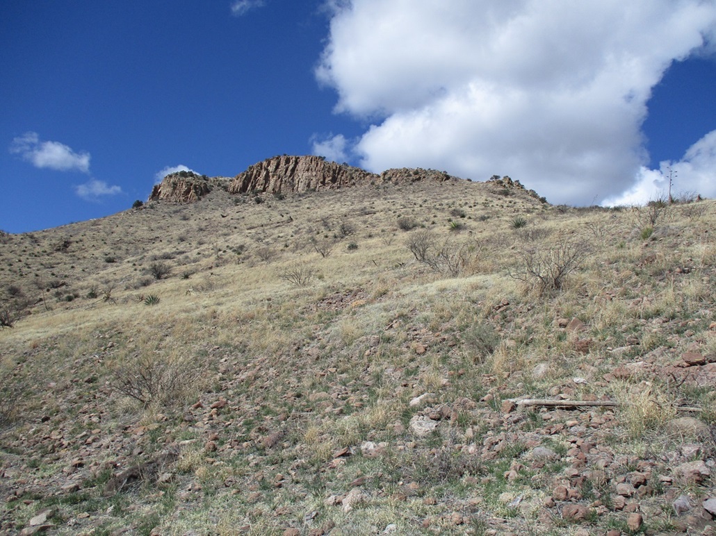
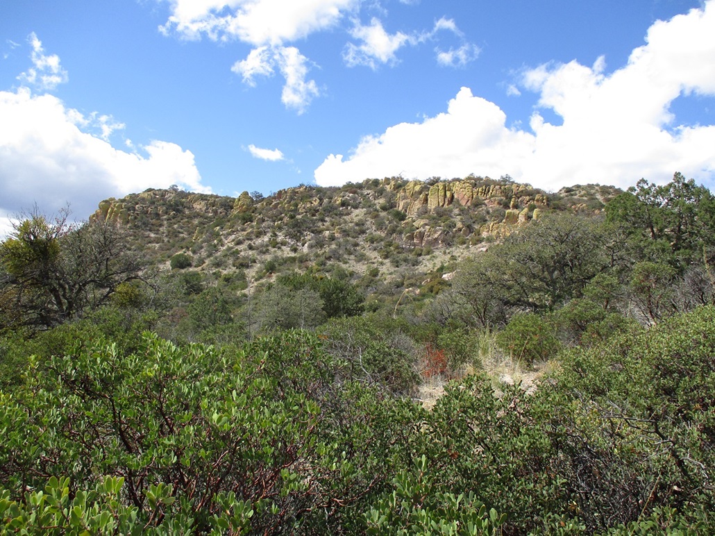
As before, the drive took mere minutes. The peak is a rocky hill tucked within the canyons, with canyon walls to the north over a thousand feet higher. The easiest and apparently the only feasible route up this bump starts on the east side, where the road makes a sharp bend north into New Mexico. At this bend is a pullout big enough for a few cars.
I parked and took a look at the peak. It is a tiny ridge ringed by tuff cliffs, and rockier formations down below. Between the rocks was a lot of brush. This one looked like it was going to be a challenge. The summit was less than a mile from me, so I started walking and just wanted to see how far I would get.
The lowest slope from the car was more open but covered in woody mountain oak and manzanita. It would form lanes, then suddenly close up, forcing me to push through to get to the next opening. It wasn't too bad for now. I was soon near a large rock formation, but saw an easy way to bypass it to the left. It was woodier here, more mid-sized trees, and more border-crosser items laying about, including a big tarp.
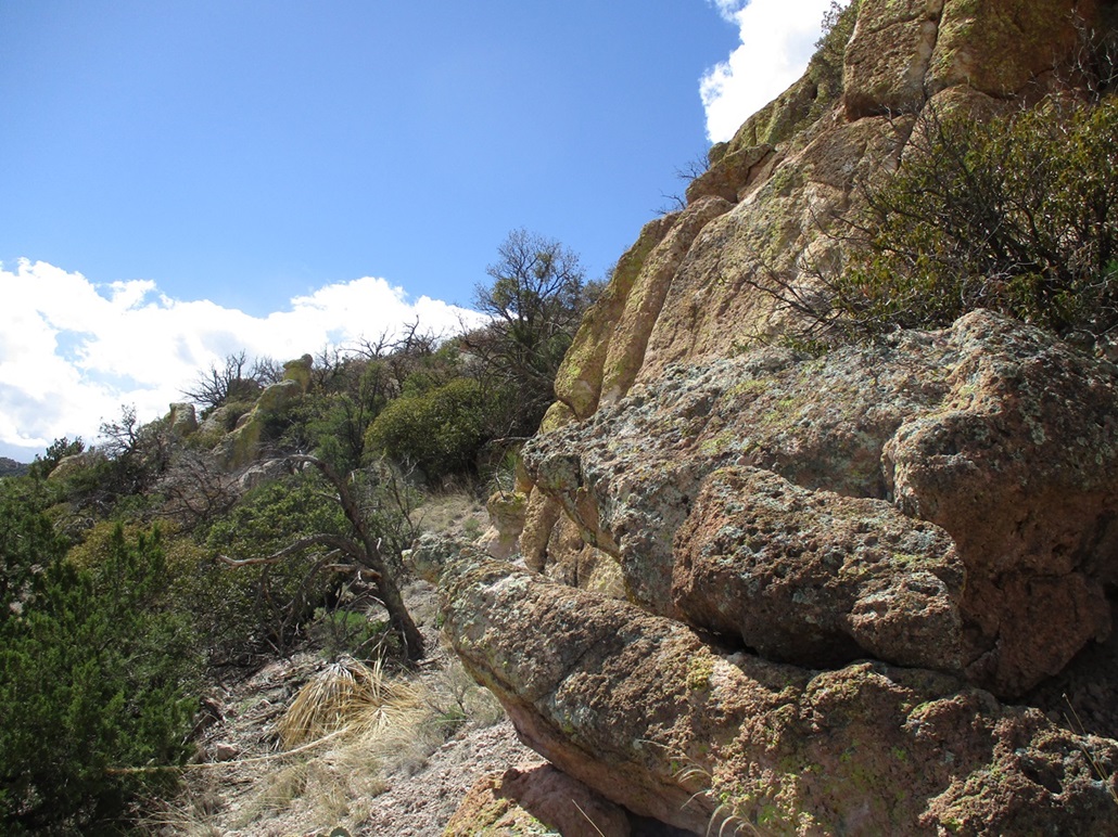
I got to the saddle beyong the rock formation. The summit was maybe a quarter-mile to the southwest, whereas the slope in front of me went west. It was rocky and heavily brushy. I pushed up one short slope into a clearing, then saw more clearing trending south, so I followed it. This was a nice ledge at first, but it soon narrowed into a scruffy slope, forcing me to hike at the base of the tuff cliffs and trying not to slide down with the loose gravel.
The cliffs above me stood about 30 feet high but were a jumble of openings and chutes, all choked with brush. I stayed on its lower margin as long as I could until I found a way up through a messy chute. The scampering here wasn't technically challenging, just Class 2, but it was brushy, pointy and loose. I was now on to the main ridge and above the tuff cliffs.
The highpoint rose not far away, a gentle hump of rock and brush. There really weren't any good ways through this. I was forced to either squeeze through brush or ease up, around and down the abundant rocks. Any lanes I found went for about twenty feet. It wasn't difficult, just slow and scratchy.
I finally emerged onto the summit which was ... brushy and rocky. I walked around until I located the highpoint. It's a 9-foot tall pillar of rock set on the south rim of the summit ridge. There was a cleft on its other side that may have allowed me to ease up the thing, but it meant sidling around its edge over a 50-foot sheer drop. No thanks, this peak wasn't worth that risk.
I situated myself beside its top and reached up. I'm 6-foot, 4-inches tall and when I reach up and stand on my tippy toes, I can reach a little above 8 feet. I cleared the area around me of smaller rocks, took off my buttpack and jacket, and jumped as high as I could. I'm no jumper but I can jump up a foot when properly motivated. I was able to slap the top this way, and called it good.
Looking around the area, I saw no cairns or registers, and wasn't motivated to stick around. I still had to get down this peak. I retraced my steps about to where I emerged above the cliffs, but chose instead to stay high and do an end-run around the cliffs, thinking I might be able to get back down to the lower saddle this way.
The problem was, I couldn't see for any distance, so I was doing this blindly. I'd get up onto a rock pile and see an opening, then have to find a way to it. A couple times I got myself "cliffed" out, but here, being rounded rocks with maybe 15 feet of drop. I ended up just bashing my way through the woody brush and the mish-mash of rocks into the saddle. It wasn't pretty, but it worked, and I enjoyed not a moment of it.
The walk out from here was easy by comparison, and I was back to my car an hour and twenty minutes after starting. I was pleased to tag the top but did not like it at all. Despite the three peaks I hiked today being so close, each had its own character and looked nothing alike. I was just happy to be done.
It was about 1:30 p.m. by now, and I had no other peaks on the agenda. I had a hotel reserved in Deming, about a hundred miles away from here. I got back on the Geronimo Trail and soon crossed into New Mexico (there are no signs here saying so). The next couple miles was up a steep shelf road to the pass, elevation 5,860 feet.
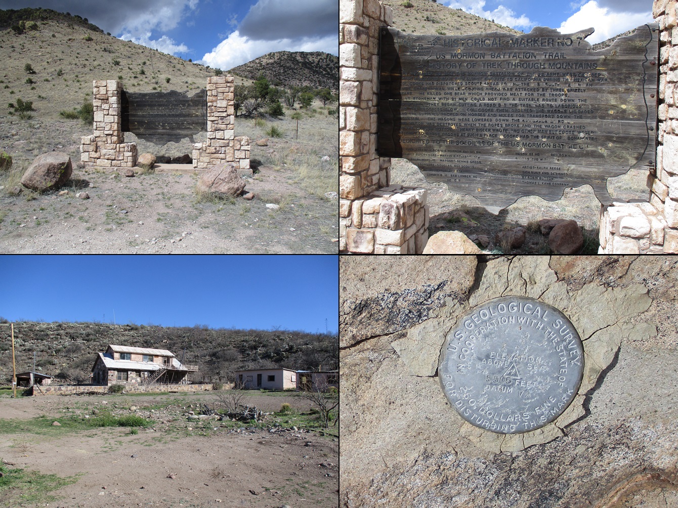
The pass has a parking area and a memorial for the Mormon Battalion, who marched through here in 1846 on the way to California and the Mexican-American War. I stopped to look around. To the west was Arizona to the east was the Animas Mountains in New Mexico. It was cloudier up here and I could see some rain sheets off in the distance to the east.
I drove down the roads another twenty miles or so into the Animas Valley. The road was still good for most vehicles but I drove through easily a dozen large puddles along the way. Slowly, the mountainous terrain and bigger trees gave way to gentler ridges, lower trees, scrub and grasses, as I entered into the valley.
I was kind of excited to do this drive. I've only been down here once, and that was almost exactly 20 years ago, when I climbed *Ahem* Peak. I recall the land down here being absolutely stunning, featuring large oaks and cottonwoods. I had a vague memory of where we camped but could not locate it exactly. Once the road leaves the National Forest, it enters into the domain of the Diamond-A Ranch. This is the second-largest contiguous ranch property in the state, over 500 square miles in area, encompassing much of the Animas Valley between the Peloncillo and Animas Mountains, all the way down to the Mexican border.
The land here is truly beautiful. You would never ever think this was southern New Mexico. It looks like something you'd see up in Wyoming or Montana. It's also very private and they have signs everywhere reminding people that the land is private and travel is allowed only on the main roads. I enjoyed the drive and never got faster that 30 miles per hour. It was just me and I had not seen another car since leaving Douglas about 5 hours ago.
I stopped once to snap some photos, including one of Animas Peak, unfortunately under a big cloud for now. Only now did I see some people driving southbound. In another half-hour, I was in the town of Animas. I followed state route NM-9 east through Hachita into Columbus, then north on NM-11 into Deming, arriving about 4 in the afternoon, where I located my hotel room. I made a quick Walmart run for drinks and got Mexican takeout from nearby, and spent the evening watching The Empire Strikes Back.
I still think those massive snow-walkers (AT-ATs) were the coolest, most inefficient fighting machines ever devised by the Empire. Did the Empire have a few already on board its massive Imperial Star Destroyer ship in space, on the off-chance they were needed on an ice world? I wonder also how they got those things down to Hoth, after learning about the rebels hiding out there, without drawing attention. Next thing you know, there they are. I'm guessing they were transported in pieces down to Hoth, then assembled. If so, I'd like to see the machines that did that. I just can't imagine a snow-walker being transported down to Hoth en toto. The rebels would surely have noticed. Also, assuming Luke and his guys had not stopped them midway, what were those things actually going to do once at the rebel stronghold? They seemed mainly equipped with artillery of various sorts, but then what? Would they just stand there and shoot away? Maybe kick at the caves with those big feet?
The Geronimo Trail was a delight to drive. It is suitable for most vehicles when dry, but something with decent clearance would be advisable. Four-wheel drive is not necessary. When it rains or snows, all bets are off. I would not recommend to pull trailers or take an RV, though. There were a few spots where the road was narrow, turns were tight and there was no margin for error.
The next day, I would hike Little Florida Mountain outside of Deming, then return to Bisbee.
|


|