The Mountains of Arizona
• www.surgent.net
|
| Geode Peak |
• Highpoint: Canelo Hills • Coronado National Forest • Santa Cruz County |
|
Date: January 19, 2025
• Elevation: 6,274 feet ✳
• Prominence: 602 feet ✳
• Distance: 7 miles
• Time: 3 hours, 50 minutes
• Gain: 1,520 feet (gross)
• Conditions: Sunny, cool and clear, nary a cloud
Arizona
•
Main
•
PB
•
LoJ
•
Lidar
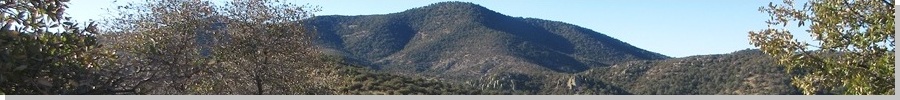
Geode Peak is the highest point of the Canelo Hills, in southeastern Santa Cruz County. The hills here are uniform in size and height and a couple other peaks nearby come within a few feet of this peak's elevation, which Lidar (1-m scale) says to be 6,274 feet. The name "Geode Peak" is unofficial, but a common de-facto name for the peak.
The Arizona Trail runs nearby, in the valleys and ridges below the peak to the south and west. But following the Arizona Trail itself from its let-in points would mean a 7-mile approach, which I wasn't interested in doing. There are some rough forest tracks that veer off the main highway that allow access into the range without the longer distances.
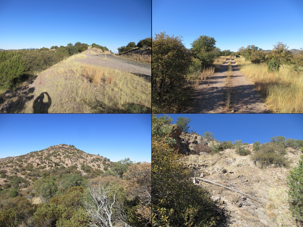
I left Bisbee about 7:30 a.m., following the highways through Sierra Vista and Whetstone, then taking the Elgin cutoff south to where it connects to AZ-83. I then followed AZ-83 about a dozen miles southeast, pulling into a cleared area just south of milepost 9. I tucked the car in behind a lone tree and got myself prepared.
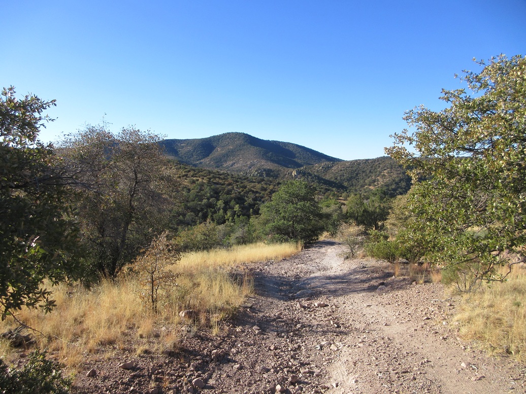
The peak itself rose just a mile or two away to the west, but I'd be following a sequence of tracks and trails to the north, then west and south, to approach the peak from its opposite side. The day was cool but comfortable, in the mid-40s for now, sunny with blue skies.
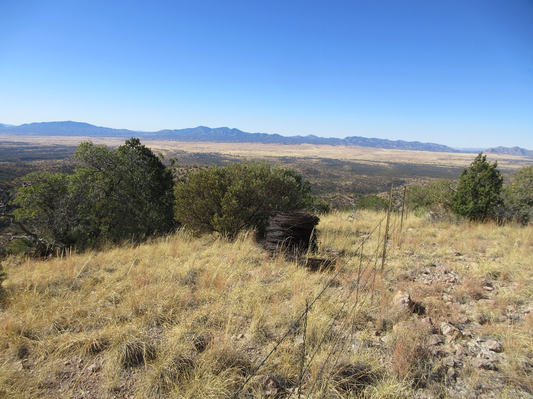
The forest road runs north from this clearing, up a rocky hill. Unfortanately, it was very rocky almost immediately and I would not be able to get my car up that road, to stash it out of sight. The road then bent west and came to a wire-stick gate, which I opened, then half-assed closed with a cord, since the wire holder wouldn't catch. I'd worry about this on the return. An old weathered forest-service road marker was here, this being FR-4636.
I walked the road, which was decent for a little while. It then dropped toward a tank called Becker's Folly. The road bent left and dropped some more, now much rockier with poor footing. It dropped almost 350 feet from its apex earlier, now in deep in a canyon with a dry sandy creek bottom.
The road crosses the creek bottom. I stayed on the road to where it again re-merged with the creek bottom, so I just stayed within the sandy creek and walked it. I missed where the road re-ascended out of the creek, but I saw it again, walked up to it, only to be fed right back into the creek bottom about fifty feet later.
The road here is mostly level. It started a noticeable trend to the north, so I knew to look for another road going south. I found a weak path that once again dropped into the creek. Across was an opening. It looked too scant and scraggly to be the continuation of the road, but sure enough, it was.
Now the track gained steeply, the tread loose and rocky and a chore to walk. At times, it was overgrown in grass and I cannot imagine a vehicle on this, except maybe a small ATV. I saw no hints of vehicle tracks anywhere. The track gained almost 500 feet, then dropped down a slope, losing about 80 feet, before coming to a turn where an old segment of the Arizona Trail intersected it.
Someone had built an arrow out of rocks pointing left (south) to the path. Honestly, I would not have seen it without the arrow. Nothing looked like a path. In fact, a lot of it was covered over in dead tree branches, which is a common way the forest service tries to hide that a path was once here. Ironically, this "there is no path here" is what hinted to me there was an actual path.
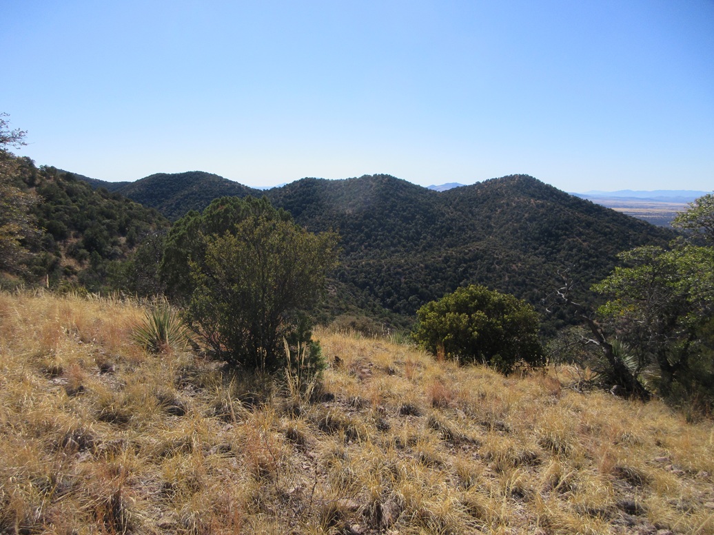
Anyway, this path aims south toward a saddle below the peak, which now rose to my left (southeast). The path was weak and haggard but easy to follow, when suddenly it was not. I walked right off of it, and did not feel like going back to find it. I could see the saddle ahead, about an eighth of mile.
I stayed high, avoiding some tuff cliffs, but it became clear I had no choice but to descend these cliffs to get to the saddle. The descent went well, the tuff being weathered and fractured with good friction and scooting options when things got steep. I dropped about a hundred feet to the saddle. Then I found the trail. Obviously, I had missed it back a ways and would learn of my error on the hike out.
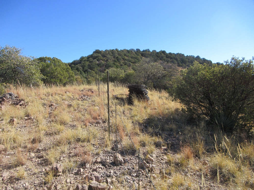
At the saddle, there is an old gate, and a fence that runs uphill. I did not pass through the gate. Instead, I just started the slow slog up the steep slope, using the fence as a guide. I was looking at over 600 feet to the summit.
The uphill grind went okay. It wasn't hard, just steep. The tread was loose lower down but slightly better higher up. At times I had nice openings and lanes, and other times, had to do end-runs around thickets of catclaw and mountain oak. In one place, with no better options, I crawled through an opening.
In time I was on a short flat stretch, now about 120 feet below the top. This part went fast but the final segment was thick with catclaw. I just moved carefully and slowly to get around the snags. And then I was on top of the peak.
The fence runs right along the top, and I was on the side where the actual highpoint was. I kicked a few rocks, snapped a couple photos, then sat near a large cairn to sign into the register. It had taken me just over two hours to get here, in 3.5 miles, with about 1,100 feet of gross elevation gain.
The register bottle held two registers, both placed in 2020. There is a "register placer" who places brand new sheets, usually too many to fit into the bottle, when the pre-existing register is sufficient. So I transcribed the names of the people on the newer register into the older one, and took down the newer register sheets. Stuffing a new register into a bottle with one already in it, especially when the first one is in good shape, is bad form, and we certainly don't need a dozen sheets. Two sheets will probably last twenty years.
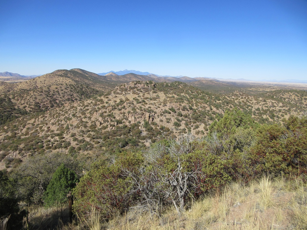
I spent about fifteen minutes up top. The views at the summit were somewhat limited, but as I hiked down, I got some fine views of the surrounding countryside. To the southwest was the grassy elevated San Rafael Valley, and in back were the Patagonia Mountains. It was pleasant up here, in the 50s, with no breeze and clear conditions, the humidity being very low.
I hiked down the same way. Back at the saddle, I followed the trail I had lost, and I saw where I had lost it. It came to some rocks, and I had stayed high. I never would have seen the trail veering down here. It didn't matter, but now I knew what my error was.
I just marched up and down the intermediate hills, then back into the creek bottom, then slowly grunted up the 350 feet to get back to my car, the outbound hike taking an hour and 40 minutes. Although tired, I was pushing myself to move fast toward the end. That wire-stick gate was a problem, but I got it latched, making it the next person's problem. I was back to my car a little after 1 p.m., just shy of 4 hours overall.
This was a fun hike and a worthy peak, being the highpoint of this hill-range. I was pleased. I got moving back toward Bisbee, but made a detour into Sierra Vista for groceries and sundries. I'll be back as there are still more peaks in this range for me to tag. I may try the others from the Arizona Trail itself, which seems to get close to the ones I seek.
|


|