The Mountains of Arizona
• www.surgent.net
|
| Gentry Lookout |
• Gentry Ridge - Mogollon Rim • Sitgreaves National Forest • Navajo County |
|
Date: September 13, 2020
• Elevation: 7,724 feet
• Prominence: 212 feet
• Distance: 0.5 mile
• Time: 20 minutes in the area
• Gain: 10 feet
• Conditions: Sunny, hazy due to smoke from California fires
Arizona
•
Main
•
PB
•
LoJ
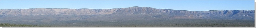
We went for a half-day drive and wander up on the Plateau, with Gentry Lookout our ostensible destination. The lookout lies about 5 miles along Sitgreaves Forest Road 300, southeast of the town of Forest Lakes. It lies on a long ridge, with drops of about 300 feet to the north, and more to the south, this being on the edge of the Mogollon Rim. However, here, the edge is not as cliffy as it is more toward Payson.
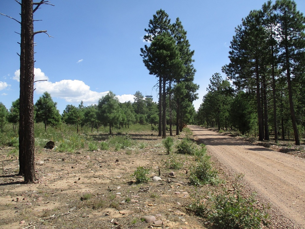
We left Payson about 11 a.m. and drove up AZ-260, surmounting the Mogollon Plateau, then about another eight miles through the town of Forest Lakes and to the turn-off to FR-300, which is the road that runs (mostly) along the edge of the Mogollon Rim for about 60 miles, roughly west of Payson to near Show Low. Once on FR-300, we went slowly until we were near Gentry Lookout. The road was good but a tad rocky, so I kept the speed to at most 20 miles per hour.
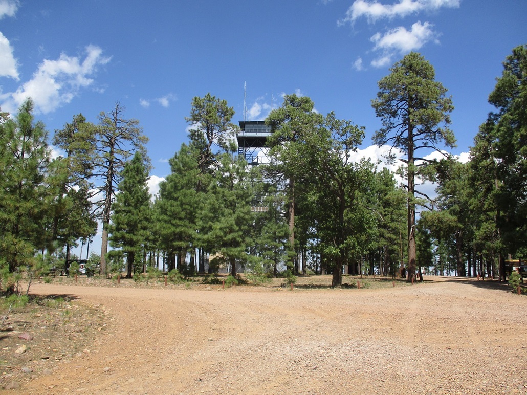
I parked in a clearing near the lookout. There were some guys in camo having a lunch near their truck at the lookout itself, plus a bunch of people on quad-runners and Polarises (Polari?) motoring about. We got out and generally wandered the area, not really hiking, just ambling about. We walked to the north "edge" of the ridge and looked down on the forest and meadows, scars of the big 2002 Rodeo-Chediski Fire still evident. Then we walked to the south edge, but views were minimal due to trees and undergrowth.
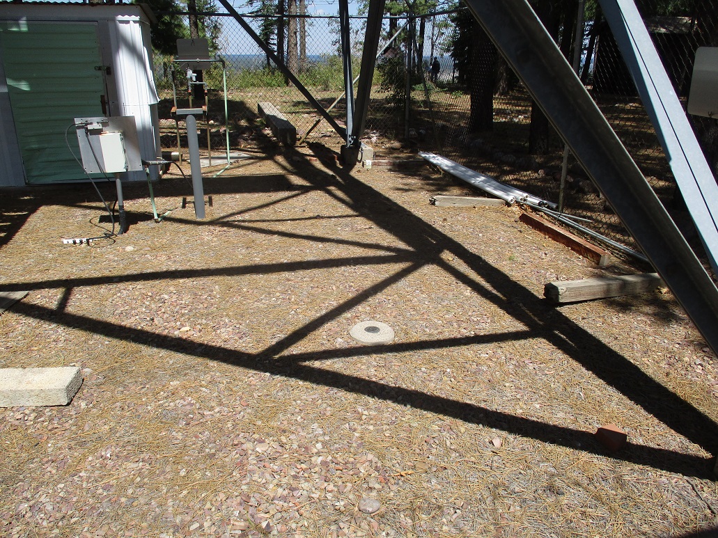
The tower itself is not accessible, behind razor wire and cyclone fencing. The benchmark was inside the fencing. The "top", wherever it is, is somewhere near the tower but could be anywhere. I stepped on and kicked a few rocks and called it good. It's hardly a mountain summit but it is a ridge-top with about 215 feet of prominence.
We spent about a half-hour here, then we drove back to another clearing along the rim and stopped there for a couple hours. We walked the area, looked for interesting rocks, and sat in the car and talked and vegged in the pleasant weather. The southern skies were hazy, due to smoke from the big fires out west.
We headed for home about 3 p.m., and being a Sunday, hoped traffic would not be too bad. It wasn't. Most of the massive trailers and RVs had already left for the day, the busiest time being around noon when the campgrounds force you to leave. We were home about 4 p.m., an enjoyable afternoon of relaxed walking in the cool forest with my wife.
|

|