The Mountains of Arizona
• www.surgent.net
|
| Fremont Peak |
• San Francisco Peaks • Coconino National Forest • Kachina Peaks Wilderness • Coconino County |
|
Date: June 18, 2016
• Elevation: 11,969 feet
• Prominence: 615 feet
• Distance: 10.5 miles
• Time: 8 hours and 40 minutes
• Gain: 3,400 feet
• Conditions: Clear and warm
• Teammates: Mattias Stender
Arizona
•
Main
•
PB
•
Interactive map
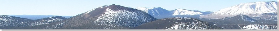
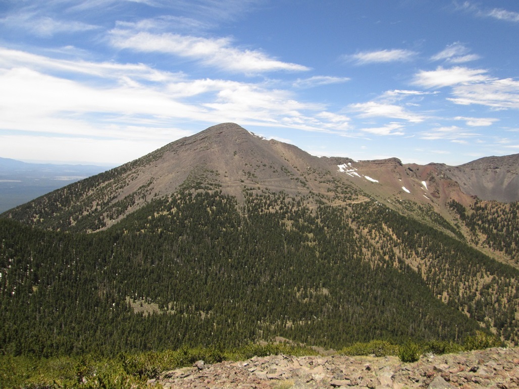
Fremont Peak is one of the main summits of the San Francisco Peaks, and is the third highest peak in Arizona, behind the state highpoint, Humphreys Peak, and nearby Agassiz Peak. Its summit elevation is 11,969 feet, just shy of the 12,000-foot barrier. But because it lies atop the main summit ridge (actually, the remnant caldera from when the mountain exploded millions of years ago), it only has a prominence of 615 feet.
I have climbed Humphreys Peak six times, the last being in 2003. I have not climbed Agassiz Peak due to it being off limits except when covered in snow. I actually had not hiked or climbed into the heart of the San Francisco Peaks since my Humphreys Peak hike in 2003. In August 2015, Mattias Stender and I teamed up to hike Fremont Peak, and possibly Doyle Peak, which is the state's 4th-highest summit.
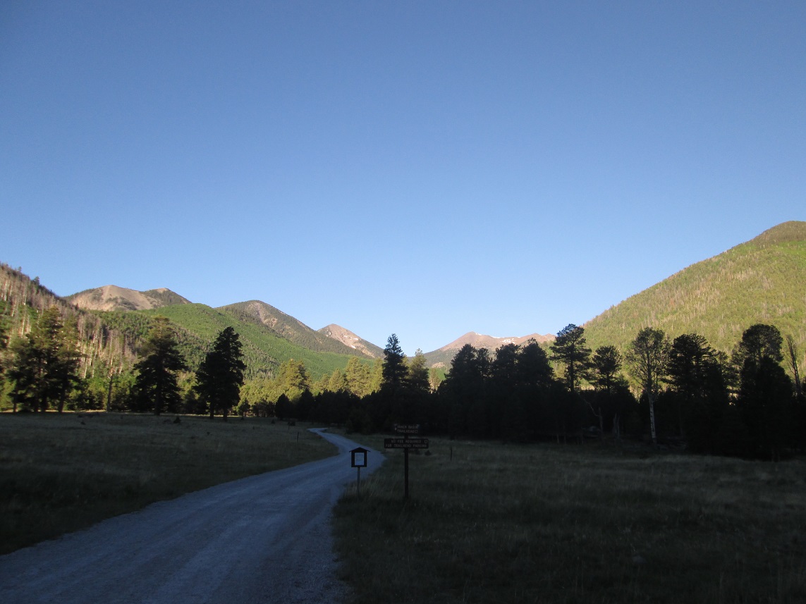
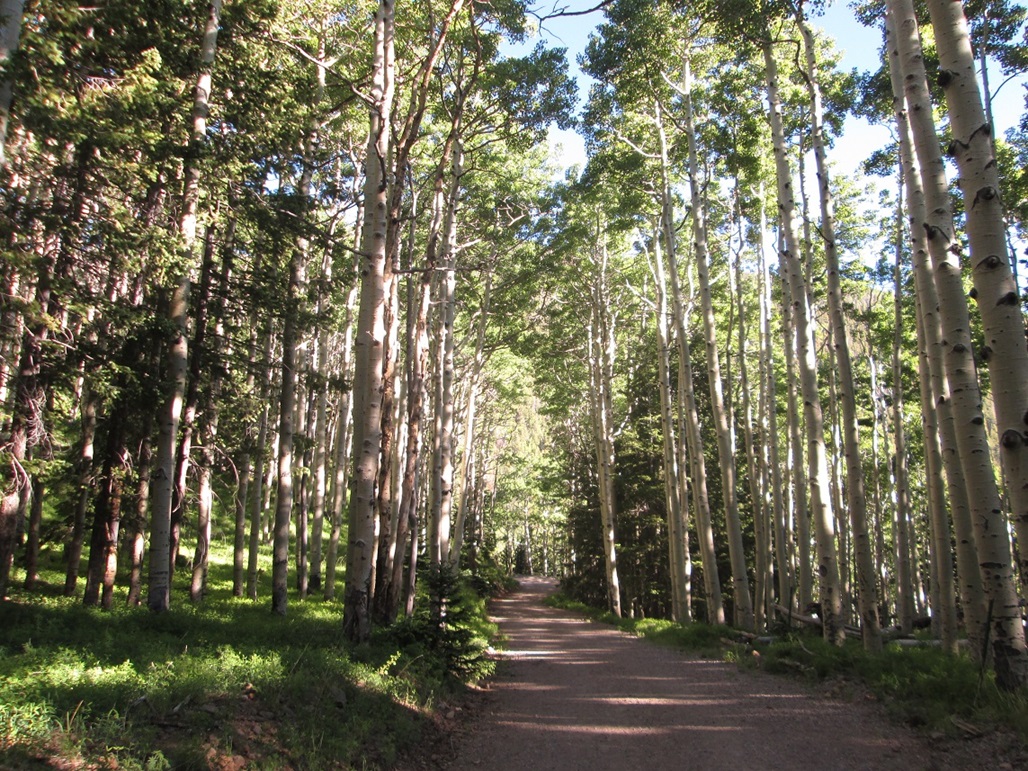
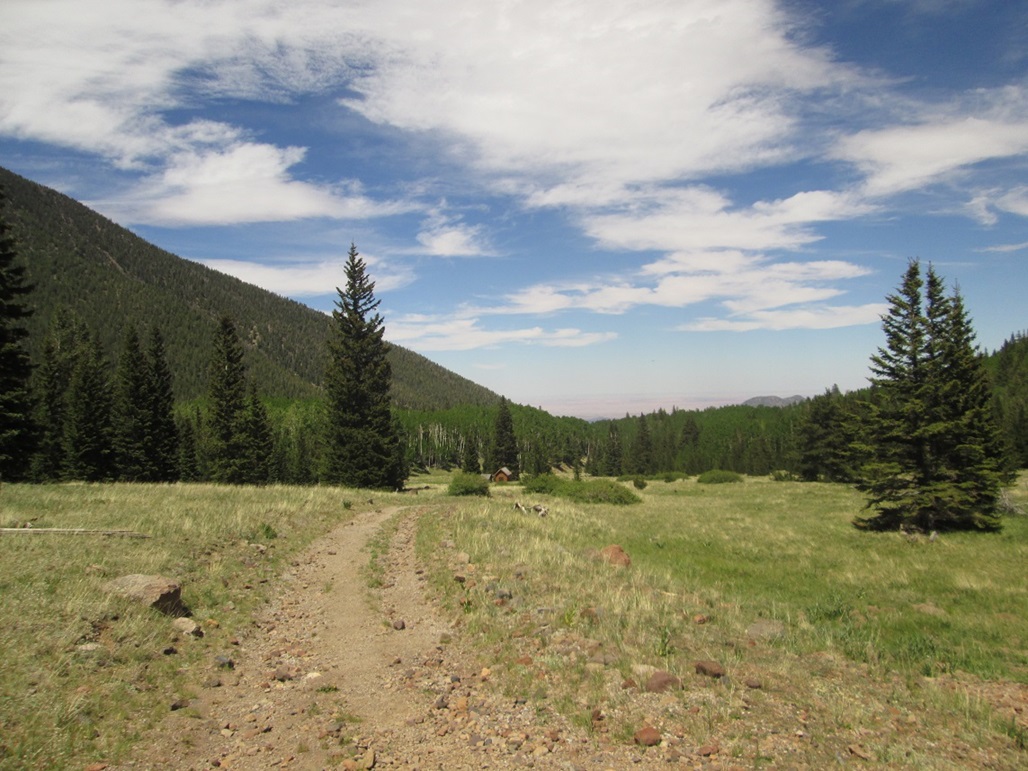
On that hike, we got an early start, Mattias picking me up from the Denny's at the Carefree Highway and Interstate-17 at 4 a.m., then driving us to the Inner Basin Trailhead at Lockett Meadow, arriving there a little before 7 a.m.. We started hiking at 7 a.m., following the Inner Basin Trail up through a thick forest of aspen, then following a road past a handful of buildings which house wells and machinery that are part of the Flagstaff watershed. There is a spigot here, and when we were here, it was dripping. A number of hummingbirds were flitting around the spigot, getting a free drink of water.
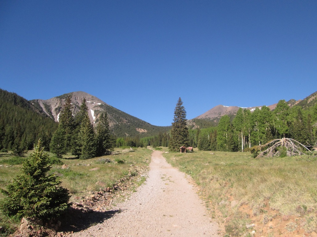
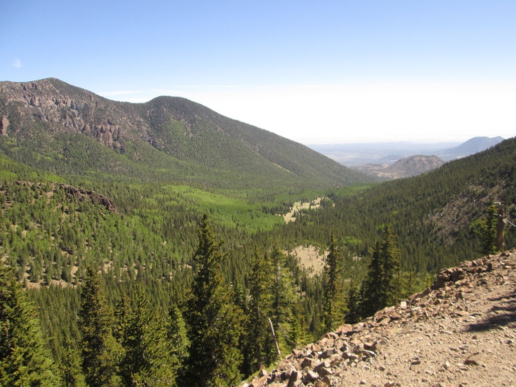
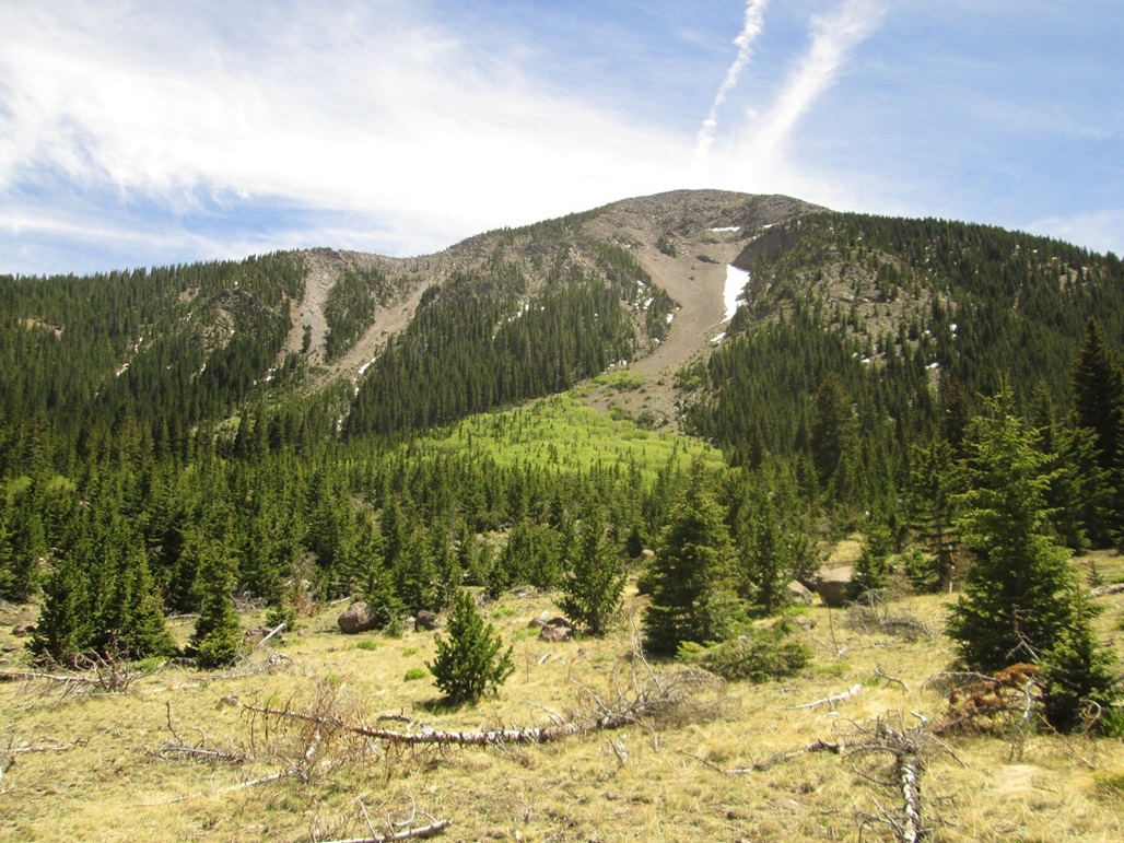
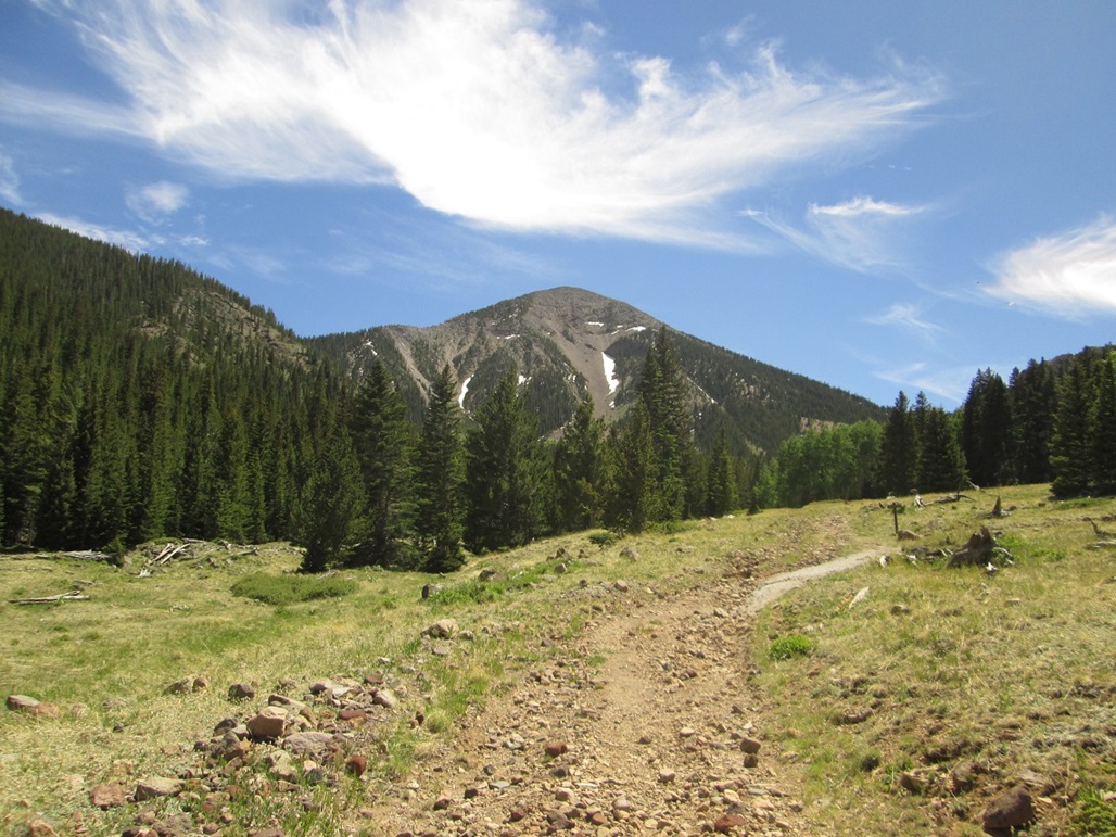
We then hiked higher into the Inner Basin itself, where the valley widens. Up here, the road goes up a meadow, with ponderosa forest on either side. The big 11,000 and 12,000-foot peaks form a three-sided cirque. From one's left looking upward, the peaks are Doyle, Fremont, Agassiz, Humphreys, Abineau and Rees. The views were marvelous. The day so far was cool but humid. This being thunderstorm season, we could expect clouds about noon and maybe a storm in the afternoon. We figured we were safe for at least three or four more hours.
We continued up the old road, which degenerates into a rocky trail, entering into the forest and starting up a series of switchbacks. In time, the trail meets the Weatherford Trail, elevation approximately 10,900 feet. To here, we had hiked four miles (going by the signs) and had gained about 2,300 feet in about 90 minutes. We were immediately below the northwest flank of Fremont Peak.
We went left (east) on the Weatherford Trail. It traverses below Fremont Peak, losing about 150 feet in elevation and cutting across a couple of long scree runouts. As the trail comes near Doyle Saddle, which separates Doyle and Fremont Peaks, it gains about a hundred feet. The saddle is wide and lovely, with some shade trees and ideal sitting rocks.
By now, not yet 9 a.m., we were a little concerned that the clouds seem to be building in abundance. They were amassing mainly over the north arm of the caldera rim, from Humphreys Peak then along Abineau and Rees Peaks. Above us, we still had blue skies with sun ... and a smattering of puffy clouds.
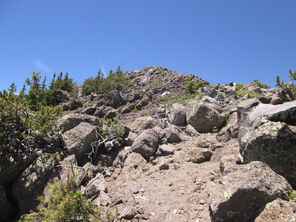
We didn't rest; instead, we moved quickly, following a scant path into the forest abutting the east slope of Fremont Peak. Whatever sense of trail we had disappeared quickly. We kept to the ridge as best we could. The climbing was easy, but we had to wend through the trees. Soon, we encountered more rock outcrops. We then found ourselves on a steep slope, the trees thick immediately to the right (north) of the ridge, and more open to the left (south) of the ridge.
Unfortunately, the clouds were really building. The big bank of clouds over Rees and Abineau Peaks had by now formed into a proper thunderhead, with a towering top and a flat, black base. We got up about 300 vertical feet above Doyle Saddle, and we were hustling, trying to beat the storm and be down into the relative safety of the forest before the skies opened up on us.
At this point, Mattias hit a wall and needed to stop. He had pushed himself and had no choice but to rest and let his body recover. He allowed me to go on my own, but I didn't get more than 50 vertical feet above him when I saw what was ahead of me. The remaining climb was not a trivial ridge-walk. And by now, the clouds were developing directly above us. I abandoned my attempt and returned to Mattias.
Mattias was sitting on an open slope, a little discombobulated. It wasn't altitude sickness, in my opinion. But I was concerned, and after a few minutes, we started a slow walk down, hoping to get to Doyle Saddle. If he was still in the same shape at the saddle, we might have had to call in for help. But he improved so that he was moving better, the worst of his ailments now mitigated.
We then started back on the Weatherford Trail, but now we had rain and lightning. The bolts were hitting the ridges above us. Had Mattias not become briefly incapacitated, we might have foolishly continued up those ridges, only to be forced to turned around while the storm was fully active. In a way, his hitting the wall probably saved us from greater grief otherwise!
But we weren't exactly safe in our current position. The trail is mostly open here, and every few seconds we would see a bolt and hear the tremendous thunder that followed, often instantaneously. This is utterly terrifying. It would be no different than being shot at. You just hope you don t get hit.
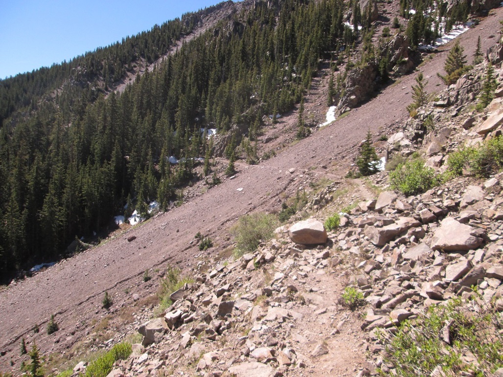
The problem was that the trail regains that 150 feet before it meets with the Inner Basin Trail. So, when we came to the big scree slope mentioned earlier, we had a decision to make. We could bail down the slope, dropping about 500 feet in a matter of minutes. We'd be in the open while on this slope, but it seemed a better bet than staying high. So we went for it.
From afar, the slope looks vertical. Even when near it, it appears steep, but not impossible. To our pleasant relief, we found the footing to be stable for the most part. Basically, it was book-sized rocks lying atop fist-sized rocks, so we had to step deliberately. But we encountered no real troubles. We kept to the scree-tree margin, and the whole time, every few seconds, we would see/hear the lightning and thunder, zapping the whole range. And it was raining hard by now.
In about ten minutes, we had dropped many hundreds of feet, and by now were off the steepest slopes and into the trees again. While this doesn t guarantee safety from the lightning, we were now much lower and our chances of being hit were reduced considerably.
We kept descending through the forest until we came upon the trail. We then walked out. People were still hiking up here, mostly downwards, but a few brave (stupid?) people going upward. Back in the open meadow, I felt uncomfortable again about all the electricity. We just moved fast, taking no breaks. Lower down, the terrain was covered in about two inches of hail pellets. And it was only about 11 a.m. by this time.
We were back to Mattias vehicle within the hour, and drove back into Flagstaff for a lunch break. We were bummed to have failed on our attempt to reach the summit, but felt absolutely no regret in turning around. This storm was massive. By the time we were in Flagstaff, the entire San Francisco Peaks were shrouded in these cells, while Flagstaff itself was being hit by cells of rain and lightning. We had rain for most of the drive home. Today had been a particular energetic day for the monsoon. It's always a gamble when hiking during the monsoon, and we lost that gamble today, although one could argue we didn't really lose since I am here to tell you all about it. I have been hit once by lightning already and I hope to never be hit again.
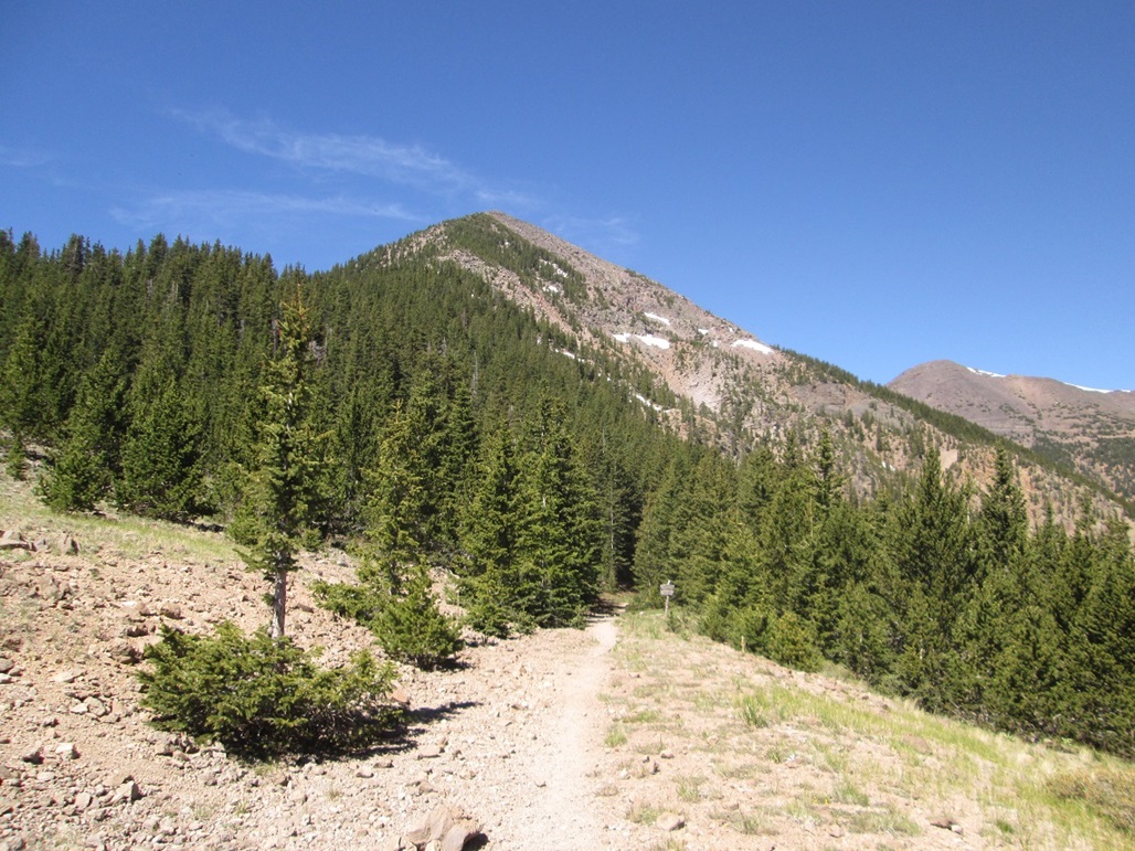
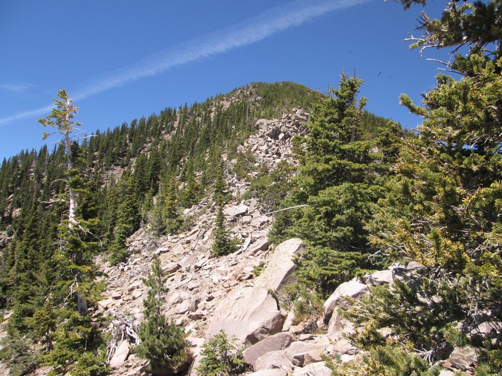
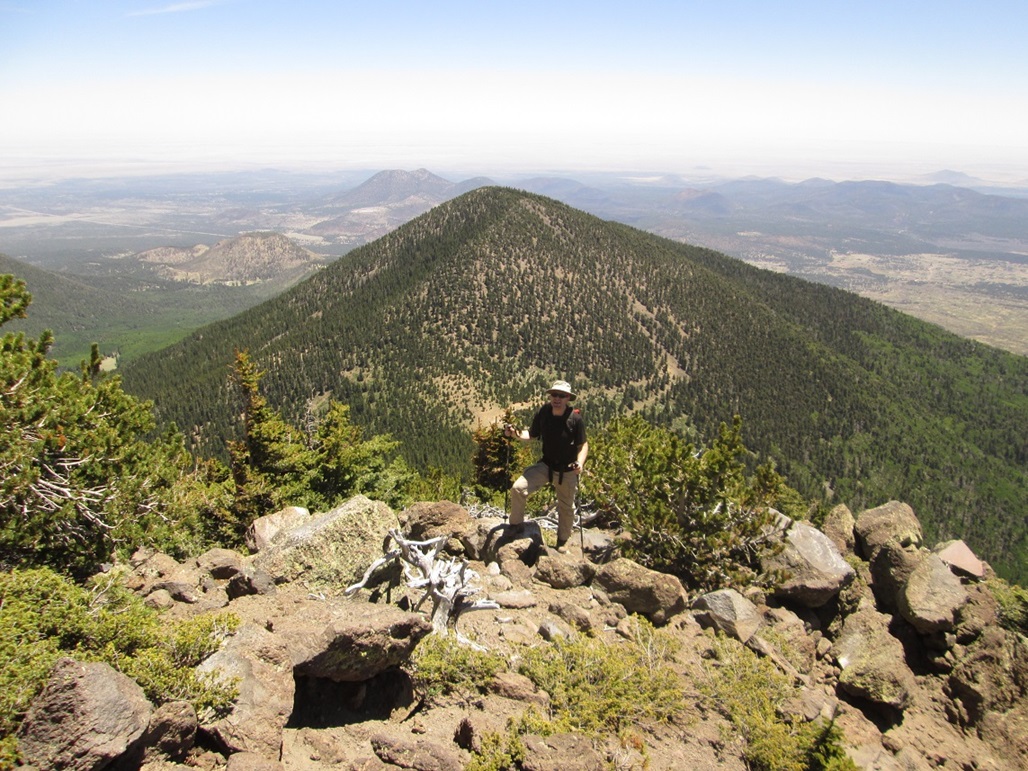
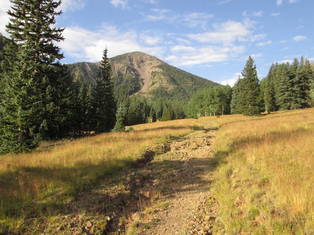
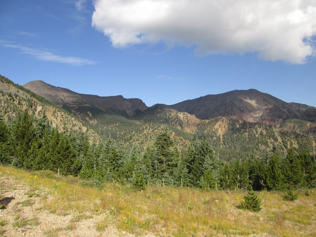
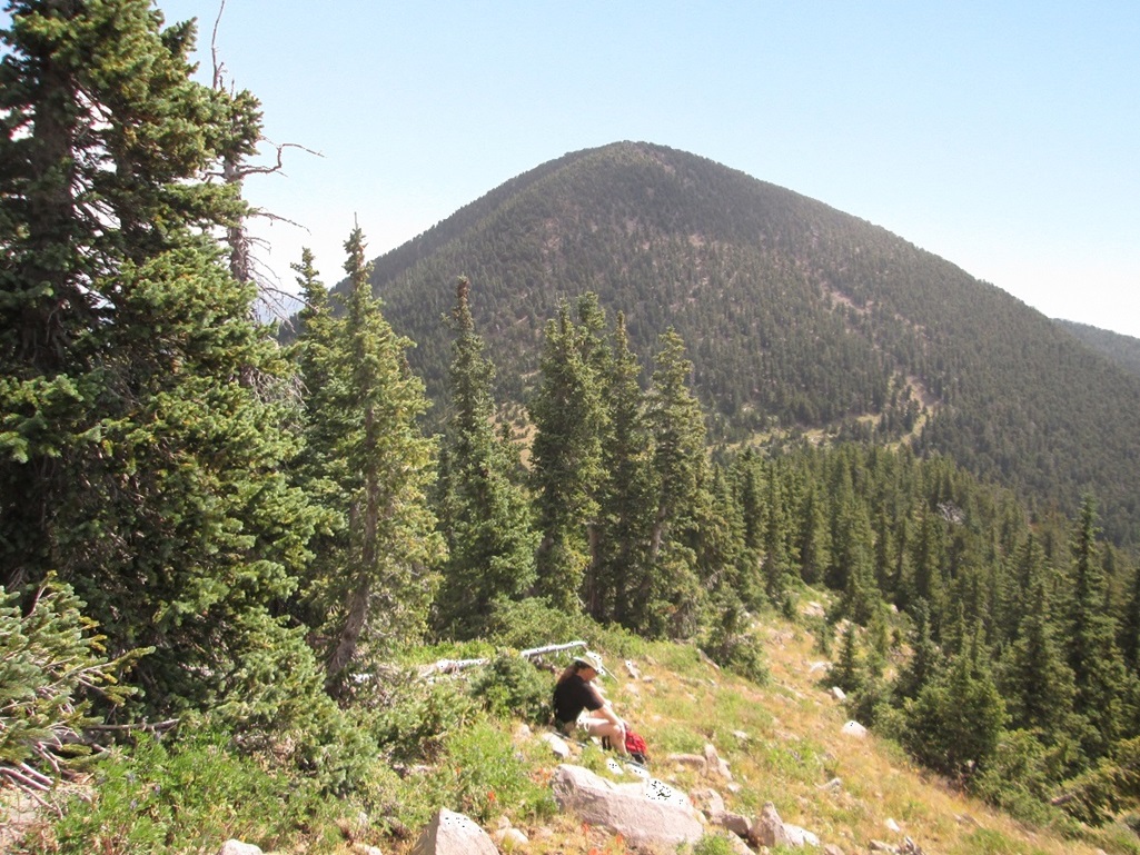
We decided to try again, waiting until mid-June, when we could expect more stable weather, as the monsoon usually does not develop until early July. Like last time, we met at the Denny's at the same early hour. Mattias drove, and we listened to more prog rock of his choosing, mostly more obscure British bands and some German bands of the late 1970s era. We were at the trailhead before 7 a.m., actually starting the hike at 6:40 in clear, cool conditions. The state was under a huge high-pressure ridge which would result in record heat throughout the region. But for us, it meant no clouds and zero chance of storms. We followed exactly the same route as we did last summer. We kept a slow but steady pace, and were at Doyle Saddle about 9:30 a.m. There were snow banks abutting the trails starting from about the 10,000-foot level. For the portion of the Weatherford Trail that traverses below the peak, these snow banks sometimes sat on the trail, there being little room to get around them. So now, we're back to where we were ten months ago. But today's weather was just lovely. However, even at this elevation (about 10,800 feet), we could sense the general warmth even up this high. We walked up the ridge, through the trees and rock outcrops, passing the point where we stopped last time. It all looked vaguely familiar. At some point, it all looked new, so I knew we were beyond where we had stopped last time. The climbing here is easy, but a chore. If we stayed directly on the ridge, we had rocks and heavy forest. If we stayed slightly off the ridge, we had loose slopes. Higher up, the slopes were sloppy. The rocks seemed to be ready to slide at any time weight was placed on them. We got to a point where we were being naturally constrained by the slopes and rocks to aim more for the rocks, which looked mighty big and possibly impossible to pass. I generally tried to bypass these rocks by staying left, while Mattias scampered onto the rocks and found a safe, if minorly exposed, scramble route that gained us about 60 feet quickly. This would be the crux, and would rate a low class-3. Above this, we had more of the same mix of trees and sloppy slopes. But fortunately, the hiking was straightforward with no more rock scrambles to deal with. Soon, we were above the last of the trees, aiming for a bare hump of blackened volcanic rock. I was relieved that this was the summit. It had taken us just under five hours to get here. The summit features a rock wall, and we found the sign-in register in a bottle in the lower rocks. We signed in and snapped a couple photos. For some bizarre reason, the summit was host to an unbelievably dense throng of flies --- the big green colored ones --- and a bunch of smaller mosquito types as well. It was extremely unpleasant. You'd literally open your mouth to say something, and get a couple insects flying in. We walked about thirty feet to the west of the summit, and there were no more flies. Here, we sat for an extended summit break. We ate snacks, drank liquids, snapped photographs and tried to see if we could see hikers up on the Humphreys Peak ridge. We could see Agassiz Peak much closer, with the trail cutting up its east flanks. The trail is an old road that got as high as almost 12,000 feet. I do not know the history of this road, but assume it was put in back in the early 1900s when doing things like this was common. We decided to descend by heading west off the summit, not retracing our route back to Doyle Saddle. Neither of us were enthused about dealing with the sloppiness of the east ridge we had ascended. The west ridge looked more friendly, and it would also save us about a mile in extra hiking. We descended about 300 feet through rocks and low brush to a saddle, then cut right (north) and started down the slopes through the trees. We were winging it here, but we knew we would cross the Weatherford Trail no matter what we did. The downward hike was steep but easy. We encountered a lot of snow patches, downed trees, and lower down, a couple of rocky talus fields. We also heard some bush-bashing and thought we may have spooked a bear. We clapped and hollered for a few minutes, but never heard the noise again. In time, we had descended back to the Weatherford Trail, meeting it immediately east of its junction with the Inner Basin Trail. We took a break here. Me, I was feeling my usual tiredness, but also a little more dehydrated than normal. The day was quite warm, even this high up. No matter what I drank, I felt thirsty again. I had enough to get me down to the cars, so I wasn't worried. It would just be a little uncomfortable is all. Once on the Inner Basin Trail, we made good time, and met with a lot of hikers going up and down, some with big packs on suggesting they were going to overnight somewhere. We saw lots of dogs, mostly unleashed even though the signs are pretty emphatic about keeping dogs leashed. The lower we descended, the more people we met. I imagine everyone was looking to escape the heat. It was in the mid-80s back at the cars. We exited at 3 p.m. This hike had gone well, much better and with less excitement than on our August hike from last year, just the way I like it. We exited back into Flagstaff where we cleaned up and got something to drink, then drove directly back into the blast furnace called Phoenix, where highs were about 112 degrees, and would reach up to 118 degrees the next day. As always, my thanks to Mattias for being an able and willing partner, for driving, and for selecting good prog-rock for the drive. We decided that we'll hike Doyle Peak on a separate trip, coming up from the Schultz Pass side just for variety. |


|