
The Mountains of Arizona
www.surgent.net |
|
Peak 2620 • Peak 3430 • Cottonwood Hill Today's activity would center around the many peaks and hilltops that lie southeast of Florence, in a huge patch of desert bounded by highways AZ-177, AZ-77 and AZ-79, south of the Gila River. The Tortilla Mountains encompass the eastern portion of this region, near the mining towns of Kearny and Hayden. The remaining peaks belong to no range, or perhaps the Tortilla Range, as the boundary is subjective. Black Mountain is the centerpiece mountain in the area. Scott Peavy and I climbed that peak back in 2014. The area that I speak of has no name or easy way to reference it. It's just a big patch of territory, most of it Arizona State Trust Land, with private land taking up most of the rest (there are a few BLM sections herein). Access is not prohibited in general, just stay off the private holdings. The main roads that pass through are dirt, but usually well maintained. I had grand plans to hike perhaps a half dozen peaks today if all went well. I had a route planned and maps ready to go. The day was cool and clear, and all indicators looked encouraging. Well, I got three, and I was happy to get those three. I did not "fail" at the other three. I was happy with my haul and needed to get back to my Tempe place to do some actual work. I can always come back.
Date: November 13, 2022
• Elevation: 2,620 feet
• Prominence: 500 feet
• Distance: 1 mile
• Time: 50 minutes
• Gain: 470 feet
• Conditions: Cold, clear
Arizona
•
Main
•
PB
•
LoJ
I left Tempe at 5:45 a.m., still dark and chilly. There was no traffic on US-60 heading east, and I had all green lights through Gold Canyon. I stopped in Superior for gas and snacks. Only now was the sun barely lighting the eastern sky. Sunrise itself was still an hour away.
I exited US-60 onto state route AZ-177, heading south through the mountainous terrain. I drove about fifteen miles to the turnoff for the Florence-Kelvin Road, which connects AZ-177 to Florence, 30 miles away. Actually, I drove right past it at first, there being no sign for it beforehand.
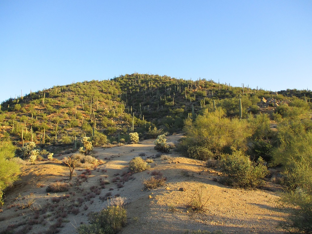
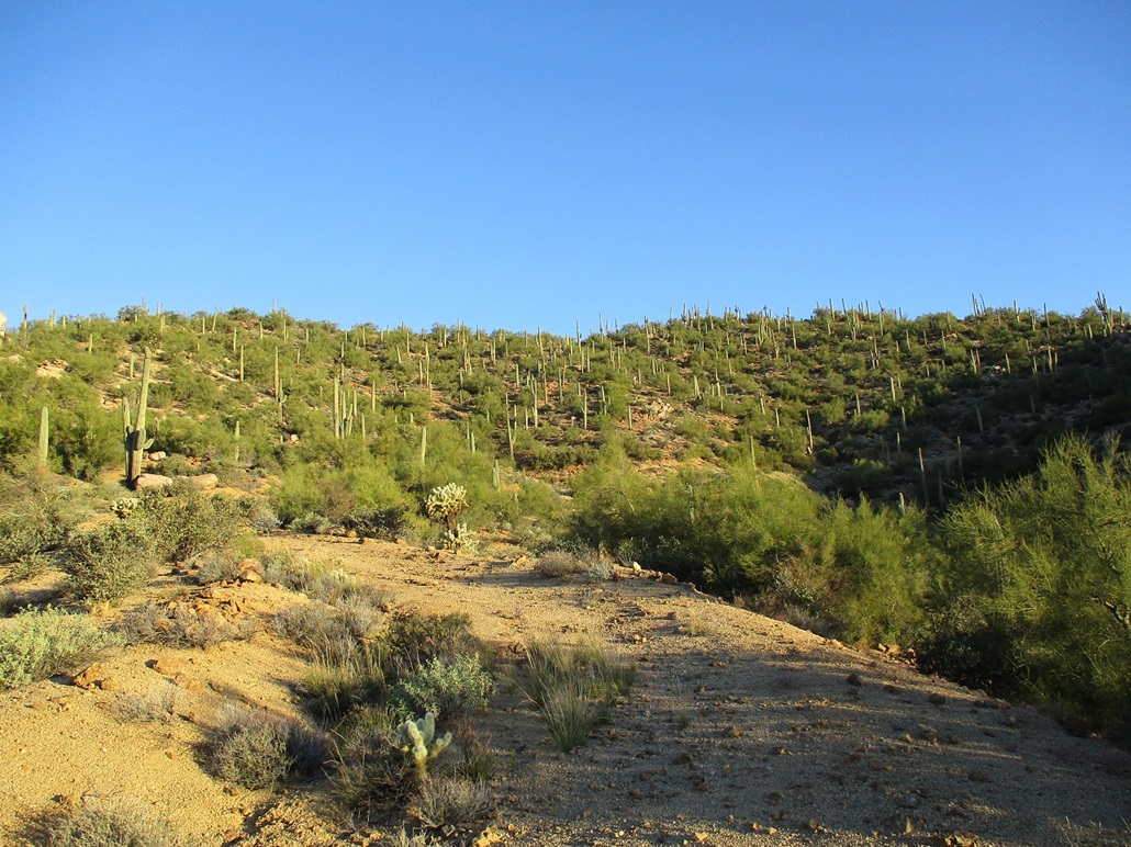
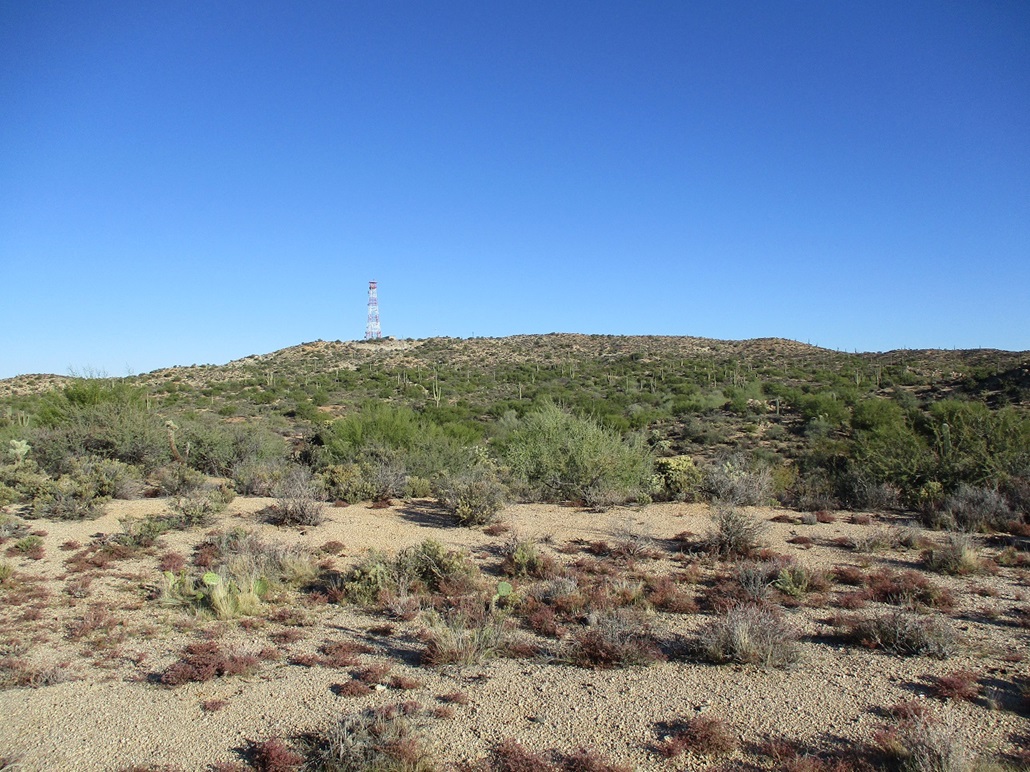
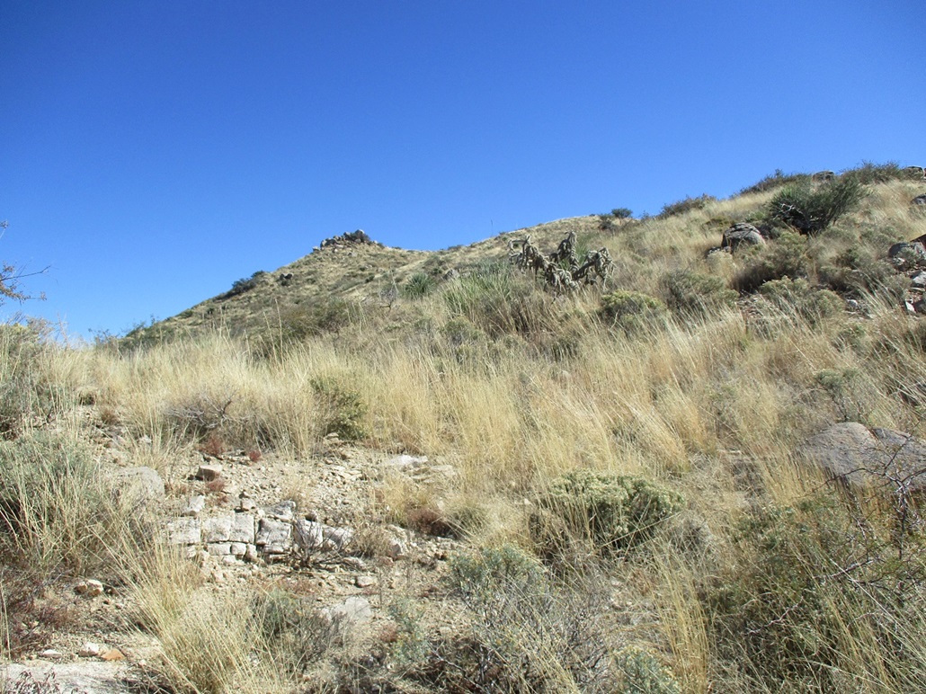
The road passes over the Gila River, then through a tiny settlement called Riverside. It loses its pavement, but the dirt roadbed is well maintained. My first peak of the day was not far ahead, Peak 2620. It's an anonymous peak, not much to recommend it. I chose it because it was close and had a track partway up. I wanted to start the day with something easy.
I parked in a small pullout a little west of Hill 2279. It was still cold, in the low 40s, but the sun was now up, barely breaching the hills to the east. A haggard track that goes half-way up the peak starts across the way.
This track is heavily eroded, grooves and ditches big enough to scare away even the hardiest of Jeeps. For walking, it was tolerable. The road was covered in coarse gravel, and it was easy to slip. Rounding a bend, the upper slopes were now visible, nicely lit by the low sun.
I stayed on the road another few hundred feet. I got as far to where the road was completely washed out. There was no point trying to get past that, so I backtracked to a bend where a slope going uphill looked promising.
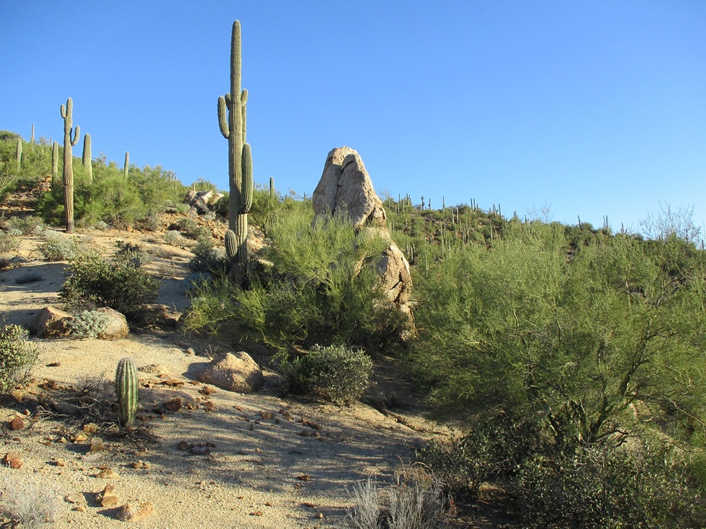
This slope was easy and it lay back well. But the footing was loose due to the gravel. The whole hill is basically one massive pile of dog-food-kibble-sized gravel. I also had to push through a couple brushy segments and palo verde growing too close together.
Soon, I was nearing a rocky top, then looking right (east), there was the real top. I was there quickly. It features a small flat platform, any of about 6 different rocks could be the highest point. A metal pole driven into the ground and buttressed by large rocks marked the summit, although downslope by a foot or two.
The views up here were quite good. Big Peak 3318 rose across the way to the north, and down below was the Gila River, choked with trees and brush. Looking southwest, I could see more hills and my next objective, Peak 3430. With the sun now up, the temperature rose by ten degrees into the 50s. It was still chilly, but comfortable.
I hiked down the same way, taking care not to slip, slide or ski. I had to move slowly. At times, every time I set my foot down, I'd slide an extra six inches. It never felt secure. I was back to my car, a round trip of about a mile in just under an hour.
I did not expect this peak to be difficult and it wasn't. I felt good, as I had one in the books already and it still early. Next up, Peak 3430.
Elevation: 3,430 feet
• Prominence: 350 feet
• Distance: 1.6 miles
• Time: 45 minutes
• Gain: 230 feet
• Conditions: Sunny
LoJ
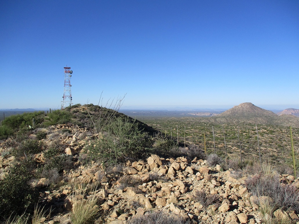
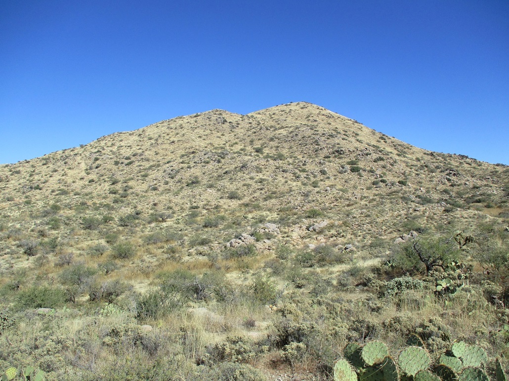
This next peak was about a six mile drive (give or take, I didn't track it that closely) along the Florence-Kelvin Road, gaining elevation until reaching an apex and flattening out. Peak 3430 is obvious, a sprawling mound with little visual relief, but with a big red-and-white communications tower near its top. A good road branches off the main road and goes all the way up. The question was, how good is this road?
As I was driving the main road then this spur road, I notices an awful lot of trucks, Jeeps and toy-haulers parked alongside the roads, and various people just standing around. It's hunting season, and the rest are probably target shooters. Thus, I would be mindful of their presence. I'm not a big fan of getting shot.
I drove in this spur road toward the tower. I intended to drive in as far as I felt prudent, but still park a little early to make this into a small hike. I got in about a mile, past a lower tower, then parking in a pullout when I came upon an erosion ditch in the road. This ditch wasn't too bad and I could have straddled it, but I was close enough to walk from here.
Part way up, a big truck full of guys came up, and a few minutes later, when I arrived onto the summit area near the tower, they were parked and looking around, all decked out in camo. I could barely see them. I said I'm going this-a-way and they said that's cool, they were headed somewhere else. One other guy in a smaller Polaris was parked a little higher up. As I walked past, we just gave a quick wave.
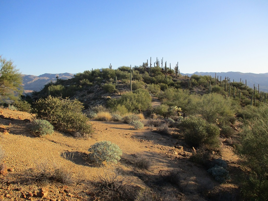
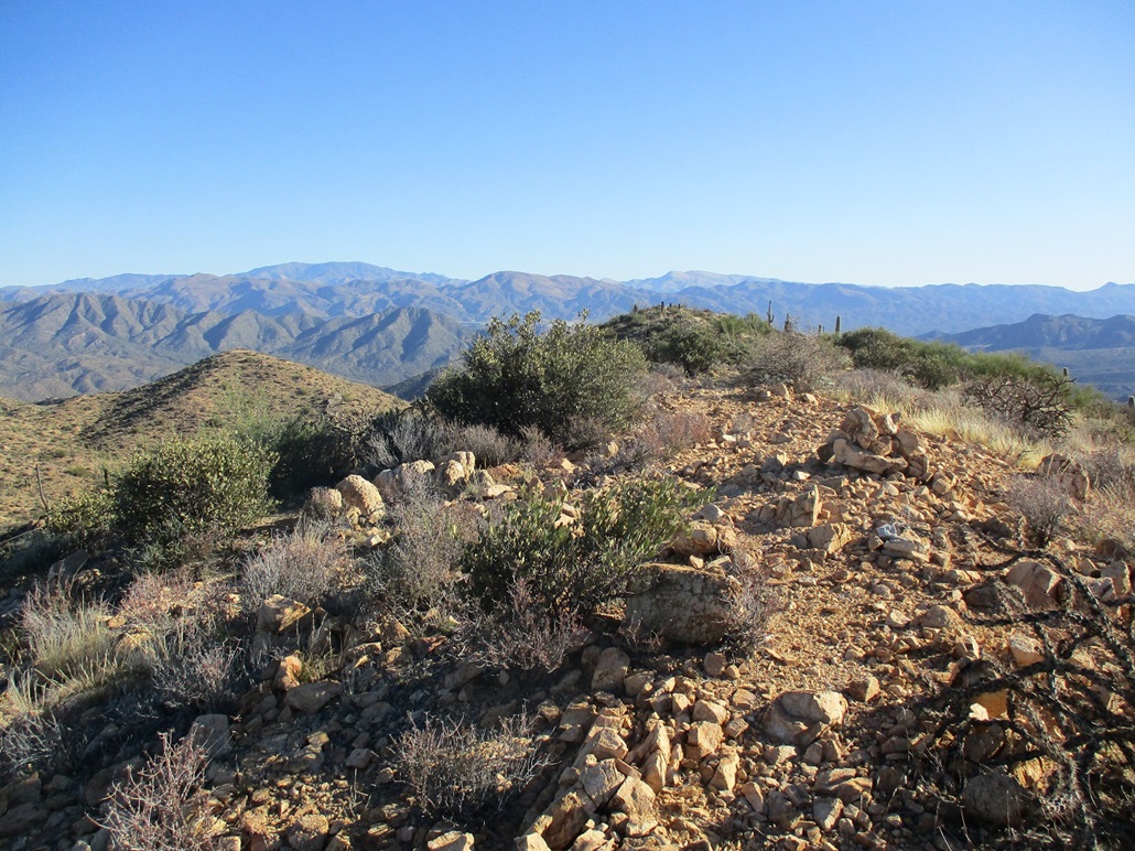
The highpoint is the middle of three bumps along the ridge east of the tower. There was a footpath to follow. I came upon the top quickly, and also hiked out to the farthest bump, which was lower by a few feet. Nevertheless, it was easy to get there and offered fine views. The day was sunny and clear, with no humidity. If the whole world had this kind of weather, we would have world peace.
I descended by bailing off the ridge directly to the road, no need to go back to the tower, and was back to my car, the round trip taking less than an hour. Those guys in camo came rumbling back down the road. I guess they didn't like their odds up there. I also came upon four other guys, newly parked, getting their stuff on. They were hunters too. One guy had a big rifle. That's how I could tell.
As I exited, I gave some side roads a look, as I would like to climb Grayback, a conical rocky peak about four miles west. I was not up for a long road walk, but wanted ideas about the road net for a future visit.
Back on the Flo-Kel road, I continued along it for a number of miles to where it becomes paved again. Then I made a left onto Barkerville Road, now heading southeast toward my next objective, Cottonwood Hill.
Elevation: 4,420 feet
• Prominence: 380 feet
• Distance: 2.5 miles
• Time: 90 minutes
• Gain: 670 feet
• Conditions: Breezy and cool
PB
•
LoJ
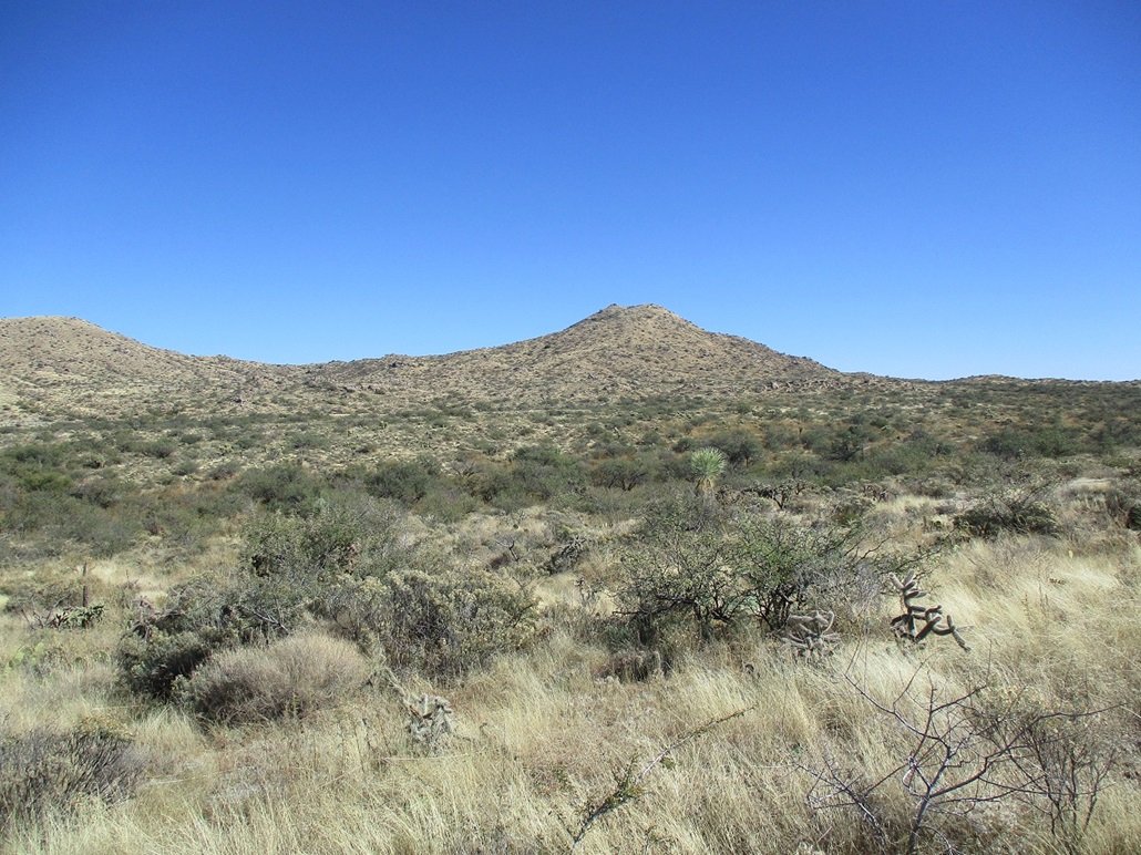
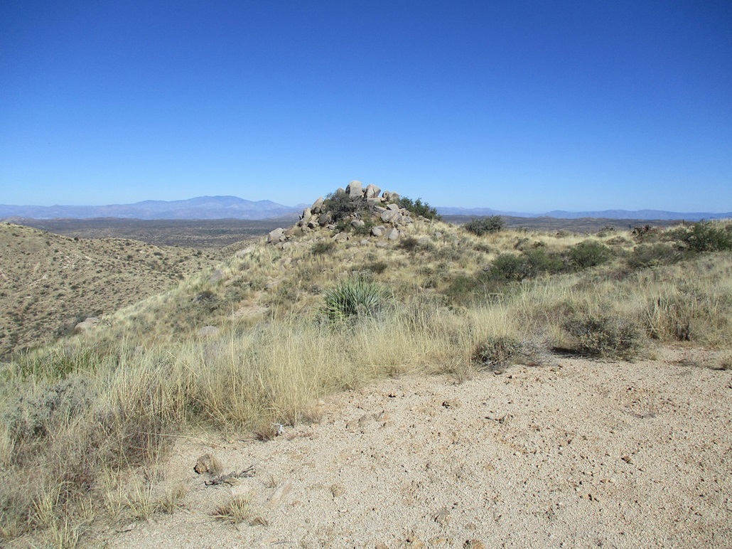
I drove southeast for 14 miles on Barkerville Road, which has mileage signs counting downward in my direction, ending where Barkerville Road meets Freeman Road. Cottonwood Hill rises east of this junction, and it could be seen from many miles out, as it has a distinct conical shape and not surrounded by much to distract it.
The closest road to the peak is where Barkerville Road cuts south of the peak, but this segment is private and posted, so I did not want to take any chances. I backtraced about a mile and parked on a scant side road atop a rise. I was on State Trust land here. I have my permit, so I was golden.
From this vantage, the summit can be viewed, a rocky crown slightly offset to the north, and long slopes of grass and rock outcrops leading upward. I started the cross-country trek, almost immediately finding myself in thick mats of grass and abundant cactus. It was cool and with a breeze, but I was still mindful of snakes as they can be out even in this weather (see below). I beat the thickest sections with my poles, and otherwise used the hope method to avoid being bitten.
The initial half mile was down low, crossing a few arroyos with thick brush, then up and down small ridges of rock and brush. I kept to any open lanes as I could find them. Cows amble through here and left behind nice cowpaths but they usually went in other directions. I was soon slowly ascending over all the lower terrain, now on the lower slopes of the peak.
The grass let up slightly and I had marginally better footing, using the rocks as steps. This upward hike went well, with no challenges and undue barriers. The breeze was heavy and cold.
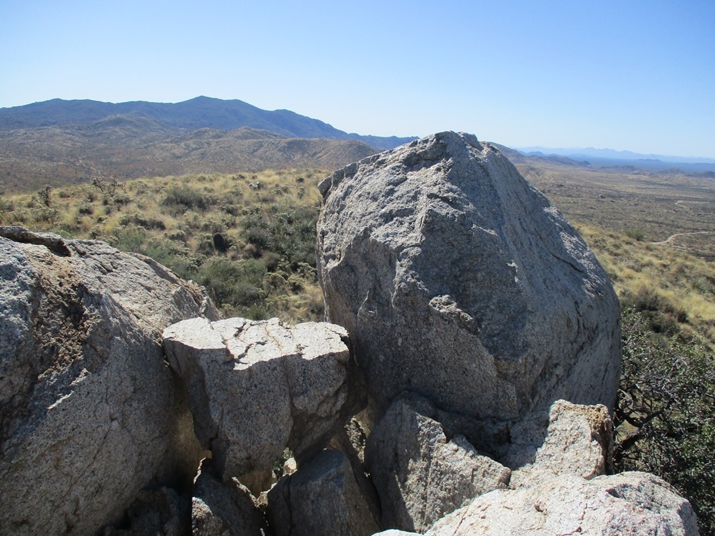
As I ascended, the summit became visible again, its rocky crown much more evident. The size of the boulders concerned me. These could be just tall enough to not be able to tag. I really did not want to hike this much and have to be turned back. So I kept hiking upward and hoped for the best.
The slope levels and the last few feet to the rocks took just moments. I could see a lot of smaller boulders, and those big ones seen down low didn't look so big up close. It turned out to be as easy as cake. I walked up a small heap, then found a lovely flat boulder wedged between the two bigger ones. One step on it, and I could slap the top, even hug it had I so desired.
I looked around for a register but found none. I looked around at the surrounding peaks and desert flats. Some smaller airplanes were taking off from a nearby strip. It was lovely up here, but the steady cool breeze was sapping my body heat. I didn't stick around long. I had a lot of getting down to do.
I retraced my route until I was about halfway down the peak. With an elevated view, I could see a nicer-looking ridge that led more southwest than west. I went that way, and it turned out to be fantastic, with almost no high grass and just scattered brush and cactus. This fed me into a sandy arroyo and out to the road, placing me about a half mile from my car. I did not mind one bit. This was better than hassling with the tall grass. There's no reason to tempt fate (and snake bites) too much.
I had been gone just 90 minutes. It felt longer. Now, I debated my next moves. I was bushed now, and not in any mood for more heavy brush and grass. I drove west on Freeman Road, and looked at a couple lower peaks that I thought I might do, but now they did not interest me. I also saw a black squiggle in the road. I slowed and drove beside it. It was a lovely four-foot long rattlesnake crossing the road. Enough evidence that they can be active when it's cool. They may not be as quick to move when it's cold, but they are out there. They don't really hibernate, they just basically hide and shut things down when cold, but if the sun is out or it warms, they'll be right back out. I did not want to run this guy over. He was minding his own business.
Another peak on my agenda was Coyote Peak, highpoint of the Ninety Six Hills. It lies beside Freeman Road, but now, I wasn't so interested. It looks easily climbable, but I decided to save it for another day and I can look at the other peaks nearby as well.
I got onto AZ-79 toward Florence, then got caught in a nasty jam as they were doing bridgework where the highway spans the Gila River. This took up neary a half hour and I was still not close to the bridge. Thus, I turned around and took a longer alternative route to get onto the Hunt Highway, which would take me into Queen Creek and the metro Phoenix area.
|


|