The Mountains of Arizona
• www.surgent.net
|
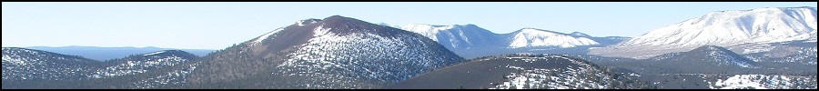
| Elden Mountain |
• San Francisco Peaks • Coconino National Forest • Coconino County |
|
Date: September 23, 2006
• Elevation: 9,299 feet
• Prominence: 1,219 feet
• Distance: 6 miles
• Time: 3 hours
• Gain: 2,400 feet
• Conditions: Nice and clear, a little cold
Arizona
•
Main
•
AZ P1K
•
PB
•
Interactive map
Elden Mountain overlooks Flagstaff, being the big hill rising above town and featuring the usual communications towers. It sits apart from giant Humphreys Peak, so while it may be overshadowed in sheer mass by Humphreys, Elden Mountain is not a little peak by any means. It's local to town and a popular fitness day hike for Flagstaff hikers not wanting to bother with the drive to Humphreys Peak.
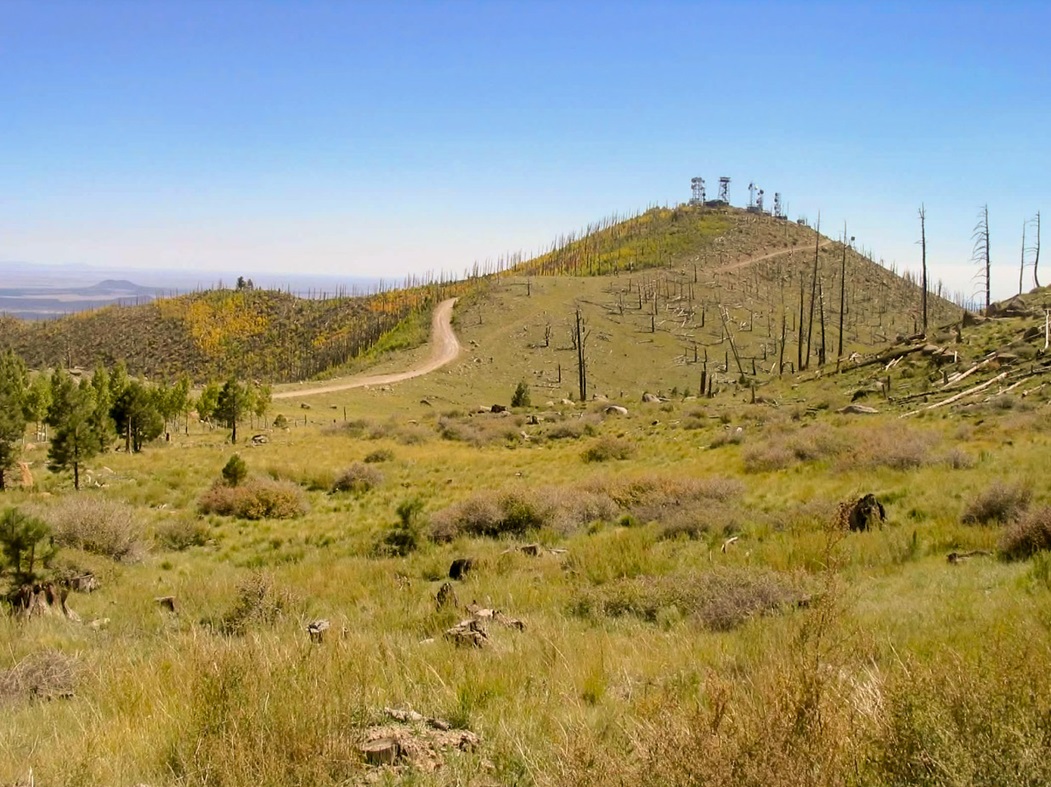
The mountain has a broad, flat top on which are a few bumps, the eastern one being the highest point at 9,299 feet. There is a good forest road that goes to the top from the west. Bicyclists come up here often, and the whole peak is usually very busy when the weather is nice.
We planned to hike Elden Mountain as part of a weekend in the high country. The worst of the summer heat was moderating, and the storms were gone. Thus, we expected that conditions in and around Flagstaff would be fantastic. We thought we would be clever, so instead of battling traffic along Interstate-17, we took a back route through Payson, then onto the higher plateau through Strawberry and Pine catching Forest Road 3 (Lake Mary Road) at Clint's Well.
We drove this paved route to the Pine Grove campground, arriving in the late afternoon, just before darkness. We found a spot, and I built us a nice fire, enjoying the starry skies, cool weather, the quiet and the solitude. That is, until five horse's asses motored up in their oversized dually trucks, took the spot next to us, then proceeded to drink beer, hoot and holler, and ruin the whole vibe. Not wanting to tell five drunks to tone down their sausage fest, we killed the fire and took another spot in the campground, away from these bozos. I was bummed because we had a nice fire going.
The next morning was cool and I built another fire. We took it slow and got dressed for the hike. βð's back was hurting. I massaged it, but it wouldn't improve. We put out the fire, and drove into Flagstaff, finding the trailhead on the east side of town across from the mall. We started walking in the late morning, she willing to give it a try. However, we got no more than a few dozen yards, and she had to concede. Her back was hurting her too much. So we walked back to our car and figured out what to do.
βð felt bad and encouraged me to go on my own. I appreciated her kindness. I got my stuff together and kissed her goodbye, and started up the trail. She relaxed back at the car, then drove to the mall where they have massage chairs set up in the main walking area, where you can get a free massage. This worked perfectly for her, and helped her back improve significantly.
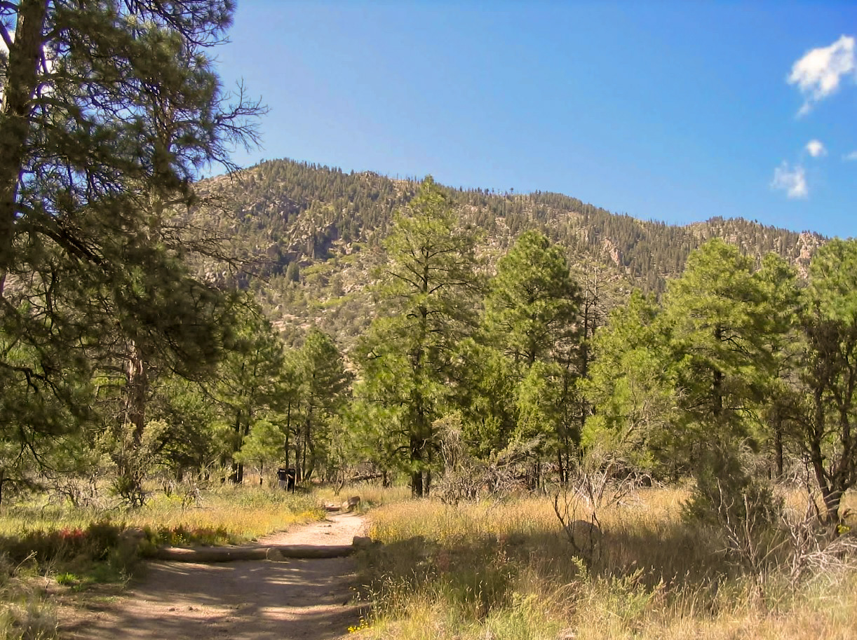
So, back to me, I went hiking up the trail. It is flat at first, passing through pinion and juniper woodland with significant wildflowers and brush. It passes a couple fences, bends right and works its way up steep rocky segments and switchbacks for a half-mile. There are other trails here, so I had to watch the signs, some of which weren't obvious. After another half-mile, the Elden Lookout Trail angles left (west) and starts a steep 2-mile grunt directly up the steep eastern slopes. I hiked for a few minutes with a woman from Nebraska who works for the National Parks Service, in town for a conference, then continued on my way. There were lots of people going up and coming down but it never felt crowded.
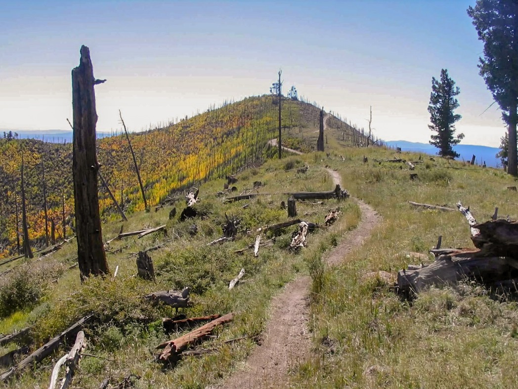
The trail works its way up a long series of switchbacks, sometimes clambering over some bare rock and always at a moderate-to-steep grade, given that it has to gain about 1,800 feet in these two miles. In places, big rocks have been moved into a series of stair steps, while big logs in other places achieve the same effect. Toward the top, the trail crosses an old rock-slide from about 30 years ago. It was always easy to follow and I made good time. Others were making even better time, and I was passed by a couple of runners working their way to the top. The trail angles to a nose on a subridge, then enters into cleared areas from the old 1977 Radio Fire burn. The top and its lookout tower come into view here. The trail then gains the main ridge, from which a spur leads to the summit.
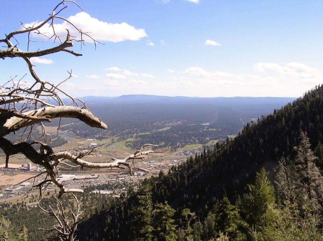
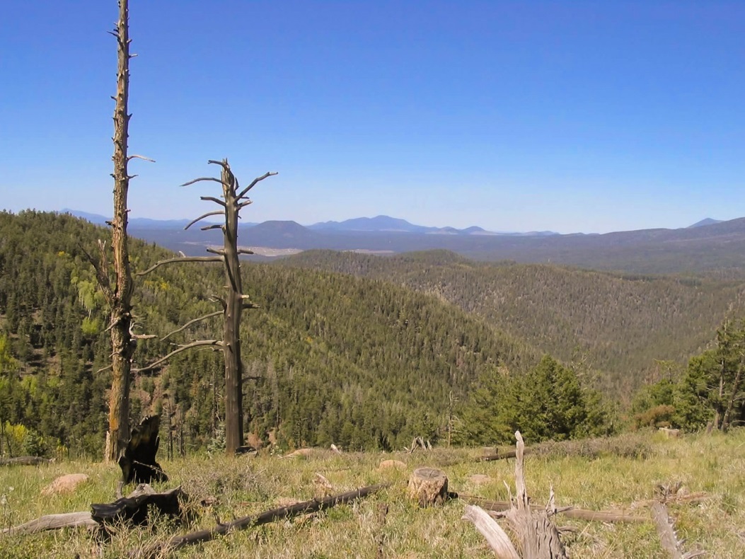
The hike up the final spur went quick, helped by a brisk, cool wind. The trail comes out to the road, from which it is an easy stroll to the top rocks, towers and antennae. I found the highpoint rock underneath the tower, and a sign posted on the side of a building reports the elevation as 9,300 feet. The woman from Nebraska showed up about 5 minutes later and walked up the stairs to the top, while I relaxed at the rocks and sent a text-message to βð that all was well and I was on my way down. It had taken me just under two hours to make the top, a gain of 2,400 feet. I was bushed, but I did stick around a few minutes to take in the views. The hike up took a lot out of me. I made good time but I could really feel it in my legs. I think I was also affected by the elevation, too.
The hike down went great, and the gradient was just right for me so that I jog-walked the three miles back down the hill, arriving back at the parking lot in exactly an hour. βð was just pulling into the lot as I emerged, so we brought out the chairs and relaxed, having cokes while I changed into dry clothes and she told me where she had been. At least she felt better about her back. She was bummed about missing the hike, although in this case had we pushed it, we probably would have run into trouble.
We stayed in a cheap "budget" hotel in town, one of thousands in Flagstaff with the word "Budget" in its name. Actually, we thought we'd made reservations for one we've stayed at before, but & wasn't sure when we drove up because there were three "Budget" hotels all near one another. Turns out we were supposed to be at a different one, and in retrosepct, this one was a lot nicer for the same price. We ate a dinner at the Galaxy 1950's Diner, and slept well.
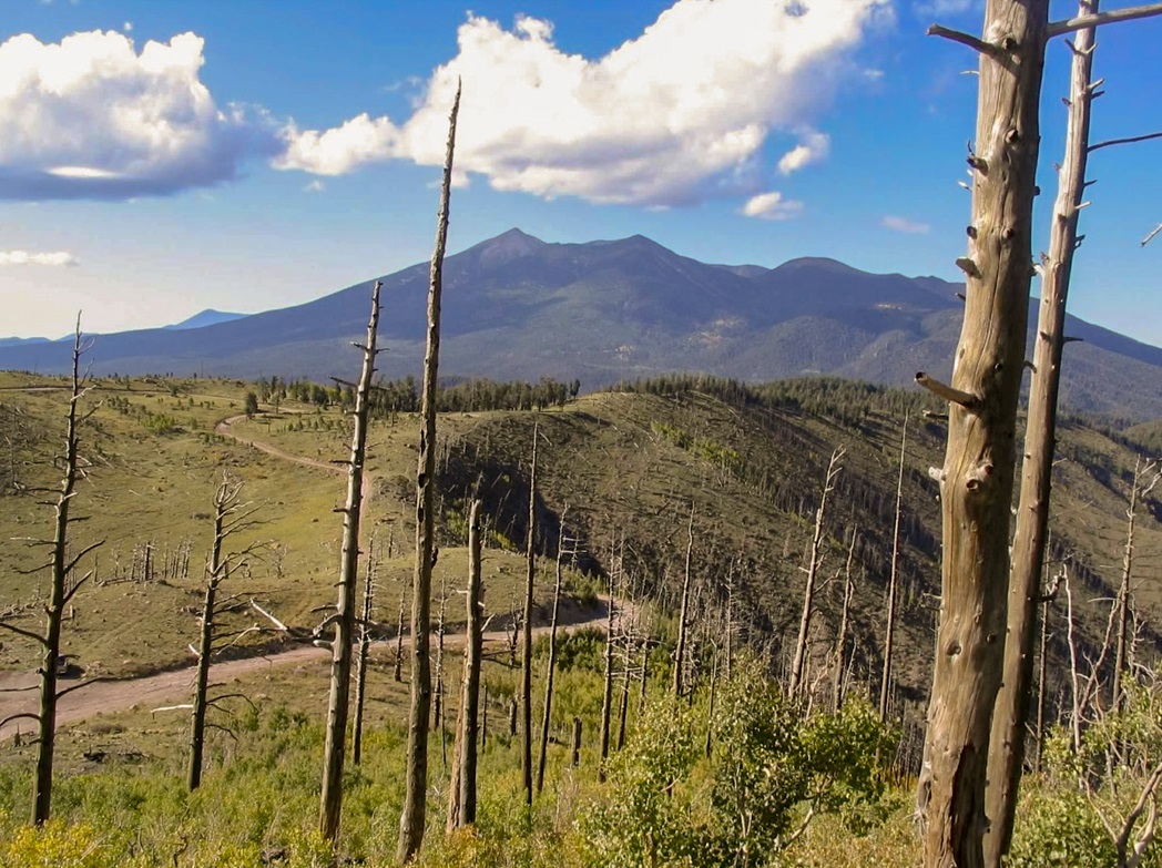
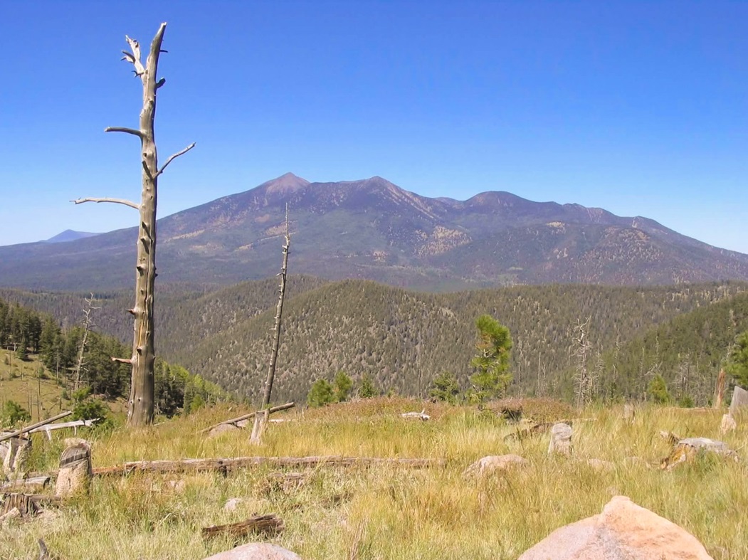
The next day we drove up the back road, following US-180 northwest out of town to Schultz Pass Road, then quickly onto Elden Mountain Road, which is paved for a couple miles, then dirt for the remaining five miles to the top. It's a decent road, has sections of rocks, ruts and steep grades, but the Subaru Outback handled it well. We parked in a pullout just west of Elden Mountain. From this angle, we could see all the beautiful Fall colors on the trees. We relaxed, sat in our chairs, made short hikes and enjoyed the area.
When another car rolled up, nearly plowing into my chair and without a peep of "sorry" or even a hello, we decided to drive to another area on the upper meadows (called Turkey Park on the map), where our only visitors were mountain bikers and an old blue truck body full of bullet holes. We actually had a great time up on top, spending almost four hours enjoying the lovely weather, although we both got a little sunburn. The drive back down and then home went well, just the usual traffic and hot weather.
|

|