
The Mountains of Arizona
• www.surgent.net
|
| East End |
• Highpoint: McDowell Mountains • McDowell Sonoran Preserve • Maricopa County |
|
Date: November 12, 2011
• Elevation: 4,065 feet
• Prominence: 1,347 feet
• Distance: 3 miles
• Time: 2 hours and 10 minutes
• Gain: 1,100 feet
• Conditions: High clouds and pleasant
The McDowell Mountains are a rocky desert range encompassed and managed by the city of Scottsdale as the McDowell Mountains Preserve. The city has been acquiring and incorporating land to surround the range, to protect it from piecemeal development. This has been an ongoing project since the 1980s and probably before.
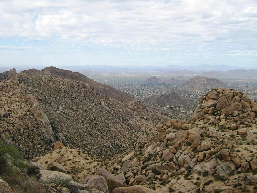
From the built-up area of Scottsdale, e.g. west of the range, the front wall of peaks consist of Thompson Peak (with the towers), McDowell Peak to its left (north), and Tom's Thumb, a notable pillar atop the highest north ridge. The highest peak in the range is East End, which is not really visible from the west side (or it is, if you are in certain spots and know exactly what to look for). East End is only about 30 feet higher than McDowell Peak, which is the highest peak of the west ridge.
I hiked here once way back in 1994. I came in from a road from the north off of Dynamite Road, and got a mile or two into the range, but not really sure where I was going or what my destination was. At the time, the development of the range as a Preserve was essentially zero. There were no parking lots, information kiosks or marked trails. It was a raw desert range at the time. Suburban development was still a few miles away.
I did not return until the Thanksgiving holiday in 2010. My intent was to explore the route to East End, but the day was cold and windy. I bailed when it got too uncomfortable, and figuring I live close by, I can always come back when it’s nicer. In May of 2011, Marvin Bittinger and I hiked a trail from the west side, from one of the newly developed trailheads. He loves the range and has hiked the trails more often than I have. We went a couple miles up one trail, then returned when the temperatures started to get hot. Still, we had fun.
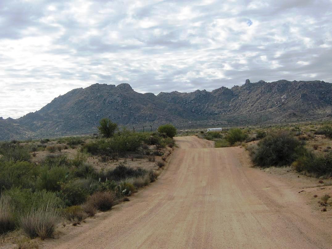
So after things cooled down again, I decided to explore the route to the summit again. I left home, took the Loop-101 freeway to Pima Road, north on Pima to Dynamite, east on Dynamite through the ritzy Troon development to 128th Street, then south on 128th, which is dirt, about three miles toward the base of the range. The roads are slightly rough and eroded in spots, and one has to follow a detour to a temporary parking area. When I rolled in, there were about 20 cars, parked every-which-where. The whole parking area in on a slope. I got dressed and everything packed, locked up the truck, and started my hike at 10:15 a.m. The weather was cool, with thick high clouds and a light breeze.
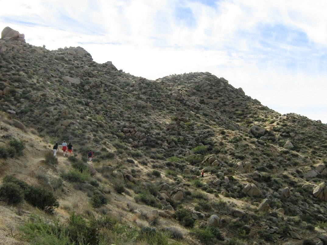
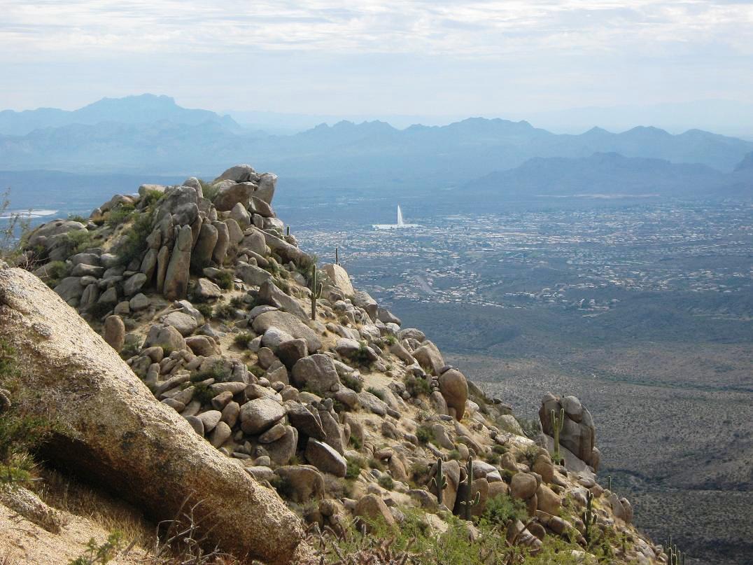
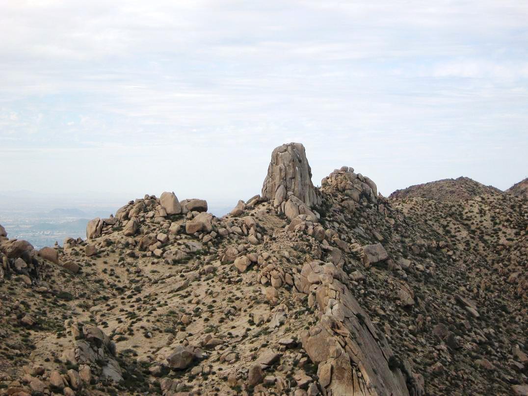
From the parking area, elevation about 2,900 feet, I started walking west on the Tom's Thumb Trail. This trail eventually leads to Tom’s Thumb, the large pinnacle way up on the range crest, and a popular rock-climbing destination. There were lots of casual hikers, some kids, a few runners, people with dogs, old people, young people, everything --- a good mix. And me.
Tom’s Thumb Trail runs flat for about 0.3 mile, paralleling the base of the range, then comes to a junction. I stayed left, still on the Tom’s Thumb Trail. Here, the trail gets steeper and switchbacks up the hillsides, gaining elevation fast. The trail is wide and smooth, but gravelly and prone to gullying from the rains. It achieves a couple of small saddles along the way, then traverses across East End’s west-facing slopes. I made good time, covering a little over a mile with about 700 feet of gain, coming to yet another small saddle at elevation 3,690 feet. East End’s summit was directly ahead of me to my left. I had come this far last year, when the weather was brisk enough to turn me back.
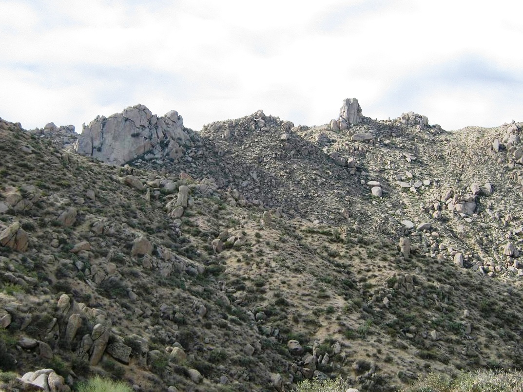
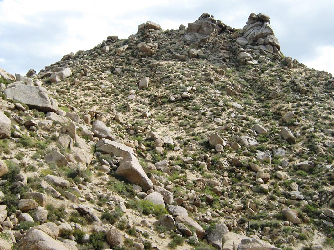
The trail drops about 60 feet into a small basin. Here, I found a use-path spurring off to the left, which I surmised was probably the way to the top. There is no official trail to the top, but it’s reasonable to assume enough people have come this way to beat in a foot-path. The terrain here is rocky, with giant blocks sitting on the slopes. The path winds through these obstacles and up the slope to a saddle north of the summit. From the main trail to here was about 200 feet of gain. The path was evident most of the way, with discreet rock cairns helping confirm the way when things got confusing.
From this saddle, I found the path again and followed it up the remaining 200 more feet to the top. It looks worse from below, but the path neatly winds through the big rocks and scrubby growth. Although I used my hands occasionally for balance, I would rate the off-trail hiking to be class 1. I didn’t even get scratched on my legs.
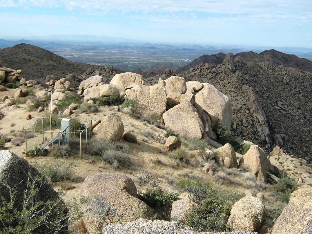
The summit itself has a small saddle, with a solar-panel apparatus sitting within a small fence. The real summit is to the left, and in moments I was there. There is a sign-in strong-box sitting in a cleft of the summit boulder. I signed in, and scanned the log for familiar names. I found a few. Two people had signed in yesterday, Veteran's Day, but before them, the previous signatures went back two weeks and seemed to average about five or six people per month, including a few who come up during the hot summer months. Given the popularity of these trails, it's apparent few seek out the summit, and I daresay most people aren’t aware of this being the summit. Only when you’re on top is it obvious that it's higher than everything else. From below, there's nothing to suggest it's the summit. It hides in plain sight.
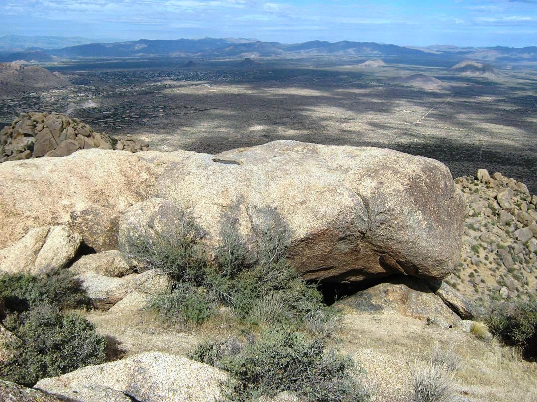
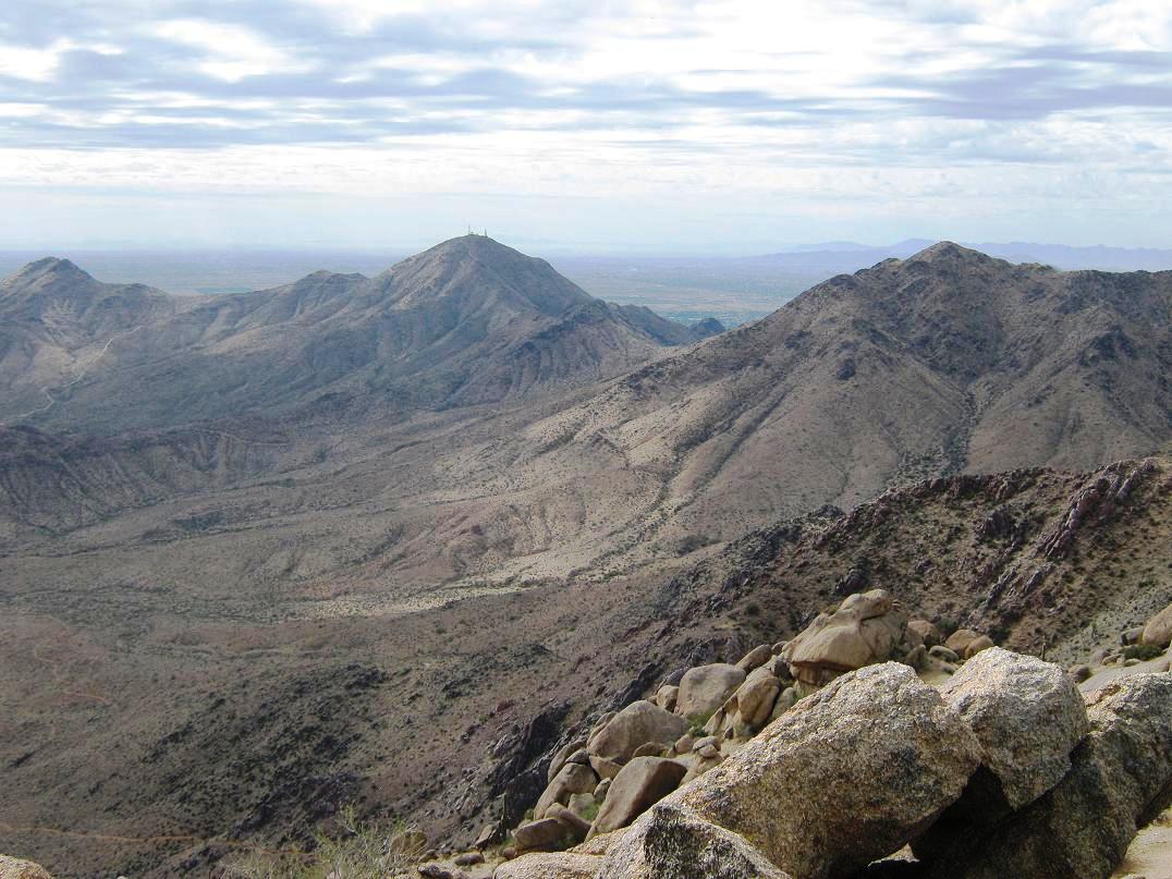
The views were great, but kind of washed out due to the cloudiness. Looking southeast, the big fountain in Fountain Hills was jetting water skyward (see photo). The Superstitions and Weavers Needle were set farther back. The west view was dominated by Thompson and McDowell Peaks, and the rocky ridgeline with Tom’s Thumb. North, I had great views into the hinterlands north of Cave Creek, with the New River Range and the FAA radar dome atop Humboldt Mountain way off in the distance. To the east was the Mazatzal Range, with Mount Ord and Browns Peak, all partly occluded by the clouds.
The benchmark and witness markers are set on top of a large flat rock about 30 feet north of the summit rock, about eight feet lower in elevation than the summit. It does suggest that the true summit elevation may be about 4,065 feet, adding eight feet to the benchmark's 4,057 feet. I went over to check them out, but one giant rock was set very precariously, pinned in by two bigger rocks. When I tested it, the damn thing moved. Thoughts of Aron Ralston and 127 hours ran through my head. So I backed off it. I don’t care that much anyway. Instead, I sat beside the solar thingy and had a short lunch.
The hike down went fine, and I took the downhills slowly due to the gravelly nature of the trails. Back onto the main trail, I jog-walked back to my truck, a total time gone of 2 hours, 10 minutes. I call the one-way mileage to be 1.5 miles, with 1,100 feet gross elevation gain. I was pleased it went so well, and am happy now to have properly summitted my home city's (almost) highest point. I took a short cut through a housing development and was home by 1 p.m.
Addenda:
The spur trail to East End's summit is not an official trail. No off-trail hiking is allowed in the McDowells, so technically, hiking to the summit is not allowed. You should be aware of this fact.
|

|