The Mountains of Arizona
www.surgent.net |
| Earp Benchmark |
• Whetstone Mountains • Coronado National Forest • Cochise County |
|
Date: October 4, 2022
• Elevation: 5,409 feet
• Prominence: 359 feet
• Distance: 2 miles
• Time: 90 minutes
• Gain: 680 feet (590 feet net)
• Conditions: Cool, clouds from a remnant storm
Arizona
•
Main
•
LoJ
•
USGS BM Datasheet
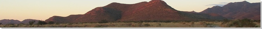
Earp Benchmark lies atop a small hill at the southeast tip of the Whetstone Mountains in Cochise County. In my recent trips along highway AZ-90 between Benson and Sierra Vista, I've eyeballed a few lower peaks that look hikable in an hour or two, something to do to break up the drive.
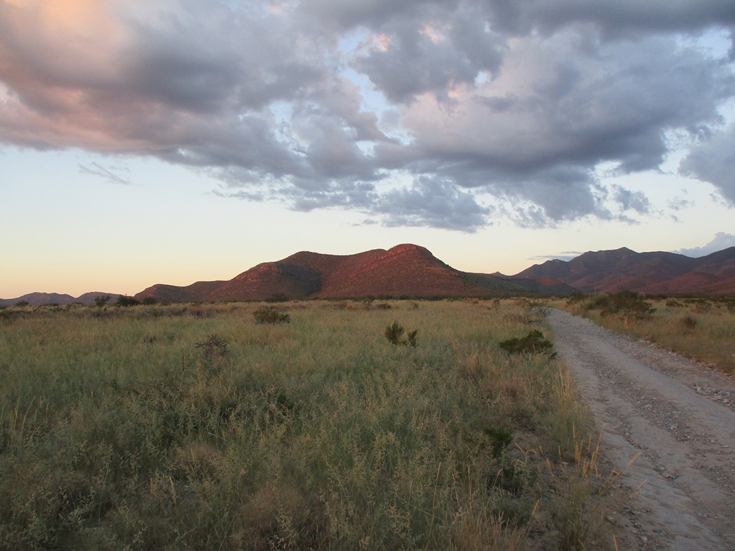
On this particular morning, I was up before dawn and heading back to Tempe, but had time available to do a hike, with the weather cooling to where hiking is feasible. From the junction of highways AZ-90 and AZ-82 in the community of Whetstone, I went north exactly 6 miles to a left-turn onto Dry Canyon Road. The road is dirt, heads west into the foothills, and is mainly used by target shooters.
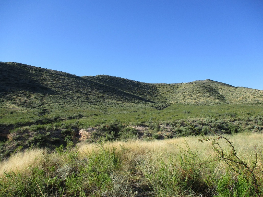
The first mile crosses Arizona State Trust land. It's bumpy with baseball-size rocks and a few ruts, but nothing to stop me. As long as I went slow and eased over the rocks, I was fine. A mile in, the road passes into the Coronado National Forest, and improves a notch. I drove in another half mile and parked in a wide cleared area overlooking a small canyon. Earp Benchmark Hill stood across the way, very close by. The summit was less than a mile on a straight line.
The day was chilly but not cold, temperatures in the high 50s. There had been some spotty storms yesterday in these parts (I found out later that a haboob had rolled over Phoenix and a tornado (!) tore up some trees and houses near Flagstaff). For now, the skies were mostly clear with random puffy clouds. If it had rained here, there was no evidence of it. Everything was dry. Nearby was an older guy setting up for some shooting. He was aiming in a direction different to where I was going. We had a short talk, and he seemed nice enough.
Once parked, I got dressed properly, got my day pack in order, locked the car and started walking. The road dips into this canyon, losing about 60 feet, then goes right back up onto the other side. The road is steep but in decent shape. Most vehicles with good tires and clearance would be fine. The tread is smooth, it's the steepness that would be challenging but it is very short. I walked the road a little more, hanging a right at a Y-junction, and following the road uphill to its end. I was about 150 feet up the side of the slopes relative to my car's elevation.
I started the uphill trudge through the brush and rock bands. The brush wasn't too bad. There were lanes to follow most of the time. Nothing grew taller than me, most of it was thigh-high or lower. Lots of sawgrass and "regular" grass, and relatively little cactus. Now and then I had to push through a tangle.
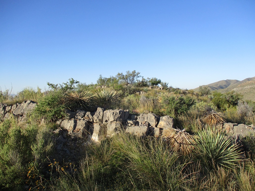
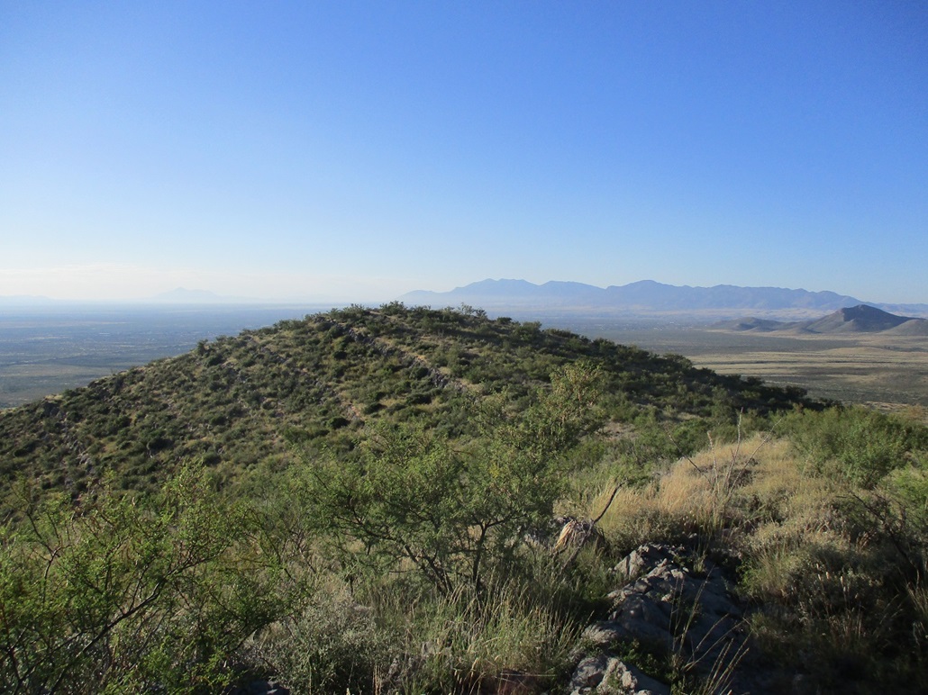
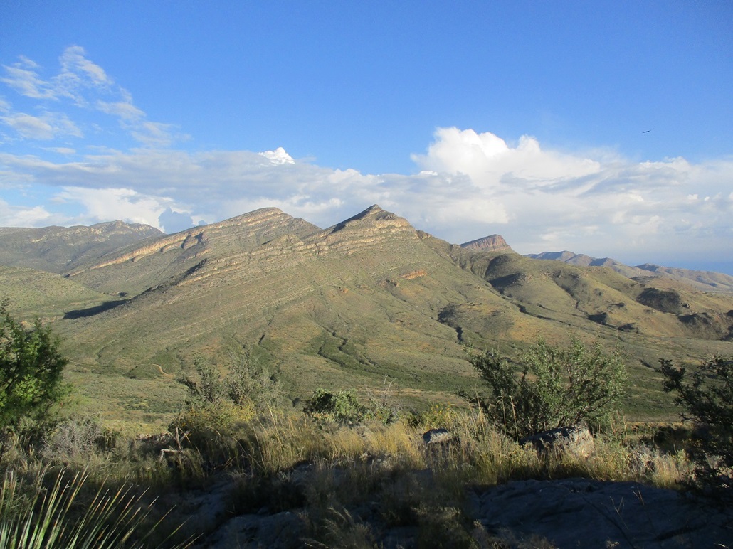
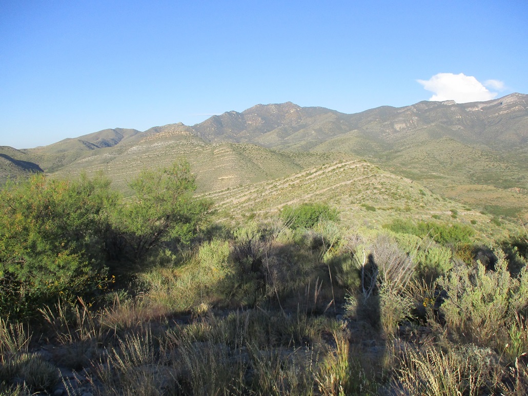
From a distance, the entirety of the Whetstone Mountains looks like a massive layer cake of tiered limestone cliff bands. On the bigger peaks, the cliffs can be over a hundred feet high. On this Earp Hill, the cliffs were five or six feet at most, more just a jumble of rocks rather than a "wall", more like bands of rock. In any case, they helped as they mitigated the brush, and with good traction, I could easily scamper up the rocks gaining elevation fast.
I was generally angling right as I ascended, aiming for a ridge above me. When I got to it, I walked a little more to the main crest, the highpoint just across the way. This was nice. No false summits or extra up-and-down to bother with. I descended to the saddle, then started uphill to the top.
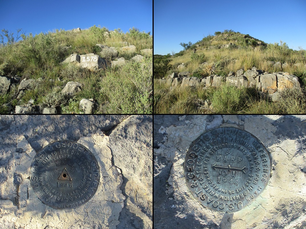
The uphill hike went well. It was the same mix of brush and low rock bands, sometimes the brush was thick, sometimes the rocks stood about 6 feet high. But I was always able to find a way up or through or both. Higher up, the rocks were painted with codes like "D-578" (see photo). Not sure what these mean.
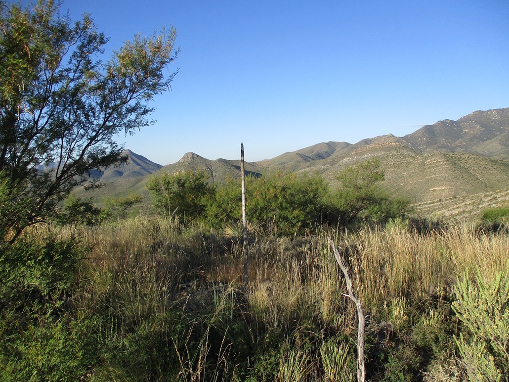
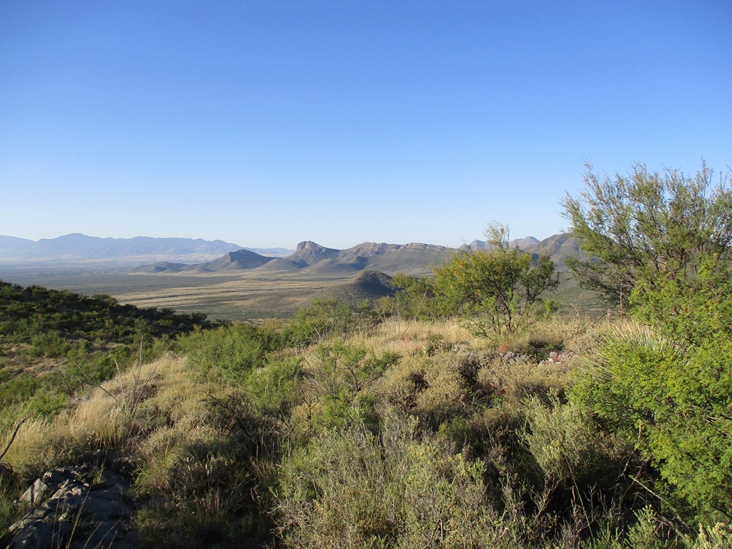
I was soon on top, the one-way hike taking about 45 minutes. I found a small cairn, but no register. I then sought out the benchmark. I found it, and one of the reference marks too. I took time to relax and inspect the views. There was mist on the farthest horizons and some big clouds north by the Rincons, but closer in, I had clear views of the nearby Whetstones and south toward the Huachucas.
I hiked down generally the same route, just following open paths as I found them. I was back to my car in about 40 more minutes, my round trip being 90 minutes and a couple miles when all the meandering is accounted for. I felt good and pleased that the logistics all worked out well. This was a fast, efficient and easy hike. It does not appear to be climbed very often.
From here, I drove back to Tempe, passing through some heavy rain in Tucson. The benchmark name is an obvious reference to the Earp brothers, famous for being the lawmen in Tombstone back in the late 1870s-early 1880s, and part of the gunfight at the O.K. Corral in 1881. Earp Benchmark is the east-most of a small line of three hills of about equivalent stature. I think it would be cool to name them after the brothers Virgil, Morgan and Wyatt.
|


|