
The Mountains of Arizona
• www.surgent.net
|
| Eagle Eye Mountain |
• Harquahala Mountains • Aguila Valley • Maricopa County |
|
Date: February 18, 2023
• Elevation: 2,820 feet
• Prominence: 400 feet
• Distance: 1.8 miles
• Time: 90 minutes
• Gain: 450 feet
• Conditions: Sunny and very pleasant
Arizona
•
Main
•
PB
•
LoJ
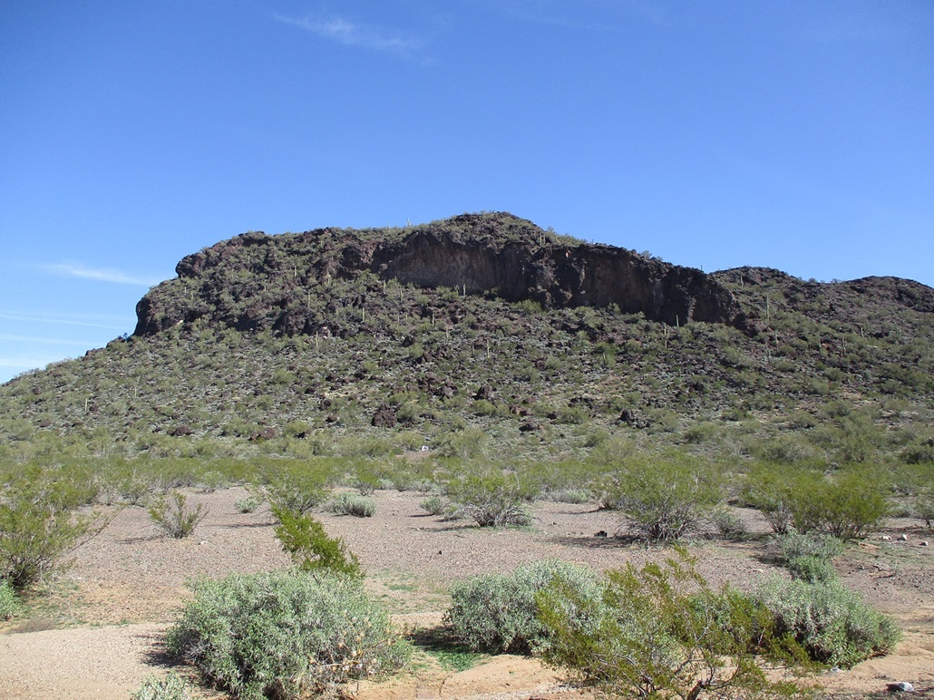
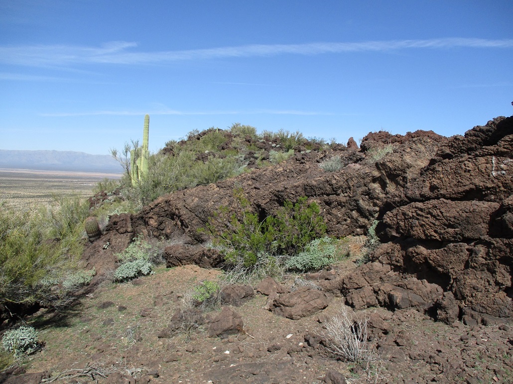
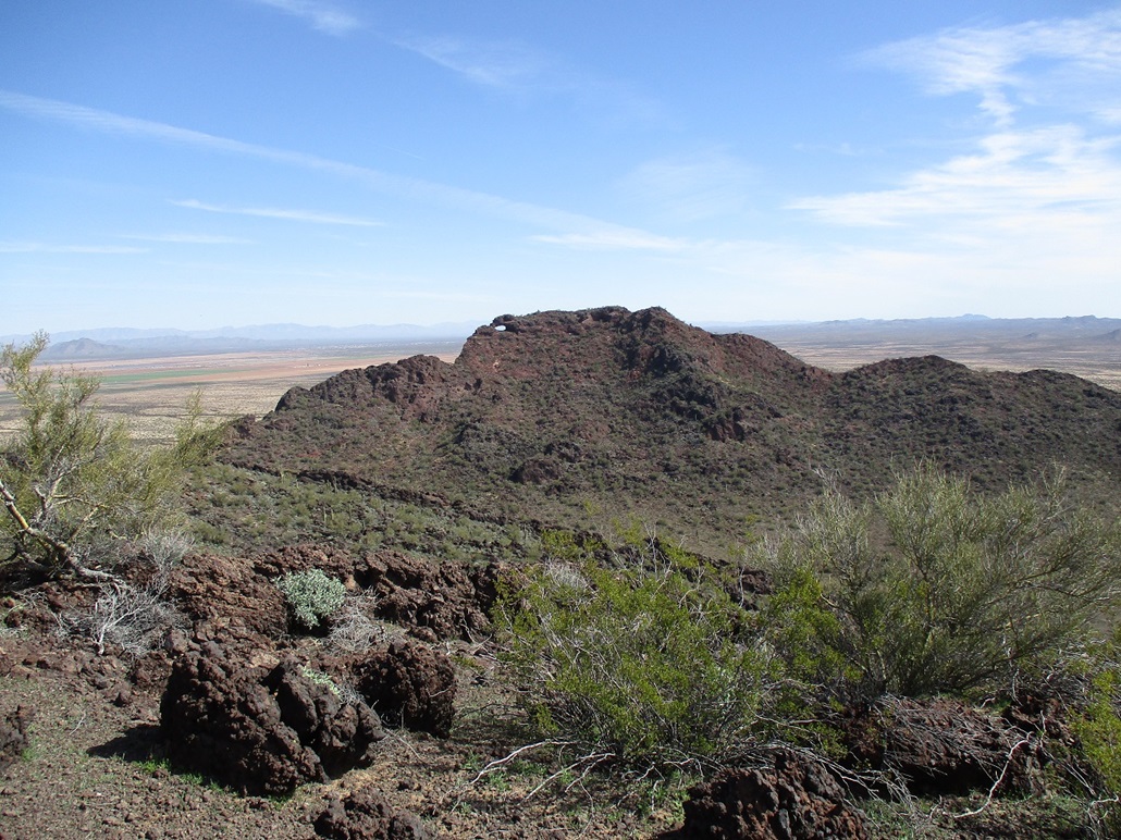
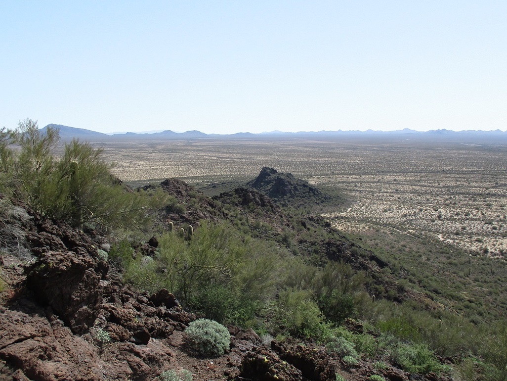
The Eagle Eyes are two peaks rising by themselves, separated from the far northeast tip of the Harquahala Mountains by about a mile, near the little farming town of Aguila. Eagle Eye Peak is the higher of the two, rising to the east, and Eagle Eye Mountain rises to the west, lower by about 30 feet. Both are composed of wildly jagged volcanic rock, looking like it solidified while still bubbling out of the ground. The peaks get their name from a large arch on the north ridge of Eagle Eye Peak, which from a distance looks like an eagle's eye. There are other smaller arches in these hills, too.
I've driven through the area many times over the years, always on the way to or from something bigger and sexier, so I tend to put off climbing in these hills. Driving on Eagle Eye Road about four miles south of Aguila, Eagle Eye Mountain parallels the road, with a wall of cliffs along its western flank. I would study its lines and it appeared there was a slope of jumbled rock on the south tip that looked like a promising way up. "Next time", I would say to myself.
I was up early today, having driven to and climbed Little Buckskin Mountain. That hike went extremely well, and I was done with it by 11 a.m.. I had no real plan afterwards. I never do. I always leave the driving route back to Phoenix an open question until I pile into the car, then I decide how I feel and what's close by. Today, I exited back onto US-60 in Wenden, then followed that northeast into Aguila. On the spot, I decided to climb Eagle Eye Mountain, the west of the two peaks. I had no map, and other what I knew from driving by it, no other preparations. Just me, my pack, my hiking poles, and a heart full of hope.
I rolled into the area about 12:15 p.m.. From Eagle Eye Road, I turned left onto a side track marked by, of all things, a boat. Someone left a boat there. I'd like to know the story behind that. I drove in not far, a quarter-mile, then parked in the open. There was no one here. Shooters evidently use the area, and there was a little garbage scattered about, but today, it was just me.
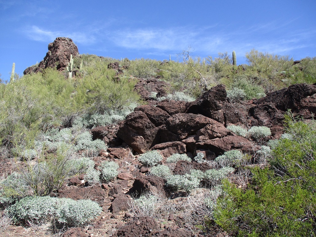
The rocky slope was close by. I walked across rocky desert flats is it sloped up slightly to put me on the lowest rocks. From here, I could see where the slope went and it looked good from down low, no obvious cliffs or show-stoppers. It looked brushy and steep, but nothing out of the ordinary. I moved slowly and deliberately. In a few spots I had to step high to get up tiny cliffs, and I used hands a couple times. This slope literally goes around the back of the west-facing cliffs.
The rocks were interesting. Typically, volcanic boulders are big rounded black things laying in heaps but usually solidly in place and easy to manage. These rocks were a chaos of large boulders, larger ones and huge ones, then scree and kibble, all of it shaped into blobs. I'm no expert in the chemistry of lava, but to me, the rocks looked like tephra, like it got spat upward then cooled as it fell, but not enough time to cool entirely. They form hills called spatter mounds. I've seen, and been on, a few of those. This may be what this is, but don't quote me on that. (If you know or can explain it better, drop me a line). The main thing that I cared about is that they were solid underfoot, and they were. Just a couple moved or rolled.
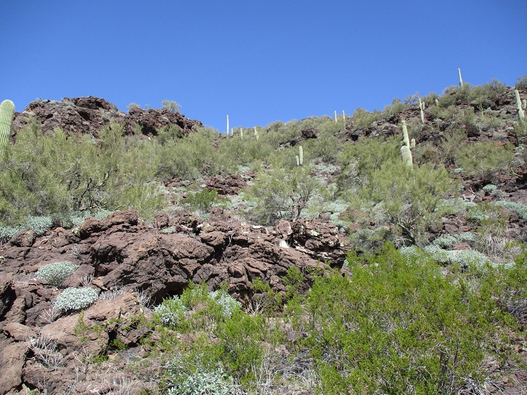
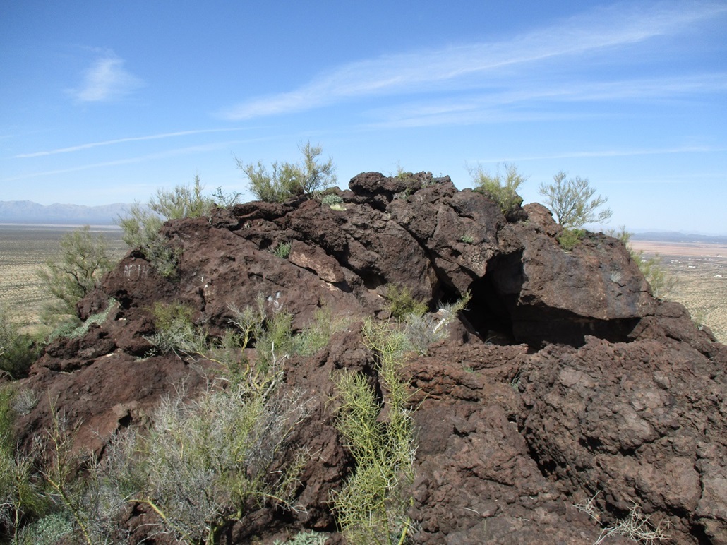
High up, the slope narrowed to a point, a small palisade of ten-foot cliffs closing in, but to the left, a ramp bypassed these little cliffs. I was now on the small summit ridge, and the highpoint was visible to the north, about 200 yards away. This ramp as essentially a wide ledge, about 15 feet on average. One one side, a jumble of rocks and brush. On the other, 60-foot cliffs. But it was not exposed. I never felt in danger.
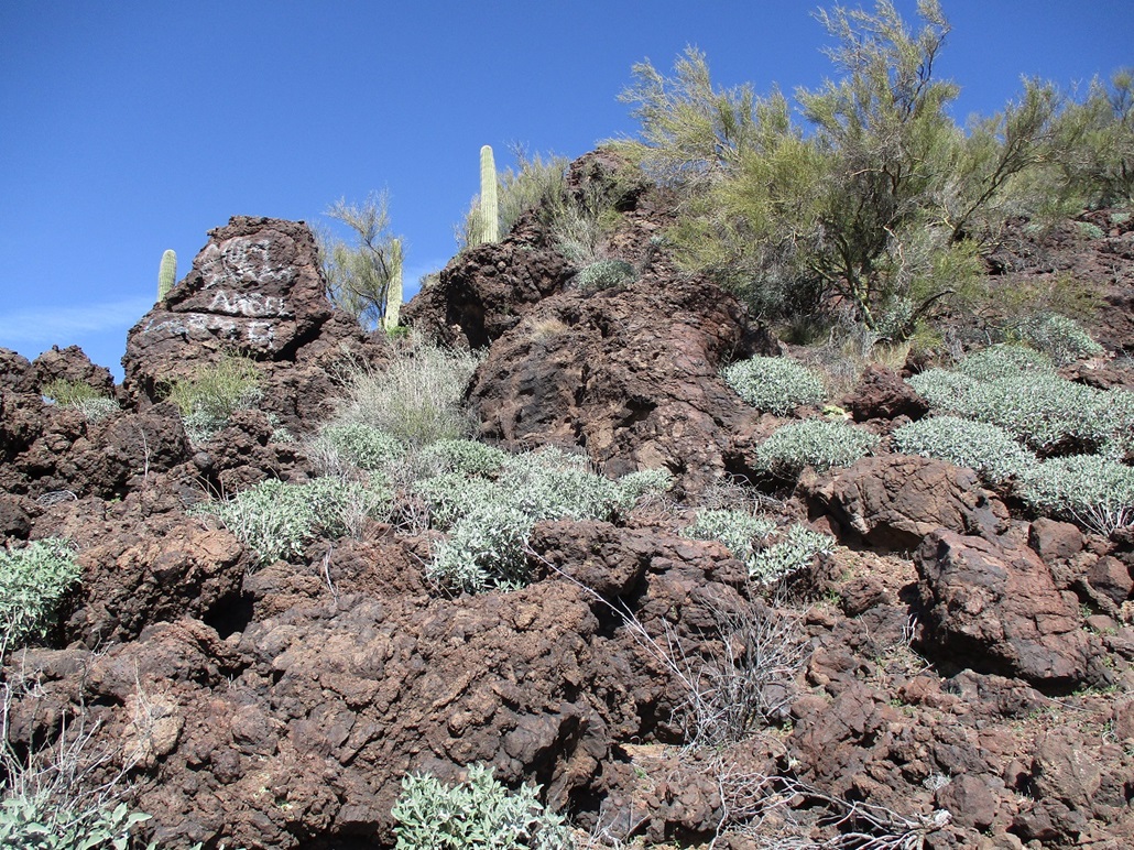
Up here, the various rocks form a maze, forming into a jumbled spine along the ridge, with little offshoots to clamber over. Here, I used hands to do a short scramble up and over one five-foot barrier. I then angled toward the spine, going in five-foot segments and following whatever looked easiest. I was on the spine itself at times, then I'd drop off on one side or another, then back on. Soon, I was at the base of the summit. From twenty feet out it looked like cake. Up close, not so much. It was about a ten-foot sloping scramble, probably class 3+, but on one side was a direct drop down a cliff. The exposure was severe with no room for error, so I backed off.
I sat for a moment, a little frustrated to get this close then get stopped. But I hadn't yet inspected all sides. Going to my left, I dropped about ten feet and got onto a narrower ledge (still wide, about 6 feet), clambering over the rocks. I essentially circled opposite from that little cliff-slope. Here, I found an easy chute and I was on top the thing. Not bad for a hike with no plan.
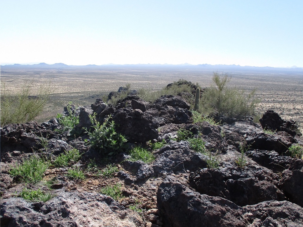
The top is a small perch about fifteen feet by ten feet, with decent sitting rocks. I found a tiny bottle register and signed in. It seems to get maybe one or two visitors a year, the most recent almost exactly a year ago. A lot were names I did not recognize, probably locals. There were the few regulars that hike everything. I didn't stay up long. I got what I came for and wanted to get started hiking out while I remembered all the little twists and turns.
The egress went well. I took it slow on the slope, watching my footing on the scree in spots. I was soon off the peak, onto the flats and quickly back to my car, the time a little before 2 p.m., a 90-minute hike. I was quite pleased, as I mentioned, I had no plan. This was a fine second summit for the day.
I looked over at Eagle Eye Mountain, studying its lines. It appears a southern ridge looks friendly, if steep, but an easier slope may be around back from my vantage. But I wasn't going to climb that one today, but I will probably be back in the future, "next time".
|


|