
The Mountains of Arizona
• www.surgent.net
|
| Dutchwoman Butte |
• Sierra Ancha • Salome Wilderness, Tonto National Forest • Gila County |
|
Date: October 16, 2021
• Elevation: 5,040 feet
• Prominence: 1,040 feet
• Distance: 8 miles
• Time: 6 hours, 30 minutes
• Gain: 2,190 feet (gross)
• Conditions: Sunny and blue skies, slightly breezy, a little warm toward the end
• Teammate: Matthias Stender
• Prog-rock bands played: Alco Frisbass, Gilgamesh
Arizona
•
Main
•
AZ P1K
•
PB
•
LoJ
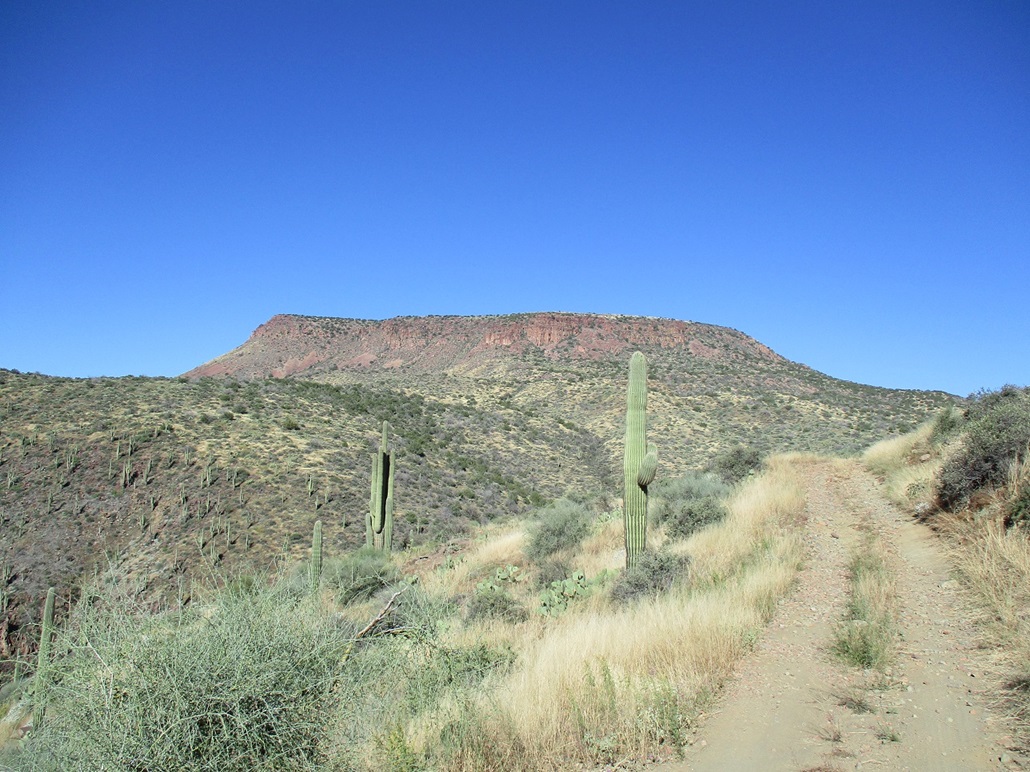
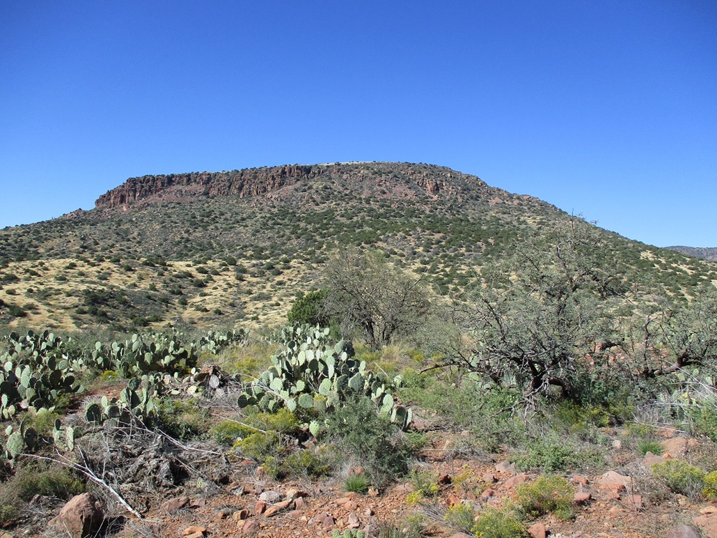
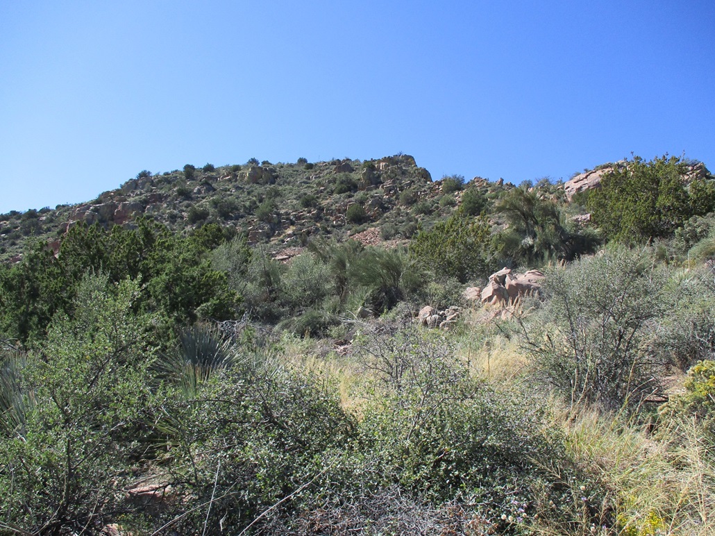
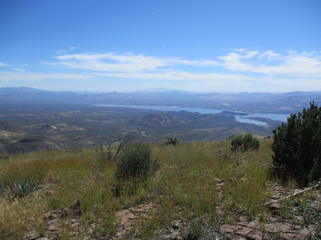
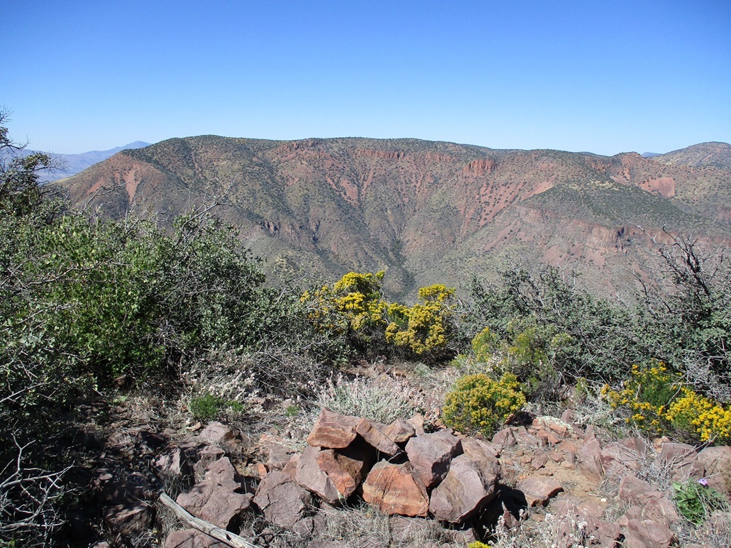
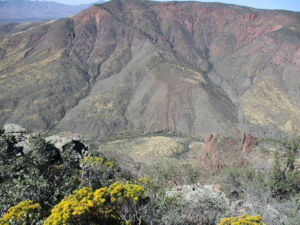
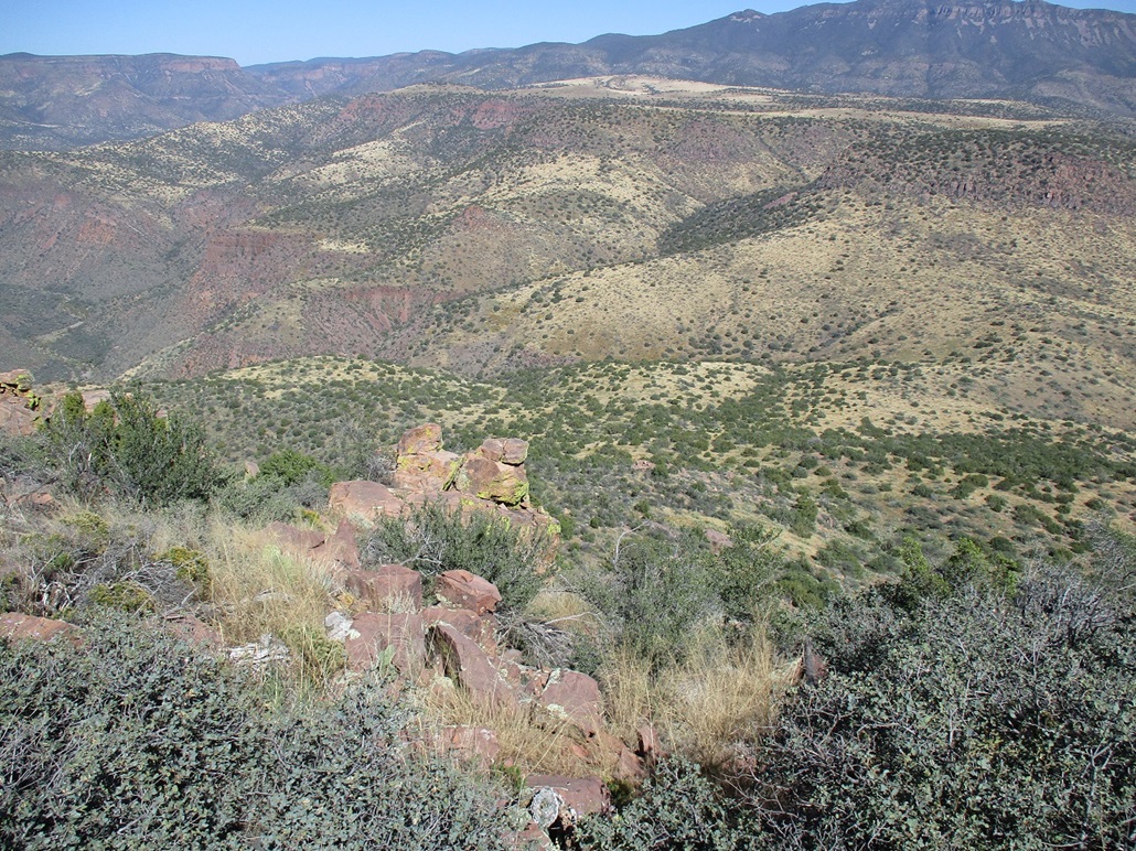
Dutchwoman Butte lies on the lower western slopes of the Sierra Ancha overlooking Lake Roosevelt, the summit rising almost 3,000 feet higher than the lake. It tops a ridge that forms the southeastern boundary of the Salome Wilderness, overlooking Salome Creek, which flows in a canyon 2,000 feet below. The butte itself is about a mile in length, almost completely surrounded by cliffs. Few people have climbed this peak and information on routes was scant. I was aware of a couple reports from HikeArizona where both came in from the north, which appears to be the only practical way up to the butte's top.
Matthias and I teamed up to climb this interesting peak. His Toyota 4-runner would be critical to get up the track close to the peak. We agreed to meet in Globe, so I got up before dawn and headed to Globe, arriving to the parking lot at the Wal-Mart a little before 7 a.m.. Matthias rolled in a few minutes later and I got my stuff into his car, and off we went.
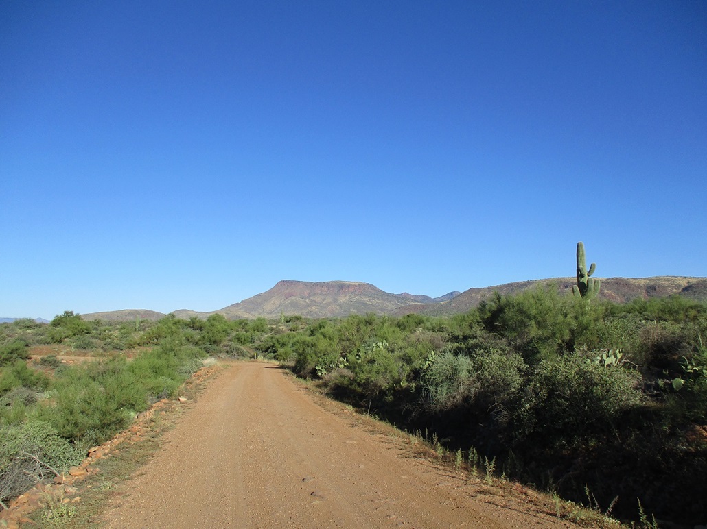
We followed state route AZ-188 northbound about a dozen miles to where AZ-288 --- the Young Highway --- branches off. We followed that down to the old Salt River truss bridge, then a few more miles heading uphill, leaving the highway onto A-Cross Road (Tonto Forest Road 60), which runs 27 miles across the base of the mountains and canyons that front Lake Roosevelt on its east side. A-Cross Road is dirt, but maintained. A few parts are rocky but most any vehicle with decent clearance would be fine.
We followed A-Cross Road westbound just under ten miles, a little past Bull Mountain, to where FR-895 branches to the north. This is where a much more robust 4-wheel drive vehicle is necessary. The first mile is rough but passable in two-wheel drive, to where it comes to a gate with signs mentioning the Thompson Mesa Watershed Project and an "adopt a ranch" program. I could have nursed my Subaru Forester to here, but no farther. The gate is dummy-locked but the public is welcome to pass through.
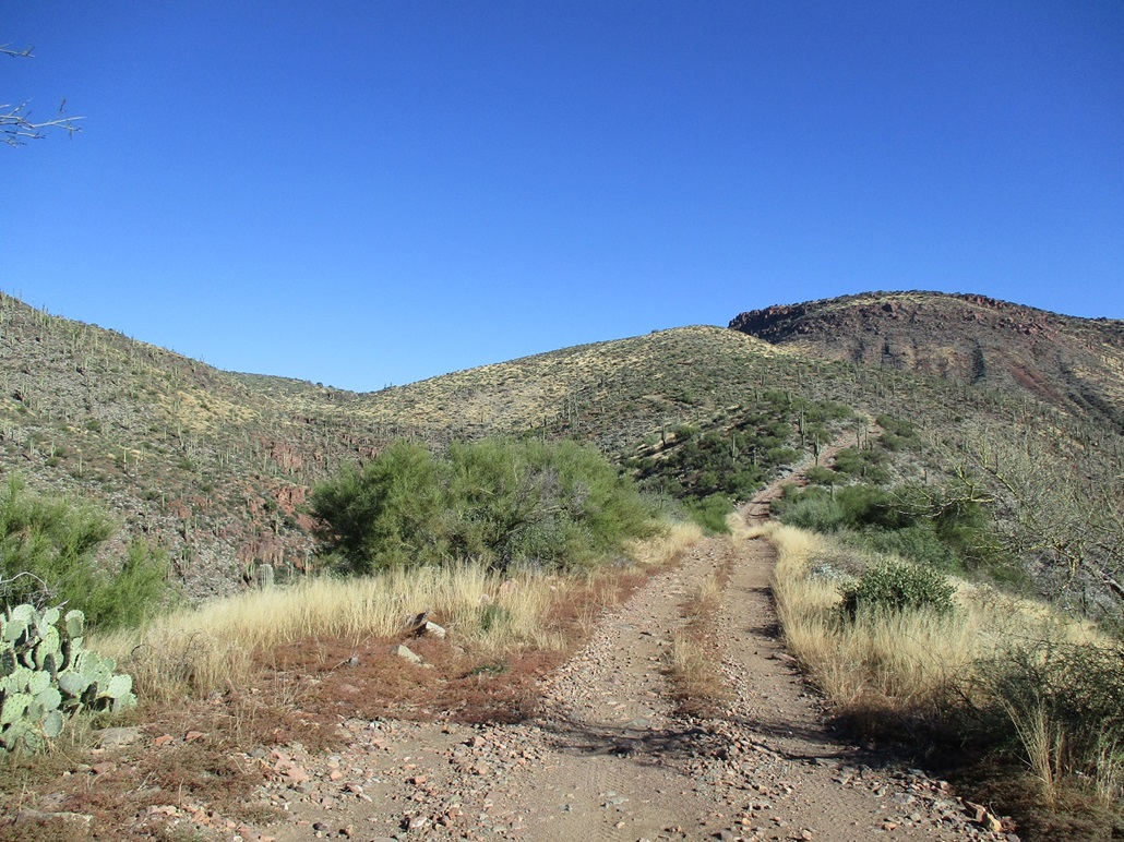
Matthias slowly drove farther in, covering about another mile, topping out on a ridge at 3,010 feet elevation. The road to here was narrow and full of football-sized rocks, and steep. Four-wheel drive is mandatory. We parked in a small clearing off the road. We got packed and properly dressed and started hiking about 8:45 a.m., the day sunny and pleasant, temperatures in the low 60s. There was a steady breeze for most of the morning.
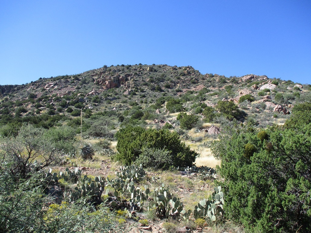
From our small perch, the road drops about 80 feet, then swings up the hillside on the opposite side, curls around the lower ridge, and resumed its northbound direction. We walked it at a good pace. We had to gain about 700 feet in a mile and a half, aiming for another small ridge at 3,700 feet elevation, marked by a "corral" on the map. We covered this segment in under an hour, then took a break nearby the corral.
We were surprised to hear an engine, and up rolled a guy in a Jeep Rubicon, coming to us from the north. He was heading out, southbound, but stopped to talk with us. He comes up here regularly and was preparing for deer-hunting season, which starts next weekend (which was fortuitous for us, because we did not know the specific starting date). He knew a lot about the roads and had even been most of the way up to Dutchwoman Butte, but never to the top. He knew the tracks to follow and offered advice on possible routes. He was friendly and knowledgeable, and we ended up talking about 20 minutes, a perfect way to get some rest.
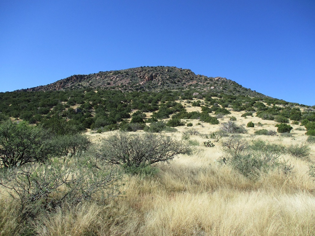
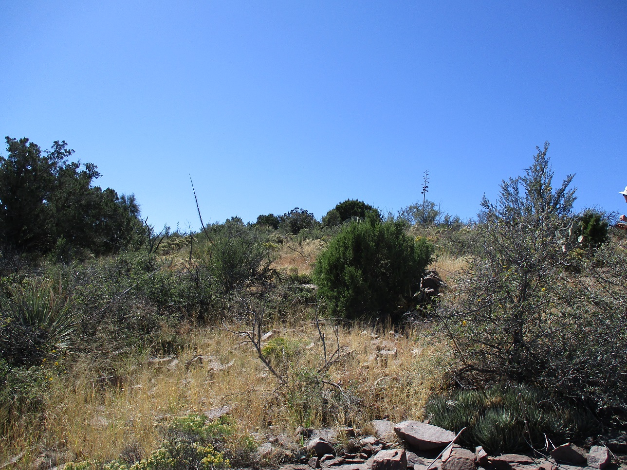
After he left, Matthias and I angled onto a lesser track, going left and up a soft ridge, gaining about 300 feet in a half-mile. The track ends at the fence of the wilderness. We left the track and started the cross-country trekking, in knee-high (and higher) grass that completely hid anything underneath, such as rocks, cactus and snakes. We moved slowly and deliberately, trying to step where we could see. We dropped about 40 feet to a broad saddle, then started up the gentle slopes, Dutchwoman Butte now directly in front of us.
We gained about 300 feet to a flat area, mostly free of grass but with abundant cactus. We took a break here. Up to now, everything had been very straightforward. We were moving quickly and in regards to avoiding snakes, we used the hope method, which is we hoped we wouldn't step on one. There was just no way to see anything hidden by the grass.
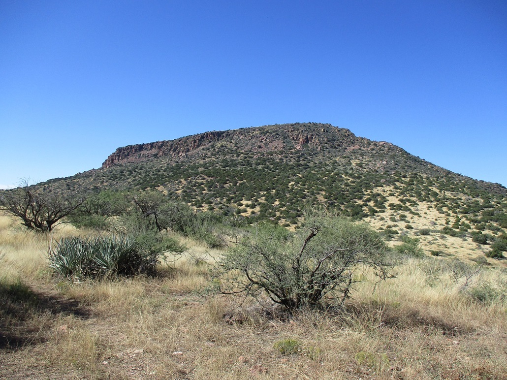
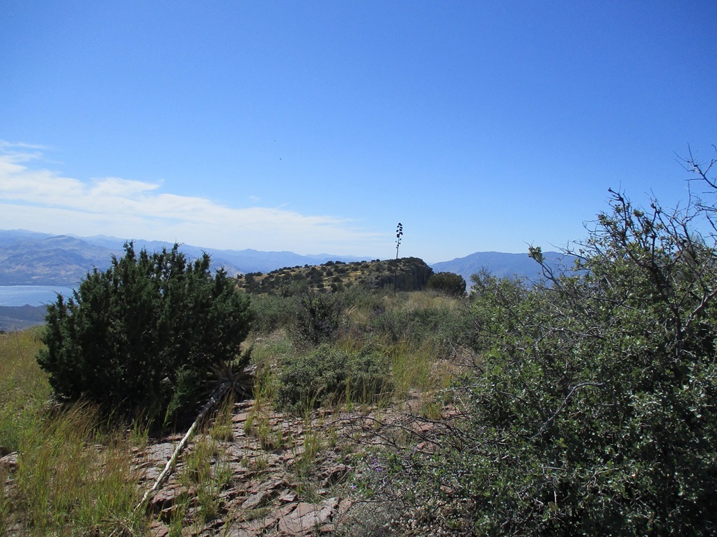
Now it was time to plan an attack up the steeper slopes and rock jumbles on the butte's north face. Nothing looked particularly obvious, so we decided to stick close to the main north ridge, lined with large rocks forming spires and small cliffs. We started hiking uphill and tacked right (westish) to get near these rocks. By now, we had more low trees (juniper and pinon), cactus, agave and grass, and more rocks too. We found ourselves on a slope of talus, which we carefully followed uphill. It was loose in spots, but it got us up about another 200 feet.
The next 400 feet or so, essentially what remained until we topped out, was literally taken in ten-foot segments. We'd hike in, look around, debate what to do, and try something. It would be hard to describe our exact route. We found ourselves scrambling up chutes, battling through brush and trees, traversing along ledges over the talus slopes. Much of it was loose. What wasn't loose was pointy. This went very slowly and at times, I feared we'd just cliff out and have to call it.
Whatever we did, it seemed to work. We'd get up one chute or slope, or through a brush thicket, then see more of a possible route to follow. At one point, we topped out of one slope and suddenly, the top was in view, about 50 feet higher with no cliffs between us. Just lots of brush, but that was fine. The top was ours. It was just a matter to get onto it and walk to the highpoint.
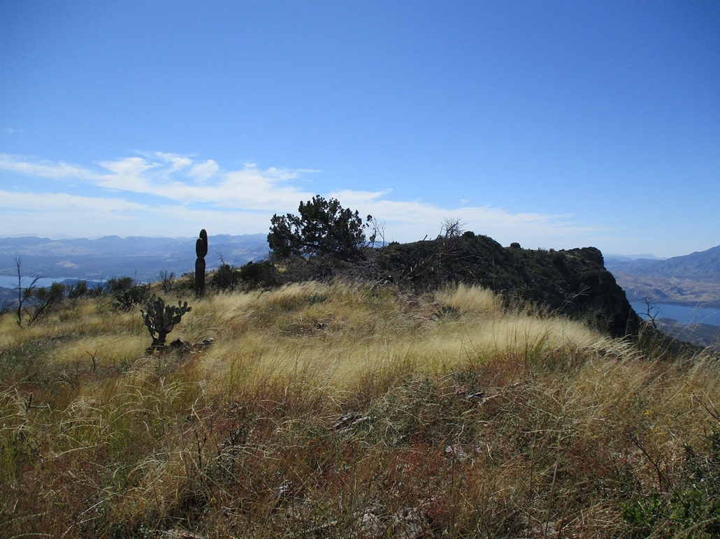
We achieved the north lip of the summit plateau at about 4,900 feet elevation. It was brushy but open. Up ahead was the first rise, a hilltop with elevation 5,021 feet. Once near it, we could see both the summit (elevation 5,040 feet) and the southwestern tip of the butte where the benchmark is located, elevation 5,017 feet. Up top, there were few trees, and a lot of grass, apparently one of very few areas in the state where natural grass biomes exist. The lower slopes are used for cattle, but they are unable to get onto this summit plateau. This report from 2000 shows the differences between a natural grassland and the effects of cattle.
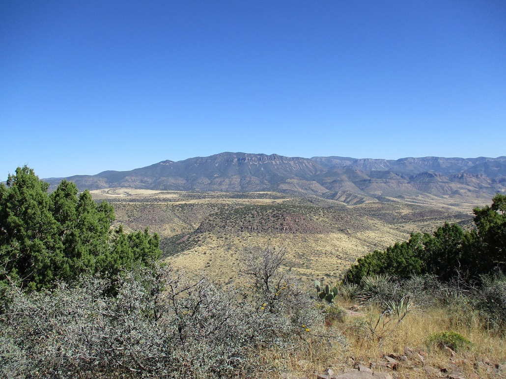
Up top, it was an enjoyable walk. We descended about 30 feet, passed perhaps the highest-elevation saguaro in the state (5,000 feet elevation), then walked up to the highest point, a gentle hill situated in the middle of the mile-long butte top. The top is mostly open, surrounded by brush and a single tree. Looking down just a few feet away to the west, the slopes dropped a solid 2,000 feet into the canyon below. It had the same airiness as you get viewing down into the Grand Canyon. It was beautiful. We had great views of the surrounding peaks, canyons, ridges and of Lake Roosevelt. A register is hidden in the cairn. It was placed there in 2009 by a couple hikers from HikeArizona, our mutual pal John Klein signed in in 2014, then another hiker from HikeArizona was here in 2015. Then, no one until us. It is very possible no one else has been up here in the past six years. We spent almost a half-hour relaxing at the top.
We decided to skip the hike out to the benchmark point. It would have added a half-mile each way and would not have been difficult, but we came here for the highpoint, and given what we still had to deal with for the descent, chose to save our energy for the hike down. We started down, intending to follow as close a track as possible as we had coming up.
In my mind, it was important to retrace our route as best we could for at least the top couple-hundred feet below the rim. I had built a couple cairns to help, plus some rock outcrops and chutes were pretty obvious, so we stayed on track very well. Once down the steepest scratchiest loosest stuff, the slope moderated ever so slightly and we were now not so beholden to the exact track. The next few hundred feet was messy and brushy, but not difficult at all. Slowly, we descended onto the grassier slopes and back to the high saddle, then the old track. It was a relief to be out of that grass and onto the tracks, where I could see my feet better. The hope method for snake avoidance worked well and I recommend it.
Once back on the tracks, we hiked out to Matthias' vehicle, arriving back a little after 3 p.m.. We had covered 8 miles round trip, a net gain of just over 2,000 feet (I add in the 80-foot drop and regain in my stats above). The hike had gone well, and despite the sloppiness of our route, things worked for us. We changed into driving clothes and slowly rumbled down the track back to A-Cross Road, then back to Globe where I picked up my car and we went out for sandwiches at a nearby Subway. I didn't get back to Tempe until after 7 p.m..
My thanks to Matthias for driving, especially up and down that steep track, and selecting the day's driving music, a contemporary French duo called Alco Frisbass, and an English group from the 1970s called Gilgamesh.
Our route was chosen mainly because the two other groups I mentioned had used it. It may not be the best route. Looking from below, there may be ways to the top coming in slightly from the northeast. The thing is, the natural approach following the old tracks will place you at the saddle immediately north of the butte. If you don't mind traversing left a ways, it may be possible to get up one of these routes, which looked brushy but free of cliffs. Our way obviously worked, but it was quite messy and I guarantee you it will never again be identically repeated. You definitely need good route-finding skills and patience.
|


|